|
The
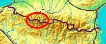
bordermarkers of the Pyrenees : the GRPdesBF
 |
|||||||||||||||||||||||||||||||||||||||||||||||||
| -
stage 24 - Port de Bielsa - Hospice de Rioumajou (bm323-325) |
 |
||||||||||||||||||||||||||||||||||||||||||||||||
Update may 2020: the 5 stages 21-25 (bm320-329) will be replaced by four stages. That will result in a more smooth main route, leaving the high altitude and non-waymarked trails to the variants. Has yet to be worked out. It will result in de following routes: |
|||||||||||||||||||||||||||||||||||||||||||||||||
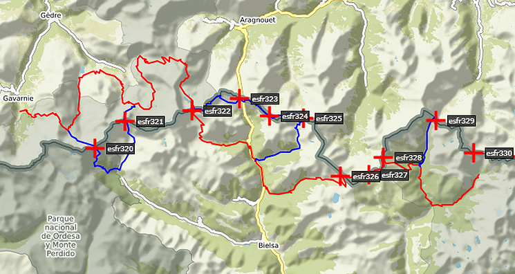 You can already watch these new routes in detail with this kml-file. |
|||||||||||||||||||||||||||||||||||||||||||||||||
Hereunder the original stage: |
|||||||||||||||||||||||||||||||||||||||||||||||||
 |
|||||||||||||||||||||||||||||||||||||||||||||||||
| Only
the bordermarkers along this stage are shown (and some adjoining ones).
The main route is red,
the variants have other colors.
The main route provides a smooth
on-going route along most bordermarkers, the variants give access to
the remaining bordermarkers. See the GRPdesBF-principles. Click here for an fullscreen interactive map. In short This start right at the high-altitude borderridge and keeps following it (on top or underneath) for several hours before descending to Hospice de Rioumajou. In fine weather, the view are wide. There are no variants in this stage. Considerations As said before, walking on a mountainridge is a risk in bad weather, be careful. The descent into France has a steep and rocky beginning: take care and take your time there. There's no water on the ridge, you need to descend for a source or stream so take enough with you at the start. When descending towards to Hospice de Rioumajou, you will come across flatter parts and streams. At Hospice de Rioumajou, the facilities seem basic but there's a room to shelter. Note: if you want to include on the next stage the first variant (bm326-327), you don't have to descend as far as Hospice de Roumajou. See further on. Factsheet
Gps-files needed
Version 02 July 2014. If you have any correction, suggestion etcetera -> please email me: eefberns@grenspalen.nl MAPS AND DIRECTIONS You might check the relevant webpages in the 'All markers'-section and 'All my trips'-section for more pictures of the bordermarkers and wayfinding-issues. Print your own maps It's easy to print your own - custom made - maps with the GRPdesBF-route and the bordermarkers on them. See: Print your own maps |
|||||||||||||||||||||||||||||||||||||||||||||||||
 |
|||||||||||||||||||||||||||||||||||||||||||||||||
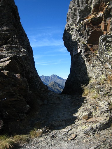 |
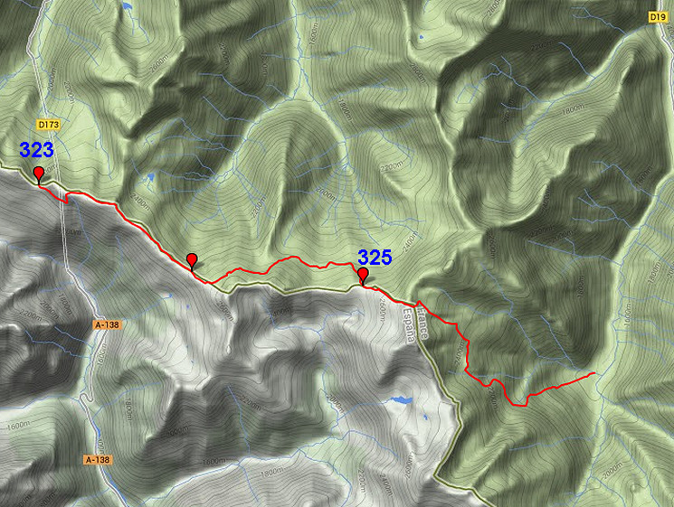
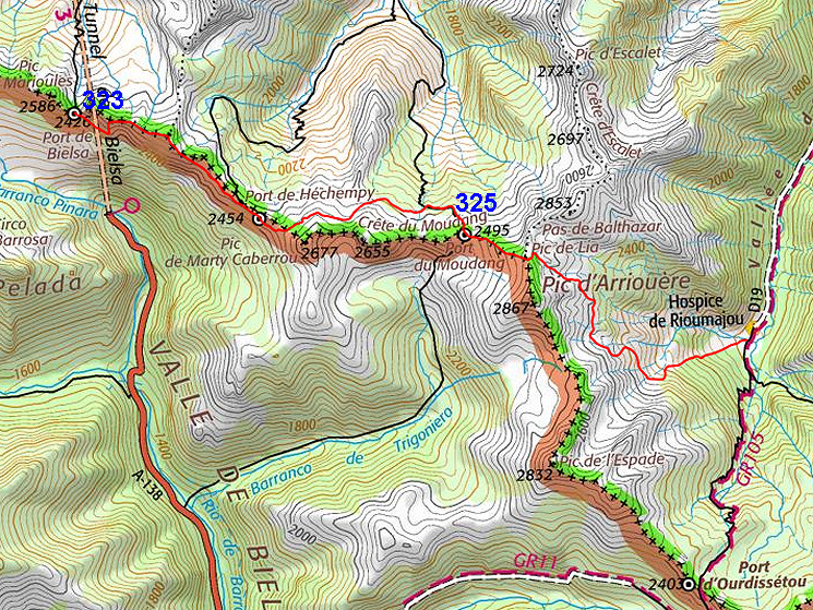
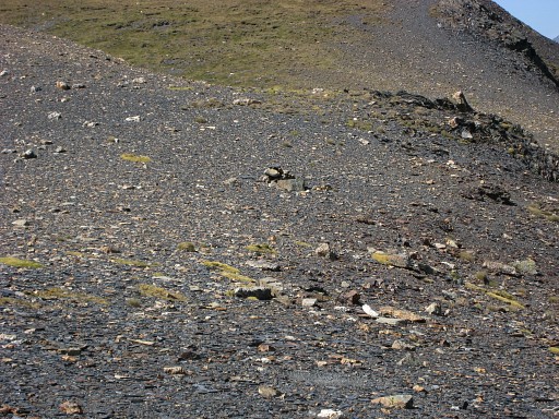
Port de Bielsa But you won't find bm323 here in the passage itself. It's on top of the left ridge. |
||||||||||||||||||||||||||||||||||||||||||||||||
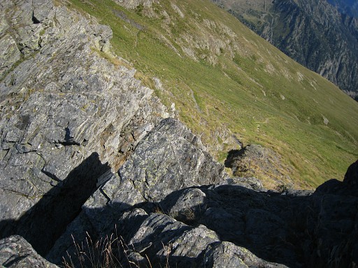 |
Bm323 is on top
of
the western side of the corridor. It requires a little climbing from the French side. |
||||||||||||||||||||||||||||||||||||||||||||||||
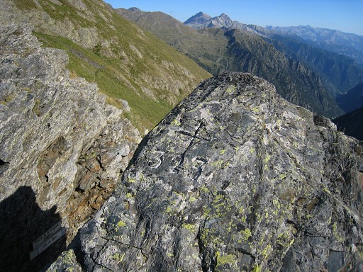 |
Bm323 |
||||||||||||||||||||||||||||||||||||||||||||||||
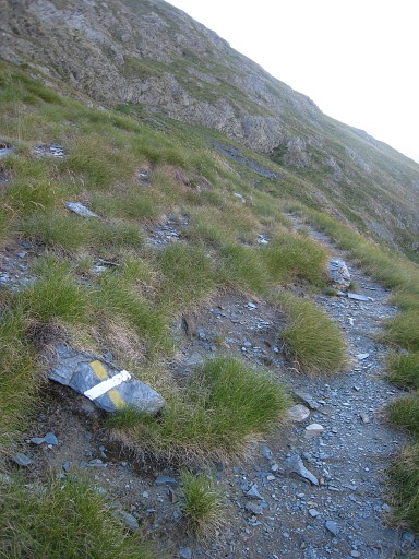 |
Descend a bit (± 50m
distance) and then take this "blocked" trail to the left. Further on there are white waymarks and cairns. After ± 500m going SEE, the trail climbs steep N and joins the borderridge going E. |
||||||||||||||||||||||||||||||||||||||||||||||||
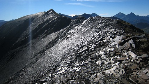 |
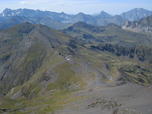
The trail leads you on and
along
the borderridge untill Port de Moudang. It may get fainter in places,
waymarks can disappear and sometimes you need to descend a bit to avoid
sharp rocky outcrops but overall it’s ok. The trail passes Pic de Bataillence and continues with lesser waymarks. Just beyond this Pic, you might be able to descend to Lac de Héchempy for a bivouac. Or else descend NNW from Port de Héchempy. |
||||||||||||||||||||||||||||||||||||||||||||||||
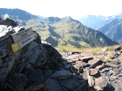 |
This pass named Port de
Salcorz (according to a sign) might confuse you. The Procès-Verbal says that this is the same as Port de Héchempy. But the real Port de Héchempy is a gentle curved pass further on. |
||||||||||||||||||||||||||||||||||||||||||||||||
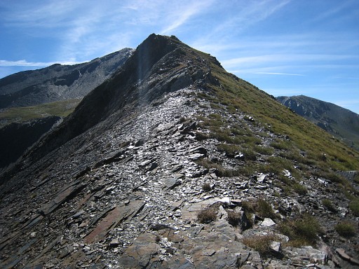 |
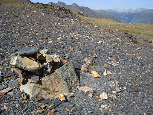
From Port de Héchempy,
bm324 is ± 250m to the E. It's on the top of the first rocky outcrop. |
||||||||||||||||||||||||||||||||||||||||||||||||
 |
Bm324 |
||||||||||||||||||||||||||||||||||||||||||||||||
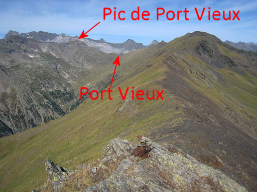 |
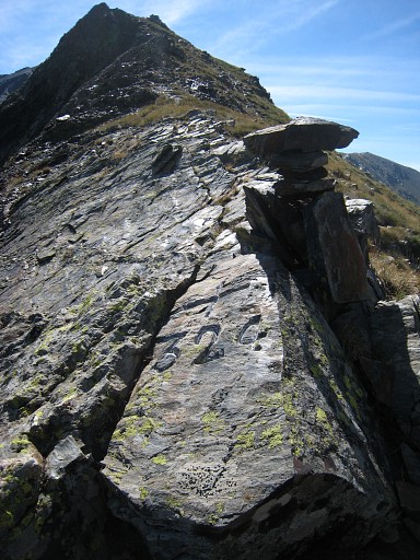
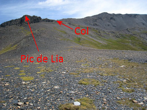
Looking back along
the borderridge. The Port Vieux and the Pic de Port Vieux are well visible. |
||||||||||||||||||||||||||||||||||||||||||||||||
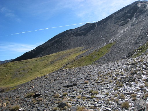 |
Then - ± 350m beyond bm324
- the
trail goes left, underneath this summit. And it will continue for ± 2,5km underneath the borderridge before you have to climb to Port de Moudang with bm325. But where to start climbing to Port de Moudang (no trail to the Port itself) |
||||||||||||||||||||||||||||||||||||||||||||||||
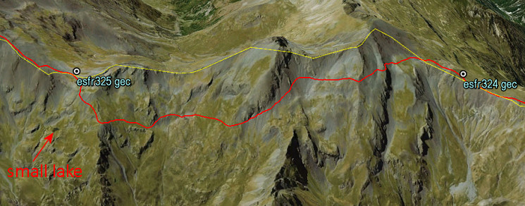 This screenshot from Google Earth (looking N->S) might help you. The small lake is helpful: if you miss the spot where to bend right and climb to the Port, you will arrive at the small lake. From there you can also climb to the Port de Moudang. |
|||||||||||||||||||||||||||||||||||||||||||||||||
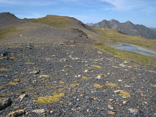 |
The Port de Moudang itself
is a broad saddle. This picture: looking to the W. |
||||||||||||||||||||||||||||||||||||||||||||||||
 |
Zoom-in of previous picure: bm325 is a small rock with a cairn. | ||||||||||||||||||||||||||||||||||||||||||||||||
 |
Bm325 |
||||||||||||||||||||||||||||||||||||||||||||||||
 |
Then you have to climb SEE
to the ridge. There’s a sort of unnamed col up the borderridge. From there a short but very steep descent (orange waymarked) starts into France before it continues to the SE. Leading up to the col, there’s a faint trail. |
||||||||||||||||||||||||||||||||||||||||||||||||
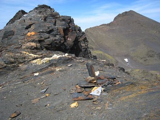 |
This is the col. The orange trail descends quite steep but by sticking to the orange waymarks at the rocks, there’s enough grip for feet, hand and walking stick. The path then continues essentially parallel to the borderridge SE and descends finally to Hospice de Rioumajou. |
||||||||||||||||||||||||||||||||||||||||||||||||
 |
From the 'col' looking back at Port de Moudang. | ||||||||||||||||||||||||||||||||||||||||||||||||
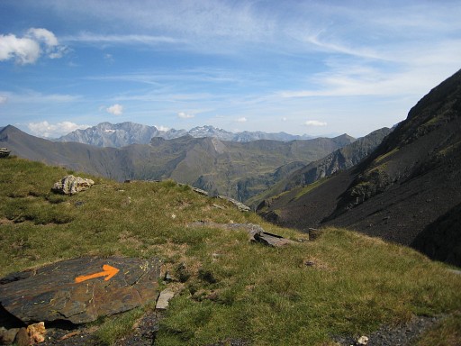 |
The trail is consistently waymarked with orange paint but you have to be attentive for the next waymark. | ||||||||||||||||||||||||||||||||||||||||||||||||
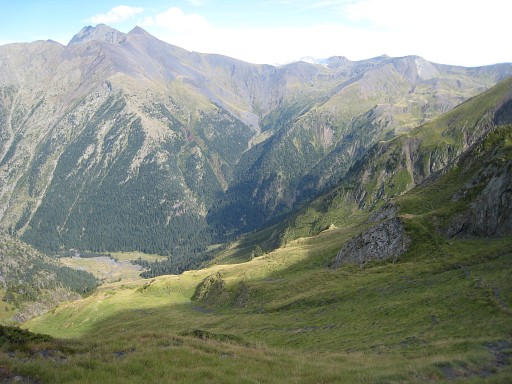 |
Hospice de
Rioumajou, hardly visible, deep down in the valley. At some point you have to leave the orange trail do descend to Hospice de Rioumajou. There are trails bringing you downhill. However, if you want to visit bm326 on the next stage (variant 1), you don't need to descend that far. |
||||||||||||||||||||||||||||||||||||||||||||||||
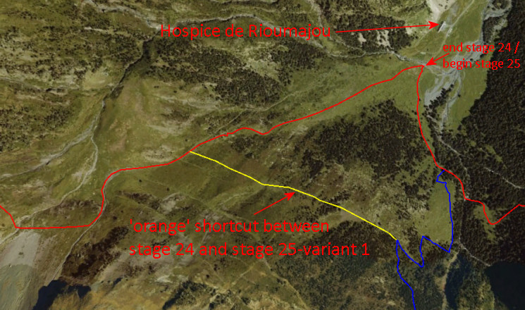 This screenshot from Google Earth shows it all. If you continue on the orange trail (=shortcut) you will get in less than 1 km to a red/white trail going up to the right (=variant 1 from the next stage). That red/white trail will bring you to Port d’Ourdissétou with bm326. |
|||||||||||||||||||||||||||||||||||||||||||||||||
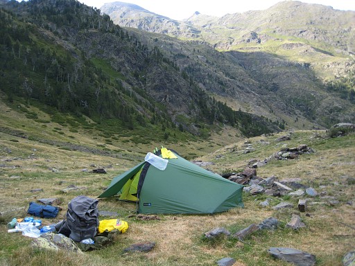 |
And in that case, you
might stop here and pitch your tent. |
||||||||||||||||||||||||||||||||||||||||||||||||