|
The
bordermarkers of the Pyrenees : the GRPdesBF
|
||||||||||||||||||||||||||||||||||||||||||||||||||||||||||
| - stage 32- Arriu des Grauèrs - Port d'Orle (bm418-420)  previous
stage next
stage previous
stage next
stage 
|
 |
|||||||||||||||||||||||||||||||||||||||||||||||||||||||||
 |
||||||||||||||||||||||||||||||||||||||||||||||||||||||||||
| Only
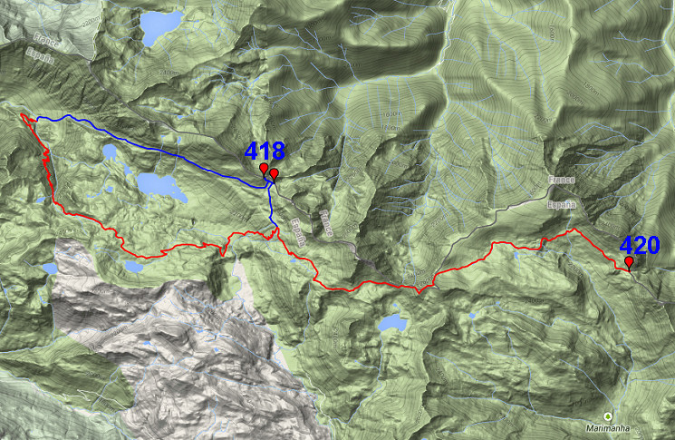
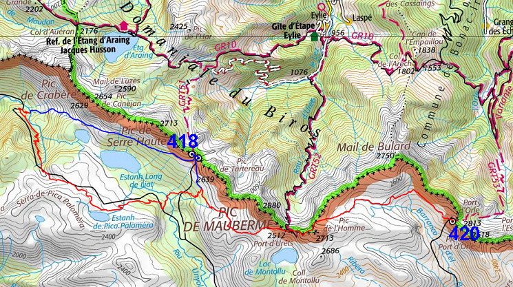
the bordermarkers on this stage are shown (and some adjoining ones).
The main route is red, the variants are blue. Click here for a fullscreen interactive map. In short We enter the high mountains. The main route climbs on a waymarked trail to the derelict mining buildings of Liat (including a cabin) and climbs then more gradual towards Port d'Urets. Then - after climbing a 27oom pass - it descends and continues to Port d'Orle (bm420). The variant starts immediately with a steep climb up a gully and then traverses above the lake of Estanh Long de Liat towards Port de la Hourquette (bm418 and 419) and then descends to join the main route. Considerations The main route passes the well equipped cabin of Mines de Liat, though quite early. Along the main route, there are enough bivouac spots but watersources are scarce. At the end of the stage - Port d'Orle - a bivouac will be difficult in the rocky terrain and by lack of fresh water. You might consider to stop earlier somewhere along the stream of Ribèra d'Òrla. On the French side however of Port d'Orle (when descending to ± 2100m) there's a small metal cabin with a source nearby. Alternatively you could already descend into Spain to find a place to bivouack Factsheet
Gps-files needed
Useful You might check the relevant webpages in the 'All markers'-section and 'All my trips'-section. They provide pictures of the bordermarkers and additional information. Version 02 December 2014. If you have any correction, suggestion etcetera -> please email me: eefberns@grenspalen.nl MAPS AND DIRECTIONS Maps and directions yet to be worked out in more detail. You might check the relevant webpages in the 'All markers'-section and 'All my trips'-section for pictures of the bordermarkers and wayfinding-issues. Print your own maps It's easy to print your own - custom made - maps with the GRPdesBF-route and the bordermarkers on them. See: Print your own maps |
||||||||||||||||||||||||||||||||||||||||||||||||||||||||||
 |
||||||||||||||||||||||||||||||||||||||||||||||||||||||||||
 previous
stage next
stage previous
stage next
stage 
|
||||||||||||||||||||||||||||||||||||||||||||||||||||||||||
