|
The
bordermarkers of the Pyrenees : the GRPdesBF
|
||||||||||||||||||||||||||||||||||||||||||||||||||||||||||
| - stage 31 - Pont du Roi - Arriu des Grauèrs (bm410-417)  previous
stage next
stage previous
stage next
stage  |
 |
|||||||||||||||||||||||||||||||||||||||||||||||||||||||||
 |
||||||||||||||||||||||||||||||||||||||||||||||||||||||||||
| Only
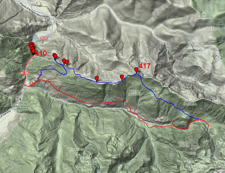
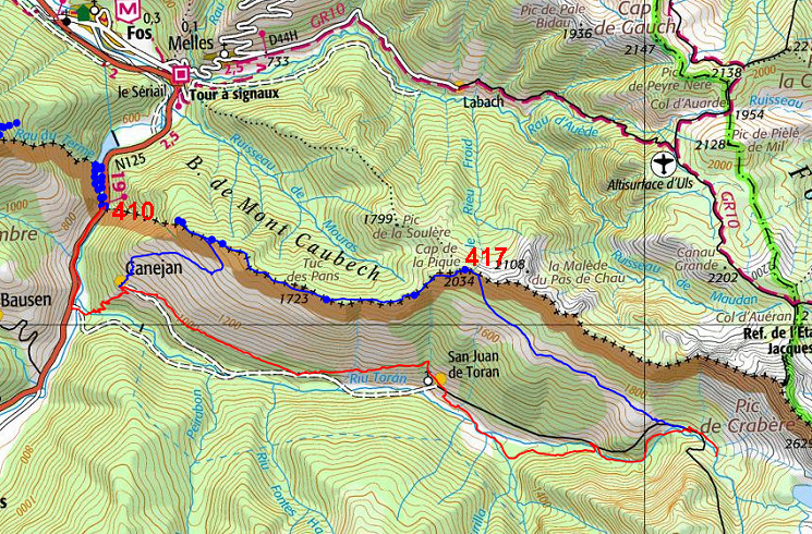
the bordermarkers on this stage are shown (and some adjoining ones).
The main route is red, the variants are blue. Click here for a fullscreen interactive map. In short The main route is a nice walk climbing to the pictoresque hillside-village of Canejan and continuing along old trails on the mountainside and through the forest. However: passing no bordermarkers, apart from bm410 at the beginning. The long variant takes care of the bordermarkers but involves heavy climbing, tough terrain and requires wayfinding (and bm-finding) capabilities. Both (main route and variant) end at the upper end of the valley where a footbridge passes the stream. Considerations The main route provides enough water refuelling options. It passes the Refugio dera Honeria after 10km. At the end of this stage (at the footbridge) a bivouac should be possible (I did that on 27 august 2006). When taking the alternative route along all the bordermarkers, you need to take enough water. There are some watersources but they might be dried up in (late) summer. The variant passes two cabins (la Trauès after 10km and le Plan 2km further) but I'm not sure how public or private they are. Factsheet
Gps-files needed
Useful You might check the relevant webpages in the 'All markers'-section and 'All my trips'-section. They provide pictures of the bordermarkers and additional information. Version 01 December 2013. If you have any correction, suggestion etcetera -> please email me: eefberns@grenspalen.nl MAPS AND DIRECTIONS December 2013. Maps and directions yet to be worked out in more detail. You might check the relevant webpages in the 'All markers'-section and 'All my trips'-section for pictures of the bordermarkers and wayfinding-issues. Print your own maps It's easy to print your own - custom made - maps with the GRPdesBF-route and the bordermarkers on them. See: Print your own maps |
||||||||||||||||||||||||||||||||||||||||||||||||||||||||||
 |
||||||||||||||||||||||||||||||||||||||||||||||||||||||||||
 previous
stage next
stage previous
stage next
stage 
|
||||||||||||||||||||||||||||||||||||||||||||||||||||||||||
