|
The
bordermarkers of the Pyrenees : all my trips
 |
|
| -
29 may
2009 - Many mouseovers |
 |
 |
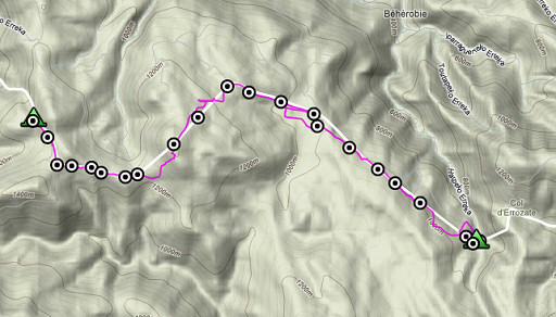
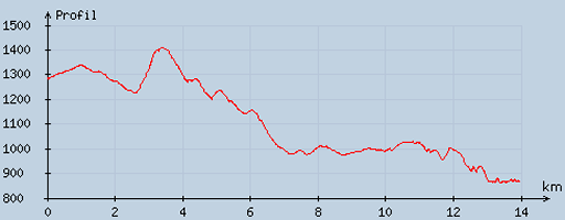
esfr-trip-track-20090529.kml (click to open in Google Earth or copy link to Google Maps; click right on this link to download gpx-version) Part of a 16-days trip, using day 1-10 to cover bm154 to 264 in the eastern Pyrenees and day 11-16 for bm416 to 365 near Bagnères-de-Luchon. Day 5: from bm198 along the borderline to the Grotte Harpea (bm219) Weather: warm, a splendid summer day. |
 |
For explanation of
the gps-coordinates and other cartographic backgrounds: see my cartography page En route: ± 7-18u, 11.07h, break 1½ h. According to my watch: Up 705m Down 1080m = 1785m in total. H max 1411m Lmin 896m |
 |
According
to visugpx - distance : 14.13 km - cum. elevation gain : 438 m - cum. elevation loss : 848 m - total elevation: 1286 - altitude maxi : 1408 m - altitude mini : 862 m - altitude average : 1108 m |
 |
An early start - about 7am - because of the very promising weather forecasts. I want to make full use of the good weather. Bm198 is next to my bivouac-spot. |
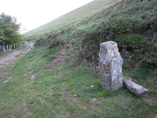 |
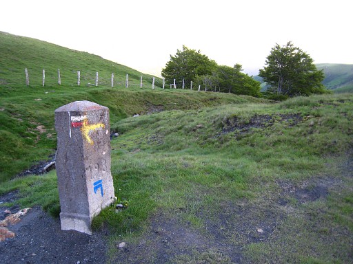
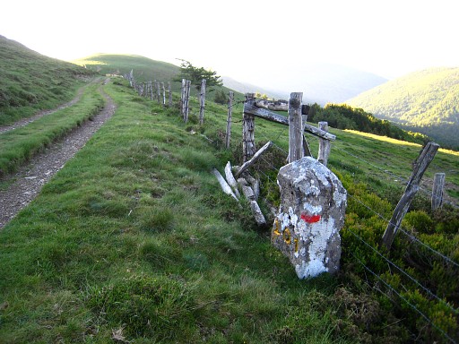
Bm199 |
 |
Then - about 20m to the right of the dirtroad - bm200. However: the dirtroad itself should be the border here, according to the Procès-Verbal. |
 |
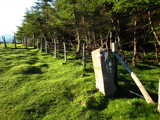
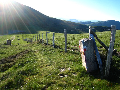
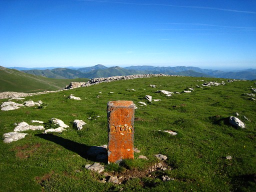
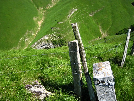
Bm201 It strikes me how well the numbers are painted in yellow-gold. This way of painting has started at bm155 and seems to end at bm234bis. Painting is useful in finding the crosses and makes photographing easier: you don't have to chalk the number. |
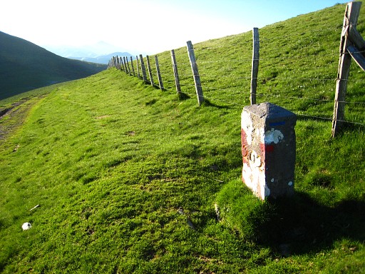 |
Bm202 |
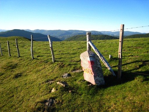 |
Bm203 |
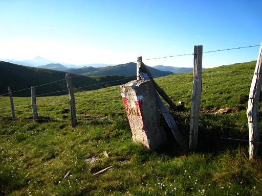 |
Bm204 |
 |
Bm204 again, now
with the mountain Urkulu visible |
 |
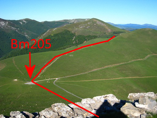
Bm205 |
|
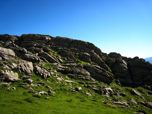
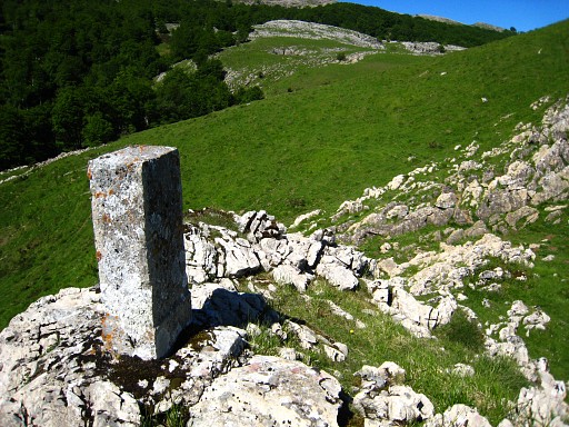
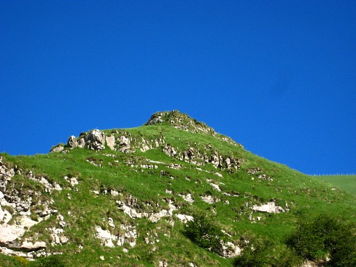
From bm205 I climb the Urkulu. There
is a distinct yellow waymarked trail uphill but the start of it is not
obvious, I began too far S. But you can't miss the summit and even without a trail, you will get on top. On the summit, there's a ruin. This picture: from the summit, looking back. Move the cursor over the picure to see the borderline and/or bordermarkers. On this page I will use a lot of mouse-over pictures to clarify routes and bm-locations. |
 |
Bm206 is further on, away from the ruin. |
 |
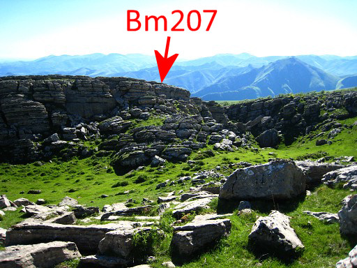
Guided by compass, I descend to a
distinct long rock-ridge. Bm207 is more at the right-side of the ridge,
I will learn. First I climb on the ridge. It takes a while to find bm207 but an iron pole and a CACA-sign (=hunting reserved) lying on the ground gave the clues. From the top of the ridge it's difficult to see: Bm207 |
 |
Bm207 |
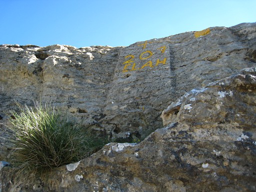 |
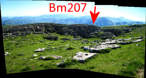
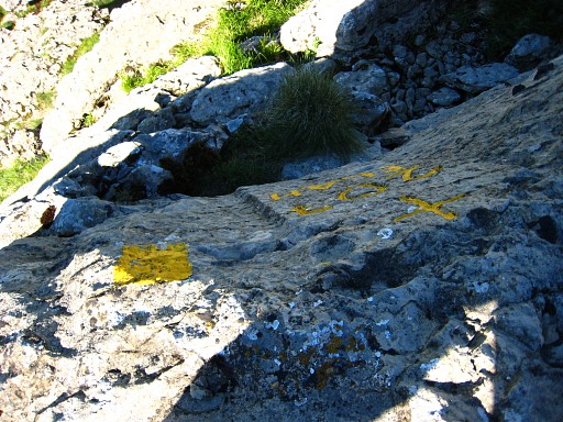
I descend to the foot of the ridge, from there bm207 is easier to spot. The characters underneath - E.L.A.H. - are mysterious. |
 |
Bm207 |
 |
Bm207, from further away. |
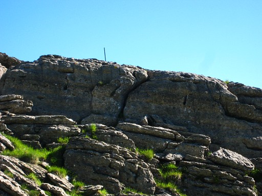 |
With this zoom-in to show the metal pole mentioned above. |
|
And from further away. Move the cursor over the picure to see the borderline and/or bordermarkers. |
|
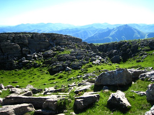
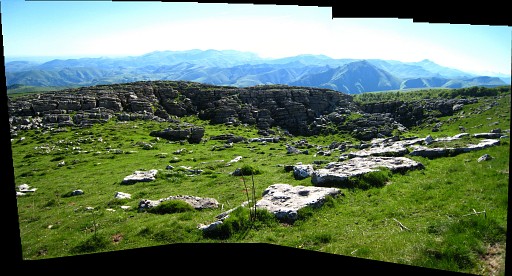
And this panorama of the ridge. Move the cursor over the picure to see the borderline and/or bordermarkers. |
 |
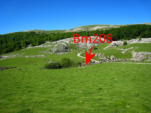
Climbing back to the ridge and on the
other side crossing a forest. There's a trail but that leads too far E.
Along that trail were small metal poles, perhaps indicating a water
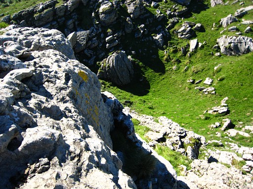
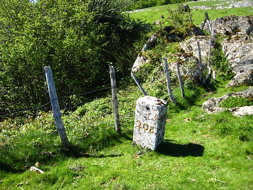
pipe or likewise. If you take the right direction, you will reach a road with a cabane at its ending. Nearby, there's a mysterious deep hole with besides it bm208. |
|
This picture: a bit further, looking back at that hole with bm208. Move the cursor over the picure to see the borderline and/or bordermarkers. |
|
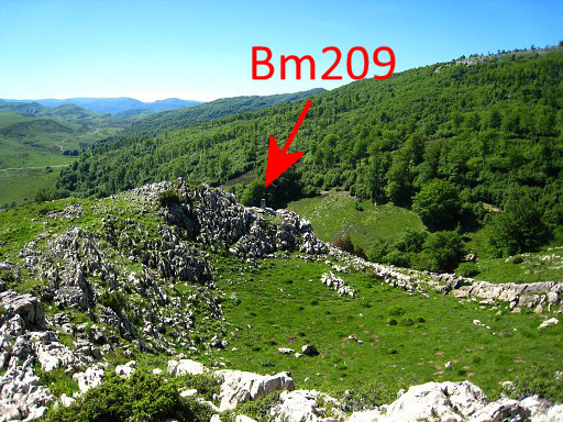
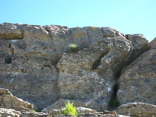
I climb on the next ridge and follow
it to the right. But that's not necessary, you can reach bm209 more
easily by going underneath along the ridge. This picture: bm209 already visible. Move the cursor over the picure to see the borderline and/or bordermarkers. |
 |
Bm209 |
 |
Bm209 is not standing on top of the ridge but at a 'sub-summit' a bit further, just below that sub-summit. You can't miss it. |
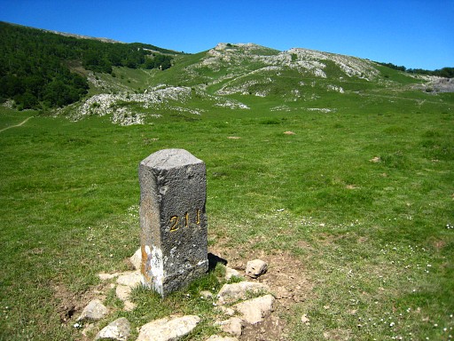 |
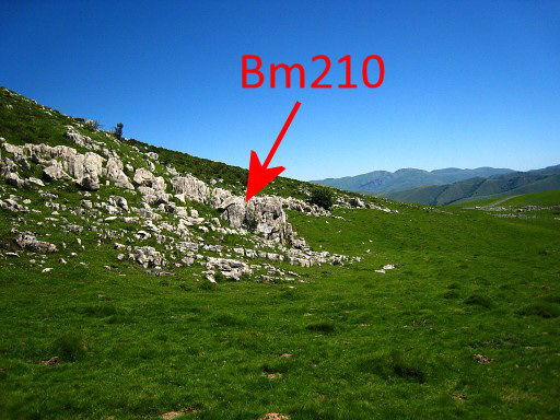
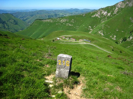
Then a long search for bm210. Finally the solution was: from bm211 - wich is well visible on a hill - |

|
walking back for 600m using the
gps-tripteller in the direction of bm209 which is also visible. By
searching well on that ± 600m spot, I find bm210! Move the cursor over the picure to see the borderline and/or bordermarkers. |
 |
In fact it seems to be located a bit
to the N of the straight line bm209-211. Not on the rocky ridge in the
middle but N of a grassy 'valley' against a rockwall. |
 |
Bm210 |
 |
Then on a Spanish dirtroad to bm212 There's a cabin closeby, nice spot for taking a break 13-14.30. I'm tired. |
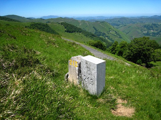 |
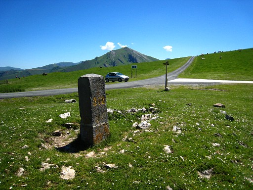
Second half I follow the tarmac road and find - just above it - bm213. There's an old and a newer bm213. |
 |
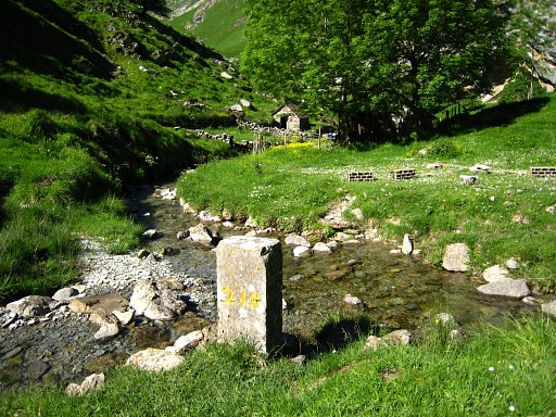
Further on - after a bend - I climb the hillside because the border goes in a straight line over that hillside. I find bm214. |
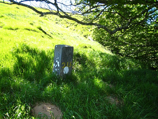 |
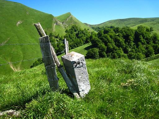
Further on - at the SW-edge of a forest, you need to cross a small groove - bm215. |
 |
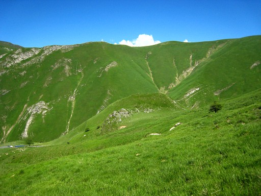
Further on - guided by compass - I find bm216. |
|
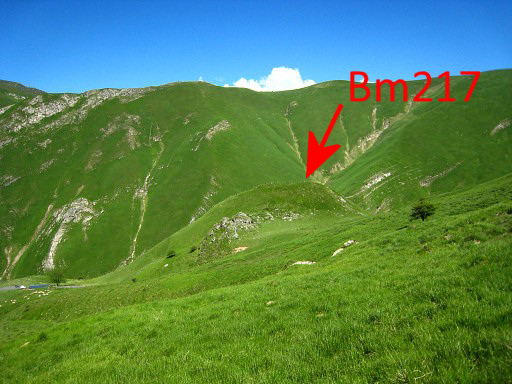
Then - while making a curve higher on the hillside or ridge - I see already in the distance on a hilltop bm217 Move the cursor over the picure to see the borderline and/or bordermarkers. |
 |
Bm217 |
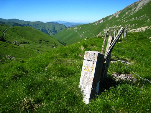 |
Bm217 |
 |
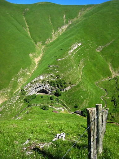
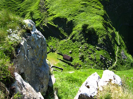
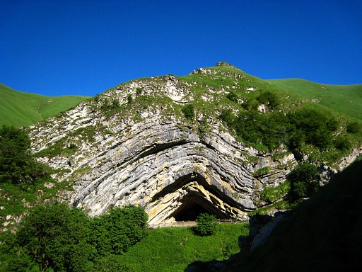
On the other side of this hilltop, you can see down below the Grotte Harpea. |
|
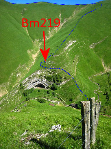
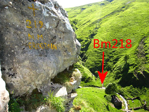
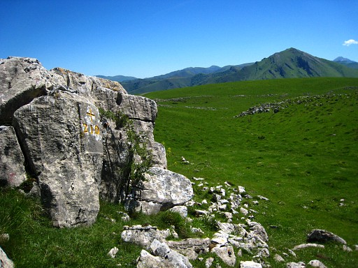
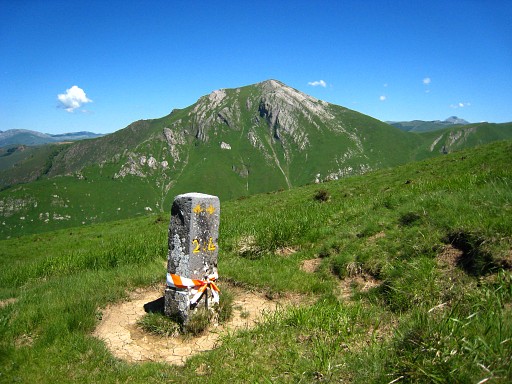
Another view of Grotte Harpea where bm218 and bm219 should be. Move the cursor over the picure to see the borderline and/or bordermarkers, the location of bm219 learned later on. I access the Grotte via the French side on a waymarked path. Two dogs at the shepherd's cabin want to chase me away. First I take a look in the cave. Apparently a tourist sight but also used as a cattle shelter. But there's no trace of a cross. I ask the 80-year old shepherd who tells me that the cross is located high above the cave. |
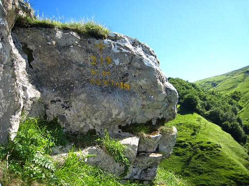 |
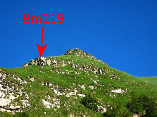
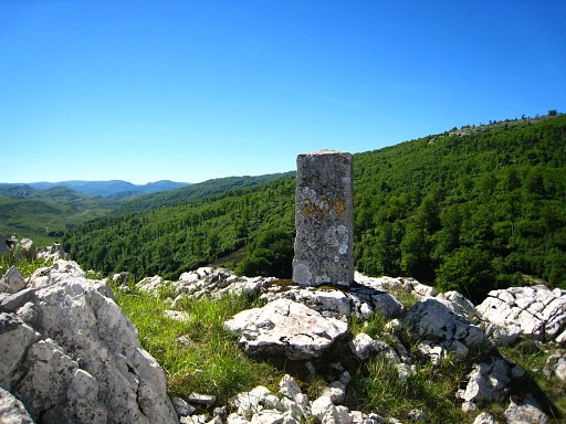
With his directions, I climb to it from the right side. Bm219 |
|
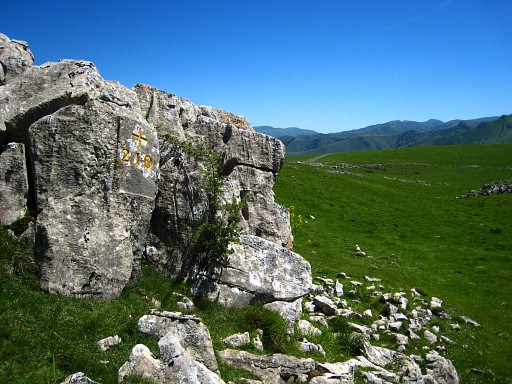
Bm219, there's a name or something else painted underneath (name of the painter?) Move the cursor over the picure to see the borderline and/or bordermarkers. |
 |
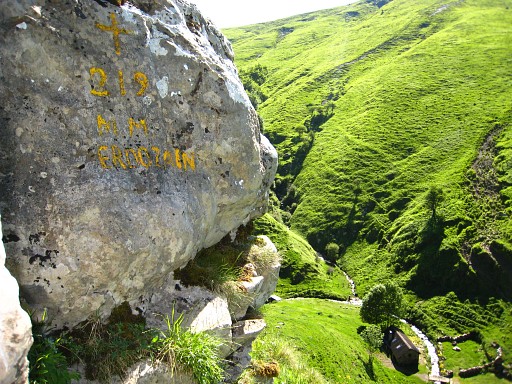
Bm219 |
 |
I descend back and find behind the cabane bm218. |
 |
Bm218 |
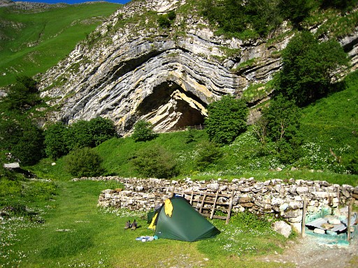 |
I have a nice chat with the French shepherd, a bivouac here is no problem. He himself with his wife will return home for the night. They are preparing the cabane for the summer season when the sheep will be brought here. It's a wonderful spot to camp. I'm content about this day's harvest. |
 |
In the evening I make a little stroll back on the access path to the cave. From there this view of the cave with |
|
this zoom-in to bm219. Move the cursor over the picure to see the borderline and/or bordermarkers. |