|
The
bordermarkers of the Pyrenees : all my trips
 |
|
| -
7 september
2010 - The mystery of bm261 |
 |
 |
Summary:
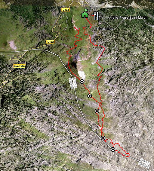
part of a 3-days exploring trip around Arette La Pierre St-
Martin. Second day: finding bm261 and then a first attempt
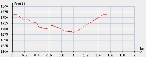
over the karst plateau to bm270. Start: 9.30, break: 11-13, finish: 18, net walking time: 6½ hours Weather: very strong winds, rain and thunder in the morning. According to the gps-tripteller (both trips together): Distance: 18, 2 km Total ascent: 1432m Maximum height: 2192m |
 |
esfr-trip-track-20100907-trip1.kml (click to open in Google Earth or copy link to Google Maps; click right on this link to download gpx-version) |
 |
For explanation of
the gps-coordinates and other cartographic backgrounds: see my cartography page |
 |
According
to visugpx - distance : 1.56 km - cum. elevation gain : 84 m - cum. elevation loss : 86 m - total elevation: 170 m - altitude maxi : 1765 m - altitude mini : 1682 m - altitude average : 1723 m |
 |
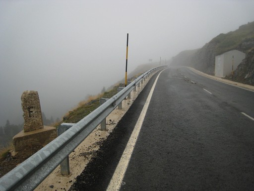
Parked
my car near bm262. A search for bm261 which Robert Darrieumerlou miraculously found in a rocky surrounding and off the current borderline. See this webpage of Robert. |
 |
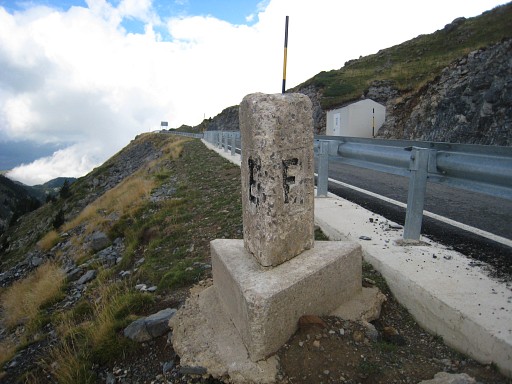
I
descend directly from bm262 to the road underneath. There are three intermediate - not numbered - triangular bordermarkers: one (this one) near bm262 and overlooking the ‘valley’ |
 |
and the two next ones on either side of the road down below. I remember them to stand in a direct line but now the two near the road stand - after the road’s reconstruction - besides it and out of line. |
 |
The third one. |
|
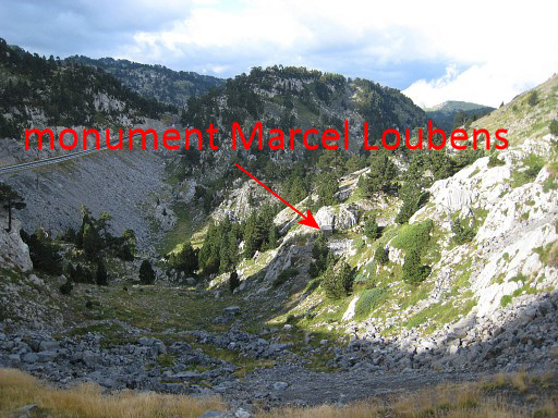
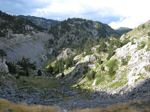
Anyway, I cross the
road and descend further
in this valley and start searching in the various pass-like trails from
that valley-floor to the west (to the right on this picture). Move the mouse over the picture to see where the monument is. A monument remembering an accident in which the famous French speleologist Marcel Loubens died in 1952. |
 |
In december 2010 - making this website - I discover this
wikipedia article
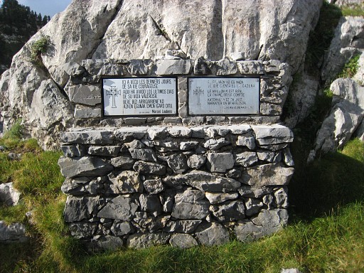
on Marcel Loubens. It tells us that Spanish policemen came to the site
in 1952 claiming that Loubens and his men were on Spanish territory. The article refers to this newspaper copy which states that this site was on the borderline but the entrance of the cave a few meters on French soil. They mention a distinctive boulder (the one behind the monument?) marked by a red cross, indicating the border. That deserves another search another time. |
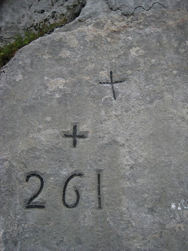 |
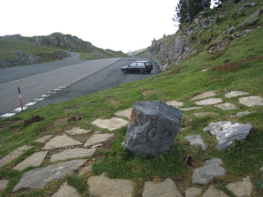
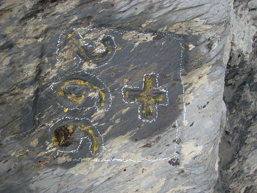
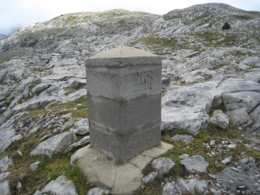
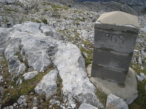
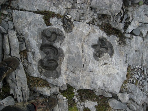
Anyway, by walking and searching around I finally find the bordercross 261 with - very unusual - two crosses. |
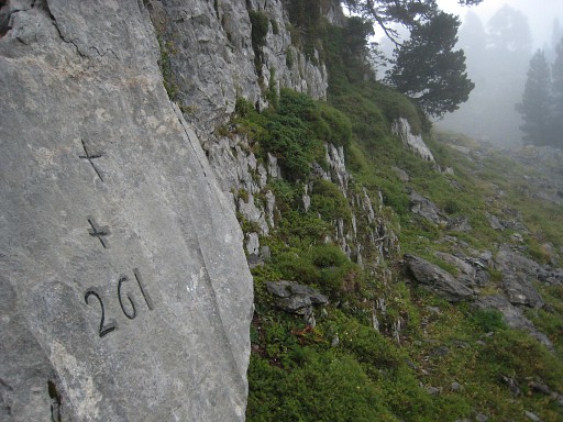 |
It's not quite a
col, I should
say, as the Procès-Verbal tells us. And definitely out of the borderline as shown on the maps. |
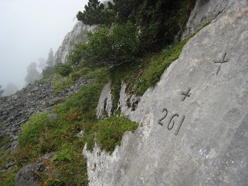 |
Perhaps the borderline has changed at some point in history, as Robert suggests. For now: a mystery. |
 |
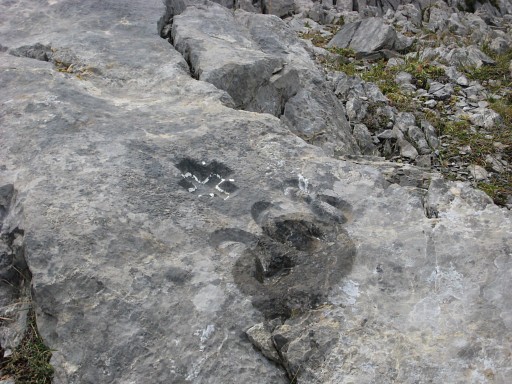
Climbing back to the road, I erect some cairns. Other clues: an car-wreck lies somewhat higher then bm261, the bm is facing south. |
 |
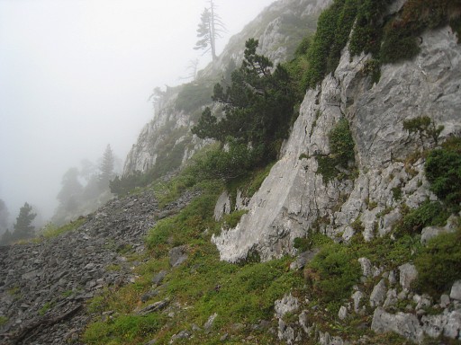
Climbing along a sort of trail with a sort or rockwall at my left hand (here at the right), I reach the road near the lowest of the three unnumbered bordermarkers. |
 |
There's a
little concrete building on the other side of the road. So here -
between the building and that bordermarker -you should descend in
sw-direction to bm261 And now - knowing where bm261 is - the new position of that lowest unnumbered bm becomes more comprehensible, perhaps it’s now in line with 261 and the middle one of the three bordermarkers. Just guessing. I hurry back to my car, just in time to shelter for rain and thunder. This break is prolongued in a restaurant at the ski station. |
 |
esfr-trip-track-20100907-trip2.kml (click to open in Google Earth or copy link to Google Maps; click right on this link to download gpx-version) When the rain is subsiding, I give it another try, starting from the ski station. |
 |
For explanation of
the gps-coordinates and other cartographic backgrounds: see my cartography page |
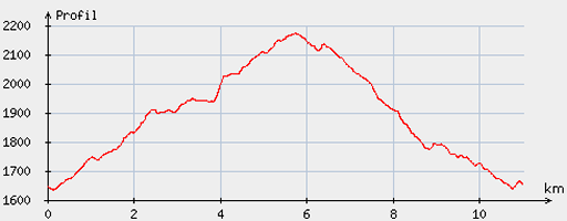 |
According
to visugpx - distance : 11.13 km - cum. elevation gain : 567 m - cum. elevation loss : 559 m - total elevation: 1126 - altitude maxi : 2172 m - altitude mini : 1635 m - altitude average : 1902 m |
 |
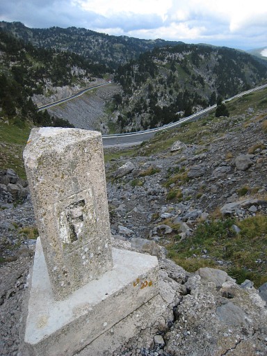
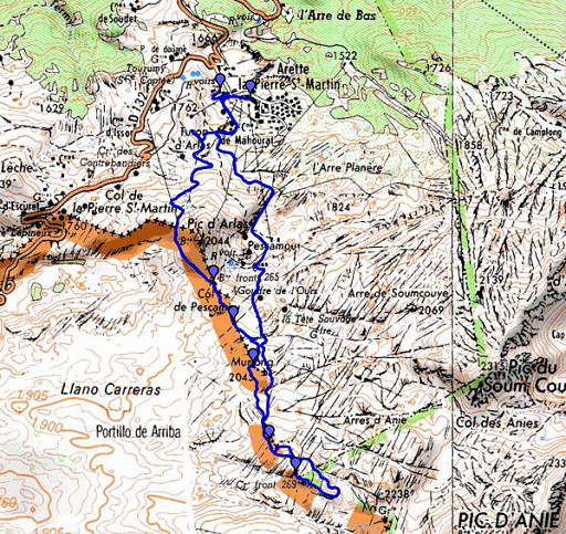
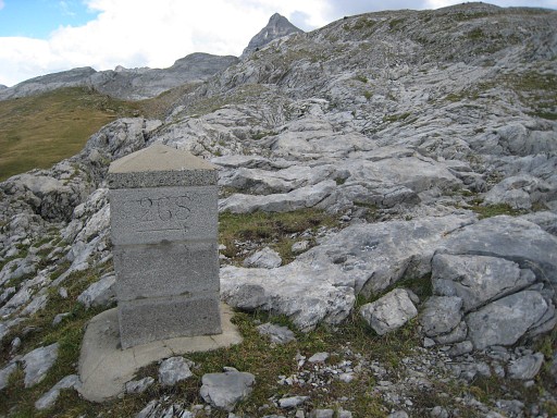
I walk to Col d’Arlas, pick up a yellow trail and find on Col de Pescamou bm265. |
 |
Bm265 |
 |
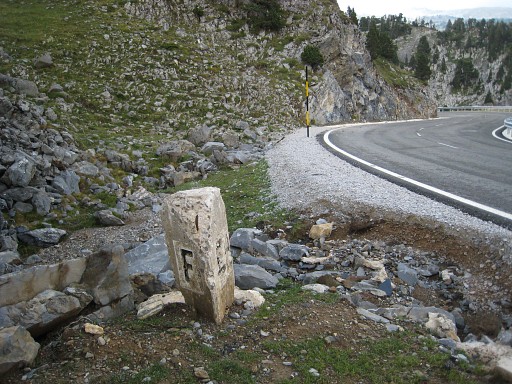
I follow my gps
directly to bm266 (Col de Boticotch) but
following the yellow trail would have brought me there too. Notice the distinct hill-ridge in the distance, the spot of bm267 |
 |
Bm266 |
 |
Bm266 |
 |
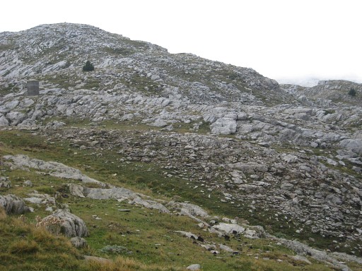
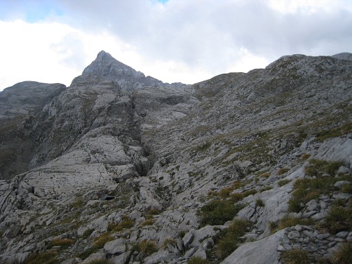
I continue for a little while on the track but then have to leave it to climb a distinct hillridge for bm267. |
 |
Bm267 |
 |
Bm267 |
 |
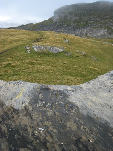
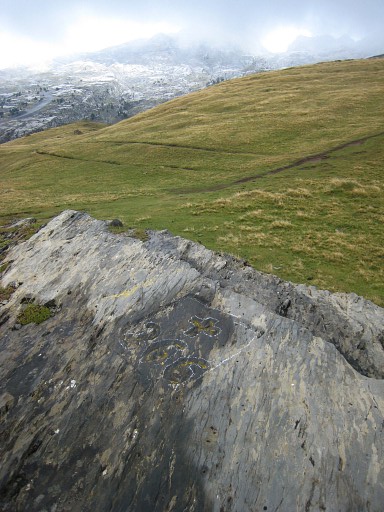
I
descend the hillridge on the other side, the terrain getting rougher, especially
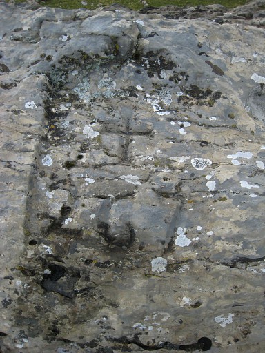
after bm268 (stone and cross) which I find easily with my gps. You can spot bm268 at this picture, at the left. |
 |
Bm268, notice the cross behind the marker. |
 |
bm268 |
 |
Bm268 |
 |
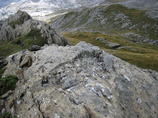
Bm268, looking back with at the left the hillridge of bm267 and in the middle in the far distance the Pic d'Arlas. |
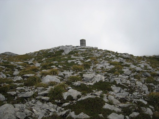 |
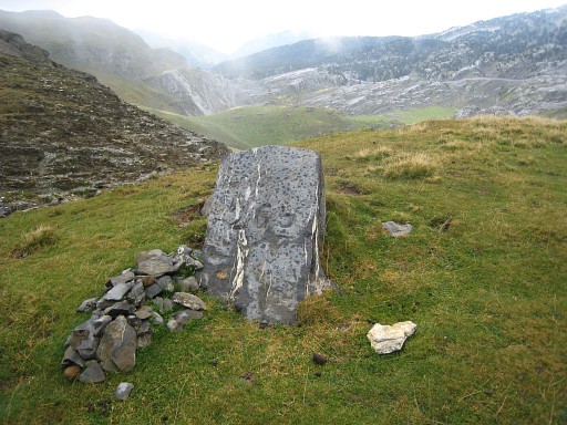
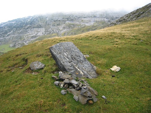
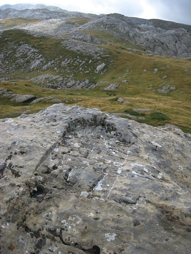
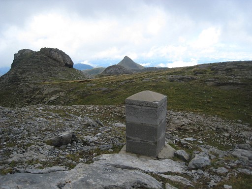
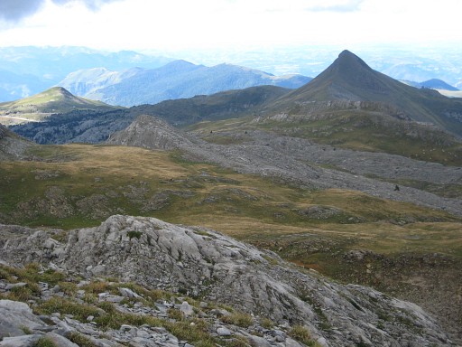
It’s finding a way over the karst plateau, torn apart by crevasses, untill I find bm269 (cross and stone). |
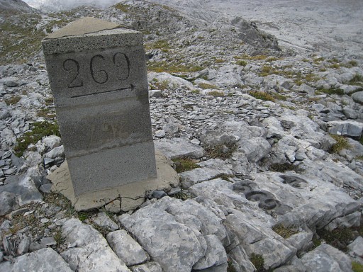 |
Bm269 |
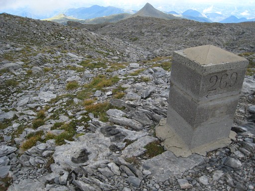 |
Bm269 |
 |
Bm269 |
 |
From bm269there’s a sort of hillridge to follow but half-way to bm270, I give up, it’s getting too late. |
 |
I'm returningin the direction of Pic d'Arlas and |
 |
pass bm269 again. I follow a cairns-waymarked trail back and later on a red waymarked trail to the ski-station. |