|
The
bordermarkers of the Pyrenees : all my trips
 |
|
| - 21 august
2011 - to Pic d’Anie |
 |
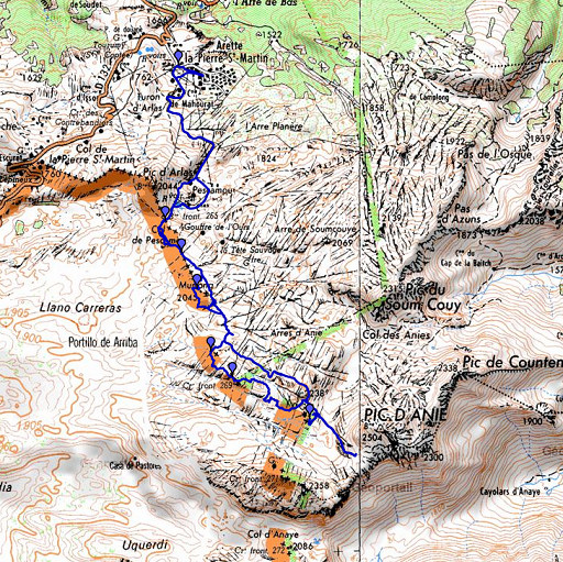 |
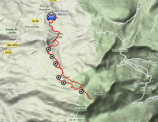
esfr-trip-track-20110821.kml (click to open this trip in Google Earth or copy link to Google Maps; click right on this link to download gpx-version) Summary: part of a 3-weeks trip to the Pyrénées to 'do' the ± 60 remaining bordermarkers. All done as daytrips from campings. Day 7: an unsuccessful attempt to conquer bm271 from Arette La Pierre St Martin. Weather: sunny, warm |
 |
For
explanation of
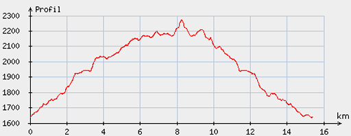
the gps-coordinates and other cartographic backgrounds: see my cartography page En route (±): 9.45 - 17.45 (8h) According to the gps-tripteller: Distance: 16,5 km Cum. elevation gain : 1161m Total elevation: 2322m Maximum height: 2186m Time: 7.55h |
 |
According
to visugpx - distance : 15,6km - cum. elevation gain : 763m - cum. elevation loss : 764m - total elevation: 1527m - altitude maxi : 2274m - altitude mini : 1635m - altitude average : 2016m |
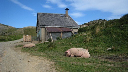 |
The drive from my basecamp in Urdos to the ski station of St Martin-de-la-Pierre lasted longer than expected on those
narrow and winding mountainroads. On my way to the Col de Pescamou, I came along these free-range pigs. |
 |
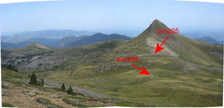
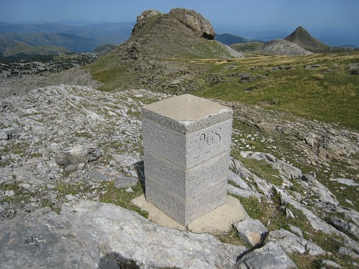
At Col de Pescamou: bm265 |
 |
Then along the
trail to bm266, the Pic d'Anie straight ahead. |
 |
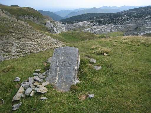
Bm266 |
 |
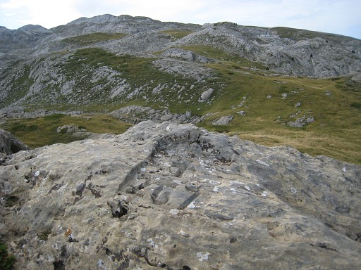
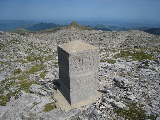
I decide to re-do bm267-269. That took more time
than I thought. This picture: the hillridge of Murlong in front. On top of it - on its southside - is bm267. Climbing to the ridge is easier than it looks. |
 From Murlong, this panorama-view back to Pic d'Arlas. |
|
 |
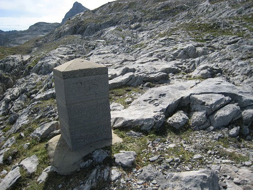
On the southside of the ridge: bm267. |
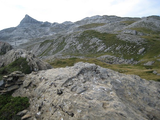 |
Bm267, the Pic d'Anie in the background. I descend on the other side of the ridge. |
 |
Then I first head straight for bm268 but the terrain is a bit too difficult. I return to the trail. Further on (± 600m from bm268) - on this distinct spot with two cairns, the trail passes between them- I leave the trail and go SW |
 |
to bm268. |
 |
Besides it: a cross. |
 |
Bm268, in the background the Murlong hillridge |
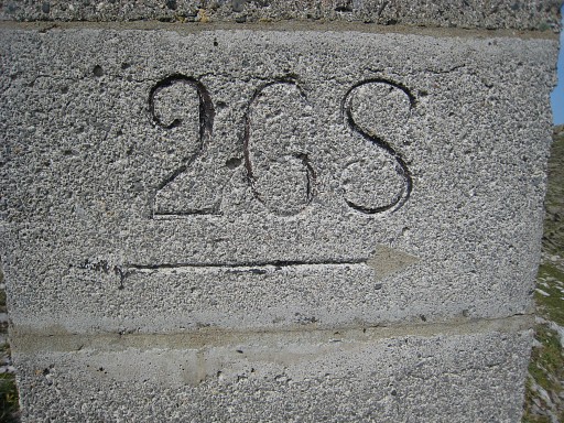 |
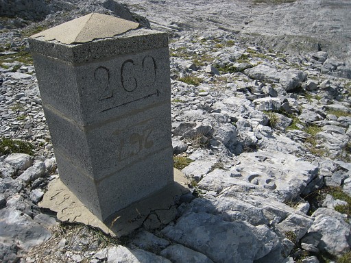
Note the arrow-like line. Bm269 is to the left. |
 |
From bm268 with compass & gps to bm269. It's about 350m to the SE. There are cairns
helping. |
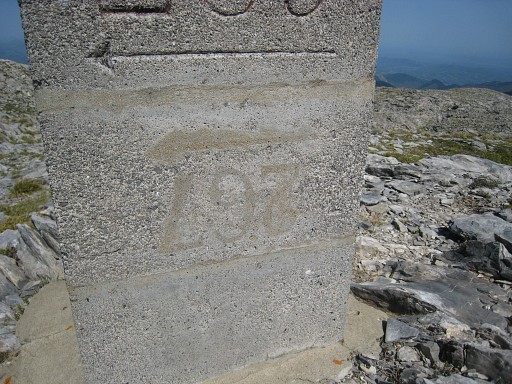 |
Under the nr. 269 and the arrow pointing to bm270, I notice a conceiled nr. 267 upside down! |
 |
And this is the other side with a similar upside down nr. 267. Note the cross at its foot. |
 |
In close-up. Apparently the original plan was to build a complementary pillar at bm267 as well. |
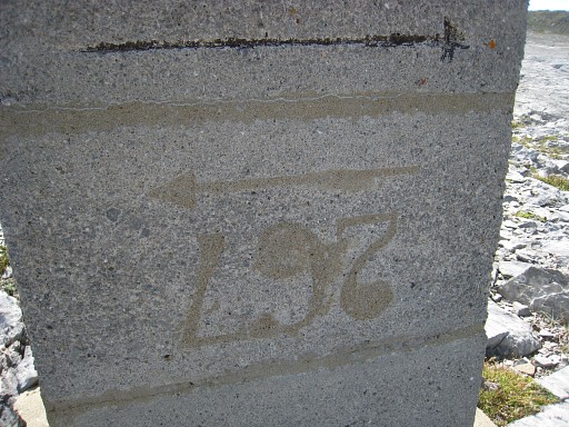
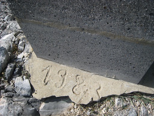 |
And the date of this scheme: apparently 1983. |
 |
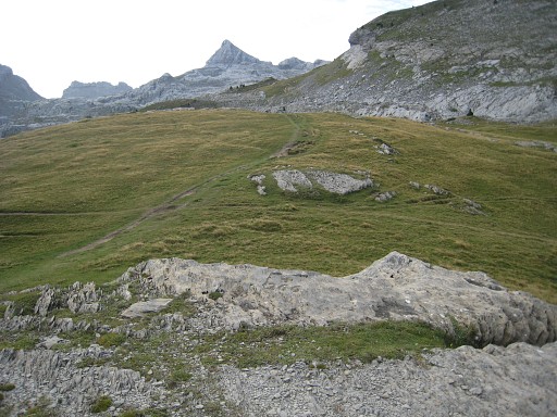
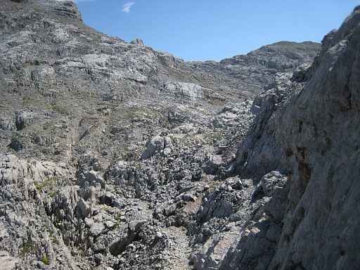
Last shot of bm269: cross and pillar. From bm269 I keep following the cairns. They bring me with some difficulties to a trail NWW of bm270. My conclusion: it’s easier to return from bm269 via bm268 to the red/orange trail and then proceed to bm270. |
 |
Anyway, I follow the trail a bit to the E and NE and I’m back at the
bifork (with a metal pole nearby) where I was last year. From here I take a red trail to Pic d’Anie. That trail seems to have taken another route through the karst crevasses than last year. Less deep into the crevasses. But first this view from the bifork. |
 |
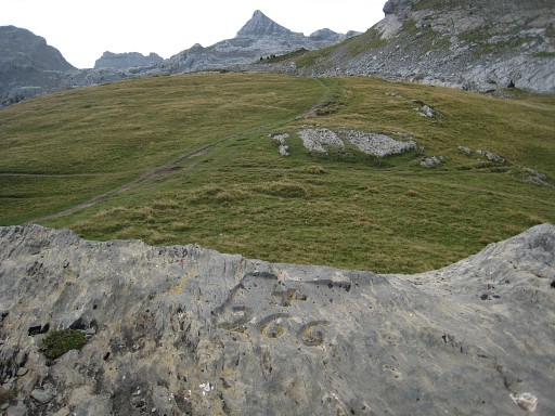
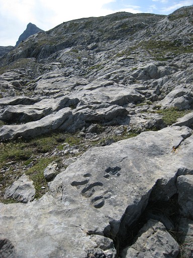
A bit further on the route: I remember the spot of bm270 from last year. |
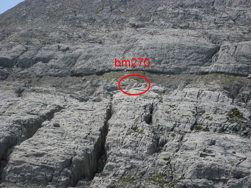 |
Zoom-in |
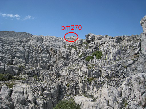 |
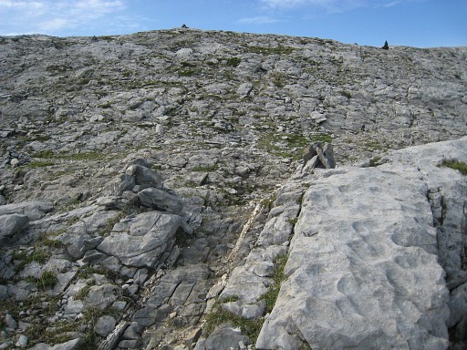
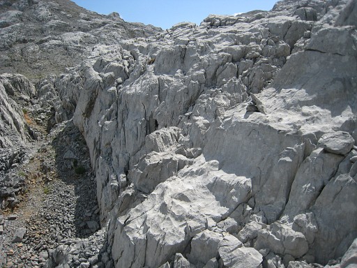
I go into the crevasses along the red trail, seeking the spot where I climbed to bm270 last year. But - as said before - the trail has taken a different track. But there's a clue: a no longer used red arrow, pointing to the right. It brings you through a sort corridor to a parallel path, ±15m further. From there, you can already see the cairn, marking bm270. |
 |
Zoom-in |
 |
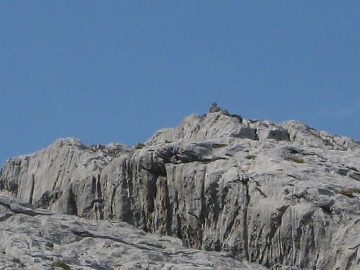
I climb towards bm270: not straight but with a bow. En route: this zoom-in picture of bm270. |
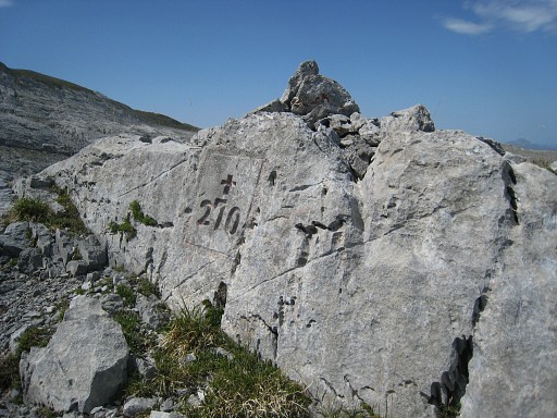 |
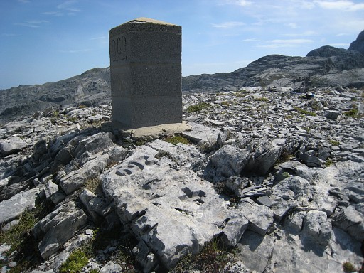
Bm270 |
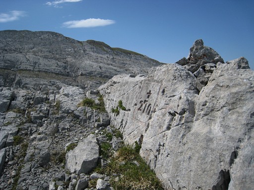 |
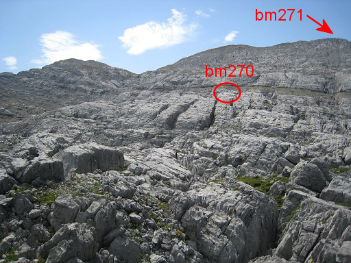
Bm270, looking to the SSW with the hillridge whereupon bm271 should be. |
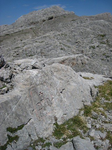 |
Bm270, looking N |
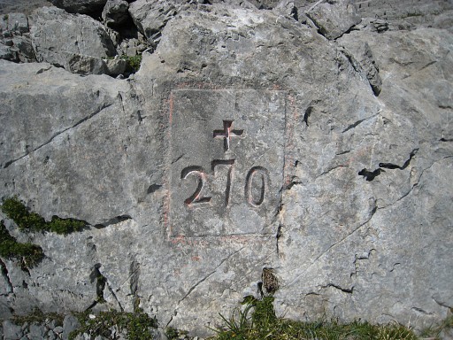 |
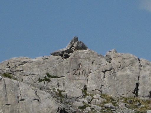
Bm270, close-up |
 |
This picture: back at that parallel path where I started my climb to bm270 There were already a few cairns and I added some . Then back through that corridor to the red trail. |
 |
And this is where the red - faded - arrow points to the
right and where you can get in 15 meters to the old (red) trail.
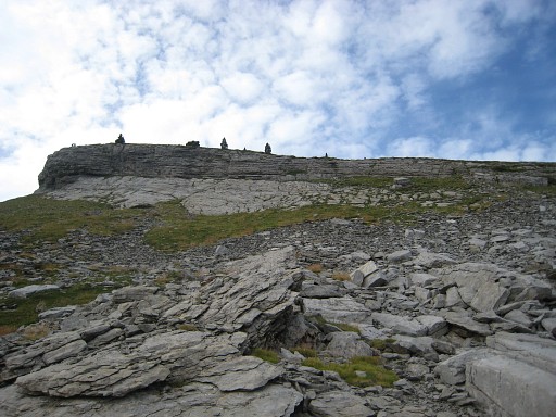
I continue on the red trail to Pic d’Anie, hoping to get on the ‘col’ between the Pic and the ridge with bm271 and bm271bis. |
 |
After the crossing of the crevasses and arriving at the foot of the
Pic, I leave the red waymarks when a steep climb appears. Instead I
follow a trail along the slope in the direction of the forenamed
‘col’. But that trail fades away. This picture: as far as I got, looking forward to the 'col'. One week later I will learn that I should have climbed that steep part of the red trail, then leave the red trail and proceed along the slope to the 'col'. I wonder if there’s a trail from Belagua via bm271 to Pic d’Anie. |
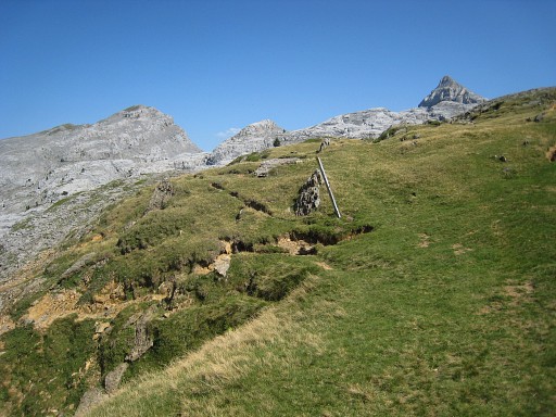 |
Meanwhile it’s 14.30 and
I have to return, knowing it will take 3 hours to do so. This picture: ± 200m SSE of the Murlong hillridge. The metal pole was once a waysign. To the left descends a yellow trail into the crevasses to Pic d'Anie. Straight forward a red/orange trail offers an alternative route, mostly parallel to the borderline. |