|
The
bordermarkers of the Pyrenees : all my trips
 |
|
| -
thursday 10 september
2020 - Reconnaissance of the trail from Refugio Belagua to Col d'Anaye |
 |
 |
Summary:
part of a series of 6 daytrips and 1 multiday trip in september 2020 in
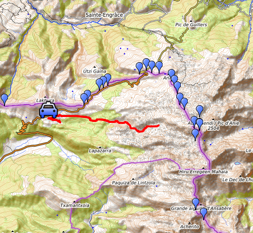
the Pyrénées Atlantiques. This is trip 6. Today: from Refugio on the GRT13 in the direction of Col d'Anaye to see where a connection to the Añelarra-ridge is possible. Basic question: might this be an easier route to get to bm271? Basecamp = camping in Arette Weather: cloudy, sunny in the afternoon. |
 track-20200910.kml
(click to open this trip in Google Earth or copy link to Google Maps; click right on this link to download gpx-version). The gps-track has not been manually corrected which explains the inaccuracy and misalignment at some points. For cartographic backgrounds: see the cartography-page Gps-waypoints of all bordermarkers (most recent version): kml: esfr-bordermarkers-all-waypoints.kml gpx: esfr-bordermarkers-all-waypoints.gpx (with elevation added by gpsvisualizer.com) |
|
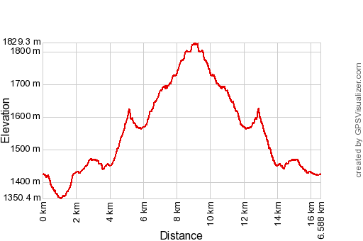 |
According to Garmin
Basecamp (uncorrected track): Distance: 16.6 km Max-height: 1877m Min-height: 1402m Elevation: +784m -779m Total elevation: 1563m Start 7:47 Finish 14:24 Total time: 6:37 |
 | Having parked at Refufio Belagua and looking forward to the terrain to traverse. (click photo to enlarge) |
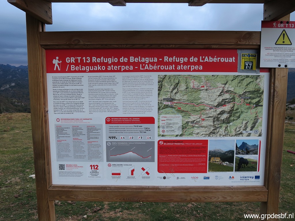 | An information panel with (click photo to enlarge) |
 | the red-white waymarked trail GRT13 to Col d'Anaye and refuge de l'Abarouat in France. Spoiler: I won't get as far as the Col d'Anaye. (click photo to enlarge) |
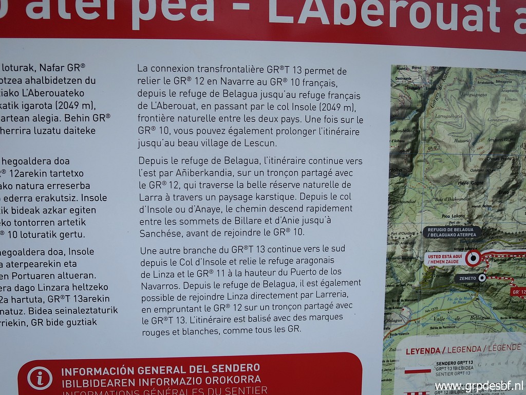 | More
information on this trail which connects on the one hand both refuges
and on the other hand (partly) the Spanish GR11 with the French GR10. (click photo to enlarge) |
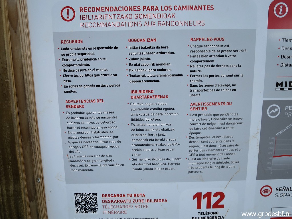 | Some warnings for the trail in winter (dangerous) and for frequent bad weather. (click photo to enlarge) |
 | It takes me a while to find the right trail from the Refugio. That is - from the Refugio - not going SEE but NEE. At this point I'm back at the right track. (click photo to enlarge) |
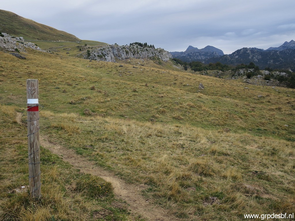 | The trail is well-waymarked and after (click photo to enlarge) |
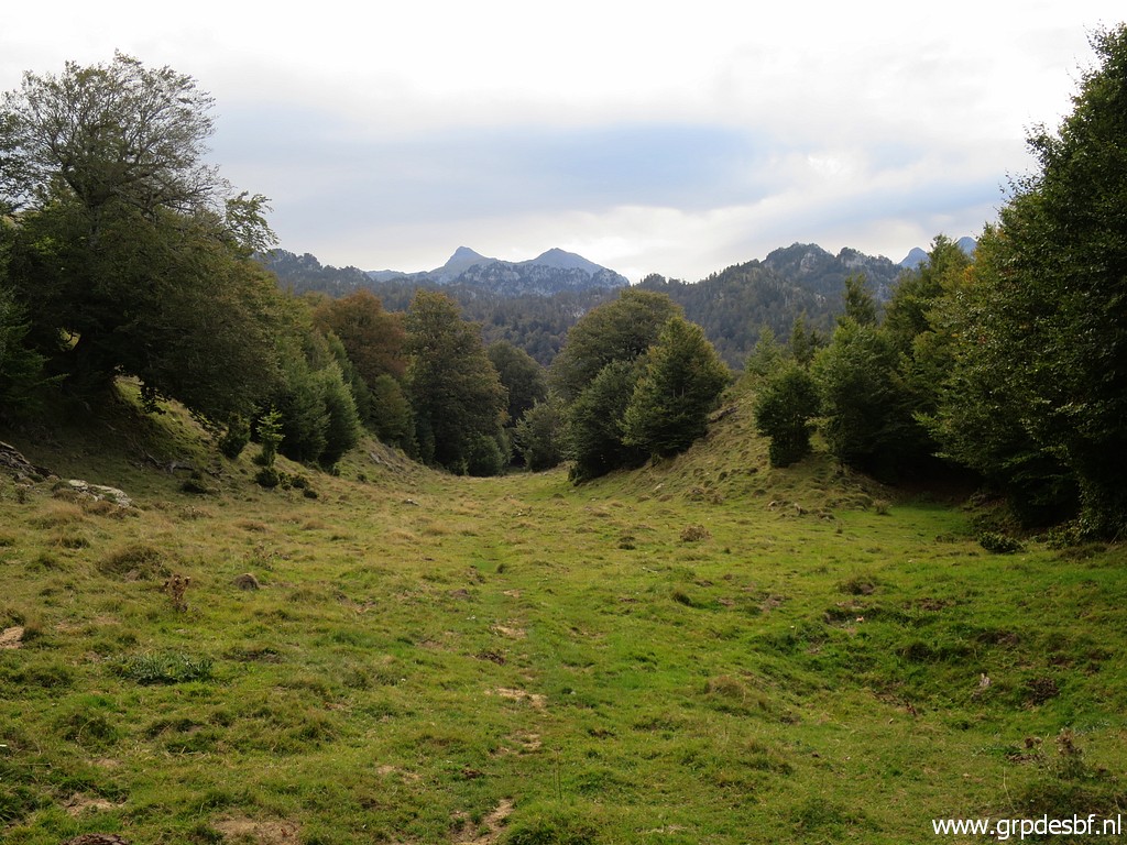 | the grassy part it enters (click photo to enlarge) |
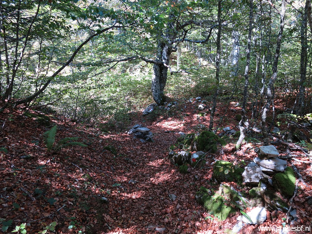
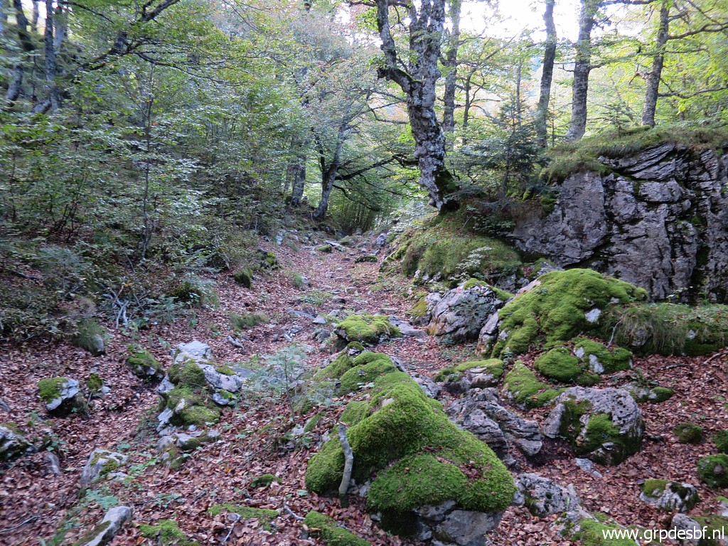 | a beautiful beech-forest. (click photo to enlarge) |
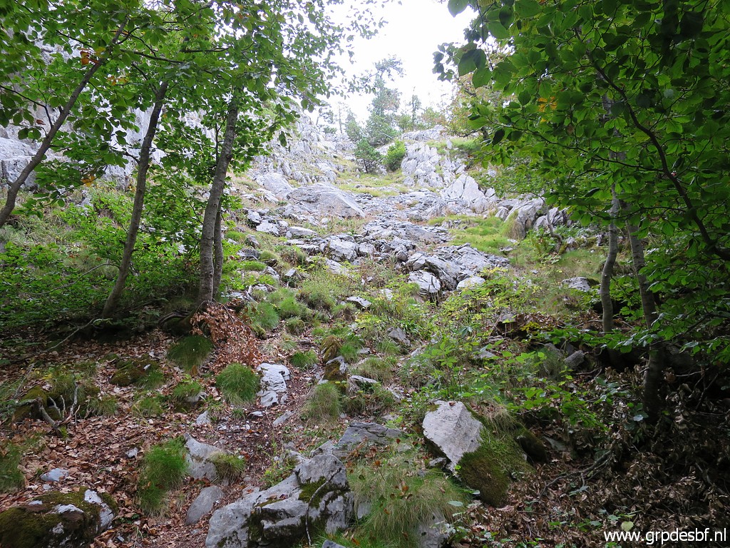 | Later on the terrain gets more rocky and the (click photo to enlarge) |
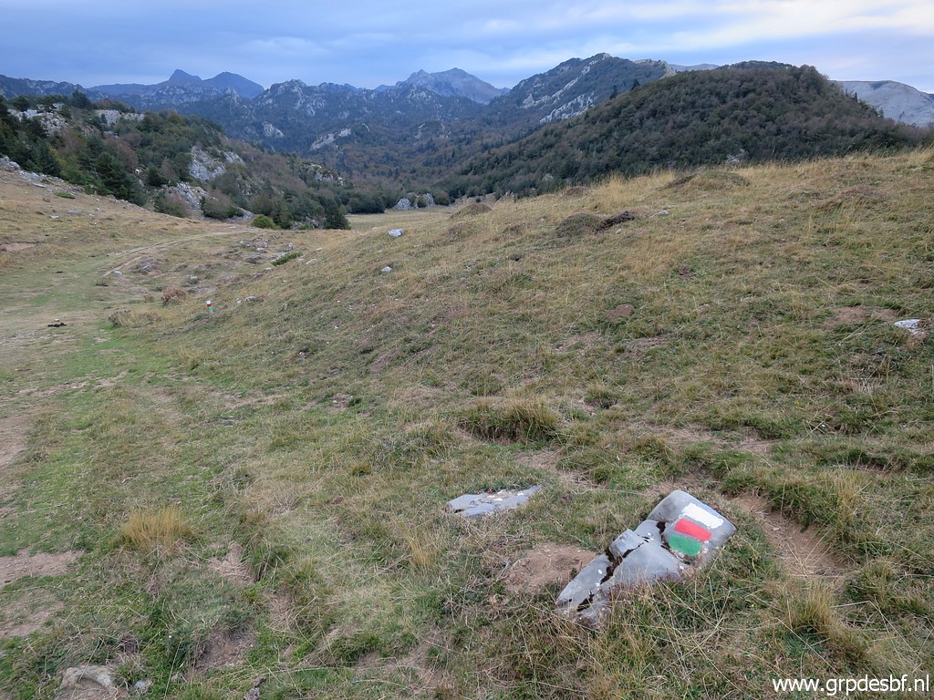
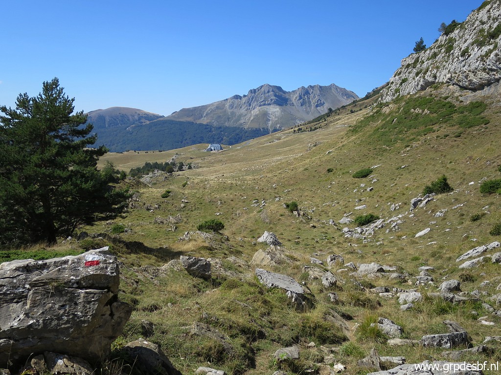
 | trail traverses this open spot. (click photo to enlarge) |
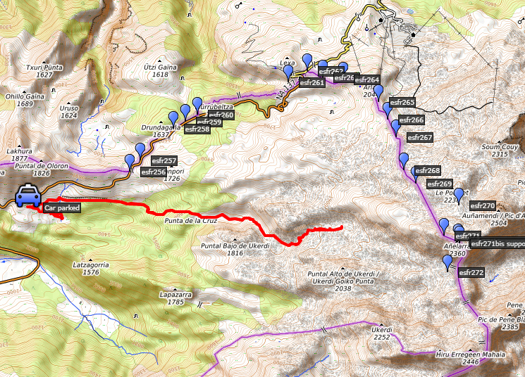
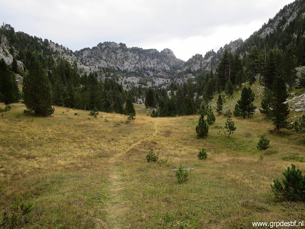
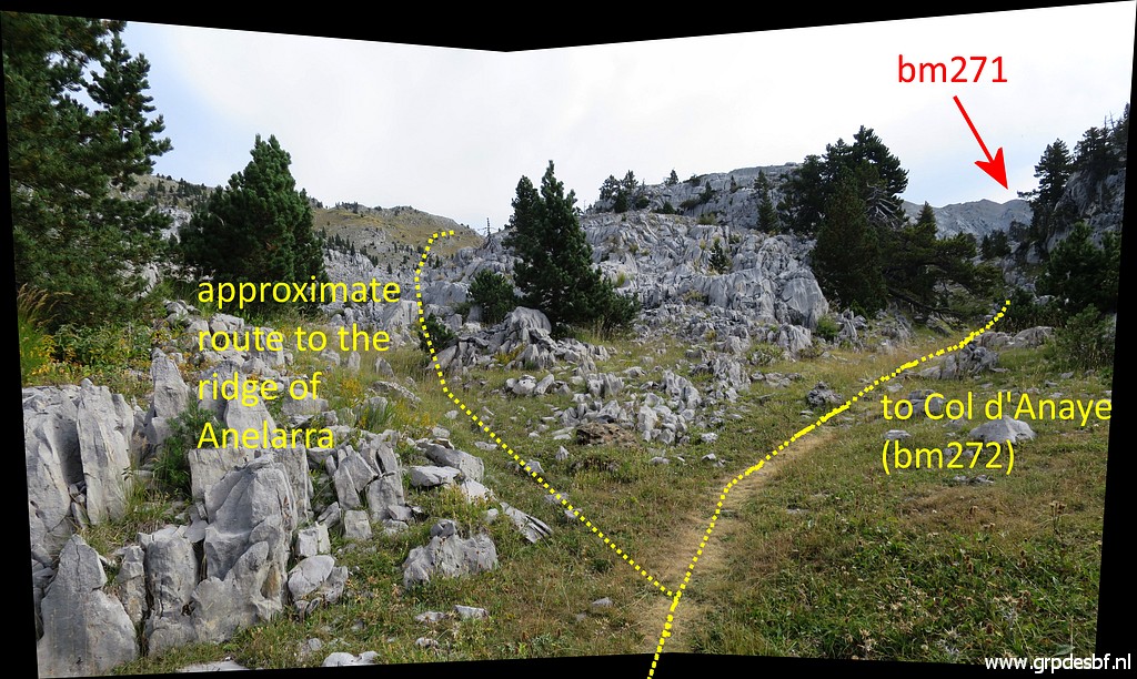
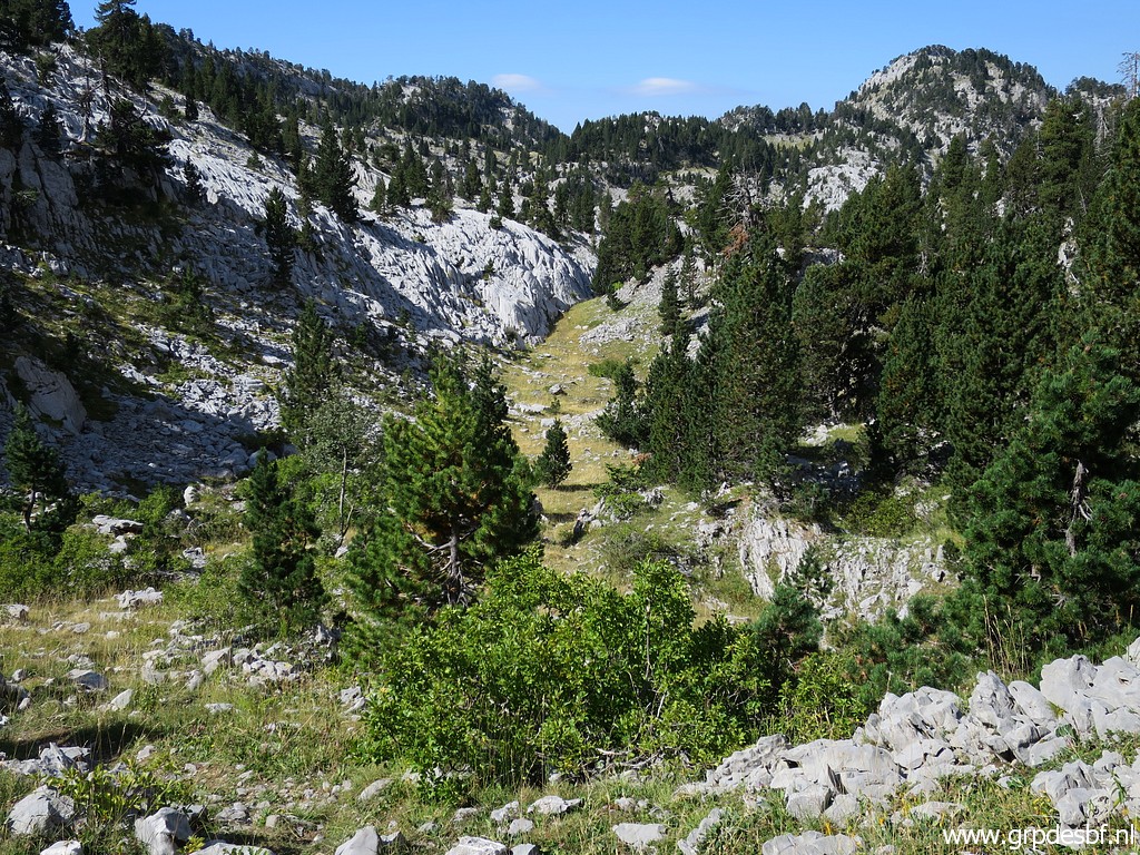
 | Later on it gets more open and the trees become scarce. The Añelarra-ridge comes in sight. Bm271 is on that ridge. (click photo to enlarge) |
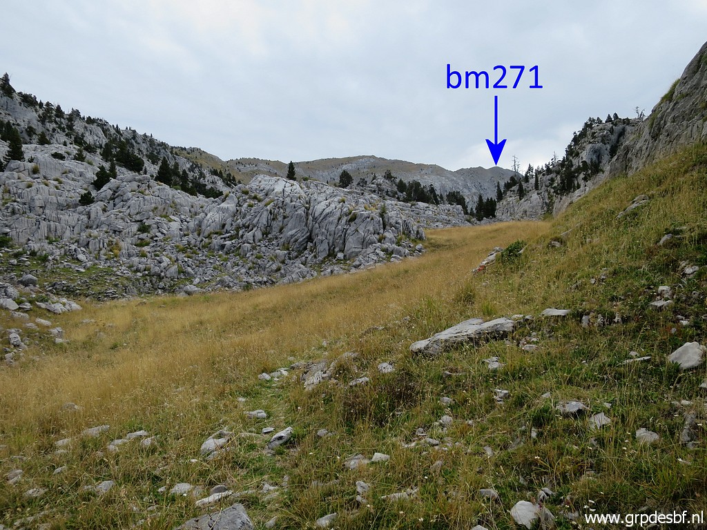
 | Later on this panorama. (click photo to enlarge) |
 | This is the spot where I on 29082012 joined the GRT13, having descended from the Añelarra-ridge. (click photo to enlarge) |
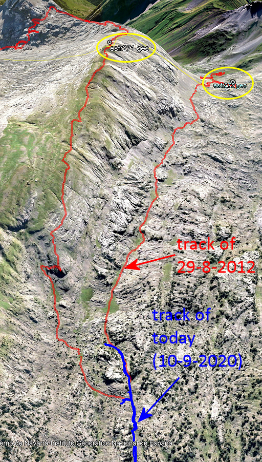 |
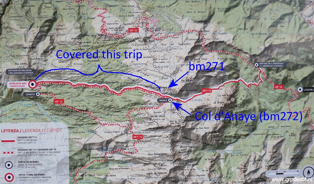
Let's show both tracks on Google Earth. It's still a long way to bm271. |
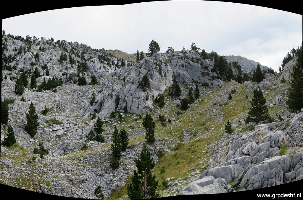
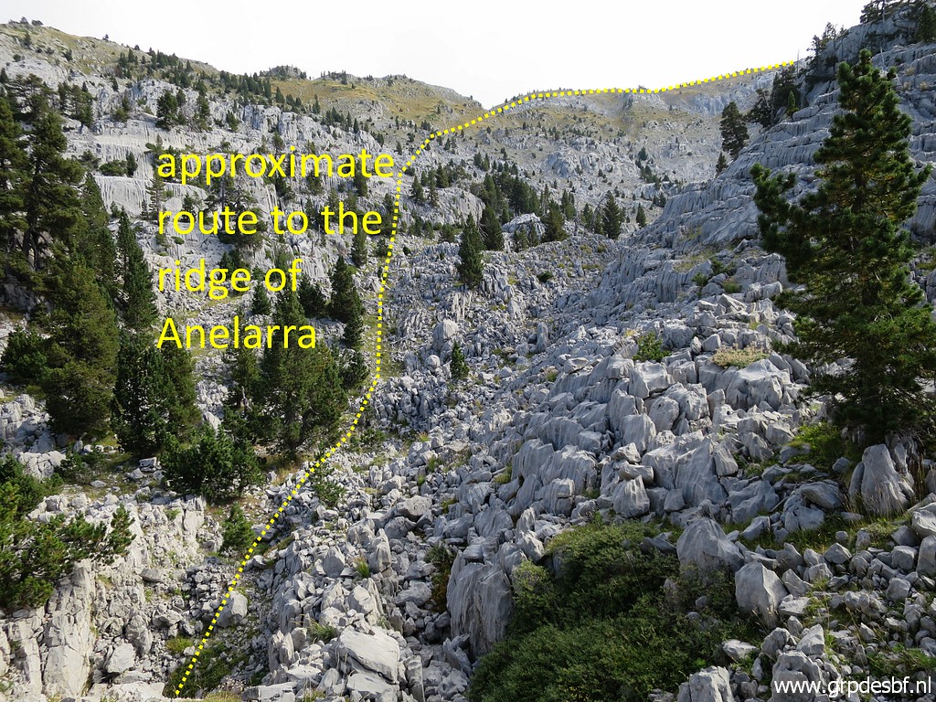 | This
picture: having entered the rocky terrain for ± 30m for a better view
of the terrain to traverse before you get at the foot of the
Añelarra-ridge. Once you get at that ridge, progress becomes easy on the ridge. (click photo to enlarge) |
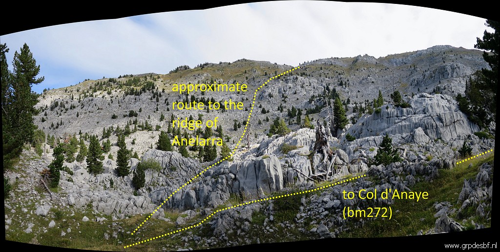 | This
picture: approximately 250m further at a spot where Topopirineos shows
the beginning of a route towards the Añelarra-ridge. But no trails, no
cairns. This is where I stop and return. Traversing to the ridge and bm271 is another 2,5km and 500m climbing. On this terrain estimated at another 2h walking and climbing. (click photo to enlarge) |
 | That would mean in total a trip of 5-6h to bm271 and 5h. back. Conclusion: this route from Refugio Belagua has no advantage to an access from Col de la Pierre St-Martin as we tried 5 days earlier on 5-9-2020. This picture: returning and descending into more green terrain. (click photo to enlarge) |
 | Back in the forest. The sun has started to shine. (click photo to enlarge) |
 | The last part back to the Refugio (visible in the background). (click photo to enlarge) |
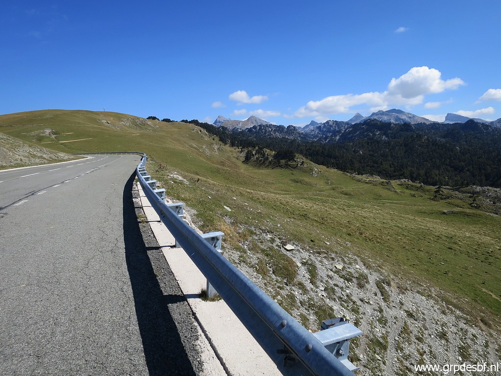 | While driving back, I stop here (click photo to enlarge) |
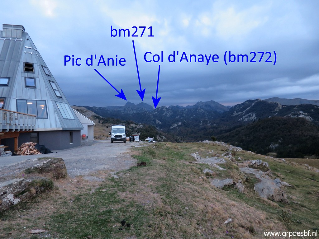
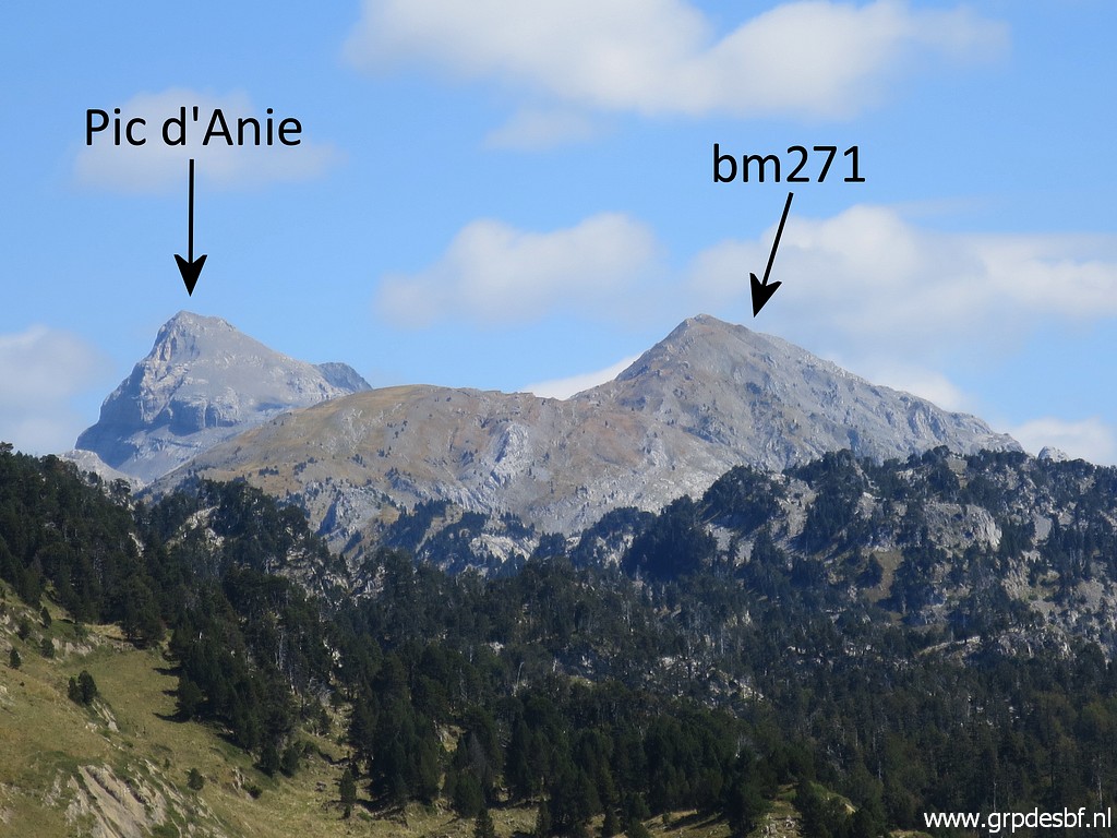 | to make a zoom-in picture of Pic d'Anie and the Añelarra-ridge. (click photo to enlarge) |
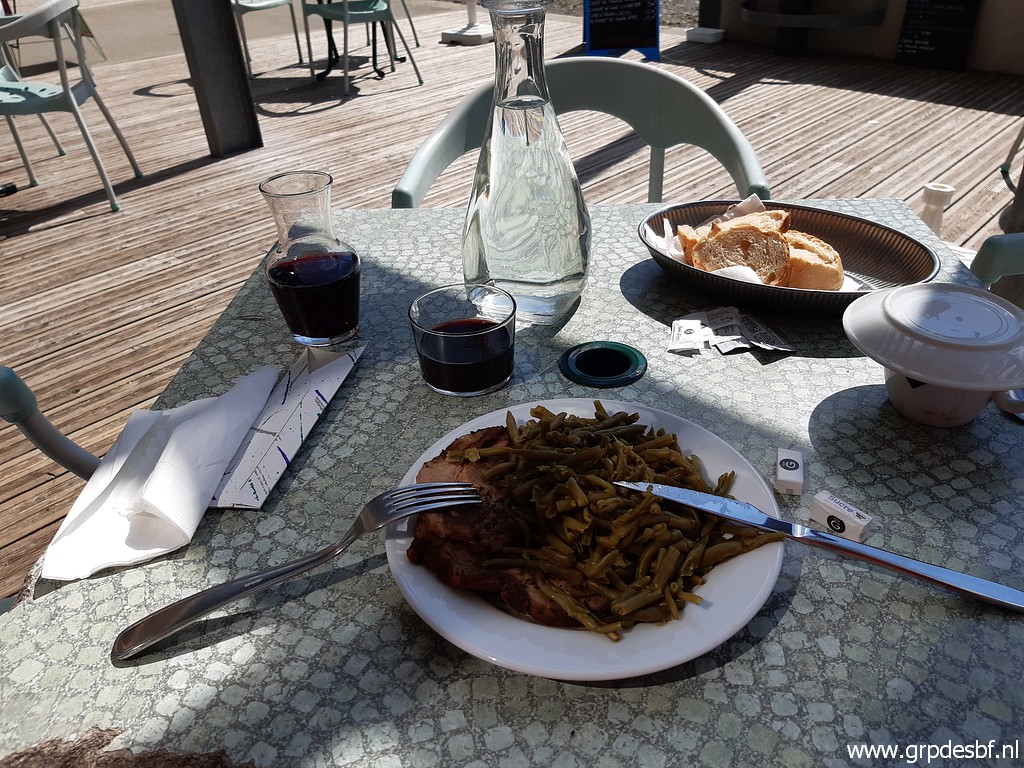 | In the ski-station of Arette La Pierre St-Martin, I enjoy a well-deserved lunch. (click photo to enlarge) |
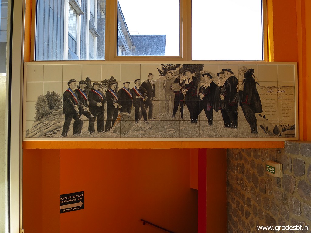
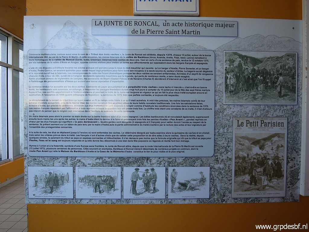 | And I am surprised to see in the alleys of the shopping mall these large information panels (click photo to enlarge) |
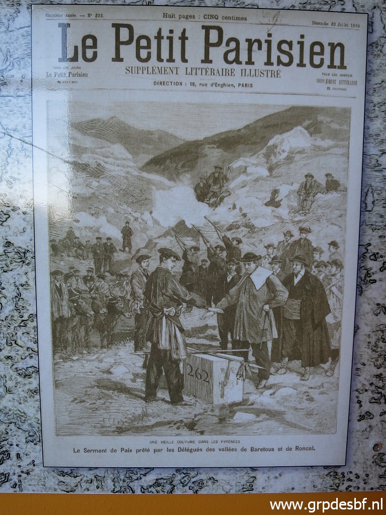
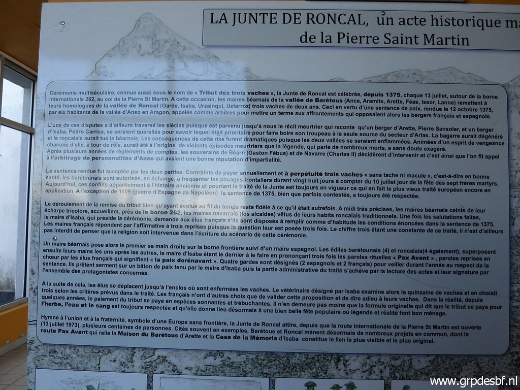 | about bm262 and the its role in the "Junte de Roncal" or "The Tribute of the Three Cows". (click photo to enlarge) |
 | It's
a yearly ceremony at july 13 since 1375 in which 3 cows are handed over
from the French community to its Spanish counterpart. It's the result of an arbitration after a bloody conflict between shepherds from both countries in 1373 and is considered as a payment for the use of Spanish grazing grounds and watersources. (click photo to enlarge) |
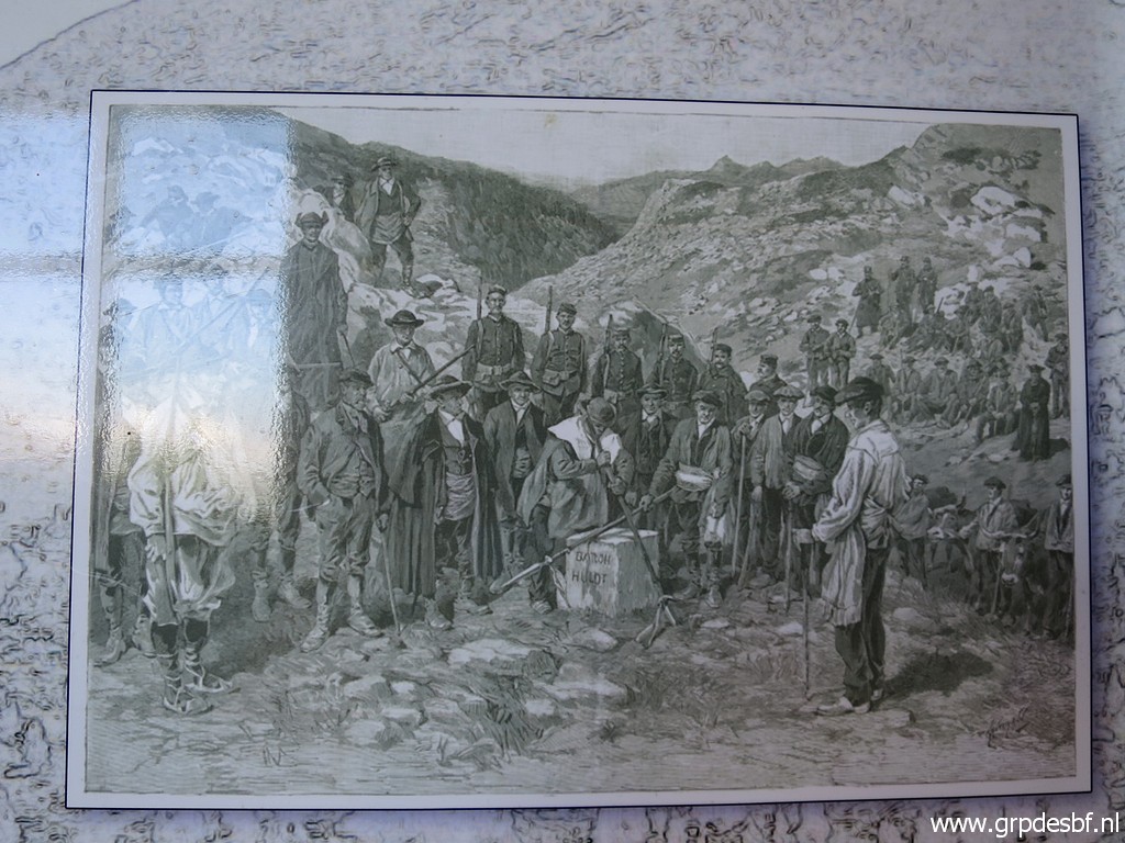
 | One
wonders if this drawing of bm262 was made of the real bordermarker in
an earlier verson or is an artist's impression or phantasy. (click photo to enlarge) |
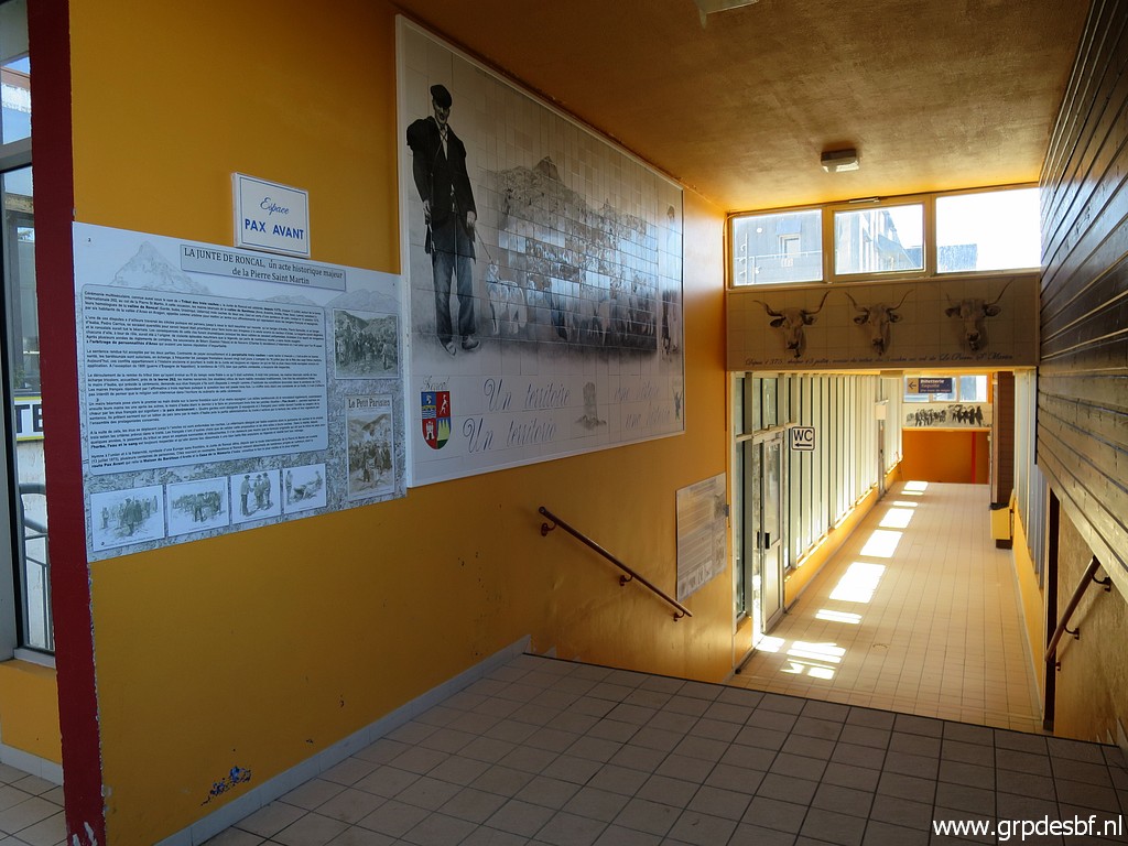 | We see more nice tiled images in the corridors. (click photo to enlarge) |
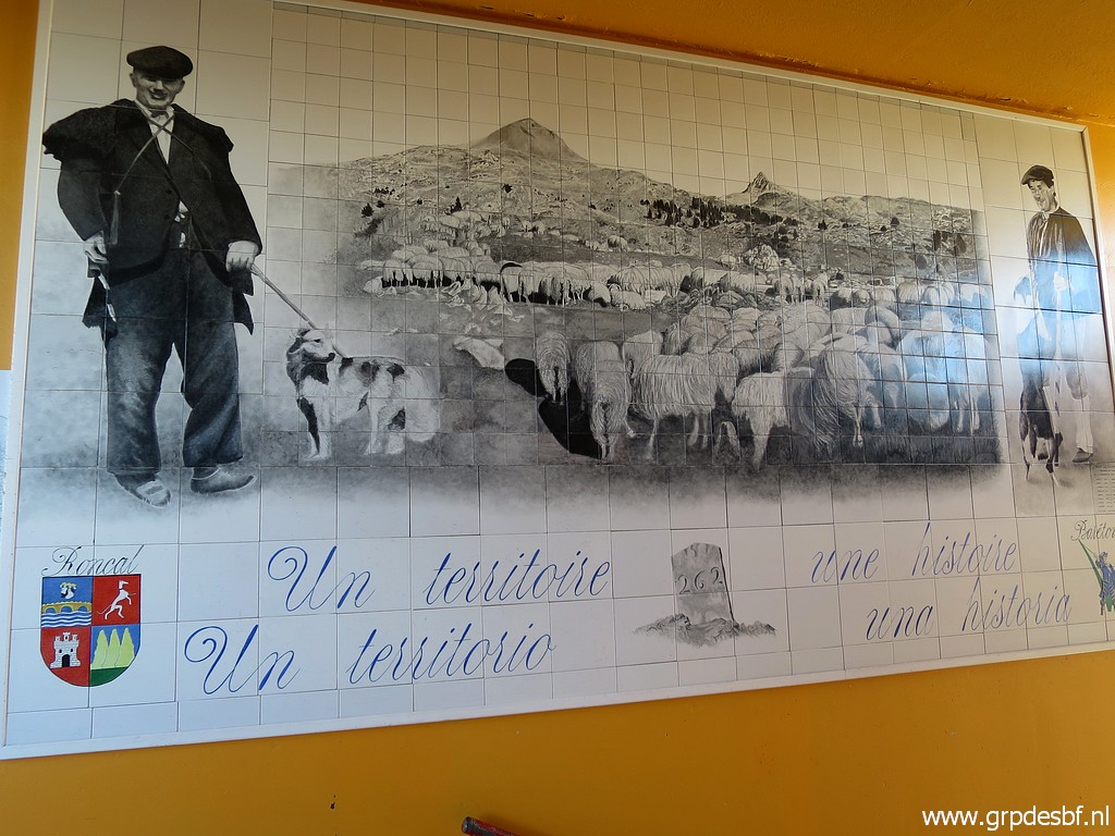 | Now we see an image of the actual bm262 (click photo to enlarge) |
 | and one of the cermonial meeting of the delegations from both communities at bm262. (click photo to enlarge) |
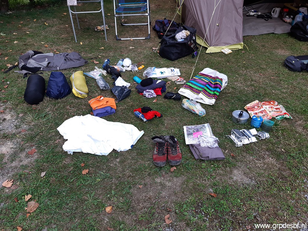 | Back at the camping and reorganizing my stuff for the multiday backpacking-trip, starting tomorrow. (click photo to enlarge) |