|
The
bordermarkers of the Pyrenees : the GRPdesBF
 |
|||||||||||||||||||||||||||||||||||||||||||||||||||||||||||||||||||
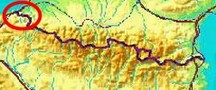
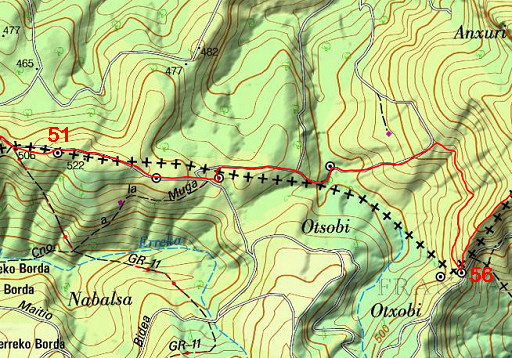
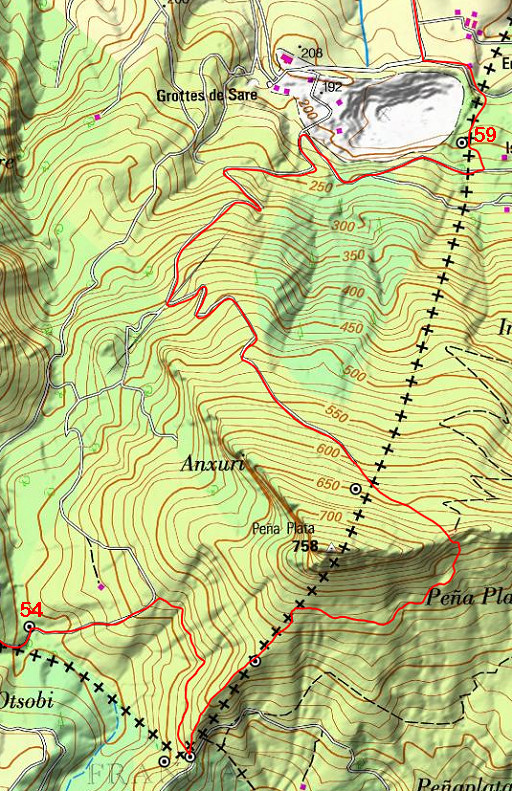
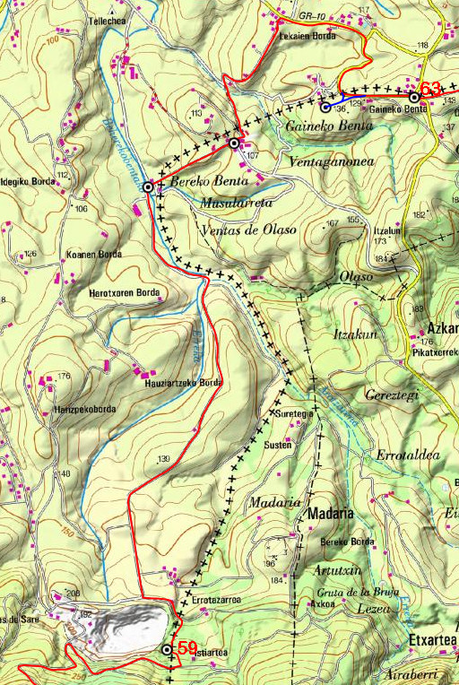
| - stage 3 - Col de Lizarrieta - Dantxaria (bm044-072) |
 |
||||||||||||||||||||||||||||||||||||||||||||||||||||||||||||||||||
 |
|||||||||||||||||||||||||||||||||||||||||||||||||||||||||||||||||||
| Only
the bordermarkers along this stage are shown (and some adjoining ones).
The main route is red,
the variants are blue. The main route provides a smooth
on-going route along most bordermarkers, the variants give access to
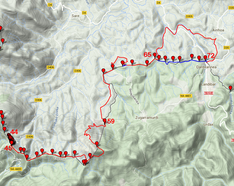
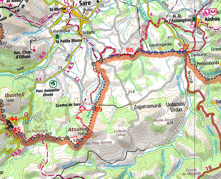
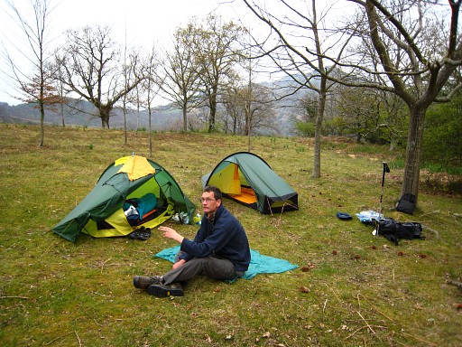
the remaining bordermarkers. See the GRPdesBF-principles. Click here for an fullscreen interactive map. Note In spring 2018 I have made some changes in the route, not yet worked out in the maps and description. The latest version (Google Earth kml-file) is grpdesbf-044-072-vs04.kml In short The continuation on the Basque hillridge brings us to the impressive hilltop of Atxuria. Then the route descends to lower and flatter terrain. While the main route picks up the winding GR10-trail at bm061, a challenging variant leads from bm066 directly over the hills - climbing fences and struggling through bush - to Dantxaria. Considerations Wayfinding shouldn't be difficult. But from the hillridge of Atxuria (where the trail arrives at the ridge) to bm058, there's no trail. Descend 350m NW and you'll find bm058. Then descend N for 70m to reach a trail which will bring you downhill. The variant along bm067-071 requires trespassing of private property: be respectful to fences and cattle & ask permission when possible. A Dantxaria - at the end - there's a camping and a lot of shops. Along the route until bm059, there are various bivouac-opportunities and save-enough-to-drink-from streams. Afterwards the terrain is more cultivated and populated and the streams less reliable as watersources. Factsheet
Gps-files needed
Useful You might check the relevant webpages in the 'All markers'-section. They provide more pictures of the bordermarkers and additional information on them. Version 03 Febr. 2015. If you have any correction, suggestion etcetera -> please email me: eefberns@grenspalen.nl MAPS AND DIRECTIONS Print your own maps It's easy to print your own - custom made - maps with the GRPdesBF-route and the bordermarkers on them. See: Print your own maps |
|||||||||||||||||||||||||||||||||||||||||||||||||||||||||||||||||||
 |
|||||||||||||||||||||||||||||||||||||||||||||||||||||||||||||||||||
 |
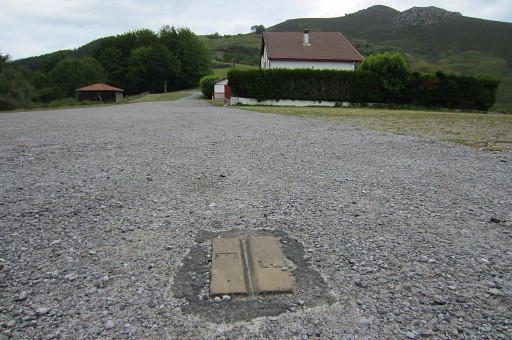
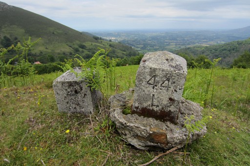
Bm044, the start of this stage at Col de Lizarrieta. At the other end of this tarmac surface, you can spot a trail going uphill. That's where the submarkers bm044A to bm044L start. They were placed in 1988. On the tarmac in front of you there are 2 plates with an E and F, also placed in 1988. A third one is either buried or lost. |
||||||||||||||||||||||||||||||||||||||||||||||||||||||||||||||||||
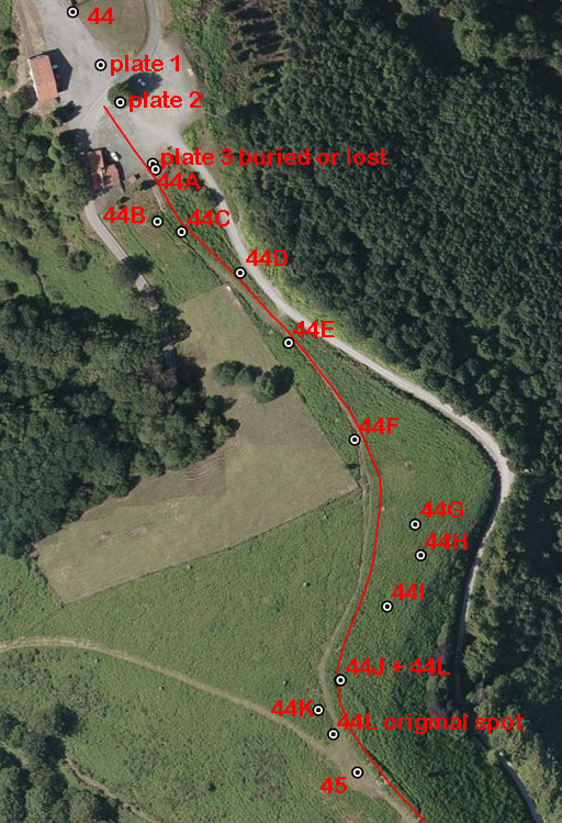 |
Let's show all these submarkers on Google Earth. |
||||||||||||||||||||||||||||||||||||||||||||||||||||||||||||||||||
 |
This is the first plate. Note: you are looking back to bm044. |
||||||||||||||||||||||||||||||||||||||||||||||||||||||||||||||||||
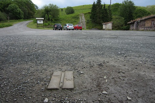 |
This is the second one, now looking forward (=S). The third one was placed 32,9 meters from this one. That's probably more or less under the middle car on this picture. At the end of the parking, take the trail uphill, visible on this picture. |
||||||||||||||||||||||||||||||||||||||||||||||||||||||||||||||||||
 |
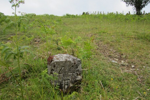
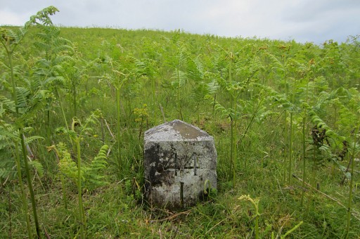
While climbing uphill to the hilltop with bm045, there are left and right of the trail the submarkers 44A to L. Most of them are easy to spot, some need some more searching, especially when the grass or fern is high. The pictures will help you. Bm044A |
||||||||||||||||||||||||||||||||||||||||||||||||||||||||||||||||||
 |
Bm044B |
||||||||||||||||||||||||||||||||||||||||||||||||||||||||||||||||||
 |
Bm044C |
||||||||||||||||||||||||||||||||||||||||||||||||||||||||||||||||||
 |
Bm044D |
||||||||||||||||||||||||||||||||||||||||||||||||||||||||||||||||||
 |
Bm044E |
||||||||||||||||||||||||||||||||||||||||||||||||||||||||||||||||||
 |
Bm044F |
||||||||||||||||||||||||||||||||||||||||||||||||||||||||||||||||||
 |
Fm044G |
||||||||||||||||||||||||||||||||||||||||||||||||||||||||||||||||||
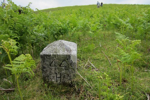 |
Bm044H |
||||||||||||||||||||||||||||||||||||||||||||||||||||||||||||||||||
 |
Bm044I |
||||||||||||||||||||||||||||||||||||||||||||||||||||||||||||||||||
 |
Bm044J, with the dislocated bm044L besides it . | ||||||||||||||||||||||||||||||||||||||||||||||||||||||||||||||||||
 |
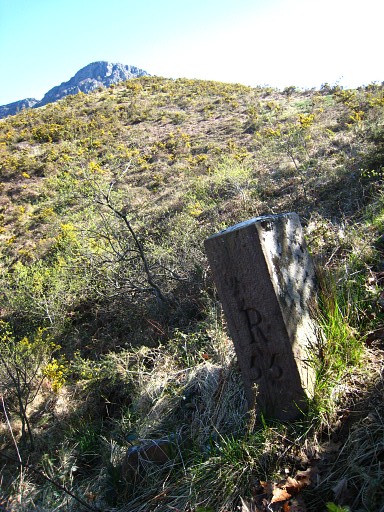
Bm044K. In the background bm045. |
||||||||||||||||||||||||||||||||||||||||||||||||||||||||||||||||||
 |
Bm044L, dislocated and placed besides bm044J | ||||||||||||||||||||||||||||||||||||||||||||||||||||||||||||||||||
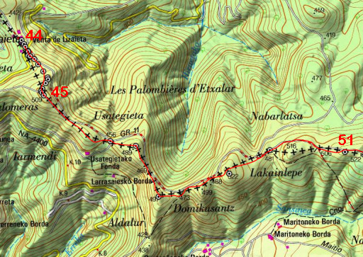 |
From bm045 onwards, you will follow the hillridge until bm050. Beyond bm050, the dirtroad is easier for a short while. |
||||||||||||||||||||||||||||||||||||||||||||||||||||||||||||||||||
 |
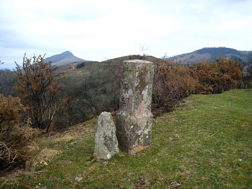
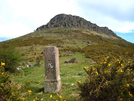
Bm045 |
||||||||||||||||||||||||||||||||||||||||||||||||||||||||||||||||||
 |
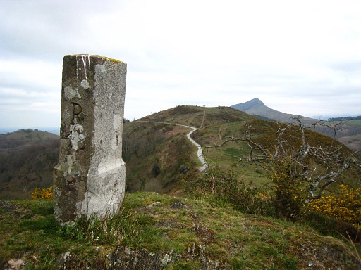
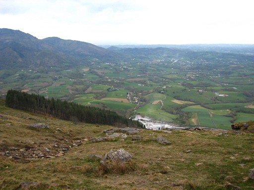
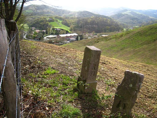
A view forward of the hillridge which is the border until bm053. The dirtroad to the left is French. |
||||||||||||||||||||||||||||||||||||||||||||||||||||||||||||||||||
 |
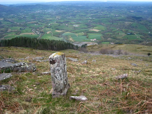
Bm046, at a sort of pass. Continue on the hillridge ahead. |
||||||||||||||||||||||||||||||||||||||||||||||||||||||||||||||||||
 |
Bm047 |
||||||||||||||||||||||||||||||||||||||||||||||||||||||||||||||||||
 |
Bm048 |
||||||||||||||||||||||||||||||||||||||||||||||||||||||||||||||||||
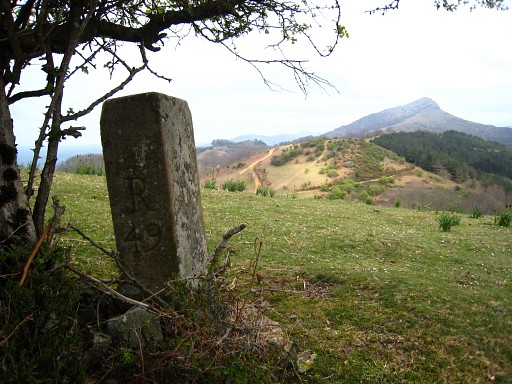 |
Bm049 Downhill to the N at the roadside, there's a fountain. |
||||||||||||||||||||||||||||||||||||||||||||||||||||||||||||||||||
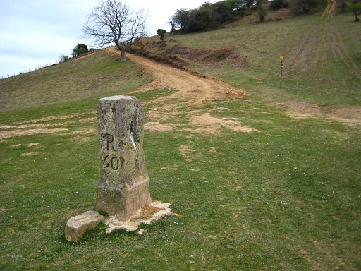 |
Bm050. Now leave the ridge and follow the dirtroad ahead to curve underneath the hilltop. Then pick up the hillridge again and climb to bm051. |
||||||||||||||||||||||||||||||||||||||||||||||||||||||||||||||||||
 |
NB: approximately 200m N of bm050, there's a wind-sheltered field which could suit your bivouac-needs. | ||||||||||||||||||||||||||||||||||||||||||||||||||||||||||||||||||
 |
From bm051 continue on a trail cq dirtroad to bm052 and 053. Then you will leave the borderline for a detour to bm056. |
||||||||||||||||||||||||||||||||||||||||||||||||||||||||||||||||||
 |
Bm051 Continue straight on. |
||||||||||||||||||||||||||||||||||||||||||||||||||||||||||||||||||
 |
Bm052 Continue on the dirtroad. |
||||||||||||||||||||||||||||||||||||||||||||||||||||||||||||||||||
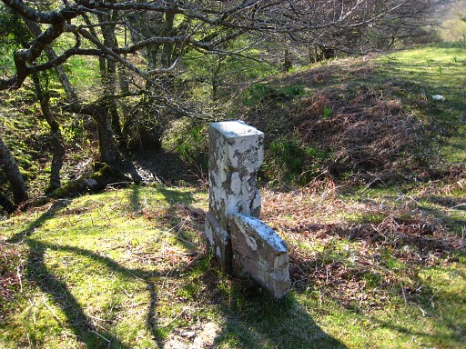 |
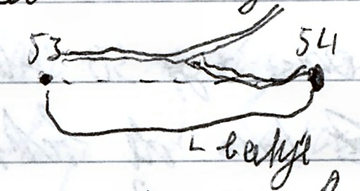
After 250m you will reach a triangle of dirtroads. Bm053 is at the SE-side of it, a stream starts here. |
||||||||||||||||||||||||||||||||||||||||||||||||||||||||||||||||||
|
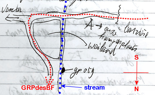
From
bm053, the borderline follows a stream to bm054. It seems a straight
line on the map but actually the stream goes a bit S, then E and
finally a bit N. You don't need to follow the stream. From bm053 (50m to the N) a dirtroad descends E with further on a branch to the right to bm054 About this sketch: "beekje" = stream. |
||||||||||||||||||||||||||||||||||||||||||||||||||||||||||||||||||
 |
Bm054 From bm054 follow the track NE uphill to a farm/barn and then take a path to the S to bm056. |
||||||||||||||||||||||||||||||||||||||||||||||||||||||||||||||||||
 |
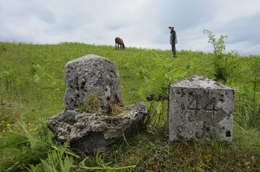
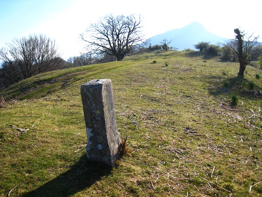
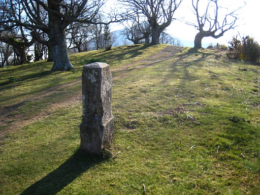
You
will first arrive at bm056 which comes in two versions. To the left the
damaged original marker, in the middle its replacement. The right one is an old local communities-tripoint-marker. From here, bm055 can be easily visited. |
||||||||||||||||||||||||||||||||||||||||||||||||||||||||||||||||||
 |
Bm055 is ± 75m SWW of bm056, descending along a fence. This picture: bm055, looking NE. |
||||||||||||||||||||||||||||||||||||||||||||||||||||||||||||||||||
 |
Now you will climb over the hillridge of Anxurri and descend to the Grottes de Sare. Between the hillridge and bm058, there's no trail. Use your compass. |
||||||||||||||||||||||||||||||||||||||||||||||||||||||||||||||||||
 |
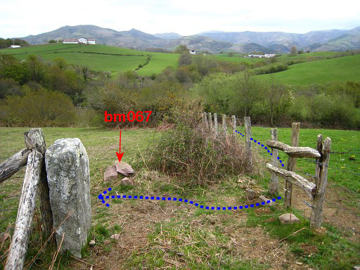
From bm056 a trail (yellow/white waymarked) climbs NE on the hillridge to bm057. Between bm056 and 057 there are 4 or five unnumbered bordermarkers. Each one has a S on one side and a B on the other. If you are interested: See this page for pictures and directions. Further on, the yellow/white trail merges with or becomes a yellow waymarked trail that goes E underneath the Atxuria and climbs to a sort of pass. |
||||||||||||||||||||||||||||||||||||||||||||||||||||||||||||||||||
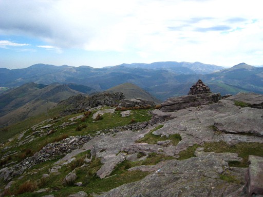 |
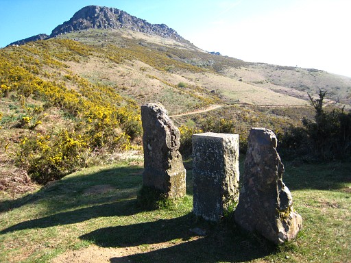
If you climb - from that pass - W to the hilltop of Atxuria, you will arrive at this cairn after 400m. There are several crosses out here. If you are interested: See this page for pictures and directions. |
||||||||||||||||||||||||||||||||||||||||||||||||||||||||||||||||||
 |
From the pass, there's no obvious trail to bm058. Use your compass and descend 350m to the NW and watch carefully. This picture, not far from the pass: a view to the NNE. The GRPdesBF will descend left of the forest to the parking of the caves of "Grotte de Sare". |
||||||||||||||||||||||||||||||||||||||||||||||||||||||||||||||||||
 |
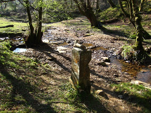
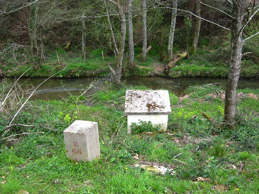
Bm059. From bm059, descend N for 75m and you will reach a trail. Now descend on that long and winding trail (yellow waymarks) to the S-edge of the parking of the Caves of Sare. From there, proceed SE->NEE on a dirtroad, passing above the quarry to the left. There's a roadblock to prevent cars to cross the border here. |
||||||||||||||||||||||||||||||||||||||||||||||||||||||||||||||||||
 |
Now we are close to bm059 which is is located in the bed of a stream. This sketch shows it all. "barrière" = where the roadblock is "onze kampeerplaats" = our campingspot "weiland" = meadow |
||||||||||||||||||||||||||||||||||||||||||||||||||||||||||||||||||
 |
Bm059, on
the w-bank of the stream, a bit to the N of the meadow, not easy to
spot on that rock-littered bank. |
||||||||||||||||||||||||||||||||||||||||||||||||||||||||||||||||||
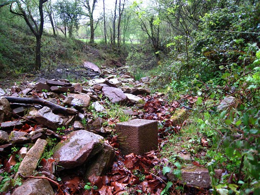 |
Bm059, looking S with the meadow visible. Get back on the road and continue to the N. |
||||||||||||||||||||||||||||||||||||||||||||||||||||||||||||||||||
 |
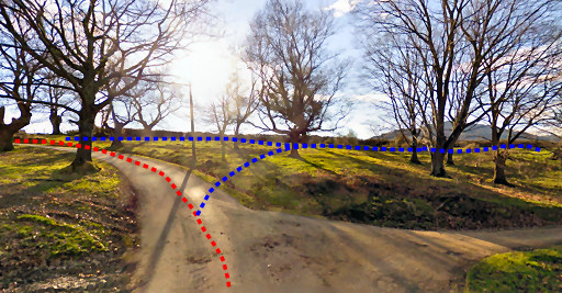
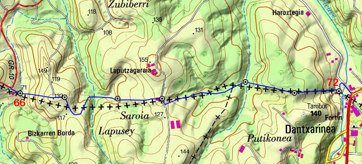
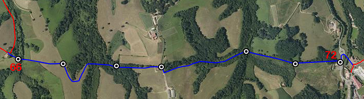
After a bend to left and 150m W, turn right and continue on easy tarmac to the N for 2,5 km. Then cross the river (bm060) and proceed to bm061. The GR10 will bring you back to the borderline further on. That's where the variant to bm062 starts. |
||||||||||||||||||||||||||||||||||||||||||||||||||||||||||||||||||
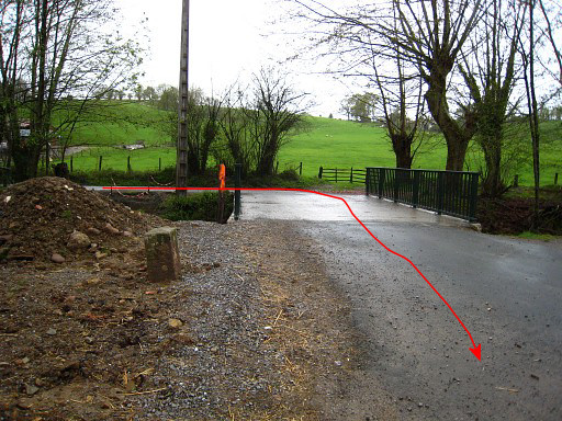 |
At this bridge, turn right to pass bm060. | ||||||||||||||||||||||||||||||||||||||||||||||||||||||||||||||||||
 |
Bm060, looking ahead. Continue straight on, climbing on the dirtroad |
||||||||||||||||||||||||||||||||||||||||||||||||||||||||||||||||||
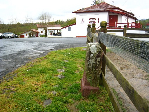 |
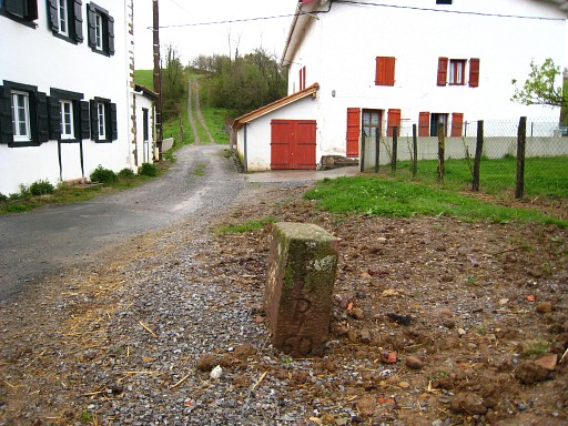
to reach after 500m this bordercrossing with bm061 and a venta-restaurant. Continue left along the restaurant and pick up the red/white waymarked GR10-trail. The GR10 makes a half-circle of ± 2km on French territory to return at the borderline. Between bm061 and bm062 there's another unnumbered bordermarker. If you are interested: See this page for pictures and directions. |
||||||||||||||||||||||||||||||||||||||||||||||||||||||||||||||||||
| Variant 1 via bm062 |
|||||||||||||||||||||||||||||||||||||||||||||||||||||||||||||||||||
 |
Having returned at the borderline, you can make a small detour W on a dirtroad to bm062. This screenshoot of Google's streetview shows where to branch off the main route towards bm062 |
||||||||||||||||||||||||||||||||||||||||||||||||||||||||||||||||||
 |
Within 150m you will get at bm062. Return and join the main route again at the tarmac road. |
||||||||||||||||||||||||||||||||||||||||||||||||||||||||||||||||||
| End of variant 2 |
|||||||||||||||||||||||||||||||||||||||||||||||||||||||||||||||||||
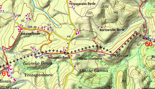 |
Keep following the GR10. |
||||||||||||||||||||||||||||||||||||||||||||||||||||||||||||||||||
 |
Further on, along the road bm063. Between bm062 and bm063 there's another unnumbered bordermarker. If you are interested: See this page for pictures and directions. Continue. After 50m leave the tarmac, taking the dirtroad and thus proceeding straight ahead. That's still the GR10. |
||||||||||||||||||||||||||||||||||||||||||||||||||||||||||||||||||
 |
After 700m at a bend of the dirtroad: bm064. |
||||||||||||||||||||||||||||||||||||||||||||||||||||||||||||||||||
 |
Then - after 500m at the next bend of the dirtroad- bm065 At 80 m beyond bm065, there's an unnumbered bordermarker. If you are interested: See this page for pictures and directions. |
||||||||||||||||||||||||||||||||||||||||||||||||||||||||||||||||||
 |
At the next bend of the dirtroad (to the left), bm066 is straight ahead down the grassy slope at 75m. The old bm66 (probably) is half buried, against the little construction. Now return to the dirtroad and continue on the GR10 for 5km towards the village of Aïnhoa |
||||||||||||||||||||||||||||||||||||||||||||||||||||||||||||||||||
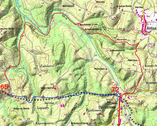 |
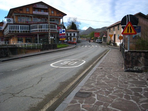
However, 200m before reaching the village, make a sharp turn to the right (leaving the GR10), going SSW. Follow this quiet road for 1,5 km and you'll arrive at the border-village of Dantxarinea. |
||||||||||||||||||||||||||||||||||||||||||||||||||||||||||||||||||
| Variant 1 via bm067-072 |
|||||||||||||||||||||||||||||||||||||||||||||||||||||||||||||||||||
 |
|||||||||||||||||||||||||||||||||||||||||||||||||||||||||||||||||||
|
|||||||||||||||||||||||||||||||||||||||||||||||||||||||||||||||||||
 |
This variant requires trespassing of private property (meadows) and climbing sturdy fences. If you can't ask for permission:
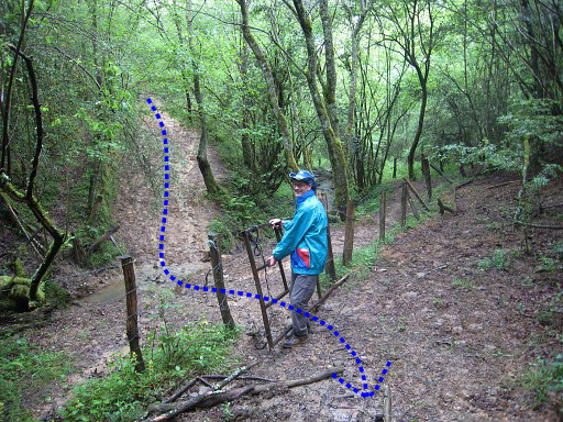
be at least respectful to fences and cattle. Here -from bm066 - you have to cross the stream and climb over a fence. Then climb steeply to the E (which can be best undertaken on the French side of the fence). |
||||||||||||||||||||||||||||||||||||||||||||||||||||||||||||||||||
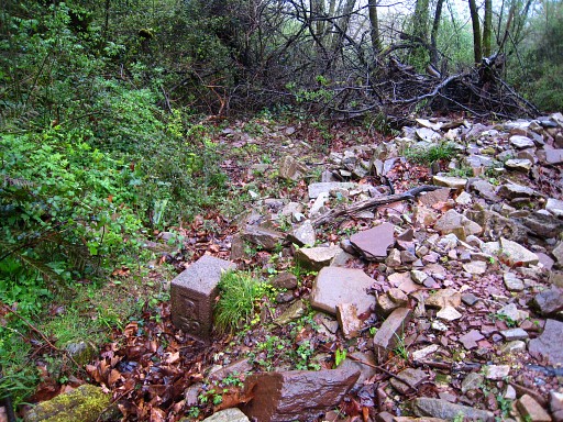
 |
You will arrive here (looking back = W) where a
bunch of reddish stones is the remainder of the destroyed bm067. The intact marker to the left is some ancient communal bordermarker. From here, make a half circle to the S through the meadows and enter the forest on a trail. |
||||||||||||||||||||||||||||||||||||||||||||||||||||||||||||||||||
 |
It descends to a tiny stream with a muddy crossing. On the other side there's this gate waiting for you. Pass the gate and continue E on the trail cq dirtroad. |
||||||||||||||||||||||||||||||||||||||||||||||||||||||||||||||||||
 |
Then - after ± 100 - bm068 is located left of the trail, at the other side of the fence (French side). This picture: taken from the French side and looking back. If you have climbed over the fence, you might as well try to proceed on this side E to bm069 (=300m further) If you stick to the trail: continue on it for 100m and enter the meadow. Cross the meadow towards the large white building and pass it on its left side. |
||||||||||||||||||||||||||||||||||||||||||||||||||||||||||||||||||
 |
You have now arrived at bm069 and we are looking back. Then: cross the gate and - after 50m - go left, entering the large meadow. Proceed to its NE-corner, tackle the fence and enter the forest. Then descend NEE for ± 400m along a stream until |
||||||||||||||||||||||||||||||||||||||||||||||||||||||||||||||||||
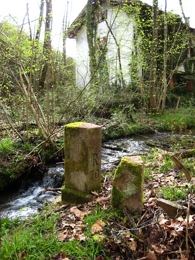 |
you arrive at the confluence with another stream. There's an abondoned house at the other side. Here you will find bm070. Now cross the stream and continue uphill E which probably can be done best at the French side of the fence. |
||||||||||||||||||||||||||||||||||||||||||||||||||||||||||||||||||
 |
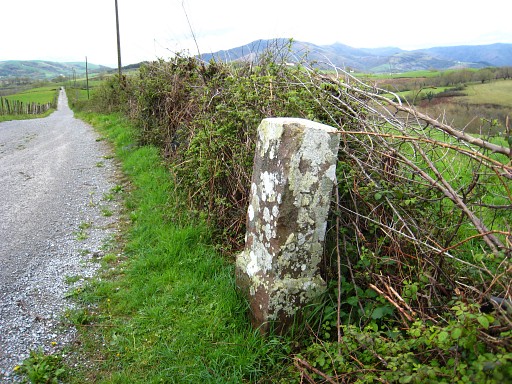
After 350m, there's is bm071 at the Spanish side of the fence. |
||||||||||||||||||||||||||||||||||||||||||||||||||||||||||||||||||
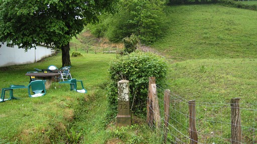 |
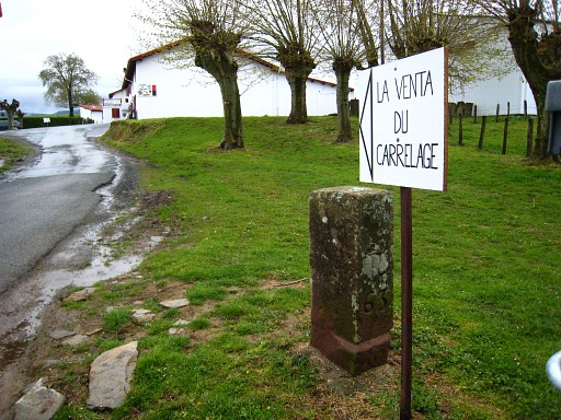
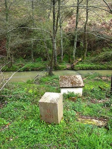
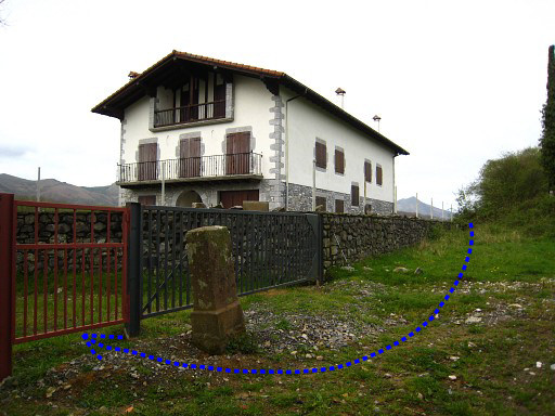
Then continue and descend E along the fence to the road. Besides a venta: bm072. At the road, go left to the roundabout, then go right and cross the bridge to the D20 where you will join the main route. |
||||||||||||||||||||||||||||||||||||||||||||||||||||||||||||||||||
| End of variant 1 |
|||||||||||||||||||||||||||||||||||||||||||||||||||||||||||||||||||
 |
Arriving at the bridge over the borderriver. The bridge is the end of the stage. We are looking into Spain. On this bridge there are plates at groundlevel at each side. If you are interested: See this page for pictures. |
||||||||||||||||||||||||||||||||||||||||||||||||||||||||||||||||||