|
The
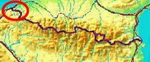
bordermarkers of the Pyrenees : the GRPdesBF
 |
|||||||||||||||||||||||||||||||||||||||||||||||||||||||||||||||||||
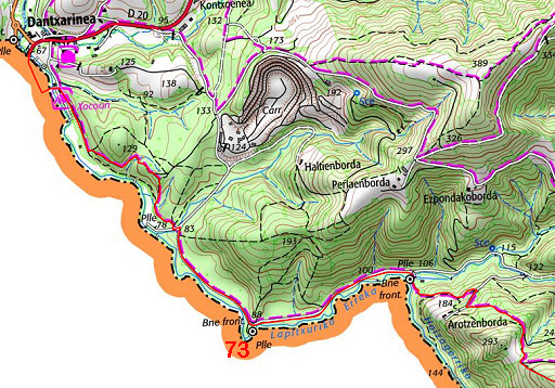
| - stage 4 - Dantxaria - Bidarray (bm073-085) |
 |
||||||||||||||||||||||||||||||||||||||||||||||||||||||||||||||||||
 |
|||||||||||||||||||||||||||||||||||||||||||||||||||||||||||||||||||
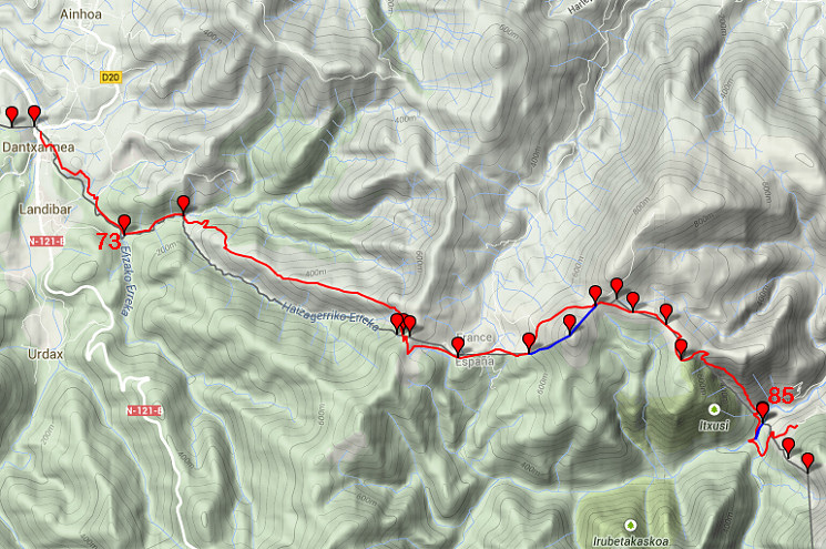
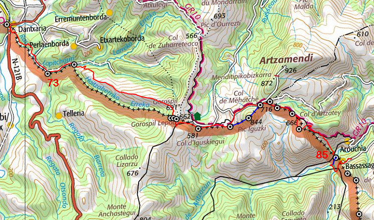
| Only
the bordermarkers along this stage are shown (and some adjoining ones).
The main route is red,
the variants are blue. The main route provides a smooth
on-going route along most bordermarkers, the variants give access to
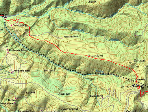
the remaining bordermarkers. See the GRPdesBF-principles. Click here for an fullscreen interactive map. Note In spring 2018 I have made some changes in the route, not yet worked out in the maps and description. The latest version (Google Earth kml-file) is grpdesbf-073-085-vs04.kml In short After a flat & easy start until bm074, there's a long climb to Col de Gorospil with bm075 and bm076. Then the (main) route continues on more or less the same altitude until bm084. A steep descent brings you deep in the valley and finally at the foot of the ridges of Crêtes d'Iparla. The first variant implies a tough climb to a hilltop with bm079, the second is an easy detour to bm085. Considerations From bm074 until bm085, there's no water supply so carry enough water for 4-5 hours of walking. That also limits bivouacing along the route. Near the end - on the second variant to bm085 - there's a perfect camping-spot along the river. Factsheet
Gps-files needed
Useful You might check the relevant webpages in the 'All markers'-section and 'All my trips'-section. They provide pictures of the bordermarkers and additional information. Version 03 February 2015. If you have any correction, suggestion etcetera -> please email me: eefberns@grenspalen.nl MAPS AND DIRECTIONS Print your own maps It's easy to print your own - custom made - maps with the GRPdesBF-route and the bordermarkers on them. See: Print your own maps |
|||||||||||||||||||||||||||||||||||||||||||||||||||||||||||||||||||
 |
|||||||||||||||||||||||||||||||||||||||||||||||||||||||||||||||||||
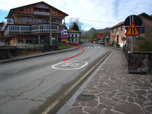 |
This bridge in Dantxaria -
crossing the borderriver - is the starting point of this stage. We are
looking into Spain. The building to the left is a large venta. On this bridge there are plates at groundlevel at each side. If you are interested: See this page for pictures. Walk into Spain. After 35m go left, walking SEE along the venta-building. |
||||||||||||||||||||||||||||||||||||||||||||||||||||||||||||||||||
 |
After a meadow and a second building, go left and cross the borderriver
on a footbridge. Pass the premises of a camping to a road. Then
turn right. Follow the narrow (dirt) road/trail SEE , it's yellow waymarked. It enters a forest and reaches after 1 km a tarmac road. Now go left, then immediately right to cross a bridge and continue on a tarmac road, still following the yellow waymarks. |
||||||||||||||||||||||||||||||||||||||||||||||||||||||||||||||||||
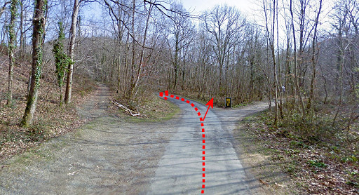 |
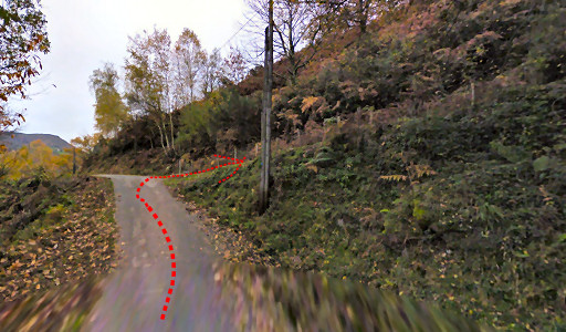
After 650m you will get here: a bend in the road with two branches. For bm073 enter the forest in the direction of the arrow. After 35m, you will spot |
||||||||||||||||||||||||||||||||||||||||||||||||||||||||||||||||||
 |
bm073. To the right is a bridge leading to a farm. Return to the road and continue in E-NEE direction for ± 1km. |
||||||||||||||||||||||||||||||||||||||||||||||||||||||||||||||||||
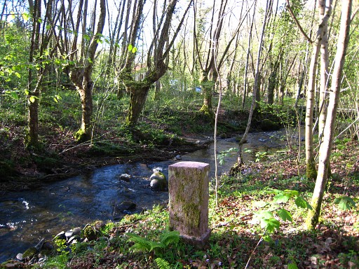
 |
until this point. Cross the river on a footbridge - still following the yellow waymarks - and find |
||||||||||||||||||||||||||||||||||||||||||||||||||||||||||||||||||
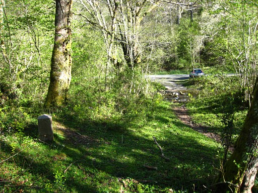 |
bm074 nearby. You are looking backwards to the road. |
||||||||||||||||||||||||||||||||||||||||||||||||||||||||||||||||||
 |
Continue on the yellow trail: it climbs in 500m to a farmbuilding and a
road. Go right on the road for 100m and reenter left the forest, still on
the yellow trail. The (yellow) trail climbs on and reaches in 500m an open hillside to the E. The yellow trail now bends to the left but the GRPdesBF continues uphill SEE-E in the direction of the Gorispil-hilltop. |
||||||||||||||||||||||||||||||||||||||||||||||||||||||||||||||||||
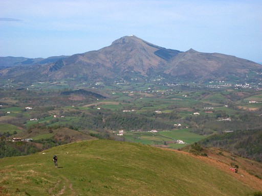 |
It's a long climb of 3km on the hillridge to the Gorispil-col with bm074 and 075. This picture: looking back along the hillridge, you can still see La Rhûne, the famous hilltop. |
||||||||||||||||||||||||||||||||||||||||||||||||||||||||||||||||||
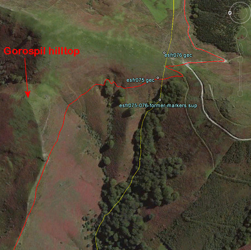 |
As you can see on this Google Earth screenhot (looking E), you don't have to climb entirely to the Gorospil-hilltop. Go underneath it and curve on a trail to the S - staying above the trees- towards a pass. |
||||||||||||||||||||||||||||||||||||||||||||||||||||||||||||||||||
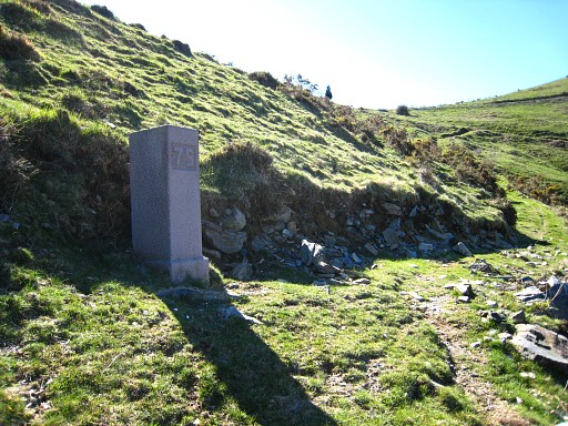 |
Just before the pass: bm075 | ||||||||||||||||||||||||||||||||||||||||||||||||||||||||||||||||||
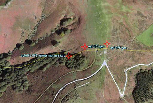 |
Beneath bm075, there's a
peculiar "cemetary" of former markers 75 and 76. If you are interested: see this page for pictures and directions. |
||||||||||||||||||||||||||||||||||||||||||||||||||||||||||||||||||
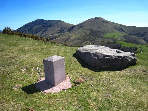 |
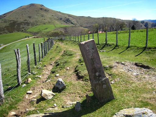
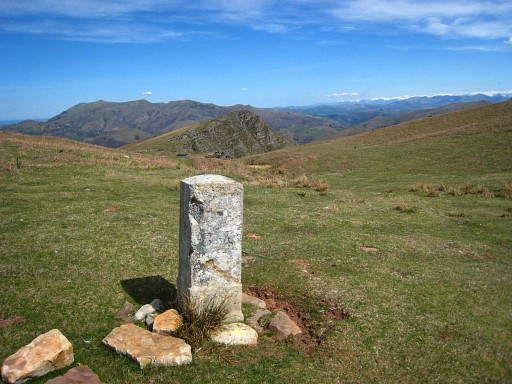
From bm075, it's a short climb to the pass of Gorospil where bm076 is 75m to the left. On the flat rock besides it, there's a cross engraved, marking the tripoint of 3 municipalities. Navigating now becomes more easy. Descend on the tarmac road, heading E and passing a farm at your left hand. Now you are back on the GR10-trail. The main route sticks largely to the GR10 until the steep descent beyond bm084 |
||||||||||||||||||||||||||||||||||||||||||||||||||||||||||||||||||
 |
Then - 200m beyond the farm - take a dirtroad, branching off to the left. It brings you to bm077. This picture: the GR10 will pass the next hilltop on the left side. To cover bm079 (=variant 1), you have to climb that hilltop. You can also see that this dirtroad merges with the road in the distance. |
||||||||||||||||||||||||||||||||||||||||||||||||||||||||||||||||||
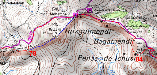 |
That road leads to a pass. Continue on the GR10. After 200m the GR10 turns left to go left along a meadow. NOW: leave the GR10 and go straight on. You have to make a little detour from the GR10 to cover bm078. |
||||||||||||||||||||||||||||||||||||||||||||||||||||||||||||||||||
 |
And that's easy: climb on a corridor between two fenced meadows to bm78. From bm078, go left=N for 100m to rejoin the GR10 which will rejoin the tarmac road further on. The tarmac road will bring you underneath the hill to the next pass where bm080 is. |
||||||||||||||||||||||||||||||||||||||||||||||||||||||||||||||||||
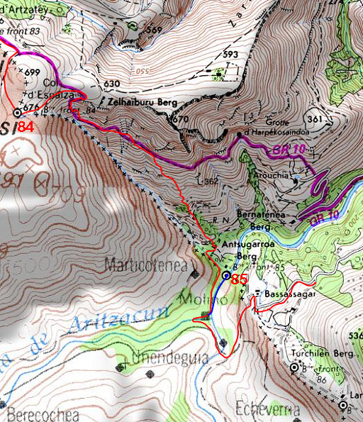
| Variant 1 via bm079 |
|||||||||||||||||||||||||||||||||||||||||||||||||||||||||||||||||||
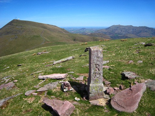 |
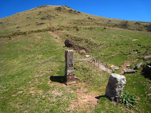
From bm078, navigation is easy: simply climb NEE to the summit where bm079 is. |
||||||||||||||||||||||||||||||||||||||||||||||||||||||||||||||||||
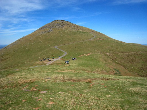 |
Then descend NE to the next pass where bm080 is located and you will rejoin the main route. |
||||||||||||||||||||||||||||||||||||||||||||||||||||||||||||||||||
| End of variant 1 |
|||||||||||||||||||||||||||||||||||||||||||||||||||||||||||||||||||
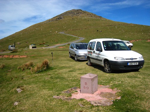 |
Bm080, back on the main route and the GR10. The GR10 leaves at bm080 the tarmac road and goes E. |
||||||||||||||||||||||||||||||||||||||||||||||||||||||||||||||||||
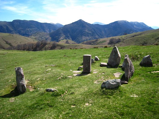 |
After 250m: bm081 is ± 75m N of the trail and surrounded by a circle of stones. That circle is a "cromlech", a megalitic monument. |
||||||||||||||||||||||||||||||||||||||||||||||||||||||||||||||||||
 |
Continuing on the GR10 and passing bm082. | ||||||||||||||||||||||||||||||||||||||||||||||||||||||||||||||||||
 |
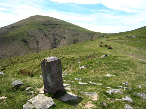
Then passing bm083. To cover bm084, we have to make another detour from the GR10. Directions: 250m beyond bm083 you will arrive at a hill. The GR10 goes left of it but the GRPdesBF goes right of it to get to |
||||||||||||||||||||||||||||||||||||||||||||||||||||||||||||||||||
 |
bm084. |
||||||||||||||||||||||||||||||||||||||||||||||||||||||||||||||||||
 |
Just E of it, starts a stream - descending steeply later on - which will be the borderline until its confluence with a river. Now head NE for 300m to rejoin the GR10. The GR10 now descends steeply to the river-valley. At some point, you have to leave the GR10 to descend to bm085. |
||||||||||||||||||||||||||||||||||||||||||||||||||||||||||||||||||
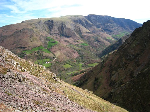 |
In the beginning of the descent this view of the famous Iparla-cliffs in the distance. That's for the next stage but you can spot nicely the borderline and the bm-locations ahead. But where are they? |
||||||||||||||||||||||||||||||||||||||||||||||||||||||||||||||||||
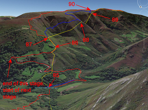 |
Approximately the same view but now in Google Earth. The yellow line is the borderline, the red line the main route. The blue lines represent the variants. At the variant to bm085, there's a perfect bivouac spot along the river. When climbing uphill, it is more difficult to find a suitable place for camping. |
||||||||||||||||||||||||||||||||||||||||||||||||||||||||||||||||||
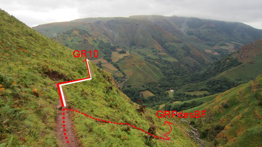 |
At some point in the descent, you have to leave the GR10. But where? Well, that spot is here, we are looking SE. You will get here after 800m from the start of the descent and after 300m elevation loss. |
||||||||||||||||||||||||||||||||||||||||||||||||||||||||||||||||||
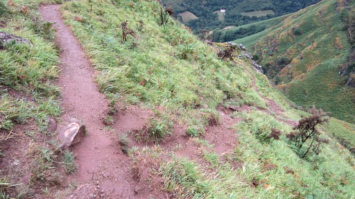 |
Closeup. Note the cairn/painted rock. So: go right here. The trail is waymarked by pink dots and brings you - steep but manageable - |
||||||||||||||||||||||||||||||||||||||||||||||||||||||||||||||||||
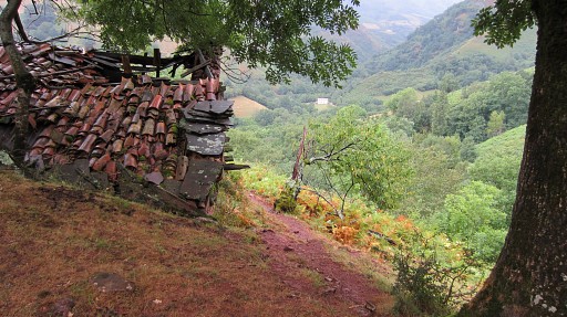 |
along this barn |
||||||||||||||||||||||||||||||||||||||||||||||||||||||||||||||||||
 |
to this barn. Pass between barn and meadow and enter the forest. Beyond the barn the trail crosses a streambed (which is the borderline) and brings you |
||||||||||||||||||||||||||||||||||||||||||||||||||||||||||||||||||
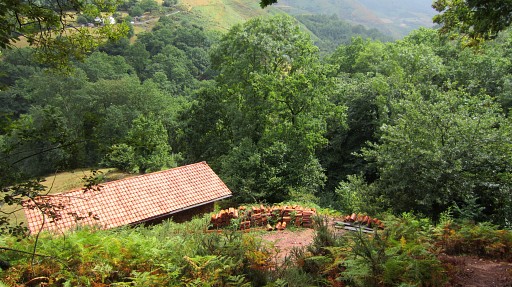
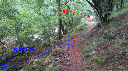 |
to the river. As soon as you spot the barrage/cascade in the distance, there’s a branch of the trail going left along the river. That branch is the variant to bm085. |
||||||||||||||||||||||||||||||||||||||||||||||||||||||||||||||||||
| Variant 2 via bm085 |
|||||||||||||||||||||||||||||||||||||||||||||||||||||||||||||||||||
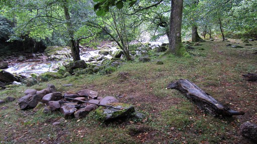 |
It's an easy trail, going 250m along the river. You will pass this perfect bivouac spot |
||||||||||||||||||||||||||||||||||||||||||||||||||||||||||||||||||
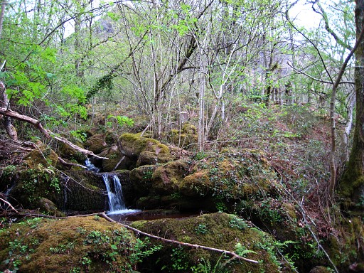 |
and reach the stream or streambed which flows into the river. That is the borderline. Standing a bit higher on its N-bank: |
||||||||||||||||||||||||||||||||||||||||||||||||||||||||||||||||||
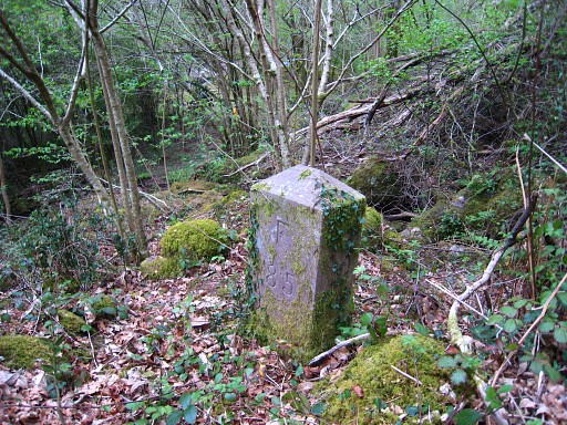 |
bm085. |
||||||||||||||||||||||||||||||||||||||||||||||||||||||||||||||||||
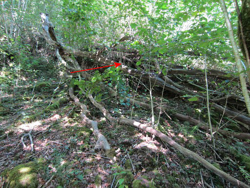 |
The extra number 85 (± 10m W of the
pillar 85 on the other side of the borderstream) is easy to find. |
||||||||||||||||||||||||||||||||||||||||||||||||||||||||||||||||||
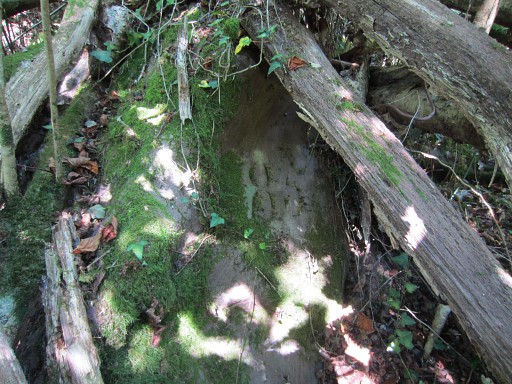 |
It’s engraved in a rock, hidden under a fallen tree. There’s only a number, no cross. Return to the main route |
||||||||||||||||||||||||||||||||||||||||||||||||||||||||||||||||||
| End of variant 2 |
|||||||||||||||||||||||||||||||||||||||||||||||||||||||||||||||||||
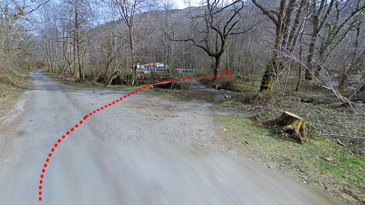
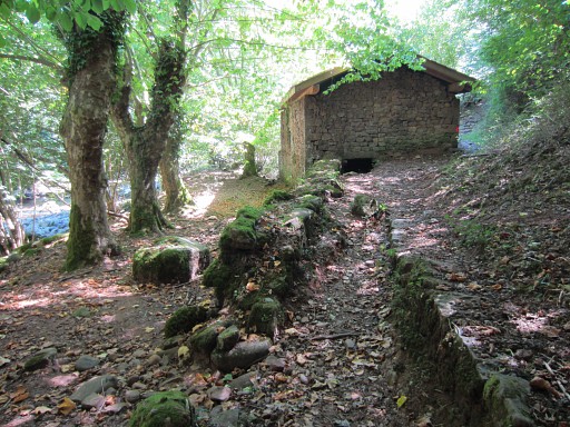 |
and proceed to the river and barrage. You can cross the river on a wooden footbridge. This pictoresque barn is at the other side of the river. Behind the barn, the trail climbs to |
||||||||||||||||||||||||||||||||||||||||||||||||||||||||||||||||||
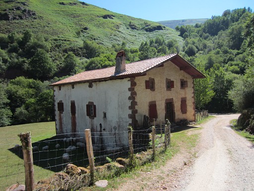 |
a dirtroad which passes this Basque-style house. Then crossing a bridge after which the dirtroad becomes a tarmac road. The tarmac road climbs to a farm, makes a sharp turn and climbs steeply to a next bend. |
||||||||||||||||||||||||||||||||||||||||||||||||||||||||||||||||||
 |
Beyond that bend - after 400m - there's a country road to the
right leading uphill, back to the border. That spot is the end of this stage. If you to want to continue to Bidarray for the gîte d'étappe or hotel, go straight ahead and pick-up the GR10. In 3,5km (45min) you will be in the village. |
||||||||||||||||||||||||||||||||||||||||||||||||||||||||||||||||||