|
The
bordermarkers of the Pyrenees : the GRPdesBF
 |
||||||||||||||||||||||||||||||||||||||||||||||||||||||||||
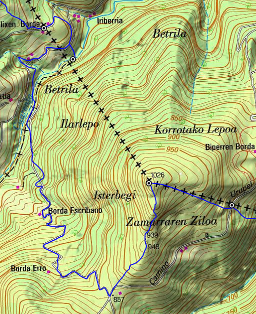
| - stage 7 - D58 - Col de Lindus (bm137-155) |
 |
|||||||||||||||||||||||||||||||||||||||||||||||||||||||||
 |
||||||||||||||||||||||||||||||||||||||||||||||||||||||||||
| Only
the bordermarkers along this stage are shown (and some adjoining ones).
The main route is red,
the variants are blue. The main route provides a smooth
on-going route along most bordermarkers, the variants give access to
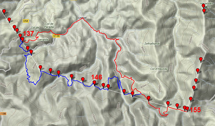
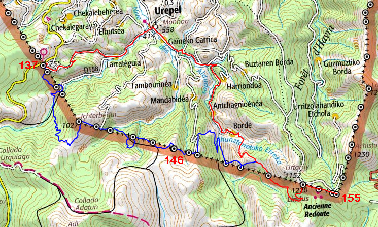
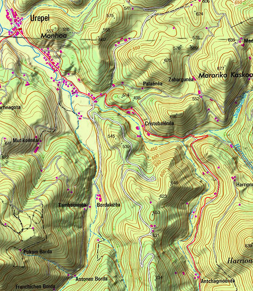
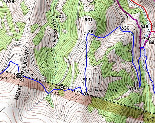
the remaining bordermarkers. See the GRPdesBF-principles. Click here for an fullscreen interactive map. In short From the Venta at the D58, the main route is fairly easy: descending to Urepel and climbing back to the border and continuing to Col de Lindus, mostly on tarmac roads and dirtroads. The variant however - doing bm138-150 - is a tough one: about 3000m elevation (often steep) to find the bordermarkers on the straight borderline which crosses ridges and valleys until Col de Lindus. This is a challenge. Considerations If you include the variant, you might consider to bivouac somewhere along it. You'll cross several streams but at Col de Lindus, there's no water. If you - from Col de Lindus - continue E on the dirtroad, there is a source along the road after 2 km. Descending S from bm154 into the valley to a stream (according to the maps) might be much faster to collect water. Remember: the next stage is mainly on the high ridge and the next source along the route is after 8,5 km near bm174. Factsheet
Gps-files needed
Useful You might check the relevant webpages in the 'All markers'-section and 'All my trips'-section. They provide pictures of the bordermarkers and additional information. Version 04 April 2015. If you have any correction, suggestion etcetera -> please email me: eefberns@grenspalen.nl MAPS AND DIRECTIONS Print your own maps It's easy to print your own - custom made - maps with the GRPdesBF-route and the bordermarkers on them. See: Print your own maps |
||||||||||||||||||||||||||||||||||||||||||||||||||||||||||
 |
||||||||||||||||||||||||||||||||||||||||||||||||||||||||||
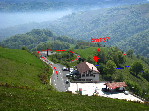 |
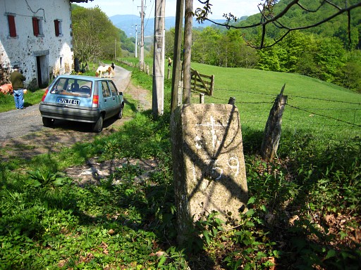
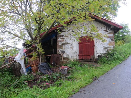
Your starting point seen from above: the venta Baztan. If you need food-supplies, take your chance here, the next shops are at the end of the next stage. |
|||||||||||||||||||||||||||||||||||||||||||||||||||||||||
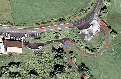 |
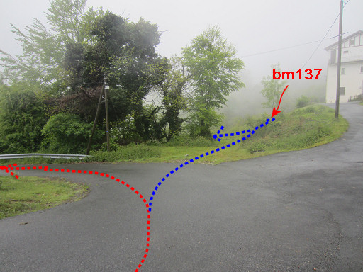
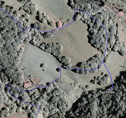
Bm137 is located SE underneath the venta. It can be easily accessed by a 50m detour from the main route. But that detour is also the start of the large variant covering bm138-150. |
|||||||||||||||||||||||||||||||||||||||||||||||||||||||||
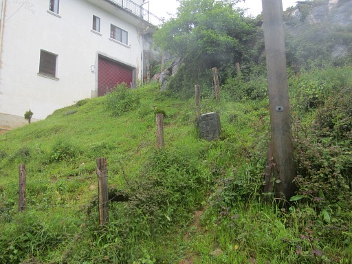 |
Bm137 | |||||||||||||||||||||||||||||||||||||||||||||||||||||||||
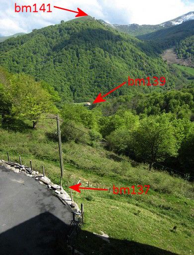 |
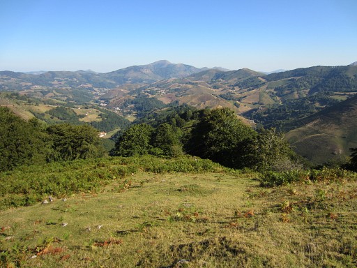
From the venta-parking this view of the hilltop of
Ichterbegui with bm141 at its top. The borderline is a straight line and all bordermarkers 138-150 are covered by the variant. The main GRPdesBF-route will join in after bm150. |
|||||||||||||||||||||||||||||||||||||||||||||||||||||||||
 |
But first a guide to the main route. On tarmac, descend E to the river. Then continue along the river to the village of Urepel. |
|||||||||||||||||||||||||||||||||||||||||||||||||||||||||
 |
It's a peaceful countryroad and navigation is easy: you can't go wrong. Distance Venta Baztan - Urepel: 4,5 km. |
|||||||||||||||||||||||||||||||||||||||||||||||||||||||||
 |
But from Urepel onwards, navigation can be confusing because of the many sideroads and branches. This map and the next will help you. |
|||||||||||||||||||||||||||||||||||||||||||||||||||||||||
 |
The route will be mainly on tarmac. Distance from Urepel until the joining with the variant: ± 7 km |
|||||||||||||||||||||||||||||||||||||||||||||||||||||||||
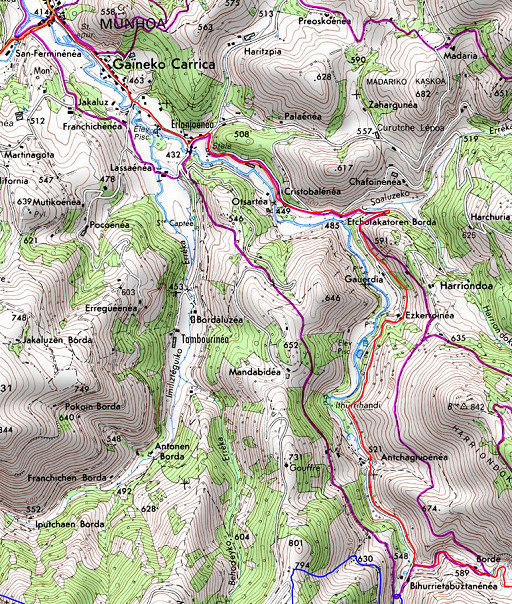 |
When we study the French IGN-maps, there are other options for the part from Urepel onwards. These are the purple trails on the maps. Usually they are officially waymarked trails but I couldn't find any reference to them and didn't try them (yet). I don't think they will save you time but they might be more rewarding in terms of views and off-tarmac. |
|||||||||||||||||||||||||||||||||||||||||||||||||||||||||
| Variant via bm138-150 |
||||||||||||||||||||||||||||||||||||||||||||||||||||||||||
 |
This picture shows well the beginning of the variant. After visiting bm137: descend SSE through the bush for ± 35m to a small stream (which actually starts ± 30m E of bm137). Then follow the small stream in its descent SW for ± 30m. |
|||||||||||||||||||||||||||||||||||||||||||||||||||||||||
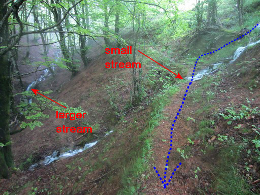 |
When it approaches a larger stream (going SEE), you will arrive at a trail parallel of it, going SE Descend along that trail until you reach a dirtroad with bm138 |
|||||||||||||||||||||||||||||||||||||||||||||||||||||||||
 |
||||||||||||||||||||||||||||||||||||||||||||||||||||||||||
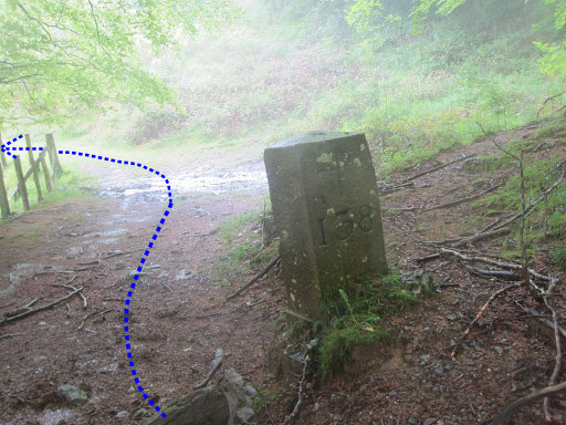 |
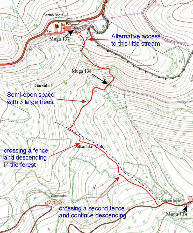
From bm138 go W to the end of the dirtroad in a final
bend of the road. |
|||||||||||||||||||||||||||||||||||||||||||||||||||||||||
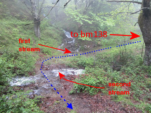 |
At this point two streams come together continuing SE. Cross the first stream. The dirtroad becomes a path. Then cross the second stream. |
|||||||||||||||||||||||||||||||||||||||||||||||||||||||||
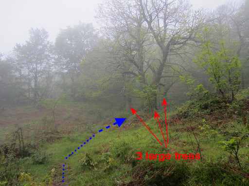 |
The path arrives at a semi-open place in the forest. The trail seems to vanish SW in the direction of 3 large trees |
|||||||||||||||||||||||||||||||||||||||||||||||||||||||||
 |
but after the last of those trees, the trail reappears. After ± 100m it crosses a third stream. The trail now turns left (=SE) parallel to the stream. |
|||||||||||||||||||||||||||||||||||||||||||||||||||||||||
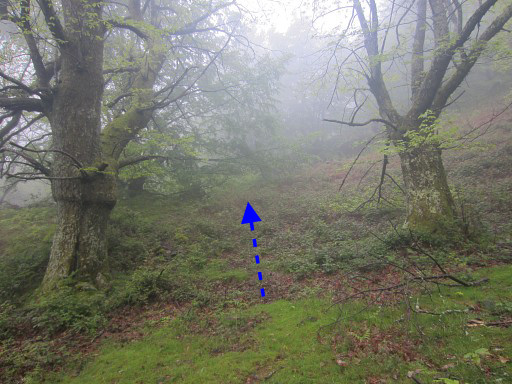
 |
The trail climbs gently SE and arrives after ± 75m at this fence. Cross the fence and descend SE through the forest, parallel to the fence/rockwall at your left. After ± 200m you'll get to a tiny stream and beyond it, there's another fence Cross that fence and continue your descent SE for ± 150m in the forest until you reach a tarmac road. On the road, go left. |
|||||||||||||||||||||||||||||||||||||||||||||||||||||||||
 |
After ± 100m, you will arrive at this farmhouse. Bm139 is at the opposite site of the road, in front of a small barn. |
|||||||||||||||||||||||||||||||||||||||||||||||||||||||||
 |
The kid of the farmhouse had built in 2013 a messy cabin against the bordermarker, using it as a cornerstone. |
|||||||||||||||||||||||||||||||||||||||||||||||||||||||||
 |
Beyond bm139, the tarmac road brings you with a curve down to another road. From there, you have to go hence & forth down a meadow to get to bm140. |
|||||||||||||||||||||||||||||||||||||||||||||||||||||||||
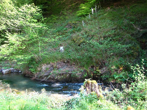 |
Bm140 is at the other side of the stream. | |||||||||||||||||||||||||||||||||||||||||||||||||||||||||
 |
Wading through the stream, is not difficult. Back to the tarmac road. |
|||||||||||||||||||||||||||||||||||||||||||||||||||||||||
|
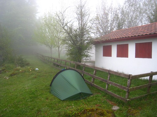
Now continue SW on the road. After the first house/farm beyond the border, the road crosses a stream in a sharp bend of the road. Just before that bend, go left on a dirtroad which crosses stream a bit further and later a larger stream. It then starts climbing SSE. If there's a bifork -> keep left. You will cross some fences and pass a barn (Borda Escribano). |
|||||||||||||||||||||||||||||||||||||||||||||||||||||||||
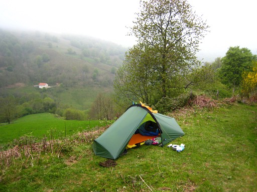 |
That's where I pitched my tent once (but there's no water nearby). |
|||||||||||||||||||||||||||||||||||||||||||||||||||||||||
 |
The trail climbs to the hillridge on a sort of plateau with this cabin 50m to the E |
|||||||||||||||||||||||||||||||||||||||||||||||||||||||||
 |
From
this plateau, climb NNE-N uphill along the ridge - with a sub-summit in
between - to the summit of Ichterbegui with bm141. Note: there's no
trail uphill. From bm141, descend SEE to a (dirt)road. |
|||||||||||||||||||||||||||||||||||||||||||||||||||||||||
 |
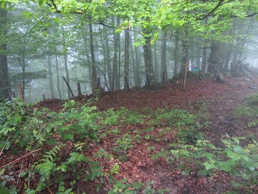
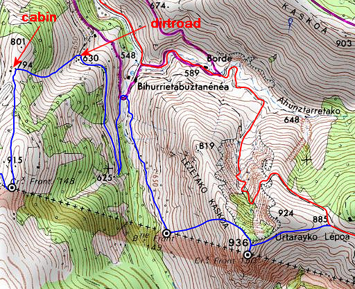
At the dirtroad, you might need to search for bm142. It's this small rockface in the western roadside. However, the border is clear at this spot: the French tarmac stops here and the road continues as a dirtroad into Spain. Also there's a fence going uphill (=the borderline) |
|||||||||||||||||||||||||||||||||||||||||||||||||||||||||
 |
And from close to bm142, the route further on is well recognizable. |
|||||||||||||||||||||||||||||||||||||||||||||||||||||||||
 |
Zoom-in from previous picture. |
|||||||||||||||||||||||||||||||||||||||||||||||||||||||||
 |
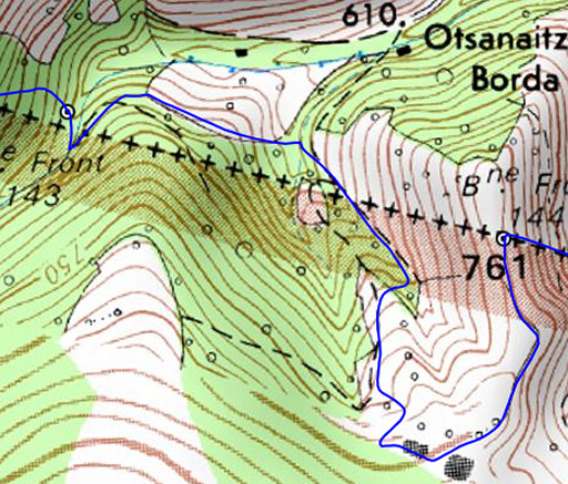
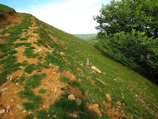
But first bm143 which requires a steep descent into the valley. |
|||||||||||||||||||||||||||||||||||||||||||||||||||||||||
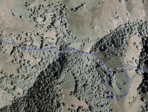 |
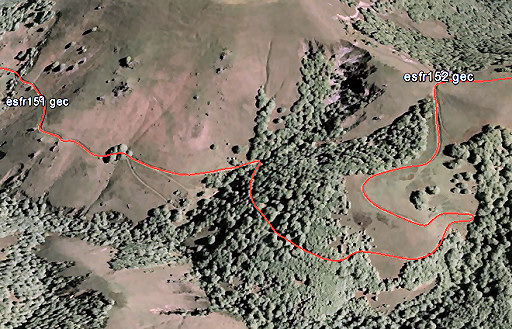
Same map, now on Google Earth. |
|||||||||||||||||||||||||||||||||||||||||||||||||||||||||
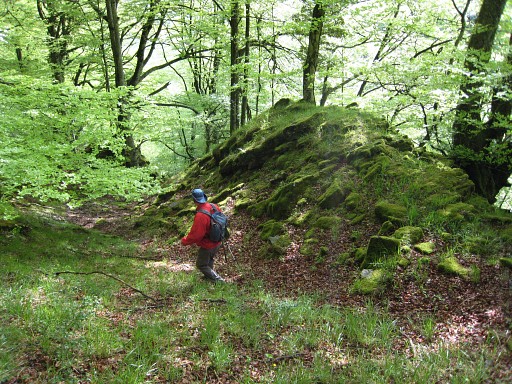 |
Below bm142, descend SE-E downhill into a beach
forest, passing an old stone wall and a large boulder. |
|||||||||||||||||||||||||||||||||||||||||||||||||||||||||
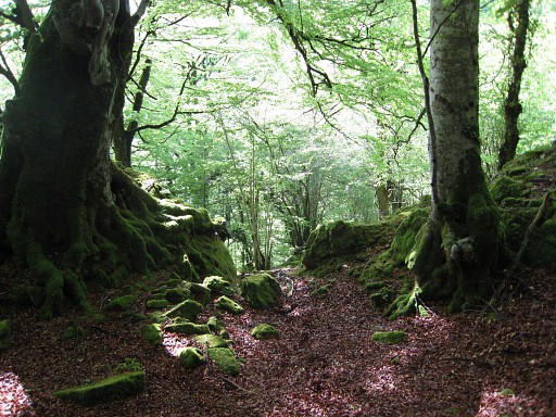 |
Both lead you on a
sort of natural trail downwards until |
|||||||||||||||||||||||||||||||||||||||||||||||||||||||||
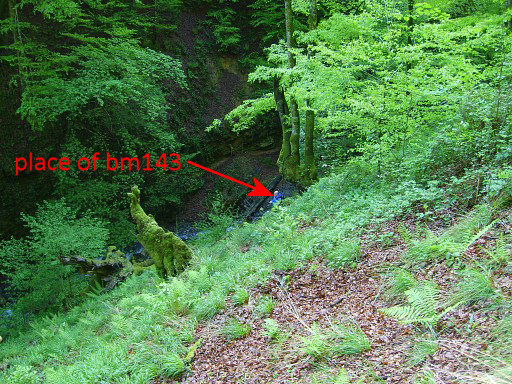 |
this open space with the stream in the valley-bottom in sight. |
|||||||||||||||||||||||||||||||||||||||||||||||||||||||||
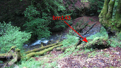 |
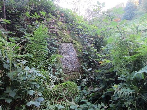
Bm143 is hidden behind a fallen tree. |
|||||||||||||||||||||||||||||||||||||||||||||||||||||||||
 |
Bm143 is split in
half, one side (also with the number 143 on it) lying besides the still
standing half. |
|||||||||||||||||||||||||||||||||||||||||||||||||||||||||
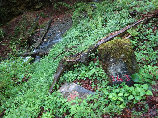 |
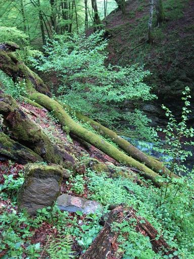
This picture showing both numbers. Now you have to descend further to the stream. It's steep and fallen trees makes progress hazardous. Be careful! Once at the stream, your next goal is a meadow 125m to the NE. |
|||||||||||||||||||||||||||||||||||||||||||||||||||||||||
 |
There is a path in the forest, leading uphill in its direction. Once having arrived at the meadow, proceed along the meadow to its SE-corner. Then continue E for 30m and arrive at a dirtroad. Climb along the dirtroad making the curve - along a cabin - to the hillridge with bm144. |
|||||||||||||||||||||||||||||||||||||||||||||||||||||||||
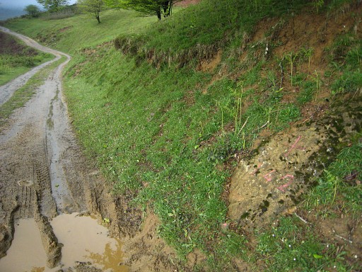
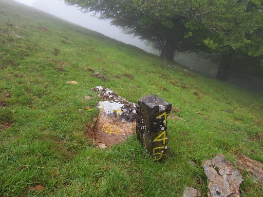
 |
Bm144 at the hillridge. |
|||||||||||||||||||||||||||||||||||||||||||||||||||||||||
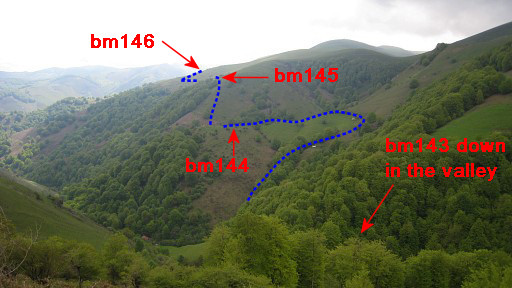
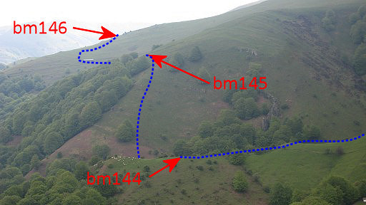
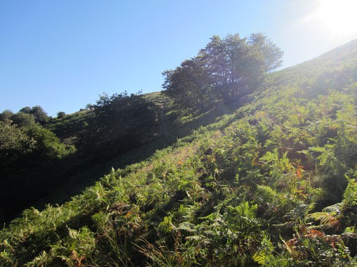
 |
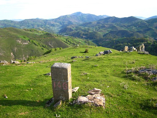
Progress to bm145 is simple but not easy: descend E (very steeply) to a stream, then climb steeply E-SEE along the forest-edge. |
|||||||||||||||||||||||||||||||||||||||||||||||||||||||||
 |
Bm145 is ± 50
meter W of a cabin and a few meters at the N-side of a
country road coming from the cabin. This picture: looking W (where you come from). |
|||||||||||||||||||||||||||||||||||||||||||||||||||||||||
 |
Bm145 |
|||||||||||||||||||||||||||||||||||||||||||||||||||||||||
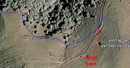 |
From bm145 (or the cabin), make a slight curve SE-E-NEE above the forest along the hillslope. Cattle-trails might help you. A large barn is you destination. Then make the climb uphill to the hillridge as show on this map. |
|||||||||||||||||||||||||||||||||||||||||||||||||||||||||
 |
Bm146 is an easy find. Besides the current pillar bm146, there's the base of a former pillar 146, so it seems. Bm146 has two 'brothers', one at each side. |
|||||||||||||||||||||||||||||||||||||||||||||||||||||||||
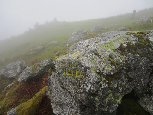 |
Approximately 15 meters W of bm146 (= the pillar in the
background), there is a number 146 engraved in a rock with a cross on the upper side. |
|||||||||||||||||||||||||||||||||||||||||||||||||||||||||
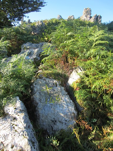 |
But there's also a rock with a cross & the number 146 at the other side of bm146 (also ± 15m). It’s low to the ground and now hidden between the fern. But still easy to find. |
|||||||||||||||||||||||||||||||||||||||||||||||||||||||||
 |
From bm146, you have to descend E to a tarmac road on the other side of the ridge. After the bend in the road, bm147 is ± 150m further, on the hillside above the road. |
|||||||||||||||||||||||||||||||||||||||||||||||||||||||||
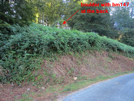 |
Bm 147 is engraved in this boulder above the road. However, fern and blackberry have grown to an unpenetrable jungle and you can't climb to it here. |
|||||||||||||||||||||||||||||||||||||||||||||||||||||||||
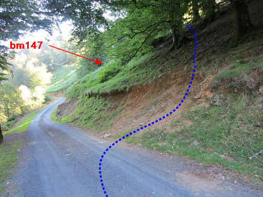 |
Luckily, a bit back on the road you can easily climb the hillside (without fern and blackberry) to traverse to bm147. | |||||||||||||||||||||||||||||||||||||||||||||||||||||||||
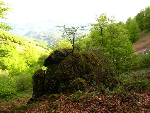 |
Approaching the backside of the boulder. Only the last few meters are still fern and blackberry but there's a sort of trail made by other visitors. |
|||||||||||||||||||||||||||||||||||||||||||||||||||||||||
 |
Bm147 |
|||||||||||||||||||||||||||||||||||||||||||||||||||||||||
 |
Go a bit back and then it’s easy to climb through grass and some fern-patches ± 100m E to a dirtroad | |||||||||||||||||||||||||||||||||||||||||||||||||||||||||
 |
which brings you nicely to the ridge where bm148 is located, 50m N of a cabin. |
|||||||||||||||||||||||||||||||||||||||||||||||||||||||||
 |
From bm148, go N leaving the summit at your right. A kind of trail will appear |
|||||||||||||||||||||||||||||||||||||||||||||||||||||||||
 |
which descends to a dirtroad, crosses it and | |||||||||||||||||||||||||||||||||||||||||||||||||||||||||
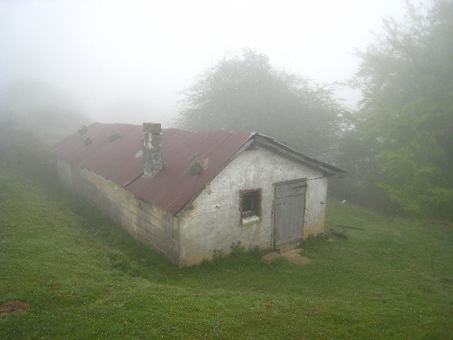
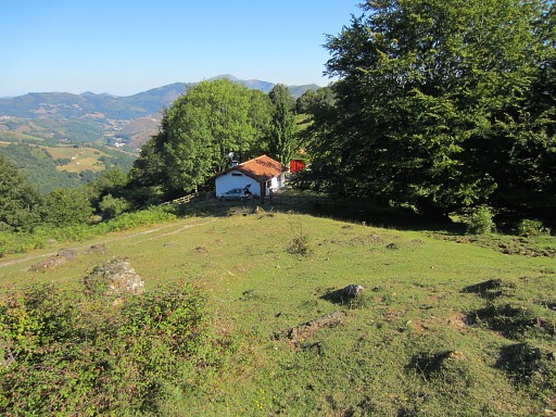 |
leads you towards this cabin. |
|||||||||||||||||||||||||||||||||||||||||||||||||||||||||
 |
I once camped here and then there was a watertap to use. |
|||||||||||||||||||||||||||||||||||||||||||||||||||||||||
 |
Just behind the cabin, descend steeply E-NEE on a meadow and
pick up a cattle trail that becomes a path which ends at a dirtroad. Follow the dirtroad to the S until it merges with a trail going N->S. Now go N on that trail until a dirtroad, close to a farm. Don't continue to the farm but turn right after the stream and go S, again on a trail. You have to stay above the stream and later above the forest at your right hand. The trail climbs gradually, is sometimes vague and brings you eventually to |
|||||||||||||||||||||||||||||||||||||||||||||||||||||||||
 |
Bm149. Now you need to climb steeply NEE up to the hillridge and then bend to the S to the summit. |
|||||||||||||||||||||||||||||||||||||||||||||||||||||||||
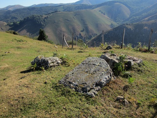
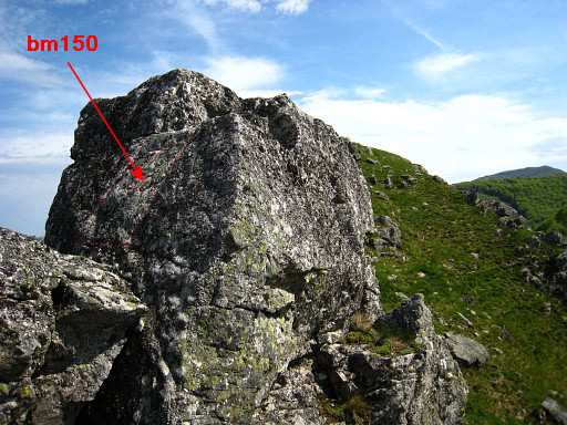 |
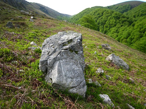
The summit is in fact a ridge with 3 rocky summits.
At the middle one of those 3, you will find bm150. |
|||||||||||||||||||||||||||||||||||||||||||||||||||||||||
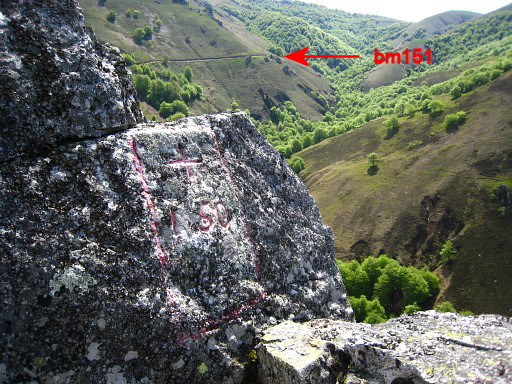 |
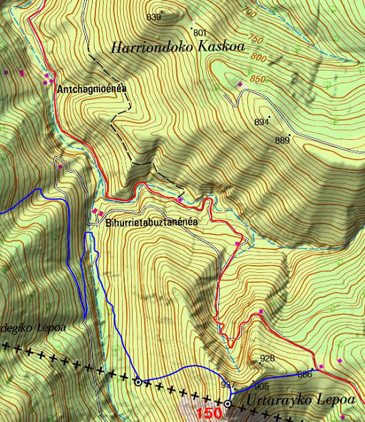
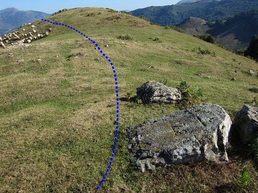
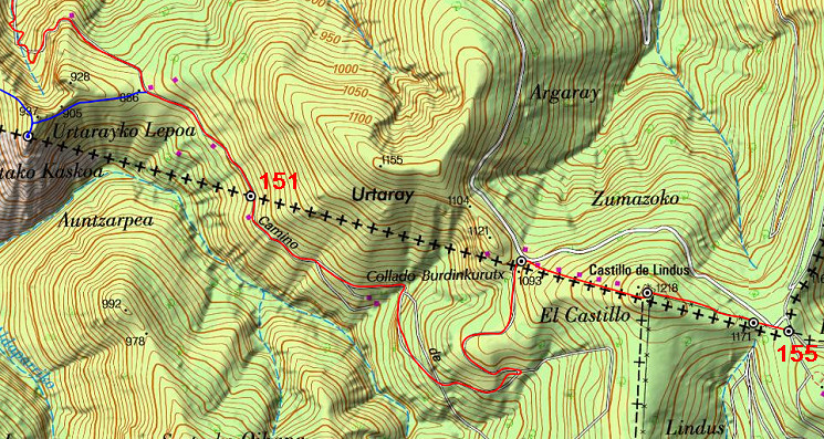
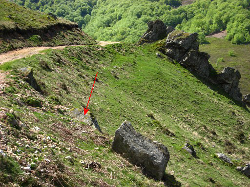
From bm150 you can already spot the location of bm151. Return 50m to the N on the summit and you can pick up a cattle trail, descending slowly NEE towards the dirtroad visible on this picture. At the dirtroad, you are back at the main route. |
|||||||||||||||||||||||||||||||||||||||||||||||||||||||||
| End of variant 1 |
||||||||||||||||||||||||||||||||||||||||||||||||||||||||||
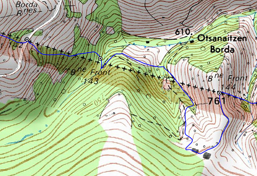
 The last part of this stage: ± 3,5km. |
||||||||||||||||||||||||||||||||||||||||||||||||||||||||||
 |
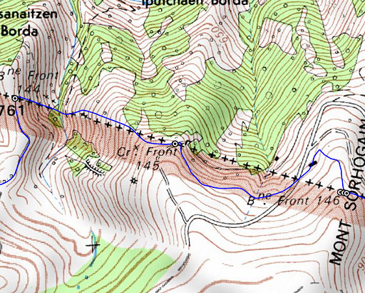
The dirtroad leads to bm151, a bit besides and below the road. | |||||||||||||||||||||||||||||||||||||||||||||||||||||||||
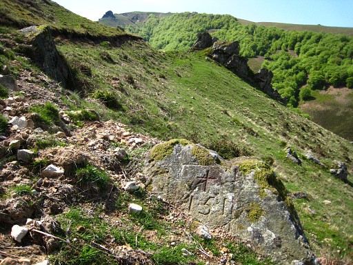 |
Bm151 Keep following that dirtroad |
|||||||||||||||||||||||||||||||||||||||||||||||||||||||||
 |
which
enters a forest after 700m. In the forest, it curves around the slope, exits the forest and then - after 200m - bends sharply back and climbs to the col with |
|||||||||||||||||||||||||||||||||||||||||||||||||||||||||
 |
bm152. Now climb SEE uphill to |
|||||||||||||||||||||||||||||||||||||||||||||||||||||||||
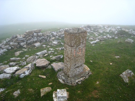
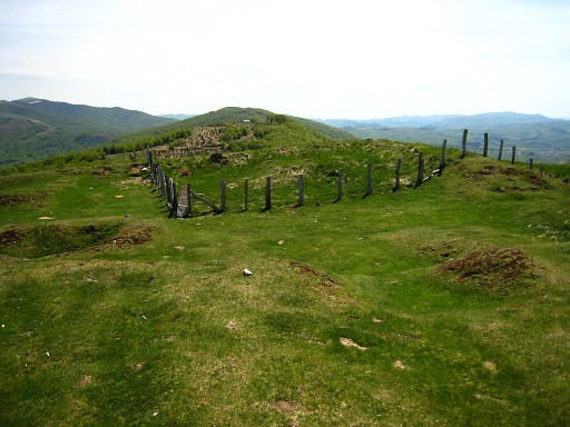 |
this hilltop with the remnants of a fortress. In the middle - at the corner of a fence: |
|||||||||||||||||||||||||||||||||||||||||||||||||||||||||
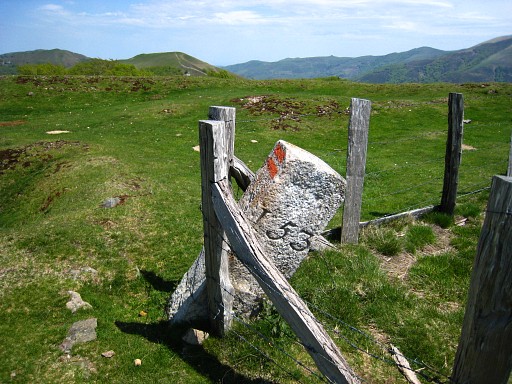 |
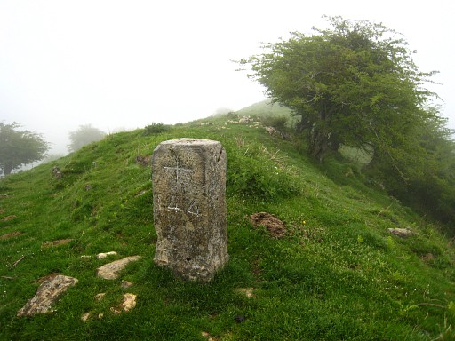
bm153. Then it's an easy descent SEE along a fence to |
|||||||||||||||||||||||||||||||||||||||||||||||||||||||||
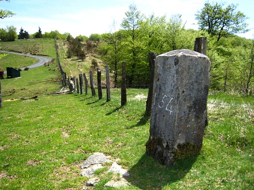 |
bm154. Keep following the fence and after 125m you will arrive at |
|||||||||||||||||||||||||||||||||||||||||||||||||||||||||
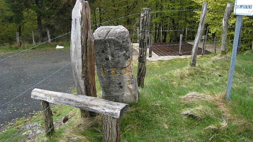 |
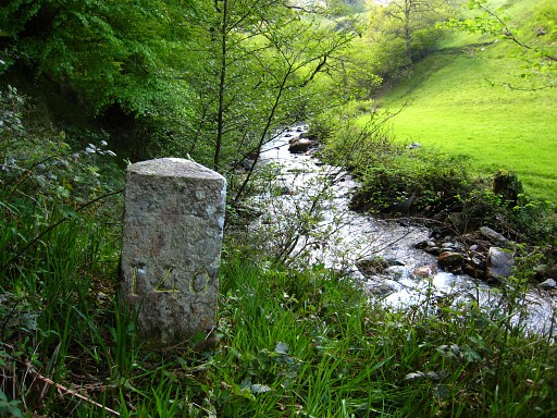
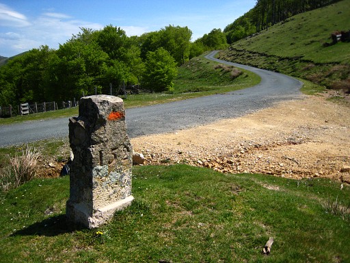
Col de Lindus with bm155, the end of this stage. |
|||||||||||||||||||||||||||||||||||||||||||||||||||||||||