|
The
bordermarkers of the Pyrenees : the GRPdesBF
 |
|||||||||||||||||||||||||||||||||||||||||||||||||||||||||||||||||||
| - stage 8 - Col de Lindus - Arnéguy (bm155-196) |
 |
||||||||||||||||||||||||||||||||||||||||||||||||||||||||||||||||||
 |
|||||||||||||||||||||||||||||||||||||||||||||||||||||||||||||||||||
| Only
the bordermarkers along this stage are shown (and some adjoining ones).
The main route is red,
the variants are blue. The main route provides a smooth
on-going route along most bordermarkers, the variants give access to
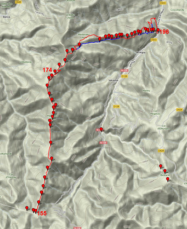
the remaining bordermarkers. See the GRPdesBF-principles. Click here for an fullscreen interactive map. In short From Col de Lindus (bm155) over the hillridge - easily guided by a borderfence - until a dirtroad between bm178 and 179. Tremendous views on the Basque landscape. Then the main route takes a detour on the Spanish side, finally descending to the valley. Two variants lead you on tough grass slopes and on forgotten tracks along the remaining bordermarkers. Considerations Water is scarce along this stage. Near Col d'Ehunzaroy (bm174) there's a Spanish cabin with a watertap and a source. Further on - at bm188 - there's another source. At the end - the venta-complex near Arnégy - there are supermarkets and restaurants. There are several bivouac-spots along the route but at the venta-complex there are none, neither lodging or campings. If you continue on the next stage, it can take 3 hours before reaching suitable terrain for camping. Factsheet
Gps-files needed
Useful You might check the relevant webpages in the 'All markers'-section. They provide more pictures of the bordermarkers and additional information on them. Version 01 January 2013. If you have any correction, suggestion etcetera -> please email me: eefberns@grenspalen.nl MAPS AND DIRECTIONS Print your own maps It's easy to print your own - custom made - maps with the GRPdesBF-route and the bordermarkers on them. See: Print your own maps |
|||||||||||||||||||||||||||||||||||||||||||||||||||||||||||||||||||
 |
|||||||||||||||||||||||||||||||||||||||||||||||||||||||||||||||||||
|
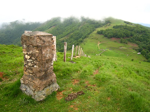
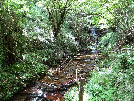
This is your start: Col de Lindus with bm155. In case you need water here: one option is going E on the dirtroad: there is a source along the road after 2 km. Descending S from bm154 (125m W) into the valley to a stream (according to the maps) might be much faster to collect water. |
||||||||||||||||||||||||||||||||||||||||||||||||||||||||||||||||||
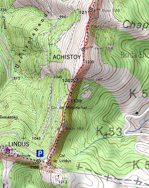 |
From the road between bm154 and 155 - at the bend - you can pick up
the borderline to the N. The borderfence will soon appear at your right hand and will be you guide onwards. Just follow it to the N. There are dirtroads/trails underneath the ridge at the French side which sometimes can be easier for your progress. |
||||||||||||||||||||||||||||||||||||||||||||||||||||||||||||||||||
|
A
bit further: bm156 |
||||||||||||||||||||||||||||||||||||||||||||||||||||||||||||||||||
 |
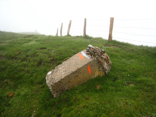
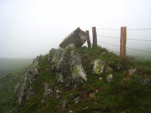
The spot of bm157 is quite clear: having left the forest, the borderline changes slightly in direction. That's here. But bm157 is missing here. It lies downhill: straight down in SSE-direction for about 20 meters. |
||||||||||||||||||||||||||||||||||||||||||||||||||||||||||||||||||
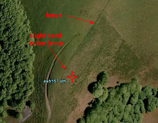 |
Let's show it's position on this Google Earth-map On the hillslope, there’s heavy undergrowth, pricky and very tough to wade through. It might be difficult to find bm157 in this undergrowth. |
||||||||||||||||||||||||||||||||||||||||||||||||||||||||||||||||||
|
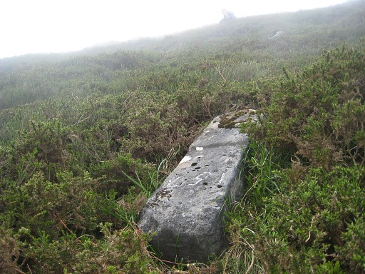
Bm157, looking towards the ridge. Climb back to the ridge, then continue N along the fence. |
||||||||||||||||||||||||||||||||||||||||||||||||||||||||||||||||||
|
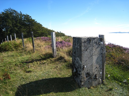
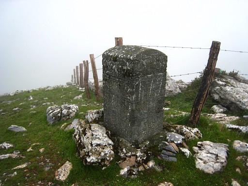
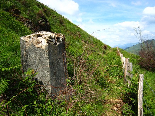
Bm158 The bordermarkers on this ridge are striking by their massive and large proportions. Some - looking more recent - are made of concrete with superficially carved numbers. |
||||||||||||||||||||||||||||||||||||||||||||||||||||||||||||||||||
|
Bm159 |
||||||||||||||||||||||||||||||||||||||||||||||||||||||||||||||||||
 |
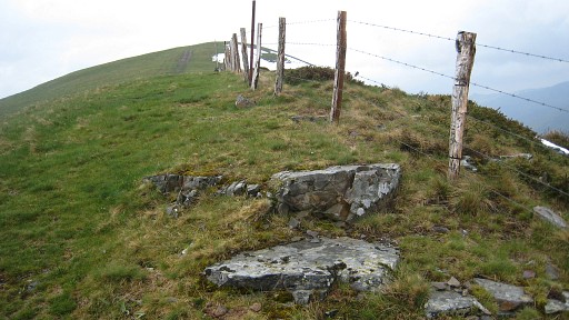
Navigation can't be easier: just follow the fence. |
||||||||||||||||||||||||||||||||||||||||||||||||||||||||||||||||||
|
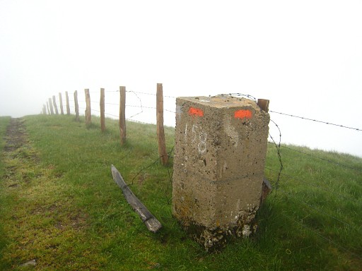
Bm160 Some of the markers are - like this one - masonry with a large number engraved in the lower part. They look older. |
||||||||||||||||||||||||||||||||||||||||||||||||||||||||||||||||||
|
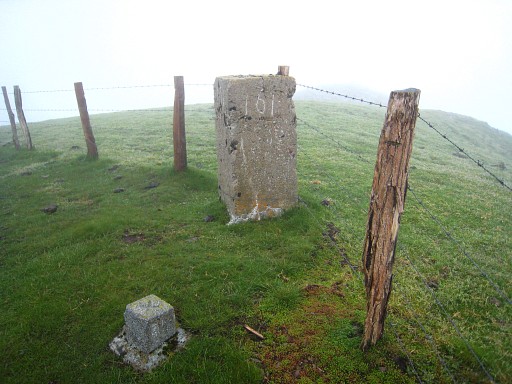
Bm161 |
||||||||||||||||||||||||||||||||||||||||||||||||||||||||||||||||||
|
Bm162 |
||||||||||||||||||||||||||||||||||||||||||||||||||||||||||||||||||
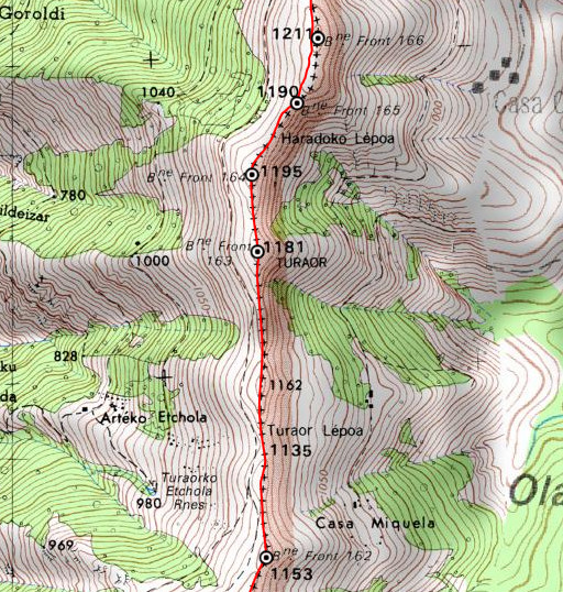 |
You can spot on this map a trail parallel to the border which makes progress easier on some parts. |
||||||||||||||||||||||||||||||||||||||||||||||||||||||||||||||||||
|
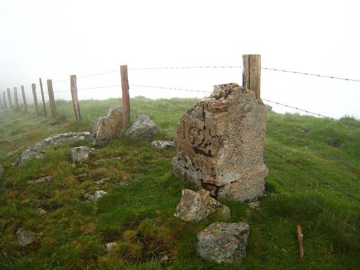
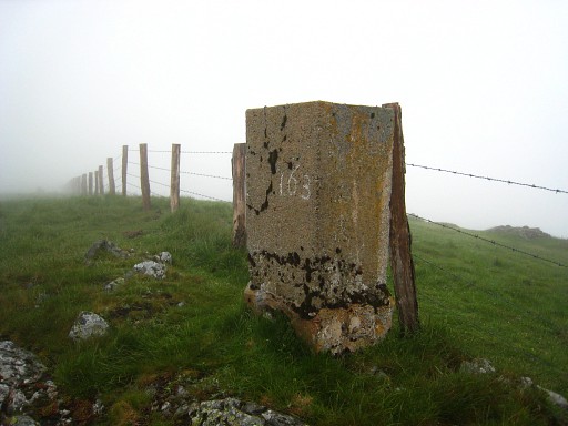
Bm163 |
||||||||||||||||||||||||||||||||||||||||||||||||||||||||||||||||||
|
Bm164 It seems that a sort of shield was part of the bordermarker. |
||||||||||||||||||||||||||||||||||||||||||||||||||||||||||||||||||
|
Bm165 |
||||||||||||||||||||||||||||||||||||||||||||||||||||||||||||||||||
|
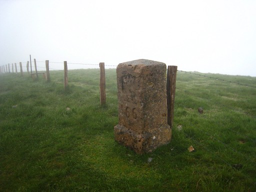
Bm166 |
||||||||||||||||||||||||||||||||||||||||||||||||||||||||||||||||||
 |
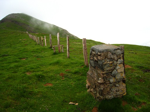
The altitude of the ridge remains around 1200 meters. |
||||||||||||||||||||||||||||||||||||||||||||||||||||||||||||||||||
|
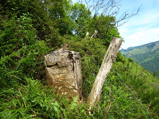
Bm167 |
||||||||||||||||||||||||||||||||||||||||||||||||||||||||||||||||||
|
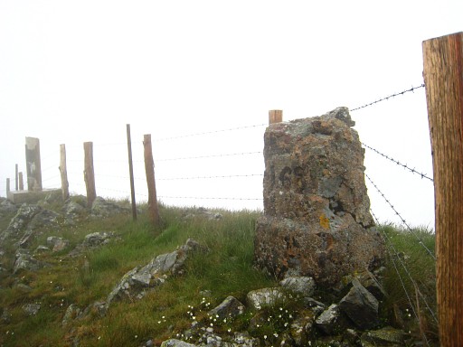
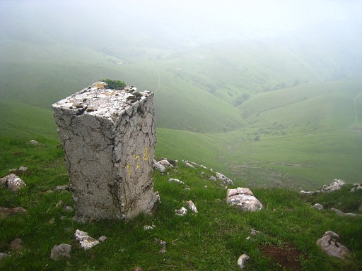
Bm168, in the background a geodetic marker. | ||||||||||||||||||||||||||||||||||||||||||||||||||||||||||||||||||
|
Bm169 |
||||||||||||||||||||||||||||||||||||||||||||||||||||||||||||||||||
|
Bm170 |
||||||||||||||||||||||||||||||||||||||||||||||||||||||||||||||||||
|
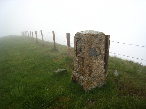
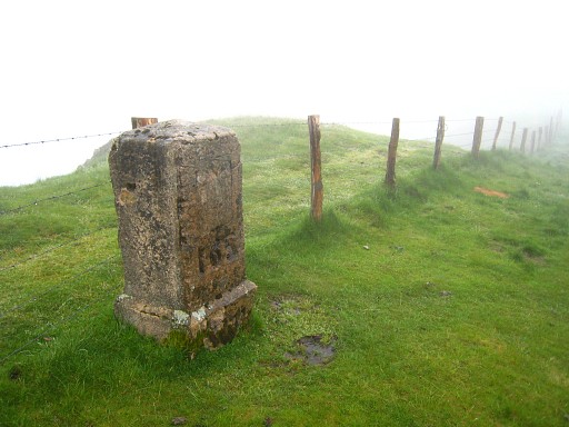
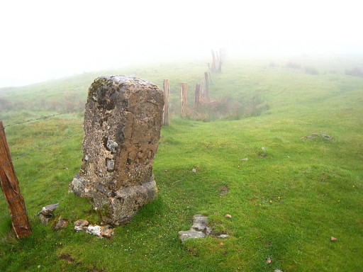
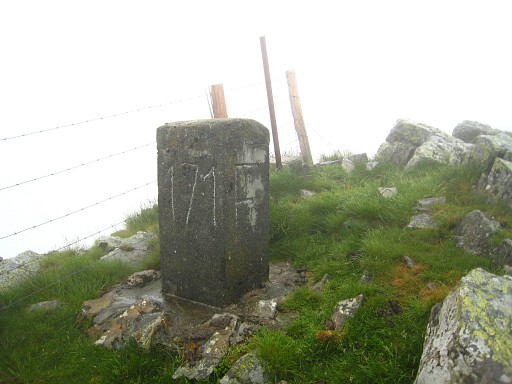
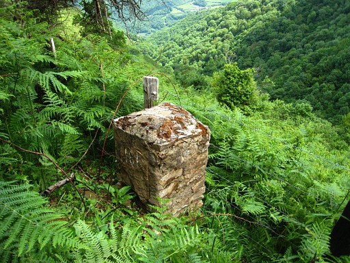
Bm171 Another type of marker: large and made of massive stone with large numbers and letters. |
||||||||||||||||||||||||||||||||||||||||||||||||||||||||||||||||||
 |
From bm171, it's a considerable descent to Col d'Ehunzaroy. | ||||||||||||||||||||||||||||||||||||||||||||||||||||||||||||||||||
|
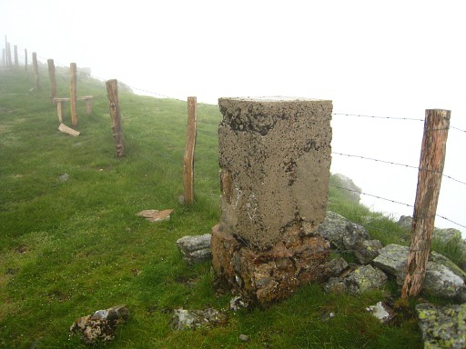
Bm172 |
||||||||||||||||||||||||||||||||||||||||||||||||||||||||||||||||||
|
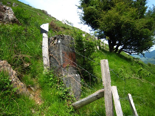
Bm173 |
||||||||||||||||||||||||||||||||||||||||||||||||||||||||||||||||||
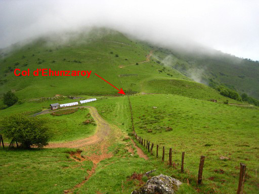 |
The final part of the descent to Col d'Ehunzaroy with bm174. |
||||||||||||||||||||||||||||||||||||||||||||||||||||||||||||||||||
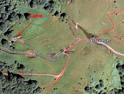 |
To the E of the Col d'Ehunzaroy is a cabin with bunkbeds and running water. | ||||||||||||||||||||||||||||||||||||||||||||||||||||||||||||||||||
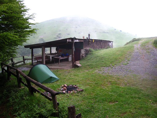 |
I camped here once, unsure how public this cabin is. Anyway, it has a water tap outside the cabin and a source besides it. |
||||||||||||||||||||||||||||||||||||||||||||||||||||||||||||||||||
|
Col d'Ehunzaroy with bm174. Cross the bridge and climb a zigzagging dirtroad to the left and join the borderfence again uphill. |
||||||||||||||||||||||||||||||||||||||||||||||||||||||||||||||||||
|
Further uphill: bm175 (looking back on Col d'Ehunzaroy) | ||||||||||||||||||||||||||||||||||||||||||||||||||||||||||||||||||
|
Bm176 |
||||||||||||||||||||||||||||||||||||||||||||||||||||||||||||||||||
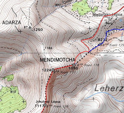 |
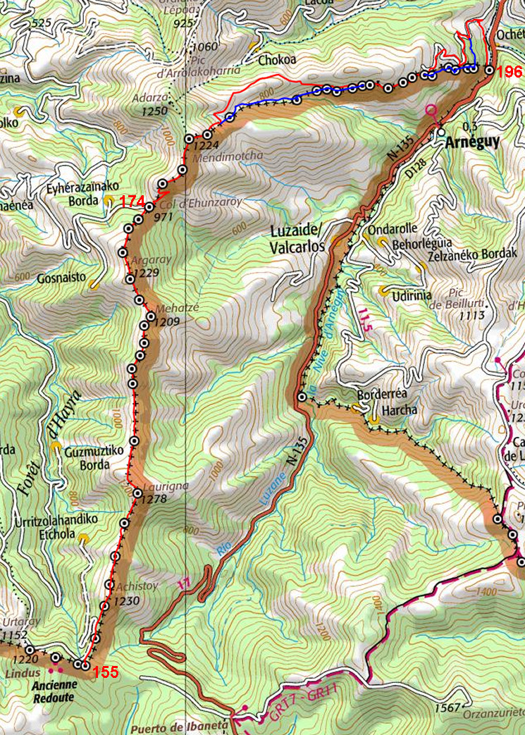
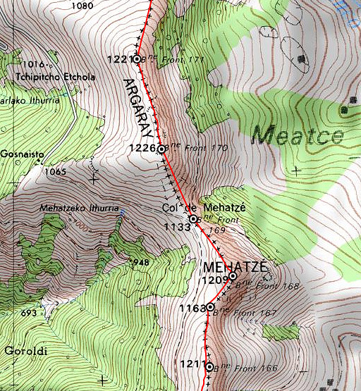
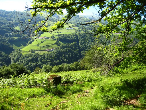
From bm176, there's a last climb to the hilltop of Mendimotcha with bm177. Beyond Mendimotcha, you will gradually descend to the rivervalley of the river Nive. At bm178, the border leaves the ridge and follows a stream starting a bit below. |
||||||||||||||||||||||||||||||||||||||||||||||||||||||||||||||||||
|
Bm177, similar to bm171. There's also a number 177 on top of it. From here it's a steep descent to |
||||||||||||||||||||||||||||||||||||||||||||||||||||||||||||||||||
|
bm178. At this point, the border leaves the ridge and follows a stream starting a bit lower. This stream will be the border until bm180. From bm178, descend further to a dirtroad which crosses the border. |
||||||||||||||||||||||||||||||||||||||||||||||||||||||||||||||||||
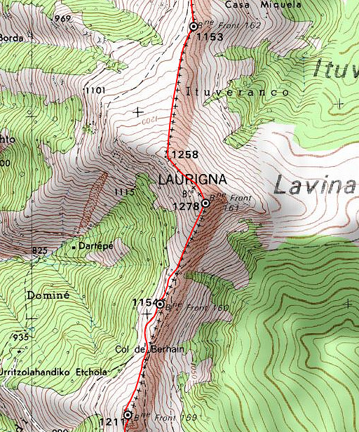
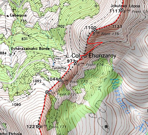
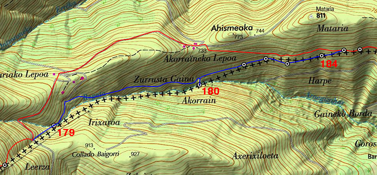
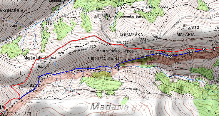 This map shows well enough how to navigate further on the main route. |
|||||||||||||||||||||||||||||||||||||||||||||||||||||||||||||||||||
 |
The second part of it can use a bit more detail | ||||||||||||||||||||||||||||||||||||||||||||||||||||||||||||||||||
 |
from Google Earth. |
||||||||||||||||||||||||||||||||||||||||||||||||||||||||||||||||||
| Variant 1 via bm179-184 |
|||||||||||||||||||||||||||||||||||||||||||||||||||||||||||||||||||
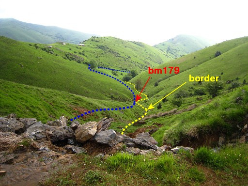 |
This picture: from the dirtroad looking NE into the valley of the borderstream. This stream - which starts below bm178 - is the border until bm180. From bm180, the border climbs uphill along a fence. |
||||||||||||||||||||||||||||||||||||||||||||||||||||||||||||||||||
|
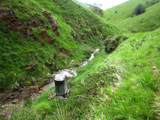
Bm179 is 200m further along the stream. Note the number is on the top. A bit further, climb 225m NNE to a barn and walled field and then proceed E parallel to the borderstream. There are some cattle-tracks to help you but mostly it's tough walking - though descending - on the hillside. |
||||||||||||||||||||||||||||||||||||||||||||||||||||||||||||||||||
 |
|||||||||||||||||||||||||||||||||||||||||||||||||||||||||||||||||||
|
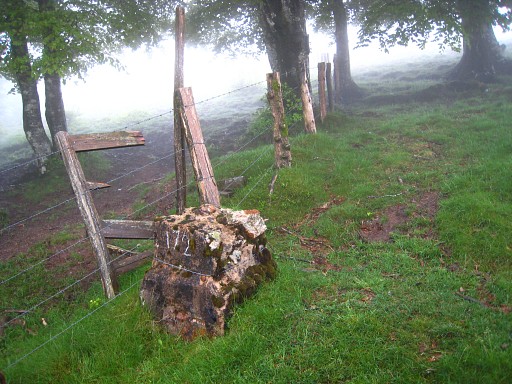
Finally - after 1,3 km from bm179 - you will arrive at a sturdy fence. It's the borderfence, coming from the stream. Now follow that fence towards the stream and you will find bm180. |
||||||||||||||||||||||||||||||||||||||||||||||||||||||||||||||||||
 |
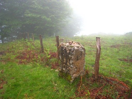
It's close to a small cascade and here the borderfence starts. From bm180 to get to bm181, it's easier to make a little detour N->E around the forested part and join the fence again than following the fence right through the forest. |
||||||||||||||||||||||||||||||||||||||||||||||||||||||||||||||||||
|
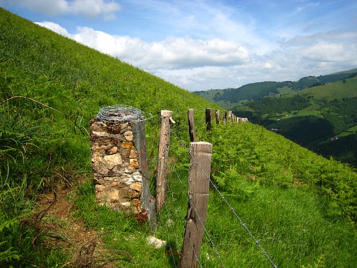
From bm181 onwards, navigating is simple. Just follow the fence = the border which will guide you until bm190. But walking remains tough until bm185 due to to fern, blackberry and sliding underground. |
||||||||||||||||||||||||||||||||||||||||||||||||||||||||||||||||||
|
Bm182. Here we have to climb a bit uphill curving around a hedge to return at the fence |
||||||||||||||||||||||||||||||||||||||||||||||||||||||||||||||||||
|
and continue to bm183. |
||||||||||||||||||||||||||||||||||||||||||||||||||||||||||||||||||
|
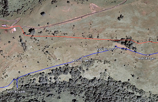
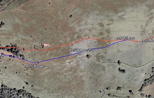
Bm184. At the next bordermarker (bm185), the main route joins in from the left. |
||||||||||||||||||||||||||||||||||||||||||||||||||||||||||||||||||
| End of variant 1 |
|||||||||||||||||||||||||||||||||||||||||||||||||||||||||||||||||||
 |
|||||||||||||||||||||||||||||||||||||||||||||||||||||||||||||||||||
|
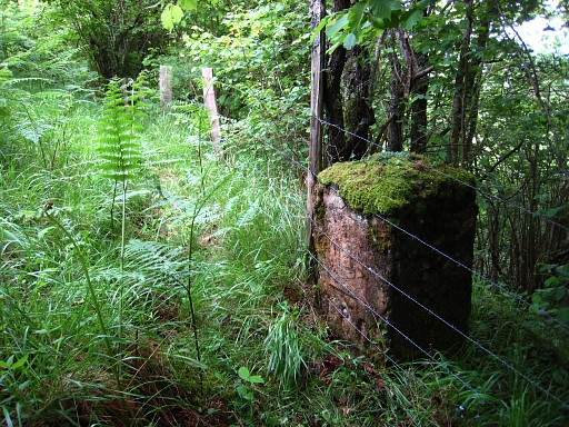
Bm185 At the point, the main route joins the border (again) on a path which makes progress much easier. |
||||||||||||||||||||||||||||||||||||||||||||||||||||||||||||||||||
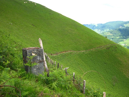
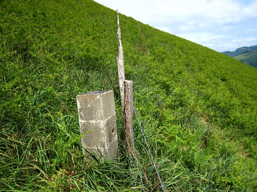
|
Bm186, looking forward. Apparently the original number has weathered/faded away. |
||||||||||||||||||||||||||||||||||||||||||||||||||||||||||||||||||
|
Bm187 |
||||||||||||||||||||||||||||||||||||||||||||||||||||||||||||||||||
|
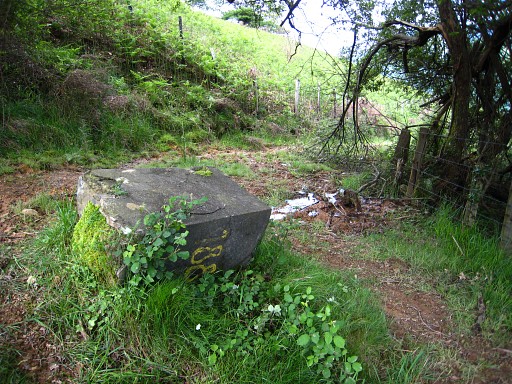
Bm188 There's a source here. From this bordermarker, the trail gets broader and more grassy. The fence now shifts to the left side of the trail. |
||||||||||||||||||||||||||||||||||||||||||||||||||||||||||||||||||
|
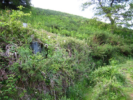
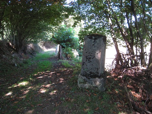
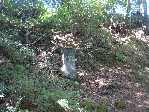
About 200m further is bm189 which might be difficult to spot in the left roadside. It's where to the right another fence starts which is a sort of a shortcut. |
||||||||||||||||||||||||||||||||||||||||||||||||||||||||||||||||||
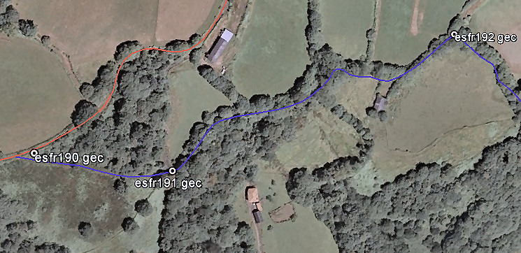
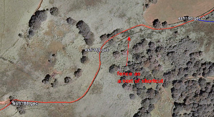 Let's show it on this Google Earth-map. |
|||||||||||||||||||||||||||||||||||||||||||||||||||||||||||||||||||
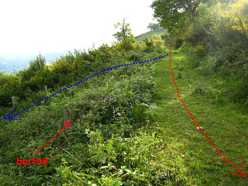 |
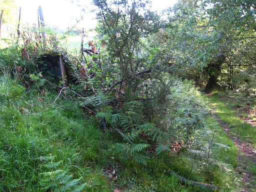
Bm190 - 225m further- might be also overgrown and difficult to find. When you proceed from bm189 on the trail, you will arrive at a spot where the righthand fence leaves the trail (with a narrow overgrown track along it). From that corner bm190 is ± 15m further in the overgrown sidewalk. |
||||||||||||||||||||||||||||||||||||||||||||||||||||||||||||||||||
|
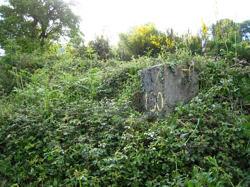
Bm190 |
||||||||||||||||||||||||||||||||||||||||||||||||||||||||||||||||||
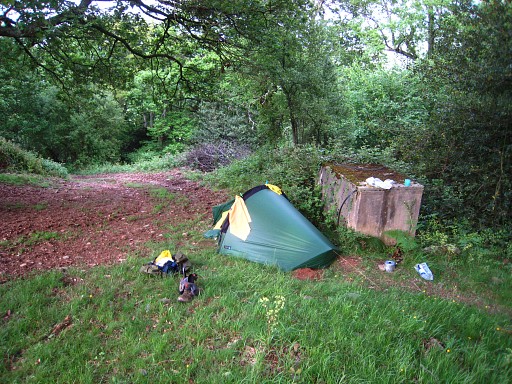 |
About 75m further, I once camped for the night at this spot. The trail has become a dirtroad. |
||||||||||||||||||||||||||||||||||||||||||||||||||||||||||||||||||
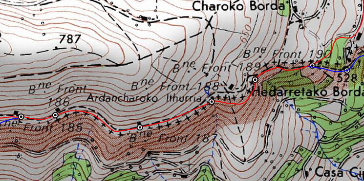
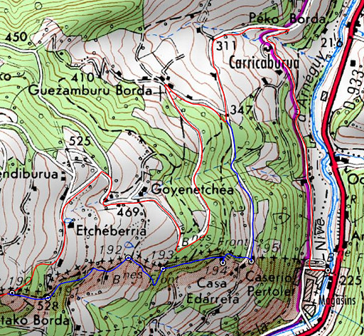 |
This map shows the remainder of this stage. Navigating is easy for the main route. |
||||||||||||||||||||||||||||||||||||||||||||||||||||||||||||||||||
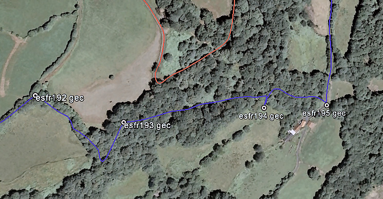
| Variant 2 via bm191-195 |
|||||||||||||||||||||||||||||||||||||||||||||||||||||||||||||||||||
 But this variant needs some directions. |
|||||||||||||||||||||||||||||||||||||||||||||||||||||||||||||||||||
|
About 15m before arriving at bm190, the fence at your right hand leaves the trail. There's a narrow overgrown track along it. Follow that track. |
||||||||||||||||||||||||||||||||||||||||||||||||||||||||||||||||||
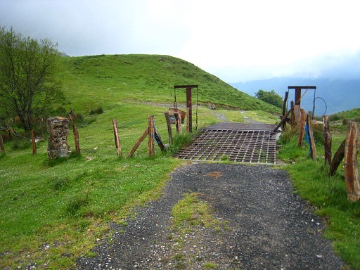
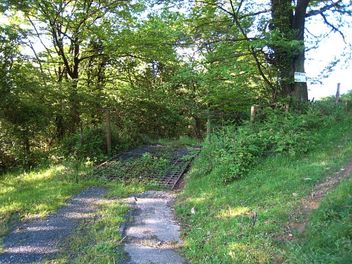 |
That track along the fence brings you in 150m to this peculiar metal (border)crossing Bm191 is at the other side of the crossroads. |
||||||||||||||||||||||||||||||||||||||||||||||||||||||||||||||||||
|
Bm191 Continue on the dirtroad ahead for 200m |
||||||||||||||||||||||||||||||||||||||||||||||||||||||||||||||||||
 |
until it ends at a meadow. At that point, there's to the right this - no longer used - trail, descending to the E. It might be blocked by a fence and full with branches. Using partly the meadow at the right is easier. Follow its course to the E and NE and in 150m you will arrive at |
||||||||||||||||||||||||||||||||||||||||||||||||||||||||||||||||||
|
bm192. |
||||||||||||||||||||||||||||||||||||||||||||||||||||||||||||||||||
 |
|||||||||||||||||||||||||||||||||||||||||||||||||||||||||||||||||||
|
At bm12, go right (=SE) on another no longer used trail. The meadow at the right is - again -
easier. Then bend to the left (NE) and you will find find bm193 to your left. After bm193: continue on the forest trail. |
||||||||||||||||||||||||||||||||||||||||||||||||||||||||||||||||||
 |
After 225m (from bm193) you will reach an open
space at your right. Bm194 is located a bit outside the forest in a field. |
||||||||||||||||||||||||||||||||||||||||||||||||||||||||||||||||||
|
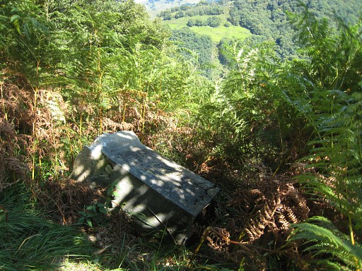
But in 2011 it was lying flat, hidden in the fern.
Continue E in the forest. Do not descend on the old trail along the forest-edge because that trail is blocked at the end. Instead descend parallel to that trail until you reach the tarmac road NE of a house. Access from the forest to the road might be a bit difficult. |
||||||||||||||||||||||||||||||||||||||||||||||||||||||||||||||||||
|
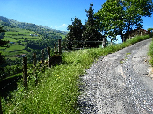
On the tarmac road towards the house is bm195. Now go N on the tarmac road and join the main route after 500m. |
||||||||||||||||||||||||||||||||||||||||||||||||||||||||||||||||||
| End of variant 2 |
|||||||||||||||||||||||||||||||||||||||||||||||||||||||||||||||||||
|
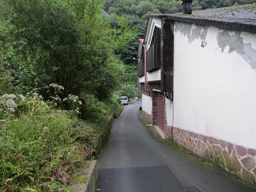
The main route brings you to a venta-comlex ("Magasins"). |
||||||||||||||||||||||||||||||||||||||||||||||||||||||||||||||||||
 |
When arriving there, go left down this road |
||||||||||||||||||||||||||||||||||||||||||||||||||||||||||||||||||
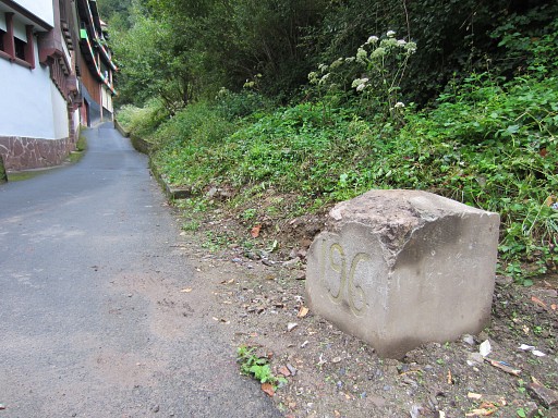
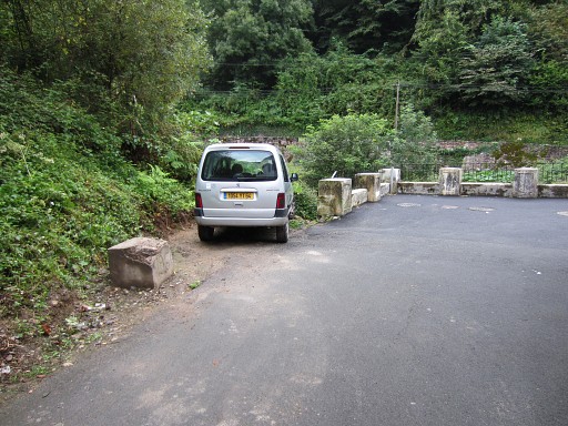 |
to arrive at bm196. |
||||||||||||||||||||||||||||||||||||||||||||||||||||||||||||||||||
|
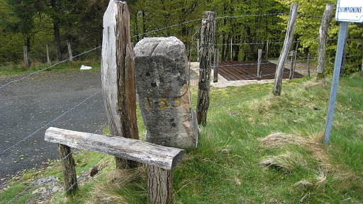
Bm196 has been buried for decades until 2014 If you need to shop, take your chance here. This is your last opportunity for shopping on the borderline for many stages. |
||||||||||||||||||||||||||||||||||||||||||||||||||||||||||||||||||