|
The
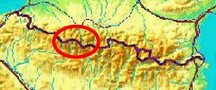
bordermarkers of the Pyrenees : the GRPdesBF
 |
|||||||||||||||||||||||||||||||||||||||||||||||||||||||||||||||||||
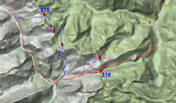
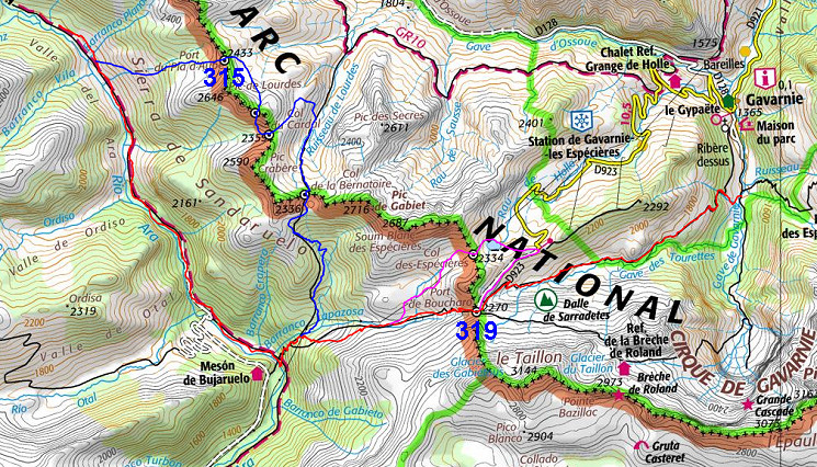
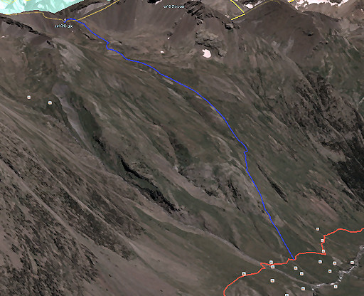
| - stage 20 - Valle del Ara - Gavarnie (bm315-319) |
 |
||||||||||||||||||||||||||||||||||||||||||||||||||||||||||||||||||
 |
|||||||||||||||||||||||||||||||||||||||||||||||||||||||||||||||||||
| Only
the bordermarkers along this stage are shown (and some adjoining ones).
The main route is red,
the variants have other colors. The main route provides a smooth
on-going route along most bordermarkers, the variants give access to
the remaining bordermarkers. See the GRPdesBF-principles. Click here for an fullscreen interactive map. In short The main route is straightforward on distinct trails and wayfinding is easy. First descend along the river Ara down the Valle del Ara until the bridge of 'San Nicolas de Bujaruelo' with the refugio Bujaruelo on the other side. Then climb to Port du Boucharo (bm319) and descend towards Gavarnie, finishing at a bridge: Pont de Nadau. The two variants demand more denivellation on rough mountain terrrain with few trails: - variant 1 climbs to bm315, then winds along the mountainridge until bm317 at Col de la Bernatoire and descends back to the main route. - variant 2 is easier regarding denivellation and navigation and covers bm319. Considerations Wayfinding on variant 1 can be a problem in bad weather. The terrain is high and rough, so take care. Water is available on various spots and there are enough opportunities for a bivouac. At the end of the stage, Gavernie is about 1 km to the N with shops & restaurants and the camping "La Bergerie". A bivouac here seems less obvious here. You could also continue on the next stage and climb to Refuge des Espuguettes (± 2h) to stay there or bivouac somewhere around. Factsheet
Gps-files needed
Version 02 July 2014. If you have any correction, suggestion etcetera -> please email me: eefberns@grenspalen.nl MAPS AND DIRECTIONS You might check the relevant webpages in the 'All markers'-section and 'All my trips'-section for more pictures of the bordermarkers and wayfinding-issues. Print your own maps It's easy to print your own - custom made - maps with the GRPdesBF-route and the bordermarkers on them. See: Print your own maps |
|||||||||||||||||||||||||||||||||||||||||||||||||||||||||||||||||||
 |
|||||||||||||||||||||||||||||||||||||||||||||||||||||||||||||||||||
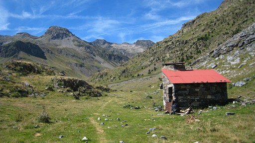 |
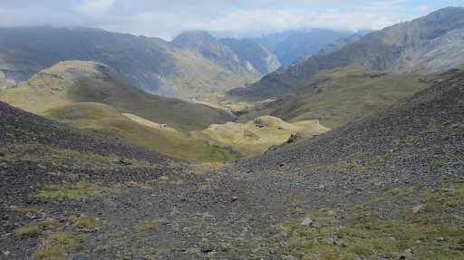
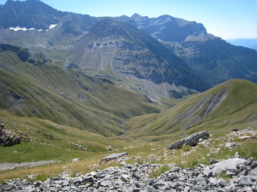
This cabin (refugio labaza) is the start of the stage. The view is to the N. | ||||||||||||||||||||||||||||||||||||||||||||||||||||||||||||||||||
 |
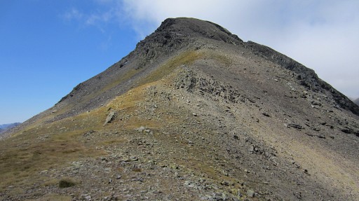
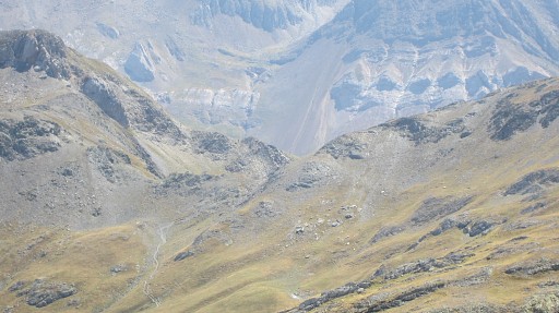
Further on, at the next
stream coming from the left, variant 1 starts and climbs up the mountainside to the E. The main route continues along the river Ara down the Valle del Ara until the bridge of 'San Nicolas de Bujaruelo' with the refugio Bujaruelo on the other side. From there, climb towards Port du Boucharo (bm319). After ± 250m altitude gain (3/4h), variant 1 will meet the main route again. |
||||||||||||||||||||||||||||||||||||||||||||||||||||||||||||||||||
| Variant 1 via bm315-317 |
|||||||||||||||||||||||||||||||||||||||||||||||||||||||||||||||||||
 |
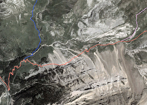
This screenprint from Google Earth shows the route up to Port du Boucharo. |
||||||||||||||||||||||||||||||||||||||||||||||||||||||||||||||||||
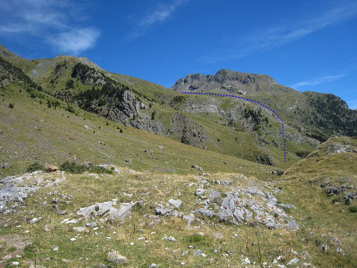 |
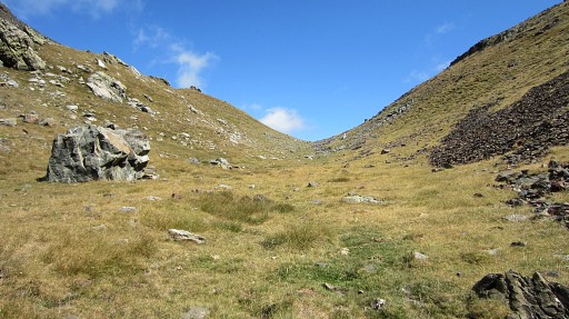
Let's project the variant on the picture of above. There’s no trail in the field– and it’s heavy climbing on that grass. |
||||||||||||||||||||||||||||||||||||||||||||||||||||||||||||||||||
 |
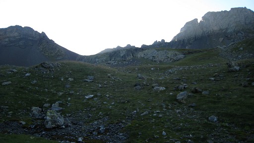
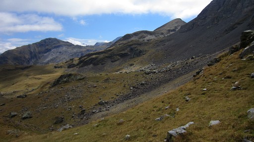
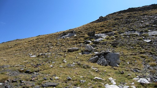
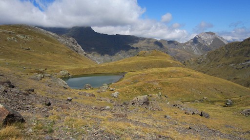
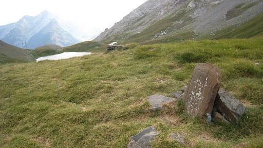
Higher on, the terrain gets flatter making a bivouac possible. When getting closer to the borderridge, it's not obvious where Port de Pla d’Aube is. |
||||||||||||||||||||||||||||||||||||||||||||||||||||||||||||||||||
 |
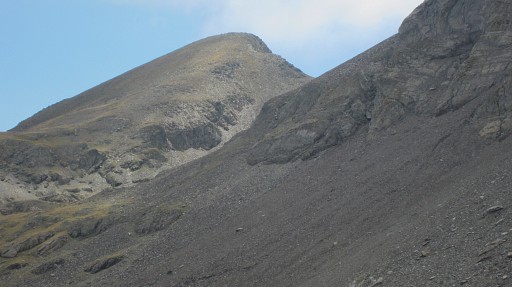
This is the clue: there are - against the ridge - two half-bowl shaped steep valleys. In the middle is a grassy ridge which leads to the Port de Pla d’Aube. |
||||||||||||||||||||||||||||||||||||||||||||||||||||||||||||||||||
 |
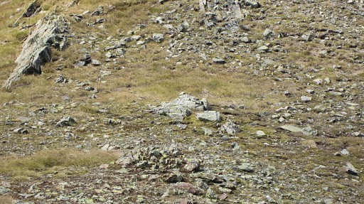
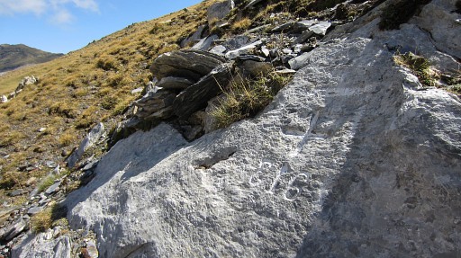
There,
on the south-side of the pass, is bm315 (the numbers are in mirror writing). |
||||||||||||||||||||||||||||||||||||||||||||||||||||||||||||||||||
 |
Then it’s a half ellipse to Col de Lourdes (a toponym not show on the IGN-maps). First a bit descending into France, |
||||||||||||||||||||||||||||||||||||||||||||||||||||||||||||||||||
 |
then bending to the right and traversing to Col de Lourdes, |
||||||||||||||||||||||||||||||||||||||||||||||||||||||||||||||||||
 |
shown on this zoom-in. | ||||||||||||||||||||||||||||||||||||||||||||||||||||||||||||||||||
 |
close now to Col de Lourdes. | ||||||||||||||||||||||||||||||||||||||||||||||||||||||||||||||||||
 |
The fake bm316 is easily found on the N-side of the pass. | ||||||||||||||||||||||||||||||||||||||||||||||||||||||||||||||||||
 |
Zoom-in of the previous picture. | ||||||||||||||||||||||||||||||||||||||||||||||||||||||||||||||||||
 |
Bm316-fake Probably painted by Spanish shepherds in an effort to legalize their border-crossing via this Col. The bordercrossing of spanish flocks was restricted to other cols. See also the curiosities-page. |
||||||||||||||||||||||||||||||||||||||||||||||||||||||||||||||||||
 |
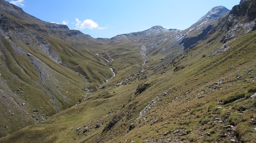
The next curve (S, then E) is
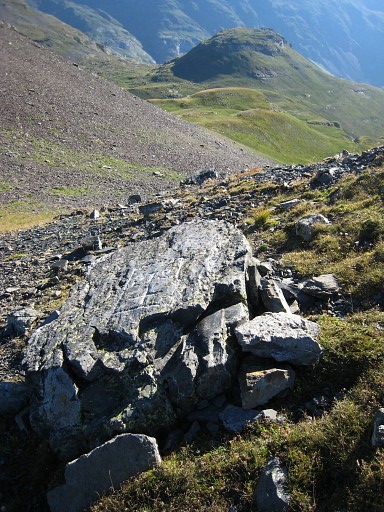
in Spain to Col du Cardal with the real bm316. That curve is easier than it seems although the descent is quite steep. One hint: stick to the grass strips while descending. This picture: I've just started the descent. In the far distance: |
||||||||||||||||||||||||||||||||||||||||||||||||||||||||||||||||||
 |
Col de la Bernatoire where bm417 is. | ||||||||||||||||||||||||||||||||||||||||||||||||||||||||||||||||||
 |
Almost at Col du Cardal |
||||||||||||||||||||||||||||||||||||||||||||||||||||||||||||||||||
 |
with at the S-side of the Col: |
||||||||||||||||||||||||||||||||||||||||||||||||||||||||||||||||||
 |
Bm316 The 3 is in mirror writing |
||||||||||||||||||||||||||||||||||||||||||||||||||||||||||||||||||
 |
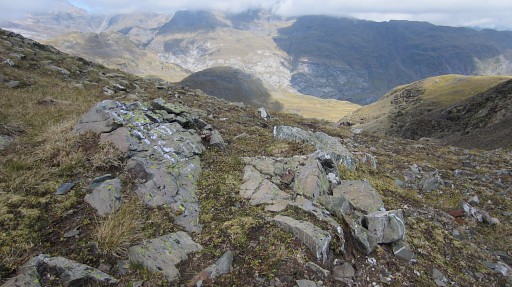
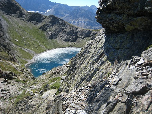
From bm316 descending back into France
to Lac du Cardal. That’s a nice bivouac spot with streaming water from the lake to down below. Parallel to that stream you can descend to the trail that leads to Col de Bernatoire. |
||||||||||||||||||||||||||||||||||||||||||||||||||||||||||||||||||
 |
It’s a bit of wayfinding in the last steep part of this descent. This picture: looking in the direction of Col de la Bernatoire. Once picked up the trail, the climb to the Col is easy. |
||||||||||||||||||||||||||||||||||||||||||||||||||||||||||||||||||
 |
Bm317 at Col de la Bernatoire. |
||||||||||||||||||||||||||||||||||||||||||||||||||||||||||||||||||
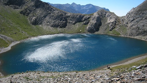 |
with behind it the Lac de la Bernatoire. |
||||||||||||||||||||||||||||||||||||||||||||||||||||||||||||||||||
 |
Then descending steep into Spain. | ||||||||||||||||||||||||||||||||||||||||||||||||||||||||||||||||||
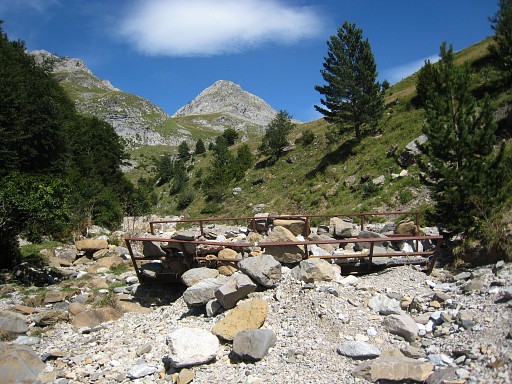 |
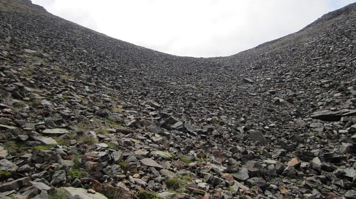
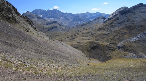
At the end, the trail descends to the dry stream and crosses it at this spot. Then it descends further along the stream for 200m before it joins the main route which climbs from the valley to Port du Boucharo We're looking to the north on this picture. |
||||||||||||||||||||||||||||||||||||||||||||||||||||||||||||||||||
 |
You are back on the main route, climbing to Port du Boucharo. This Google Earth-screenprint shows the part between variant 1 and variant 2. |
||||||||||||||||||||||||||||||||||||||||||||||||||||||||||||||||||
| Variant 2 via bm218 |
|||||||||||||||||||||||||||||||||||||||||||||||||||||||||||||||||||
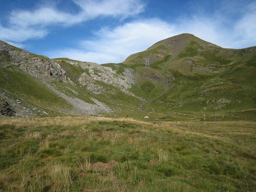 |
This variant starts where a valley to the left comes in view from the main route. A trail climbs to this upper valley Note the electric line which will lead you to |
||||||||||||||||||||||||||||||||||||||||||||||||||||||||||||||||||
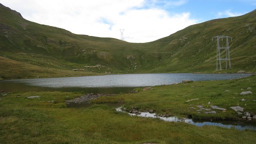 |
another level with a lake. Col des Espécières is now in sight and is a short climb. |
||||||||||||||||||||||||||||||||||||||||||||||||||||||||||||||||||
 |
Bm318 On the other side is a lake and a nice bivouac possibility. From there take the path to the parking lot and then continue SW on |
||||||||||||||||||||||||||||||||||||||||||||||||||||||||||||||||||
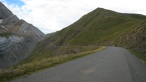 |
the tarmac road to bm319. The roads ends at the border. |
||||||||||||||||||||||||||||||||||||||||||||||||||||||||||||||||||
 |
The Port de Boucharo in sight, with the rock with bm319. The main route arrives at the Port from the other side. |
||||||||||||||||||||||||||||||||||||||||||||||||||||||||||||||||||
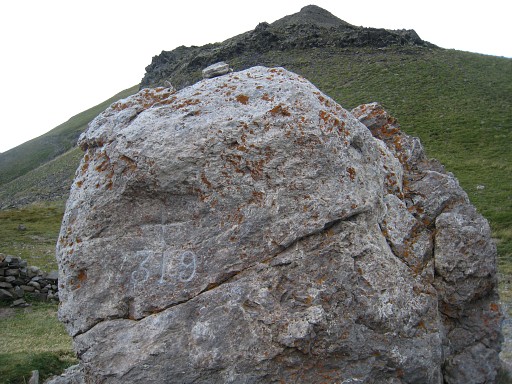 |
Bm319 |
||||||||||||||||||||||||||||||||||||||||||||||||||||||||||||||||||
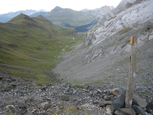 |
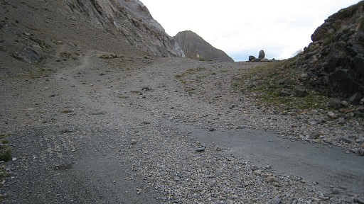
Then
it's a long tiring descent into the Vallée des Pouey Aspé along Cabane des soldats towards Gavarnie. |
||||||||||||||||||||||||||||||||||||||||||||||||||||||||||||||||||
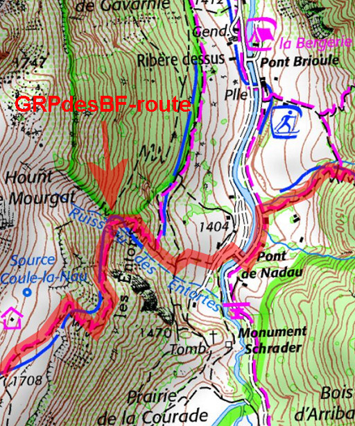 |
Don't go as far as Gavarnie itself. Approximately 1,5 km before the village, descend directly to the river to Pont de Nadau | ||||||||||||||||||||||||||||||||||||||||||||||||||||||||||||||||||