|
The
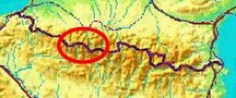
bordermarkers of the Pyrenees : the GRPdesBF
 |
|||||||||||||||||||||||||||||||||||||||||||||||||
| - stage 21 - Gavarnie - Llanos de Larri (bm320) |
 |
||||||||||||||||||||||||||||||||||||||||||||||||
Update may 2020: the 5 stages 21-25 (bm320-329) will be replaced by four stages. That will result in a more smooth main route, leaving the high altitude and non-waymarked trails to the variants. Has yet to be worked out. It will result in de following routes: |
|||||||||||||||||||||||||||||||||||||||||||||||||
 You can already watch these new routes in detail with this kml-file or this gpx-file |
|||||||||||||||||||||||||||||||||||||||||||||||||
Hereunder the original stage: |
|||||||||||||||||||||||||||||||||||||||||||||||||
 |
|||||||||||||||||||||||||||||||||||||||||||||||||
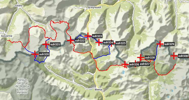
| Only
the bordermarkers along this stage are shown (and some adjoining ones).
The main route is red,
the variants have other colors. The main route provides a smooth
on-going route along most bordermarkers, the variants give access to
the remaining bordermarkers. See the GRPdesBF-principles. Click here for an fullscreen interactive map. In short The route (there are no variants) will take you from the Gavarnie-valley over two high mountainpasses (Hourquette d'Alans and Port Neuf de Pinède ). Then - after a steep descent - it will bring you to the green pastures of LLanos de la Larri. Considerations Wayfinding shouldn't be a problem: a lot of the route is waymarked, the trails are distinct. Mountain-walking can be risky in bad weather and that could be the case in the part covering the two high passes. The descent from Port Neuf de Pinède is quite steep and takes special care. In the hight part of the route, water is scarce. A bivouac is easy in the first part of the route, a bit above Refuge des Espuguettes, and at the end at LLanos de Larri. In between, it's rocky and steep. Factsheet
Gps-files needed
Version 02 July 2014. If you have any correction, suggestion etcetera -> please email me: eefberns@grenspalen.nl MAPS AND DIRECTIONS You might check the relevant webpages in the 'All markers'-section and 'All my trips'-section for more pictures of the bordermarkers and wayfinding-issues. Print your own maps It's easy to print your own - custom made - maps with the GRPdesBF-route and the bordermarkers on them. See: Print your own maps |
|||||||||||||||||||||||||||||||||||||||||||||||||
 |
|||||||||||||||||||||||||||||||||||||||||||||||||
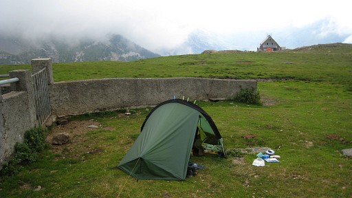 |
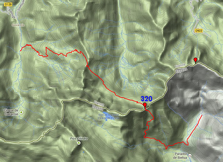
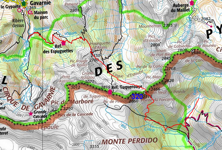
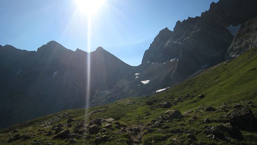
From Pont de Nadau, a steep track will bring you to Refuge des Espuguettes. This picture: beyond the refuge it's flatter and that could a fine spot for a bivouac if you have extra time left on the previous stage. |
||||||||||||||||||||||||||||||||||||||||||||||||
 |
SEE of the Refuge, the pass of Hourquette d'Alans is already visible. |
||||||||||||||||||||||||||||||||||||||||||||||||
 |
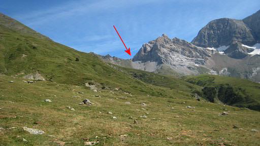
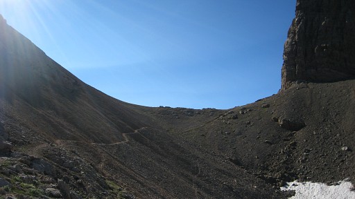
On the
pass itself, the Port Neuf de Pinède (bm320) is already visible, above
the
mist. After descending a bit, there’s path going to the right, that’s a short-cut. The path is ok (waymarked by cairns) and melts into another path (the main path coming from the valley) |
||||||||||||||||||||||||||||||||||||||||||||||||
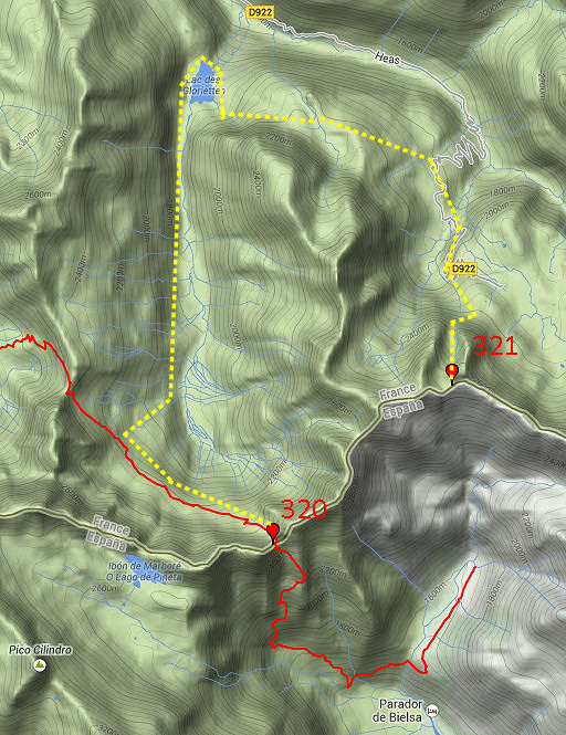 |
From Port Neuf de Pinède (bm320) I will take a route via Spain to the next bordermarker at Port de la Canau (bm321).
But Jacques Koleck suggested in 2013 another route: "I know this region very well. As the storms of late afternoon are frequent and violent, I would consider an alternative. From Port Neuf de Pinède return down the beautiful valley to reach the Estaubé Gloriettes dam and the road leading to the hamlet of Heas and the Cirque du Troumouse. All along the route there are great places to camp. This is much longer but it is much less dangerous in case of bad weather." |
||||||||||||||||||||||||||||||||||||||||||||||||
 |
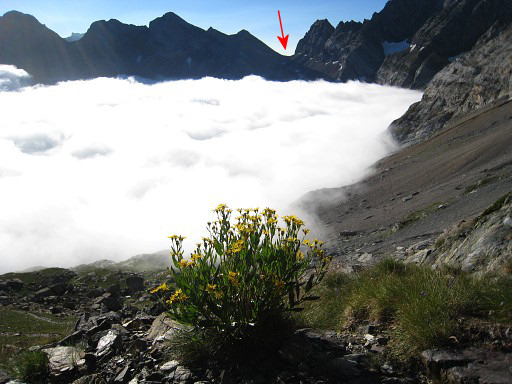
Getting closer to Port Neuf de Pinède. |
||||||||||||||||||||||||||||||||||||||||||||||||
 |
After finally
passing a rockslide, the trail leads me to the Port. |
||||||||||||||||||||||||||||||||||||||||||||||||
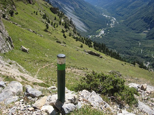
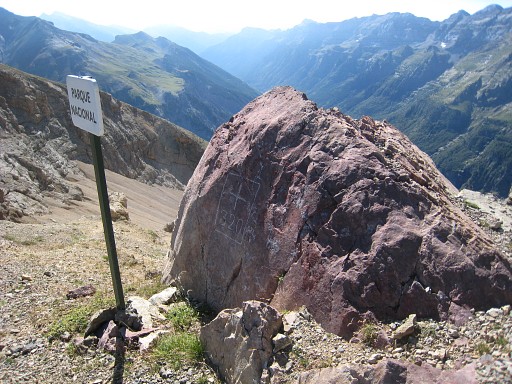 |
Bm320 |
||||||||||||||||||||||||||||||||||||||||||||||||
|
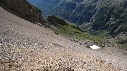
Then a long, long descent into Spain. First there’s a steep gravel-slide to tackle | ||||||||||||||||||||||||||||||||||||||||||||||||
|
and later on there
are many slippery
parts, taking 3 hours to reach the road. This is a popular hiking area, making trails to be worn out and slippery. When reaching the dirtroad, go to the left (passing a fountain) and get in 30-45 minutes to |
||||||||||||||||||||||||||||||||||||||||||||||||
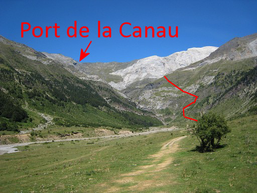
|
the plains of
LLanos de la
Larri. This is the end of this stage. If you have time & enery left - you could continue on the next stage to another bivouac-spot. That involves a steep climb (red line) and an easy descent to the foot of Port de la Canau (bm321) -> ± 1,5h extra. |
||||||||||||||||||||||||||||||||||||||||||||||||