|
The
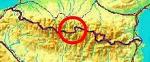
bordermarkers of the Pyrenees : the GRPdesBF
 |
|||||||||||||||||||||||||||||||||||||||||||||||||||||||||||||||||||
| -
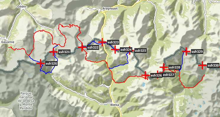
stage 25 - Hospice de Rioumajou - Valle de Añes Cruces (bm326-329) |
 |
||||||||||||||||||||||||||||||||||||||||||||||||||||||||||||||||||
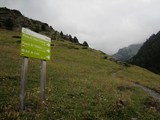
Update may 2020: the 5 stages 21-25 (bm320-329) will be replaced by four stages. That will result in a more smooth main route, leaving the high altitude and non-waymarked trails to the variants. Has yet to be worked out. It will result in de following routes: |
|||||||||||||||||||||||||||||||||||||||||||||||||||||||||||||||||||
 You can already watch these new routes in detail with this kml-file. |
|||||||||||||||||||||||||||||||||||||||||||||||||||||||||||||||||||
Hereunder the original stage: |
|||||||||||||||||||||||||||||||||||||||||||||||||||||||||||||||||||
 |
|||||||||||||||||||||||||||||||||||||||||||||||||||||||||||||||||||
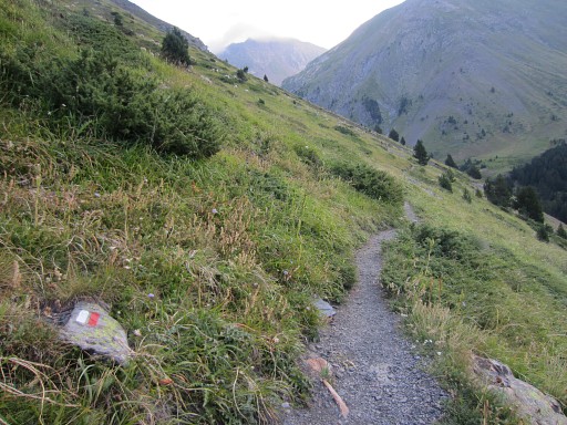
| Only
the bordermarkers along this stage are shown (and some adjoining ones).
The main route is red,
the variants have other colors.
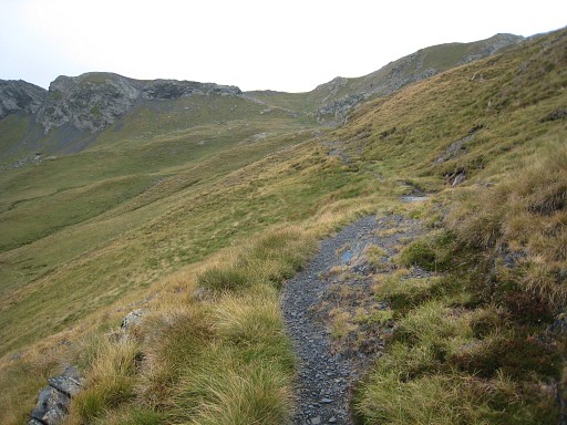
The main route provides a smooth
on-going route along most bordermarkers, the variants give access to
the remaining bordermarkers. See the GRPdesBF-principles. Click here for an fullscreen interactive map. In short The main route is fairly straightforward on well trails, climbing to Port de Madère (or Port de Cauarère, bm328) and then descending to the valley of Ria Cinqueta. Via a curve along the camping & refuge facilities of Viadós, you will gently climb to the Valle de Añes Cruces. Variant 1 comprises a waymarked climb to Port d'Ourdissétou (bm326) but then you need to find your way on a grassy mountainside towards bm327. The rest of the variant - along the ridge to bm328 - is easier in navigating. Variant 2 is a few hours-trip hence & forth to Port de la Pez (bm329). I prefer on-going routes but in this case this was the best solution. Considerations Wayfinding is a bit of an issue in the first variant, the rest should give you no problems. A large part is downhill or along a valley and there are enough streams and sources. A bivouac is easy at the spot where variant 2 starts and Viadós has a camping and a refuge. At the end there also bivouac-opportunities and there's a cabin (cabanã de Añes Cruces). There one drawback: if you include the variants (and I hope you do), you will need two days to complete this stage. But there are indications that a shortcut is possible from the valley of Ria Cinqueta (where variant 2 begins and ends) via the mountain pass of Señal de Viadós to bm330. Then you are already on the next stage (variant 1). Factsheet
Gps-files needed
Version 02 July 2014. If you have any correction, suggestion etcetera -> please email me: eefberns@grenspalen.nl MAPS AND DIRECTIONS You might check the relevant webpages in the 'All markers'-section and 'All my trips'-section for more pictures of the bordermarkers and wayfinding-issues. Print your own maps It's easy to print your own - custom made - maps with the GRPdesBF-route and the bordermarkers on them. See: Print your own maps |
|||||||||||||||||||||||||||||||||||||||||||||||||||||||||||||||||||
 This is the overview of main route and variants on the Spanish IGN-map. Starting at Hospice de Rioumajou, there is soon the bifurcation between main route and variant 1. But variant 1 can also be reached more directly from the previous stage with a shortcut. |
|||||||||||||||||||||||||||||||||||||||||||||||||||||||||||||||||||
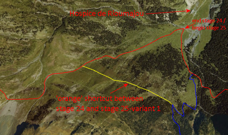 This screenshot from Google Earth shows it all. The previous stage approaches this scene on an orange waymarked trail. At a certain point, you have to leave the orange trail to descend to Hospice de Rioumajou. If you continue on the orange trail (=shortcut) you will get in less than 1 km to a red/white trail going up to the right (=variant 1 from the next stage). That red/white trail will bring you to Port d’Ourdissétou with bm326. |
|||||||||||||||||||||||||||||||||||||||||||||||||||||||||||||||||||
 |
The main route
climbs on a trail to Port de Caurère. Bm328 is ± 50m up
the southern slope of the port. This picture: at the pass, looking uphill to bm328 |
||||||||||||||||||||||||||||||||||||||||||||||||||||||||||||||||||
| Variant
1 via bm326-327 |
|||||||||||||||||||||||||||||||||||||||||||||||||||||||||||||||||||
 |
This
is the spot where the orange trail meets the red/white trail going up
to the right. That red/white trail will bring you to Port d’Ourdissétou. You will climb uphill, then cross a ridge and then you will see |
||||||||||||||||||||||||||||||||||||||||||||||||||||||||||||||||||
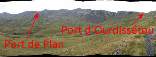 |
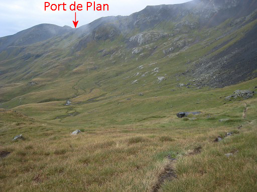
this
panorama. Port de Plan with bm327 is not well recognizable as such on the borderridge. From Port d'Ourdissétou you will have to traverse over the grassy foothills towards Port de Plan. |
||||||||||||||||||||||||||||||||||||||||||||||||||||||||||||||||||
 |
But
first to Port d’Ourdissétou, now getting closer. The Port is on the pilgrim's way to Santiago de Compostella. |
||||||||||||||||||||||||||||||||||||||||||||||||||||||||||||||||||
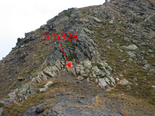
 |
This
is Port d'Ourdissétou Bm326 is at the far western side of the Port. |
||||||||||||||||||||||||||||||||||||||||||||||||||||||||||||||||||
 |
Zoom-in
of previous picture. |
||||||||||||||||||||||||||||||||||||||||||||||||||||||||||||||||||
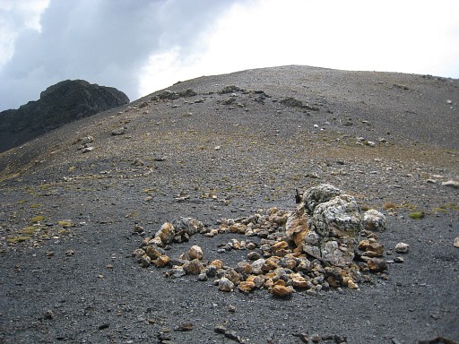
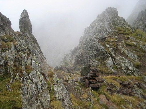
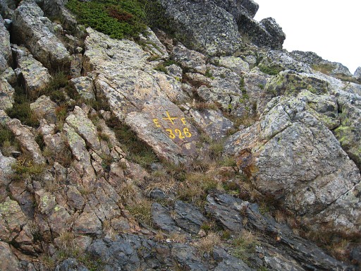 |
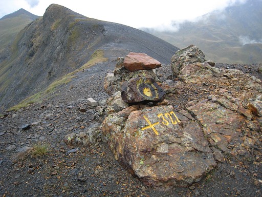
Bm326 |
||||||||||||||||||||||||||||||||||||||||||||||||||||||||||||||||||
 |
Then
back to the Port and descending
back a little
untill a small track (not waymarked) appears to the right which will
bring you to the foot
of Port de Plan. If you don't see that trail -> then go in what ever way you like over the plains in the direction of the Port. But where do you have to climb to the ridge? |
||||||||||||||||||||||||||||||||||||||||||||||||||||||||||||||||||
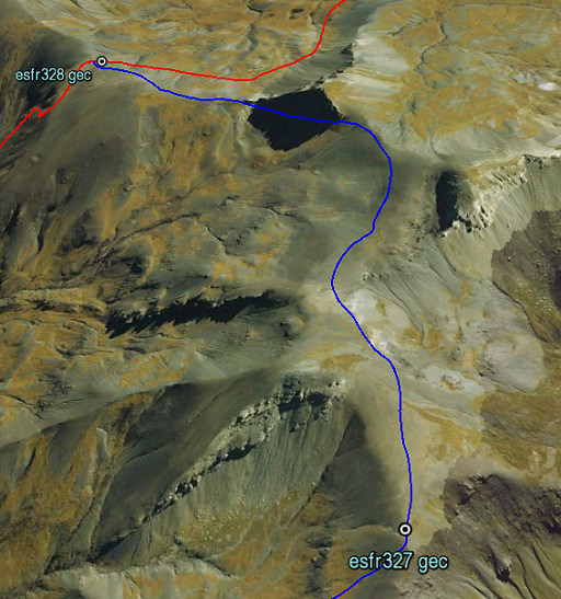
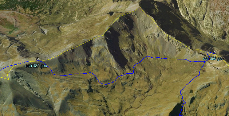 This is a screenshot from Google Earth (looking N->S), showing better how to go to Port de Plan with bm327 |
|||||||||||||||||||||||||||||||||||||||||||||||||||||||||||||||||||
 |
Bm327
is not at the
lowest point but at the NEE-side of the pass. This picture: looking to the W, the lowest point of the pass is a bit further. |
||||||||||||||||||||||||||||||||||||||||||||||||||||||||||||||||||
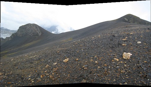
 |
The
Port is very
broad, on this picture we are looking from the W-side of the pass to
the NEE. We are also looking in the direction to continue, going underneath the left summit (at its right side) and underneath the right summit (at its left side). |
||||||||||||||||||||||||||||||||||||||||||||||||||||||||||||||||||
 |
Let's
show it more clearly on Google Earth. There are trails. |
||||||||||||||||||||||||||||||||||||||||||||||||||||||||||||||||||
 |
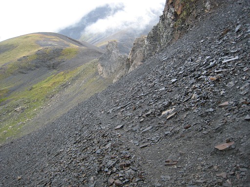
We
have passed the first summit and look ahead. You will now pass underneath the Tuquet de Caurère (the Pic at the right) and continue to the foot of the next summit |
||||||||||||||||||||||||||||||||||||||||||||||||||||||||||||||||||
 |
which you will pass underneath its huge rockwall. | ||||||||||||||||||||||||||||||||||||||||||||||||||||||||||||||||||
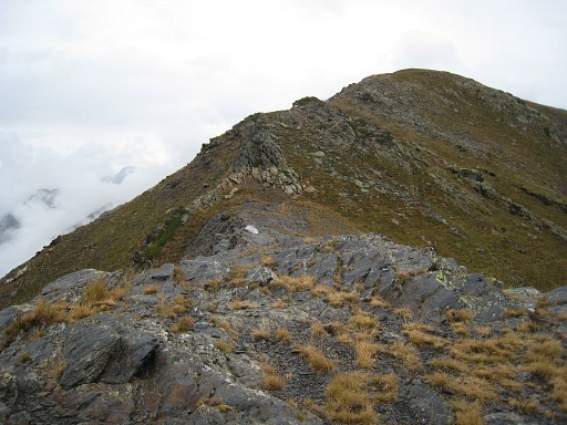
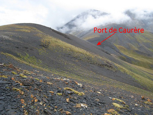 |
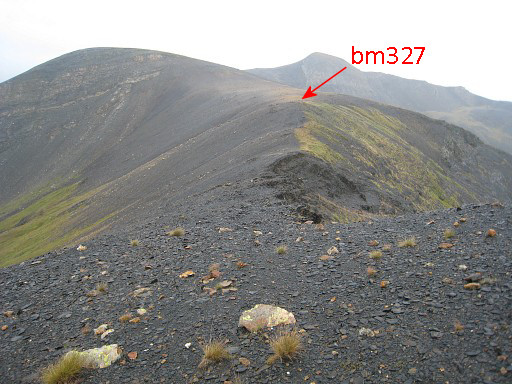
Then
you are back at the borderridge itself. The saddle-like Port de Caurère already visible in the distance. Continue over the ridge until bm328. |
||||||||||||||||||||||||||||||||||||||||||||||||||||||||||||||||||
| End
of variant 1 |
|||||||||||||||||||||||||||||||||||||||||||||||||||||||||||||||||||
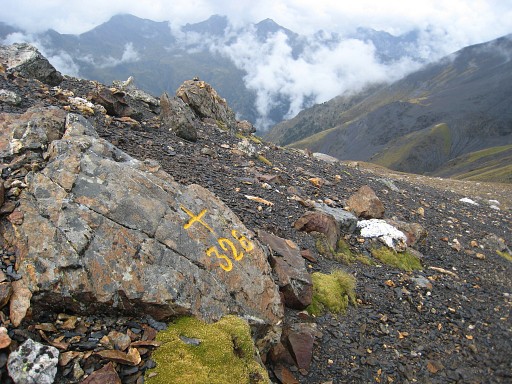 |
Bm328
is ± 50m up
the southern slope of the Port de Caurère and as such part of the
main route. We are back at the main route. |
||||||||||||||||||||||||||||||||||||||||||||||||||||||||||||||||||
 |
Then -from the Port - a
descent into Spain on a waymarked path (green/white) to the
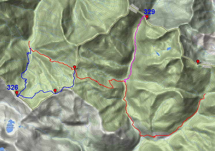
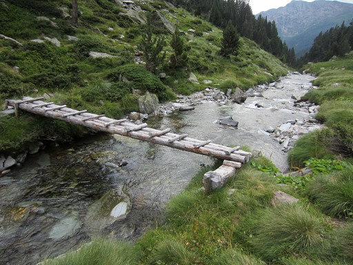
bottom of the valley. At the bottom of the valley you will get to a small bridge. If you want to continue on the main route: don't cross the small bridge but follow the stream to the right = downstream. The main route skips bm329 ánd bm330/330bis. If you want to include bm329, then cross the small bridge and further on a larger footbridge. That is the access to variant 2 to Port de la Pez (bm329) which takes ± 4h. |
||||||||||||||||||||||||||||||||||||||||||||||||||||||||||||||||||
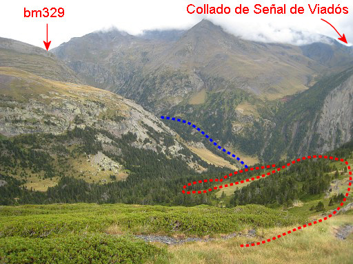
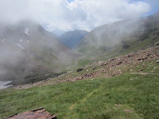
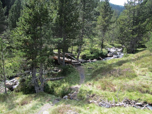
 |
We are now at the bottom
of the valley. Looking straight ahead (=E) along the 'cascade': the valley climbing to the pass of Señal de Viadós. The “Collado de Señal de Viadós” gives access to the valley of d’Aygues Tortes. |
||||||||||||||||||||||||||||||||||||||||||||||||||||||||||||||||||
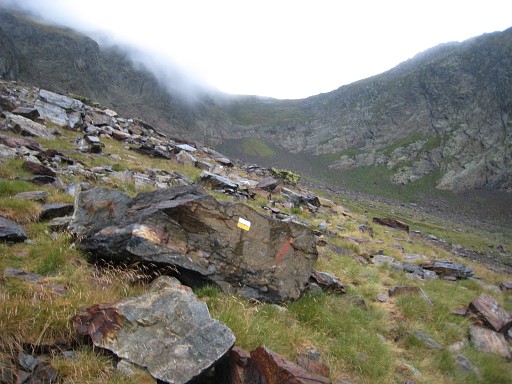
 |
There are cairns which
mark the beginning of that trail towards Señal de Viadós. From that ‘“Señal’ you might be able to traverse directly to Port d’Aigues Tortes (bm330), staying more or less at the same altitude. On the Topo Pirineos-map, we see a track doing that traverse.I did a first search for this traverse on 20140904 but made a misstake then. If it's possible remains unsure. So altogether, there are 3 options to continue to bm330 (after having visited bm329, if you wish). |
||||||||||||||||||||||||||||||||||||||||||||||||||||||||||||||||||
| Let's
show the 3 options on this Google Earth-screenshot: 1. climb to Señal de Viadós and traverse to bm330 -> the blue/pink route 2. climb to Señal de Viadós, descend to the Cabaña de Añes Cruces and climb to bm330 -> the blue route 3. descend to Viadós, climb to Cabaña de Añes Cruces and proceed to bm330 -> the red/blue route 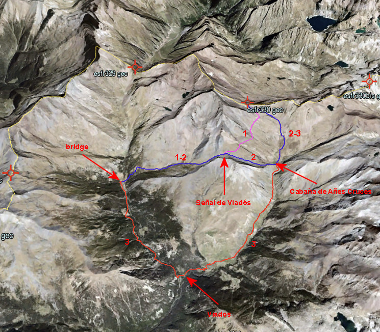 |
|||||||||||||||||||||||||||||||||||||||||||||||||||||||||||||||||||
Let’s put their data in a
table:
|
Considering that option 1
probably will take more time than scheduled because of the traverse on
the hillside and option 3 is likely to be faster because most of
it is on easy paths, there isn’t that much difference. Option 3 takes
you along the camping and refugio of Viadós. My advice: if you want the fastest connection -> try option 1, otherwise choose option 3. |
||||||||||||||||||||||||||||||||||||||||||||||||||||||||||||||||||
| Variant
2 via bm329 |
|||||||||||||||||||||||||||||||||||||||||||||||||||||||||||||||||||
|
When
you cross that small bridge you will spot this second and larger bridge. Cross the larger bridge and then proceed to the N on a waymarked trail (white/yellow) NB: the trip to bm329 is a long roundtrip of ± 4h. But in a on-going route along all bordermarkers it’s inevitable that in the range 328-330bis, there’s such a back-and-forth trip. |
||||||||||||||||||||||||||||||||||||||||||||||||||||||||||||||||||
 |
After
some climbing you will return to the river and then there's this small
bridge. Cross it although the waymarked route stays on the other side. Later on, you will meet the waymarked route again. Reason: you will have to cross the river anyway and further on, there might be still too much water to cross it easily or safely. |
||||||||||||||||||||||||||||||||||||||||||||||||||||||||||||||||||
 |
A bit further, this simple cabane which is used for cattle (not suitable for an overnight's stay). | ||||||||||||||||||||||||||||||||||||||||||||||||||||||||||||||||||
 |
On
this picture: approaching the final (steep) climb to the Port. |
||||||||||||||||||||||||||||||||||||||||||||||||||||||||||||||||||
 |
Arriving at the ridge, the trail follows the ridge for ± 250m to the SSE before it reaches the real Port de la Pez (this breach). | ||||||||||||||||||||||||||||||||||||||||||||||||||||||||||||||||||
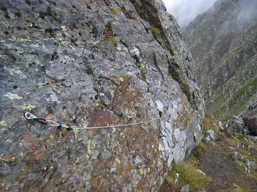 |
Bm329, somewhat hidden behind the attachment of a cable. | ||||||||||||||||||||||||||||||||||||||||||||||||||||||||||||||||||
 |
Then
back on the same trail. Downhill, there are enough bivouac-opportunities. |
||||||||||||||||||||||||||||||||||||||||||||||||||||||||||||||||||
 |
This
picture: the flat grassy part with the bridge where you started this
variant. |
||||||||||||||||||||||||||||||||||||||||||||||||||||||||||||||||||
 |
This
picture: the second bridge, close to the other one, which will bring
you back at the main route. |
||||||||||||||||||||||||||||||||||||||||||||||||||||||||||||||||||
| End
of variant 2 |
|||||||||||||||||||||||||||||||||||||||||||||||||||||||||||||||||||
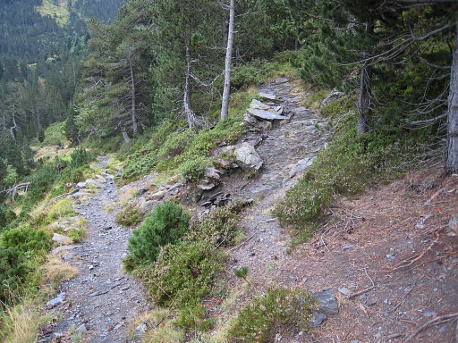
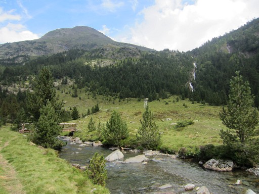
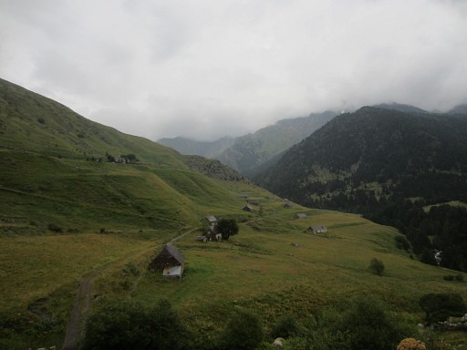
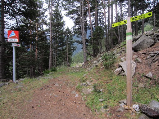 |
Then: continue to Viadós
along the green/white trail which brings you in 1½h along these
way-signs and through the forest |
||||||||||||||||||||||||||||||||||||||||||||||||||||||||||||||||||
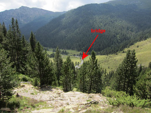
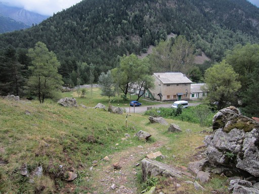 |
to
a deserted campground (behind the building at this picture), apparently
only in use
when there are large pilgrimages to the chapel of 'la Virgen Blanca'
nearby. Down at the dirtroad, go left and pick up the GR11-trail with its red/white-waymarks. |
||||||||||||||||||||||||||||||||||||||||||||||||||||||||||||||||||
 |
A bit further on, there's
a real camping (behing the building), open in summer. |
||||||||||||||||||||||||||||||||||||||||||||||||||||||||||||||||||
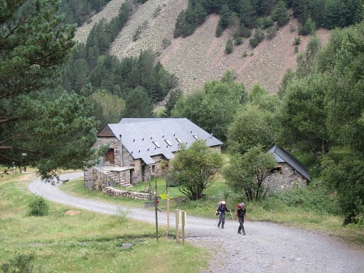
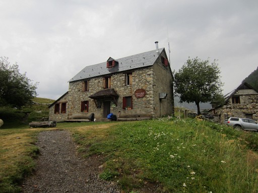 |
Then passing along Refugio de Viadós. | ||||||||||||||||||||||||||||||||||||||||||||||||||||||||||||||||||
 |
Continuing on the
GR11-trail along these cabins. |
||||||||||||||||||||||||||||||||||||||||||||||||||||||||||||||||||
 |
The waymarking is perfect
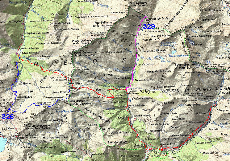
here but the different names in Spanish can be confusing. Puerto de Añes Cruces = Port d'Aygues-Tortes (bm330) |
||||||||||||||||||||||||||||||||||||||||||||||||||||||||||||||||||
 |
Getting closer to the end
of the stage. By the way, when measured from the Refugio de Viadós, it will take you ± 3h to get to bm330 if want to continue on the next stage. |
||||||||||||||||||||||||||||||||||||||||||||||||||||||||||||||||||
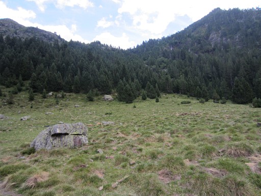
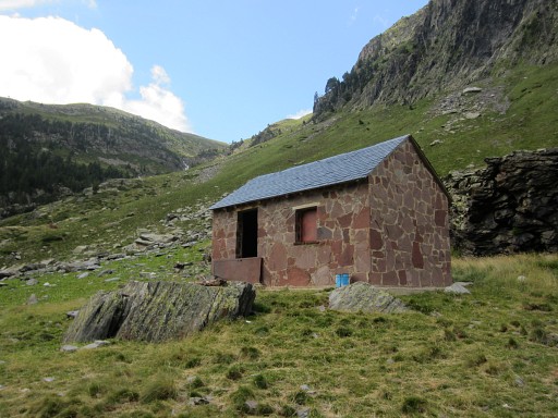
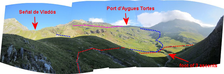 After ± 1½h, I’m at the foot of 3 ascents: - left (=W) descending from Collado de Señal de Viadós (the blue line) - right (=E) where the GR11 continues (GR11 = the red line) = the main route of the GRPdesBF, the next stage - in front (=N) towards Port d’Aigues Tortes (alias “Puerto de Añes Cruces” on Spanish signposts) = the continuation of the blue line = variant 1 of the next stage The pink line is the approximate shortcut from Señal de Viadós to Port d'Aygues Tortes 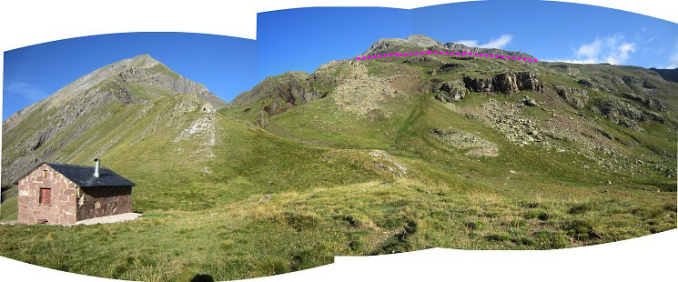 This is the Cabaña de Añes Cruces, at the end of this stage. You are looking towards the pass of Señal de Viadós and (in pink) the approximate shortcut to Port d'Aygues Tortes. |
|||||||||||||||||||||||||||||||||||||||||||||||||||||||||||||||||||