|
The
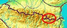
bordermarkers of the Pyrenees : the GRPdesBF
 |
||||||||||||||||||||||||||||||||||||||||||||||||||||||||||
| - stage 41 - Portella Blanca - Pla Llauró (bm427-444) |
 |
|||||||||||||||||||||||||||||||||||||||||||||||||||||||||
 |
||||||||||||||||||||||||||||||||||||||||||||||||||||||||||
| Only
the bordermarkers along this stage are shown (and some adjoining ones).
The main route is red,
the variants have other colors. The main route is a smooth
on-going route passing along many bordermarkers, the variants give access to
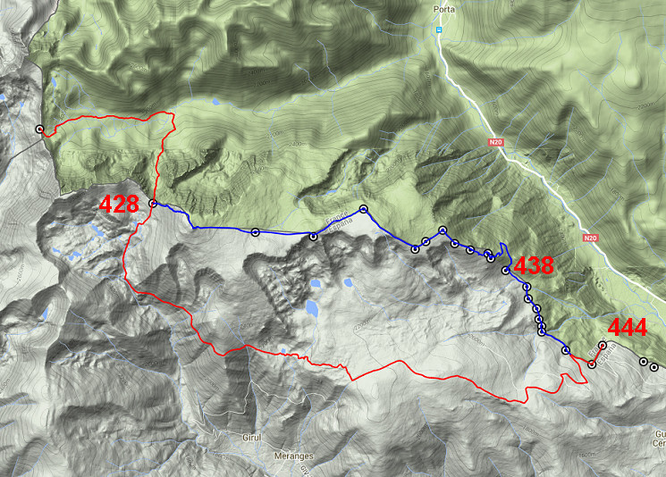
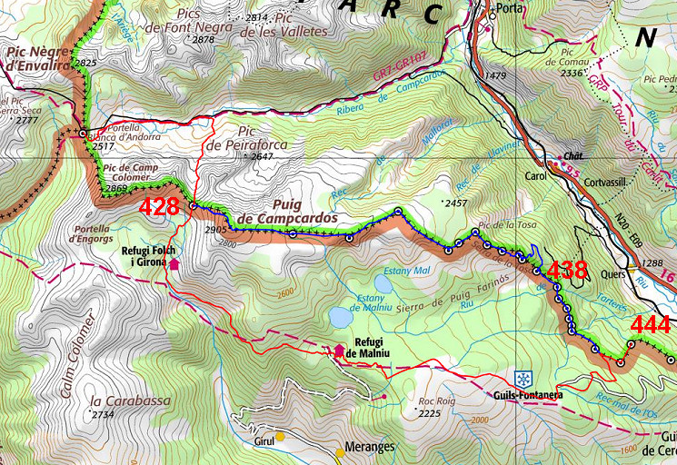
the remaining bordermarkers. See the GRPdesBF-principles. Click here for an fullscreen interactive map. In short From Andorra descending to the plains of the Cerdagne. But in doing so you'll need to do a steep climbing in the beginning to the Portella Blanca de Meranges (bm428 at 2634m). The main route then descends S, joins the GR11 and gradually descends to (close to) the cross-country ski-station of Guils-Fontanera. Then - leaving the GR11 - easy (dirt)roads will bring you to bm443-444. The variant however climbs from bm428 further to the summit of Puigpedros (officially 2915m), the highest point on the whole GRPdesBF! Then it traverses the plateau of Campcardós for 6km along bm429-434, gradually descending. From bm434 onwards it soon gets greener and forests appear. Considerations The main route shouldn't present problems though the climb to Portella Blanca de Meranges is steep in the end. Wayfinding is easy and you will pass a cabin (when you join the GR11) and later on the refuge of Malniu The variant should be taken seriously: the high altitude on the rough and islolated plateau of Campcardós (from the Puigpedros to ± bm434) requires good weather or at least experience & wayfinding competences. Bad weather can be dangerous here. From the Puigpedros until bm439, there are no trails or waymarkings. There's a running water at bm429 and bm439. The end of this stage - bm444 - is a nice bivouac-spot, streaming water available. Factsheet
Gps-files needed
Useful You might check the relevant webpages in the 'All markers'-section and 'All my trips'-section. They provide pictures of the bordermarkers and additional information. Version 03 May 2017. If you have any correction, suggestion etcetera -> please email me: eefberns@grenspalen.nl MAPS AND DIRECTIONS Print your own maps It's easy to print your own - custom made - maps with the GRPdesBF-route and the bordermarkers on them. See: Print your own maps |
||||||||||||||||||||||||||||||||||||||||||||||||||||||||||
 |
||||||||||||||||||||||||||||||||||||||||||||||||||||||||||
|
Bm427 at the Portella Blanca, looking into France As you can see, you can pick up red/white waymarks |
|||||||||||||||||||||||||||||||||||||||||||||||||||||||||
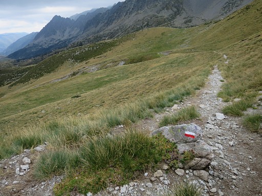 |
and descend into France. | |||||||||||||||||||||||||||||||||||||||||||||||||||||||||
 |
Down in the valley, the mountain ridge to the right gets more in view, | |||||||||||||||||||||||||||||||||||||||||||||||||||||||||
 |
including (zoom-in) the gap to where you have to climb to towards Portella Blanca de Meranges (bm428) |
|||||||||||||||||||||||||||||||||||||||||||||||||||||||||
 |
This zoom-in, shows the way up into that gap. |
|||||||||||||||||||||||||||||||||||||||||||||||||||||||||
 |
After ± 3km, you will get
at the crossing of a stream. Just beyond the stream, you have to turn
right and leave the red/white trail. |
|||||||||||||||||||||||||||||||||||||||||||||||||||||||||
 |
Having crossed the stream, cairns show you the way up ro Portella Blanca de Meranges | |||||||||||||||||||||||||||||||||||||||||||||||||||||||||
 |
Climb uphill along the cairns - wayfinding is no problem - | |||||||||||||||||||||||||||||||||||||||||||||||||||||||||
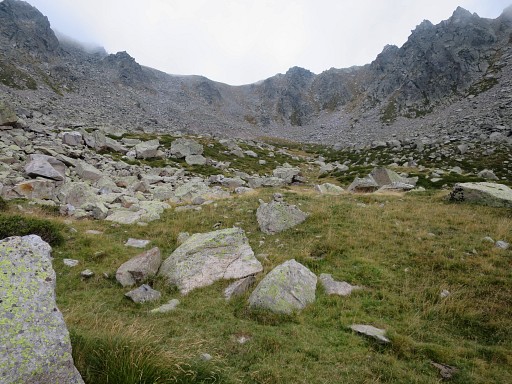 |
until you arrive at this bowl below the Portella Blanca de Meranges There are two successive green areas where a bivouac should be possible (if you bring your water). The last part is steep. There are several cairns-routes: take the one which starts at the right side of the end of the bowl. |
|||||||||||||||||||||||||||||||||||||||||||||||||||||||||

|
Having arrived at the Portella Blanca de Meranges with bm428. This is the starting point of variant 1 which climbs SE to Puigpedros. The main route descends into the valley towards a cabin (Refugi Joaquim Folch i Girona, acess free) |
|||||||||||||||||||||||||||||||||||||||||||||||||||||||||
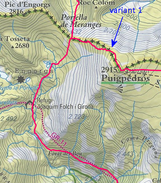 |
the cabin, you can pick up the red/white GR11-trail. On this map we spot a different course (probably earlier version) for the GR11 but the actual course is the one followed by the GRPdesBF. |
|||||||||||||||||||||||||||||||||||||||||||||||||||||||||
 |
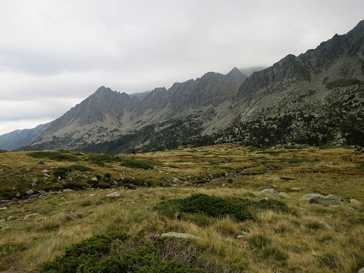
The GR11 descends in ± 4,5 km to Refugi de Malniu. |
|||||||||||||||||||||||||||||||||||||||||||||||||||||||||
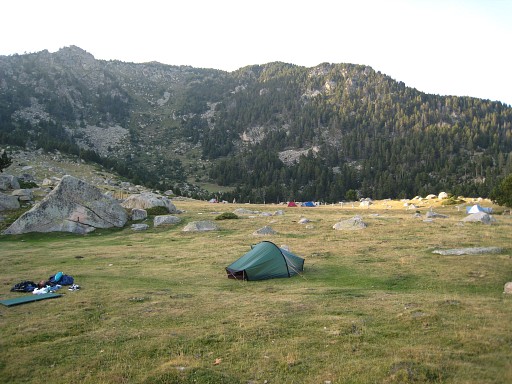 |
Just before the Refugi there's this free camping area with access to streaming water at the stone bridge, just beyond the Refugio. | |||||||||||||||||||||||||||||||||||||||||||||||||||||||||
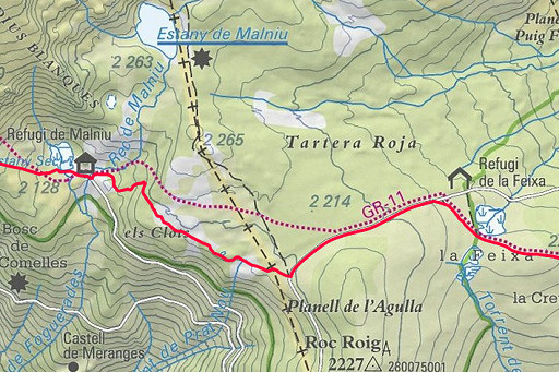 |
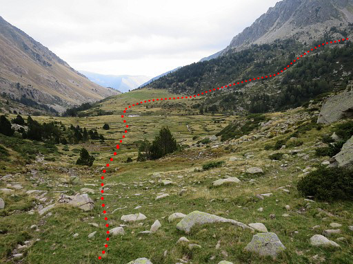
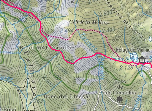
The GR11 continues to the W, mainly through fields and forest. Note the Refugi de la Feixa which could suit your need for an overnight's shelter. |
|||||||||||||||||||||||||||||||||||||||||||||||||||||||||
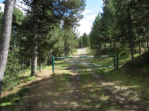
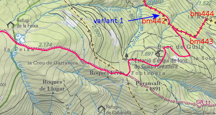 Continue on the GR11 until it crosses a road close the 'Estació d'esqui de fons de Guils Fontera'. Go left on that road. Continue on the GR11 until it crosses a road close the 'Estació d'esqui de fons de Guils Fontera'. Go left on that road. |
||||||||||||||||||||||||||||||||||||||||||||||||||||||||||
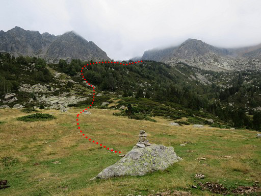
 The Google Earth shows better how the GRPdesBF descends further towards bm442/443. It takes tranquil trails through the forests but you might as well follow the tarmac road until the connection with variant 1. |
||||||||||||||||||||||||||||||||||||||||||||||||||||||||||
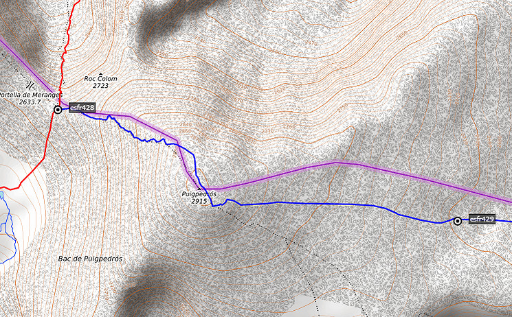
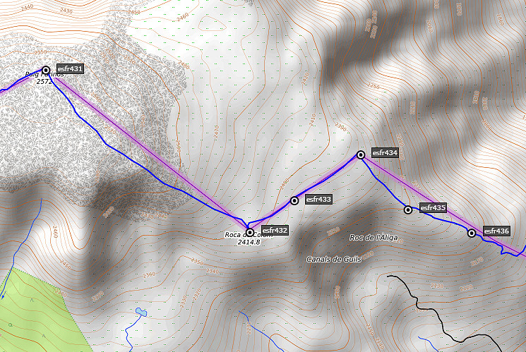
| Variant 1 via bm429-442 | ||||||||||||||||||||||||||||||||||||||||||||||||||||||||||
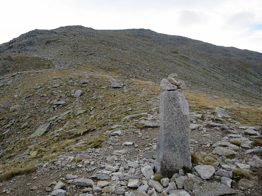 |
Bm428, looking SE to the summit of Puigpedrós. There's a trail uphill waymarked with cairns. |
|||||||||||||||||||||||||||||||||||||||||||||||||||||||||
 |
||||||||||||||||||||||||||||||||||||||||||||||||||||||||||
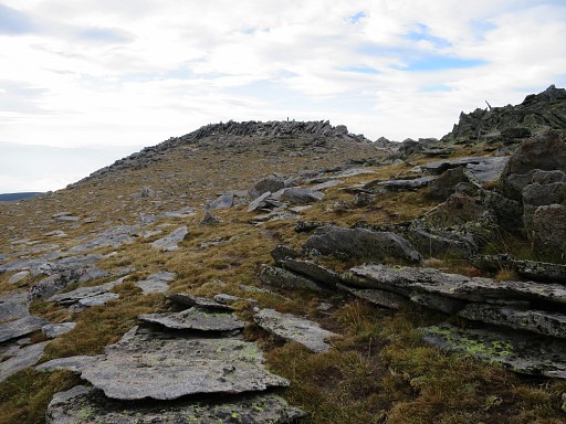 |
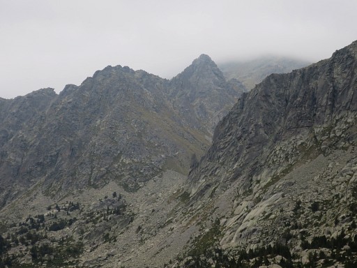
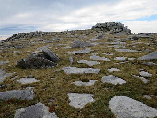
When you arrive at the top, there are three hilltops. The Puigpedros-summit is the third hilltop on the ridge and clearly the highest. |
|||||||||||||||||||||||||||||||||||||||||||||||||||||||||
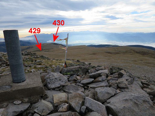 |
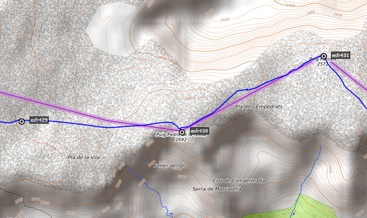
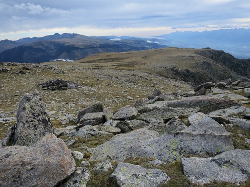
The Puigpedros -officially 2915m - is the highest point on the entire GRPdesBF. In fact you don't need to 'do' the Puigpedrós - you can head straight from the ridge to bm 429 - but as a famous landmark it's included in the GRPdesBF. This picture: looking E over the plains where the borderline is a straigt line to bm430 with bm429 in between. |
|||||||||||||||||||||||||||||||||||||||||||||||||||||||||
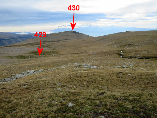 |
There is no trail and no waymarking. Just cross the plains eastwards to the hilltop. After ± 750m (from Puigpedrós) a stream appears |
|||||||||||||||||||||||||||||||||||||||||||||||||||||||||
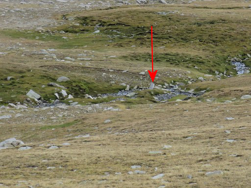 |
and in this zoom-in you can spot further on a bordermarker. This is not an esfr-bordermarker but a local marker. |
|||||||||||||||||||||||||||||||||||||||||||||||||||||||||
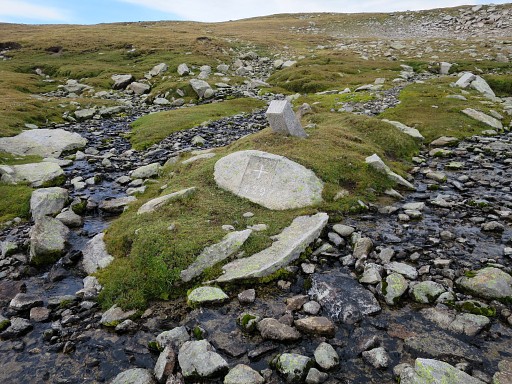 |
Bm429 is bordercross at the foot of the local marker. As you can see, it's is a confluence of two streams. You might bivouac around here. But its high and exposed here. |
|||||||||||||||||||||||||||||||||||||||||||||||||||||||||
 |
||||||||||||||||||||||||||||||||||||||||||||||||||||||||||
|
Then straight on to the hilltop 1200m to the E | |||||||||||||||||||||||||||||||||||||||||||||||||||||||||
|
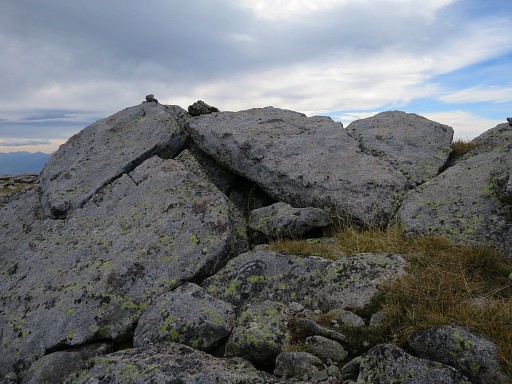
At the top of this rocky hilltop, you will find bm430 |
|||||||||||||||||||||||||||||||||||||||||||||||||||||||||
 |
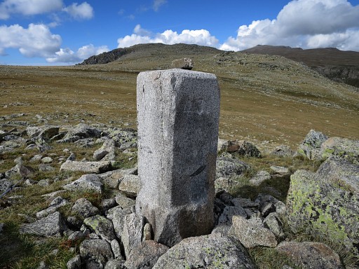
Now continuing 1200m to the NEE to bm431 which is a pillar. |
|||||||||||||||||||||||||||||||||||||||||||||||||||||||||
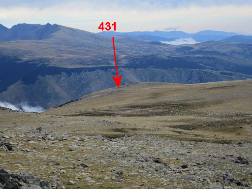 |
Zoom-in of previous picture | |||||||||||||||||||||||||||||||||||||||||||||||||||||||||
 |
Bm431 becomes visible | |||||||||||||||||||||||||||||||||||||||||||||||||||||||||
 |
Bm431, looking towards the direction of bm430 where you come from. | |||||||||||||||||||||||||||||||||||||||||||||||||||||||||
 |
||||||||||||||||||||||||||||||||||||||||||||||||||||||||||
 |
Then 1300m to the SE - gradually descending - to bm432. | |||||||||||||||||||||||||||||||||||||||||||||||||||||||||
 |
The small hilltop where bm432 can be found. | |||||||||||||||||||||||||||||||||||||||||||||||||||||||||
|
B432 at the top of that hilltop | |||||||||||||||||||||||||||||||||||||||||||||||||||||||||
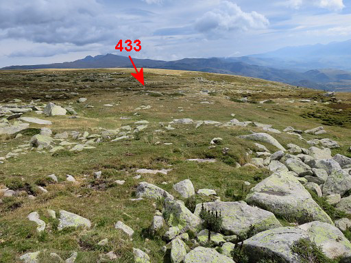 |
The next bm (433) is to the NE at 250m and might be missed because of its tilted position. |
|||||||||||||||||||||||||||||||||||||||||||||||||||||||||
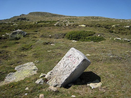
|
Bm433 |
|||||||||||||||||||||||||||||||||||||||||||||||||||||||||
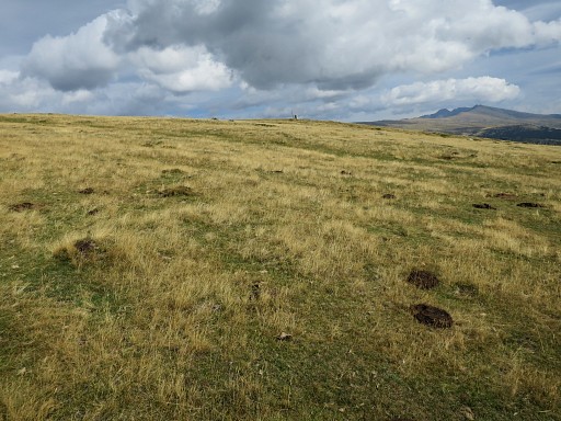 |
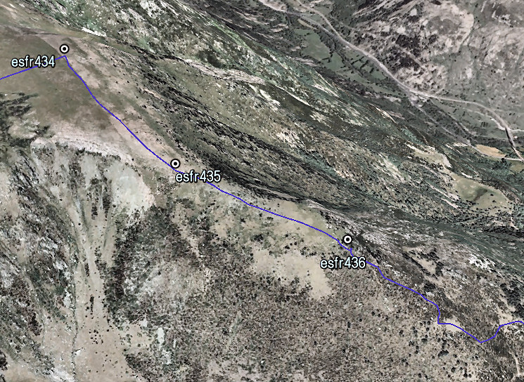
Then continuing straigt on (NE) for 400m to bm434. This picture: bm434 in the distance. |
|||||||||||||||||||||||||||||||||||||||||||||||||||||||||
|
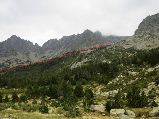
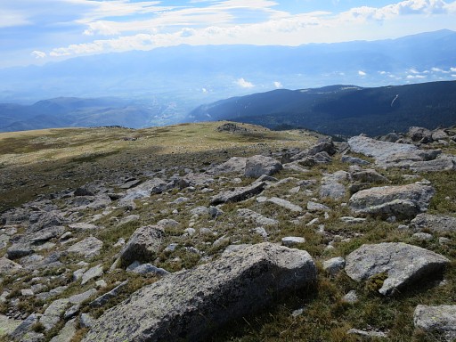
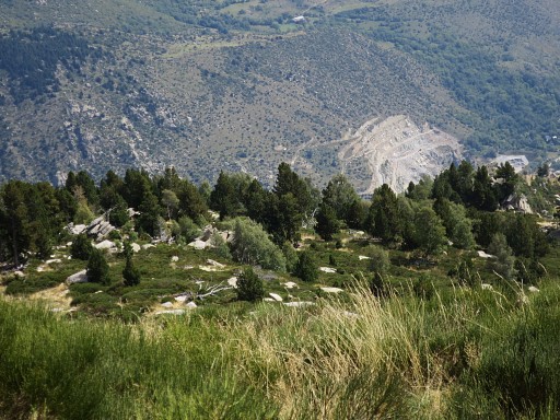
Bm434 is at the end of the high plains where bm429-434 are placed. It will take you approximately 2.30h to cross the plains from Puigpedrós to bm434. |
|||||||||||||||||||||||||||||||||||||||||||||||||||||||||
 |
||||||||||||||||||||||||||||||||||||||||||||||||||||||||||
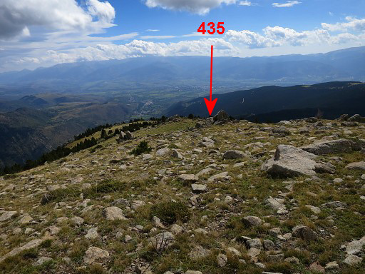 |
Now descend SSE for 350m to bm435 which can be easily missed. |
|||||||||||||||||||||||||||||||||||||||||||||||||||||||||
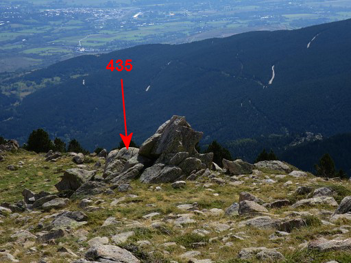 |
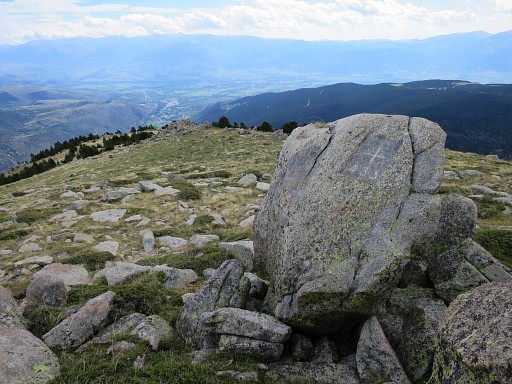
Bm435 is engraved at this rock formation | |||||||||||||||||||||||||||||||||||||||||||||||||||||||||
|
Bm435 |
|||||||||||||||||||||||||||||||||||||||||||||||||||||||||
 |
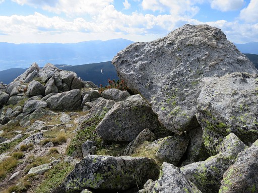
Then descending further - now SEE - to bm436 at 350m from bm435 | |||||||||||||||||||||||||||||||||||||||||||||||||||||||||
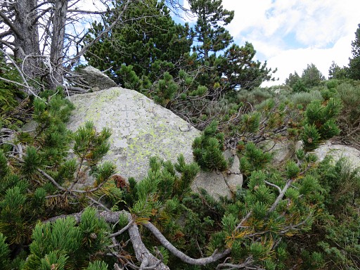
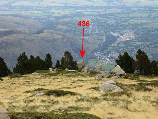 |
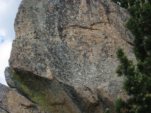
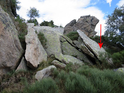
Bm436 is engraved at a large and well recognizable boulder, |
|||||||||||||||||||||||||||||||||||||||||||||||||||||||||
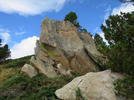 |
The boulder seen from the other side. Bm436 is engraved at this side but is very difficult to recognize. From the side of the boulder you could climb to it but it's risky. |
|||||||||||||||||||||||||||||||||||||||||||||||||||||||||
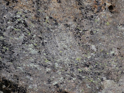
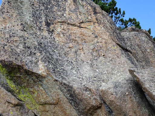 |
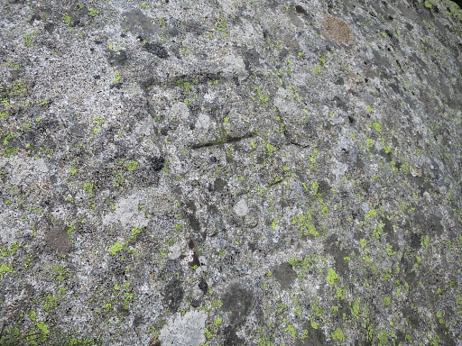
This is the spot of the actual cross and number in 2015 but not recognizable. |
|||||||||||||||||||||||||||||||||||||||||||||||||||||||||
|
Bm436 in 2010 when it was painted. |
|||||||||||||||||||||||||||||||||||||||||||||||||||||||||
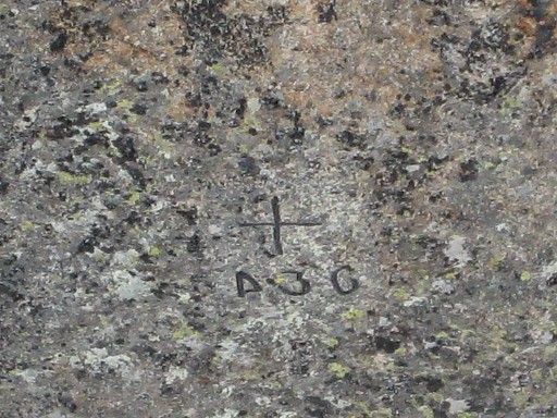
 |
Zoom-in from the picture of 2015 |
|||||||||||||||||||||||||||||||||||||||||||||||||||||||||
 |
Zoom-in from the picture of 2010 | |||||||||||||||||||||||||||||||||||||||||||||||||||||||||
 |
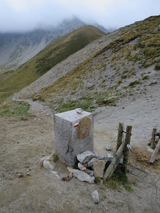
Continuing downhill, a sign like this is a bordermarker in itself. The next bm (437) can be found |
|||||||||||||||||||||||||||||||||||||||||||||||||||||||||
 |
at the right side (= S-side) of this forest strip and then at the most southern of a few rock formations. | |||||||||||||||||||||||||||||||||||||||||||||||||||||||||
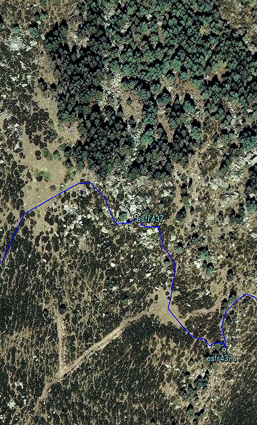 |
This map shows the position of bm437 , S of the forest-strip. |
|||||||||||||||||||||||||||||||||||||||||||||||||||||||||
 |
But bm437 is not easy to find without a clue like this picture |
|||||||||||||||||||||||||||||||||||||||||||||||||||||||||
 |
Bm437 |
|||||||||||||||||||||||||||||||||||||||||||||||||||||||||
|
Bm437 I is not far away from bm437 - 125m to the SSE - but is hidden behind trees. | |||||||||||||||||||||||||||||||||||||||||||||||||||||||||
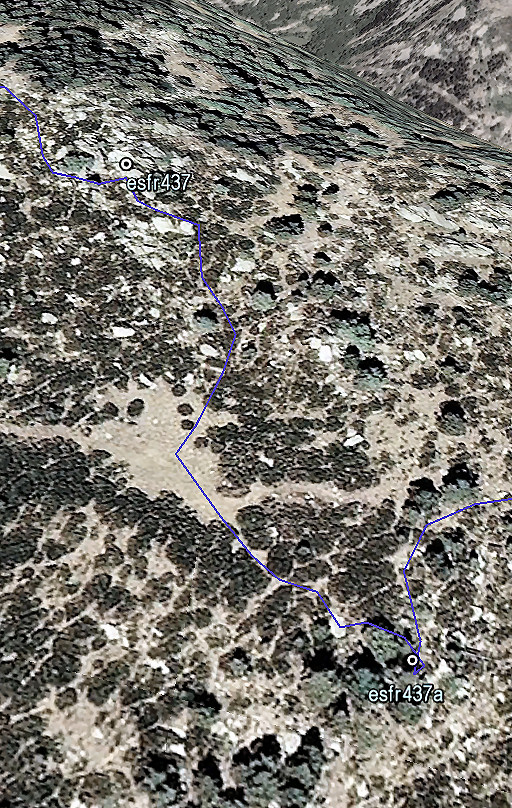 |
This Google Earth screenprint might help you to find it. There is an open grassy space in between which helps orienting. |
|||||||||||||||||||||||||||||||||||||||||||||||||||||||||
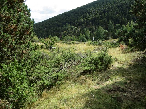
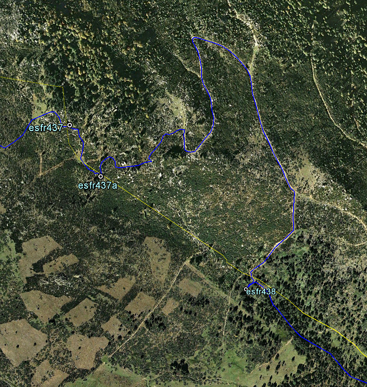 But how to proceed to bm438? A direct descent SE is not impossible but difficult because of the thick broom undergrowth. There's a longer but much smoother route. From the open space between bm437 and 437 I, there's a vague and grassy dirtroad going E. After 250m it merges with distinct dirtroad. Go right (=S) and follow this dirtroad, descending in its windings (S-N-SE-S) for 750m until |
||||||||||||||||||||||||||||||||||||||||||||||||||||||||||
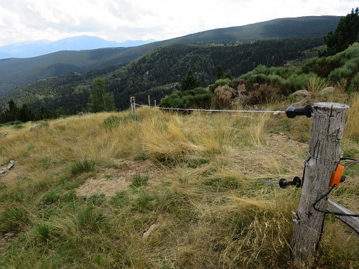 |
this fence appears at your right hand. Now continue S along this fence for 100m |
|||||||||||||||||||||||||||||||||||||||||||||||||||||||||
 |
until this fence-crossing. Cross the fence and follow the grassy dirtroad for 150m downhill |
|||||||||||||||||||||||||||||||||||||||||||||||||||||||||
 |
Then the dirtroad bends SE and after 25m you are here. Bm438 is nearby but hidden at 25m distance at the right side of the fence |
|||||||||||||||||||||||||||||||||||||||||||||||||||||||||
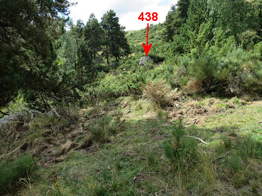 |
View SW from the fence towards the boulder of bm438. | |||||||||||||||||||||||||||||||||||||||||||||||||||||||||
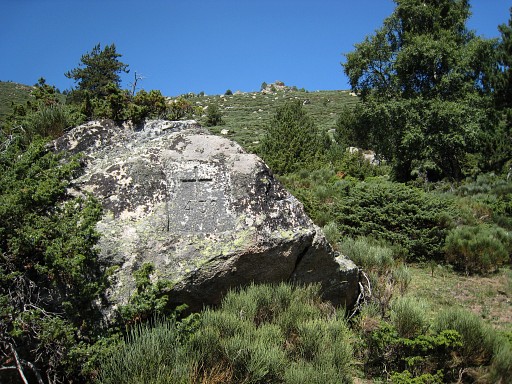
|
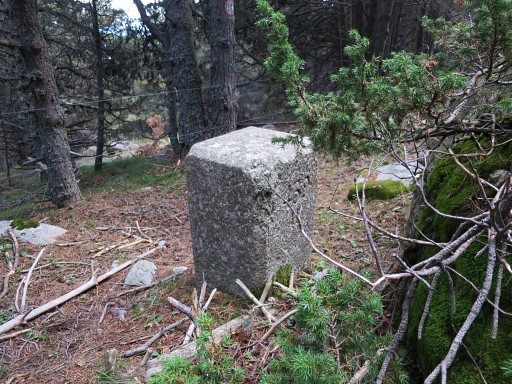
Bm438 |
|||||||||||||||||||||||||||||||||||||||||||||||||||||||||
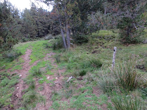
 |
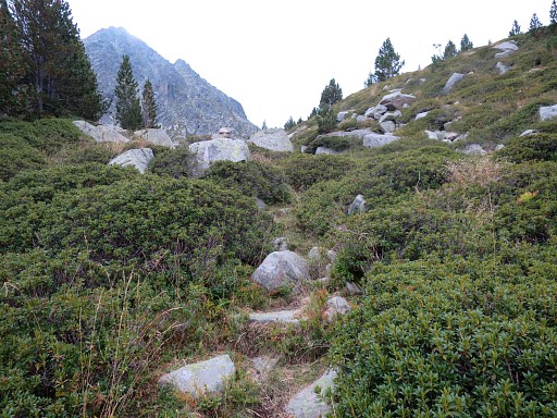
Wayfinding becomes easier now. Get back at the dirtroad and descend further along the dirtroad for 150m and keep straight on, entering the forest. |
|||||||||||||||||||||||||||||||||||||||||||||||||||||||||
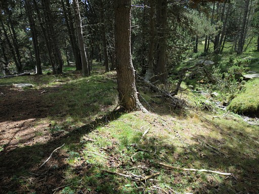 |
A little stream appears at the right side, keep that in sight because | |||||||||||||||||||||||||||||||||||||||||||||||||||||||||
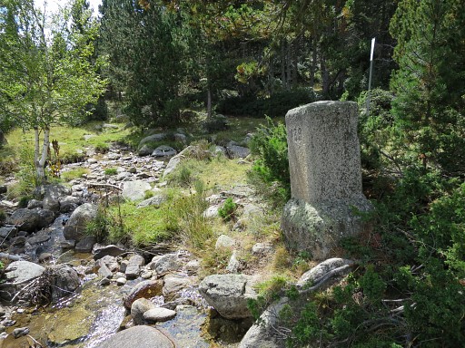
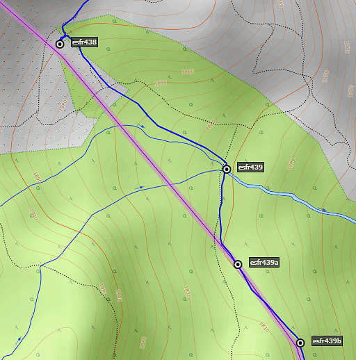
|
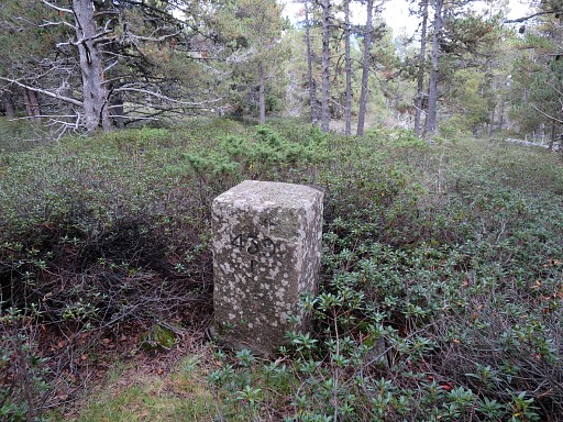
bm439 is standing besides that stream. |
|||||||||||||||||||||||||||||||||||||||||||||||||||||||||
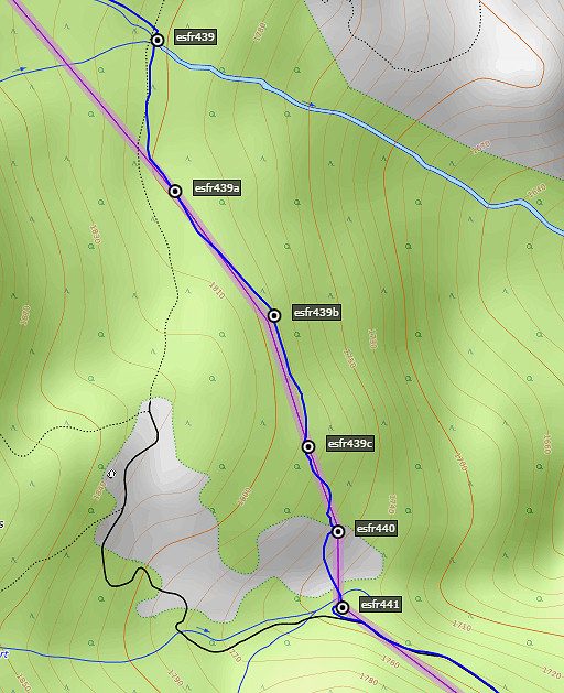 |
Just beyond bm439 cross the stream and now continue for ± 1km to the S and SSE to cover bm439 I to bm440. Finding these bordermarkers is easy. First keep a fence at your left hand. |
|||||||||||||||||||||||||||||||||||||||||||||||||||||||||
|
About 250m from bm439: Bm439 I |
|||||||||||||||||||||||||||||||||||||||||||||||||||||||||
|
Then after 250m: bm439 II |
|||||||||||||||||||||||||||||||||||||||||||||||||||||||||
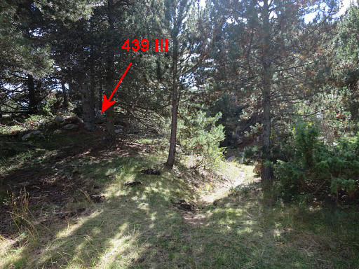 |
Another 200m brings you to bm439 III which is hidden under a tree. | |||||||||||||||||||||||||||||||||||||||||||||||||||||||||
|
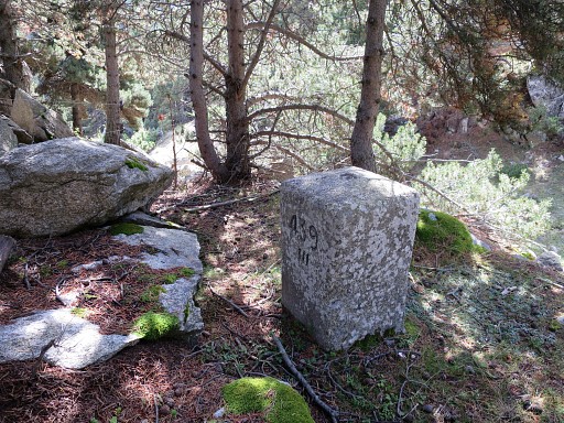
Bm439 III |
|||||||||||||||||||||||||||||||||||||||||||||||||||||||||
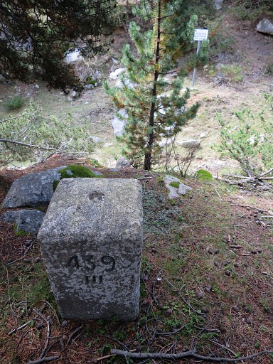 |
Bm439 III You now leave the fence out and descend to the the trail below bm439 III to continue S to bm440. |
|||||||||||||||||||||||||||||||||||||||||||||||||||||||||
 |
The trail leaves the forest and bm440 appears at your left hand. | |||||||||||||||||||||||||||||||||||||||||||||||||||||||||
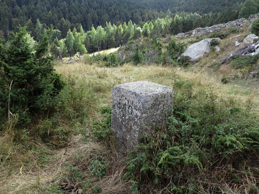
|
Bm440 |
|||||||||||||||||||||||||||||||||||||||||||||||||||||||||
 |
Then crossing a field - you can climb over the fence here - to get to | |||||||||||||||||||||||||||||||||||||||||||||||||||||||||
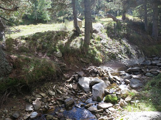 |
bm441 at the other side of a stream. |
|||||||||||||||||||||||||||||||||||||||||||||||||||||||||
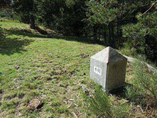
|
Bm441 |
|||||||||||||||||||||||||||||||||||||||||||||||||||||||||
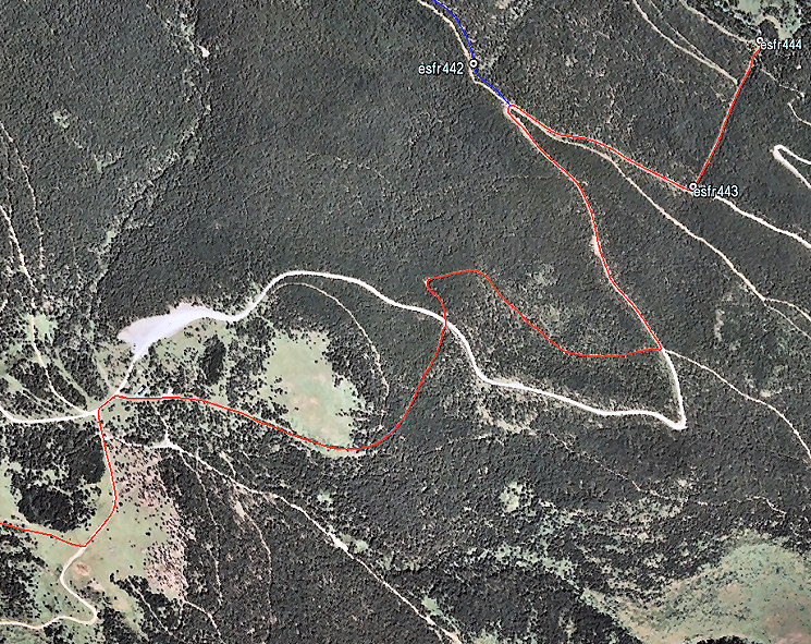
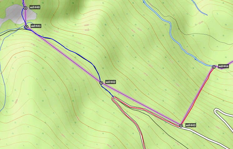 From bm441 pick up the forest road going SE and pass |
||||||||||||||||||||||||||||||||||||||||||||||||||||||||||
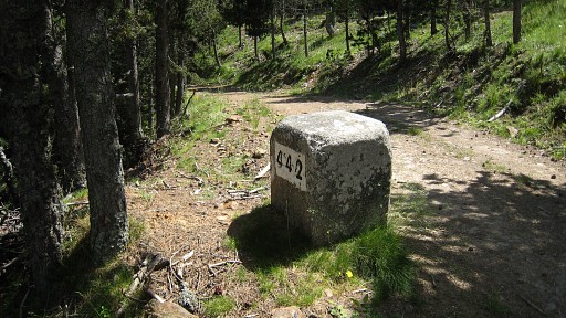 |
Bm442 |
|||||||||||||||||||||||||||||||||||||||||||||||||||||||||
 |
Further on, the forest road ends at a tarmac road. That's where you join the main route again. |
|||||||||||||||||||||||||||||||||||||||||||||||||||||||||
 |
From
the connection of the variant with the main route: follow the tarmac
road SE until - after 500m - an open strip appears at your left
hand, descending steeply. That's where bm443 is, down the road. |
|||||||||||||||||||||||||||||||||||||||||||||||||||||||||
|
Bm443 Now descend down the open strip which is the border until |
|||||||||||||||||||||||||||||||||||||||||||||||||||||||||
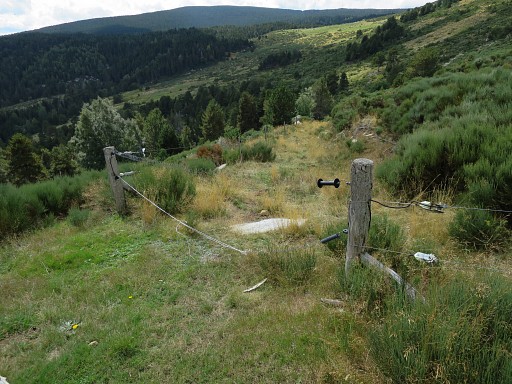
|
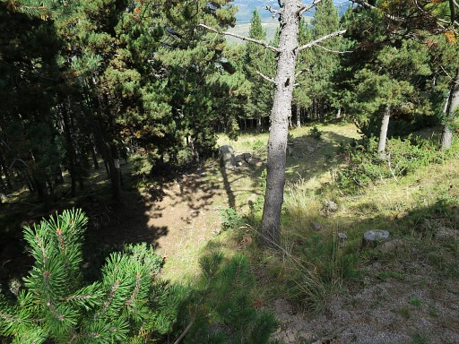
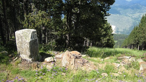
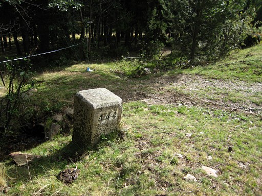
bm444 at the bottom of the strip, standing besides a stream. A bivouac is well possible here. |
|||||||||||||||||||||||||||||||||||||||||||||||||||||||||