|
The
bordermarkers of the Pyrenees : the GRPdesBF
 |
|||||||||||||||||||||||||||||||||||||||||||||||||||||||||||||||||||||||||||||||||||||
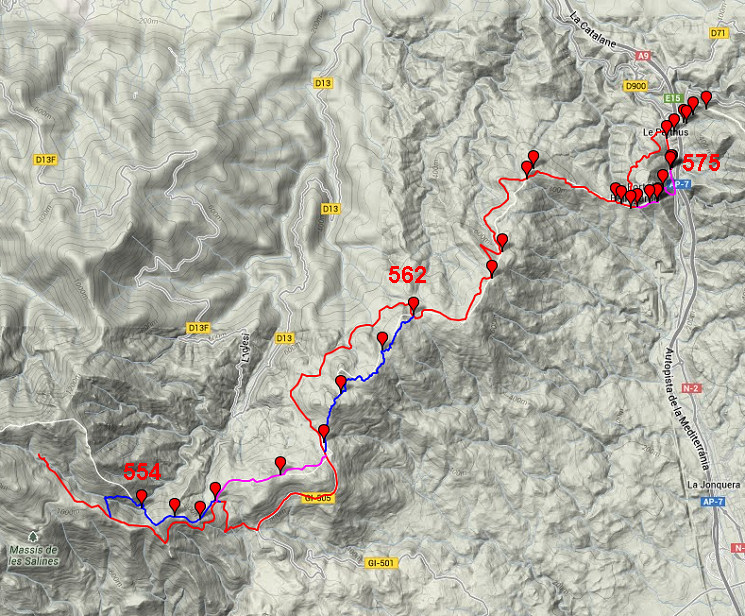
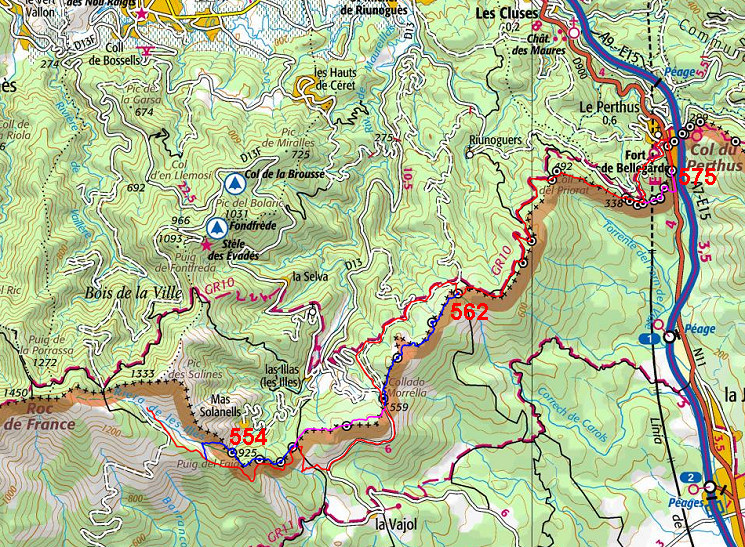
| - stage 50 - Refuge de Salinas - Col de Perthus (bm554-575) |
 |
||||||||||||||||||||||||||||||||||||||||||||||||||||||||||||||||||||||||||||||||||||
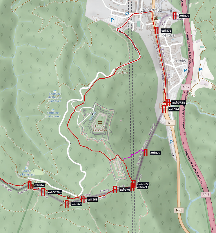
Update may 2020: access to bm558 (variant) will be from the Spanish side, bm573 will become a back and forth variant from Fort de Bellegarde and the main route will include bm570-572. This is the result of new reconnaissances on 20200828 and 2020829. |
|||||||||||||||||||||||||||||||||||||||||||||||||||||||||||||||||||||||||||||||||||||
 |
|||||||||||||||||||||||||||||||||||||||||||||||||||||||||||||||||||||||||||||||||||||
| You can already watch these new routes in detail with this kml-file. | |||||||||||||||||||||||||||||||||||||||||||||||||||||||||||||||||||||||||||||||||||||
Hereunder the original stage with its original variants along bm358 and bm570-573 |
|||||||||||||||||||||||||||||||||||||||||||||||||||||||||||||||||||||||||||||||||||||
 |
|||||||||||||||||||||||||||||||||||||||||||||||||||||||||||||||||||||||||||||||||||||
| Only
the bordermarkers along this stage are shown (and some adjoining ones).
The main route is red,
the variants have other colors. The main route provides a smooth
on-going route along most bordermarkers, the variants give access to
the remaining bordermarkers. See the GRPdesBF-principles. Click here for an fullscreen interactive map. In short The main route is mainly an easy going walk on winding dirtroads until the bordertown of Le Perthus. At two points the main route goes offroad. At Col del Portell, it takes a path to the right towards bm562 to rejoin the dirtroad further on. At bm565, it leaves the dirtroad to climb NE to a hilltop (needing there a 60m detour NW for bm566) to descend thereafter to bm567-569. The variants require a bit more wayfinding and tackling steep hillsides. Variant 1: you'll leave the dirtroad left on a trail down to a stream and climb E to the borderridge which descends SE (steeply in the end) to the stream. Bm554 is engraved semi-horizontal on a large rock above the stream. After crossing the stream, a very steep climb through pines - parallel to the borderfence - will take you to the hilltop of Puig del Faig. Then - continuing along cq parallel to the borderfence - you will pass bm555 and 556 (hidden behind a wall) and descend to bm557 and the main route. Variant 2: you might - from bm557 - continue in one go to this next variant which keeps following the borderfence over the hills to bm558. Later on, the route descends to Coll de Manrella where you'll join the main route again. Variant 3: this variant is a delight to walk but needs some directions. From Coll de Manrella, standing before th monument and facing N, go along the rightside of the small hill, heading N. After 75 meter, you'll spot to your left a path entering the bush: go hence and forth to bm559. Then - after ± 100m, where the trail is bending to the right, take a 50m shortcut NW to a dirtroad. From that point a trail climbs N-NE up the forested hillside. After ± 125m the trail gets broader. Another 250m brings you at a sort of T-junction, go right on the dirtroad. Now take care: after 40m there's a trail at your right climbing to a hilltop (with a watchtower). Then a 175m descent NE will bring you to bm560. At the T-junction 50m further, go right and keep following the winding dirtroad for 500m until it ends. At that point, a trail climbs E up a rocky hill and keeps winding - roughly NE - over the hills for ± 0,7 km until it reaches bm561. Bm561 is in fact on a eastern branch of the trail you were following. Now continue on that branch which climbs over rocky hills and brings you in 0,8 km to bm562 where the main route is picked up again. Variant 4: behind the ancient cemetary (bm569) a dirtroad descends E into Spain and directly bends with a curve to the S. At that curve, take a trail NEE climbing towards the Fort de Bellegarde and you'll reach bm570. Don't continue NE to the ramparts of the Fort but go E on a trail for 100m to reach bm571 and (20m NNE) bm572. Now things get tougher. You have to wrestle N through pricky bush for 200m to reach a rocky ridge which descends to the E. Descends along that ridge and you will find bm573. From there it's quite easy to descend in a curve to the road. NB: the enormous forest fires in 2012 in Catalogne burnt away the maquis, making access much easier: see this trip-report of 12 september 2012. Considerations If you stick to the main route, you have to collect enough water at Los Salines. However, there's one source along the road, 1km past Coll de Manrella (Font de la Figueras). Possibly there's a stream passing the road betweeen Coll de Lly and Coll de Manrella. When you do the variants, you can take water - apart from Los Salines - at the stream near bm554 and that's all. In case of need, you could make a detour from Coll de Manrella to Font de la Figueras. Arriving in busy Le Perthus, the possibilities to stay overnight are limited, there's only one hotel. When you want to bivouac somewhere around, there are two nice opportunities I know of. In both cases you need to bring enough water. One - special - place are the ramparts of Fort de Bellegarde. A large part is public property, so it seems. I camped there on 24-03-2011. Beyond Le Perthus, you could try the fields besides Mas de la Comtessa (200m W of bm580), I slept there on 26-04-2006. Factsheet
Gps-files needed
Useful You might check the relevant webpages in the 'All markers'-section and 'All my trips'-section. They provide pictures of the bordermarkers and additional information. Version 01 March 2014. If you have any correction, suggestion etcetera -> please email me: eefberns@grenspalen.nl MAPS AND DIRECTIONS March 2014. Maps and directions yet to be worked out in more detail. You might check the relevant webpages in the 'All markers'-section and 'All my trips'-section for pictures of the bordermarkers and wayfinding-issues. Print your own maps It's easy to print your own - custom made - maps with the GRPdesBF-route and the bordermarkers on them. See: Print your own maps |
|||||||||||||||||||||||||||||||||||||||||||||||||||||||||||||||||||||||||||||||||||||
 |
|||||||||||||||||||||||||||||||||||||||||||||||||||||||||||||||||||||||||||||||||||||
 |
From the Refugi de les Salines, a trail SE brings you easily in 1 km directly to the dirtroad from Las Salinas to Col de LLy. | ||||||||||||||||||||||||||||||||||||||||||||||||||||||||||||||||||||||||||||||||||||
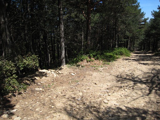 |
Then - after ± 650m - you have to be attentive not to miss this trail at you left. That's the entrance for the variant via bm554-556 |
||||||||||||||||||||||||||||||||||||||||||||||||||||||||||||||||||||||||||||||||||||
|
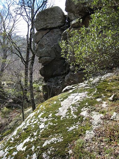
Variant 1 via bm554-556 Bm554 |
||||||||||||||||||||||||||||||||||||||||||||||||||||||||||||||||||||||||||||||||||||
|
Bm555 |
||||||||||||||||||||||||||||||||||||||||||||||||||||||||||||||||||||||||||||||||||||
|
Bm556 |
||||||||||||||||||||||||||||||||||||||||||||||||||||||||||||||||||||||||||||||||||||
|
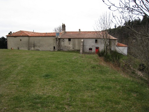
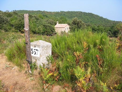
Bm557. We're more or less back on the main route (which passes in fact along that house on a dirtroad) |
||||||||||||||||||||||||||||||||||||||||||||||||||||||||||||||||||||||||||||||||||||
|
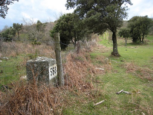
Variant 2 via bm558 Bm558 |
||||||||||||||||||||||||||||||||||||||||||||||||||||||||||||||||||||||||||||||||||||
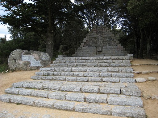 |
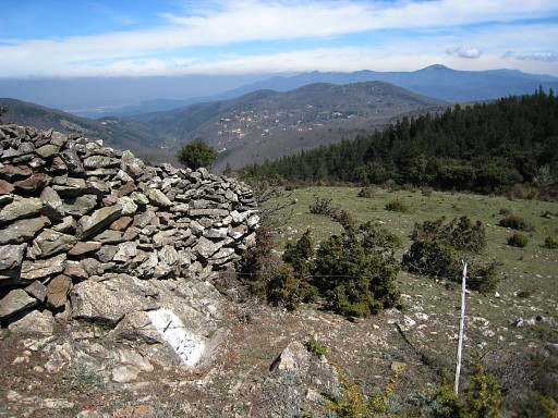
We're back on the main route at the Coll de Manrella with this monument for the Spanish refugees of the Spanish civil war. By the way: this monument is the subject of a territorial dispute between France and Spain, that is to say: at least in 2002. In the proceedings of a meeting of Commission Mixte d'Abornement, Spain insists that is on Spanish territory. |
||||||||||||||||||||||||||||||||||||||||||||||||||||||||||||||||||||||||||||||||||||
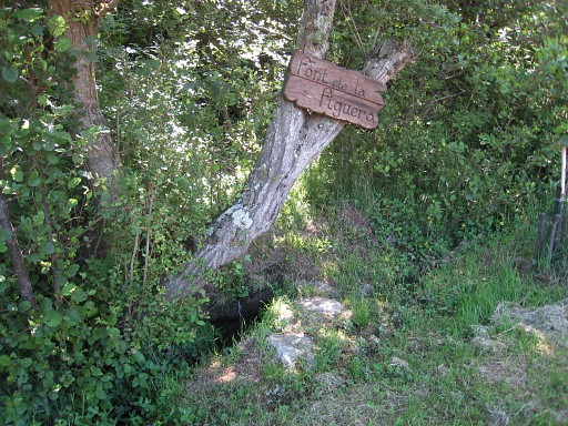 |
At Coll de Manrella, variant 2 has ended while variant 3 starts rightaway. The main route continues NNW on the dirt road. Important to know: after 1 km the main route joins the GR10 and bends NE. Just before that junction is this watersource. |
||||||||||||||||||||||||||||||||||||||||||||||||||||||||||||||||||||||||||||||||||||
|
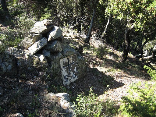
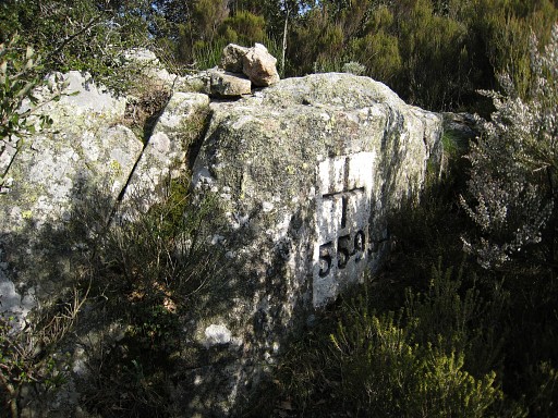
Variant 3 via bm559-561 Bm559 |
||||||||||||||||||||||||||||||||||||||||||||||||||||||||||||||||||||||||||||||||||||
|
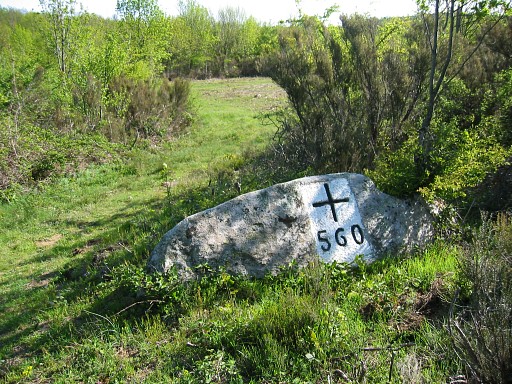
Bm560 |
||||||||||||||||||||||||||||||||||||||||||||||||||||||||||||||||||||||||||||||||||||
|
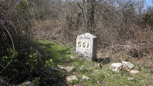
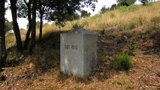
Bm561 |
||||||||||||||||||||||||||||||||||||||||||||||||||||||||||||||||||||||||||||||||||||
|
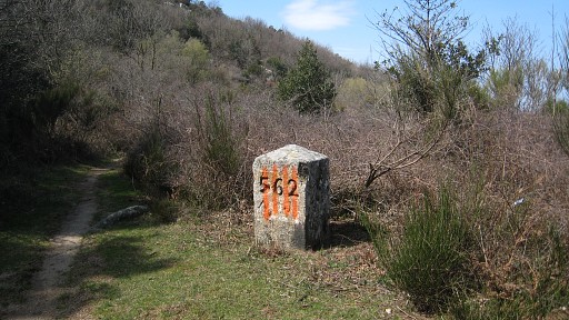
Bm562 |
||||||||||||||||||||||||||||||||||||||||||||||||||||||||||||||||||||||||||||||||||||
|
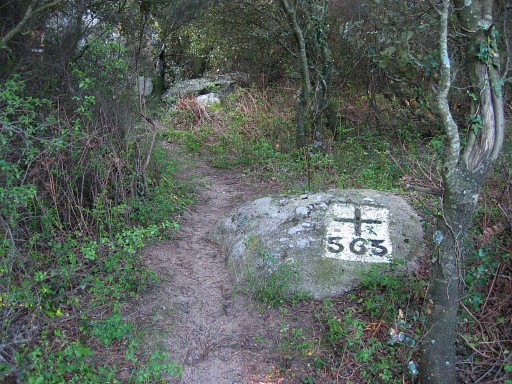
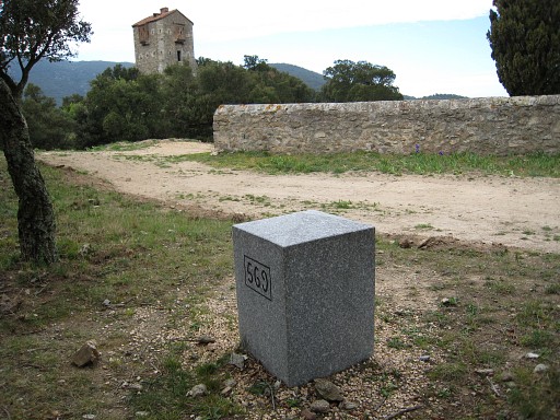
Bm563 |
||||||||||||||||||||||||||||||||||||||||||||||||||||||||||||||||||||||||||||||||||||
|
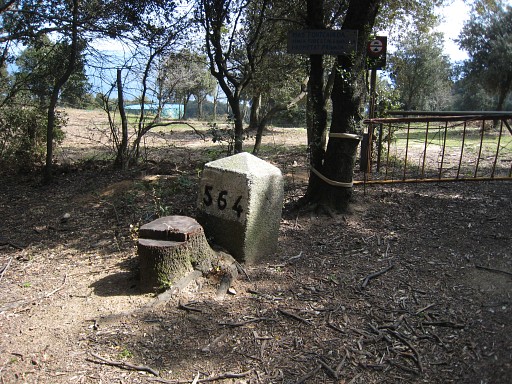
Bm564 |
||||||||||||||||||||||||||||||||||||||||||||||||||||||||||||||||||||||||||||||||||||
|
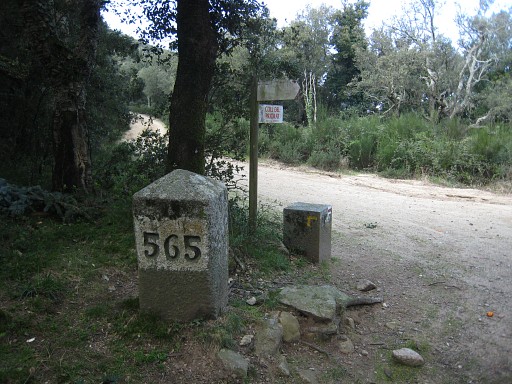
Bm565 |
||||||||||||||||||||||||||||||||||||||||||||||||||||||||||||||||||||||||||||||||||||
|
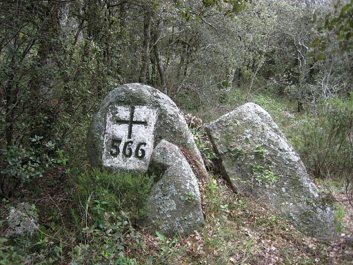
Bm566 |
||||||||||||||||||||||||||||||||||||||||||||||||||||||||||||||||||||||||||||||||||||
|
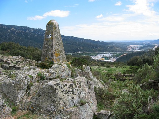
Bm567 |
||||||||||||||||||||||||||||||||||||||||||||||||||||||||||||||||||||||||||||||||||||
|
Bm567bis |
||||||||||||||||||||||||||||||||||||||||||||||||||||||||||||||||||||||||||||||||||||
|
Bm568 |
||||||||||||||||||||||||||||||||||||||||||||||||||||||||||||||||||||||||||||||||||||
|
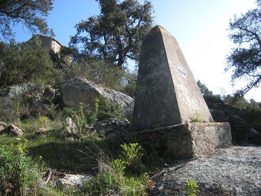
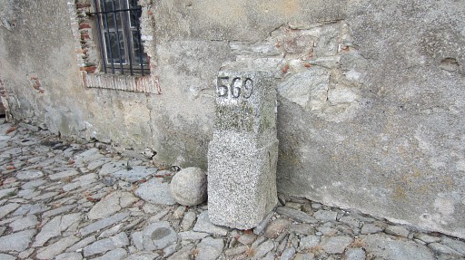
Bm569 |
||||||||||||||||||||||||||||||||||||||||||||||||||||||||||||||||||||||||||||||||||||
|
Bm569, the old marker in the Fort de Bellegarde |
||||||||||||||||||||||||||||||||||||||||||||||||||||||||||||||||||||||||||||||||||||
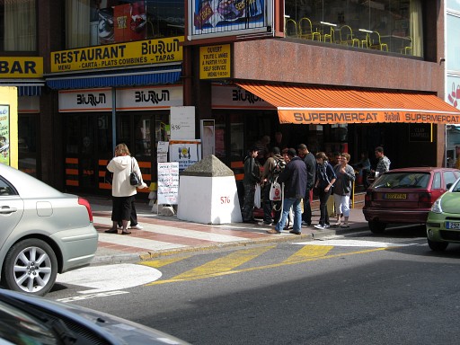 |
The main route descends on a winding road and a stairway-shortcut into downtown Le Perthuis. On your way to bm574, you will pass bm576 on the other side of the street. Technically speaking, bm576 belongs to the next stage. If you reach bm574 at the end of the variant 4 via bm570-573, you won't pass bm576. That's why |
||||||||||||||||||||||||||||||||||||||||||||||||||||||||||||||||||||||||||||||||||||
|
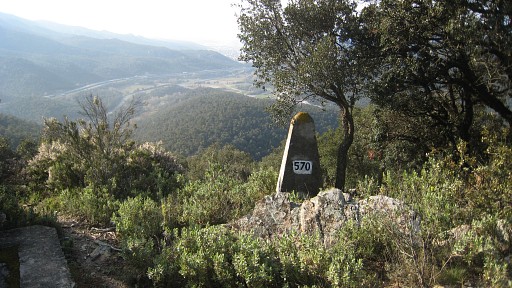
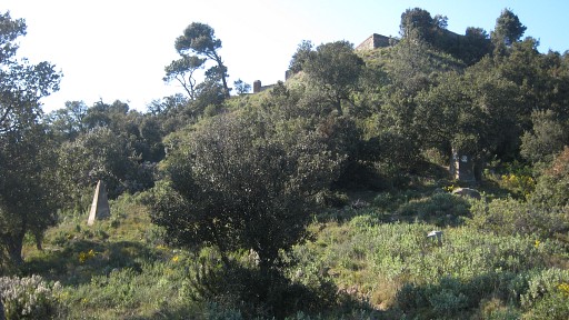
Variant 4 via bm570-573 Bm570 |
||||||||||||||||||||||||||||||||||||||||||||||||||||||||||||||||||||||||||||||||||||
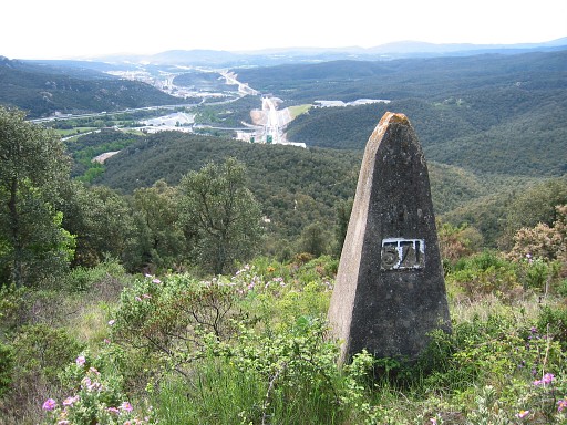 |
Bm571 |
||||||||||||||||||||||||||||||||||||||||||||||||||||||||||||||||||||||||||||||||||||
|
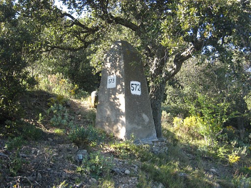
Bm571 (left) and bm572 (right) |
||||||||||||||||||||||||||||||||||||||||||||||||||||||||||||||||||||||||||||||||||||
|
Bm572 |
||||||||||||||||||||||||||||||||||||||||||||||||||||||||||||||||||||||||||||||||||||
|
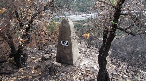
Bm573 |
||||||||||||||||||||||||||||||||||||||||||||||||||||||||||||||||||||||||||||||||||||
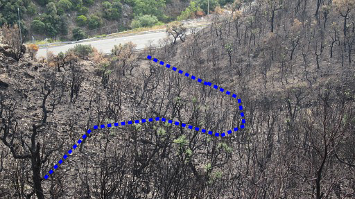 |
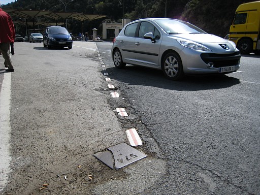
And from bm573 you can easily descend in this curve to the road and then proceed N to the bordercrossing. |
||||||||||||||||||||||||||||||||||||||||||||||||||||||||||||||||||||||||||||||||||||
|
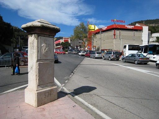
Bm574 |
||||||||||||||||||||||||||||||||||||||||||||||||||||||||||||||||||||||||||||||||||||
|
Bm574bis |
||||||||||||||||||||||||||||||||||||||||||||||||||||||||||||||||||||||||||||||||||||
|
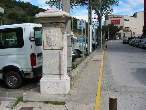
Bm575 |
||||||||||||||||||||||||||||||||||||||||||||||||||||||||||||||||||||||||||||||||||||