|
The
bordermarkers of the Pyrenees : all my trips
 |
|
| -
12 september
2010 - The way of the empress |
 |
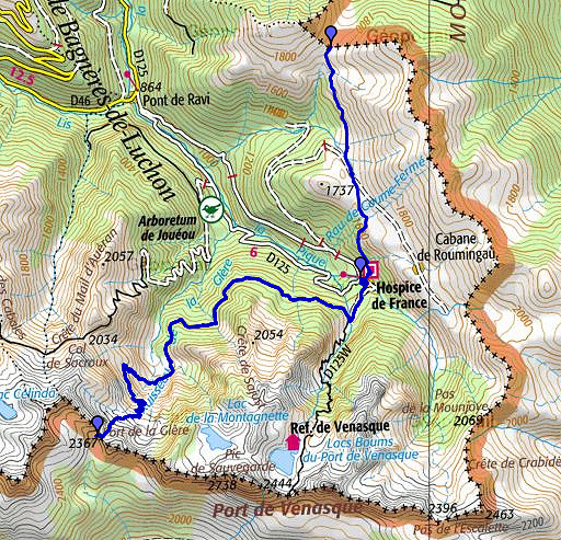 |
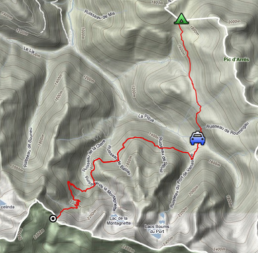
esfr-trip-track-20100912.kml (click to open in Google Earth or copy link to Google Maps; click right on this link to download gpx-version) Summary: part of a 3-days trip around Hospice de France near Bagnères-de-Luchon, exploring bm331 to bm359. Third day: descending to Hospice de France, continuing to Port de la Glère (bm331), back to the Hospice. Weather: bright and sunny untill the afternoon when clouds start drifting in. |
 |
For explanation of
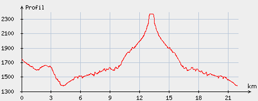
the gps-coordinates and other cartographic backgrounds: see my cartography page Start: 9.00, break: 13.45-14.15, finish: 17.15, net walking time: 7.45 According to the gp-tripteller: Distance: 25,5 km Time moved: 6.53h Time standing still: 1.35h In total: 8.28h Total ascent: 979m Maximum height: 2360m |
|
According
to visugpx - distance : 22.59 km - cum. elevation gain : 1378 m - cum. elevation loss : 1747 m - total elevation: 3125 - altitude maxi : 2375 m - altitude mini : 1378 m - altitude average : 1754 m |
 |
From my camping-spot
on Col de Barèges, I follow the waymarked trails to Cabane de Campsoure
and to Hospice de France. |
|
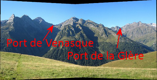
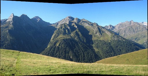
In between this
panorama showing both Port de Venasque and Port de la Glère. Move the mouse over the picture to see the Ports. |
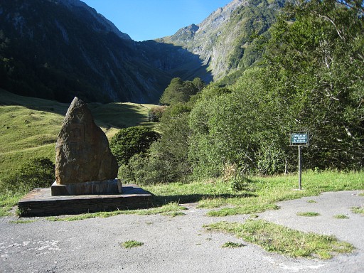 |
Back at the
Hospice de France where my car is parked. At this picture: in the background the Port de Venasque and in the foreground another monument |
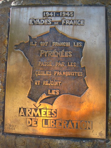 |
remembering the
refugees from France who crossed the Pyrenees
in WWII to join the allied forces. |
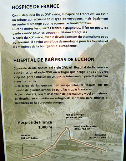 |
An interesting
information panel. It tells us that the Hospice was from the 17th
century a refuge and
exchange center for the crossborder commerce. During all the French-Spanish wars it was a military post. From the beginning of the 19th century it became more and more a tourist refuge At my car, I change my backpack for my day-backpack |
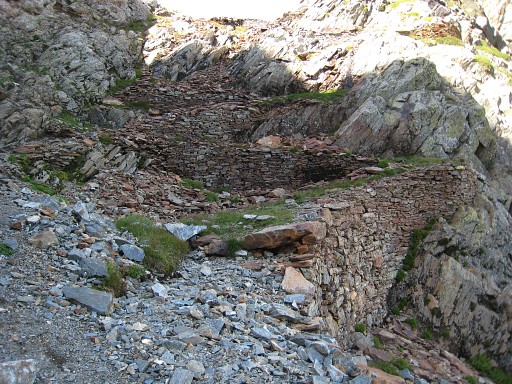 |
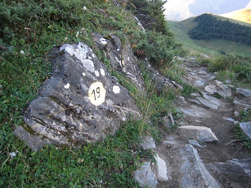
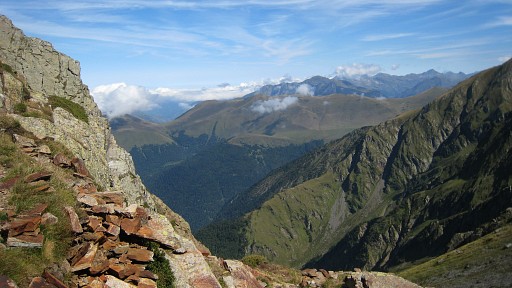
and
continue on the trail of Chemin de
l’Impératrice (the way of the empress) to the Cirque de la Glère (1 ½
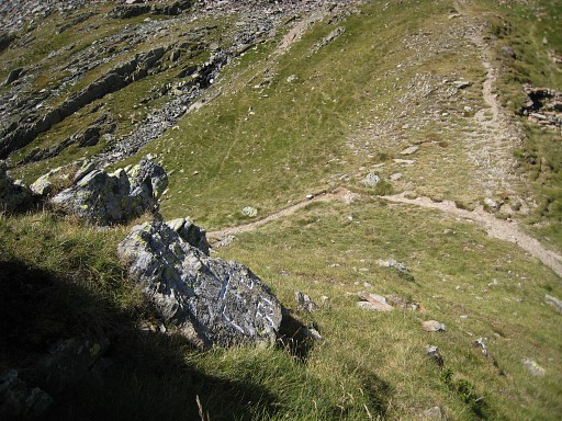
h). Then on a yellow-waymarked trail (nr. 33) in 1 ¾ h to Port de la Glère, quite longer then I thought. In the final ascent, there's this artificial amelioration of the path. A prove - I think - of the importance of this pass in former days. |
 |
Looking back, I can
recognize in the distance |
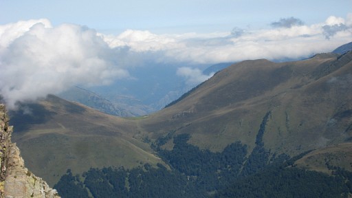 |
the Port de Barèges
where I started in the morning. |
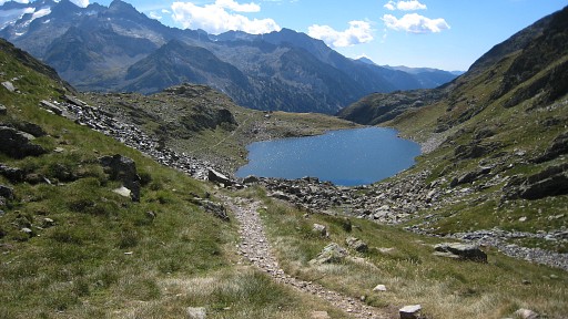 |
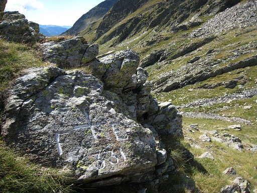
I had to look around a bit for bm331. On the pass you have to proceed to the highest point (with view on this lake in Spain). |
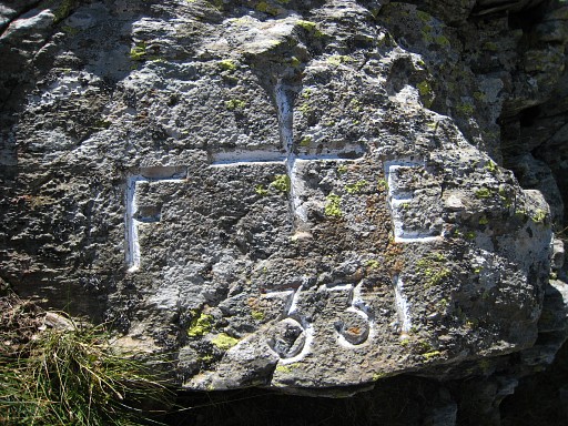 |
At that point,
it’s - say - 20 meters climbing to the SE to bm331. Also here a F and a E, just like at bm332 (and bm344). |
 |
Bm331, looking down
at the pass. |
 |
Bm331 |
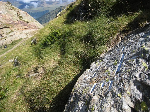 |
Bm331, looking to
the east |
|
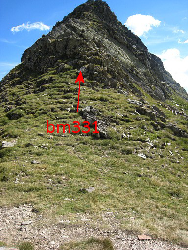
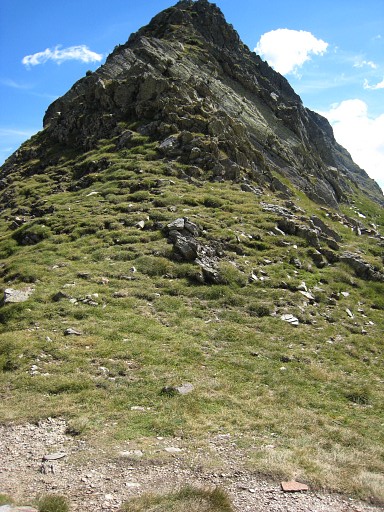
Bm331, in the
distance from the pass. Move the mouse over the picture to see where the bm is. I descend back in 3 hours (trail 33 and 30) to Hospice de France. By car to Bagnères-de-Luchon and settling in a hotel. |