|
The
bordermarkers of the Pyrenees : all my trips
 |
|
| - 28 august
2012 - A mongolian tent in the Pyrenees |
 |
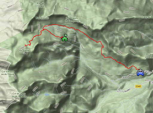 |
esfr-trip-track-20120828.kml (click to open this trip in Google Earth or copy link to Google Maps; click right on this link to download gpx-version) Summary: part of a 2½-weeks-trip to the Pyrenees with a lot of targets, most of them reconnaisances of routes for the GRPdesBF. Day 3: start of a 3-days-trekking to explore routes in the bm270-272-area. Weather: sunny, warm |
 |
For
explanation of
the gps-coordinates and other cartographic backgrounds: see my cartography page Start: 10.00, break: 12.30-13.15, finish: 17.00, net walking time: 6¼h According to the gps-tripteller: Distance: 16,3km En route: 6.59h Total ascent: 1389m Maximum height: 2203m |
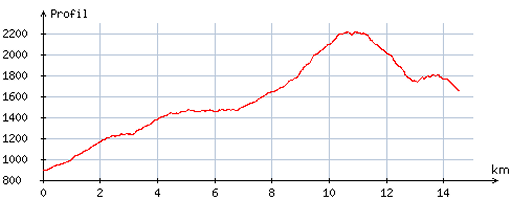 |
According
to visugpx - distance : 14,9 km - cum. elevation gain : 1430m - cum. elevation loss : 674m - total elevation: 2104m - altitude maxi : 2211m - altitude mini : 892m - altitude average : 1599m |
 |
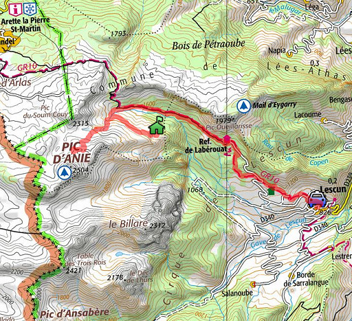
I park my car in Lescun and walk along the GR10-trail in 2½ hour to Cabane Cap de la Baigt. This picture: I have just passed the Refuge de Labérouat and look towards the mountain Le Billare |
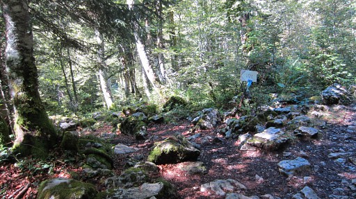 |
In the forest there's this branch leading to Cabane de Lagne. Two days later I will return on thats path |
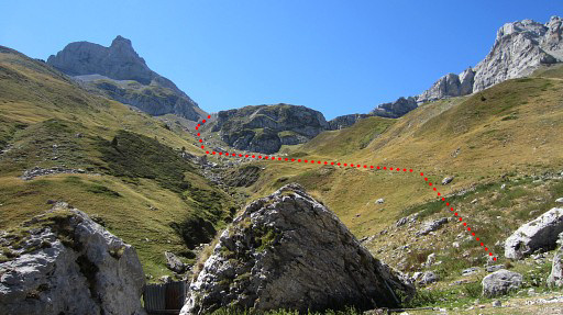 |
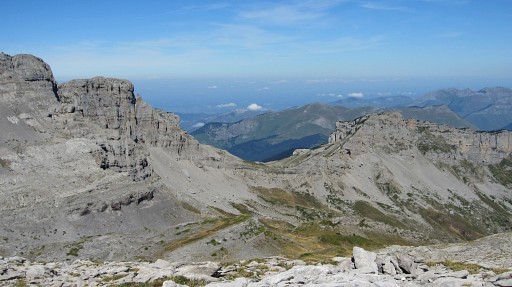
Having arrived at Cabane Cap de la Baigt, I climb SW on a well trodden cq worn out trail in the direction of Col des Anies. This picture: the trail roughly indicated. |
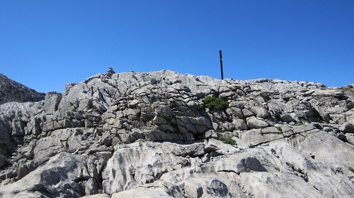 |
You can’t go wrong: higher up on the karst plateau, there are loads of cairns. There are some branches but the main trail is obvious. You will pass this wooden signpost (which has lost his sign). |
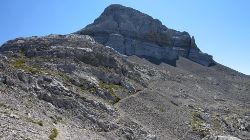 |
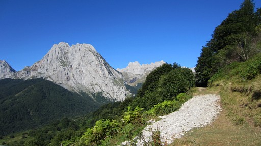
After 1½ hour, the trail merges in a yellow trail which leads to Pic d’Anie, visible on this picture. But it’s time to return (although I could have also proceeded to the gîte d’Étappe in Arette la Pierre Saint-Martin). Going back is in the beginning a bit confusing because of various cairn-directions. One hint: when having arrived at the wooden signpost, choose the trail that descends. |
 |
Looking NE from the karst-plateau, you can see the Pas d'Azuns where the GR10 passes. |
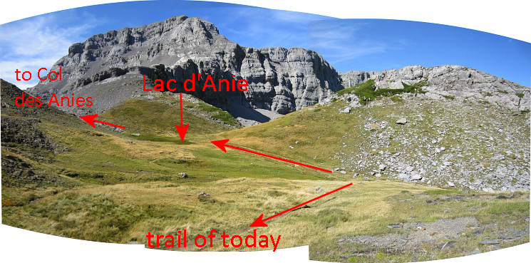 Later I wonder if I have reached the Col des Anies at all. The trail that I followed had one goal: getting you at Pic d’Anie. And yes, checking the maps, I see that I didn’t get to Col des Anies, the Col des Anies is just south of Pic du Soum Cuy. From Lac d’Anie (which is a pond, almost dry) I saw another trail going W. That's the one to Col des Anies as I will learn tomorrow. |
|
 |
After 1 hour of returning, I’m getting closer to Cabane Cap de la Baigt. At the last bend of the trail - before it crosses the streambed for the final part of the descent - I go E on an ‘unwaymarked’ trail (I saw it on the map as a HRP-variant that should bring me to Cayolars d’Anaye.) |
 |
But this trail brings me too high: suddenly I see Cabane de Lacure down below while the trail should pass along that cabane. |
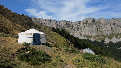 |
I descend and discover a mongolian Yurt (round tent) behind the cabane! It’s ornamented and you can sleep in it. |
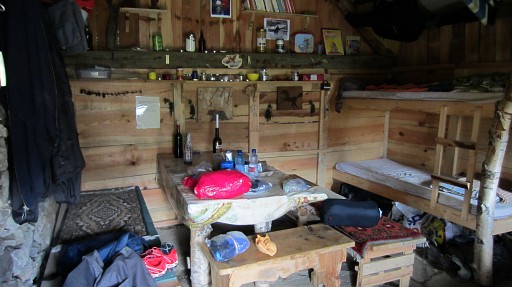 |
The cabane itself has been restaurated and is well equipped and nicely decorated. A water source is ± 50m down the slope. I decide to stay, it’s 5pm and it’s been a tiring day. |