|
The
bordermarkers of the Pyrenees : all my trips
|
|
| - 29 august
2012 - Rocky  previous
trip next
trip previous
trip next
trip 
|
 |
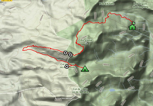 |
esfr-trip-track-20120829.kml (click to open this trip in Google Earth or copy link to Google Maps; click right on this link to download gpx-version) Summary: part of a 2½-weeks-trip to the Pyrenees with a lot of targets, most of them reconnaisances of routes for the GRPdesBF. Day 4: second day of a 3-days-trekking to explore routes in the bm270-272-area, today trying an ongoing route from bm271 to 272. Weather: cloudy, in the afternoon sun, thunderstorm in the evening |
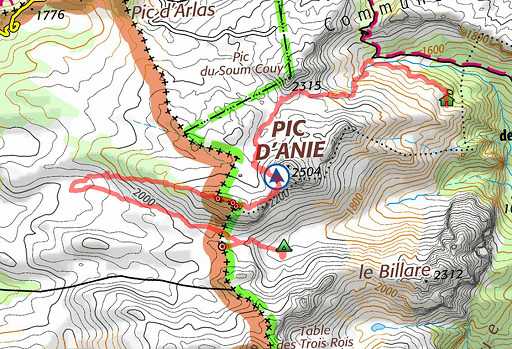 |
For
explanation of
the gps-coordinates and other cartographic backgrounds: see my cartography page Start: 09.15, no break, finish: 18.00, net walking time: 8¾h According to the gps-tripteller: Distance: 16,4km En route: 8.51h Total ascent: 1341m Maximum height: 2356m |
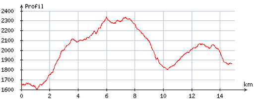 |
According
to visugpx - distance : 15,2 km - cum. elevation gain : 1144m - cum. elevation loss : 932m - total elevation: 2076m - altitude maxi : 2337m - altitude mini : 1603m - altitude average : 2008m |
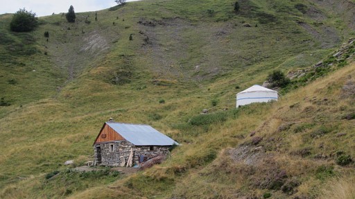 |
A long day without a break with as main achievement finding a route from bm271 to 272. I start with returning to Cabane de la Baigt, following the trail from Cabane Lacure (this picture, where I slept) with his Yurt. |
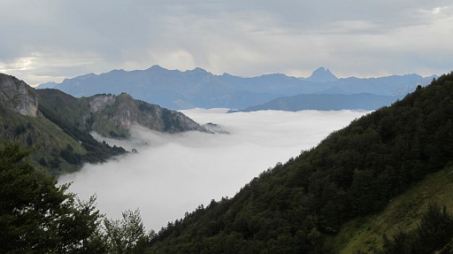 |
Looking E. |
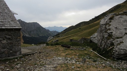 |
This picture: having arrived at Cabaen de la Baigt. If you want to go the opposite way, then - from Cabane de la Baigt - head for a passing through two rocks, |
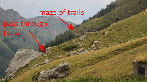 |
then further to the maze of trails along an exposed hill and then entering the forest. If you come from above (Col des Anies), then you might as well follow the route I took yesterday. Once you see a sort of pass - high up at your right - you should descend to the left, the Cabane Lacure with his yurt soon visible. |
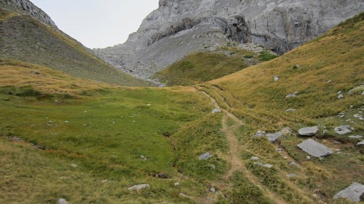 |
I climb once again in the direction of
Col des Anies but now taking at the Lac d’Anie the trail to the
right. That should bring me to the real Col des Anies instead of the
towards Pic d'Anie trail of yesterday. Lac d'Anie (the green triangle at this picture) is an almost dry pond. The spot itself is a nice bivouac place but you need to bring water. |
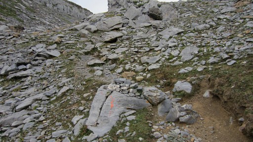 |
The trail is well cairned and painted in places |
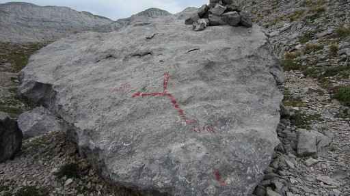 |
A bifork. |
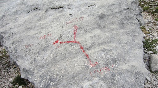 |
Left is to (Pic d') Anie, right is to Arette, down is to Lescun where I came from. |
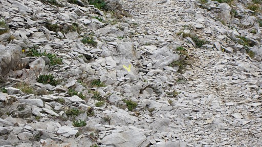 |
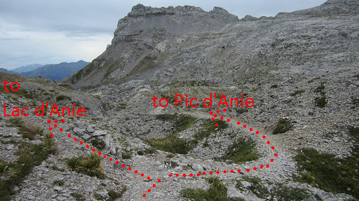
Finally the trail brings me to the Col
des Anies and ends at the yellow trail which - coming from Arette
- leads to Pic d’Anie. If you’re on the yellow trail itself, the branch leading to Lac d’Anie (where I came from) is ‘blocked’ with a yellow cross. |
 |
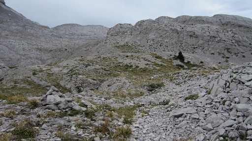
Another view: standing on the yellow trail, looking SE |
 |
I follow the yellow trail a bit NW to
see if I can find back that shortcut to the red trail that skirts bm270
(and some previous bm’s) and leads to Pic d'Anie. I did that shortcut
on 20100908. I do find a ‘way-cairned’ trail that looks like that one (and comparing its track to that shortcut, it is the same). In the end however, it leads me directly towards Pic d'Anie and not to the red trail close to bm270. |
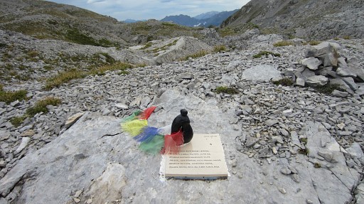 |
Along this shortcut trail, this sad monument. The little statue represents a couple embracing each other. Jon Álvarez Suárez and Naiara Larrinaga Velasco - a Spanish couple of 37 and 40 years - died here on 11 july 2011 of hypothermia. Only dressed in short and T-shirt, they were surprised by bad weather, merciless on this altitude and terrain when you're not prepared. |
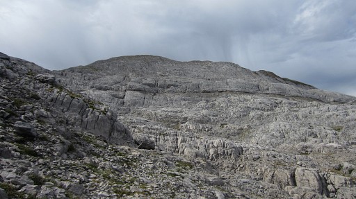 |
A view towards the 'two-headed' hillridge with bm271 and the (lost) bm271bis. |
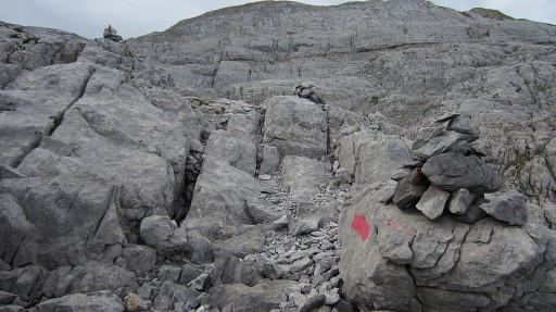 |
Anyway, the trail brings me finally close to the red trail at the foot of Pic d'Anie and I switch to the red trail. Meanwhile I have decided - weather and visibility are OK - to try a connecting route from bm271 to bm272. I climb the ‘chimney’ completely and when the red trail makes a bend in the direction of the summit, I go S. There’s a kind of trail which is - confusingly - waymarked red for a while. |
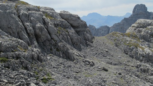 |
Nevertheless, the goal is clear: the ridge between Pic d’Anie and the ridge of bm271. It looks like a pass but on the other side is a scary precipice. In 2011 I called it the "little pass". |
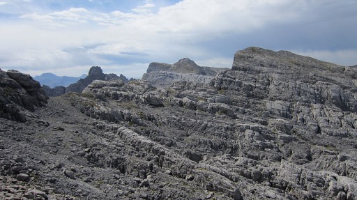 |
And a 'zoom-out' of the previous picture. |
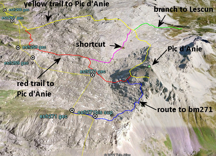 Now it's time - after a few years of exploring this karst-plateau - to map the various trails. Keep in mind that the cairn-waymarked trails can change a bit from year to year. Check these route in detail on Google Earth with this kml |
|
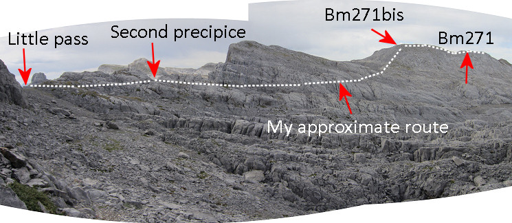
Back to today. Let's put it all - what's coming - in perspective. |
|
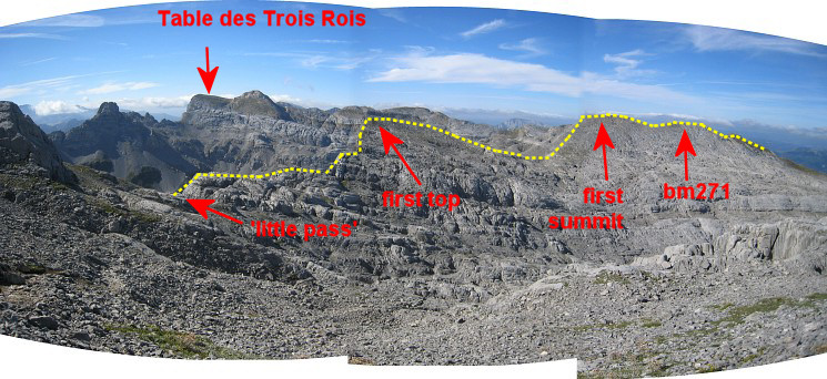 And for comparison-reasons: this picture taken on 20110828 from a higher viewpoint. The yellow line is the ridge. |
|
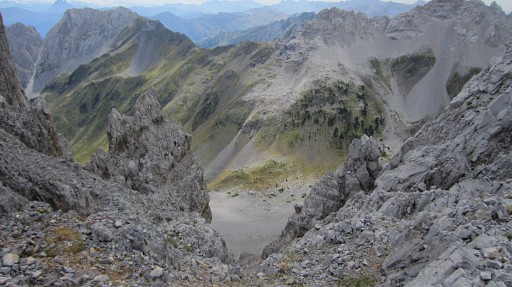 |
I first walk to the "little pass": the edge of a precipice. |
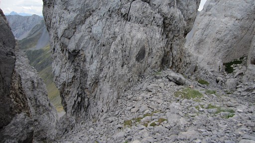 |
Then traversing SW along cairns to the edge of a second precipice, now with a giant pillar in the middle. |
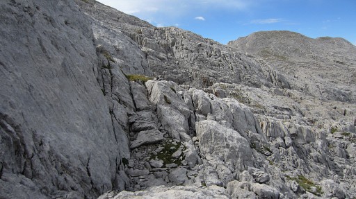 |
Now things get tougher: cairns help you on a route SWW through rough karst terrain. |
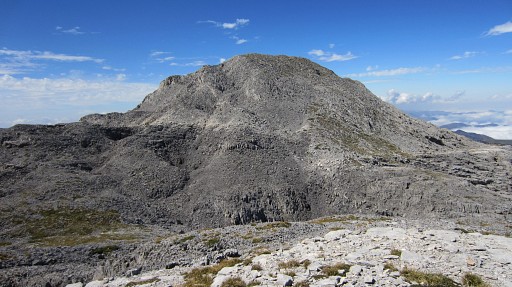 |
It brings you at the foot of the double-headed ridge and its ascent is easy. |
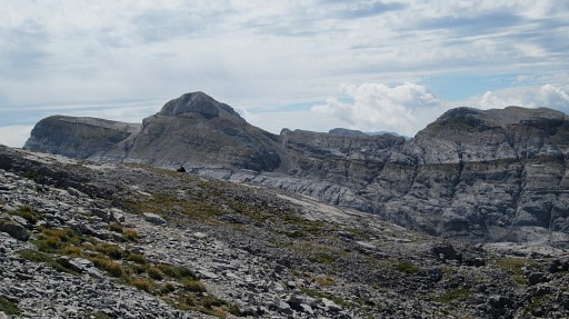 |
In the far distance to the S: le Table and Pic de trois rois. |
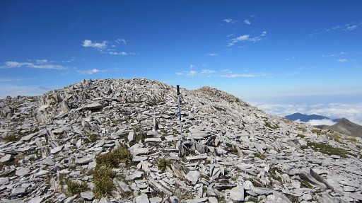 |
At the first hilltop (in fact 75 meter SE of its real summit), I search around
the gps-position of bm271bis (my walking-stick).
The gps-waypoint is based on the French Ign-map. But bm271bis is since long reported as being destroyed and I can't find any trace of it. |
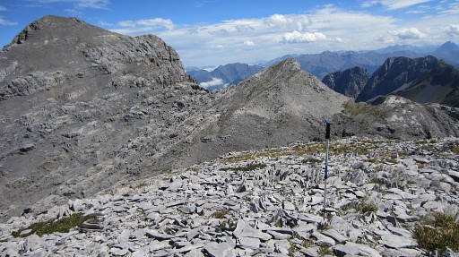 |
Looking back in the direction of Pic d'Anie. |
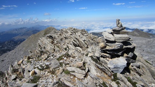 |
Further on (so: 75 meters to the NW, at the 'real' summit of this first hilltop, there’s a big cairn with |
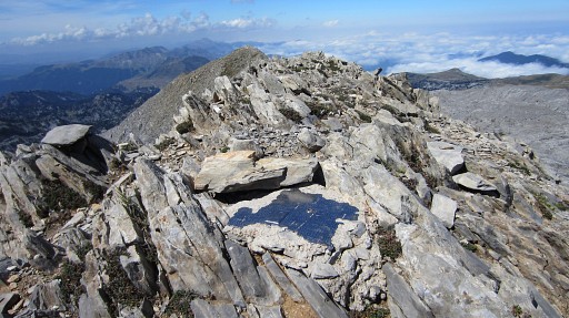 |
besides it an iron plate with
the map-contour of Navarra. As said before, it’s more or less the
highest point of this first ‘head’. It makes more sense that this spot - or the summit of this first hilltop - was the location of bm271bis. However, if we take in account the 360 meters along the ridge from bm271 (according the treaty of 1858), it must have been the previous spot: the Ign-waypoint. Nevertheless, I also search around here, as far as I remember. |
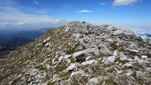 |
Then along the ridge towards bm271 at the second hilltop which |
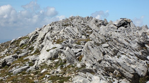 |
is a few meters S and below of a large cairn at the hilltop. |
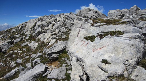 |
Bm271 |
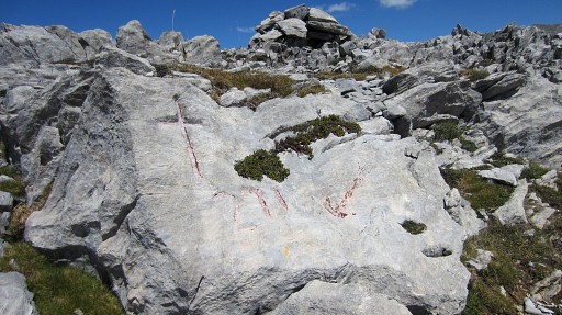 |
Bm271 |
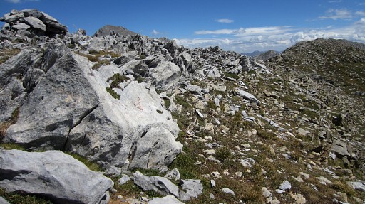 |
Bm271, looking E |
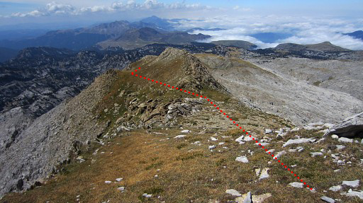 |
Then continuing on the ridge. It will take ± 1½ hour to reach finally the red/white trail at the ‘bottom’. The underground soon becomes grassy which is a relief after so much rocky surface. First the ridge is very clear and there's a obvious trail to follow. |
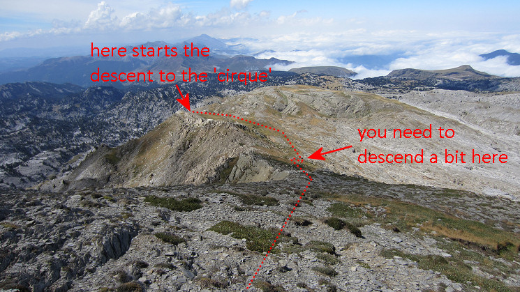 then it becomes more like a plateau |
|
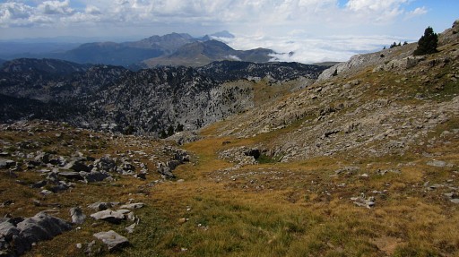 |
and then - when solid rock ridges appear to the right - the green slope descends to the left (=W). |
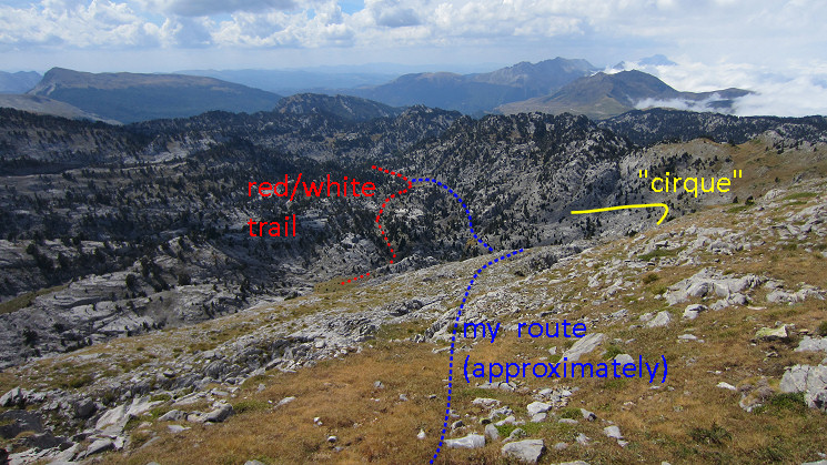 I follow its descent in the direction of what seems the bottom of a ‘cirque’: a half-circle of rockwall |
|
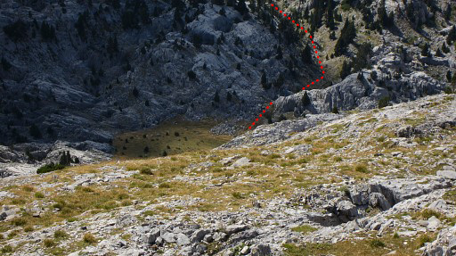 |
The descent becomes rocky and it’s a bit of way-finding to descend decently to the bottom of the cirque. This picture: a zoom-in from above. The white/red-trail from Belagua to Col d'Anaye is visible. |
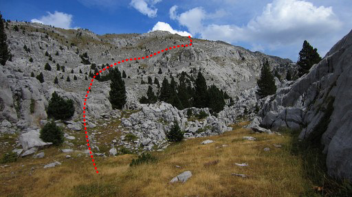 |
More or less at the bottom and looking back to where I came from with my (very) approximate route. Here, at the bottom, I don't recognize the Cirque-aspect anymore. I haven't yet reached the red/white trail, that requires a SW continuation of about 300 meters. |
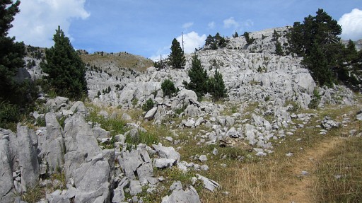 |
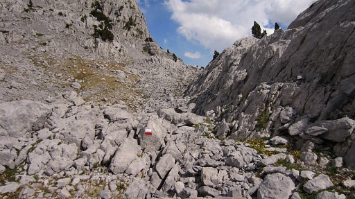
Now I have arrived at the red/white waymarked trail, that's the trail to the right. I came from left. I follow the red/white trail to the E for 2,5 km untill a signpost. The trail is also yellow waymarked. |
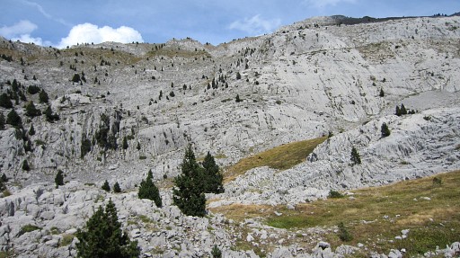 |
Now I'm a bit further, actually at the grass-field I have spotted earlier from above. On 20110819 I got - coming from the E - as far as here before I had to return. I look NE, up the hillside where I came from. |
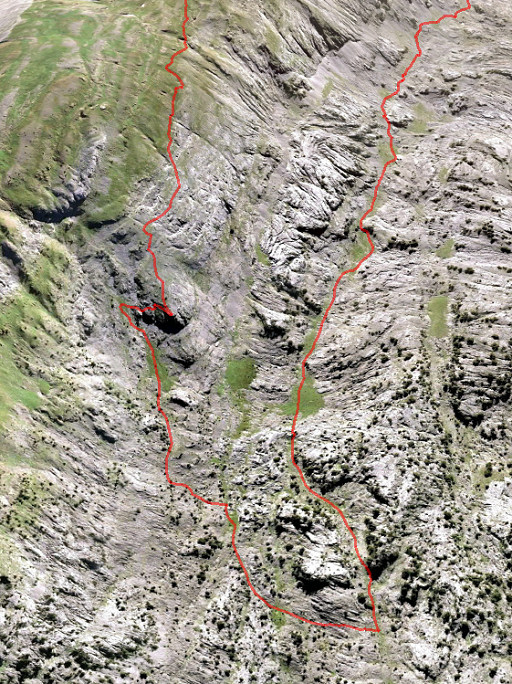 |
And here we see the descent to the red/white trail in detail on this Google Earth screenprint (looking E) Perhaps there's a shorter connection to the red/white trail possible. |
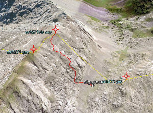 And yes: there is a shortcut from bm271bis to Col d'anaye! I found that out later from the books of Iñaki Vigor & Carlos Sanz and Javier et María-Jesús Sancho-Esnaola, information which was confirmed by Charles & Josette Darrieu. The trail is shown on the Topopirineos-map (see the cartography-page). I made a kml-file of this shortcut: esfr-bm271bis-272-connection-on-topopirineos.kml 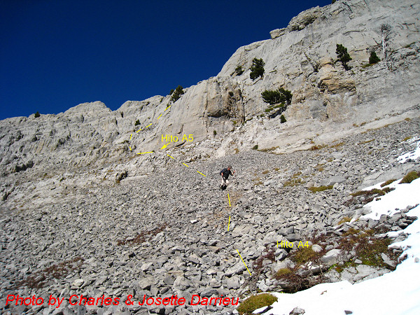 And this picture shows the very beginning, when started from Col d’Anaye. In fact it’s very simple: from the current wooden signpost at Col d’Anaye, climb straight N and soon you will pick up the trail (hito = cairn). 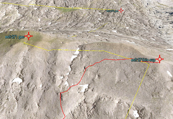 And this image of Google Earth shows in more detail the start of this shortcut. |
|
 |
Back to my own route, climbing (gently) along the trail until |
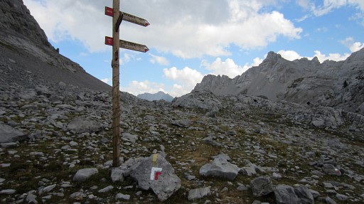 |
this signpost. The red/white trail turns to the right, the yellow trail goes straight on. |
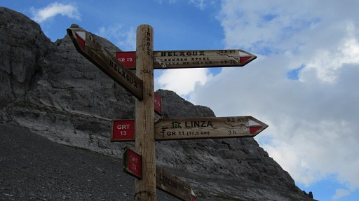 |
We see that the red/white trail apparently makes a loop and returns at (the former refuge of) Belagua. That gives me (months later when editing this page) an idea: is that providing a better connection to bm272? See further on. |
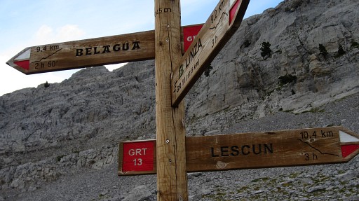 |
According to this sign, the red/white trail continues to Lescun, but I only see yellow waymarks in that direction. About 150m further, you will pass the borderline which is also the highest point before descending towards Lescun. So I would say that that spot is the Col d'Anaye or de l'Insole. But the pass with bm272 is ± 200m to the S on the other side of a rock-hill. In the treaty of 1858 it was called "col d'Insolo ou col de Lescun". |
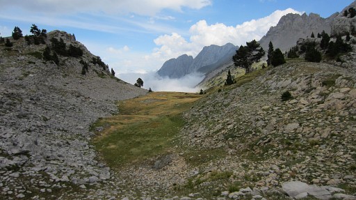 |
I continue on the yellow track until I arrive at the grassy horizontal area, just before the descent into the valley |
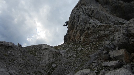 |
Now turn around and choose a trail (now with cairns) which goes left of the giant rounded rock |
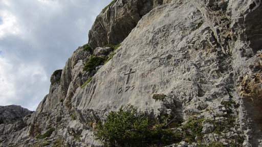 |
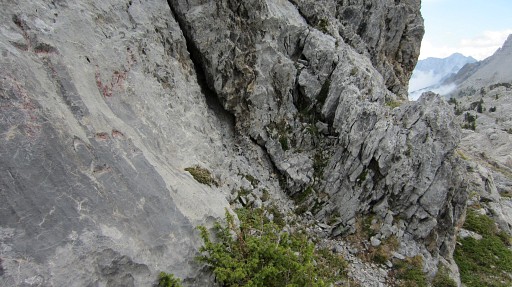
and brings you to bm272 (at your right in the rockwal). It’s ± 250m from the grassy area. |
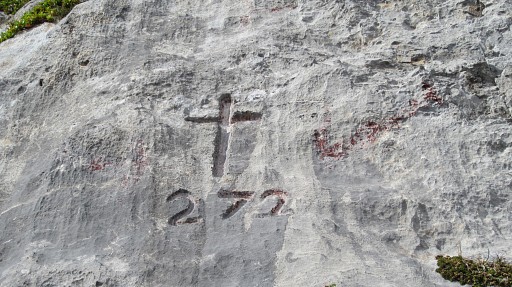 |
Bm272 |
 |
Bm272 looking E |
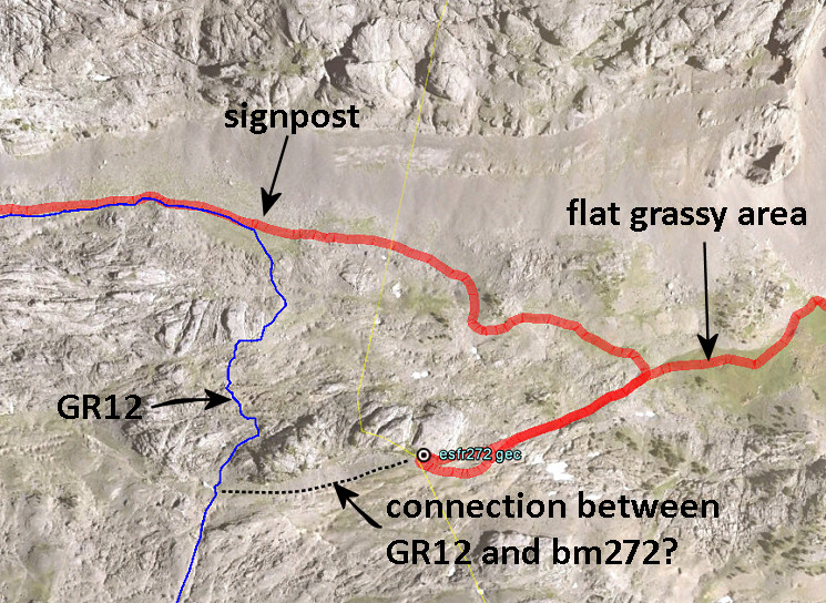 Months later - while editing this page - I find on this page a gps-track of the GR12-loop from Belagua. This screenprint shows a possible (and likely) connection between GR12 and bm272. That would mean an ongoing route via bm272 instead of a detour from the 'flat grassy area'. And something else puzzles me: in the 19th century, the pass where bm272 is engraved must have been an important crossborder-pass. In the treaty of 1858 it was called col d'Insolo or col de Lescun. But where did that bordertrail - now apparently vanished - lead to? To Isaba (picking up the current GR12-trail for a while?) or to (crossing again into France) Larreau? |
|
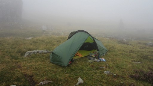 |
I return to the flat grassy area. Then I descend to Sources de Marmitou - it’s foggy there - to pitch my tent. At night: a fierce thunderstorm and nowhere to hide. |
 previous
trip next
trip previous
trip next
trip 
|
|
