|
The
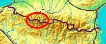
bordermarkers of the Pyrenees : all my trips
 |
|
| - tuesday 2 september
2014 - Three cols, two refuges |
 |
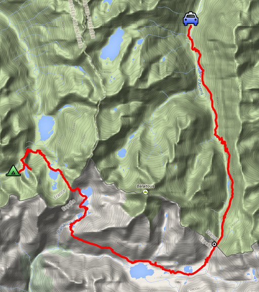 |
esfr-trip-track-20140902.kml (click to open this trip in Google Earth or copy link to Google Maps; click right on this link to download gpx-version) Summary: part of a 2-weeks trip along the entire Pyrenees, focussing on high altitude reconnaissance of parts of my GRPdesBF-trail. Second day of a two-days trip exploring the trails between bm311 (Col de Sobe) and bm312 (Port de la Peyre St-Martin). Today: via Col d'Arrious, Col d'Arrémoulit and Port de la Peyre St-Martin back to Val d'Aste. Weather: splendid, warm |
 |
For
explanation of
the gps-coordinates and other cartographic backgrounds: see the cartography-page Start: 7.15, break: 14.15-15.00, finish: 19.30, net walking time: 11.30h Gps-tripteller: no stats due to partial gps-failure |
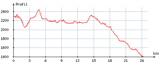 |
According
to visugpx - distance : 24,8 km - cum. elevation gain : 991m - cum. elevation loss : 1892m - total elevation: 2883m - altitude maxi : 2446m - altitude mini : 1400m - altitude average : 2128m |
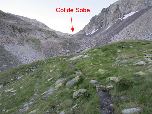 |
Early start. From my bivouac-spot, I walk back in the direction of Col de Sobe. |
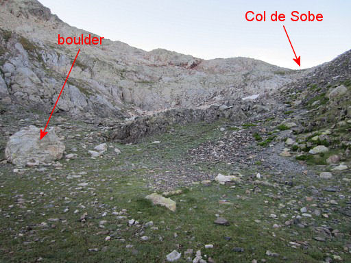 |
But I don't go that far because I visited bm311 yesterday. This spot (with the boulder to the left) is where I have to make a sharp bend to proceed to Col d'Arrious. |
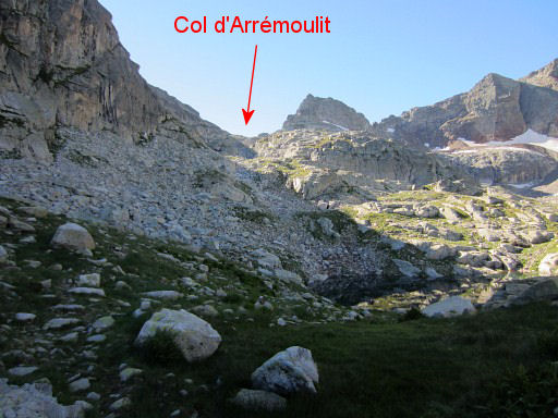
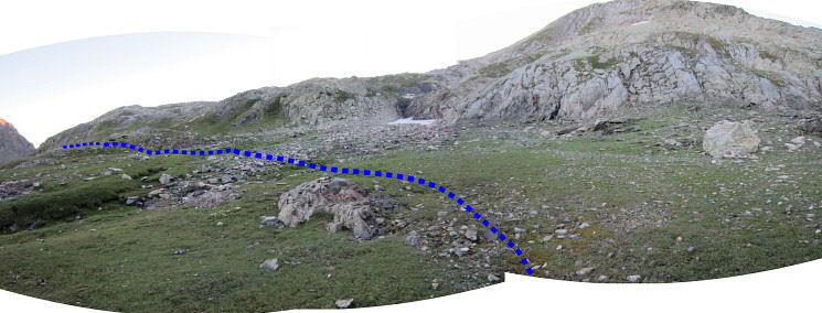 This panorama shows the approximate course of the route |
|
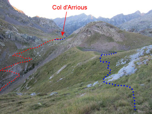 |
Soon the Col d´Arriou comes in sight. But the trail doesn't head directly to the Col (slope too steep as you can see) but takes a course via the Lac d'Arriou. It then joins the main route at Col d'Arrious unless the Passage d'Orteig provides a manageable shortcut to the Lacs d'Arrémoulit. I want to check that. |
 |
I'm at the Lac d'Arriou, looking S. To the left the trail which brings me to the |
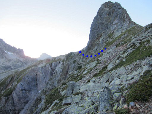 |
famous Passage d'Orteig (blue dotted line) which is a shortcut between Lac d'Arriou and Lacs d'Arrémoulit. I want to see if that's an option for me and the average GRPdesBF-walker. |
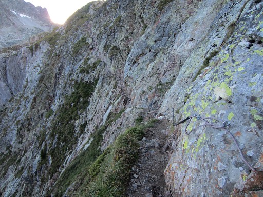 |
It's a dangerous-looking passage above a precipice. There are cables to secure your passage I have a look and doubt for a while but it's too vertiginous for me and - thus, so I decide - for the GRPdesBF. |
 |
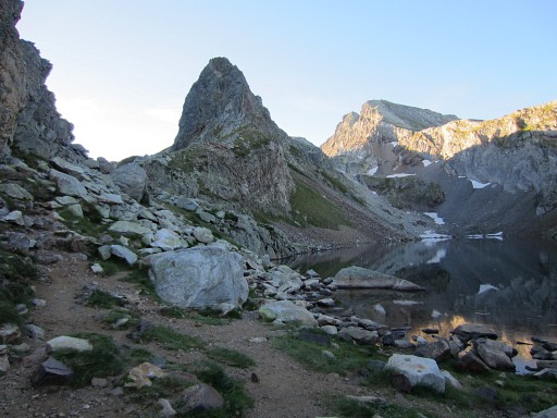
Then back to the lake and proceeding
to Col d'Arriou and doing the easy descent/climb to the Lacs
d'Arrémoulit via the 'normal' route. This picture: the Lac d'Artouste to the left and the trail climbing to the Lacs d'Arrémoulit. |
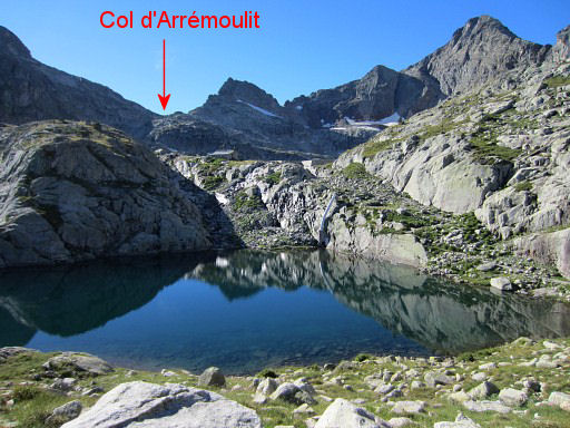 |
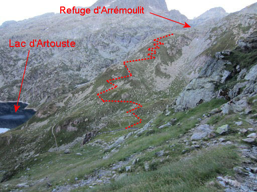
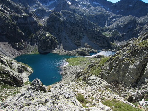
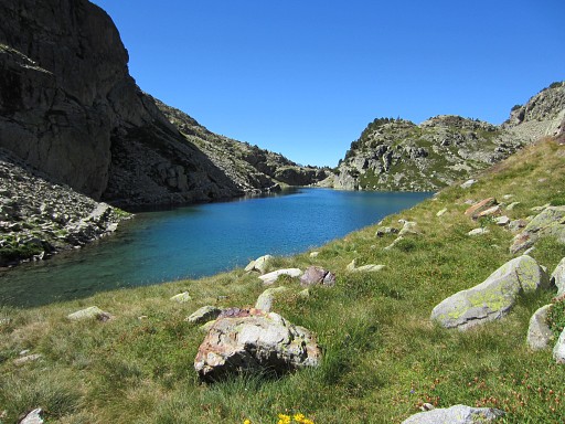
Arriving at the first of the several Lacs d'Arrémoulit. The Col d'Arrémoulit comes in sight. |
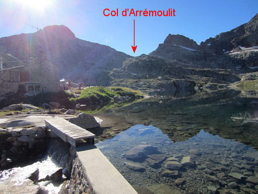 |
The next one is the largest. There's a refuge here. |
 |
Zoom-in of previous picture. |
 |
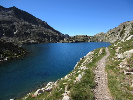
From the refuge – along the lake – a trail starts with a vague beginning but later on with more cairns. |
 |
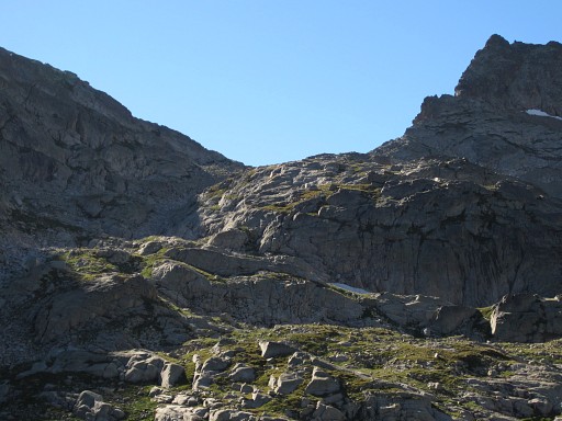
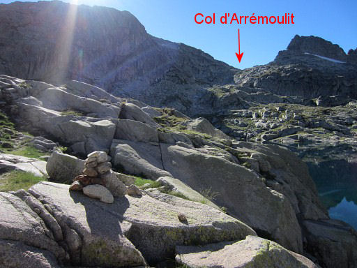
The trail climbs through rockfalls (well waymarked with cairns) |
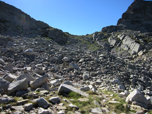 |
to Col d'Arrémoulit. |
 |
From Col d'Arrémoulit, it's a steep, steep descent to the lakes of 'Ibones de Arriel'. |
 |
This is the first lake |
 |
and this is the second (the trail now going along the left side of the lake). |
 |
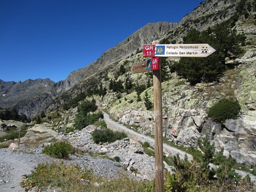
Beyond the second lake, a 'paved' path takes you along |
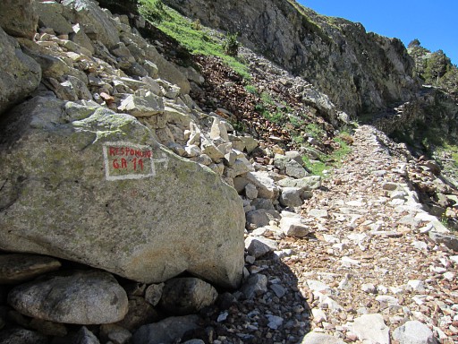 |
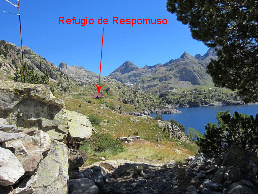
this waysign. And that's my destination: the lake of Respomuso |
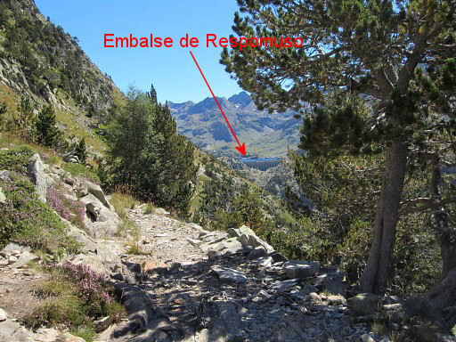 |
which now comes in view in the far distance. |
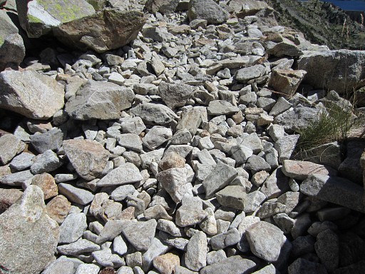 |
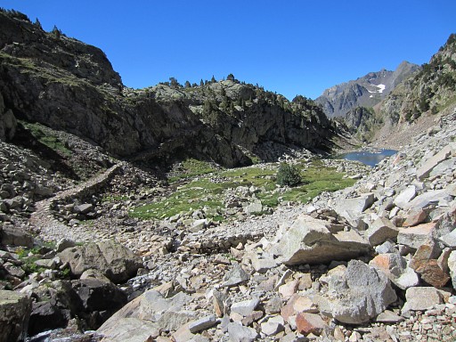
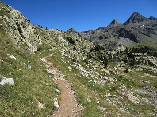
The trail so far is mainly rocky like this: loose cobbles which make walking a tiring experience. |
 |
Then the trail arrives at the lake and joins the GR11-trail. |
 |
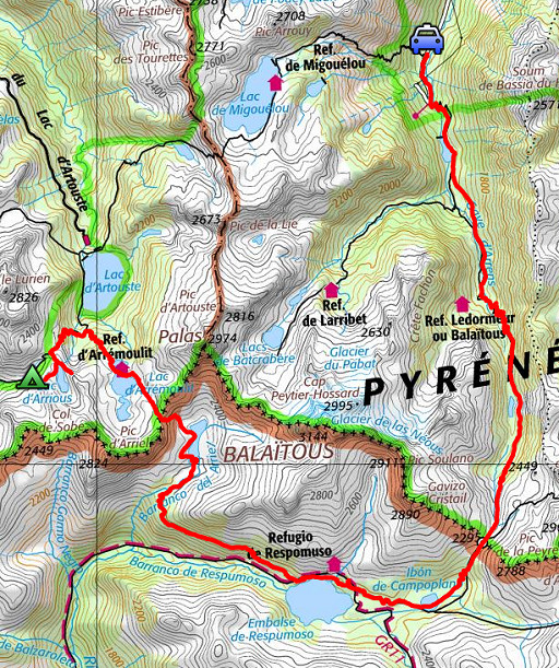
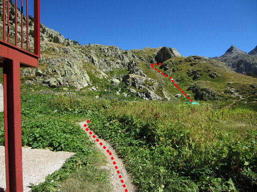
The GR11 brings you along Refugio
de Respomuso which is a bit off the GR11. Lunchbreak at the refuge. |
|
After the lunch continuing to the lake of Embalse de Campo Plano. Navigating is easy, the GR11 will bring you there. There's a shortcut from the refuge to the GR11: continue past the refuge for ±75m and climb E along a tiny stream to the GR11. |
|
The trail is now easier to walk on |
|
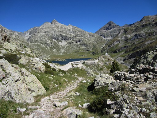
and brings me smoothly to the lake of Embalse de Campo Plano. |
|
Just before a long concrete wall, the
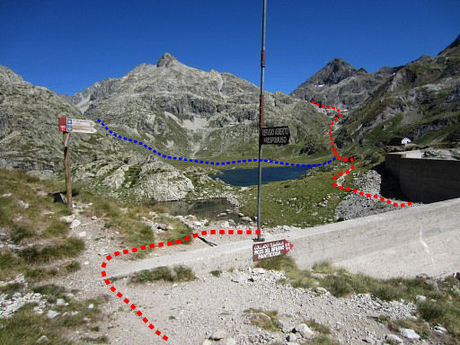
GR11 bends to the right. I part from the GR11 and continue on the other side of the wall on a trail to the lovely grassy plains of Campo Plano. NB: the red line = the main route of the GRPdesBF, the blue line the variant to bm312. |
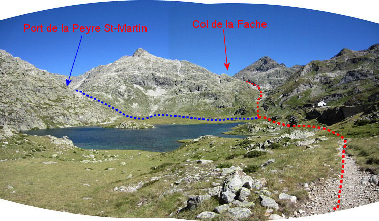 On this panoram we can see very well the GRPdesBF-routes to be taken. The main route (red) will climb to Col de la Fache, the blue route (variant) climbs hence and forth to Port de la Peyre St-Martin to cover bm312. |
|
|
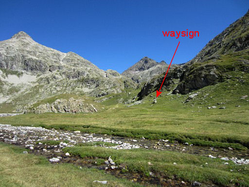
The Campo Plano makes a perfect place for a bivouac including a stream for fresh water. This picture: looking ahead towards the trail to Col de la Fache. There's a waysign pointing to it: |
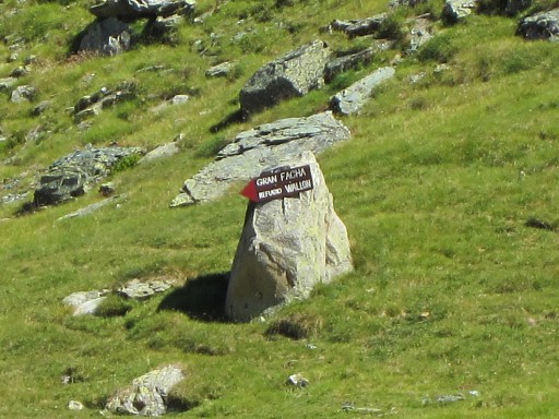
|
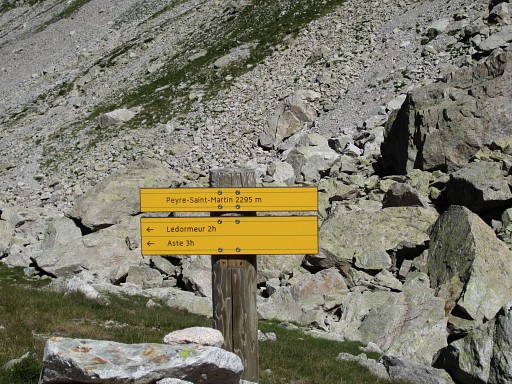
this one. But I continue to Port de la Peyre St-Martin. |
|
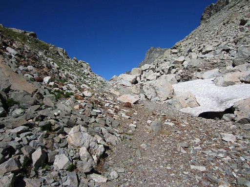
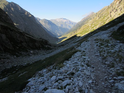
It's a short climb towards Port de la Peyre St-Martin. |
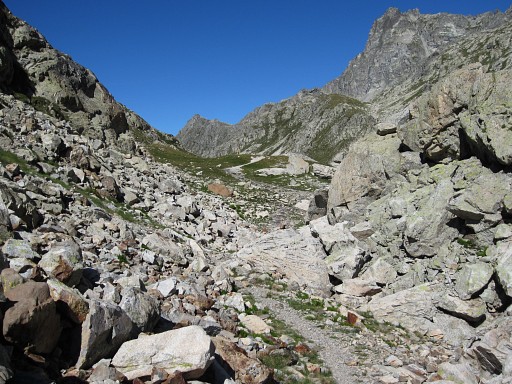
|
which is followed by a long rocky corridor |
|
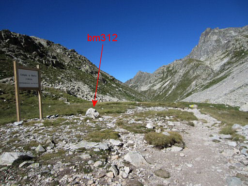
to the green borderpass itself with bm312. |
|
I see that it's still 3 hours walking to Val d'Aste where my car is parked. |
 |
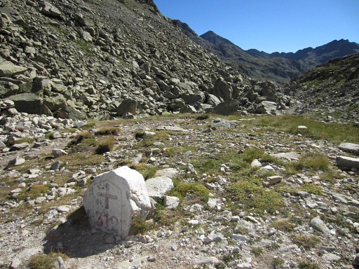
Bm312 |
 |
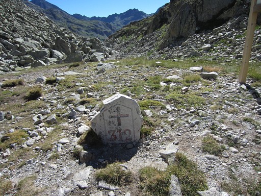
Bm312 |
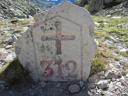 |
Bm312 - closeup |
 |
Then on an easy but long, long trail |
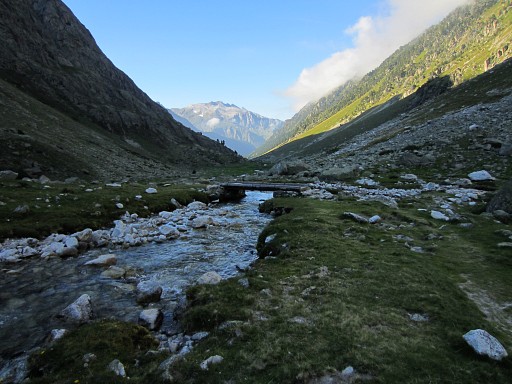 |
descending back to my car. Finally hurrying to find a camping in Arrens-Marsou before dusk. I end up on Camping Mialanne. |