|
The
bordermarkers of the Pyrenees : all my trips
 |
|
| -
wednesday 31 august
2022 - Redoing bm602 by swimming - failed trial |
 |
 |
Summary:
part of a series of 9 daytrips in august & september 2022 across
the Pyrenees. The main goal was to finish my plan to have visited all
bordermarkers at least twice. It was also a kind of sentimental farewell journey, visiting old friends and cherished places. This is daytrip 6. Today: I try to swim to bm602 but I left too far away from the cave. Also the sea was rougher than expected. So I abort my swim and return. Weather: overcast |
 track-20220831.kml
(click to open this trip in Google Earth or copy link to Google Maps; click right on this link to download gpx-version). The gps-track has not been manually corrected which explains the inaccuracy and misalignment at some points. For cartographic backgrounds: see the cartography-page Gps-waypoints of all bordermarkers (most recent version): kml: esfr-bordermarkers-all-waypoints.kml gpx: esfr-bordermarkers-all-waypoints.gpx (with elevation added by gpsvisualizer.com) |
|
 |
According to Garmin
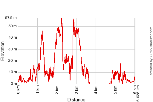
Basecamp (uncorrected track with elevation added by Gpsvisualizer.com): Distance: 6,0 km Max-height: 57m Min-height: 0m Elevation: +558m -558m Total elevation: 1116m Start 12:18 Finish 15:48 Total time: 3:30 |
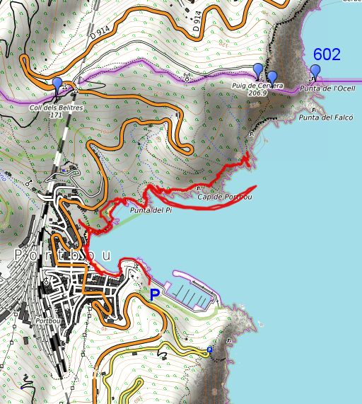
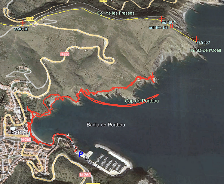
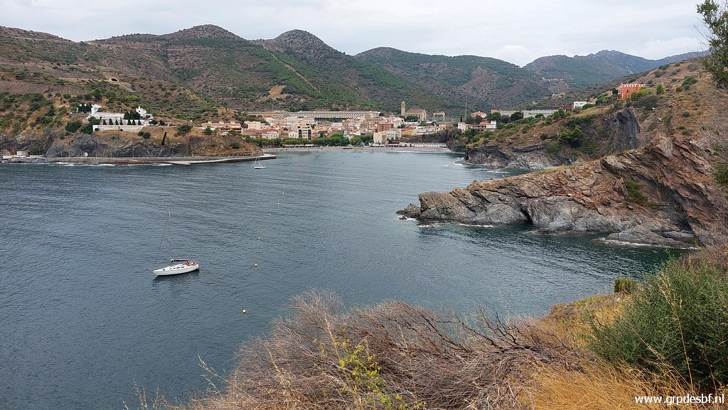
 | Coming from the Cerdagne, I drive straight to Port Bou because of the favourable weather forecasts. Parking at the large P near the harbor and walking along the coast (click photo to enlarge) |
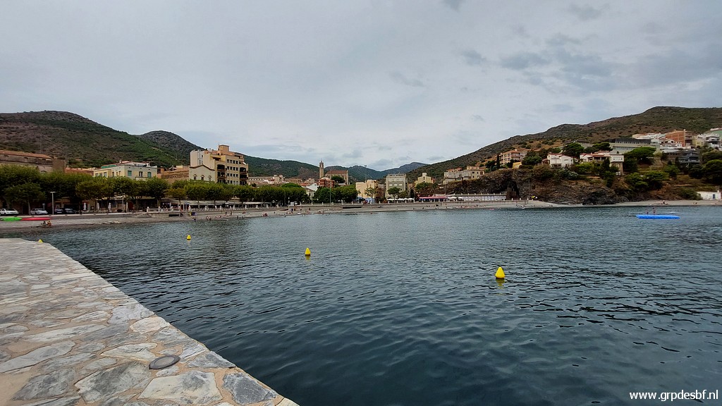
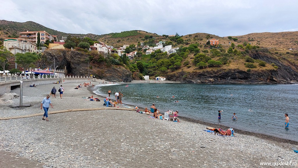 | and beach (click photo to enlarge) |
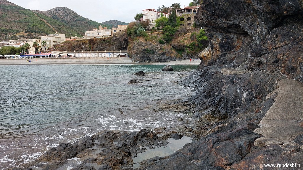
 | and picking up a trail at the other side of the bay. (click photo to enlarge) |
 | That trail - winding and going up and down - brings me (click photo to enlarge) |
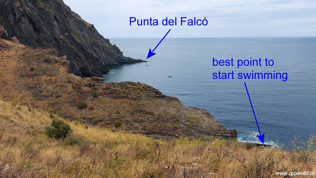
 | to this point of departure. This is where Corinne Gourgeonnet and her son Arthur left twice for their swimming to bm602. But I find the sea at this point too rough and the coast too rocky and slippery. (click photo to enlarge) |
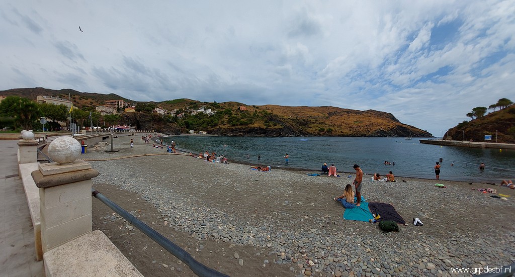
 | I have passed a beach earlier and that could be a better place to start, I thought. (click photo to enlarge) |
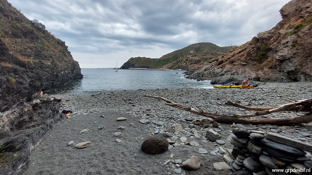 | This is that beach. I put on my wetsuit, fill my swimming buoy and leave my clothes in a backpack behind. (click photo to enlarge) |
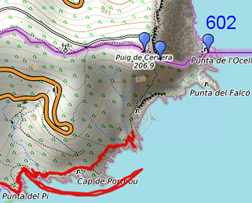 |
And I start swimming around 14:00 But the sea sways more than I expected and when I note that I approach my original point of departure, I see on my sports watch that I already swum ± 500m. The cave with bm602 is still 750m further and that will be too much. So I stop and return to the beach in an even more swaying sea. |
 | Returning to Port Bou (click photo to enlarge) |
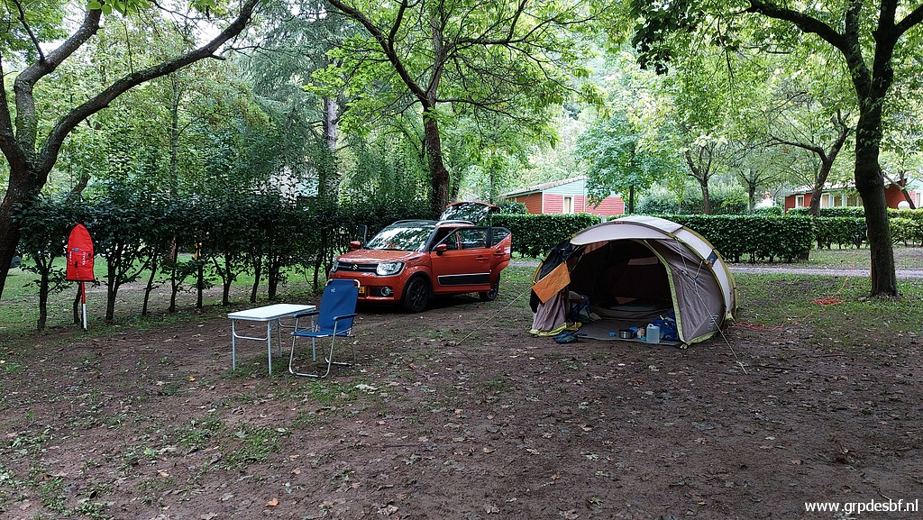 | and driving to camping Verte Rive in St-Laurent-de-Cerdans, my basecamp for the next days. (click photo to enlarge) |