|
The
bordermarkers of the Pyrenees : the GRPdesBF
 |
||||||||||||||||||||||||||||||||||||||||||||||||||||||||||||||||||||||||||||||||||||||||||||||
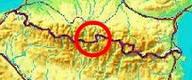
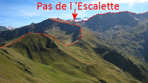
| - stage 28 - Pas de l'Escalette - Col du Portillon (bm333-366) |
 |
|||||||||||||||||||||||||||||||||||||||||||||||||||||||||||||||||||||||||||||||||||||||||||||
 |
||||||||||||||||||||||||||||||||||||||||||||||||||||||||||||||||||||||||||||||||||||||||||||||
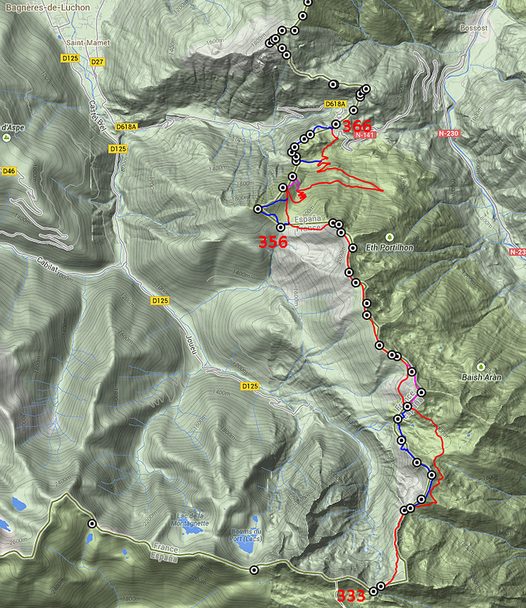
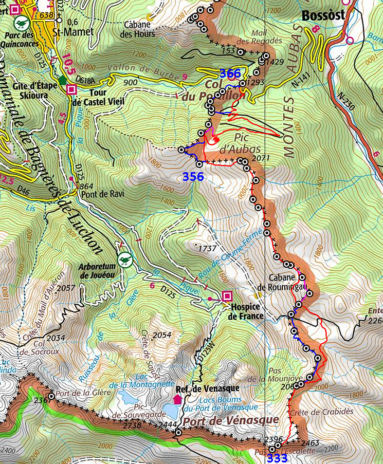
| Only
the bordermarkers along this stage are shown (and some adjoining ones).
The main route is red,
the variants have other colors. The main route provides a smooth
on-going route along most bordermarkers, the variants give access to
the remaining bordermarkers. See the GRPdesBF-principles. Click here for an fullscreen interactive map. In short The first part is essentially an extended walk along and over the borderridge from bm333 to 355. The main route avoids some hillpeaks before sticking to the ridge from bm344 onwards. Two variants take care of the missing bordermarkers in between. This part is quite up and down and can be tiring. When having arrived at Col de Barèges, a small variant covers bm356-357. Things get tougher beyond bm358 with the variant doing bm359 on the steep and difficult hillside. The main route descends easily along a dirtroad towards Col du Portillon (bm366). The last variant takes a detour through the forest to cover bm360-365 Considerations Walking on the borderridge can be tricky in bad weather. Be careful. Water is available NW of bm340 at the small valley of Roumingou and at Col de Barèges which both offer nice bivouac possibilities. Downhill from Col de Barèges, there are more streams. There's a suitable bivouac spot (flat & grassy) besides the dirtroad before the bend in the largest lacelet (at 1530m). At Col du Portillion, there's no water neither an appropiate spot for a bivouac. However, hitchhiking hence and forth to Bagnères-du-Luchon (camping, shops) is not difficult. You might also continue on the next stage for ± 1h where 100m N of bm373, there's an open space and a stream nearby. Factsheet
Gps-files needed
Version 02 July 2014. If you have any correction, suggestion etcetera -> please email me: eefberns@grenspalen.nl MAPS AND DIRECTIONS You might check the relevant webpages in the 'All markers'-section and 'All my trips'-section for more pictures of the bordermarkers and wayfinding-issues. Print your own maps It's easy to print your own - custom made - maps with the GRPdesBF-route and the bordermarkers on them. See: Print your own maps |
||||||||||||||||||||||||||||||||||||||||||||||||||||||||||||||||||||||||||||||||||||||||||||||
 |
||||||||||||||||||||||||||||||||||||||||||||||||||||||||||||||||||||||||||||||||||||||||||||||
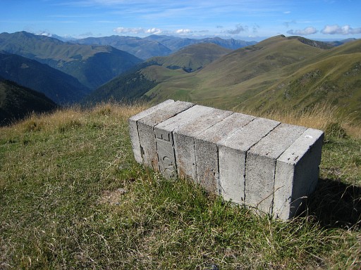
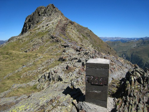 |
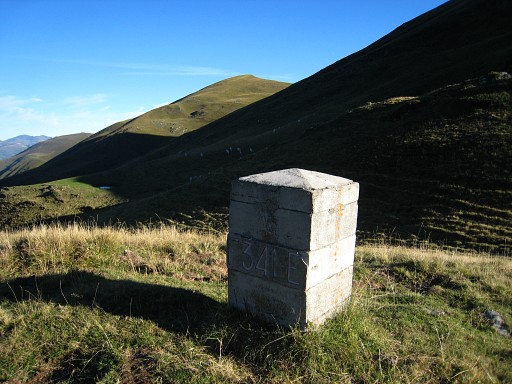
The starting point: Pas de l'Escalette with bm333, a few meters off the path. On the summit in the background is bm334 |
|||||||||||||||||||||||||||||||||||||||||||||||||||||||||||||||||||||||||||||||||||||||||||||
 |
Bm334, also off the path |
|||||||||||||||||||||||||||||||||||||||||||||||||||||||||||||||||||||||||||||||||||||||||||||
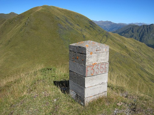 |
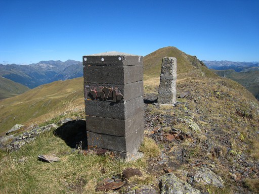
Then it’s
approximately 2km N along the trail. Bm335 is to the right of the trail, uphill on the hillridge. |
|||||||||||||||||||||||||||||||||||||||||||||||||||||||||||||||||||||||||||||||||||||||||||||
 |
The trail then bends to the right and descends to
bm336 on Pas de
la Mounjoye. Here starts variant 1, climbing the steep hill (Pic de la Mounjoye) in front of you. The main route takes it easy and curves along the eastern hillside of the Pic, then remaining on the Spanish hillsides and winding to the gentle valley of Roumingou. This is an interesting part in terms of delimitation: the borderline leaves the watershed for a while. |
|||||||||||||||||||||||||||||||||||||||||||||||||||||||||||||||||||||||||||||||||||||||||||||
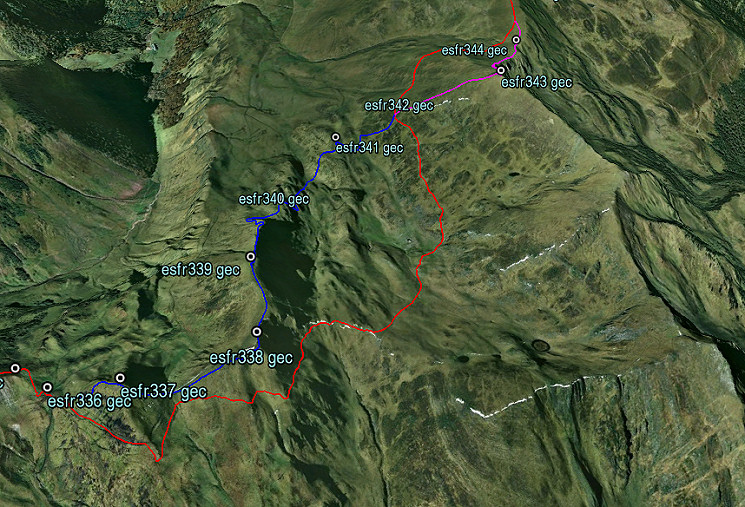 Let's show it on this Google Earth screenshot: viewing NW. You can see that the watershed between ± bm338 and bm343 is on Spanish territory. The blue and purple variant follow more or less the official borderline. You might search for an unnumbered bordercross which is between bm340 and 341 on a rock along the trail which leaves the Roumingou-valley to the NW. |
||||||||||||||||||||||||||||||||||||||||||||||||||||||||||||||||||||||||||||||||||||||||||||||
| Variant 1 via bm337-341 |
||||||||||||||||||||||||||||||||||||||||||||||||||||||||||||||||||||||||||||||||||||||||||||||
 |
This variant starts with a
steep climb to get on he Pic de Mounjoye. On the pic: bm337 |
|||||||||||||||||||||||||||||||||||||||||||||||||||||||||||||||||||||||||||||||||||||||||||||
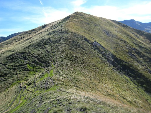 |
Looking forward along the border-ridge to Pic de Roye with | |||||||||||||||||||||||||||||||||||||||||||||||||||||||||||||||||||||||||||||||||||||||||||||
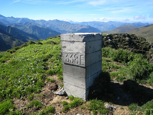 |
Bm338 |
|||||||||||||||||||||||||||||||||||||||||||||||||||||||||||||||||||||||||||||||||||||||||||||
 |
A fine view back at the borderridge (the red line = the borderline). | |||||||||||||||||||||||||||||||||||||||||||||||||||||||||||||||||||||||||||||||||||||||||||||
 |
Further on at the ridge: bm339 Then - at the end of the ridge - there's a steep slope. Descend at the west-side of it and continue |
|||||||||||||||||||||||||||||||||||||||||||||||||||||||||||||||||||||||||||||||||||||||||||||
 |
to spot bm340 in the distance | |||||||||||||||||||||||||||||||||||||||||||||||||||||||||||||||||||||||||||||||||||||||||||||
 |
Bm340 |
|||||||||||||||||||||||||||||||||||||||||||||||||||||||||||||||||||||||||||||||||||||||||||||
 |
Bm340. Looking back to that (too) steep hill slope. From bm340, wind downhill to the valley of Roumingou. |
|||||||||||||||||||||||||||||||||||||||||||||||||||||||||||||||||||||||||||||||||||||||||||||
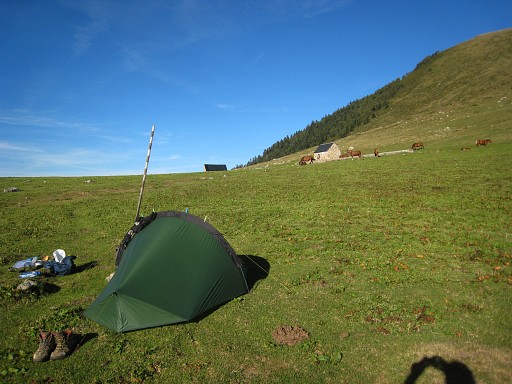
 |
The Roumingou-valley makes a perfect spot for a bivouac. | |||||||||||||||||||||||||||||||||||||||||||||||||||||||||||||||||||||||||||||||||||||||||||||
 |
From the valley, climb N towards bm341 |
|||||||||||||||||||||||||||||||||||||||||||||||||||||||||||||||||||||||||||||||||||||||||||||
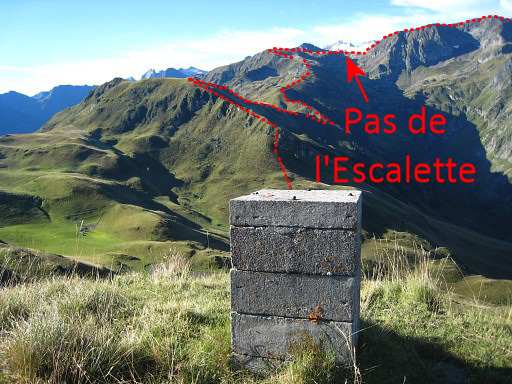 |
Bm341, looking back
at the borderridge of yesterday, up to Pas de l'Escalette. Then find your way uphill to the NE towards bm342. You will meet the main route and that's where this variant ends (and the next one starts) |
|||||||||||||||||||||||||||||||||||||||||||||||||||||||||||||||||||||||||||||||||||||||||||||
 |
Bm342 is a short climb NE (50m distance, 30m higher) from the main route. If you want to do the next variant, you have to climb from bm342 further NE to Pic de Poulain (bm343) |
|||||||||||||||||||||||||||||||||||||||||||||||||||||||||||||||||||||||||||||||||||||||||||||
| Variant 2 via bm343 |
||||||||||||||||||||||||||||||||||||||||||||||||||||||||||||||||||||||||||||||||||||||||||||||
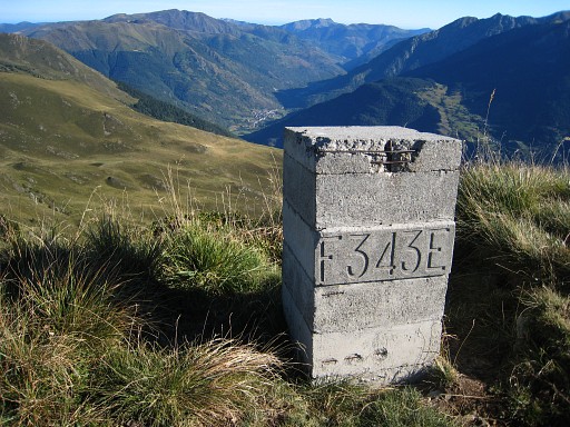 |
From bm342 climb further NE to Pic de Poulain with bm343. Then descend along the ridge to the N. At Pas de Vilamos, you'll be back at the main route. |
|||||||||||||||||||||||||||||||||||||||||||||||||||||||||||||||||||||||||||||||||||||||||||||
 |
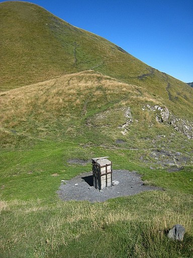
There's a surprise at Pas de Vilamos: bm344 is a cross. |
|||||||||||||||||||||||||||||||||||||||||||||||||||||||||||||||||||||||||||||||||||||||||||||
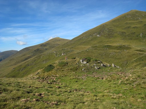
 |
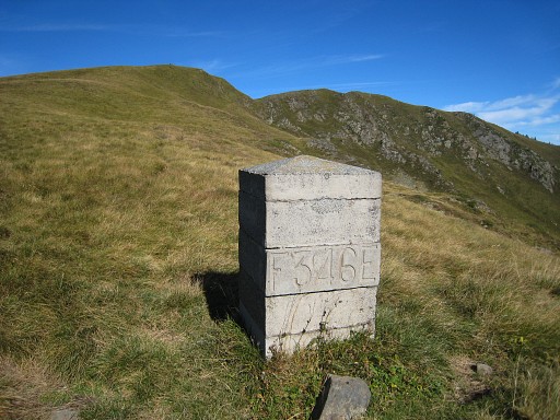
Then - up to bm355 - you can follow the borderridge from bm to bm. There are trails which often go just underneath the ridge (and bordermarkers) This is bm345 |
|||||||||||||||||||||||||||||||||||||||||||||||||||||||||||||||||||||||||||||||||||||||||||||
 |
Bm346 |
|||||||||||||||||||||||||||||||||||||||||||||||||||||||||||||||||||||||||||||||||||||||||||||
 |
Bm347 |
|||||||||||||||||||||||||||||||||||||||||||||||||||||||||||||||||||||||||||||||||||||||||||||
 |
Bm348, is wrong indicated at the French map. It's not at Pic de Campsaure but close to Passage d’Arrou to the N. | |||||||||||||||||||||||||||||||||||||||||||||||||||||||||||||||||||||||||||||||||||||||||||||
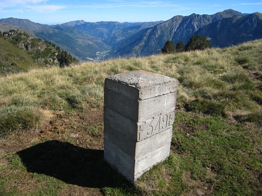 |
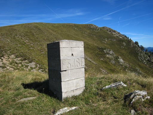
Bm349 |
|||||||||||||||||||||||||||||||||||||||||||||||||||||||||||||||||||||||||||||||||||||||||||||
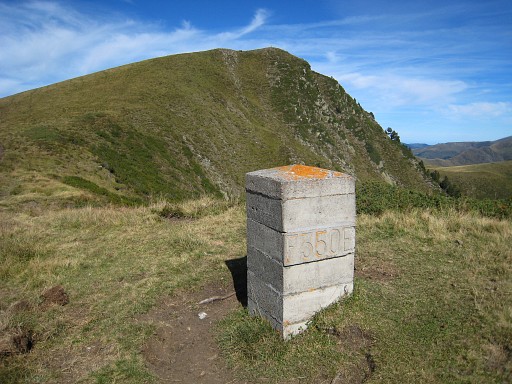 |
Bm350 |
|||||||||||||||||||||||||||||||||||||||||||||||||||||||||||||||||||||||||||||||||||||||||||||
 |
Bm351 |
|||||||||||||||||||||||||||||||||||||||||||||||||||||||||||||||||||||||||||||||||||||||||||||
 |
Bm352 |
|||||||||||||||||||||||||||||||||||||||||||||||||||||||||||||||||||||||||||||||||||||||||||||
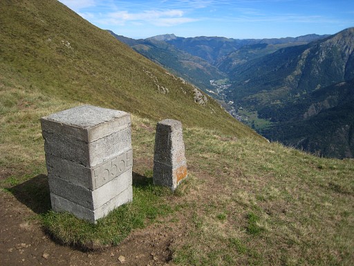
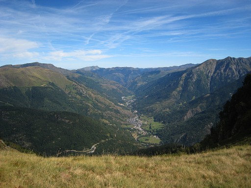 |
A bit further on: looking northwards into the valley from Bossòst to the border near Canejan. | |||||||||||||||||||||||||||||||||||||||||||||||||||||||||||||||||||||||||||||||||||||||||||||
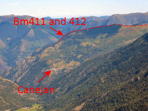 |
A further zoom-in
in which Canejan and the borderline are well visible. That will be your terrain on stage 31. |
|||||||||||||||||||||||||||||||||||||||||||||||||||||||||||||||||||||||||||||||||||||||||||||
 |
Bm353 |
|||||||||||||||||||||||||||||||||||||||||||||||||||||||||||||||||||||||||||||||||||||||||||||
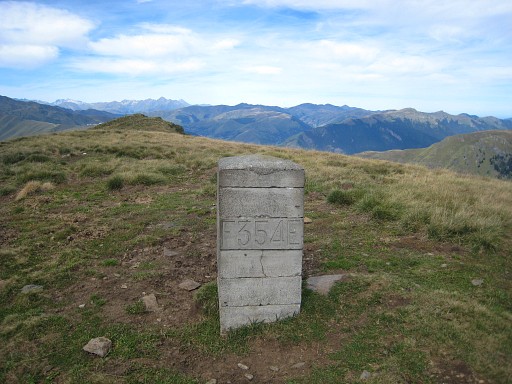 |
Bm354 |
|||||||||||||||||||||||||||||||||||||||||||||||||||||||||||||||||||||||||||||||||||||||||||||
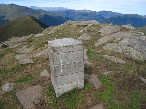 |
Bm355 You have to leave the ridge here and descend E to |
|||||||||||||||||||||||||||||||||||||||||||||||||||||||||||||||||||||||||||||||||||||||||||||
 |
Col de Barèges towards its cabins (visible in the background). |
|||||||||||||||||||||||||||||||||||||||||||||||||||||||||||||||||||||||||||||||||||||||||||||
| Variant 3 via bm356-357 |
||||||||||||||||||||||||||||||||||||||||||||||||||||||||||||||||||||||||||||||||||||||||||||||
 |
Bm356 is on the Col de Barèges but too far away from the main route (200m SW of the cabins) to be part of it. |
|||||||||||||||||||||||||||||||||||||||||||||||||||||||||||||||||||||||||||||||||||||||||||||
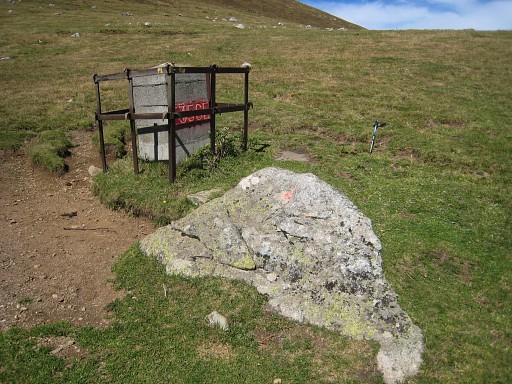 |
On the rock besides the bm, there are old engravings. The rock is a centuries-old bordermarker. See fore more details: this page |
|||||||||||||||||||||||||||||||||||||||||||||||||||||||||||||||||||||||||||||||||||||||||||||
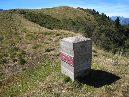 |
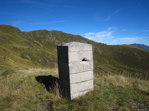
Bm357 is on the hillridge, ± 600 to the NW of bm356. Now descend NEE along the ridge and connect with the dirtroad which is the main route. |
|||||||||||||||||||||||||||||||||||||||||||||||||||||||||||||||||||||||||||||||||||||||||||||
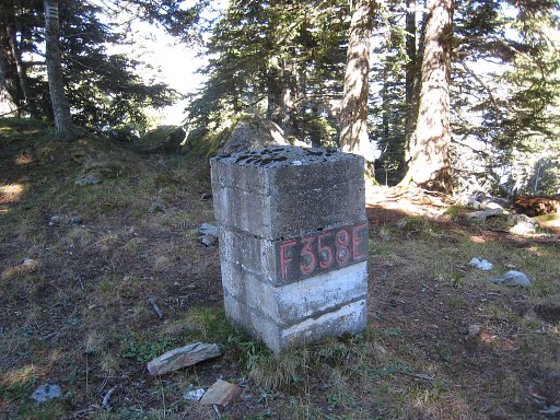 |
We
are back at the main route. Go down the dirtroad. Approximately 25m
before the first bend, bm358 is to the left (W), 50m from the dirtroad
in the forest. At the bend of the dirtroad, variant 4 starts. The main route continues easily on the dirtroad descending on lacelets to a parking spot where variant 3 will connect again. |
|||||||||||||||||||||||||||||||||||||||||||||||||||||||||||||||||||||||||||||||||||||||||||||
| Variant 4 via bm359 |
||||||||||||||||||||||||||||||||||||||||||||||||||||||||||||||||||||||||||||||||||||||||||||||
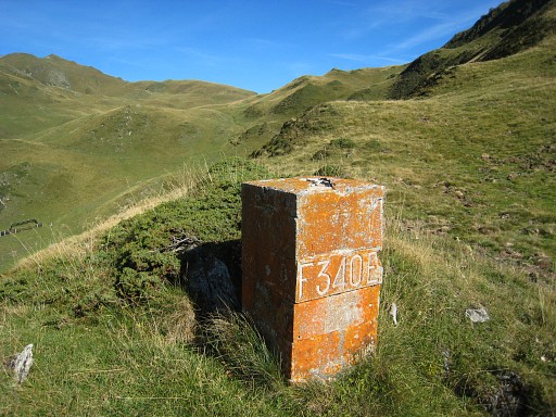
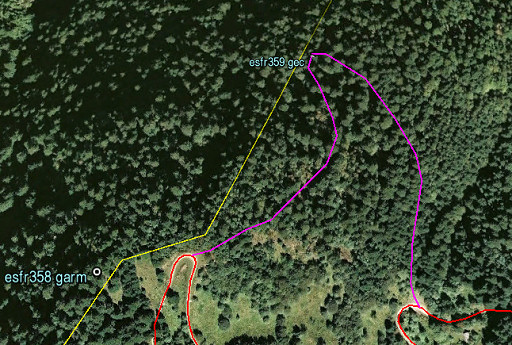 |
Bm359 is one of the most difficult bm's to reach. It's on a steep and risky hillside, so take care. Access in this area is complicated by the effects of the ferocious Xinthia-storm in february 2010. Many trees have fallen down, blocking a straightforward route to bm359. There are no trails. Without a gps, finding bm359 requires a lot of luck though the large rectangular rockface itself is a striking one and unique on this hillside. |
|||||||||||||||||||||||||||||||||||||||||||||||||||||||||||||||||||||||||||||||||||||||||||||
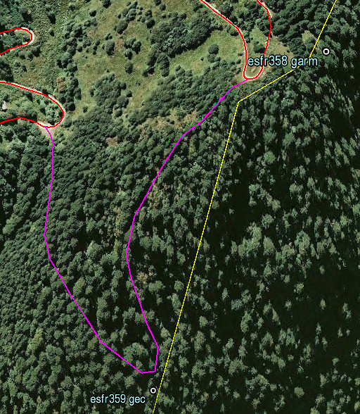 |
This Google Earth-screenshot (view is N->S) shows the elevation better. My proposed route avoids the steep straight borderline between bm358 and 359 by doing a curve. In a straigh line from the dirtroad it's ± 225m in horizontal distance but ± 200m elevation drop. |
|||||||||||||||||||||||||||||||||||||||||||||||||||||||||||||||||||||||||||||||||||||||||||||
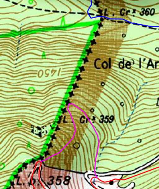 |
The variant projected on the French topographic map. An alternative could be a hence & forth trip from where the variant ends (parking lot) but the essential problem remains the same: the fallen trees. |
|||||||||||||||||||||||||||||||||||||||||||||||||||||||||||||||||||||||||||||||||||||||||||||
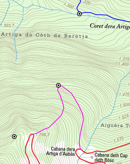 |
And projected on the Catalonian topographic map with its precise elevation lines. You can see better how my proposed curve avoids some very steep parts. |
|||||||||||||||||||||||||||||||||||||||||||||||||||||||||||||||||||||||||||||||||||||||||||||
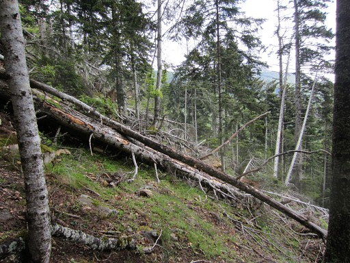 |
A direct descent from bm358 towards 359 soon gets too steep. It's easier to enter the forest a bit beyond the bend in the dirtroad. There are fallen trees everywhere, making progress difficult. |
|||||||||||||||||||||||||||||||||||||||||||||||||||||||||||||||||||||||||||||||||||||||||||||
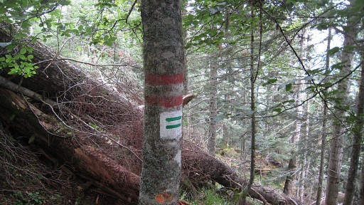 |
What can be helpful: these red and green-white stripes on
the trees. They indicate the borderline according to the foresters. When doing my curved descent, you have to spot these stripes when getting close to bm359. The rockwall with bm359 is however ± 50m E of this "divisoria"-line! |
|||||||||||||||||||||||||||||||||||||||||||||||||||||||||||||||||||||||||||||||||||||||||||||
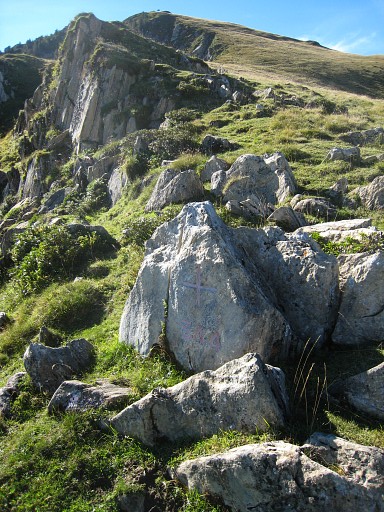
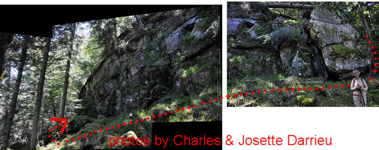 Without a gps, finding bm359 requires a lot of luck though the large rectangular rockface itself is a striking one and unique on this hillside. Let's show the rockface on this panorama with the route followed by the Darrieu's. |
||||||||||||||||||||||||||||||||||||||||||||||||||||||||||||||||||||||||||||||||||||||||||||||
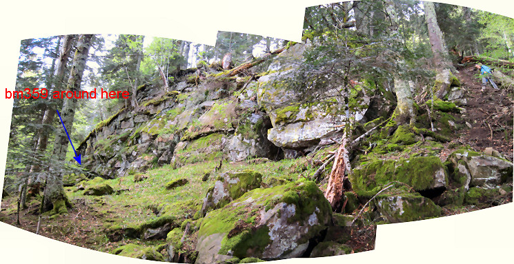 And the same scene on this panorama. |
||||||||||||||||||||||||||||||||||||||||||||||||||||||||||||||||||||||||||||||||||||||||||||||
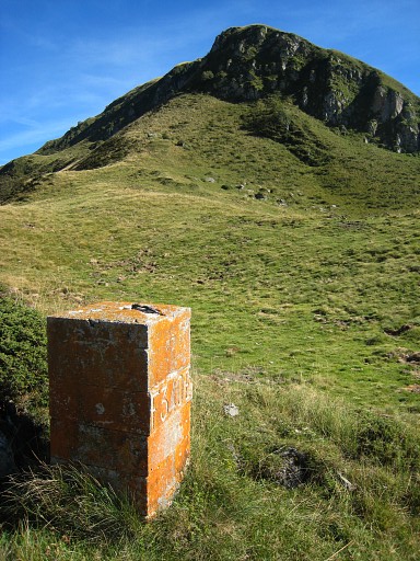
 |
Bm359 What strikes: no number. But description and distance from bm358 fit. The distance has been remeasured with cords by Jean Sermet and Charles Darrieau. But I have still doubts if this is really the spot where originally bm359 was engraved. See this this page for my thoughts about this matter. For the time being, I assume that this is bm359 and you can't do without if you want to visit all the Pyrenean bordermarkers. |
|||||||||||||||||||||||||||||||||||||||||||||||||||||||||||||||||||||||||||||||||||||||||||||
 |
A view down the hillside. It's steep but to be honest, not much steeper then the hillside above. Perhaps it's possible to descend directly to bm360. |
|||||||||||||||||||||||||||||||||||||||||||||||||||||||||||||||||||||||||||||||||||||||||||||
 |
When traversing to the dirtroad, you have to find your way by trial and error. Sometimes through fields of fallen trees, helped by game trails through them. |
|||||||||||||||||||||||||||||||||||||||||||||||||||||||||||||||||||||||||||||||||||||||||||||
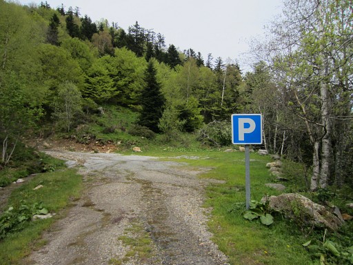 |
This is the parking where variant 4 emerges from the forest. We are back on the main route. Descending along the dirtroad is the easiest route to Col du Portillon. There are shortcut-trails linking the lacets but that won't give you much benefit in time. |
|||||||||||||||||||||||||||||||||||||||||||||||||||||||||||||||||||||||||||||||||||||||||||||
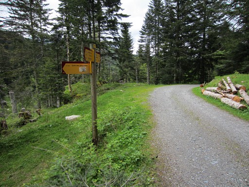 |
Then - after ± 4km - you will see this signpost. Go to the left for variant 5. Straight on will bring you to |
|||||||||||||||||||||||||||||||||||||||||||||||||||||||||||||||||||||||||||||||||||||||||||||
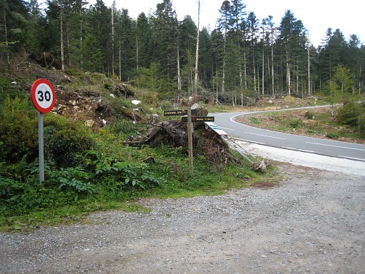 |
this junction with the tarmac road. Col du Portillon is to the left (± 400m) |
|||||||||||||||||||||||||||||||||||||||||||||||||||||||||||||||||||||||||||||||||||||||||||||
| Variant 5 via bm360-365 |
||||||||||||||||||||||||||||||||||||||||||||||||||||||||||||||||||||||||||||||||||||||||||||||
|
From this signpost (pointing to Còth des Artiguetes) there's a trail going W. |
|||||||||||||||||||||||||||||||||||||||||||||||||||||||||||||||||||||||||||||||||||||||||||||
 |
That trail leads you to an open grassy space, a bit rerouted because
of the fallen trees. It goes along the right side of the open space, then along a tiny stream until you reach bm360. |
|||||||||||||||||||||||||||||||||||||||||||||||||||||||||||||||||||||||||||||||||||||||||||||
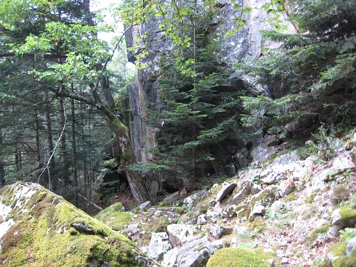
 |
From bm360, various red stripes and waymarks will bring you uphill to the N. |
|||||||||||||||||||||||||||||||||||||||||||||||||||||||||||||||||||||||||||||||||||||||||||||
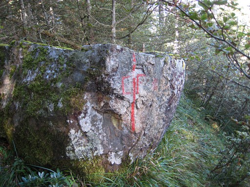
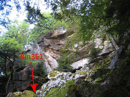 |
Bm361 is under a large overhanging rock wall. | |||||||||||||||||||||||||||||||||||||||||||||||||||||||||||||||||||||||||||||||||||||||||||||
 |
The red color of bm361 is visible through the pine tree. | |||||||||||||||||||||||||||||||||||||||||||||||||||||||||||||||||||||||||||||||||||||||||||||
 |
Bm361 |
|||||||||||||||||||||||||||||||||||||||||||||||||||||||||||||||||||||||||||||||||||||||||||||
 |
Red stripes and
crosses will help you again, now to get to bm362 (± 125m to the NW) in a slight curve. |
|||||||||||||||||||||||||||||||||||||||||||||||||||||||||||||||||||||||||||||||||||||||||||||
 |
Bm362 |
|||||||||||||||||||||||||||||||||||||||||||||||||||||||||||||||||||||||||||||||||||||||||||||
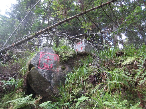
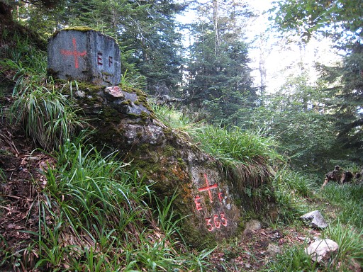 |
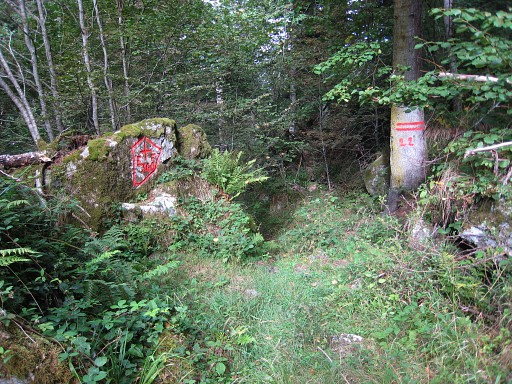
Bm363 (± 100m to the NNE) is easier to find since it has a borderstone on top of a bordercross. | |||||||||||||||||||||||||||||||||||||||||||||||||||||||||||||||||||||||||||||||||||||||||||||
 |
This picture: somewhere in the forest, indicator of the border. It's located 108m from bm363 and ± 4m west from the
dirtroad |
|||||||||||||||||||||||||||||||||||||||||||||||||||||||||||||||||||||||||||||||||||||||||||||
 |
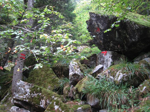
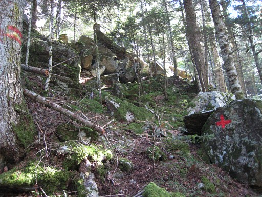
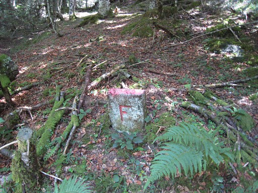
Bm364 is unfindable and has possibly been destroyed when the forest road was constructed. The position of bm364 can be established quite exact, taking in account the distances from bm363 and bm365 to bm364 as mentioned in the Procès-Verbal and the red stripes on trees in between. But - as said - it's unfindable. |
|||||||||||||||||||||||||||||||||||||||||||||||||||||||||||||||||||||||||||||||||||||||||||||
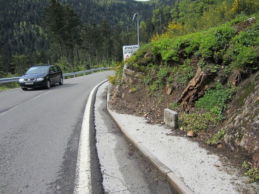
 |
Bm365 is several meters above the S-roadside. | |||||||||||||||||||||||||||||||||||||||||||||||||||||||||||||||||||||||||||||||||||||||||||||
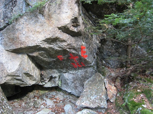
 |
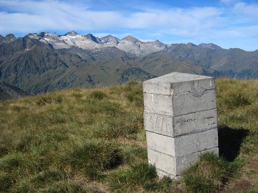
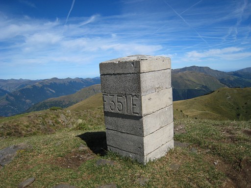
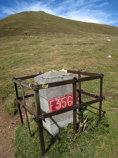
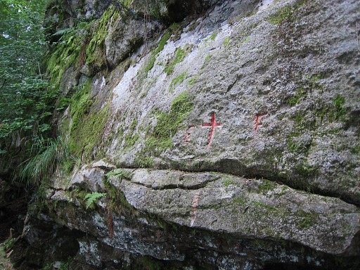
Between bm365 and 366
there are several of these intermediate bordermarkers with an F on
one side and an E on the other side. On 20110901 I counted 4 of them and probably some others didn't survive the Xynthia-storm of february 26th, 2010. I remember spotting more than 4 markers on previous visits. But Jacques Koleck reports having found 9 markers and I guess that happened in 2010 when he searched for bm364. |
|||||||||||||||||||||||||||||||||||||||||||||||||||||||||||||||||||||||||||||||||||||||||||||
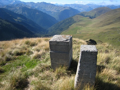
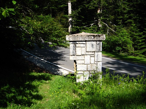 |
Then the dirroad/trail meets the tarmac road with this peculiar triangular border-pillar. At the tarmac road, you are back on the main route |
|||||||||||||||||||||||||||||||||||||||||||||||||||||||||||||||||||||||||||||||||||||||||||||
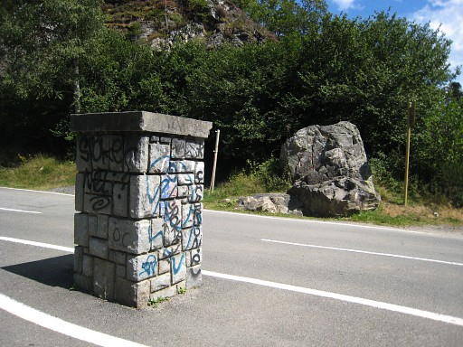
 |
You are close to Col du Portillon. This picture (looking S): another unnumbered F/E-marker. So the borderline goes along the western roadside, |
|||||||||||||||||||||||||||||||||||||||||||||||||||||||||||||||||||||||||||||||||||||||||||||
 |
heading to this unnumbered marker (similar to the previous triangular one) on the Col. It then crosses the road to the rock on the other side where |
|||||||||||||||||||||||||||||||||||||||||||||||||||||||||||||||||||||||||||||||||||||||||||||
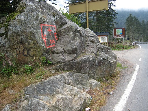 |
bm366 is. |
|||||||||||||||||||||||||||||||||||||||||||||||||||||||||||||||||||||||||||||||||||||||||||||