|
The
bordermarkers of the Pyrenees : the GRPdesBF
 |
|||||||||||||||||||||||||||||||||||||||||||||||||||||||||||||||||||
| -
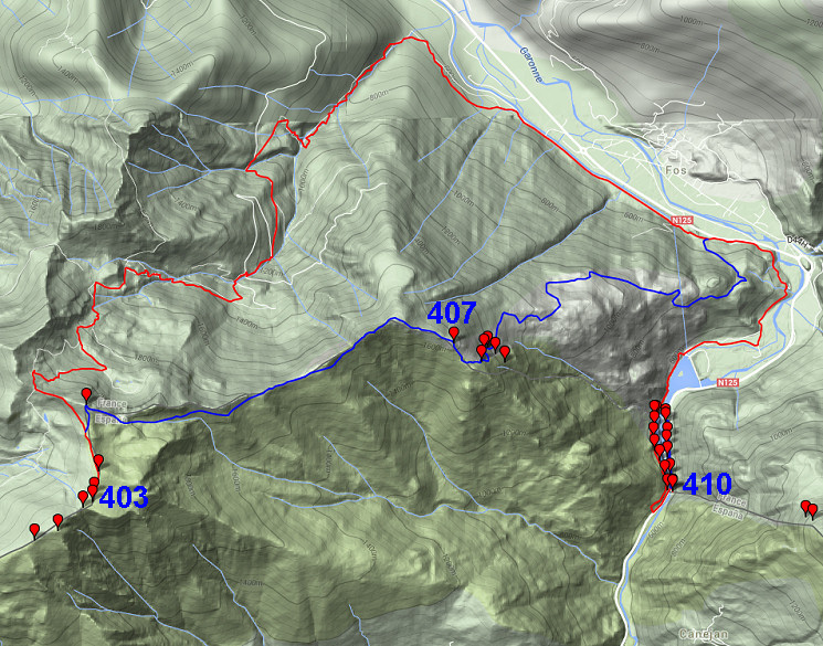
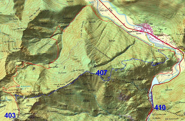
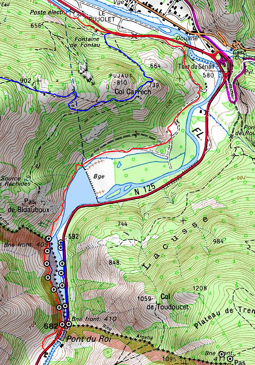
stage 30 - Plan de Cigalèra - Pont du Roi (bm403-410) |
 |
||||||||||||||||||||||||||||||||||||||||||||||||||||||||||||||||||
 |
|||||||||||||||||||||||||||||||||||||||||||||||||||||||||||||||||||
| Only
the bordermarkers along this stage are shown (and some adjoining ones).
The main route is red,
the variants have other colors.
The main route provides a smooth
on-going route along most bordermarkers, the variants give access to
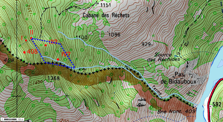
the remaining bordermarkers. See the GRPdesBF-principles. Click here for an fullscreen interactive map. In short The main route is for a large part a descent along the GR10-trail and then along the barrage of Plan d'Arem and the Garonne to Pont du Roi (bm410). Wayfinding: no problem. The large variant 1 from bm406 onwards is a different story. The route along the ridge from bm406 until bm407 is straightforward and with simple directions you will easily reach bm408. But finding bm408 I and II is more difficult on the steep hillside. Bm408 III and IV have been never found but you might give it your own try. From the cabin of Héréchet there's an easy trail descending to the main route. Variant 2 is a short trip up and down the N125, doing the submarkers on the French bank of the Garonne. Considerations When arriving at Pont du Roi, there's no spot for a bivouac. In the village of Fos, the camping has closed but there's still a Gîte d'Étappe. Earlier on variant 1 there´s the nice Cabane de Hérechet. Along the Garonne towards bm409 there are some bivouac opportunities, the best spot might be next to bm409 with fresh water from the Ruisseau du Terme. Factsheet
Gps-files needed
Version 03 December 2014. If you have any correction, suggestion etcetera -> please email me: eefberns@grenspalen.nl MAPS AND DIRECTIONS You might check the relevant webpages in the 'All markers'-section and 'All my trips'-section for more pictures of the bordermarkers and wayfinding-issues. Print your own maps It's easy to print your own - custom made - maps with the GRPdesBF-route and the bordermarkers on them. See: Print your own maps |
|||||||||||||||||||||||||||||||||||||||||||||||||||||||||||||||||||
 |
|||||||||||||||||||||||||||||||||||||||||||||||||||||||||||||||||||
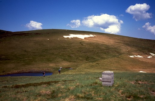 |
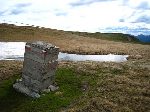
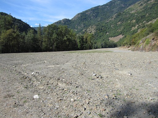
Bm403 In fact, this stage starts at the small lake downhill next to bm404 but bm403 is within 100m reach of the main route. |
||||||||||||||||||||||||||||||||||||||||||||||||||||||||||||||||||
 |
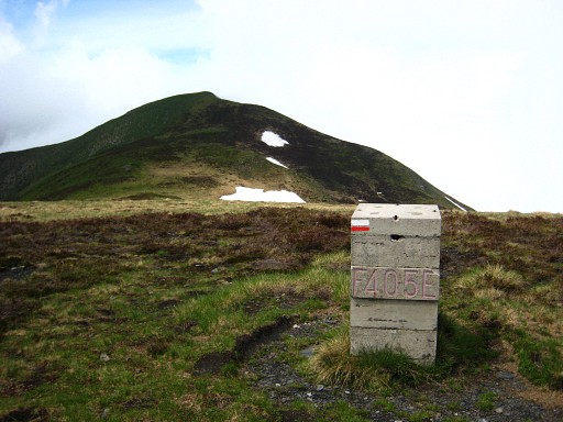
Bm404 Note the white/red waymarks of the GR10 which will be your guidance for a long time (when doing the main route). |
||||||||||||||||||||||||||||||||||||||||||||||||||||||||||||||||||
 |
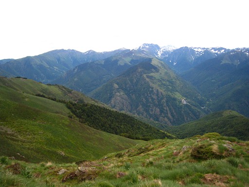
Bm405 Further on, main route and variant 1 will part. Variant 1 will climb to the hilltop (Pic de la Hage) in front with bm406. The main route keeps following the GR10, curving underneath Pic de la Hage to the left. After crossing the Crête de Cigalères, the GR10 descends in a long descent to the Garonne-valley. |
||||||||||||||||||||||||||||||||||||||||||||||||||||||||||||||||||
 |
You will pass two cabins:
the Cabanes des Courraux and this one: Cabane Artiguessans. Having reached the bottom of the valley and the bank of a canal: |
||||||||||||||||||||||||||||||||||||||||||||||||||||||||||||||||||
 |
keep
following the canal to the SE for 1,5km until its beginning. This picture: at this point the GR10 will take another course: towards the village of Fos. The GRPdesBF continues on the dirtroad. After 1,25 km the canal ends, the dirtroad continues. |
||||||||||||||||||||||||||||||||||||||||||||||||||||||||||||||||||
 |
After ±300m variant 1 -
descending from the hillside - will meet the main route. That's about here. |
||||||||||||||||||||||||||||||||||||||||||||||||||||||||||||||||||
| Variant
1 via bm406-408 II |
|||||||||||||||||||||||||||||||||||||||||||||||||||||||||||||||||||
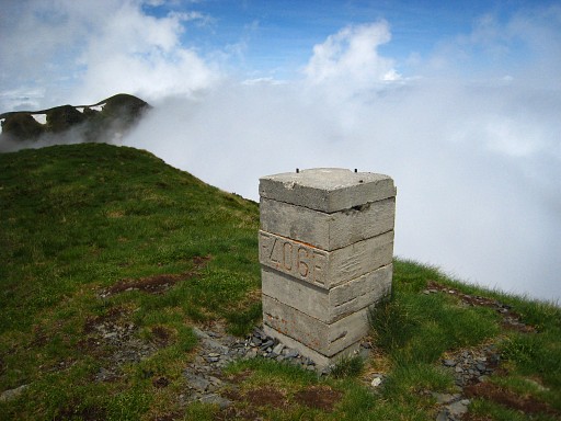 |
Bm406
at Pic de la Hage. |
||||||||||||||||||||||||||||||||||||||||||||||||||||||||||||||||||
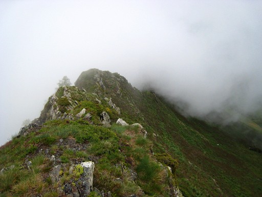 |
Then
follow the ridge to the E, either on the ridge or underneath it when
it gets too
sharp/rocky or when trails underneath are easier. |
||||||||||||||||||||||||||||||||||||||||||||||||||||||||||||||||||
 |
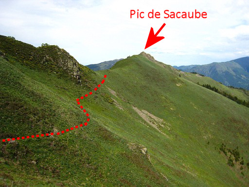
This
picture: probably taken not from the ridge but a bit to the S. It shows the ridge well and the rocky summit of Pic de Sacaube ahead. |
||||||||||||||||||||||||||||||||||||||||||||||||||||||||||||||||||
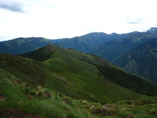
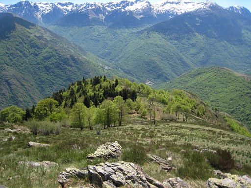
 |
A
view to the SEE with the village of Canejan on the hillside far away.
That is for the next stage. |
||||||||||||||||||||||||||||||||||||||||||||||||||||||||||||||||||
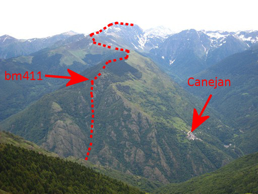 |
A
zoom-in with the borderline indicated. |
||||||||||||||||||||||||||||||||||||||||||||||||||||||||||||||||||
 |
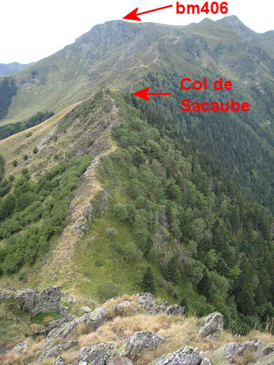
When
getting closer to Pic de Sacaube, the
ridge becomes more narrow and rocky. You might go underneath the ridge there but the Pic de Sacaube itself can be climbed (steeply) from the ridge. |
||||||||||||||||||||||||||||||||||||||||||||||||||||||||||||||||||
 |
Having
climbed up the Pic de Sacaube and looking back. |
||||||||||||||||||||||||||||||||||||||||||||||||||||||||||||||||||
 |
This picture is taken - I think - from Pic de Sacaube, looking in the direction of bm407. | ||||||||||||||||||||||||||||||||||||||||||||||||||||||||||||||||||
 |
A zoom-in | ||||||||||||||||||||||||||||||||||||||||||||||||||||||||||||||||||
 |
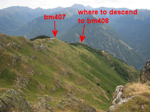
Approaching
bm407, visible in the far distance. |
||||||||||||||||||||||||||||||||||||||||||||||||||||||||||||||||||
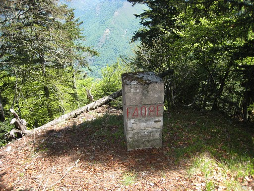
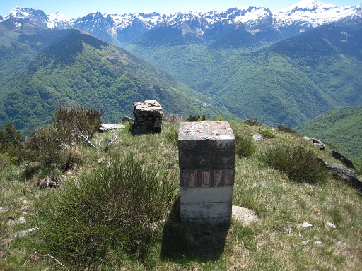 |
Bm407 The original - masonry - version is still there |
||||||||||||||||||||||||||||||||||||||||||||||||||||||||||||||||||
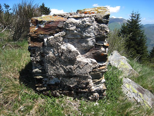 |
with
the remains of an arm on its side. |
||||||||||||||||||||||||||||||||||||||||||||||||||||||||||||||||||
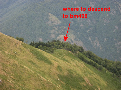
 |
Looking
forward to the descent of the ridge and where to leave the ridge
towards bm408. |
||||||||||||||||||||||||||||||||||||||||||||||||||||||||||||||||||
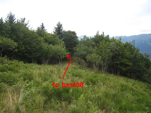 |
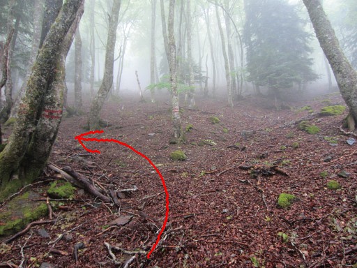
This picture: having descended further. So - when coming from bm407 and before that larger tree - descend NEE to bm408. | ||||||||||||||||||||||||||||||||||||||||||||||||||||||||||||||||||
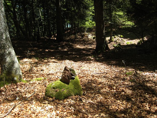 |
This picture: descending to bm408, I created a cairn to help you. | ||||||||||||||||||||||||||||||||||||||||||||||||||||||||||||||||||
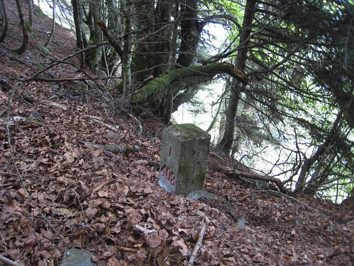
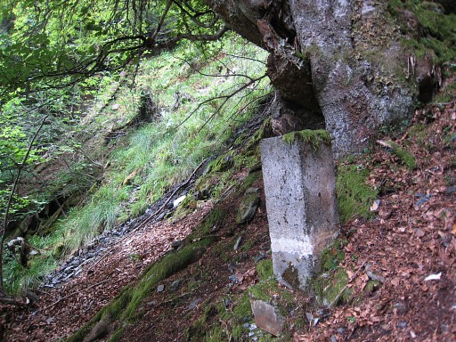
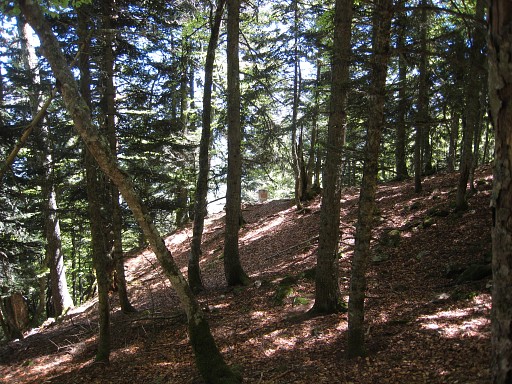 |
Bm408
visible in the distance. |
||||||||||||||||||||||||||||||||||||||||||||||||||||||||||||||||||
 |
Bm408 From bm408 to bm408-I is a difficult search on a steep wooded hillside. The gps is here - in a forest on steep terrain - of limited value. Your ears are as much important in finding the little stream/cascade which springs just underneath bm408-I. |
||||||||||||||||||||||||||||||||||||||||||||||||||||||||||||||||||
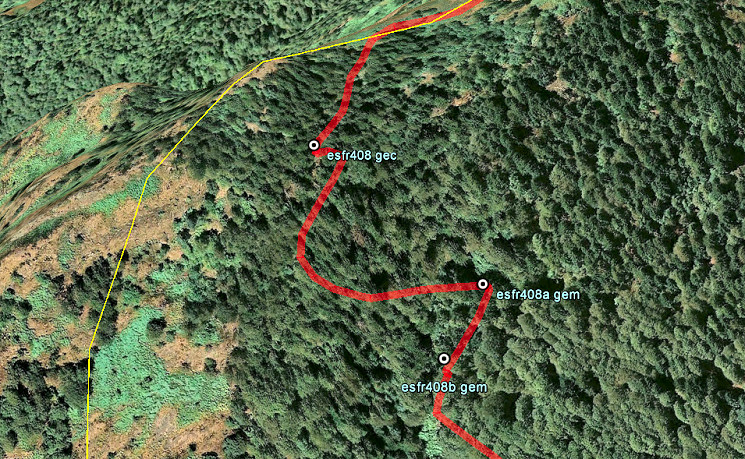 My directions: from bm408 go a bit N (say 20m), there you are able to descend E down the hillside. Descend considerably (± 70m in altitude) to the E, then go N on approximately the same level for ± 125m until you see bm408-I and/or hear the stream. |
|||||||||||||||||||||||||||||||||||||||||||||||||||||||||||||||||||
 |
Bm408
I |
||||||||||||||||||||||||||||||||||||||||||||||||||||||||||||||||||
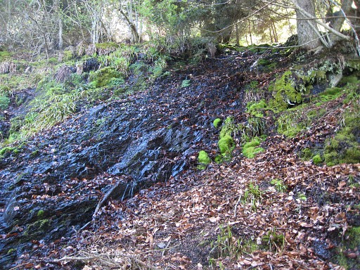
 |
From
bm408-I along the stream (a very steep descent) to 408-II which is at
the left side of the stream which resembles a cascade in its steepness. |
||||||||||||||||||||||||||||||||||||||||||||||||||||||||||||||||||
 |
The
foot of the stream (an open space with
fern) is visible on this picture. |
||||||||||||||||||||||||||||||||||||||||||||||||||||||||||||||||||
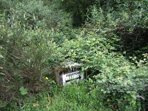
 Bm408-III and IV haven't been found so far. Their history is a peculiar story. See the special page on the submarkers I-IV of bm408. I think these lost bordermarkers were placed in the blue area. You might undertake a search for yourself. |
|||||||||||||||||||||||||||||||||||||||||||||||||||||||||||||||||||
 |
Bm408
III See also the special page on the submarkers I-IV of bm408. |
||||||||||||||||||||||||||||||||||||||||||||||||||||||||||||||||||
|
Bm408
IV See also the special page on the submarkers I-IV of bm408. |
||||||||||||||||||||||||||||||||||||||||||||||||||||||||||||||||||
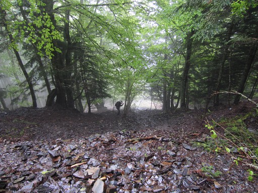
 |
From
the foot of the cascade (this picture), there’s a trail starting to the
left
(N). First vaguely but later more distinct, finishing at the back of Cabane de Hėrechet |
||||||||||||||||||||||||||||||||||||||||||||||||||||||||||||||||||
 |
That
trail merges - after ± 300m - with another trail going downhill
which will bring you to Cabane de Héréchet. At this point, two trees have a double red stripes. This picture: looking back with the arrow showing the branch going left to the cascade. |
||||||||||||||||||||||||||||||||||||||||||||||||||||||||||||||||||
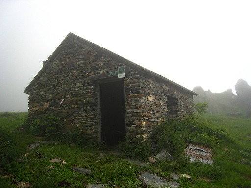
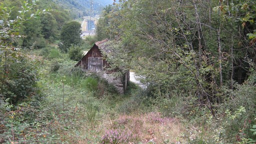
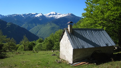 |
The
Cabane de Héréchet is well maintained and clean and there's a
water-supply next to it. |
||||||||||||||||||||||||||||||||||||||||||||||||||||||||||||||||||
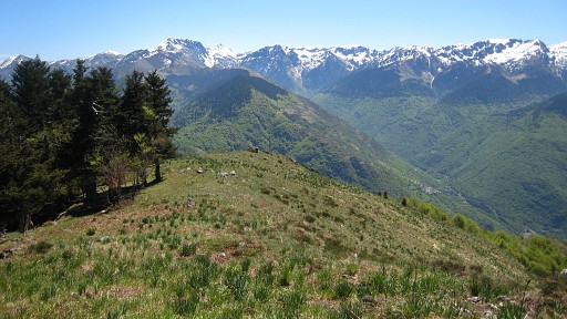
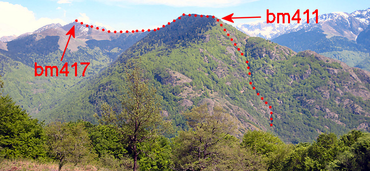 From the cabane this panorama to the SE of the borderline and bordermarkers of the next stage. |
|||||||||||||||||||||||||||||||||||||||||||||||||||||||||||||||||||
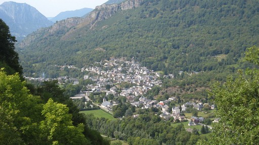 |
From
the cabane, the trail winds downhill. In between this view of the
village of Fos. |
||||||||||||||||||||||||||||||||||||||||||||||||||||||||||||||||||
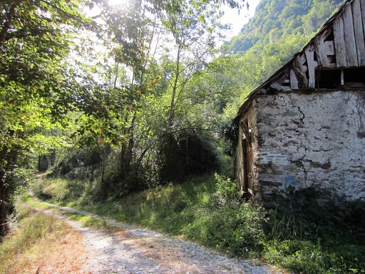
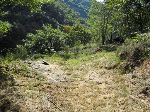
 |
Almost
at the connection with the main route. Before the barn, go right and arrive at the dirtroad and you are back at the main route. |
||||||||||||||||||||||||||||||||||||||||||||||||||||||||||||||||||
| End
of variant 1 |
|||||||||||||||||||||||||||||||||||||||||||||||||||||||||||||||||||
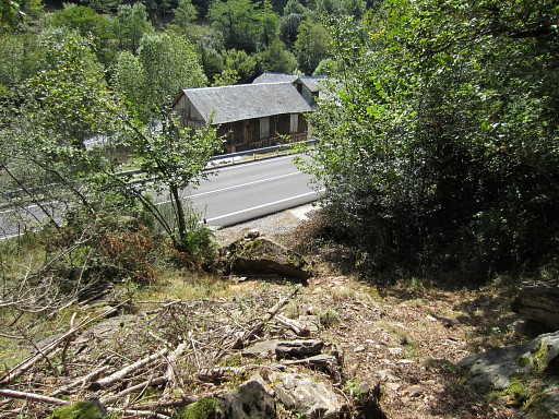
 |
The main route continues
on the (dirt)road which makes a clockwise curve to arrive at the N-side
of the barrage. From there you can pick up a trail along the bank of the barrage lake. It will bring you to |
||||||||||||||||||||||||||||||||||||||||||||||||||||||||||||||||||
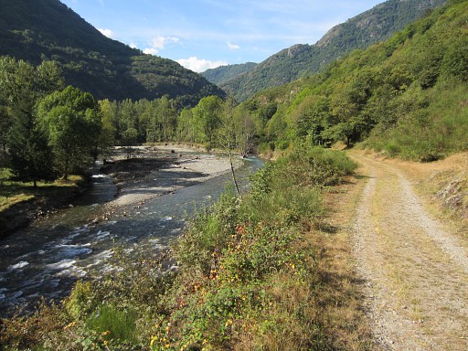 |
Along the Garonne |
||||||||||||||||||||||||||||||||||||||||||||||||||||||||||||||||||
 |
By the way: there are two
nice bivouac-spots along the dirtroad leading to the barrage. This is the first. However: no fresh water around. |
||||||||||||||||||||||||||||||||||||||||||||||||||||||||||||||||||
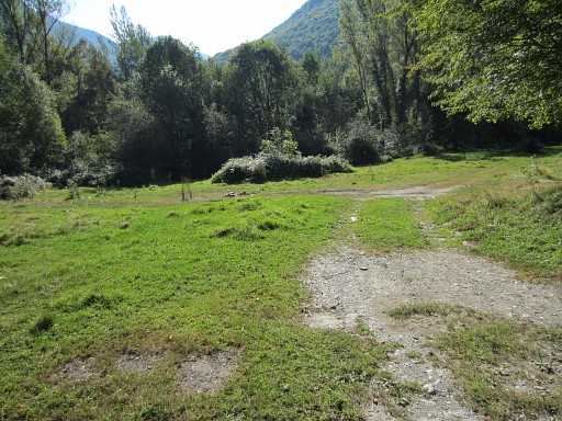
 |
You have to cross this
terrain - stripped from its trees in recent years - to its end. At the end the dirtroad appears again, and |
||||||||||||||||||||||||||||||||||||||||||||||||||||||||||||||||||
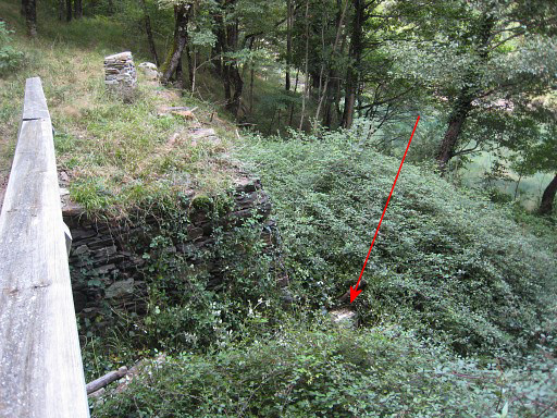
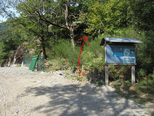 |
arrives at the barrage but
you don't have to enter the premises. The red arrow shows where the (nature education-) trail continues. |
||||||||||||||||||||||||||||||||||||||||||||||||||||||||||||||||||
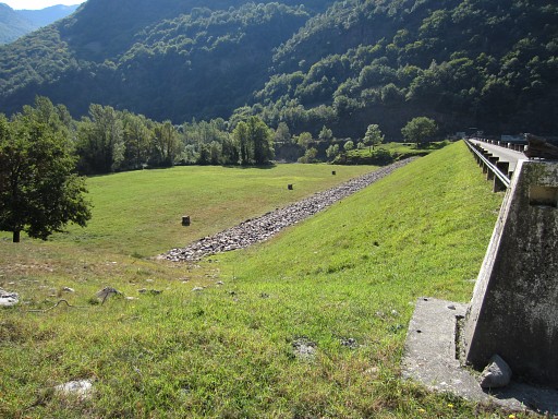 |
NB: this is the second
opportunity for a bivouac: the vast meadow at the foot of the
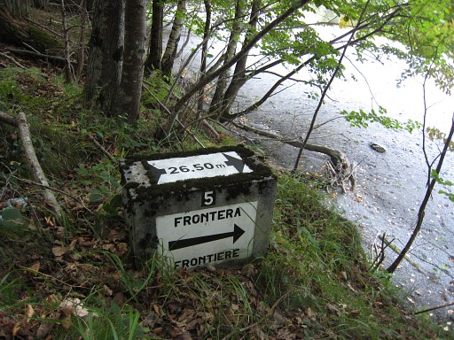
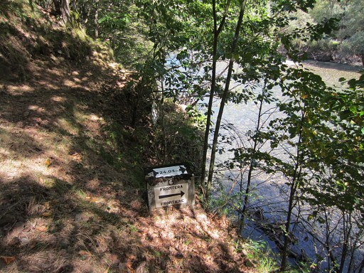
barrage-dam. But: no fresh water nearby, you have to bring it. But there's no (reliable) source nearby. Either you collect – a few kilometers earlier - water from the stream (Ruisseau de la Batch) which descends along the GR10 to the Garonne-valley, either you get your water from the Ruisseau du Terme at bm409 further on (0,6 km). But at bm409 there's also some place for a bivouac. |
||||||||||||||||||||||||||||||||||||||||||||||||||||||||||||||||||
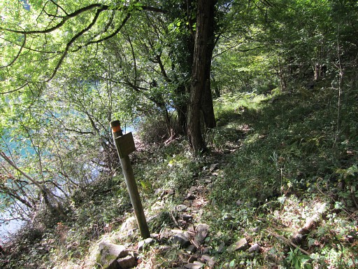 |
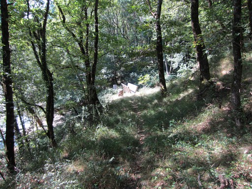
The trail from the
barrage-dam up to bm409 is vague
in places (but simple in its overall course = along the lake). Some waymarks help. From bm409 onwards the trail is better. |
||||||||||||||||||||||||||||||||||||||||||||||||||||||||||||||||||
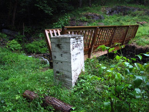
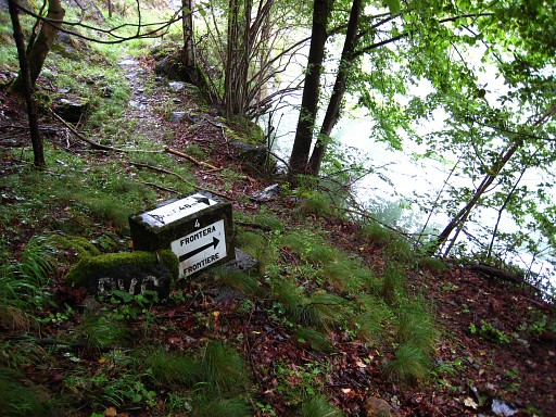
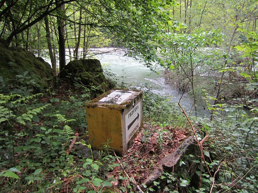
 |
In the distance the
footbridge over the borderstream of Ruisseau du Terme with at the other
side bm409. |
||||||||||||||||||||||||||||||||||||||||||||||||||||||||||||||||||
 |
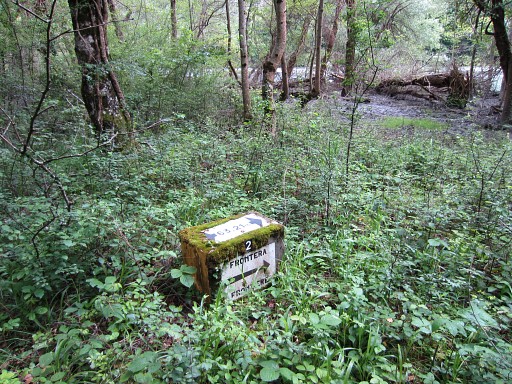
As you can see, this spot also provides some bivouac-place and there's the advantage of fresh water from the borderstream. | ||||||||||||||||||||||||||||||||||||||||||||||||||||||||||||||||||
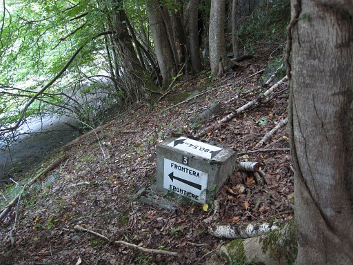
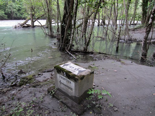
 |
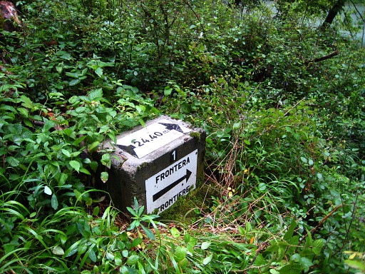
Here, a serie of 7
submarkers start along the riverbank. At the other side of the lake/river, there's another set of 7 submarkers. See for more information: this page At the foot of the bridge, number 1 is visible. But it might be totally overgrown. The first submarker down below can be easily reached from the lakeside via a little detour clockwise. Probably it will be overgrown. |
||||||||||||||||||||||||||||||||||||||||||||||||||||||||||||||||||
 |
Bm409-1 (spanish). The ceramic plates are vulnerable. |
||||||||||||||||||||||||||||||||||||||||||||||||||||||||||||||||||
 |
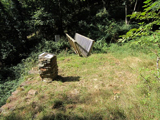
Bm409 |
||||||||||||||||||||||||||||||||||||||||||||||||||||||||||||||||||
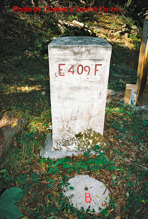 |
Besides bm409 at ground
level, there's a peculiar round base with the letter B engraved. Continue on the trail. |
||||||||||||||||||||||||||||||||||||||||||||||||||||||||||||||||||
 |
Bm409-2 (spanish), along the path | ||||||||||||||||||||||||||||||||||||||||||||||||||||||||||||||||||
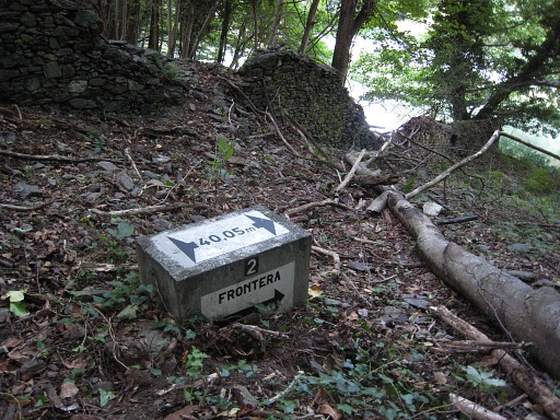
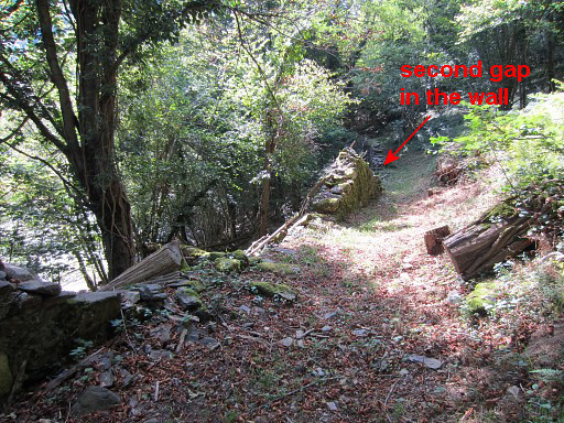 |
Bm409-3 (spanish) cannot be seen from the path -> when a long sturdy wall starts at the left side of the path, you should pass through the second breach (this picture) and descend SE to the river. | ||||||||||||||||||||||||||||||||||||||||||||||||||||||||||||||||||
 |
Bm409-3 (spanish) | ||||||||||||||||||||||||||||||||||||||||||||||||||||||||||||||||||
 |
Bm409-4 (spanish), along the trail. | ||||||||||||||||||||||||||||||||||||||||||||||||||||||||||||||||||
 |
Bm409-5 (spanish) needs
also a little descent from the trail. It's visible from the trail but you have to watch carefully. |
||||||||||||||||||||||||||||||||||||||||||||||||||||||||||||||||||
 |
Bm409-6 (spanish), along
the path |
||||||||||||||||||||||||||||||||||||||||||||||||||||||||||||||||||
 |
The next one is off the
trail. This is where you have to descend from the path |
||||||||||||||||||||||||||||||||||||||||||||||||||||||||||||||||||
 |
to go SE to | ||||||||||||||||||||||||||||||||||||||||||||||||||||||||||||||||||
 |
bm409-7 (spanish) Back to the trail. |
||||||||||||||||||||||||||||||||||||||||||||||||||||||||||||||||||
 |
Further on, the path
descends to the main road. |
||||||||||||||||||||||||||||||||||||||||||||||||||||||||||||||||||
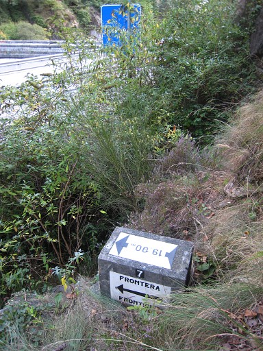
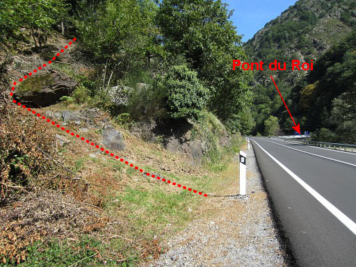 |
Then go left, to Pont du Roi. | ||||||||||||||||||||||||||||||||||||||||||||||||||||||||||||||||||
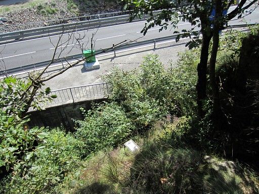
 |
Now walk 200m to the N
along the road and you will arrive at the new bridge. From the bridge, you can spot bm409-7 (spanish), the one you have just visited. |
||||||||||||||||||||||||||||||||||||||||||||||||||||||||||||||||||
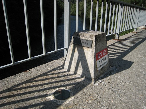 |
On the new bridge, there
are on either side bordermarkers (unnumbered) like this. |
||||||||||||||||||||||||||||||||||||||||||||||||||||||||||||||||||
 |
A view from the bridge to the E to the ravine which is the borderline from bm410 to bm411. | ||||||||||||||||||||||||||||||||||||||||||||||||||||||||||||||||||
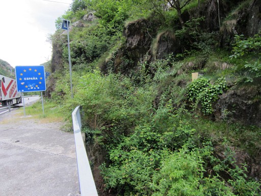
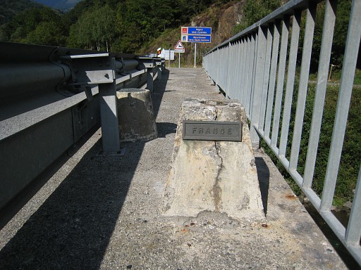 |
The markers at the other
side of the bridge. At the end of the bridge, turn right and the main route will end at bm410. If you want to include variant 2, go straight ahead along the road. |
||||||||||||||||||||||||||||||||||||||||||||||||||||||||||||||||||
| Variant
2 via bm409-1 (french) - 409-6 (french) |
|||||||||||||||||||||||||||||||||||||||||||||||||||||||||||||||||||
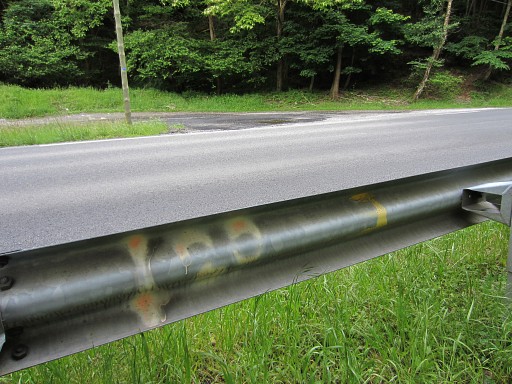
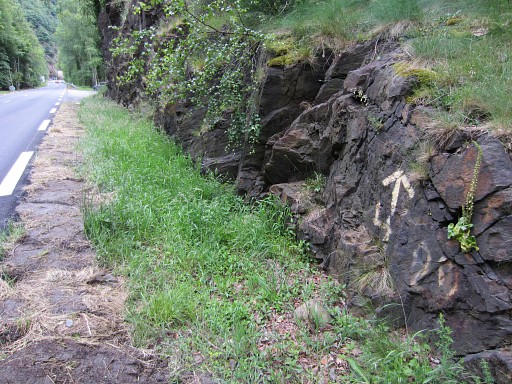
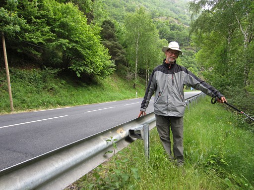
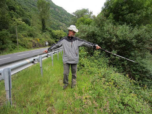 |
From
the new bridge, first follow the road for ± 550m. We will start with submarker 1 and work our way back along nr 2 to 6. They are all between the road and the river. But where are they? Well, finding is quite easy because they are indicated by yellow paint (though vague now) on the roadside barrier. Jan-Willem shows the painting and points to nr. 1. |
||||||||||||||||||||||||||||||||||||||||||||||||||||||||||||||||||
 |
Bm409-1
(french) which is getting overgrown. |
||||||||||||||||||||||||||||||||||||||||||||||||||||||||||||||||||
 |
Submarker
2: yellow painting and a little cairn indicate the position. |
||||||||||||||||||||||||||||||||||||||||||||||||||||||||||||||||||
 |
Bm409-2 (french) | ||||||||||||||||||||||||||||||||||||||||||||||||||||||||||||||||||
 |
And
this is the painted nr. 3 at the side-rail. That's the yellow number to the right, the nr. 20 indicates a metal sign-post close to the submarker. |
||||||||||||||||||||||||||||||||||||||||||||||||||||||||||||||||||
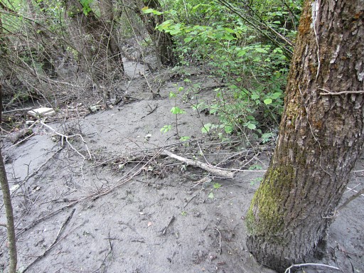 |
But
the floodings of the Garonne in 2013 have changed its course and
submarker 3 can be covered by mud as it is on this picture. |
||||||||||||||||||||||||||||||||||||||||||||||||||||||||||||||||||
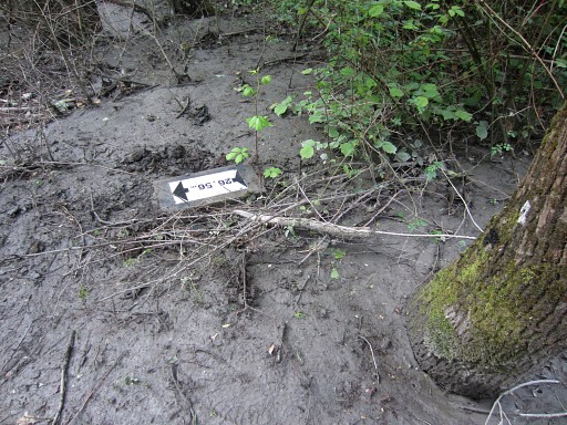 |
Submarker
3 uncovered. |
||||||||||||||||||||||||||||||||||||||||||||||||||||||||||||||||||
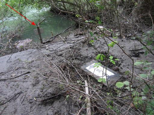 |
Bm409-3
(french) Note the metal sign-post with nr 20. |
||||||||||||||||||||||||||||||||||||||||||||||||||||||||||||||||||
 |
Further
on there's no side-rail but now an arrow and nr. 4 points to the
location of submarker 4. You might struggle from here directly to submarker 4 but it's easier to walk further (40m) to a parking spot and enter the bush along the road and walk back. |
||||||||||||||||||||||||||||||||||||||||||||||||||||||||||||||||||
 |
It's
closer to the road than the river with a sort of gully in between. Bm409-4 (french) Now return to the parking and at the other side you will easily spot |
||||||||||||||||||||||||||||||||||||||||||||||||||||||||||||||||||
 |
bm409-5
(french) which is also visible from the road. On the road again. |
||||||||||||||||||||||||||||||||||||||||||||||||||||||||||||||||||
 |
Submarker
6 is also indicated by yellow painting. |
||||||||||||||||||||||||||||||||||||||||||||||||||||||||||||||||||
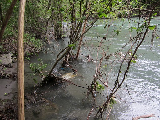 |
But
it has submerged under water after the flooding and shift of the
rivercourse. It's hardly visible. Bm409-6 (french) Back to the bridge and you are on the main route again. |
||||||||||||||||||||||||||||||||||||||||||||||||||||||||||||||||||
| End
of variant 2 |
|||||||||||||||||||||||||||||||||||||||||||||||||||||||||||||||||||
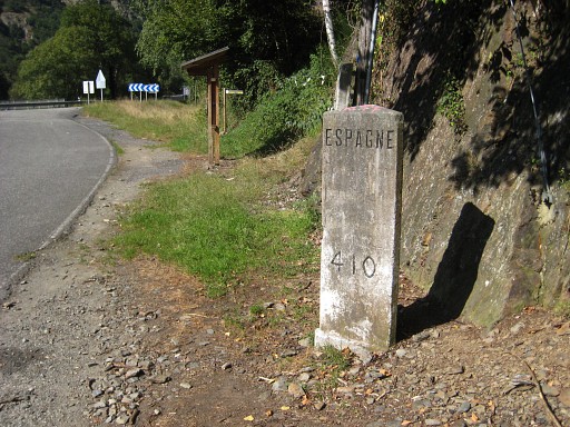 |
Bm410 is close-by with the
|
||||||||||||||||||||||||||||||||||||||||||||||||||||||||||||||||||
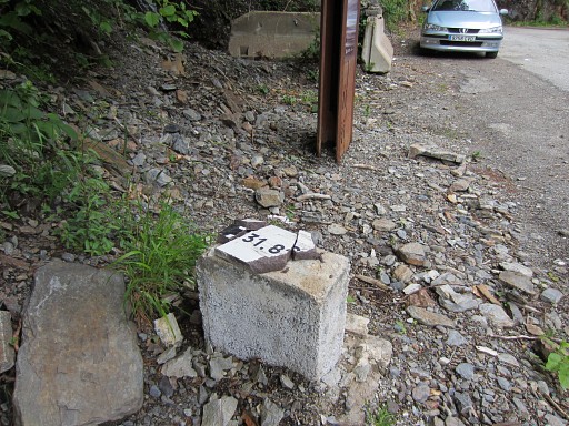 |
vandalised
bm409-7 (french) a few meters further. |
||||||||||||||||||||||||||||||||||||||||||||||||||||||||||||||||||