|
The
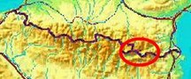
bordermarkers of the Pyrenees : the GRPdesBF
 |
||||||||||||||||||||||||||||||||||||||||||||||||||||||||||
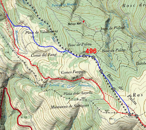
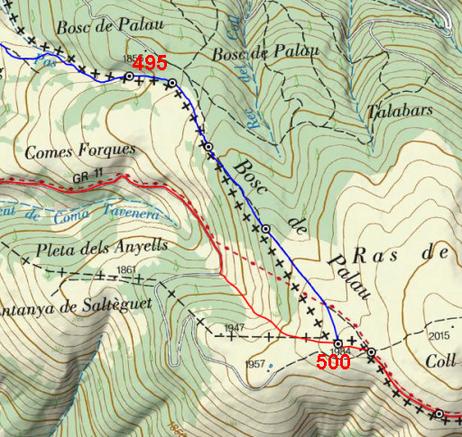
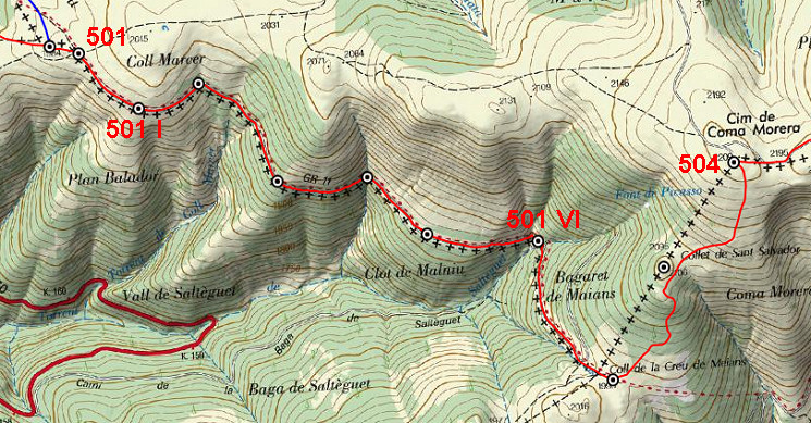
| - stage 44 - Vilallovent - Puigmal d'Err (bm496-506) |
 |
|||||||||||||||||||||||||||||||||||||||||||||||||||||||||
 |
||||||||||||||||||||||||||||||||||||||||||||||||||||||||||
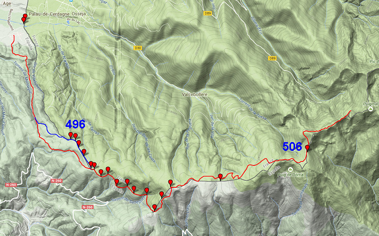
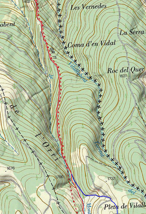
| Only
the bordermarkers along this stage are shown (and some adjoining ones).
The main route is red,
the variants have other colors. The main route provides a smooth
on-going route along many bordermarkers, the variants give access to
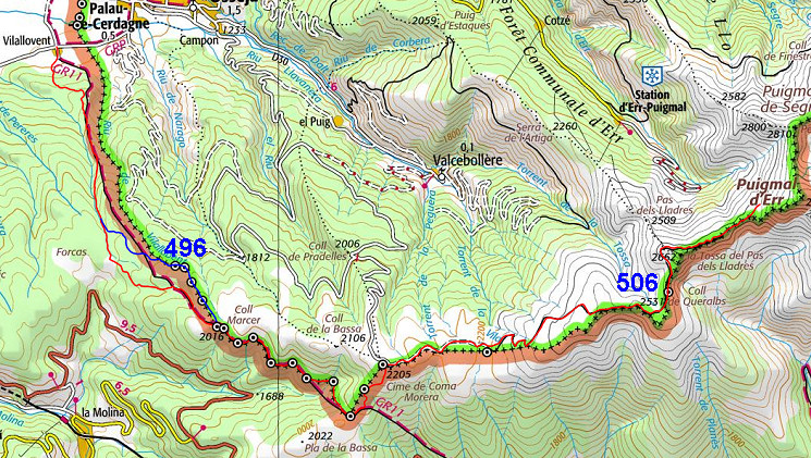
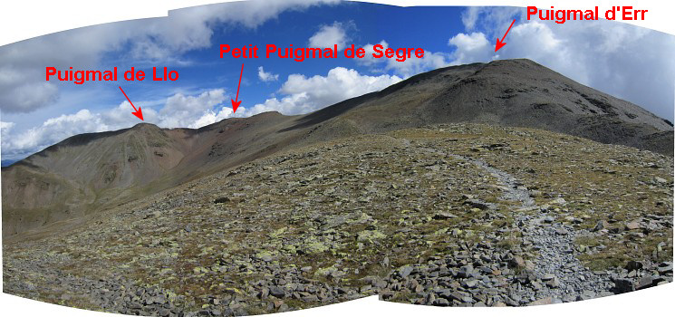
the remaining bordermarkers. See the GRPdesBF-principles. Click here for an fullscreen interactive map. In short After the Cerdagne-plains we have to climb again into high mountains. The main route sticks to the GR-11 trail until bm502. A variant covers bm496-499. From bm502 we climb NE to bm504 at the summit of Cim de Coma Morera. Then a dirtroad on a plateau takes us for 7km E along bm505 and bm506. Then it takes another 3km to reach a spot E of Puigmal d'Err where a bivouac is possible. Considerations Wayfinding shouldn't give you problems, most of the stage being on waymarked trails or easy dirtroads. But water is a concern once you get beyond the bm501-submarkers. At the end of the stage, you might need to descend 450m NW to find water. But there's another possibility 3km before the end: from bm506 descending E to a source. If you have enough time left, you could consider to go on and - after the Puigmal d'Err - descend to Nuria (a camping terrain available) for a stay overnight. If you do this and descend from the Puigmal directly to Nuria, it's ± 2.45h extra. When you first continue to Col de Finistrelles (bm507) and then go down: ± 3.45h extra. And there's another possibility to get water: beyond the Puigmal d'Err at the Petit Puigmal de Segre, descend to the saddle between that summit and the Puigmal de Llo and then descend NNW to the source of Fonts de Segre. That's ± 2h extra. From that source, you can pick the trail climbing to Col de Finistrelles. If the terrain around the Fonts de Segre is suitable for a bivouac is uncertain but I don't think so. Factsheet
Gps-files needed
Useful You might check the relevant webpages in the 'All markers'-section and 'All my trips'-section. They provide pictures of the bordermarkers and additional information. Version 02 May 2015. If you have any correction, suggestion etcetera -> please email me: eefberns@grenspalen.nl MAPS AND DIRECTIONS Print your own maps It's easy to print your own - custom made - maps with the GRPdesBF-route and the bordermarkers on them. See: Print your own maps |
||||||||||||||||||||||||||||||||||||||||||||||||||||||||||
 |
||||||||||||||||||||||||||||||||||||||||||||||||||||||||||
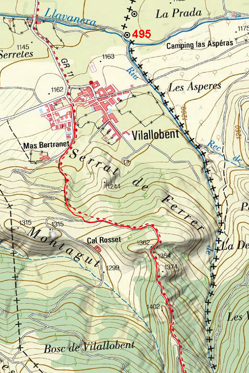 |
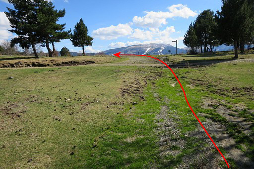
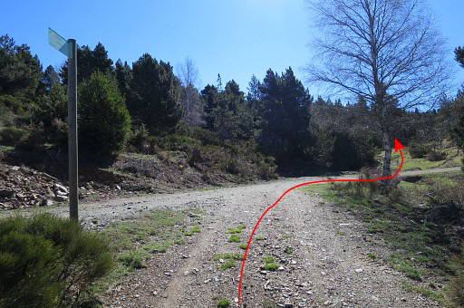
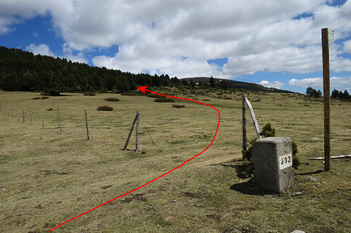
From Vilallobent I follow the GR11. The waymarks are not that abundant but with my directions you
should be able to find your way. And if you just follow the dirtroad up into the forest, it will also bring you to the plateau where bm500 and 501 are (but you will miss bm496-499). |
|||||||||||||||||||||||||||||||||||||||||||||||||||||||||
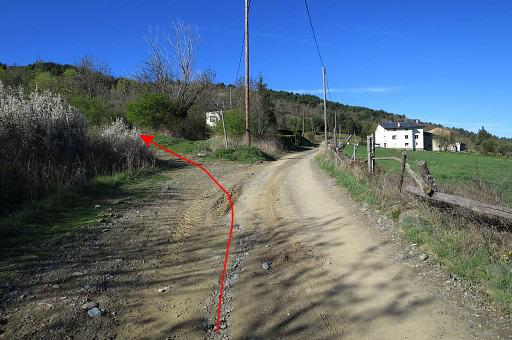 |
This picture: just outside Vilallobent where the Gr11 branches off the dirtroad on a trail climbing S. | |||||||||||||||||||||||||||||||||||||||||||||||||||||||||
 |
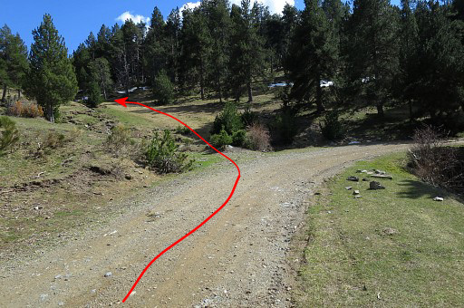
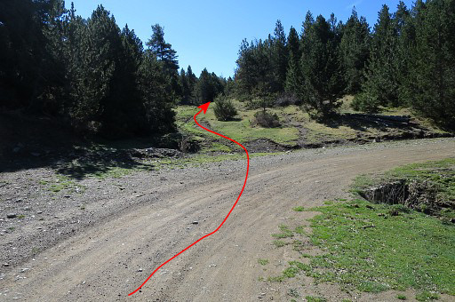
That trail is a shortcut (500m long) and joins at this point again with the dirtroad A bit further there's another minor GR11-shortcut but if you miss it (like I did), no problem. Just continue on the dirtroad. |
|||||||||||||||||||||||||||||||||||||||||||||||||||||||||
 |
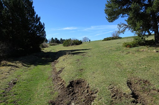
Then continuing 2,5 km S, gently climbing on the dirtroad. A stream will appear at your right hand. This is a opportunity to fill your waterbottles but there will be more sources at the bm501-submarkers. |
|||||||||||||||||||||||||||||||||||||||||||||||||||||||||
 |
Then - soon - the GR11 (the main route) descends to the stream |
|||||||||||||||||||||||||||||||||||||||||||||||||||||||||
 |
and continues SEE
climbing along the stream to a crossroad of dirtroads. At that point a waysign shows how to continue to the SE. Later on the GR11 leaves the dirtroad to climb on a track towards the plateau with bm500 and 501. |
|||||||||||||||||||||||||||||||||||||||||||||||||||||||||
 |
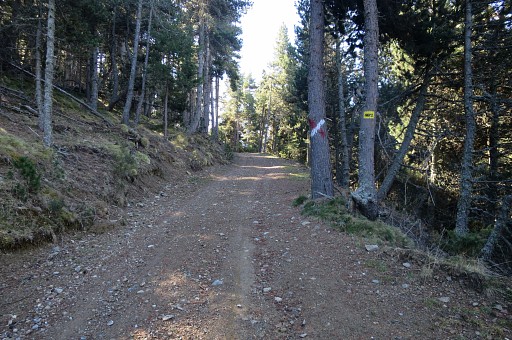
This is the crossroad of dirtroads where the
GR11 emerges from the forest on its shortcut and will continue on the
dirtroad. A waysign shows the right direction. |
|||||||||||||||||||||||||||||||||||||||||||||||||||||||||
 |
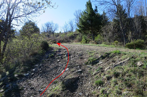
This is where the
GR11 leaves the dirtroad to climb on a track towards the plateau with
bm500 and 501. As said the GR11-waymarks are almost absent on that plateau but a GR11-waysign and the easy to spot bm500 on the hilltop will guide you. |
|||||||||||||||||||||||||||||||||||||||||||||||||||||||||
| Variant 1 via bm496-449 | ||||||||||||||||||||||||||||||||||||||||||||||||||||||||||
 |
Continue on the dirtroad past this red/white cross. | |||||||||||||||||||||||||||||||||||||||||||||||||||||||||
 |
||||||||||||||||||||||||||||||||||||||||||||||||||||||||||
 |
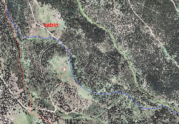
That dirtroad merges after 500m with another dirtroad. About there, there's a cabin to the left with some picnic-tables and some flat space to camp (but no water nearby). The refuge-part was closed at the time of my visit but an emty room - apparently meant for cattle - could give shelter in bad weather. |
|||||||||||||||||||||||||||||||||||||||||||||||||||||||||
 |
This is where the dirtroad joins the other one. | |||||||||||||||||||||||||||||||||||||||||||||||||||||||||
 |
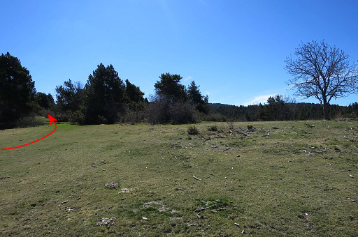
A little bit further - when the dirtroad bends to the right - leave the dirtroad and enter on a track SSE into the forest which | |||||||||||||||||||||||||||||||||||||||||||||||||||||||||
 |
brings you soon to a large open space. Follow it along its E-side and |
|||||||||||||||||||||||||||||||||||||||||||||||||||||||||
 |
in the SE corner enter the forest and | |||||||||||||||||||||||||||||||||||||||||||||||||||||||||
 |
pick up a sort of (cattle-)trail. Now navigating is not that straightforward anymore. There's still a sort of track winding through the fir-trees but there are more of them. In any case, you have to go SEE (and not SE) and then you will inevitably arrive at |
|||||||||||||||||||||||||||||||||||||||||||||||||||||||||
 |
a sort of valley with possibly a stream, depending on the season. Distance from the open space to this valley is ± 500m. |
|||||||||||||||||||||||||||||||||||||||||||||||||||||||||
 |
Most important feature (zoom-in of previous picture): a (border)fence climbing SE or SEE which is the proof that you have arrived at the border. | |||||||||||||||||||||||||||||||||||||||||||||||||||||||||
 |
Now simply climb uphill parallel to
the fence. The bordermarkers bm496 to 499 are placed along the fence with a maximum distance of ± 10m from the fence. You can't miss them if you keep that in mind. |
|||||||||||||||||||||||||||||||||||||||||||||||||||||||||
|
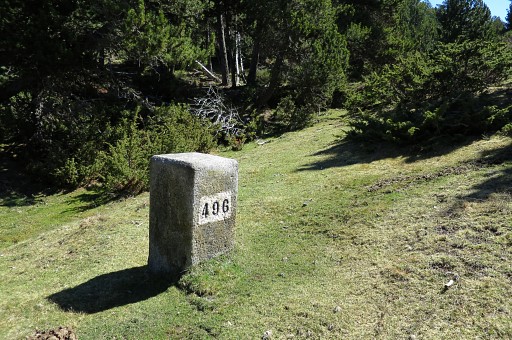
Bm496 |
|||||||||||||||||||||||||||||||||||||||||||||||||||||||||
|
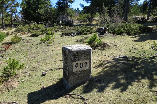
After 150m: bm497 | |||||||||||||||||||||||||||||||||||||||||||||||||||||||||
|
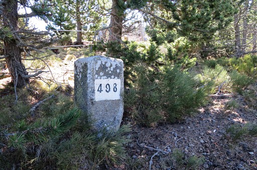
Then - after 350m - bm498. | |||||||||||||||||||||||||||||||||||||||||||||||||||||||||
 |
While proceeding SSE to bm499 it gets more open. | |||||||||||||||||||||||||||||||||||||||||||||||||||||||||
|
At 400m from bm498: bm499 | |||||||||||||||||||||||||||||||||||||||||||||||||||||||||
 |
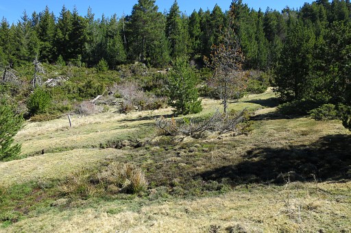
Finally you will arrive at the plateau with bm500 and join the main route. This picture: you can spot bm500 already at the hilltop. |
|||||||||||||||||||||||||||||||||||||||||||||||||||||||||
| End of variant 1 |
||||||||||||||||||||||||||||||||||||||||||||||||||||||||||
 |
Bm500, looking in the direction of bm501. |
|||||||||||||||||||||||||||||||||||||||||||||||||||||||||
 |
||||||||||||||||||||||||||||||||||||||||||||||||||||||||||
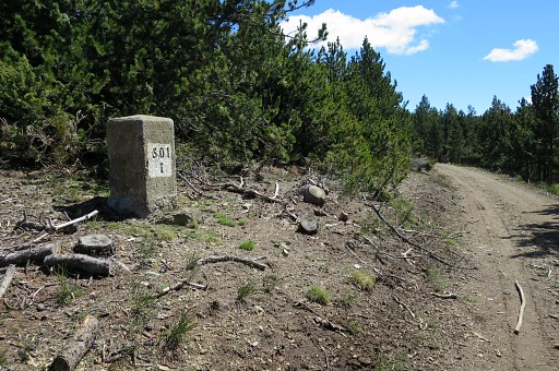
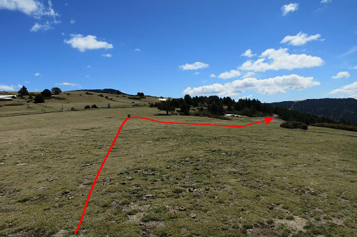 |
Bm501 is not far away: 150m to the SEE. On this picture you can see how to proceed from bm501 to the bm501-submarkers. |
|||||||||||||||||||||||||||||||||||||||||||||||||||||||||
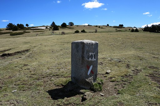 |
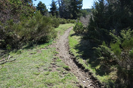
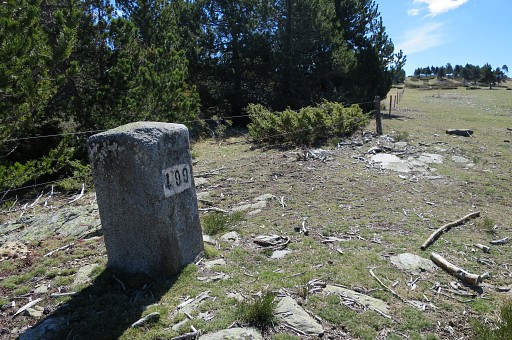
Bm501 Now the main route (and GR11) takes a dirtroad starting 15om SSE from bm501 |
|||||||||||||||||||||||||||||||||||||||||||||||||||||||||
|
and following the
contours of the mountain-slope and passing the submarkers bm501-I to
501-VI. Bm501 I |
|||||||||||||||||||||||||||||||||||||||||||||||||||||||||
|
Bm501 II in sight |
|||||||||||||||||||||||||||||||||||||||||||||||||||||||||
|
Bm501 III |
|||||||||||||||||||||||||||||||||||||||||||||||||||||||||
 |
Bm501 IV in the distance |
|||||||||||||||||||||||||||||||||||||||||||||||||||||||||
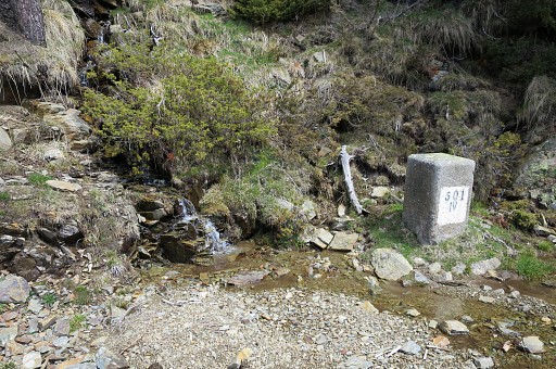
|
Bm501-IV Opportunity to refill your waterbottle. There's another one at bm501-VI but this one seems more reliable through the seasons. Note: when walking the GRPdesBF, the next source is in the second half of the next stage so you have to take your chance here. |
|||||||||||||||||||||||||||||||||||||||||||||||||||||||||
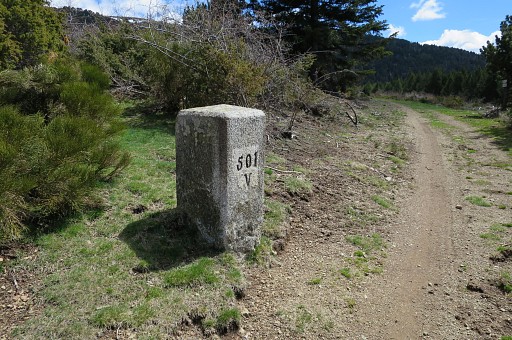
|
Bm501 V |
|||||||||||||||||||||||||||||||||||||||||||||||||||||||||
 |
Bm501 VI in the distance with streams on either side of it though they don't seem as continuous through the year as at bm501-IV. | |||||||||||||||||||||||||||||||||||||||||||||||||||||||||
 |
Beyond bm501 VI the trail climbs to a pass (Coll de la Creu de Meians) | |||||||||||||||||||||||||||||||||||||||||||||||||||||||||
|
with bm502. At the other side of the fence a dirtroad starts to climb NE uphill. |
|||||||||||||||||||||||||||||||||||||||||||||||||||||||||
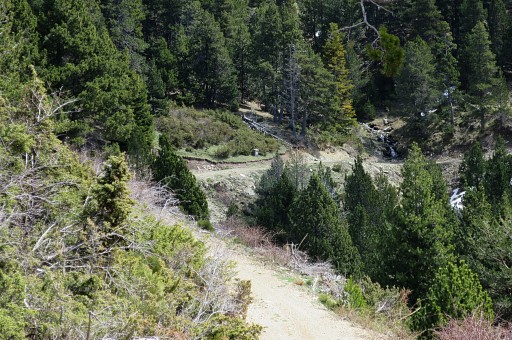
 |
Zoom-in. The dirtroad climbs and winds NE-E through a forest. | |||||||||||||||||||||||||||||||||||||||||||||||||||||||||
 |
Higher up (± 1,5 km from bm502) you will spot the (border-)fence again to the left, | |||||||||||||||||||||||||||||||||||||||||||||||||||||||||
 |
Zoom-in: you can see the (border)fence. That's about where |
|||||||||||||||||||||||||||||||||||||||||||||||||||||||||
|
bm503 is at the other side of the fence but it's not visible from the dirtroad. | |||||||||||||||||||||||||||||||||||||||||||||||||||||||||
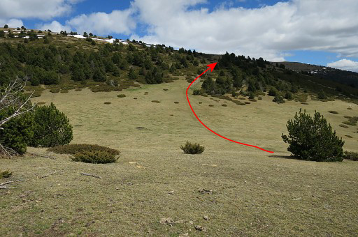 |
Return NE from this little detour to the dirtroad which | |||||||||||||||||||||||||||||||||||||||||||||||||||||||||
 |
climbs further and higher on |
|||||||||||||||||||||||||||||||||||||||||||||||||||||||||
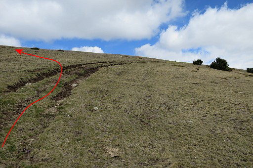 |
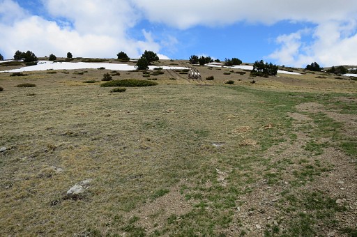
bends to the right (=NE) and that's about here. At this point leave the dirtroad and climb NNW through the grass to the hilltop |
|||||||||||||||||||||||||||||||||||||||||||||||||||||||||
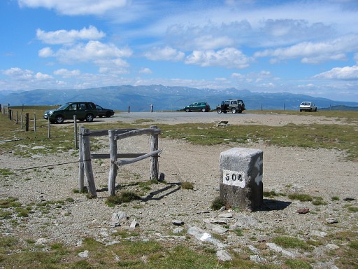
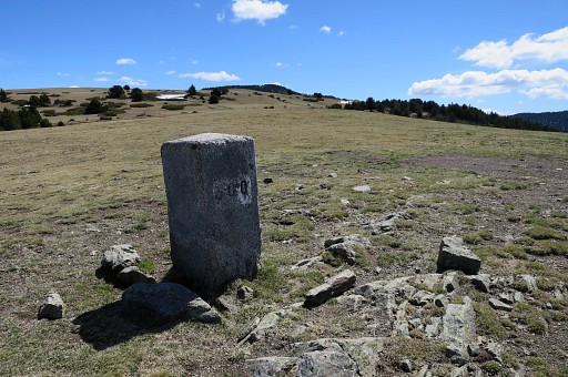
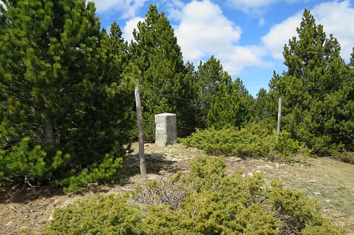
|
where bm504 is standing at the corner of a parking. | |||||||||||||||||||||||||||||||||||||||||||||||||||||||||
 |
||||||||||||||||||||||||||||||||||||||||||||||||||||||||||
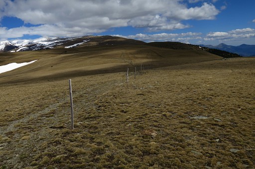 |
From bm504 I descend E along the borderfence and continue on a dirtroad. |
|||||||||||||||||||||||||||||||||||||||||||||||||||||||||
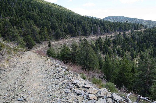
 |
This dirtroad winds generally E and will bring me after 2km close to bm505. The dirtroad is easier than following the straight borderfence over the grassy hills. |
|||||||||||||||||||||||||||||||||||||||||||||||||||||||||
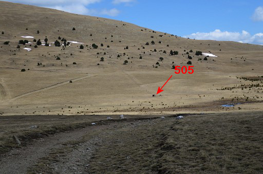 |
After 2km the 'valley' or pass in sight where bm505 is. | |||||||||||||||||||||||||||||||||||||||||||||||||||||||||
|
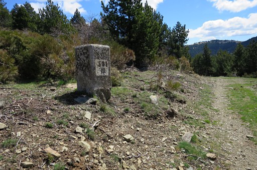
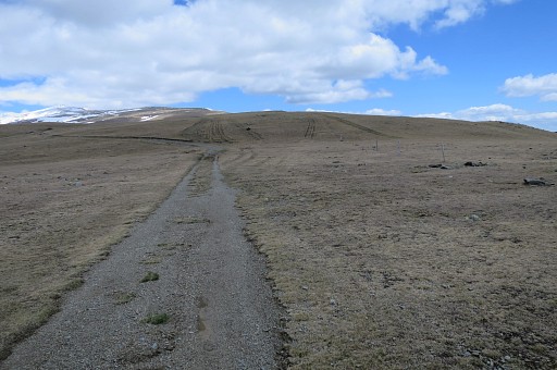
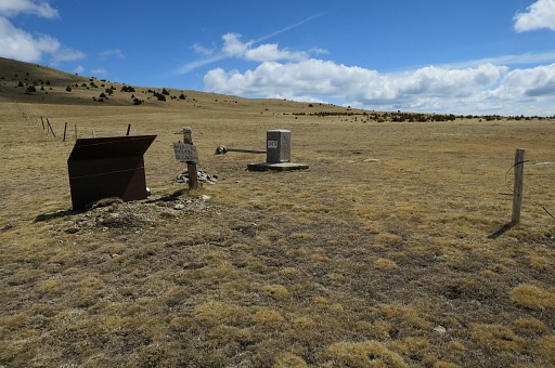
Bm505 Continue on the dirtroad for 4,5 km and you will arrive at |
|||||||||||||||||||||||||||||||||||||||||||||||||||||||||
|
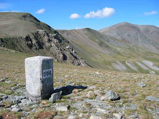
bm506 This picture: looking N, the Puigmal visible in the far distance. |
|||||||||||||||||||||||||||||||||||||||||||||||||||||||||
 |
From bm508 a look into the valley. From here you can descend E for 200 elevation meters to the source of 'Fonts dels carrabiners' at 'Clot de fontseca' where the terrain also seems flat enough for a bivouac. Remember: on the next - high altitude - stage, there's no water until the final part so you'll need to refuel anyway |
|||||||||||||||||||||||||||||||||||||||||||||||||||||||||
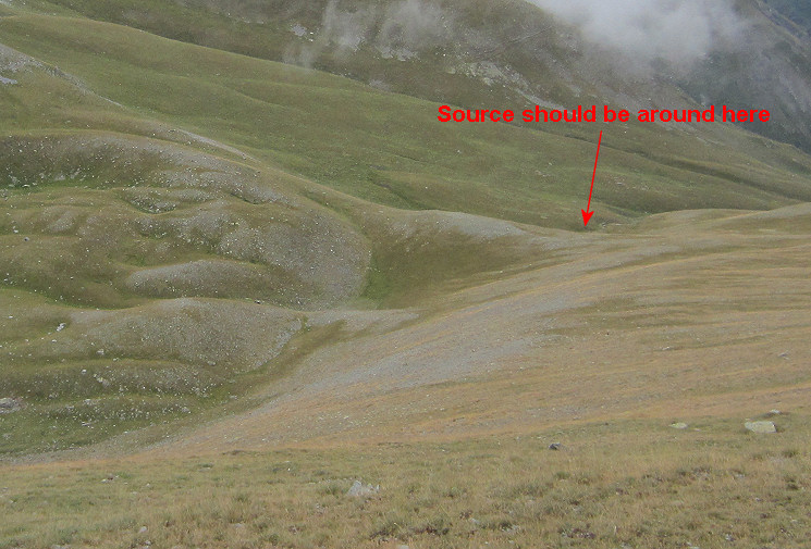 Zoom-in. A suitable place for a bivouac seems no problem there. If the source is running all season, we don't know. If no, you have to descend further along the streambed. |
||||||||||||||||||||||||||||||||||||||||||||||||||||||||||
 |
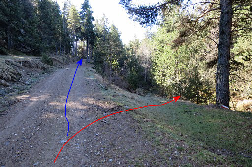
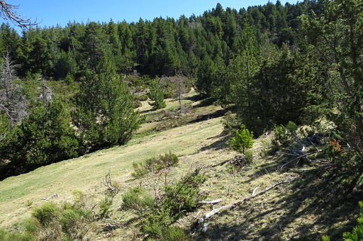
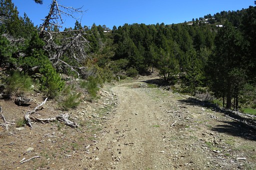
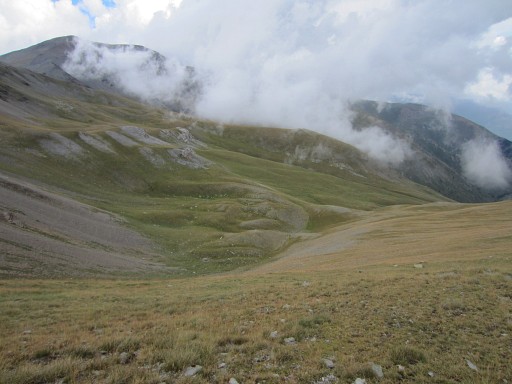
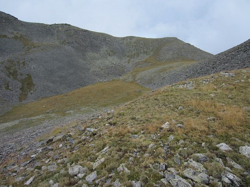
Continuing on the dirtroad and curving around the summit of 'Tossa del Pas dels Lladres'. | |||||||||||||||||||||||||||||||||||||||||||||||||||||||||
 |
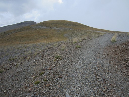
Further on, the dirtroad becomes a trail but allways in well shape and well waymarked. | |||||||||||||||||||||||||||||||||||||||||||||||||||||||||
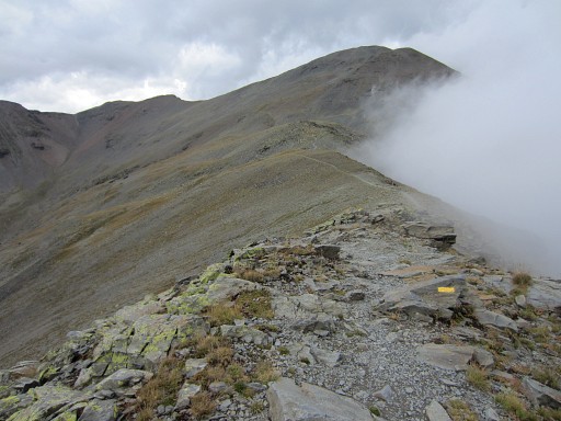
 Getting closer to Puigmal d'Err which is the first summit of the next stage. |
||||||||||||||||||||||||||||||||||||||||||||||||||||||||||
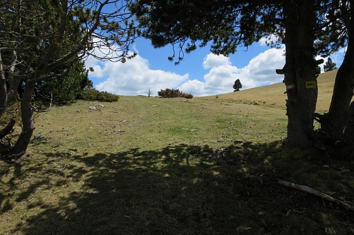
 |
But first you will discover to your right a kind of bowl: |
|||||||||||||||||||||||||||||||||||||||||||||||||||||||||
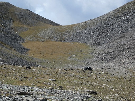 |
flat and sheltered against the wind. Fit for a bivouac but: no water here. Altitude: ± 2650m. From the bowl, a trail descends to the ski-station, however only reaching a stream at the bottom. That means an elevation descent NW of ± 450m before reaching water. |
|||||||||||||||||||||||||||||||||||||||||||||||||||||||||