|
The
bordermarkers of the Pyrenees : the GRPdesBF
 |
|||||||||||||||||||||||||||||||||||||||||||||||||
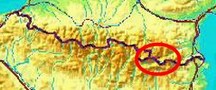
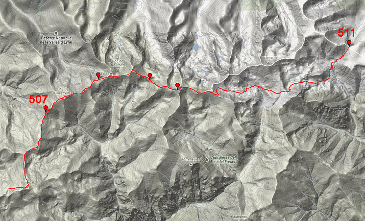
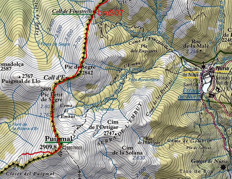
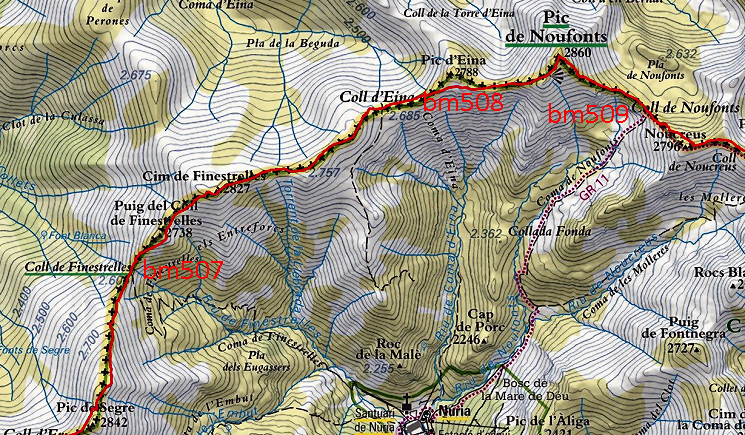
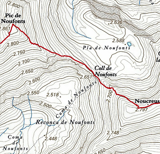
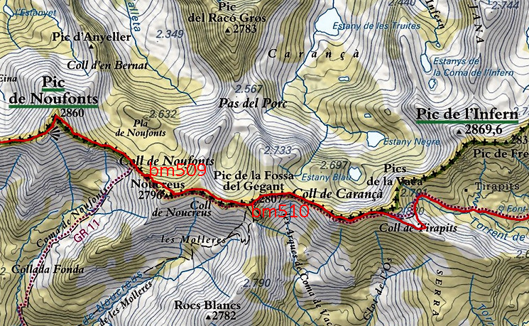
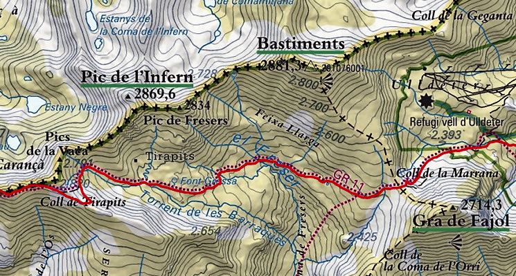
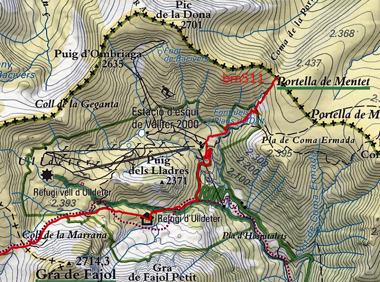
| - stage 45 - Puigmal d'Err - Porteille de Mantet (bm507-511) |
 |
||||||||||||||||||||||||||||||||||||||||||||||||
 |
|||||||||||||||||||||||||||||||||||||||||||||||||
| Only
the bordermarkers along this stage are shown (and some adjoining ones).
The main route is red,
the variants have other colors. The main route provides a smooth
on-going route along many bordermarkers, the variants give access to
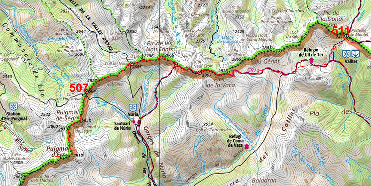
the remaining bordermarkers. See the GRPdesBF-principles. Click here for an fullscreen interactive map. In short A long and tough high-altitude stage, one of the highest of the GRPdesBF. The first 14km remain above 26oom, going up and down along the borderridge. After the climb to Puigmal d'Err, the GRPdesBF keeps following the borderridge. At Col de les Nou Fonts (bm509), the GR11 joins our route which later on leaves the border and descends into green valleys and to Refugi d'Ulldeter. Having arrived at the tarmac road , we leave the GR11 and climb to the ski-station of Vallter. From there a trail brings us to Porteille de Mantet (bm511) Considerations Bad weather might get you in serious problems on the high and exposed borderridge. Be prepared with good clothing and knowing where to descend when needed. Wayfinding shouldn't be difficult, the borderridge being as evident as is the trail along it. From bm509, you can follow the GR11 until the tarmac road. The rest to Porteille de Mantet is also straightforward in its navigating. Water is however scarce and sources are non-existant until after 14km when you have descended from bm510 to the 'Fonts del Freser' and bivouacing becomes possible. You might consider to descend from Coll de Finistrelles (bm507) to the pilgrimage center of Nuria (camping terrain available) for worship and/or a beer. Climbing back to Coll de Núria (bm508) will bring you on the GRPdesBF again. At your terminus - bm511 - a bivouac is possible but you need to bring water to this windy spot. You might descend into France for water and bivouac. It might be wiser to stop earlier and either spend the night in Refugi d'Ulldeter or bivouac around there or somewhere along the stream towards the tarmac road. The next stage is also a water-scarce trail and you need to take enough before you start. Factsheet
Gps-files needed
Useful You might check the relevant webpages in the 'All markers'-section and 'All my trips'-section. They provide pictures of the bordermarkers and additional information. Version 03 May 2017. If you have any correction, suggestion etcetera -> please email me: eefberns@grenspalen.nl MAPS AND DIRECTIONS Print your own maps It's easy to print your own - custom made - maps with the GRPdesBF-route and the bordermarkers on them. See: Print your own maps |
|||||||||||||||||||||||||||||||||||||||||||||||||
 |
|||||||||||||||||||||||||||||||||||||||||||||||||
 |
This is the starting point of this stage, close to a flat and sheltered 'bowl' in the mountain ridge. Altitude: ± 2650m. You might have used it for a bivouac. But: no water available here. |
||||||||||||||||||||||||||||||||||||||||||||||||
 |
|||||||||||||||||||||||||||||||||||||||||||||||||
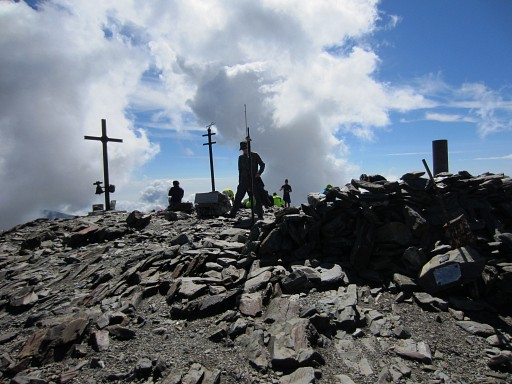 |
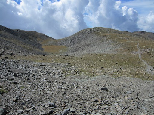
The trail climbs in ± 1h to the summit of Puigmal d'Err. All trails here are well, the Puigmal is a popular daytrip-destination. |
||||||||||||||||||||||||||||||||||||||||||||||||
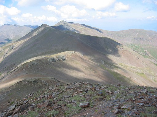
 From approximately the Puigmal d'Err, looking ahea. The red line is the borderline. |
|||||||||||||||||||||||||||||||||||||||||||||||||
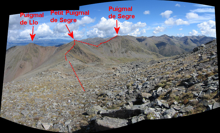
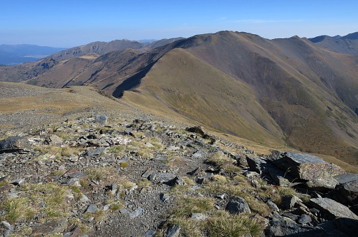
 Having passed the summit of Puigmal d'Err, you will arrive at the Petit Puigmal de Segre. You have to proceed NE-N. That's over and underneath the dark-grey mountain ridge (the Puigmal de Segre). |
|||||||||||||||||||||||||||||||||||||||||||||||||
 |
Zoom-in. From this point, the Coll de Finestrelles (bm507) is already visible | ||||||||||||||||||||||||||||||||||||||||||||||||
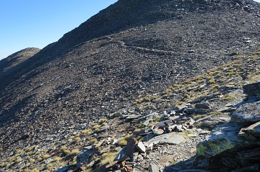 |
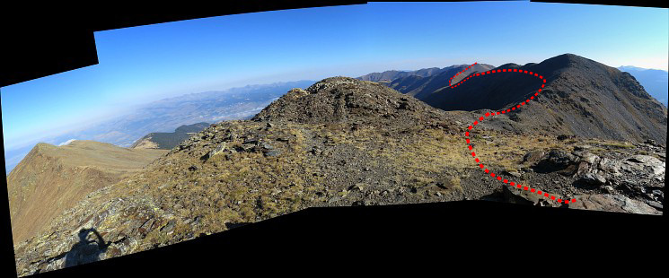
The trail goes underneath the Puigmal de Segre and |
||||||||||||||||||||||||||||||||||||||||||||||||
 |
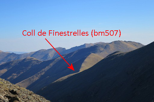
then descends to Coll de Finestrelles. | ||||||||||||||||||||||||||||||||||||||||||||||||
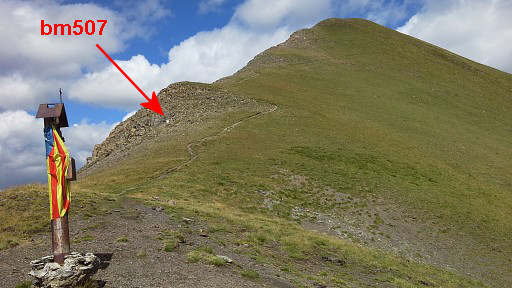 |
Bm507 is not at the Coll de Finestrelles itself but higher up. |
||||||||||||||||||||||||||||||||||||||||||||||||

|
Bm306 |
||||||||||||||||||||||||||||||||||||||||||||||||
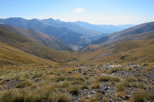 |
From the Coll, looking down to Núria: place of worship, ski-station and providing a small campingsite. This could suit you for an overnight's stay, picking up the GRPdesBF at the next day at the next Coll with bm508. That next Coll is called Coll d'Eina or Coll de Nuria |
||||||||||||||||||||||||||||||||||||||||||||||||
 |
|||||||||||||||||||||||||||||||||||||||||||||||||
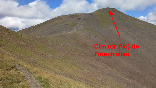 |
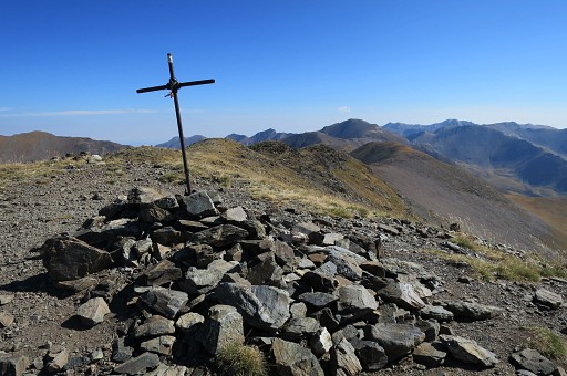
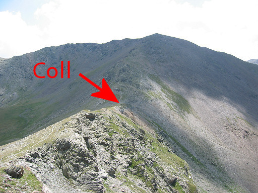
From bm509 continue along the borderridge towards Cim de Finestrelles. Navigating is no problem on the well trodden trail. The borderridge here is one of the highest stretches of the GRPdesBF. As said, you'll be vulnerable in bad weather. |
||||||||||||||||||||||||||||||||||||||||||||||||
 |
Cim (or Pic) de Finestrelles. |
||||||||||||||||||||||||||||||||||||||||||||||||
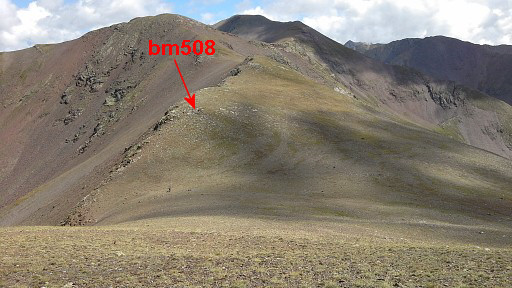 |
Descending to Coll d'Eina or Coll de Núria. Bm508 is not at the Coll itself but higher up. |
||||||||||||||||||||||||||||||||||||||||||||||||
 |
Zoom-in to the spot of bm508. |
||||||||||||||||||||||||||||||||||||||||||||||||
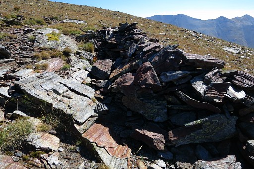
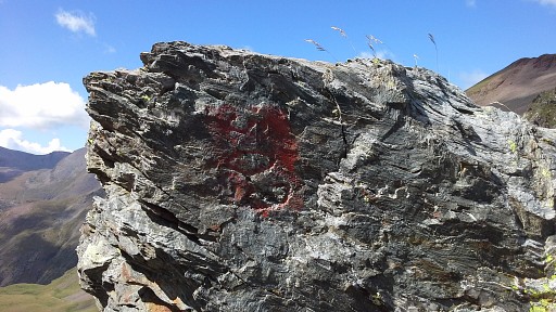
|
Bm508 Note the small wall around bm508, as if to give it shelter. There's no number. But identification as bm508 was certain because of the similarity of the cross with the other bordercrosses in this area and the correct distance from the Coll as stated by the Treaty. |
||||||||||||||||||||||||||||||||||||||||||||||||
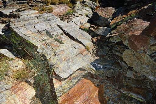 |
The number seemed to be lost completely. But Serge Poncet did an amazing discovery in november 2015. He brushed away the loose grit and stone around the cross and he found an engraved 8! On this picture it has been chalked to show it better. |
||||||||||||||||||||||||||||||||||||||||||||||||
 |
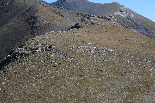
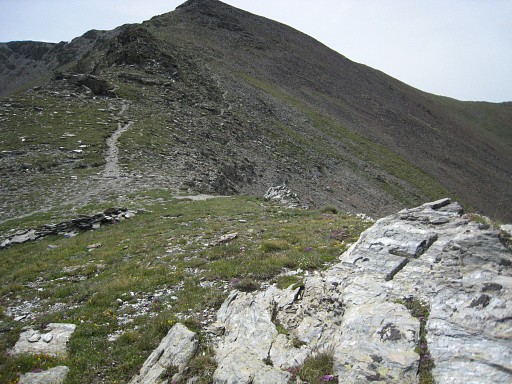
Continung on the borderridge to the east. |
||||||||||||||||||||||||||||||||||||||||||||||||
 |
Approaching the Coll de la Nou Fonts with bm509. |
||||||||||||||||||||||||||||||||||||||||||||||||
|
Bm509 has a peculiar |
||||||||||||||||||||||||||||||||||||||||||||||||
 |
90% rotated aspect. |
||||||||||||||||||||||||||||||||||||||||||||||||
 |
From
this Coll at both sides there are green valleys where a bivouac with
water-supply might be possible without having to descend too much. There are good chances for flat campingspace to the north at Pla de Noufonts (65m lower) but fresh water might need a longer descent. Descending to the S to Coma de Noufonts involves a longer descent (150-200m lower) but there seems more chance to have fresh water, even in the driest time of the year. |
||||||||||||||||||||||||||||||||||||||||||||||||
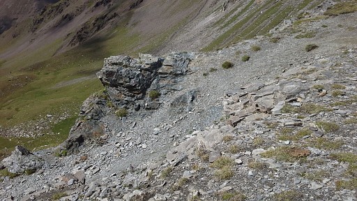 |
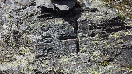
At the Coll also this rocky outcrop, pointing to Spain, |
||||||||||||||||||||||||||||||||||||||||||||||||
 |
with this peculiar engraving "509". Reason and origin unknown. |
||||||||||||||||||||||||||||||||||||||||||||||||
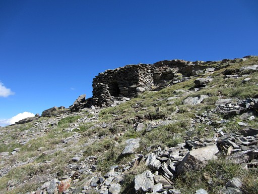 |
At the E-side of the Coll, this small shelter. It has a low ceiling but it could be very helpful in bad weather. | ||||||||||||||||||||||||||||||||||||||||||||||||
 |
|||||||||||||||||||||||||||||||||||||||||||||||||
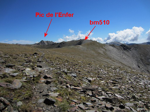 |
After traversing underneath the Noucreus, bm510 is not far away. |
||||||||||||||||||||||||||||||||||||||||||||||||
|
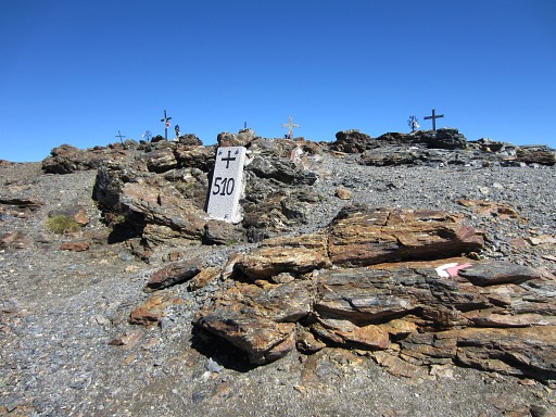
Bm510 with a lot of crosses behind it. I guess they represent mountaineers perished in the mountains. The original bordercross was lost for many years but in 2013 replaced by this granite marker. |
||||||||||||||||||||||||||||||||||||||||||||||||
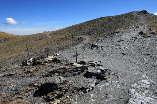 |
The GR11-trail ahead. |
||||||||||||||||||||||||||||||||||||||||||||||||
 |
|||||||||||||||||||||||||||||||||||||||||||||||||
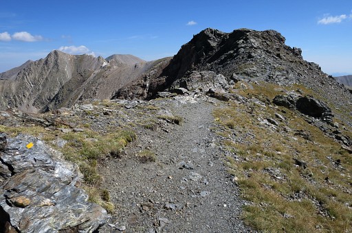 |
First following the borderridge and climbing to Coll de Tirapits and |
||||||||||||||||||||||||||||||||||||||||||||||||
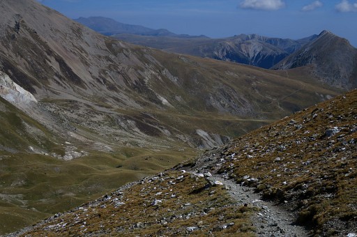 |
then descending into the valley, making a large half-circle | ||||||||||||||||||||||||||||||||||||||||||||||||
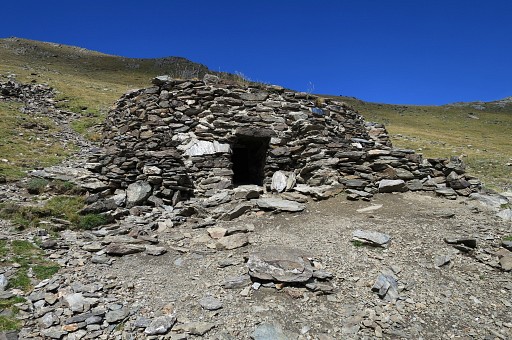 |
passing this simple shelter. |
||||||||||||||||||||||||||||||||||||||||||||||||
 |
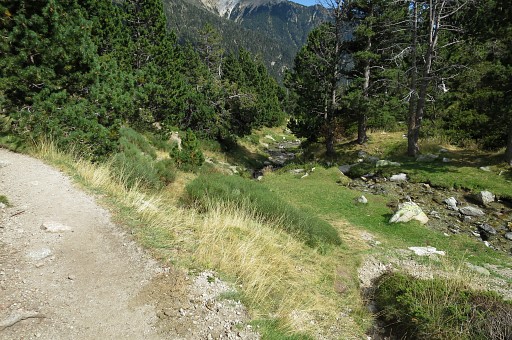
Then continuing to a next coll (Coll de la Marrana) passing streams where the terrain is flat enough here and there for a bivouac. | ||||||||||||||||||||||||||||||||||||||||||||||||
 |
From the Coll de la Marrana a view in the direction of Refugio de Ull de Ter. | ||||||||||||||||||||||||||||||||||||||||||||||||
 |
|||||||||||||||||||||||||||||||||||||||||||||||||
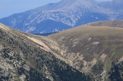 |
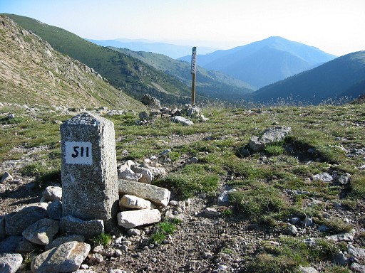
Zoom-in to Porteille de Mantet (bm511). That's the end of this GRPdesBF-stage. |
||||||||||||||||||||||||||||||||||||||||||||||||
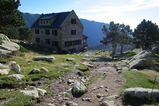 |
Refugio de Ull de Ter | ||||||||||||||||||||||||||||||||||||||||||||||||
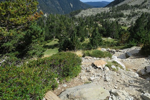 |
Then a steep descent to the road | ||||||||||||||||||||||||||||||||||||||||||||||||
 |
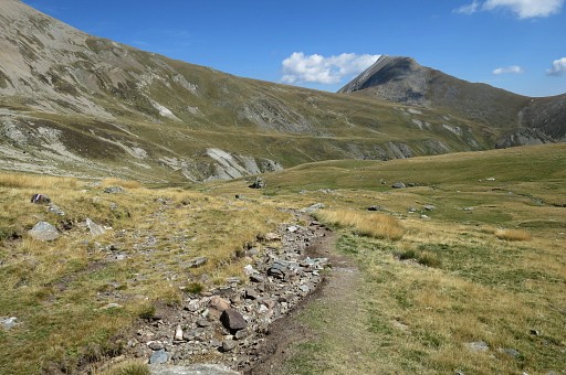
with alongside the trail some spots suitable for a bivouac (besides a stream). That's important because further on, up to Porteille de Mantet and on the next stage there are no sources and no bivouac-spots for a long time. When arriving on the road, go left and climb along the road to the ski station Vallter 2000. |
||||||||||||||||||||||||||||||||||||||||||||||||
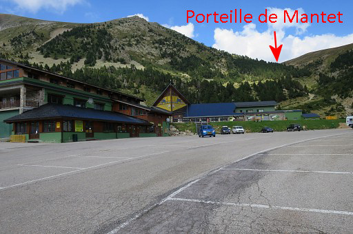 |
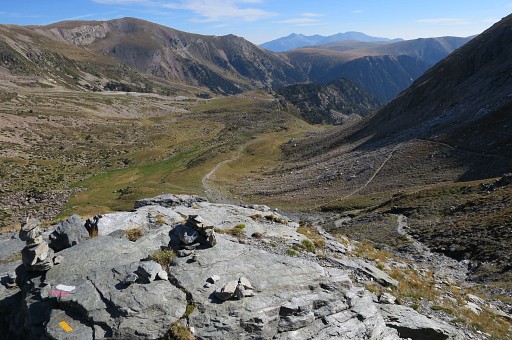
Having arrived at the ski station, this picture shows where Col de Mantet is. |
||||||||||||||||||||||||||||||||||||||||||||||||
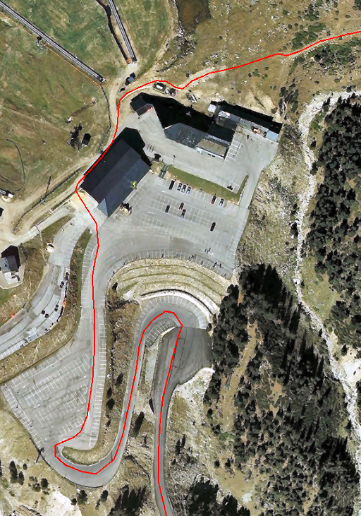 |
And map shows how to get to the trail to Col de Mantet. |
||||||||||||||||||||||||||||||||||||||||||||||||
|
Bm511 at Col de Mantet, the end of this stage. If you descend into France for 750m (200m elevation descent), there's a stream and opportunities for a bivouac. |
||||||||||||||||||||||||||||||||||||||||||||||||