|
The
bordermarkers of the Pyrenees : the GRPdesBF
|
||||||||||||||||||||||||||||||||||||||||||||||||||||||||||
| - stage 49 - Coustouges - Refuge de Salinas (bm543-553)  previous
stage next stage previous
stage next stage  |
 |
|||||||||||||||||||||||||||||||||||||||||||||||||||||||||
 |
||||||||||||||||||||||||||||||||||||||||||||||||||||||||||
| Only
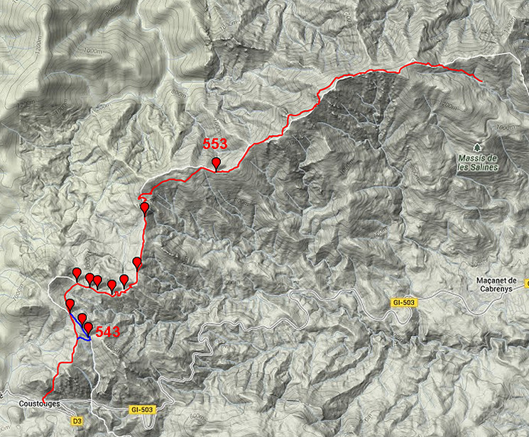
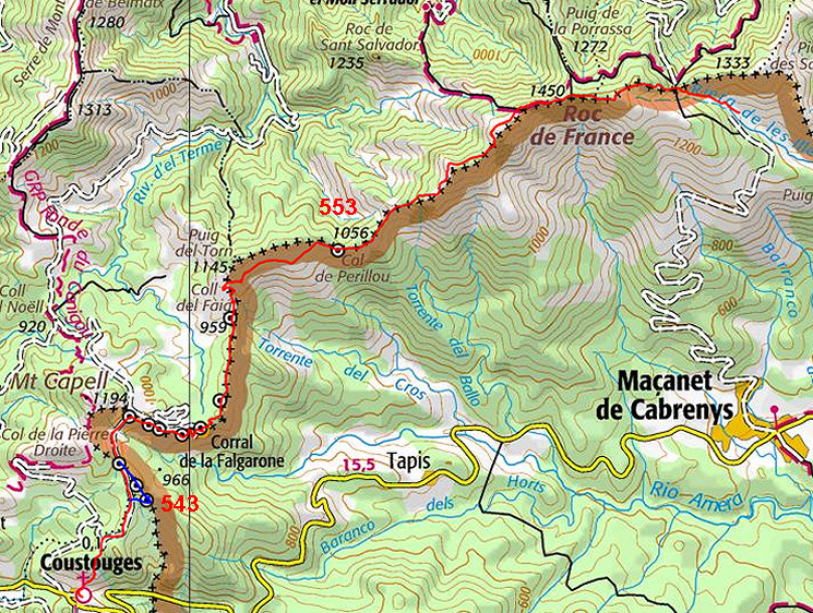
the bordermarkers along this stage are shown (and some adjoining ones).
The main route is red,
the variants have other colors. The main route provides a smooth
on-going route along most bordermarkers, the variants give access to
the remaining bordermarkers. See the GRPdesBF-principles. Click here for an fullscreen interactive map. In short A nice walk along the borderridge, gradually climbing to the landmark of Roc de France (1450m) and then - in the final part - descending to the refuge de Salinas. From Coustouges we climb on a rocky trail to a dirtroad which passes bm545. You have to leave the dirtroad to cover on the only variant in this stage bm543 and 544. The dirtroad brings you then on Spanish soil directly to bm546 and continues (with bordermarkers left and right of the road) until Pla de Falguerona (bm550) with a deserted restaurant. A smaller road/trail leads you further and higher along the borderridge/borderfence until bm552. The dirtroad continues underneath the borderridge until bm553, the last bm in this stage. Then it takes another 4,5 km and 350m elevation along the borderridge up to Roc de France. After the descent to Coll dels Pous, there's a footpath bringing you directly and easily to Refuge de Salinas. Considerations Again, water is a concern since most of the route is on the borderridge. Collect enough water while you're still in Coustouges. At the end - at Refuge des Salinas, there's plenty of water. Refuge de Salinas is nothing more then a large room with bunkbeds and a fireplace in a larger building. Camping seems possible beyond the building, further along the stream. Factsheet
Gps-files needed
Useful You might check the relevant webpages in the 'All markers'-section and 'All my trips'-section. They provide pictures of the bordermarkers and additional information. Version 01 March 2014. If you have any correction, suggestion etcetera -> please email me: eefberns@grenspalen.nl MAPS AND DIRECTIONS You might check the relevant webpages in the 'All markers'-section and 'All my trips'-section for more pictures of the bordermarkers and wayfinding-issues. Print your own maps It's easy to print your own - custom made - maps with the GRPdesBF-route and the bordermarkers on them. See: Print your own maps |
||||||||||||||||||||||||||||||||||||||||||||||||||||||||||
 |
||||||||||||||||||||||||||||||||||||||||||||||||||||||||||
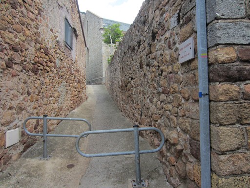 |
We start in the lovely village of Coustouges and pick up the yellow/red trail |
|||||||||||||||||||||||||||||||||||||||||||||||||||||||||
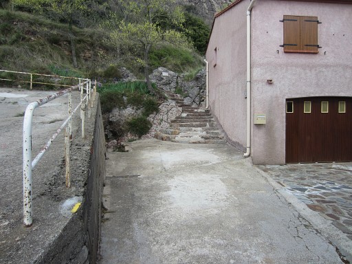 |
which soon becomes only yellow waymarked and climbs |
|||||||||||||||||||||||||||||||||||||||||||||||||||||||||
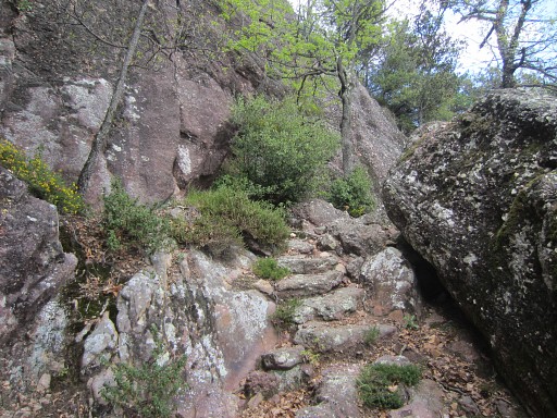 |
on a rocky path |
|||||||||||||||||||||||||||||||||||||||||||||||||||||||||
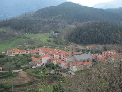 |
- with in between this viewpoint back on Coustouges - |
|||||||||||||||||||||||||||||||||||||||||||||||||||||||||
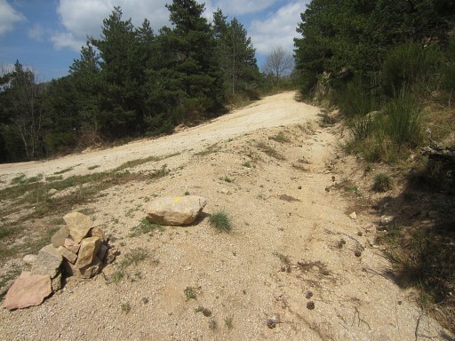 |
until you reach this broad sandy dirtroad. |
|||||||||||||||||||||||||||||||||||||||||||||||||||||||||
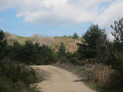 |
A bit further you can already spot the hill-ridge where bm543 ans 544 are located. |
|||||||||||||||||||||||||||||||||||||||||||||||||||||||||
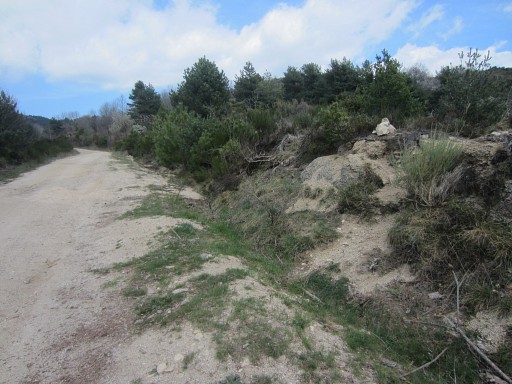 |
There is a trail from the dirtroad towards bm543 but where does it start? You will pass a first cairn at the right side of the road but it's the second one - 100m further - which is the one. |
|||||||||||||||||||||||||||||||||||||||||||||||||||||||||
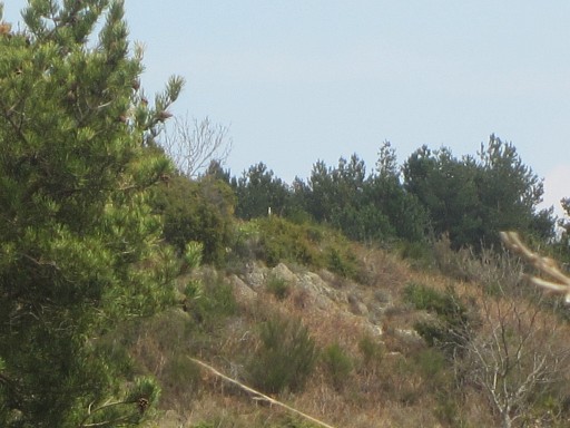 |
Variant 1 via bm543-544 Actually , you can already spot from this cairn in the distance the white metal pole besides bm543 (see the pictures further on) |
|||||||||||||||||||||||||||||||||||||||||||||||||||||||||
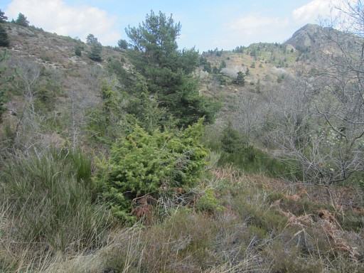 |
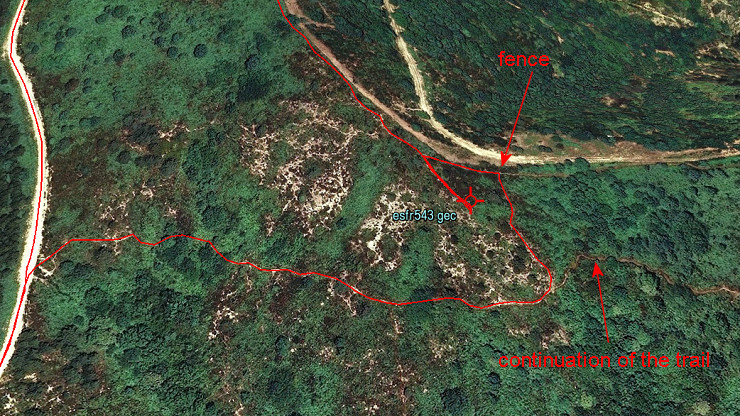
The trail leads me to a hillside. Its course is E-SEE for ± 250m, (passing in the end in fact underneath bm243), then bends N to climb the hillside. Note: that bend to the N is the dominant course of the trail but the trail also continues straight ahead (NE -> SEE) on a smaller path. Don't go wrong there. Let's show it on a map: |
|||||||||||||||||||||||||||||||||||||||||||||||||||||||||
 |
||||||||||||||||||||||||||||||||||||||||||||||||||||||||||
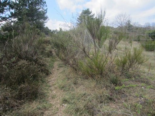 |
So: the trail bends to the NNW and climbs to a high fence From there the trail goes left along the fence. |
|||||||||||||||||||||||||||||||||||||||||||||||||||||||||
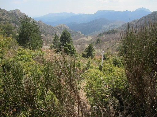 |
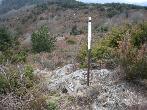
When you have reached the ridge after ± 30m, there is a side-trail going SE. In 40m hence and forth, you can visit bm543, its finding facilitated by a metal pole. |
|||||||||||||||||||||||||||||||||||||||||||||||||||||||||
|
Bm543 |
|||||||||||||||||||||||||||||||||||||||||||||||||||||||||
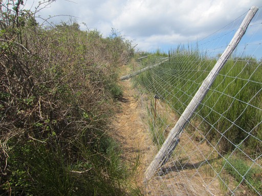 |
The back and continuing along the fence |
|||||||||||||||||||||||||||||||||||||||||||||||||||||||||
|
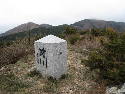
to bm544 Then further along the trail until |
|||||||||||||||||||||||||||||||||||||||||||||||||||||||||
|
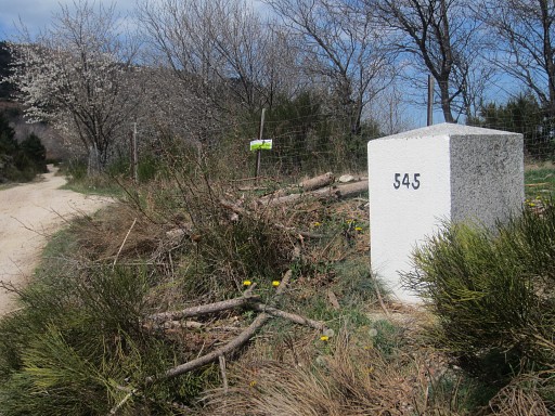
bm545. You are now back on the main route. Continue on the dirtroad, it will bring you in 700m to |
|||||||||||||||||||||||||||||||||||||||||||||||||||||||||
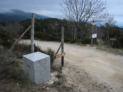
|
bm546. At this point, go to the right. |
|||||||||||||||||||||||||||||||||||||||||||||||||||||||||
|
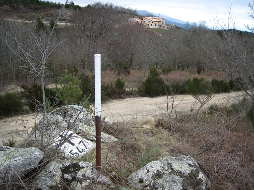
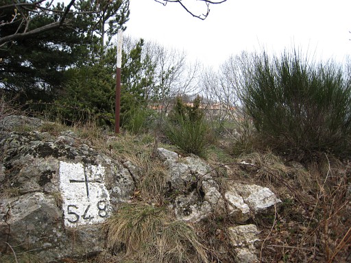
Bm547, on a small hill S of the dirtroad, amidst blackberry, with a iron pole besides it. The pole is visible from the road. |
|||||||||||||||||||||||||||||||||||||||||||||||||||||||||
|
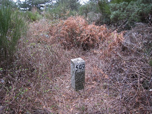
Bm548, to the N of the dirtroad, again with a pole besides. The pole is visible from the road. |
|||||||||||||||||||||||||||||||||||||||||||||||||||||||||
|
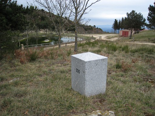
Bm549, an atypical bm, located at a
forested hill, amidst blackberry. Might be difficult to reach, perhaps better from the dirtroad N of it. |
|||||||||||||||||||||||||||||||||||||||||||||||||||||||||
|
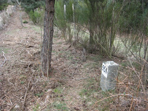
Bm550, again a 'fat' granite one, close to a closed restaurant. Beyond bm550 there's a 'borderpath' between two fences like a sort of no man's land. |
|||||||||||||||||||||||||||||||||||||||||||||||||||||||||
|
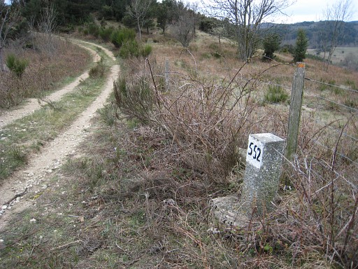
Bm551, a small bm like bm549 | |||||||||||||||||||||||||||||||||||||||||||||||||||||||||
|
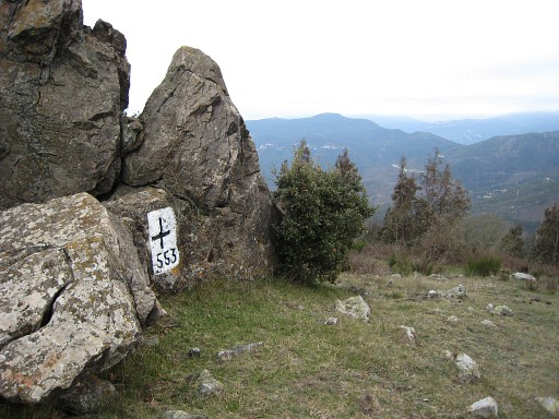
Bm552, idem Keep following the dirtroad which first winds left and right on eitherside of the borderline, then enters Spain and goes (orange waymarked) NEE to |
|||||||||||||||||||||||||||||||||||||||||||||||||||||||||
|
bm553 Then it takes another 4,5 km and 350m elevation along the borderridge up to Roc de France. |
|||||||||||||||||||||||||||||||||||||||||||||||||||||||||
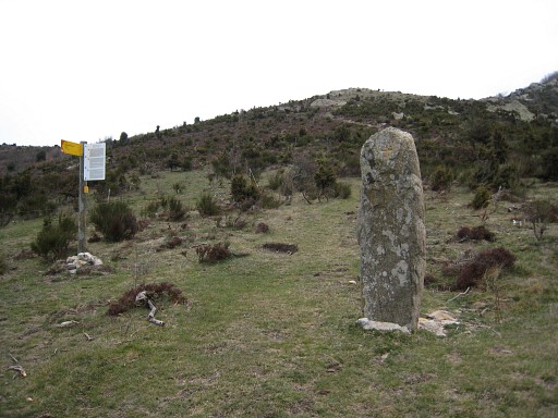 |
Not much further beyond bm553: this "Menhir de la Dona Morta". Continue on the -variously waymarked - trail over the borderridge. |
|||||||||||||||||||||||||||||||||||||||||||||||||||||||||
At Collada de Sant Martí the trail connects with the
GR10-trail. When approaching Roc de France, wayfinding might be a bit confusing. This map might help you: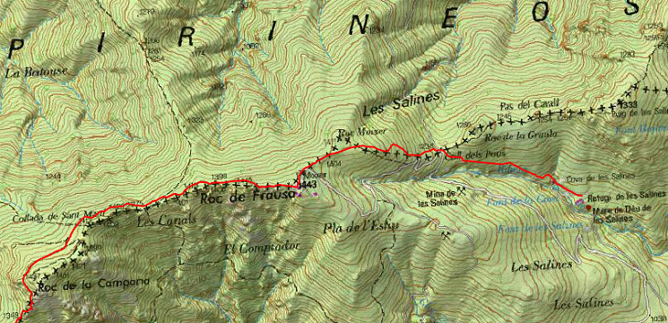 Remember that the GR10 (which winds underneath Roc de France at its N-side) will also bring you to Coll dels Pous. |
||||||||||||||||||||||||||||||||||||||||||||||||||||||||||
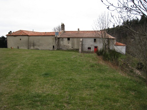 |
At Coll dels Pous, there's a footpath going SE, bringing you directly and easily to
Refuge de Salinas. Refugi de Salines: the red door is the entrance of the refuge-part. |
|||||||||||||||||||||||||||||||||||||||||||||||||||||||||
 previous
stage next stage previous
stage next stage  |
||||||||||||||||||||||||||||||||||||||||||||||||||||||||||
