|
The
bordermarkers of the Pyrenees : the GRPdesBF
 |
|||||||||||||||||||||||||||||||||||||||||||||||||||||||||||||||||||||||||||||||||||||
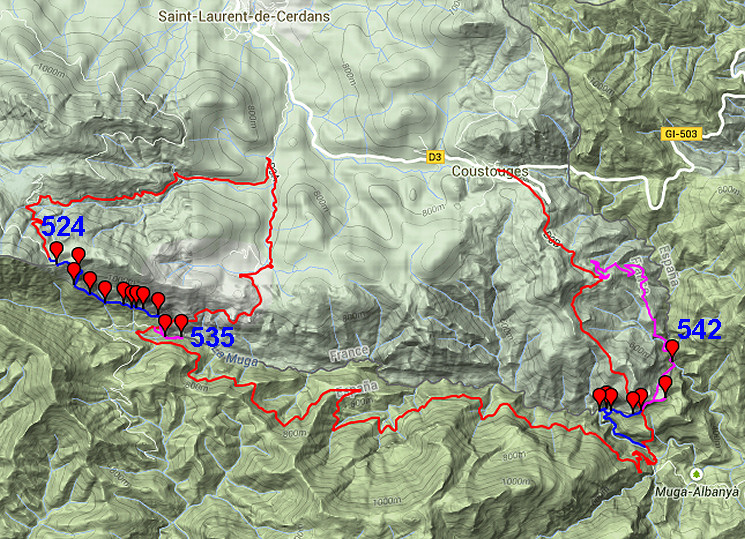
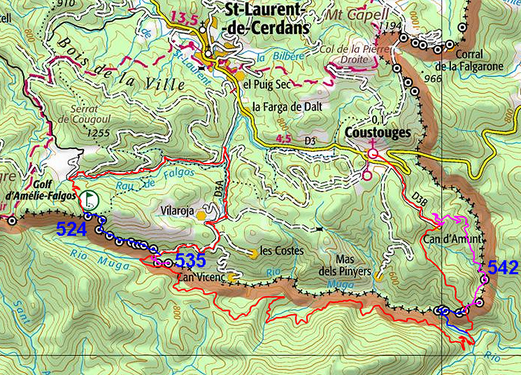
| - stage 48 - Coll de les Maçanes - Coustouges (bm524-542) |
 |
||||||||||||||||||||||||||||||||||||||||||||||||||||||||||||||||||||||||||||||||||||
Update may 2020: the variants along bm536-5395 and bm541-542 will be shortened to back & forth trips from bm540. This is the result of new reconnaissances, the last one was on 20200830. |
|||||||||||||||||||||||||||||||||||||||||||||||||||||||||||||||||||||||||||||||||||||
 |
|||||||||||||||||||||||||||||||||||||||||||||||||||||||||||||||||||||||||||||||||||||
| You can already watch these new routes in detail with this kml-file. | |||||||||||||||||||||||||||||||||||||||||||||||||||||||||||||||||||||||||||||||||||||
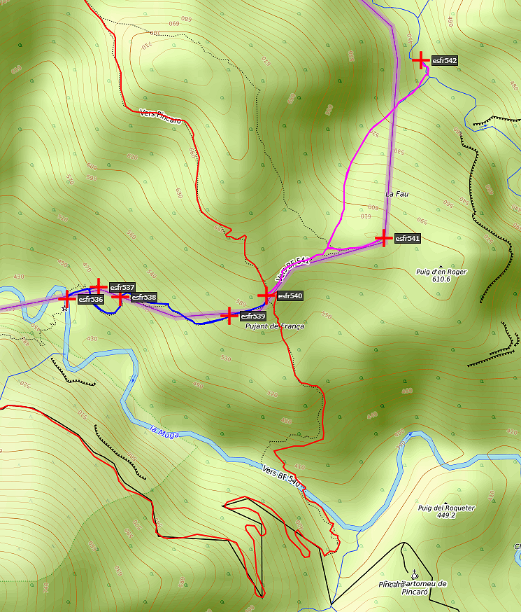
Hereunder the original stage with its original variants along 536-539 and 541-542: |
|||||||||||||||||||||||||||||||||||||||||||||||||||||||||||||||||||||||||||||||||||||
 |
|||||||||||||||||||||||||||||||||||||||||||||||||||||||||||||||||||||||||||||||||||||
| Only
the bordermarkers on this stage are shown (and some adjoining ones).
The main route is red,
the variants have other colors. The main route provides a smooth
on-going route along most bordermarkers, the variants give access to
the more remote bordermarkers. See the GRPdesBF-principles. Click here for an fullscreen interactive map. In short This might be the most challenging stage of the entire GRPdesBF in terms of finding the bordermarkers. The border traverses a wild and rugged terrain and many bordermarkers are difficult to reach. As a consequence the main route (on easy roads and trails) hardly passes bordermarkers - in fact only one: bm540 - and makes for the same reason a peculiar detour in the beginning. As said, the variants are not easy. Variant 1 is essentially a descent from Coll de les Maçanes along bm524-532 through the forest to Hostal de la Muga Variant 2 is a short detour from Hostal de la Muga to do bm534 and 535 along the Muga Variant 3 is an adventurous climb from the Muga through thick forest and along a rock ridge, covering bm536 to bm539 Variant 4: after the easy bm541, you have to descend down a forested hillside to the Rio Mayor where bm542 is engraved. Then you can proceed more gentle to Can d'Amunt and join the main route. But wayfinding can be tricky! Considerations Be careful, the variants are rough and isolated. Variant 3 and 4 involve streams which can rise dangerously fast in heavy rain. The computer-generated times in the factsheet for variant 1-2-3 should at least be doubled. This stage could be too much for one day if you include one or more variants. There are - early in the stage - nice bivouac-opportunities around Hostal de la Muga. Further on to the east - a bit beyond the point where you have to leave the dirtroad to cross the Muga - there are more suitable spots. My recommendation: first collect your water at the Muga, then pitch your tent besides the mysterious chapel of St. Bartomeu de Pincaró. Another spot could be: the half-open space 125m SWW of bm541 (but take your water). If you reach Coustouges, there's no obvious place to bivouac overnight. You could consider a bivouac in the fields behind the cemetary: there's a watertap in the cemetary and it's ... very, very quit at night. Factsheet
Gps-files needed
Useful You might check the relevant webpages in the 'All markers'-section and 'All my trips'-section. They provide more pictures of the bordermarkers and additional information. Version 03 December 2014. If you have any correction, suggestion etcetera -> please email me: eefberns@grenspalen.nl MAPS AND DIRECTIONS Print your own maps It's easy to print your own - custom made - maps with the GRPdesBF-route and the bordermarkers on them. See: Print your own maps |
|||||||||||||||||||||||||||||||||||||||||||||||||||||||||||||||||||||||||||||||||||||
 |
|||||||||||||||||||||||||||||||||||||||||||||||||||||||||||||||||||||||||||||||||||||
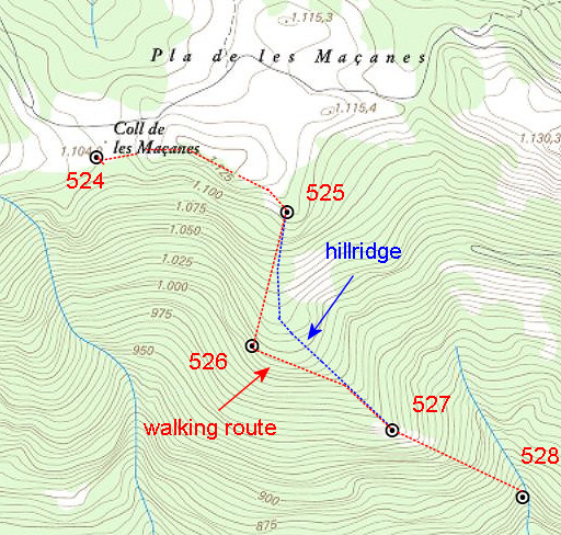
| From
the Coll de les Maçanes, the main route descends N along the dirtroad
to the entrance of the Falgos-golf complex. Then it descends E along
the tarmac road untill the junction with the D3A. Go right and follow
the tarmac road up to the hamlet of Pla de Castanyer (don't take the branch to
the village of Vilaroja). From there you can descend along a winding dirtroad to
Hostal de la Muga. Total distance: 9km NB: why this detour to the N? Well, there are more direct routes but then you have to tresspass private property. The GRPdesBF-main route uses in principle only public roads and paths. |
|||||||||||||||||||||||||||||||||||||||||||||||||||||||||||||||||||||||||||||||||||||
| Variant 1 via bm524-533 from Coll de les Maçanes to Hostal de la Muga | |||||||||||||||||||||||||||||||||||||||||||||||||||||||||||||||||||||||||||||||||||||
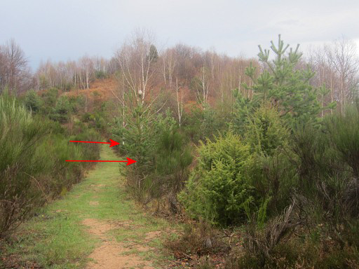 |
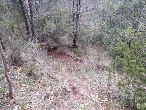
At the path going SEE from the open space of Col de les Maçanes, you
will spot two birch trees at its right side. Just before the first birch tree, a faint trail enters the 'field' to the right |
||||||||||||||||||||||||||||||||||||||||||||||||||||||||||||||||||||||||||||||||||||
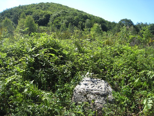 |
and winds
50m through the blackberry and broom to reach bm524 Bm524 can be overgrown- in summertime - by blackberry bush. So access and finding can be difficult. Then proceed 10m beyond bm544 to the S to the fence and climb through it |
||||||||||||||||||||||||||||||||||||||||||||||||||||||||||||||||||||||||||||||||||||
 |
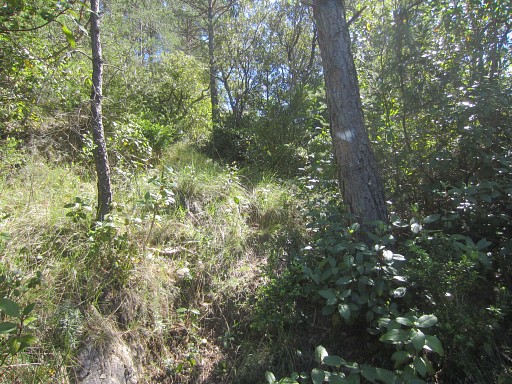
Then (this picture) go left towards the hilltop E (± 125m distance), some faint trails might help you to climb it. That hilltop is the beginning of a sort of ridge, going first SEE. A faint trail will help you along. That ridge first climbs very gently in 100m to a second hilltop. |
||||||||||||||||||||||||||||||||||||||||||||||||||||||||||||||||||||||||||||||||||||
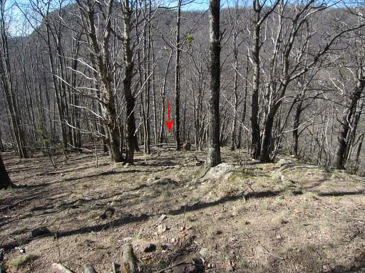
 |
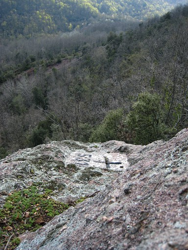
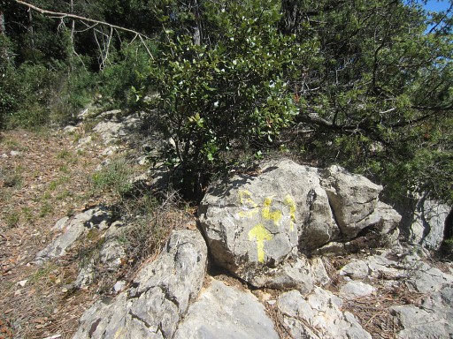
And then the ridge slowly descends, bending from SEE to SE (this is important,
otherwise you might continue NE to another hilltop in the distance) to
reach in 100m a lower - rocky -hilltop. That's the end of the ridge and that's where (red arrow) bm525 can be found. |
||||||||||||||||||||||||||||||||||||||||||||||||||||||||||||||||||||||||||||||||||||
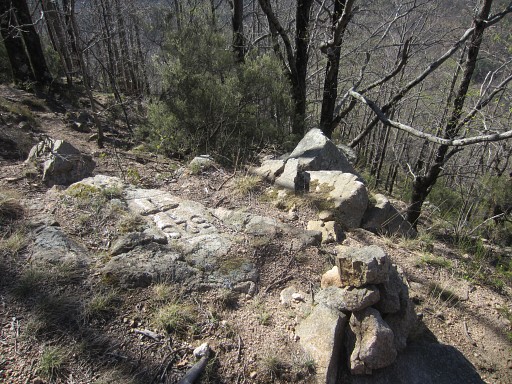
 |
Bm525 is situated on the W-side of a rocky outcrop. This picture: looking approximately in the direction where you have to descend towards bm526. |
||||||||||||||||||||||||||||||||||||||||||||||||||||||||||||||||||||||||||||||||||||
|
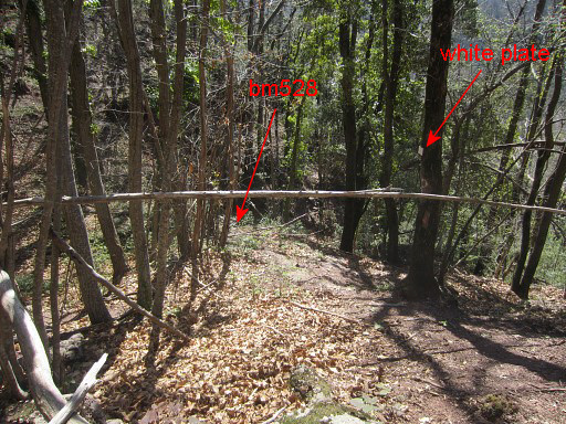
Then a steep and slippery descent (later less steep) for ± 200m through the forest SSW to bm526. Use your compass (or gps)! You can easily stray away from your course in the forest. Luckily, there's a cairn now on this groundlevel-bordercross. |
||||||||||||||||||||||||||||||||||||||||||||||||||||||||||||||||||||||||||||||||||||
 |
Bm526 |
||||||||||||||||||||||||||||||||||||||||||||||||||||||||||||||||||||||||||||||||||||
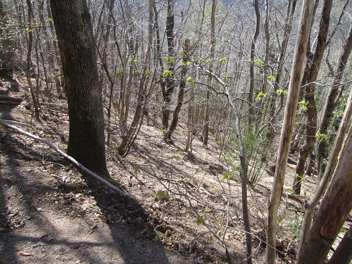 |
From
bm526, descend further but now SEE for ± 200m to a very distinctive
rocky ridge. First that descent is on a hillside but then - after 100-150m - the hillside becomes a descending hillridge. |
||||||||||||||||||||||||||||||||||||||||||||||||||||||||||||||||||||||||||||||||||||
 |
This is an important
direction because you might go too far SE instead of SEE. Then the hillside remains a hillside and you will miss that rocky ridge with bm527 alltogether. |
||||||||||||||||||||||||||||||||||||||||||||||||||||||||||||||||||||||||||||||||||||
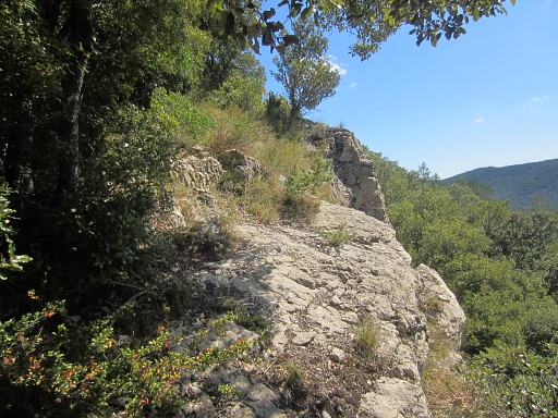
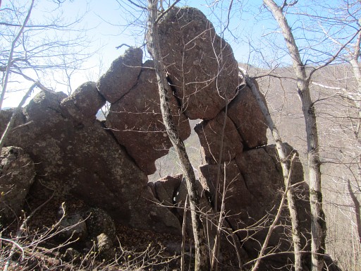 |
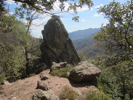
The rocky ridge has a peculiar beginning: this impressive rock-construction. | ||||||||||||||||||||||||||||||||||||||||||||||||||||||||||||||||||||||||||||||||||||
 |
Bm527 is however ± 75m further SEE on the rocky
ridge: just follow it and get on it when you can and you will reach
bm527.
|
||||||||||||||||||||||||||||||||||||||||||||||||||||||||||||||||||||||||||||||||||||
 |
Then
- to bm528 - it's a steep descent SEE besides the rocky ridge for ±
225m to a stream. For a part, orange waymarks will help you |
||||||||||||||||||||||||||||||||||||||||||||||||||||||||||||||||||||||||||||||||||||
 |
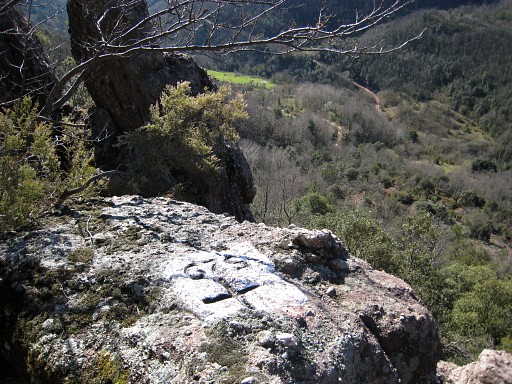
Bm528 shouldn't be difficult to find: it's horizontal on floorlevel on a long flat rock which almost 'hangs' above the stream. | ||||||||||||||||||||||||||||||||||||||||||||||||||||||||||||||||||||||||||||||||||||
 |
It might be covered be leaves. |
||||||||||||||||||||||||||||||||||||||||||||||||||||||||||||||||||||||||||||||||||||
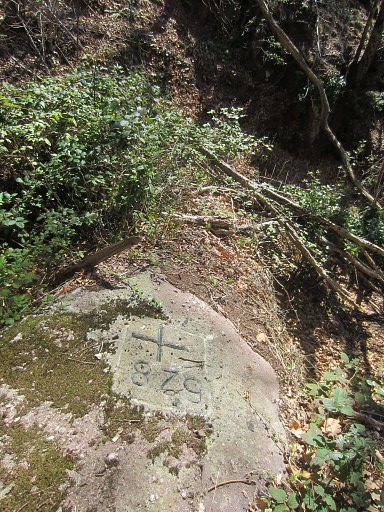 |
Bm528 |
||||||||||||||||||||||||||||||||||||||||||||||||||||||||||||||||||||||||||||||||||||
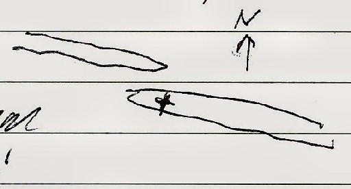
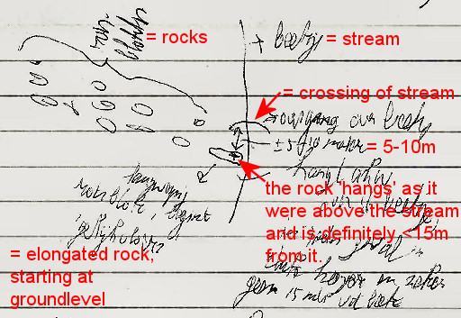 |
I made this small sketch of the situation on 4 april 2008. | ||||||||||||||||||||||||||||||||||||||||||||||||||||||||||||||||||||||||||||||||||||
 |
A few meters to
the left is a tiny cascade in the stream, another help to find bm528. You can cross the stream left of this cascade. |
||||||||||||||||||||||||||||||||||||||||||||||||||||||||||||||||||||||||||||||||||||
 |
After crossing the stream, climb E up the hill where the rocky ridge reappears in a modest form (looste boulders in a line) and continue E along that ridge. | ||||||||||||||||||||||||||||||||||||||||||||||||||||||||||||||||||||||||||||||||||||
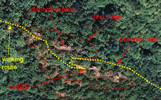 |
Gradually
the ridge becomes more prominent and gets its summit in a
distinctive peak. After ± 225m (from bm528) you'd better get on the ridge (± 50m before that peak) because you have to be on the other side of the ridge on a second ridge. |
||||||||||||||||||||||||||||||||||||||||||||||||||||||||||||||||||||||||||||||||||||
 |
I made this small sketch of the situation on 4 april 2008. | ||||||||||||||||||||||||||||||||||||||||||||||||||||||||||||||||||||||||||||||||||||
 |
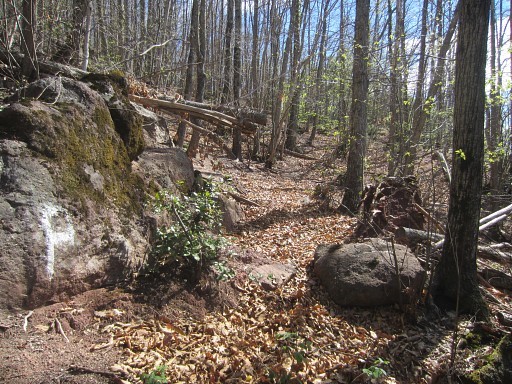
This picture: still along the ridge coming from bm528. The ridge is about to culminate in a summit. A bit further on |
||||||||||||||||||||||||||||||||||||||||||||||||||||||||||||||||||||||||||||||||||||
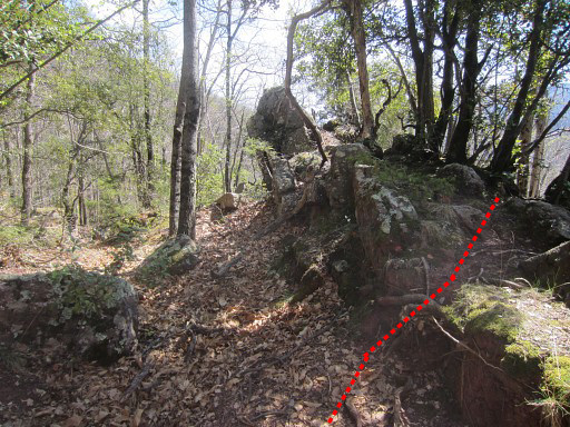 |
at this point, get on the ridge itself. | ||||||||||||||||||||||||||||||||||||||||||||||||||||||||||||||||||||||||||||||||||||
 |
Continue on the ridge until this 'distinctive peak' is near. Bm529 is situated on the second ridge ± 25m SE of this 'distinctive peak'. First descend a few meters to the S and |
||||||||||||||||||||||||||||||||||||||||||||||||||||||||||||||||||||||||||||||||||||
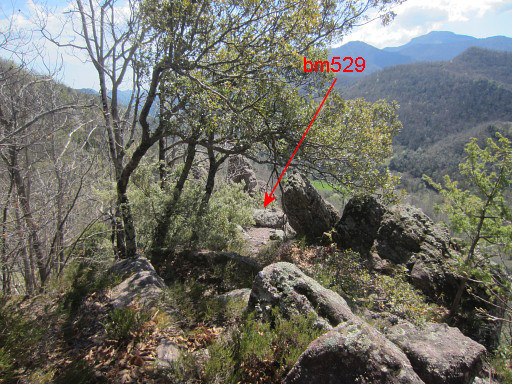 |
proceed SE to the second ridge and you will get to bm529. | ||||||||||||||||||||||||||||||||||||||||||||||||||||||||||||||||||||||||||||||||||||
 |
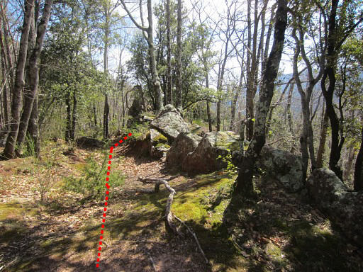
Bm529. In the distance: the green pastures of Hostal de la Muga already visible. From bm529 you can descend between both ridges SEE- steeply - for ±125m to another stream. |
||||||||||||||||||||||||||||||||||||||||||||||||||||||||||||||||||||||||||||||||||||
 |
Bm530 is in the line of the ridge which continues from bm529 and
descends to the stream. Close to that stream, you'll arrive at this spot Bm530 is horizontal on a rockledge, above the stream. |
||||||||||||||||||||||||||||||||||||||||||||||||||||||||||||||||||||||||||||||||||||
 |
Bm530 Then go left of bm530, descend a bit and cross the stream. |
||||||||||||||||||||||||||||||||||||||||||||||||||||||||||||||||||||||||||||||||||||
 |
Then climb E up the hill and reach after ± 75m on a hilltop this ruined barn ("Can Toni") and | ||||||||||||||||||||||||||||||||||||||||||||||||||||||||||||||||||||||||||||||||||||
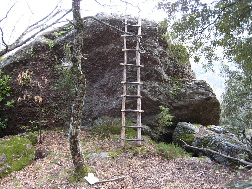 |
this boulder opposite of it. Bm531 is engraved at the top of it. The ladder - once made by Jean Iglesias - is one way to reach the top. But you can also easily climb to it at the right side of the boulder (unless the rock is wet, I suppose) and then you will get a closer view of bm531. |
||||||||||||||||||||||||||||||||||||||||||||||||||||||||||||||||||||||||||||||||||||
 |
Bm531 |
||||||||||||||||||||||||||||||||||||||||||||||||||||||||||||||||||||||||||||||||||||
 |
From this spot (Can Toni), a trail to the E (white waymarked, later yellow) brings you easily in ± 100m along | ||||||||||||||||||||||||||||||||||||||||||||||||||||||||||||||||||||||||||||||||||||
 |
bm532 |
||||||||||||||||||||||||||||||||||||||||||||||||||||||||||||||||||||||||||||||||||||
|
and then - further along the white cq yellow trail - you will get in ± 225m | ||||||||||||||||||||||||||||||||||||||||||||||||||||||||||||||||||||||||||||||||||||
 |
at this crossing of a stream (usually dry).
That stream is the borderline from bm533 - which is only 20m higher along the stream- to the junction with the Muga in the SSE. |
||||||||||||||||||||||||||||||||||||||||||||||||||||||||||||||||||||||||||||||||||||
 |
But how
to get to bm533? This is the easiest way: go back 10-20m on the trail and then make a curve to the right to the stream higher on, following the white arrow and waymarks to |
||||||||||||||||||||||||||||||||||||||||||||||||||||||||||||||||||||||||||||||||||||
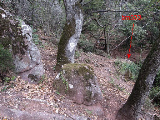 |
this hunters's post with |
||||||||||||||||||||||||||||||||||||||||||||||||||||||||||||||||||||||||||||||||||||
 |
bm533. |
||||||||||||||||||||||||||||||||||||||||||||||||||||||||||||||||||||||||||||||||||||
 |
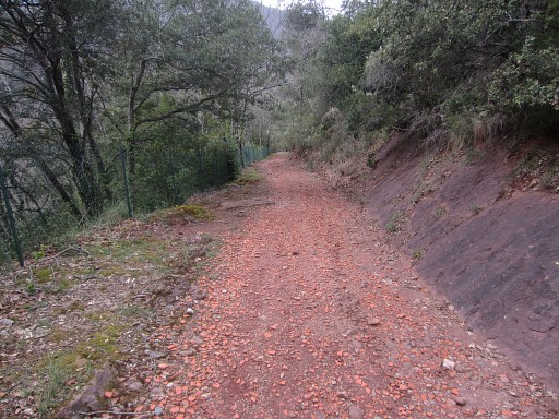
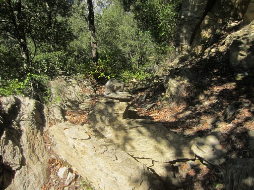
Then return the same way to the crossing of the stream where you came from. The trail - still yellow waymarked - continues and descends, |
||||||||||||||||||||||||||||||||||||||||||||||||||||||||||||||||||||||||||||||||||||
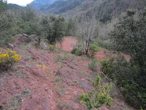 |
crossing red sandy terrain, and ends at a a dirtroad. This is the dirtroad descending from the hamlet of Pla Castanyer, south of Vilaroja. |
||||||||||||||||||||||||||||||||||||||||||||||||||||||||||||||||||||||||||||||||||||
| End of variant 1 |
|||||||||||||||||||||||||||||||||||||||||||||||||||||||||||||||||||||||||||||||||||||
 |
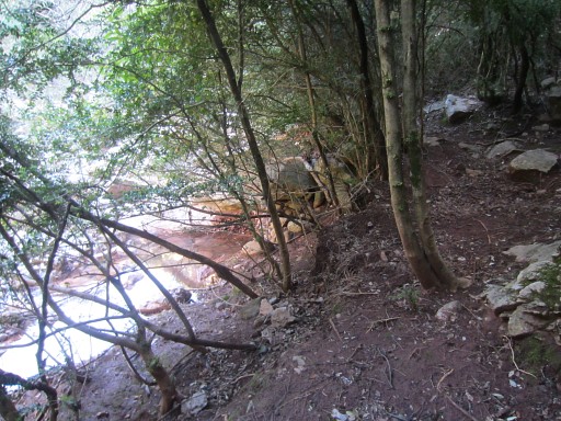
We are now back at the main route. Now continue W on the dirtroad which arrives (and ends) soon |
||||||||||||||||||||||||||||||||||||||||||||||||||||||||||||||||||||||||||||||||||||
 |
at the streambed of the borderstream. A bit to the right is the trail which brings you across the border to the ruined farm of Hostal de la Muga, not far away. |
||||||||||||||||||||||||||||||||||||||||||||||||||||||||||||||||||||||||||||||||||||
| Variant 2 via bm534-535 | |||||||||||||||||||||||||||||||||||||||||||||||||||||||||||||||||||||||||||||||||||||
 |
This variant is a small detour. From the spot above, you can descend directly S (a bit through the streambed, then along it) to the junction of stream and the Muga. |
||||||||||||||||||||||||||||||||||||||||||||||||||||||||||||||||||||||||||||||||||||
 |
Bm534
is on the other side of the Muga. If the water is not too high, you can easily jump to the other side. If not, be careful: the streambed can be very slippery. |
||||||||||||||||||||||||||||||||||||||||||||||||||||||||||||||||||||||||||||||||||||
 |
On
the other side - a bit to the left of bm534- you can climb up the hill and arrive after 20-30m
at a trail going E. That trail is an easy access towards bm535. You'd better make a waymark here because - when returning - it's not obvious where to descend back to bm534. |
||||||||||||||||||||||||||||||||||||||||||||||||||||||||||||||||||||||||||||||||||||
 |
When you spot - after ± 175m - 2 houses at the other side of the Muga, descend to them. | ||||||||||||||||||||||||||||||||||||||||||||||||||||||||||||||||||||||||||||||||||||
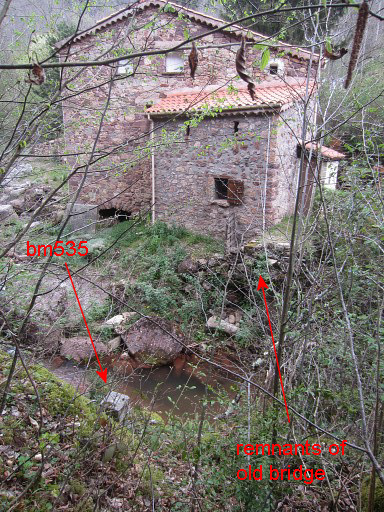 |
Bm535 is just opposite the left house. You can see the remnants of the bridge which was flooded away in october 1940 when enormous rainfall caused destruction all over the eastern Pyrenees. |
||||||||||||||||||||||||||||||||||||||||||||||||||||||||||||||||||||||||||||||||||||
 |
Bm535 Climb back to the trail and return to bm534. If you have made a waymark before, you will know where to descend back to the Muga. Then cross the meadow directly to Hostal de la Muga and you're back at the main route. |
||||||||||||||||||||||||||||||||||||||||||||||||||||||||||||||||||||||||||||||||||||
| End of variant 2 |
|||||||||||||||||||||||||||||||||||||||||||||||||||||||||||||||||||||||||||||||||||||
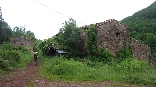 |
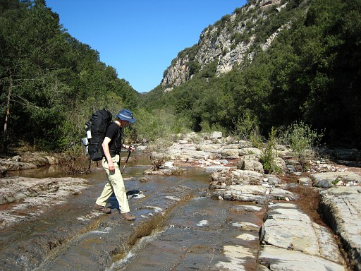
Hostal de la Muga closed its doors in january 1992. The roads leading to it are from the 70ties. From here, the main route continues on the S-side of the Muga on a winding dirtroad to the E. for 11km. |
||||||||||||||||||||||||||||||||||||||||||||||||||||||||||||||||||||||||||||||||||||
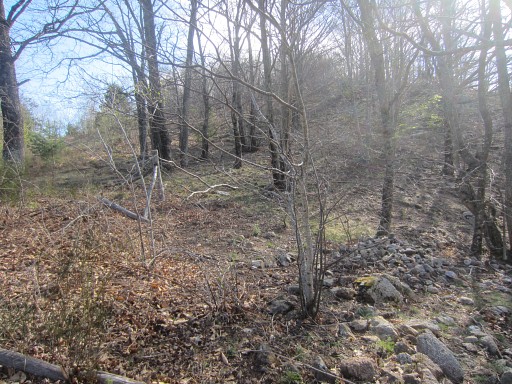
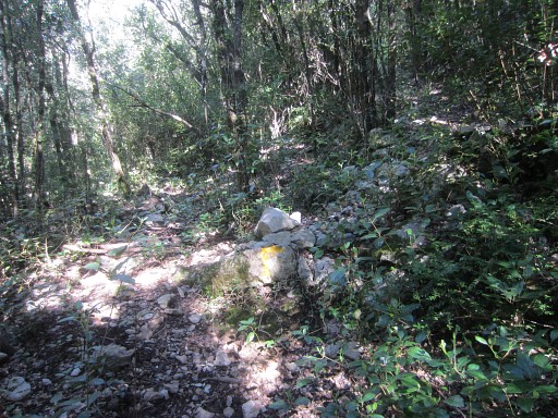
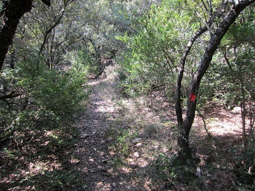
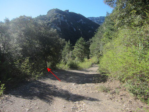 |
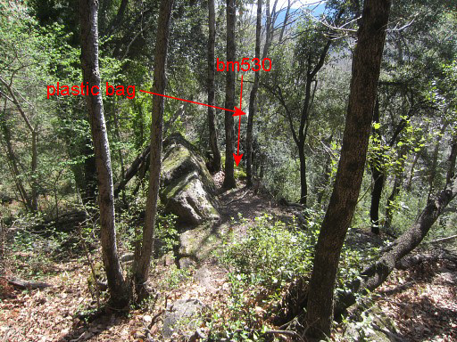
Then ( ± 200m before the path to the right up to the chapel of St. Bartomeu de Pincaró) it leaves
the dirtroad left on a yellow waymarked trail which descends to the Muga. So: after those 11km, you have to be attentive to the spot where you have to leave the dirtroad. This picture: a view from the dirtroad looking S and showing where the trail to the Muga starts. |
||||||||||||||||||||||||||||||||||||||||||||||||||||||||||||||||||||||||||||||||||||
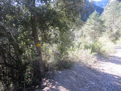 |
As you can see: yellow waymarked. | ||||||||||||||||||||||||||||||||||||||||||||||||||||||||||||||||||||||||||||||||||||
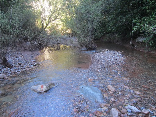
 |
The trail descends to the Muga. Then follow the Muga ± 50m upstream (there are yellow marks and cairns in the streambed) and the yellow trail continues on the other side in the forest. |
||||||||||||||||||||||||||||||||||||||||||||||||||||||||||||||||||||||||||||||||||||
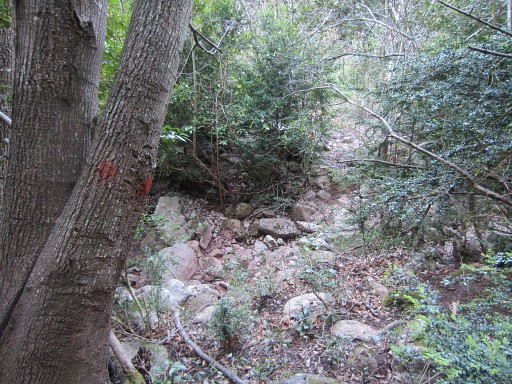
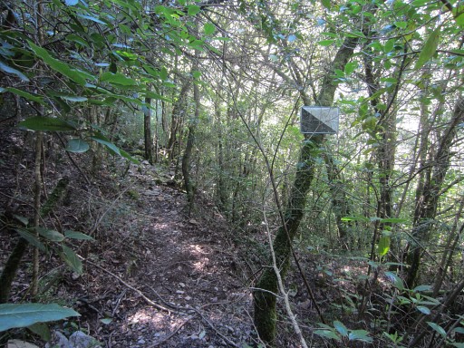
 |
But - after ± 100m (?)
- the yellow trail branches right and starts to climb the hillside. There's a cairn and yellow paint to mark the branch. The main route continues along the yellow route and will climb to bm540. Variant 3, however, goes straight on |
||||||||||||||||||||||||||||||||||||||||||||||||||||||||||||||||||||||||||||||||||||
| Variant 3 via bm536-539 | |||||||||||||||||||||||||||||||||||||||||||||||||||||||||||||||||||||||||||||||||||||
 |
So: continue on
the trail parallel to the Muga, now with no waymarks. It climbs above the Muga |
||||||||||||||||||||||||||||||||||||||||||||||||||||||||||||||||||||||||||||||||||||
 |
and descends
back to its bank. From there you can follow the riverbed upstream |
||||||||||||||||||||||||||||||||||||||||||||||||||||||||||||||||||||||||||||||||||||
 |
or
take a dry river-arm to the right and reach the streambed
further on. There are red waymarks in that dry river-arm. That dry rivier-arm get's a bit narrow at places but no problem to get through. You will |
||||||||||||||||||||||||||||||||||||||||||||||||||||||||||||||||||||||||||||||||||||
 |
arrive at the Muga again. There - again - red waymarks: in the stream and |
||||||||||||||||||||||||||||||||||||||||||||||||||||||||||||||||||||||||||||||||||||
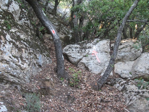
 |
at the bank where the red trail enters the forest. (At this point you might - if the Muga is dry - try to follow the Muga upstream until bm536. But I wonder if it's possible. You will also need a gps because it's not obvious where bm536 is located, hidden at the bank, a few meters from the stream.) |
||||||||||||||||||||||||||||||||||||||||||||||||||||||||||||||||||||||||||||||||||||
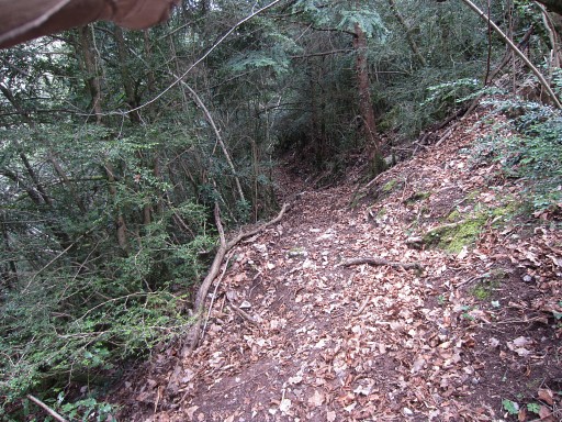
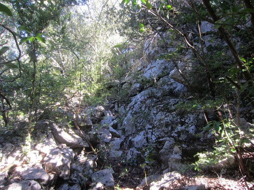 |
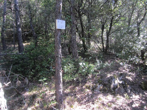
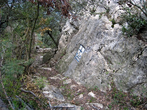
In the forest, the trail first zigzags NW uphill. Higher on, the trail becomes more vague but you should be able to reach | ||||||||||||||||||||||||||||||||||||||||||||||||||||||||||||||||||||||||||||||||||||
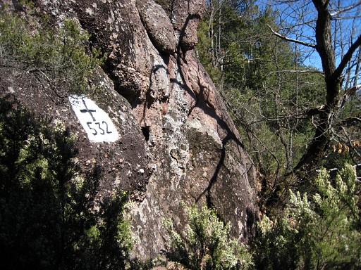
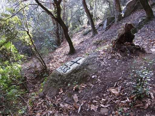
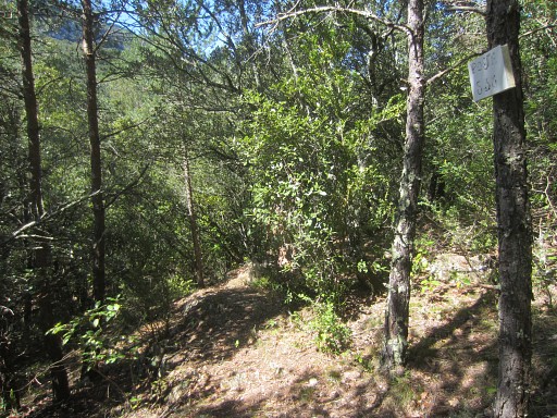 |
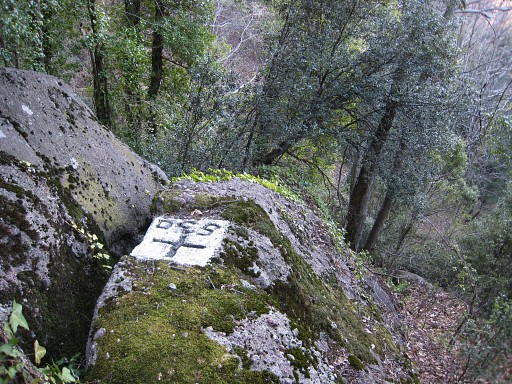
a hunter's sign on a tree: "Poste 538". The same number is painted on a rock, ± 20m S down the hill. This Poste is a crucial point in finding elegantly your way to bm536 en 537 and later bm538. If you arrive at Poste 538 and stand in front of it, go left (=W). |
||||||||||||||||||||||||||||||||||||||||||||||||||||||||||||||||||||||||||||||||||||
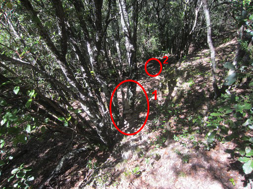 |
A few cairns I built, will bring you in ± 30m to
the beginning of a distinct trail. That trail will bring you to the streambed which is the border between bm536 and 537. These are the first and second cairn. |
||||||||||||||||||||||||||||||||||||||||||||||||||||||||||||||||||||||||||||||||||||
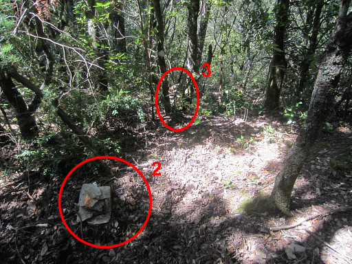 |
The second and third cairn | ||||||||||||||||||||||||||||||||||||||||||||||||||||||||||||||||||||||||||||||||||||
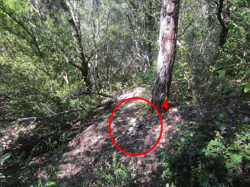 |
The fourth cairn at the beginning of the trail to the streambed. Then it takes ±75m to reach tthe streambed. |
||||||||||||||||||||||||||||||||||||||||||||||||||||||||||||||||||||||||||||||||||||
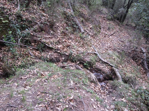
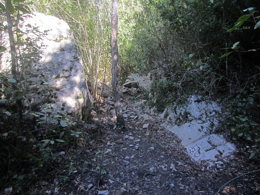
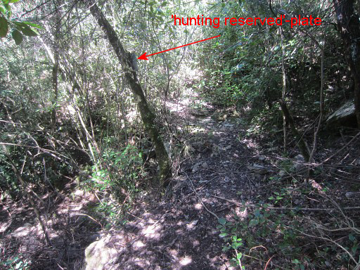 |
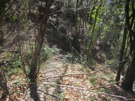
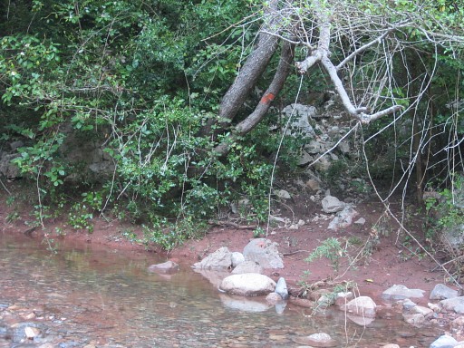
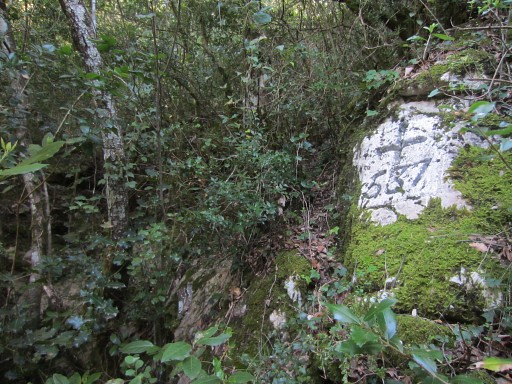
This is where you cross the ravine/streambed There's a risk of crossing the ravine/streambed without noticing it. But at this point, there's a 'hunting reserved' plate nailed at a tree. From here, you can descend SW in the streambed to bm536 in 5-10 minutes |
||||||||||||||||||||||||||||||||||||||||||||||||||||||||||||||||||||||||||||||||||||
 |
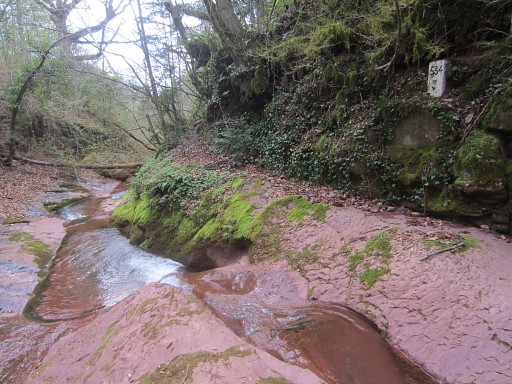
Bm536, at the bank of the Muga which is a few meters away. |
||||||||||||||||||||||||||||||||||||||||||||||||||||||||||||||||||||||||||||||||||||
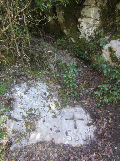 |
Bm536 can be covered by sand and mud but white arrows mark its spot. | ||||||||||||||||||||||||||||||||||||||||||||||||||||||||||||||||||||||||||||||||||||
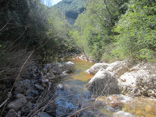 |
The Muga |
||||||||||||||||||||||||||||||||||||||||||||||||||||||||||||||||||||||||||||||||||||
 |
Then climb back to the crossing of the streambed. From this spot, a sort of trail climbs besides the streambed (S of it) in 25m to |
||||||||||||||||||||||||||||||||||||||||||||||||||||||||||||||||||||||||||||||||||||
 |
bm537 which is a few meters to the S of the (dry) stream. You can't miss it. Now descend back to the crossing and |
||||||||||||||||||||||||||||||||||||||||||||||||||||||||||||||||||||||||||||||||||||
 |
return via the trail and 4 cairns back to Poste 538. From Poste 538, the trail reaches |
||||||||||||||||||||||||||||||||||||||||||||||||||||||||||||||||||||||||||||||||||||
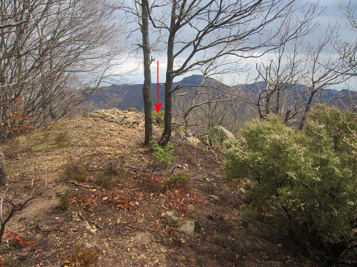
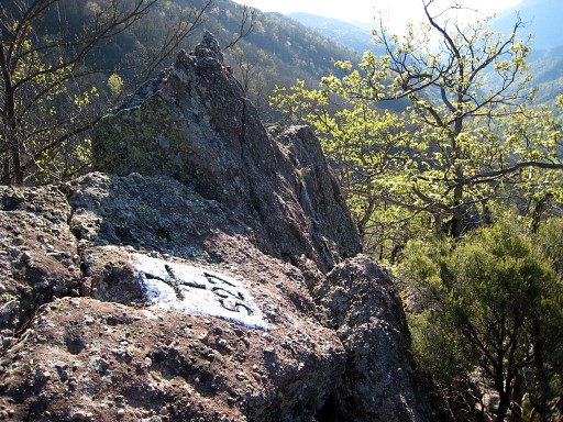
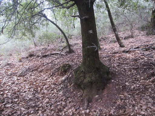
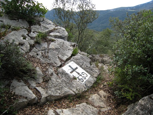
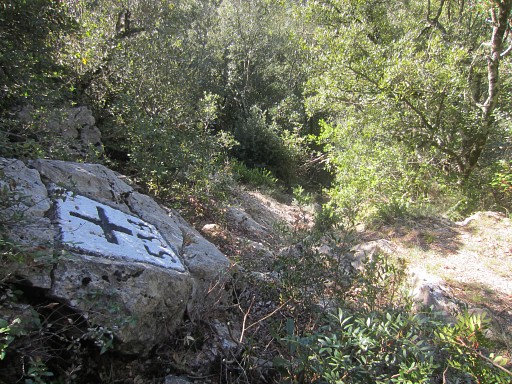 |
bm538 in ± 100m NE uphill. Bm538, looking ± SW where I came from. |
||||||||||||||||||||||||||||||||||||||||||||||||||||||||||||||||||||||||||||||||||||
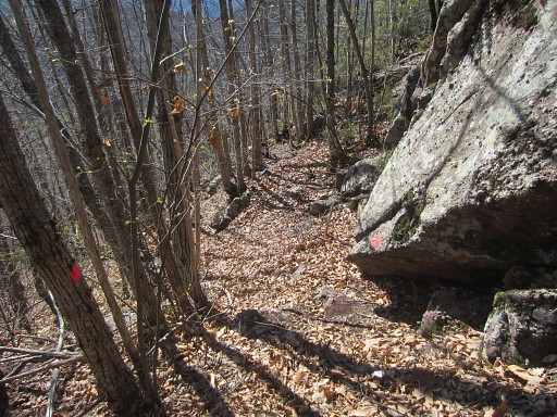
 |
From bm538 onwards I keep following the trail which gets white waymarked. It bends to the right |
||||||||||||||||||||||||||||||||||||||||||||||||||||||||||||||||||||||||||||||||||||
 |
and soon climbs the rocky ridge which is the borderline between bm538 and bm541 It brings you in 300m (from bm538) to |
||||||||||||||||||||||||||||||||||||||||||||||||||||||||||||||||||||||||||||||||||||
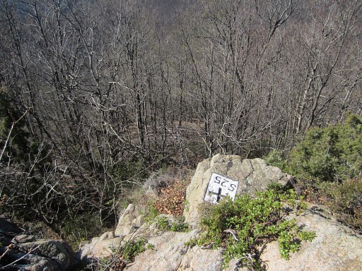
 |
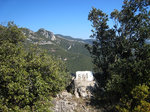
bm539 which is also at a sort of corridor in the ridge. Then continue on the ridge for ± 125m to reach the corridor with bm54o. |
||||||||||||||||||||||||||||||||||||||||||||||||||||||||||||||||||||||||||||||||||||
| End of variant 3 |
|||||||||||||||||||||||||||||||||||||||||||||||||||||||||||||||||||||||||||||||||||||
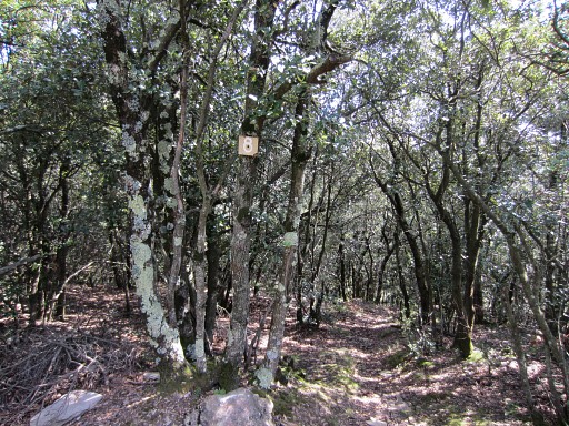
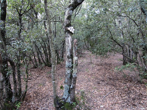
 |
We are now back on the main route The main route continues on its yellow trail to the hamlet of Can D'amunt and then along the road to Coustouges. |
||||||||||||||||||||||||||||||||||||||||||||||||||||||||||||||||||||||||||||||||||||
| Variant 4 via bm541-542 | |||||||||||||||||||||||||||||||||||||||||||||||||||||||||||||||||||||||||||||||||||||
 |
This variant starts easy. From bm540 continue 200m to the NE on a yellow waymarked trail which follows roughly the ridge and |
||||||||||||||||||||||||||||||||||||||||||||||||||||||||||||||||||||||||||||||||||||
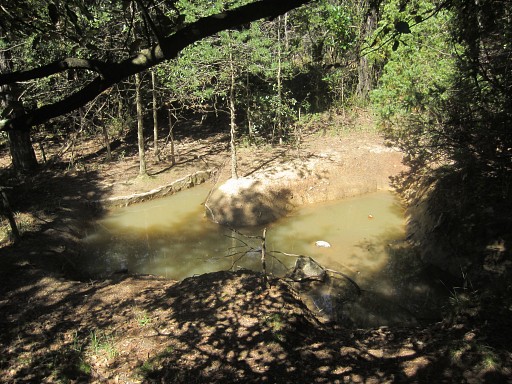 |
passes along this little pond, exceptional in these dry hills, and brings you a bit further to | ||||||||||||||||||||||||||||||||||||||||||||||||||||||||||||||||||||||||||||||||||||
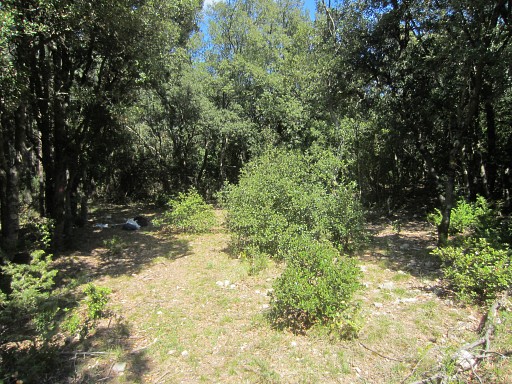 |
a small
semi-open space (it used to be hunter's post P6, in 2016 P7). From here you can continue on the yellow trail, climbing up the ridge and going NEE on the ridge for 125m to reach |
||||||||||||||||||||||||||||||||||||||||||||||||||||||||||||||||||||||||||||||||||||
 |
bm541. From here you could struggle NW steeply through the forest to a dry stream and then descend to bm542. But it's easier to return to P7 (formerly P6) and start from there. |
||||||||||||||||||||||||||||||||||||||||||||||||||||||||||||||||||||||||||||||||||||
|
Back at the small open space (P7) where a bivouac is possible (but you have to bring your water). |
||||||||||||||||||||||||||||||||||||||||||||||||||||||||||||||||||||||||||||||||||||
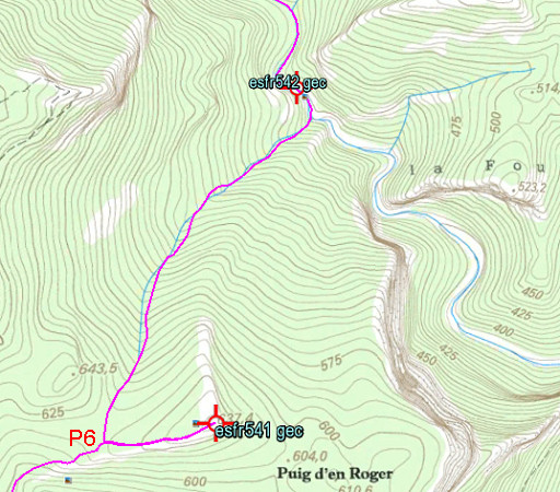 |
Now things get tougher. From P6 (in 2016 named P7) you have to descend N into the forest. NB: in 2016 P6 had shifted 150m to the NE where a descent to bm542 was impossible because of the dense vegetation. So be certain to descent from the right place. You'll soon reach the beginning of a (dry) streambed, descending NNE |
||||||||||||||||||||||||||||||||||||||||||||||||||||||||||||||||||||||||||||||||||||
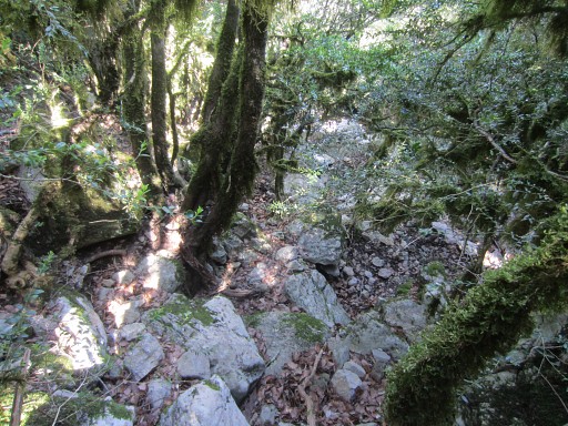 |
Traversing the forest downhill is easier than you might expect,
there's not much undergrowth to struggle through. The greater part of the descent seems more easy on the right side of the streambed. |
||||||||||||||||||||||||||||||||||||||||||||||||||||||||||||||||||||||||||||||||||||
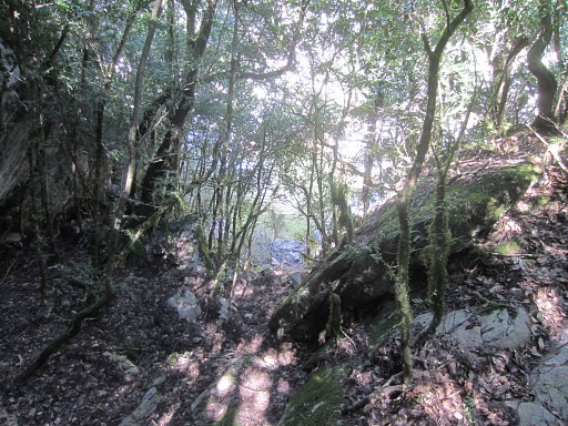 |
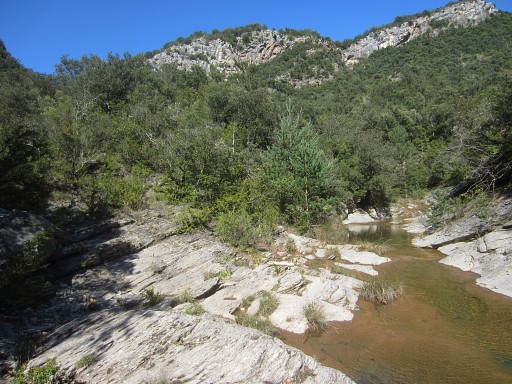
It will take you ± 30min to reach the Rio Major. This picture: you can see the water already. |
||||||||||||||||||||||||||||||||||||||||||||||||||||||||||||||||||||||||||||||||||||
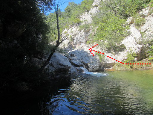 |
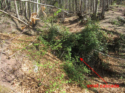
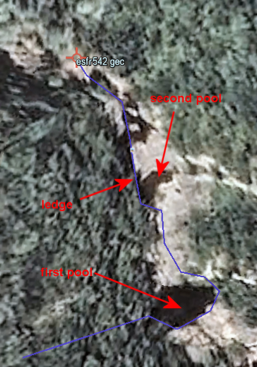
You'll arrive at the edge of a pool. But the final part to bm542 - going ± 50m upstream- is not that easy. This first pool can be easily passed by circling it counter-clockwise and a little scrambling. |
||||||||||||||||||||||||||||||||||||||||||||||||||||||||||||||||||||||||||||||||||||
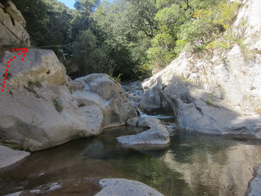
|
But
then, further
progress is blocked by a second waist-deep pool with a small
cascade. The steep sides along the cascade make a passage tricky.
One way to tackle this obstruction is via a ledge on the left side (W). |
||||||||||||||||||||||||||||||||||||||||||||||||||||||||||||||||||||||||||||||||||||
|
Let's put it on a Google Earth-map. That ledge might be too risky for your taste. Remember that going back along that ledge is more difficult. If you can tackle the ledge both ways, then returning (after visiting bm542) the same way is faster and easier then continuing as I describe hereunder. If you do so (returning the same way), I advise you to return to bm540 and from there follow the yellow trail to Can D'Amunt. |
||||||||||||||||||||||||||||||||||||||||||||||||||||||||||||||||||||||||||||||||||||
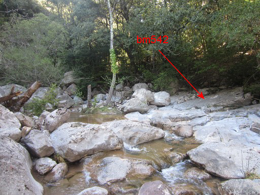 |
Then, bm542 is close. |
||||||||||||||||||||||||||||||||||||||||||||||||||||||||||||||||||||||||||||||||||||
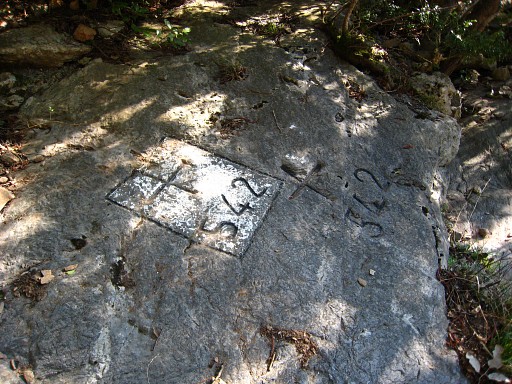 |
Bm542 The continuation of this variant to Can d'Amunt is nice but requires careful wayfinding. |
||||||||||||||||||||||||||||||||||||||||||||||||||||||||||||||||||||||||||||||||||||
 |
I've been here several times. Navigation from bm542 to Can d'Amunt or
viceversa is not straigtforward. Especially in the forest beneath
Can d'Amunt it's easy to go astray. There are many trails and a lot of
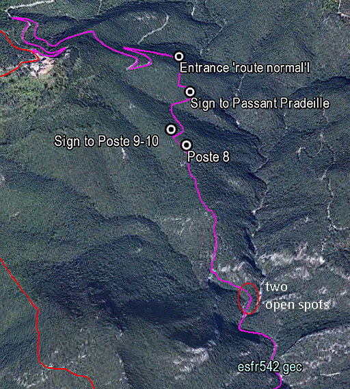
hunter's posts. I learned that the route of Jean Iglesias when he guided me on 20090318 (which I call the "route normal") is still the best. That route passes some hunter's post and other landmarks. I put the waypoints of them together in this kml-file and this gpx-file. That might help you not to get lost. |
||||||||||||||||||||||||||||||||||||||||||||||||||||||||||||||||||||||||||||||||||||
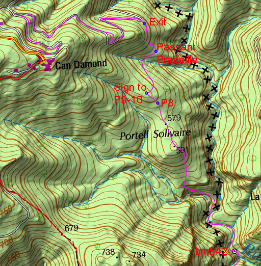 |
The same waypoints on the Spanish IGN-map. The 'Exit' is the exit of the forest to the dirtroad = the entrance of the forest from the dirtroad. |
||||||||||||||||||||||||||||||||||||||||||||||||||||||||||||||||||||||||||||||||||||
|
From bm542 work your way upstream (possibly and partly in
the forest on the W-bank when needed) for ± 300m until this point. From the left a broad (dry) streambed descends and merges with the Rio Major. Very recognizable as such. A trail will bring you along the N-side of this streambed uphill (first N, then NWW) But: finding that path from the Rio Major climbing uphill is not easy, the lower part being overgrown. In the kml/gpx-file with waypoints, there are tw0 open spots included which you have to pass. |
||||||||||||||||||||||||||||||||||||||||||||||||||||||||||||||||||||||||||||||||||||
|
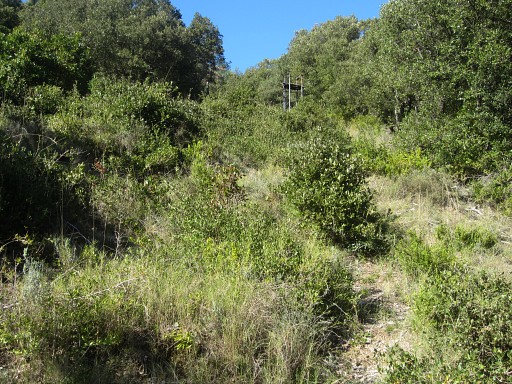
You will arrive at the lower end of a long grassy strip which climbs N for ± 200m. There's a hunter's watchtower in between and - as you can see - the grass is getting overgrown by bush. |
||||||||||||||||||||||||||||||||||||||||||||||||||||||||||||||||||||||||||||||||||||
 |
From the upper end of the open strip: go straight on, following a trail with fluorescent red waymarking. | ||||||||||||||||||||||||||||||||||||||||||||||||||||||||||||||||||||||||||||||||||||
 |
It soon makes a curved steep climb to a higher level, going NE-N-NW. Then the trail continues NNW, climbing more gently. Be attentive not to miss the red waymarks. At some point they are succeeded by vague white waymarking. |
||||||||||||||||||||||||||||||||||||||||||||||||||||||||||||||||||||||||||||||||||||
 |
Continue and you will pass hunter's post P8 and |
||||||||||||||||||||||||||||||||||||||||||||||||||||||||||||||||||||||||||||||||||||
 |
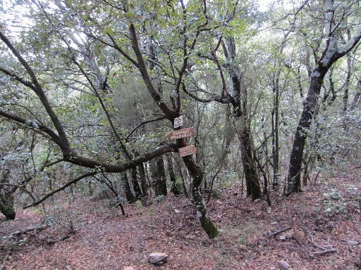
arrive after ± 75m at this sign
pointing to P10-9. At this spot you have to turn NE (= to the right) to continue on the 'route normal' towards the forest exit. Don't go towards Poste 9 and 10! |
||||||||||||||||||||||||||||||||||||||||||||||||||||||||||||||||||||||||||||||||||||
 |
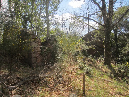
After 300m you will arrive at this Post: "Passant Pradeille". From here, the right trail is not obvious. But the trail is there and starts to the N of this Post. The trail heads NNW for ± 50m, then goes W for ± 50m and then heads N for ± 100 m to arrive at the forest's entrance. |
||||||||||||||||||||||||||||||||||||||||||||||||||||||||||||||||||||||||||||||||||||
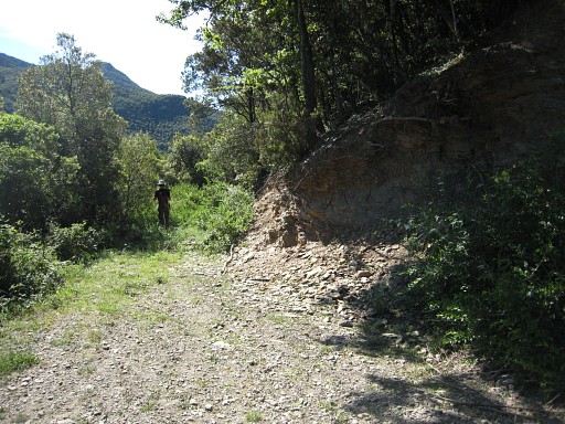 |
This picture: having emerged from the forest. Then it's a 1,6km walk uphill (keeping left) on the winding dirtroad to Can d'Amunt. |
||||||||||||||||||||||||||||||||||||||||||||||||||||||||||||||||||||||||||||||||||||
| End of variant 4 |
|||||||||||||||||||||||||||||||||||||||||||||||||||||||||||||||||||||||||||||||||||||
|
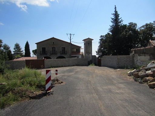
Can d'Amunt, the restaurant closed since long, the wall built in summer 2014. You're back at the main route and a stroll of half an hour will bring you to |
||||||||||||||||||||||||||||||||||||||||||||||||||||||||||||||||||||||||||||||||||||
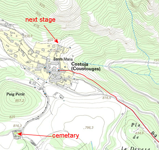 |
the nice village of Coustouges, the terminus of this stage. As said before, the fields behind the cemetary might suit you for a bivouac. There's a watertap at the cemetary. |
||||||||||||||||||||||||||||||||||||||||||||||||||||||||||||||||||||||||||||||||||||