|
The
bordermarkers of the Pyrenees : all my trips
 |
|
| -
19 august
2003 - |
 |
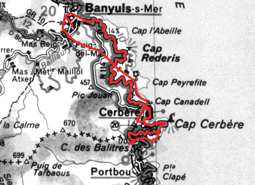 |
Trip-summary Appointment with Roland de Courson, a French journalist. He took us from Banyuls-sur-Mer to the borderpass between Cerbčre and Portbou - to bordermarker 600 - for the interview and the pictures. Afterwards Bert and I walked to bm601, descended on a steep path to Cerbčre and took the train back to Banyuls-sur-Mer. The interview was published in a number of French newspapers. For example this article , published in L'Indépendant, 22 august 2003. |
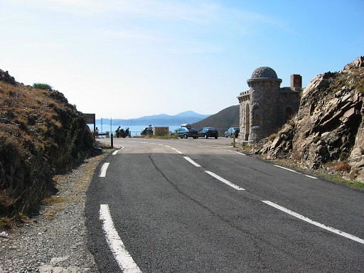 |
Borderpass
between Cerbčre and
Portbou The borderline is where the tarmac changes in color (I suppose) |
 |
Bm600 |
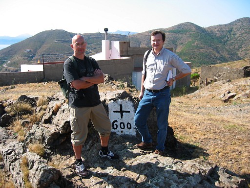 |
Bm600 With journalist Roland de Courson (right) and me. |
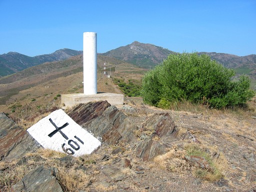 |
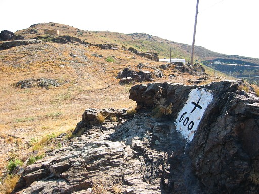
Bm601 After the interview we followed the borderline eastwards to this bordermarker. The concrete pillar is a geodesic marker. |
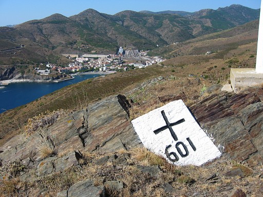 |
Bm601 With a view of Portbou. From somewhere here, we followed a steep path leading to the (French coast). |
|
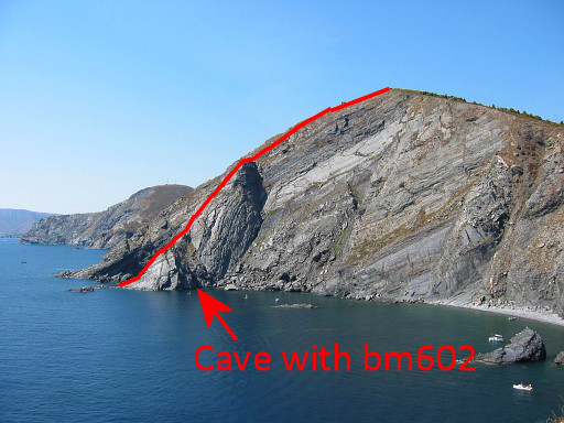
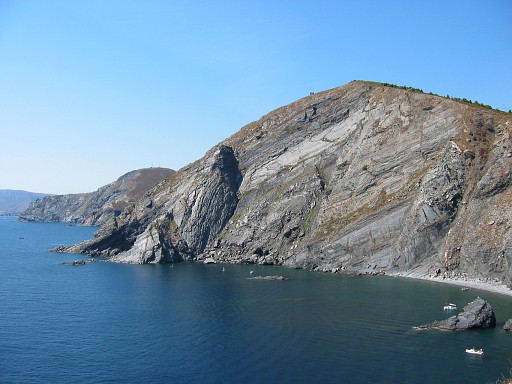
And from the coastline we could observe the
bordercliff descending steeply to the sea. Roland told us that there
should be a bordermarker 602 in a submarine cave or something alike
where the borderline meets the water. An intruiging fact: the only submarine bordermarker I've ever heard of. And how to access the very spot? Anyway not by foot, the coastline being to steep. Move the cursor over the picture to see the approximate borderline and the probable spot of the cave as I found out in 2009. See: esfr-html-trips-20090320.html And in june 2010 Alain Laridon sent me pictures of bm602: see esfr-html-markers-600-602.html |