The bordermarkers of the Pyrenees : all my trips | |
| - 8 april
2008 - Losing my precious notebook  previous
trip next
trip previous
trip next
trip 
|
 |
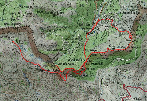 |
esfr-trip-track-20080408.kml (click to open in Google Earth or copy link to Google Maps) Part of a 8-days backpacking-trip in the eastern Pyrenees with Jan-Willem, roughly covering the area bm528 - bm575 and bm600 - 601bis. Day 6: from Refuge de Salines to the gîte d'Etappe in Las Illas and from there making a solo-trip doing bm554 to 559. |
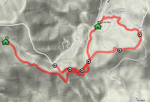 |
For explanation of the gps-coordinates and other cartographic backgrounds: see my cartography page |
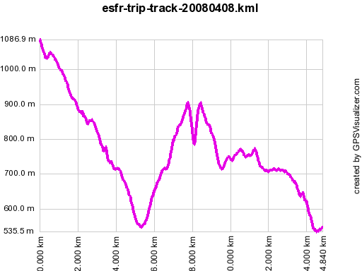 |
According to gpx-view: Distance : 14.812 km Altitudes : Maxi 1087 m Mini 536 m Dénivelées : +471 m -1029 m En route: ± 8 ½h According to my watch: Up 839m Down 1417m In total: 2256m Hmax 1097m Lmin 495m |
 |
At
10am we leave Refuge de Salines. Underneath the building there's a path
along a picknick-spot which later on merges with the dirtroad. After
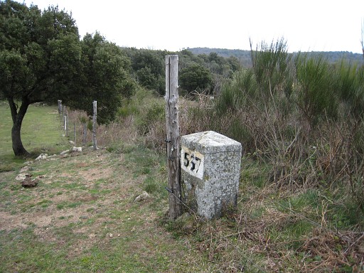
about one hour we arrive at Bm557 |
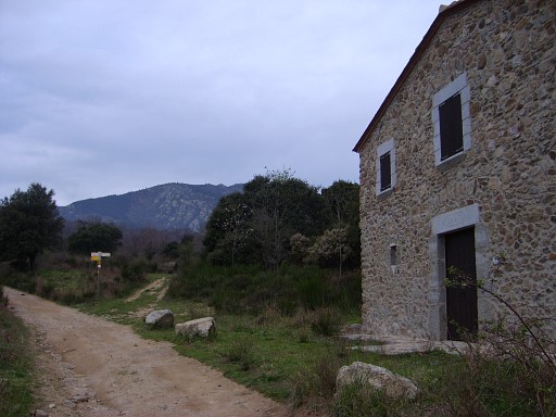 |
This
picture: a house near bm557 on the Spanish side with in the background
the waysigns and the branch wich leads to the borderfence and to Las
Illas. We descend to Las Illas to the Gîte d'Etappe. Jan-Willems stays there after the lunch while I go on a solo-trip. |
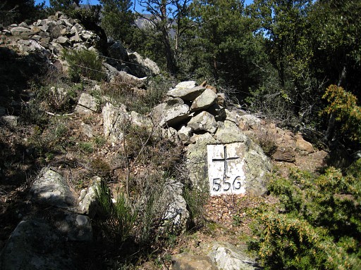 |
I go back to bm557 and climb easily - on the French side of the fence on cattle tracks - to bm556 |
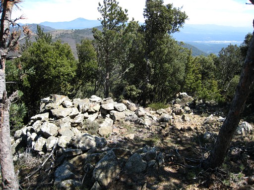 |
Bm556 is a bit hidden: it's on the
Spanish side of the fence directed towards the S. On the French side
you see only this pile of rocks. |
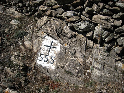 |
The borderline is easy to follow by its borderfence. Nice views from the borderridge. Bm555 |
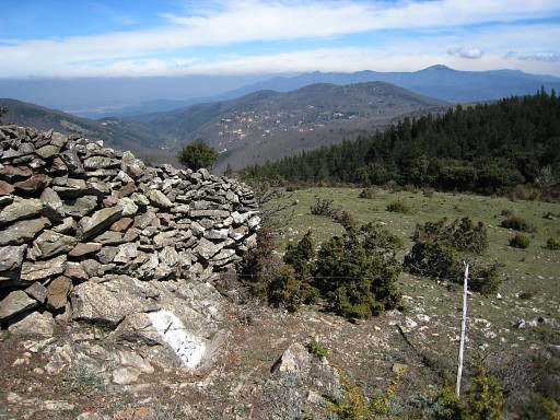 |
Also bm555 is somewhat hidden, now behind a wall, meant as a hunter's post. Further on it's a steep descent - parallel to the fence - in the forest to the stream 'Riera de los Salines'. At one point you hear and see the stream. Go straight to it and pass under the fence which - close to the stream - bends to the right. |
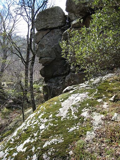 |
After the fence you, you'll see a trail descending to the stream. When you arrive at the stream, you can already spot bm554 on a rock higher above the stream. That is to say: if you know where to look, see hereunder. Cross the stream and climb to bm544. |
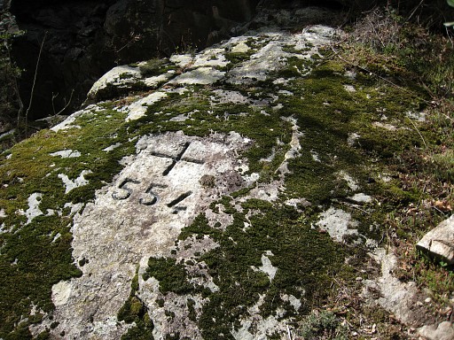 |
Bm554, the white painting weathered away. |
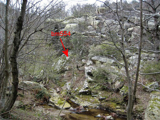 |
I go back to bm557. This picture: from the E-side of the stream, looking towards the rock-formation on the other side. Bm544 is visible, if you know where to look. |
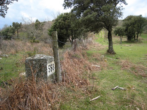 | From bm557, I continue along a fence which is the borderline and find bm558 |
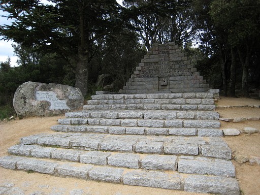 | and go until the Coll de Manrella with this monument for the Spanish refugees of the Spanish civil war. This monument is the subject of a territorial dispute between France and Spain, that is to say: at least in 2002. In the proceedings of a meeting of Commission Mixte d'Abornement, Spain insists that is on Spanish territory. |
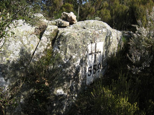 | I
start searching for bm559 with help of the directions of Alain Laridon. But it
takes trial and error on both sides of the small ridge on trails which
soon get stuck in blackberry and broom. Finally I find this route: from the monument, there's a path going N. Further on - after a concrete cave-like shelter -, there's a trail going left into the bush to the top of the ridge. That's where bm559 is. Unfortunately, I have lost somewhere my notebook with all my notes and gps-waypoint of the previous days. I return to Las Illas, disappointed by the loss of my notebook. |
 previous
trip next
trip previous
trip next
trip 
| |
