|
The
bordermarkers of the Pyrenees : all my trips
 |
|
| -
24 may
2011 - Thank God, there are hunters |
 |
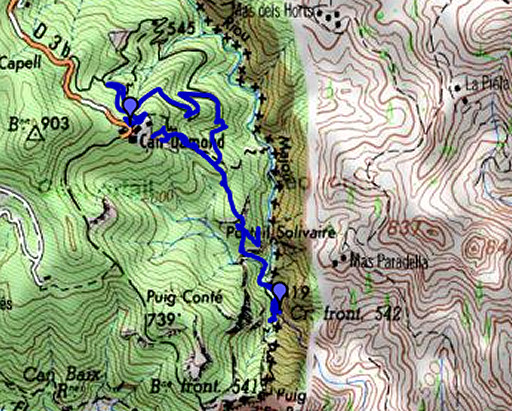 |
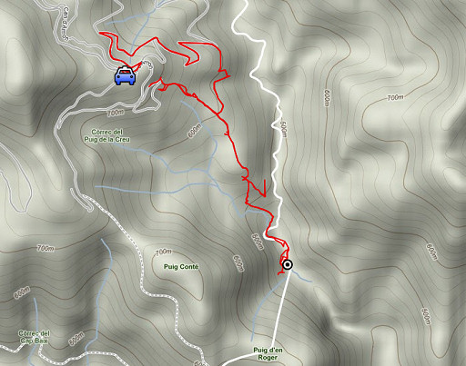
esfr-trip-track-20110524.kml (click to open this trip in Google Earth or copy link to Google Maps; click right on this link to download gpx-version) Summary: part of a 7-days trip to the Pyrénées Orientales with Jan-Willem. Mainly reconnaissances of routes. Supreme highlight: sailing to bm602 on day 1. Day 4: from Can Damund to bm542 and searching there for a route to bm541. Weather: very sunny, very warm |
 |
For explanation of
the gps-coordinates and other cartographic backgrounds: see my cartography page En route: 10 - 12.45 (to bm542, 12.45 - 14.30 break and reconnaissance around bm542, 14.30 - 17.45 back to Can Damund. En route: 7.45, walking time 6 hours According to the gp-tripteller: Distance: 11,7km Time en route: 7.43h Total ascent: 1528m Maximum height: 767m |
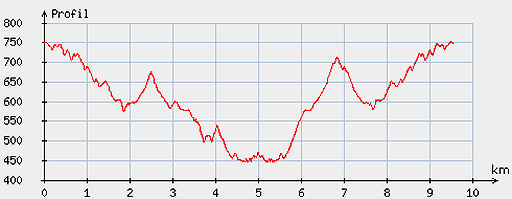 |
According
to visugpx - distance : 9.78 km - cum. elevation gain : 590 m - cum. elevation loss : 591 m - total elevation: 1181 - altitude maxi : 753 m - altitude mini : 445 m - altitude average : 605 m |
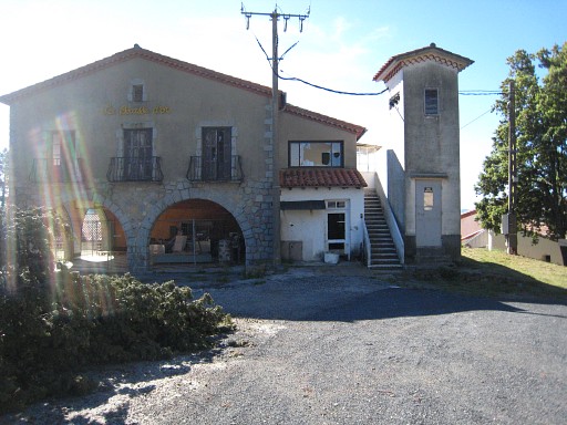 |
Start from Can Damund, chat with the new Belgian owner who wants to re-open the restaurant and start a B & B in august. |
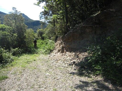 |
We
descend on the winding dirt-road and enter the forest on a hunters
trail. I was here in march 2009, guided by Jean Iglesias. We will try to walk the same route to bm542 |
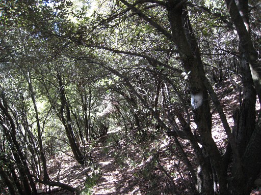 |
The trail isn’t that straightforward
as I remember but navigation is simple: follow the white waymarkings,
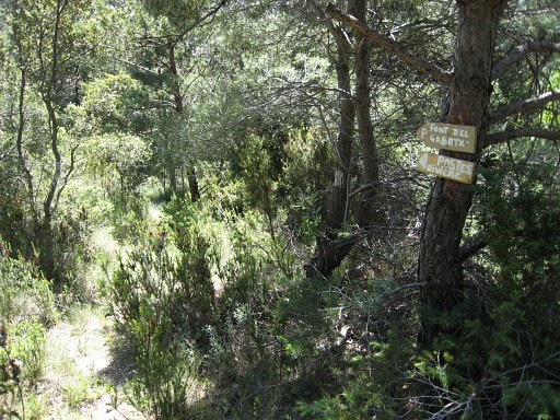
neglect branches to other P’s (=hunter’s Posts) |
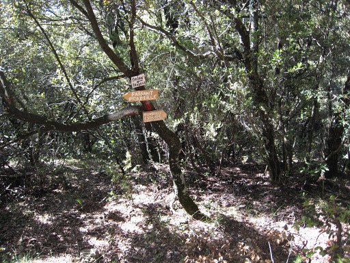 |
These are signs used by hunters. The trails here are maintained by hunters and we must be thankful to them. Without them, these paths would vanish and bordermarkers like bm542 inaccessible. |
 |
This is Post 8-9. From here, there's a
trail climbing in the direction of Can Damund. I try that one for a
while to see where it's heading. |
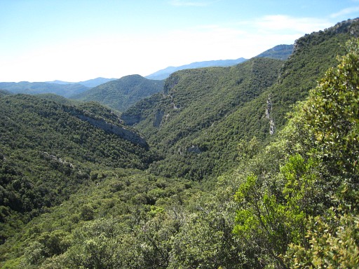 |
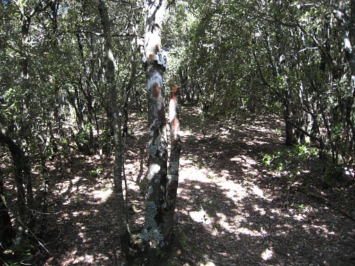
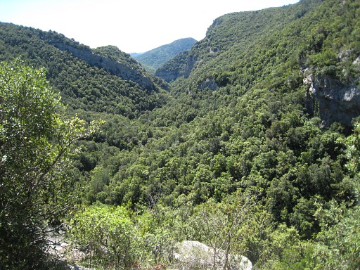
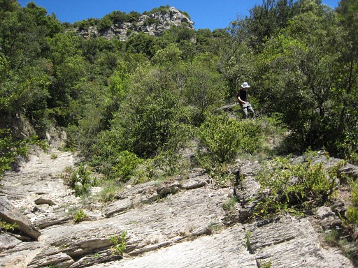
From P8-9 we continue on the white trail. In between this view: looking ahead into the valley where we will descend. |
 |
untill you reach a long strip of grass which descends to the south. At this point, leave the white trail and descend on the the grass-strip. The white trail - we continued it for a while - descends to the east and then north. Apparently to a a source and a "Poste rivière" as these signs tell us. We return to |
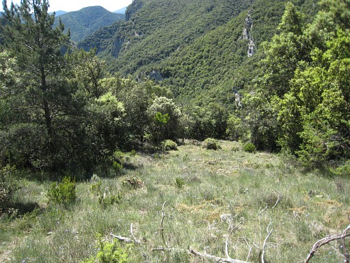 |
that long strip of grass and descend. |
 |
At the end of it - at the right side - a trail starts descending to the river. |
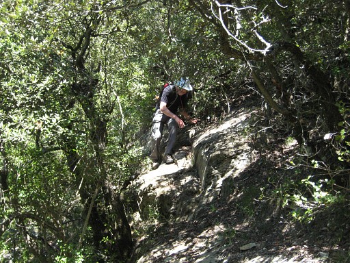 |
In general easy to follow, sometimes a little bit scrambling as Jan-Willem shows. |
 |
Close to the river, the trail is getting overgrown and not obvious
anymore. |
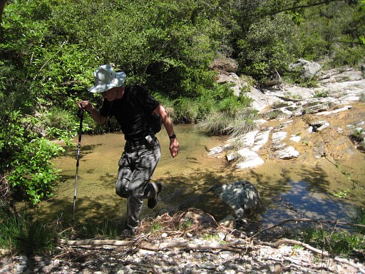 |
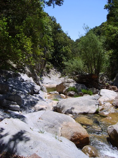
At the river: follow the river downstream, taking a
shortcut through the forest at the bank at your right hand when it gets a bit
difficult along the stream. |
 |
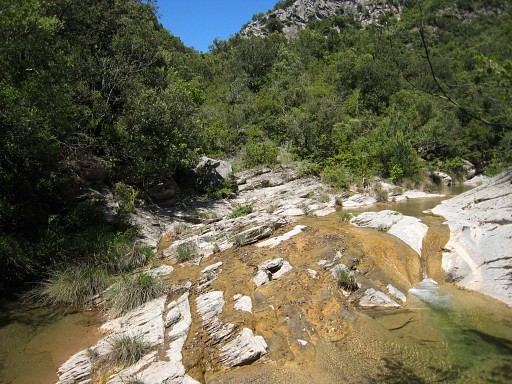
Just beyond a bend in the river, you’ll
find bm542 on the left bank. |
 |
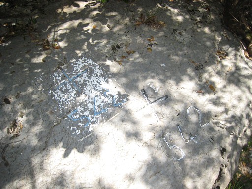
Bm542. This bordercross is unique in being engraved twice: both cross and number. One of them is set in a rectangular frame. Why this is done is unknown. Perhaps the officials weren't satisfied with the first irregular engraved cross & number. I know only one similar case: bm261. See this page |
 |
Bm542 |
 |
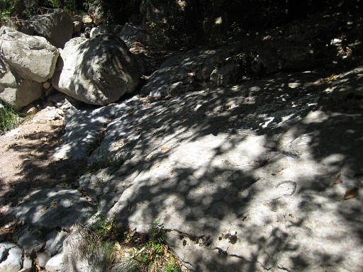
A view down the river. |
 |
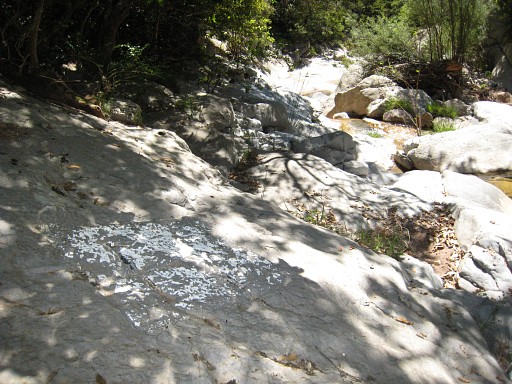
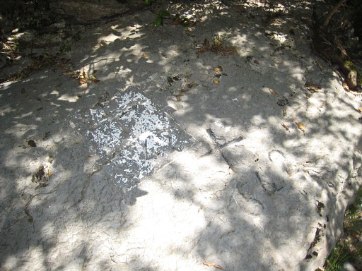
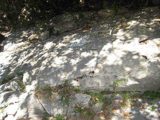
Bm542 with some chalk. |
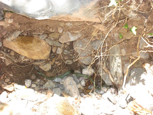 |
I return to bm542 and Jan-Willem, we spot snakes in the stream. |
 |
Bm542 for the last time. |
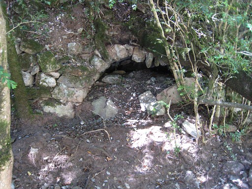 |
We take a break and I undertake a reconnaissance for a trail going uphill to ± 541. There’s indeed one: if you walk back along the river, you’ll notice a a sort of masonry tunnel at the right bank (the west bank). Jean Iglesias thought it to be the remains of a water-tunnel from a waterdriven mill. If you enter the forest approximately at this spot, you’ll discover a distinct track. |
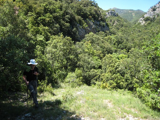 |
That
track climbs to the the rock ridge you see high above you from bm542.
Further on, the trail vanishes in the bush. Apparently the fate of
every trail here, when it lacks the fortune of becoming a hunter’s
trail. This picture confused me, it must be the scene of a second climb to the rock ridge, now with Jan-Willem. That is the conclusion after examining the view here and the sequence & time differences of the pictures. But I can't remember a second climb. |
 |
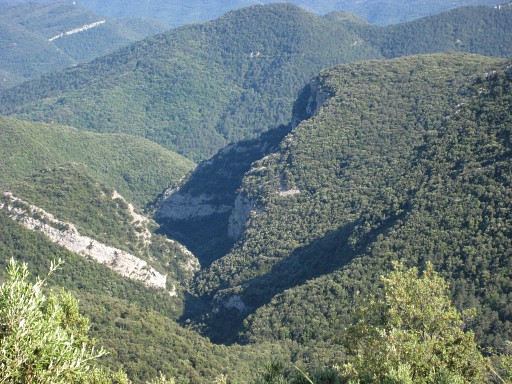
Back to Can Damund. Now we can follow the stream almost entirely along its bed untill we have to climb the hills. Finding the waymarks (white, sometimes orange) is more difficult then on the outward trip. |
 |
We walk until the ‘Poste 9-10’ where I already tried a path directly to Can Damund. We try again but - close to Can Damund - get stuck in the bush and bramble. We return to ‘Poste 9-10’ and go back to Can Damund on our outward route. We visit the chapel but it's closed. From the chapel this view into the valley. We’re tired, it has been tough. |