|
The
bordermarkers of the Pyrenees : all my trips
 |
|
| -
12 may
2012 - Mission impossible |
 |
 |
Summary: part of a 6-days trip - accompanied by Jan-Willem Doomen- with
daytrip-targets in the Basque country, near Fos and around Puigcerda. Day 2: two trips -> finding bm157 - tumbled from the borderridge - and a check if bm196 can be excavated Weather: cloudy, foggy at the borderridge |
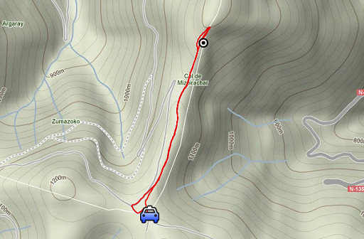 |
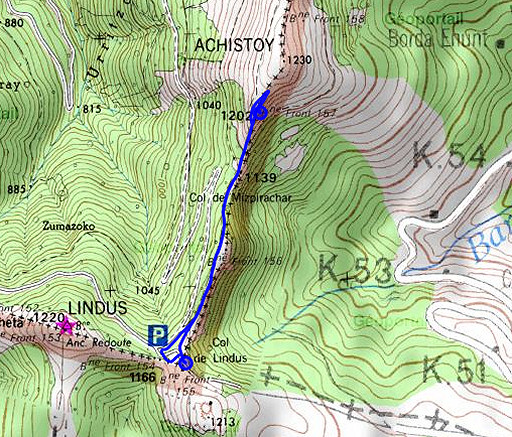
Trip 1 esfr-trip-track-20120512-trip1.kml (click to open this trip in Google Earth or copy link to Google Maps; click right on this link to download gpx-version) Short trip from Col de Lindus to find bm157, previously not found on 20090526 and 20100509 and 20110816 It must be lying on the hillside in de undergrowth, tumbled from the ridge. |
 |
For
explanation of
the gps-coordinates and other cartographic backgrounds: see my cartography page En route: 13.00 - 14.15 (1.15h)
|
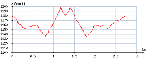 |
According
to visugpx - distance: 2,6 km - cum. elevation gain: 79m - cum. elevation loss: 89m - total elevation: 168m - altitude maxi: 1198m - altitude mini: 1135m - altitude average: 1168m |
 |
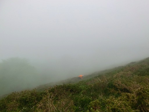
Unfortunately, it's foggy up there today. But this time I have gps-coordinates and additional pictures from one dr. Grijando and it's an easy find. |
 |
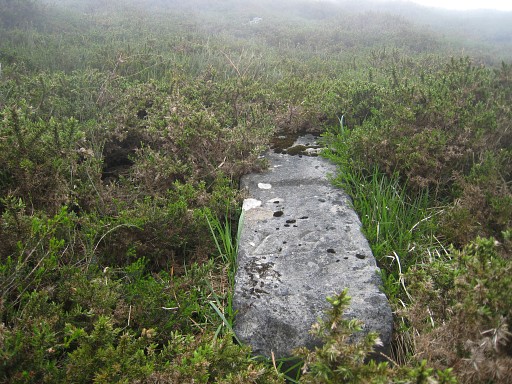
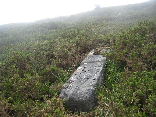
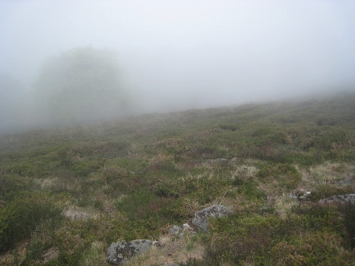
I can't understand that I didn't find it last year on this steep and pricky hillside, traversed back and forth for so long. This picture (photo by Jan-Willem): looking down on me, near bm157. |
 |
Bm157, Jan-Willem visible higher uphill. |
 |
Something puzzles me: this bm is an older type, not like the massive square blocks which we see
from bm156 up to bm170 and beyond. Perhaps there has been a square successor to this tumbled one, a successor which also has disappeared from its place. We just don't know. |
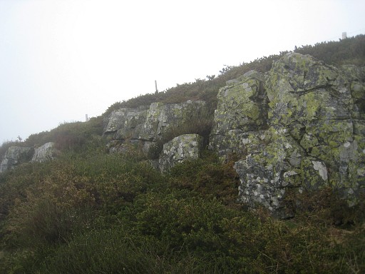 |
This is the rocky ridge just below the actual borderridge (you can see the posts of the borderfence). |
 |
From the (presumed) original place - that is on the borderridge where there is a slight
bend in the fence - it's straight down in SSE-direction (150 degrees)
for about 20 meters. |
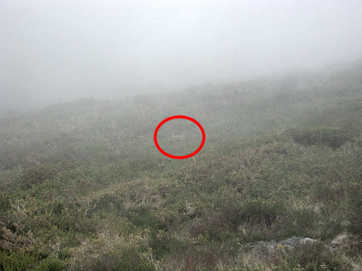 |
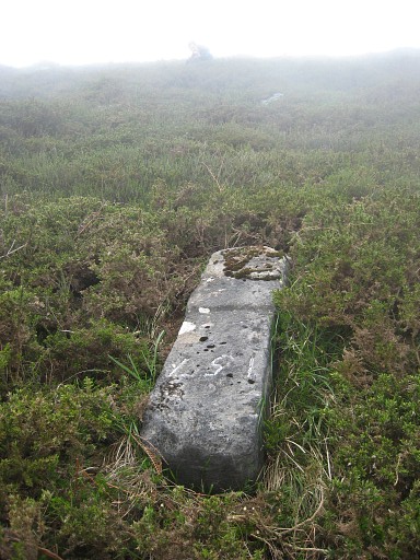
This zoom-in from the previous picture shows where bm157 lies. |
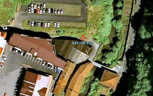 |
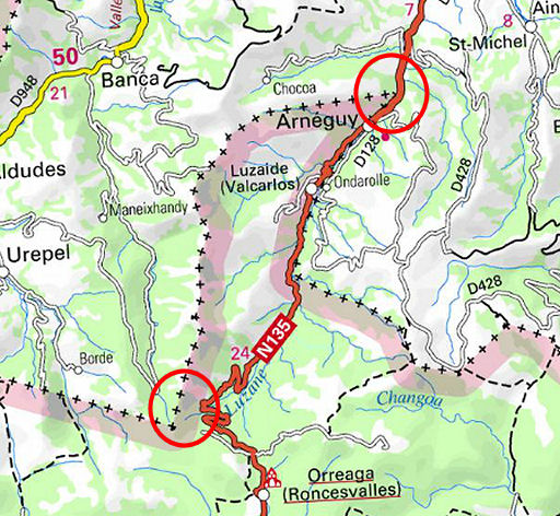
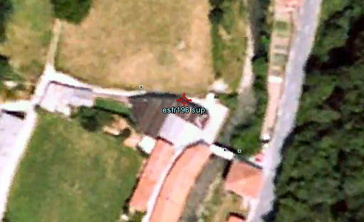
Trip 2 While driving back to our camping in Saint-Étienne-de-Baïgorry, a short stop at the venta between Arneguy and Saint-Jean-Pied-de-Port. I have been here before and I wondered if it's possible to dig for the buried bm196. I took a shovel from Holland to try. This Google Earth-capture shows the parking-lot on French soil which has been constructed somewhere in the last 10 years. |
 |
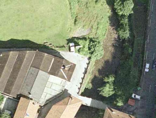
But in 2003 the venta-complex was a lot smaller as we see on this old Google Earth-map. The parking-lot is still a meadow. |
 |
But we can zoom-in even further on this 'orthophoto' captured from the Navarran cartographic site Sitna We can spot the former entrance gate to the meadow and a wall which seems to end at that gate. |
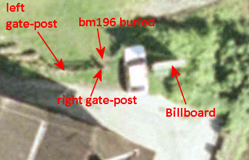 |
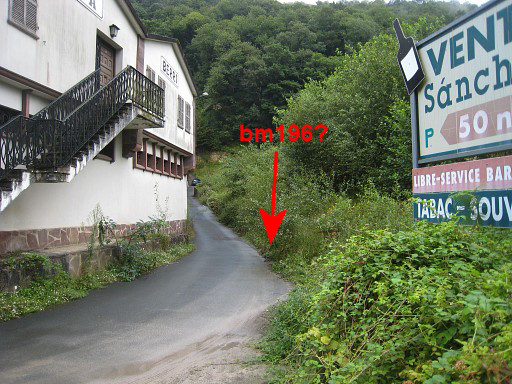
And this is a zoom-in of the zoom-in. Javier Marténez Ruiz (see the bibliography-page) describes its position as "in front of Venta Berri, left of the entrance gate to the meadow". But on 25 august 2012, I will learn that its exact position was at the right side of the gate. Bm196 is still there underground). But in order to level horizontally the parking-lot, the location of bm196 has been covered with the foot of a earth wall. |
 |
It's location can be established quite exact with info
of Jean Sermet and some old people living nearby whom I spoke last year
(see esfr-html-markers-184-196.html) It should be on the right edge of this road. |
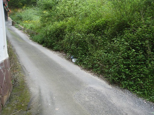 |
About here, where the building-wall left makes a bend. That's what I thought And here digging is a mission impossible: with the tarmac road surface and its adjacent stone/concrete wall/edge plus the earth wall on top, there's no way to dig here. But I'm a bit wrong, the probable place is bit backwards where the concrete edge has ended. |
 |
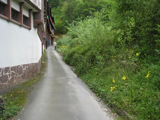
This picture from our visit on 20110816 shows the probable spot better. But on 25 august 2012, I will learn that the exact location is ± 2m to the right. |
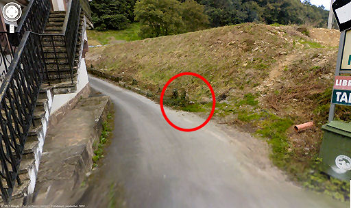 |
But internet provides more
clues: this is a screencapture from the Streetview-modus of Googlemaps.
The picture dates from september 2008. Apparently, the parking-lot has been recently constructed. There's hardly any grass or weed growing on the earth wall. While looking, something struck me: it seemed a stone or rock with white painting on top of it. But - again - on 25 august 2012, I will learn that the exact location is ± 2m to the right. |
 |
On this zoom-in, it's less convincing, I admit. But the concrete edge has ended here, the wooden pole could be the remains of the former entrance gate. Digging might be possible here. I have to return again, best in early spring. Anyway: with a shovel! But - again - on 25 august 2012, I will learn that the exact location is ± 2m to the right. |
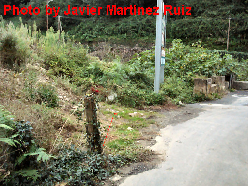 |
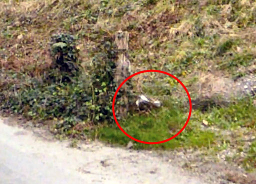
But suddenly - after the
research above - I received the final confirmation of Javier Martínez
Ruiz that this is THE location of bm196. But - again - on 25 august 2012, I will learn that the exact location is ± 2m to the right. Javier offers additional information: the Navarran government office of "Diputación Foral de Navarra" put a cement marker with "DFN" on the location of bm196. That was done in 1999. This picture dates (according to the Exif-data) from august 2007. |
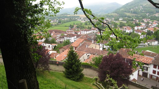 |
On our way home, we pay a visit to the pictoresque town of Saint-Jean-Pied-de-Port and its fort. Once - in 1997 - I started here my pilgrimage to Santiago-de-Compostella. |