|
The
bordermarkers of the Pyrenees : all my trips
 |
||||||||||||||||||||||||||||||||||||||||||||||
| -
thursday 31 may
2018 - Bm408 III and IV discovered! |
 |
|||||||||||||||||||||||||||||||||||||||||||||
 |
Summary:
part of 6 day-trips in
the Pyrenees, near Bagnères-de-Luchon and in the Basque country,
together with Jan-Willem Doomen Today: together with Michel Molia and his son & grandson a final search for the lost bm408 III an IV Basecamp: camping Las Espalias in Bossost. Weather: hazy in the morning, sunshine in the afternoon |
|||||||||||||||||||||||||||||||||||||||||||||
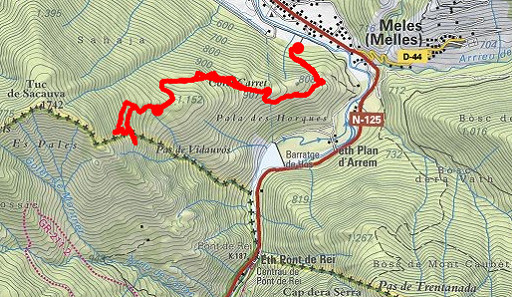
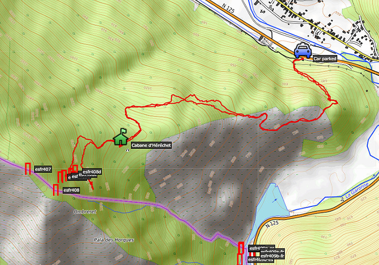 track-20180531.kml
(click to open this trip in Google Earth or copy link to Google Maps; click right on this link to download gpx-version). The gps-track has not been manually corrected which explains the inaccuracy and misalignment at some points. For cartographic backgrounds: see the cartography-page Gps-waypoints of all bordermarkers (most recent version): kml: esfr-bordermarkers-all-waypoints.kml gpx: esfr-bordermarkers-all-waypoints.gpx |
||||||||||||||||||||||||||||||||||||||||||||||
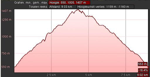 |
According to Google Earth:
9km, max-height 1407m, min-height 550m, elevation: +1159m -1160m Start 8:31 Finish 15:15 |
|||||||||||||||||||||||||||||||||||||||||||||
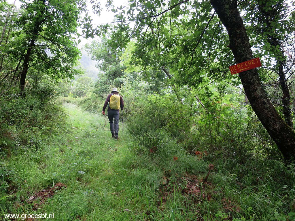 |
Early climb to Cabane
d'Héréchet. Michel Molia is already up there, having climbed to the cabane yesterday evening with his son Xabi and grandson Thomas. We were here 0n 8 october 2017 (Michel, Charles, me and Henny) for a previous 'final search' for bm408 III & IV. The submarkers 408 I-IV were placed in 1969. The borderline was shifted to the north ceding territory to Spain. Bm408 I & II are still there, III & IV until now unfindable. (click photo to enlarge) |
|||||||||||||||||||||||||||||||||||||||||||||
 |
Conclusion of our last
trip: without
the mysteriously lost cadastral map with the spots of bm408 I-IV, we
have no
clue where to search for III & IV. And their locations would
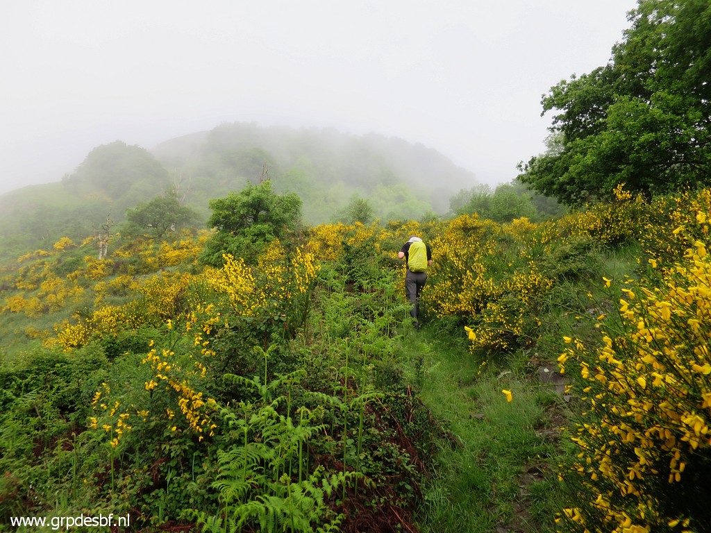
finally reveal how the new borderline was envisioned in the 1960-ies. But recently Michel recovered THE map from a Spanish archive! Read all about the bm408 I-IV-submarkers on this page. Meanwhile: a hazy view ahead, Jan-Willem blending elegantly his yellow raincover with the broom-blossoms. (click photo to enlarge) |
|||||||||||||||||||||||||||||||||||||||||||||
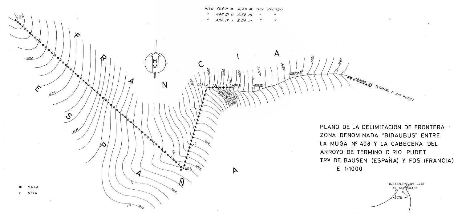 (click picture to enlarge) And this is the map drawn in 1969 after the placement of the bm408-submarkers and recently found back by Michel Molia. It reveals that bm408 III and IV were placed not far away from I and II and roughly in the same line. In fact a part of the terrain which we crossed so often. So at forehand, I really doubted if they were still there. |
||||||||||||||||||||||||||||||||||||||||||||||
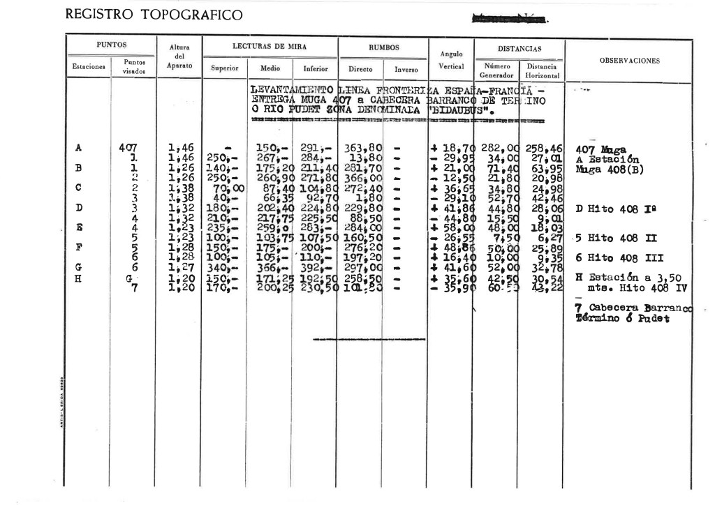 (click picture to enlarge) The map was accompanied by this table of surveyor-data. As you can see: no coordinates themselves but intermediate distances and angles. Geometricien Philippe Barsacq (a friend of Michel) converted these 'old-skool'-data in modern gps-coordinates with the well established coordinates of bm407 and 408 as reference. |
||||||||||||||||||||||||||||||||||||||||||||||
That
resulted in the following table of coordinates:
|
||||||||||||||||||||||||||||||||||||||||||||||
|
And
when I used Google Earth to measure the intermediate distance on the
ground, I got this table.
Distances
between the 408-submarkers as measured in Google Earth and GE Height
Profile Stretch Direction
(degrees) Horizontal
distance Real distance on the ground 408a-b 80 29m 53m 408b-c 89 23m 40m 408c-d 70 62m 100m |
||||||||||||||||||||||||||||||||||||||||||||||
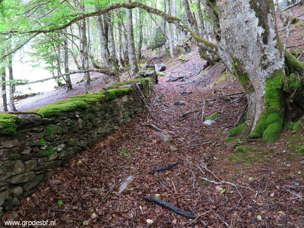
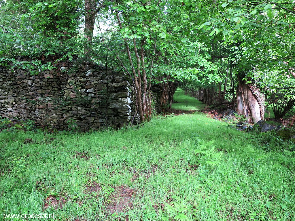 |
It is an intriguing
mountainside with its many ruines. Once there must have been a lot of activity by shepherds. (click photo to enlarge) |
|||||||||||||||||||||||||||||||||||||||||||||
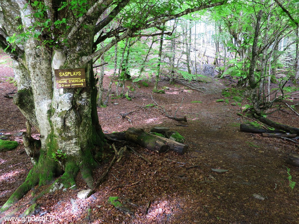 |
Getting higher, close to
the small twin ponds of Sasplays. It has been a wet season so far and the ponds are fully filled with water. (click photo to enlarge) |
|||||||||||||||||||||||||||||||||||||||||||||
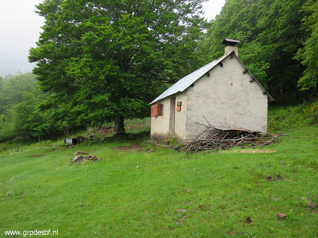 |
Arriving at the Cabane
d'Héréchet but no one is there. (click photo to enlarge) |
|||||||||||||||||||||||||||||||||||||||||||||
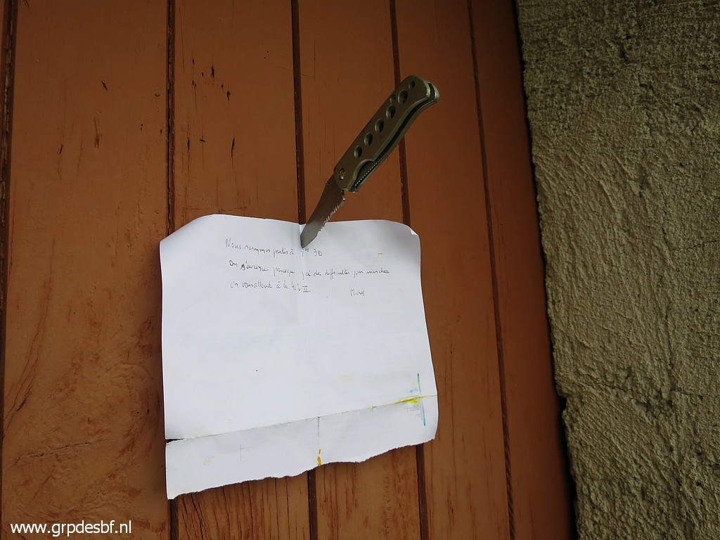 |
The three Molia-musketeers
have already left to climb to the spot of the bm408-submarkers. Michel is still recovering from a surgery and needs more time to climb. (click photo to enlarge) |
|||||||||||||||||||||||||||||||||||||||||||||
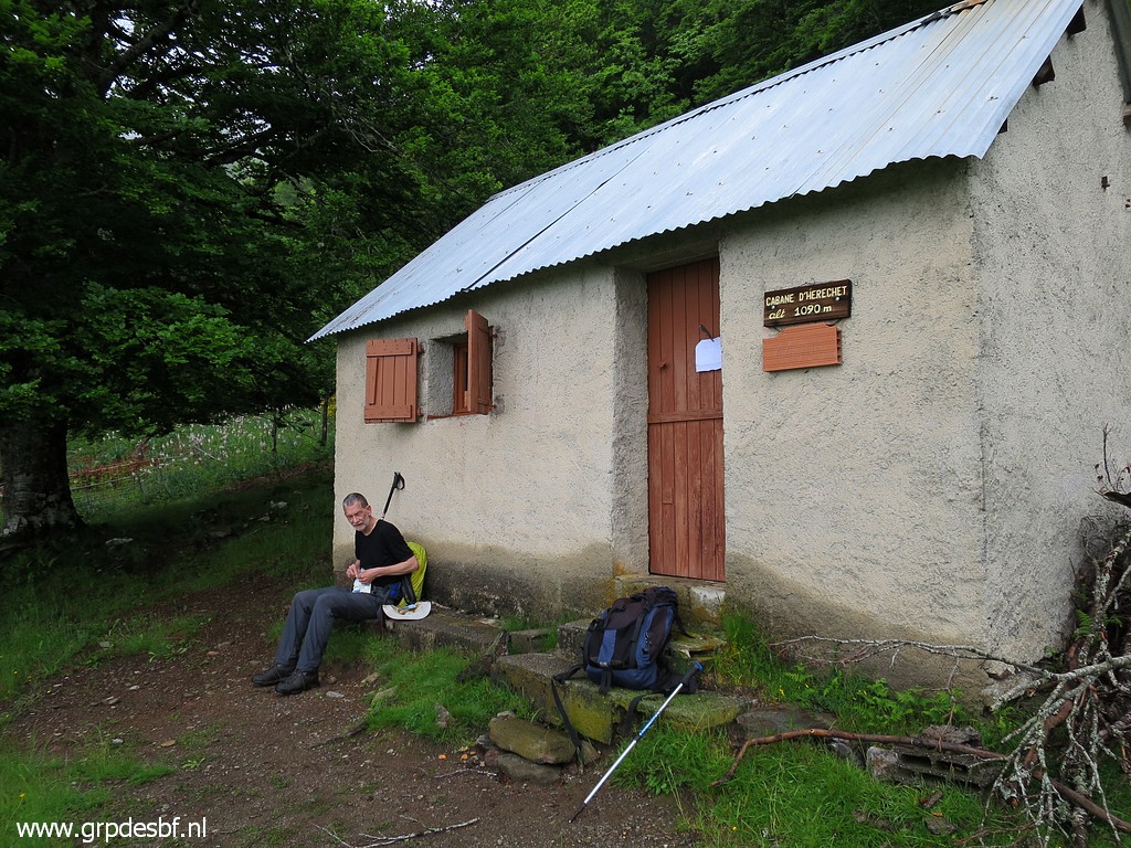 |
We take a short break (click photo to enlarge) |
|||||||||||||||||||||||||||||||||||||||||||||
 |
and continue uphill on a
trail - well known after so many visits - (click photo to enlarge) |
|||||||||||||||||||||||||||||||||||||||||||||
 |
with at this point (double
red markers at the two trees) taking a side-trail to the
left. It brings us close to the foot of th small stream/cascade which starts at bm408 I and passes along bm408 II (click photo to enlarge) |
|||||||||||||||||||||||||||||||||||||||||||||
 |
But already we hear
excited screaming from below: they have already found a marker! From left to right: Thomas, Xabi and Michel. It was Xabi who found the marker, half buried in the ground with the number hidden. It takes some effort to undig it and turn it. We are surprised that it is nr IV and not III. That means that nr III is uphill. (click photo to enlarge) |
|||||||||||||||||||||||||||||||||||||||||||||
 |
We take a lot of pictures
but forget to photograph it with no person on it. Michel and I, caressing the long lost marker 408 IV (click photo to enlarge) |
|||||||||||||||||||||||||||||||||||||||||||||
 |
Bm408 IV (click photo to enlarge) |
|||||||||||||||||||||||||||||||||||||||||||||
 |
Last picture of bm408 IV.
Next target is bm408 III. (click photo to enlarge) |
|||||||||||||||||||||||||||||||||||||||||||||
 |
I brought a 100m field
measure tape. As mentioned above; the cadastral map that Michel found (drawn in1969), contained the original surveyance data of the spots of bm407 to bm408 IV. And that's how we could establish the intermediate distances taking in account the elevation and the compass directions. This picture: Jan-Willem holding the end of the measure tape at bm408 IV. (click photo to enlarge) |
|||||||||||||||||||||||||||||||||||||||||||||
 |
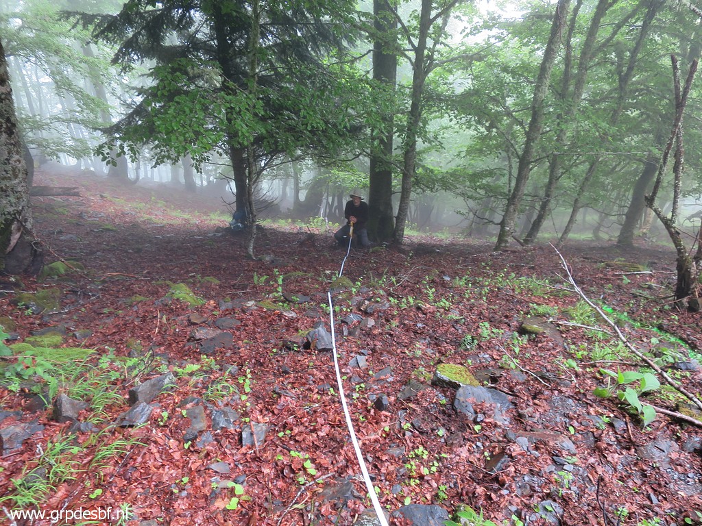
With the other end of the
measure tape, I climb uphill in the direction of - while monitoring the
distance - the spot of bm408 III. But I assumed that the spot of bm408 IV was the original one but we had already concluded that it had probably slided downhill. Thus not very clever. We had better started from bm408 II which stands still erect at its presumed original spot. On this picture is already visible the actual location of 408 III which will be found in a few seconds (click photo to enlarge) |
|||||||||||||||||||||||||||||||||||||||||||||
 |
by once again Xabi. Like bm408 IV it's half in the ground with the number hidden. (click photo to enlarge) |
|||||||||||||||||||||||||||||||||||||||||||||
 |
Doing some cleaning (click photo to enlarge) |
|||||||||||||||||||||||||||||||||||||||||||||
 |
and Michel already proudly
posing. The concrete bases of both markers are quite meagre, no wonder they slid away. (click photo to enlarge) |
|||||||||||||||||||||||||||||||||||||||||||||
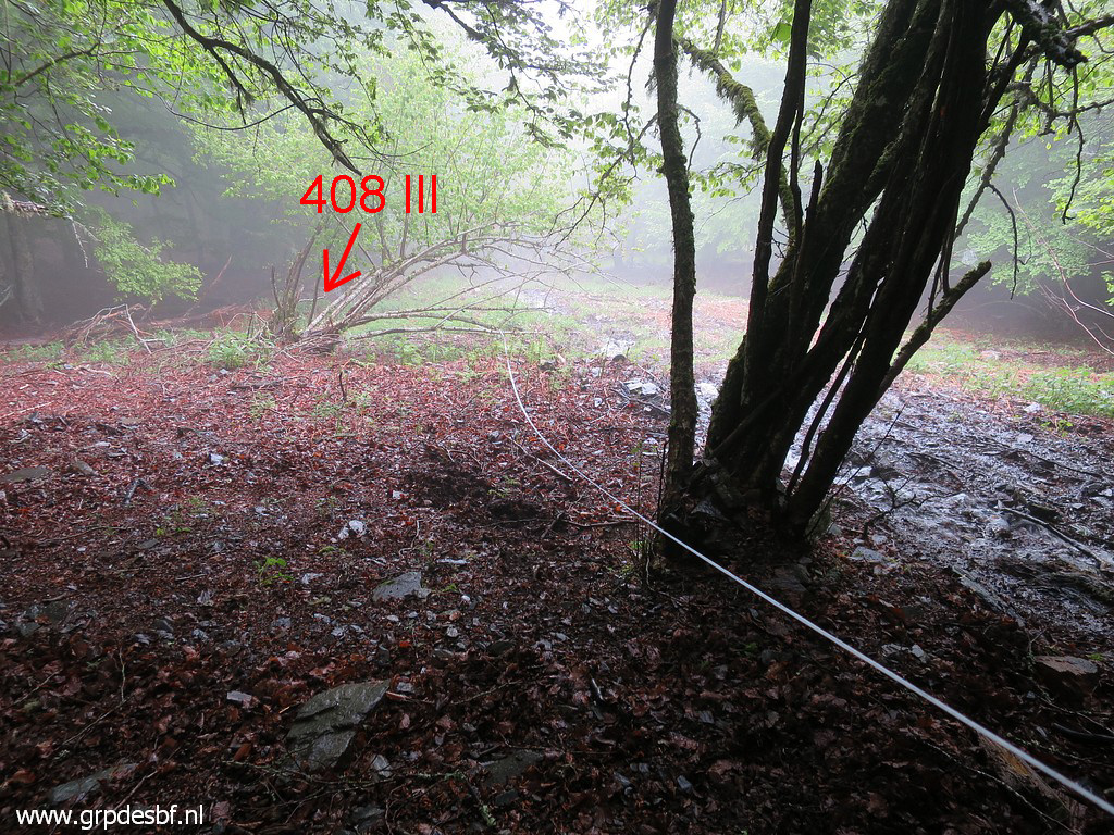
 |
Turning the marker around
reveals that this is indeed bm408 III. It's unbelievable that we have found III and IV. (click photo to enlarge) |
|||||||||||||||||||||||||||||||||||||||||||||
 |
Jan-Willem and me with my
field measure tape. (click photo to enlarge) |
|||||||||||||||||||||||||||||||||||||||||||||
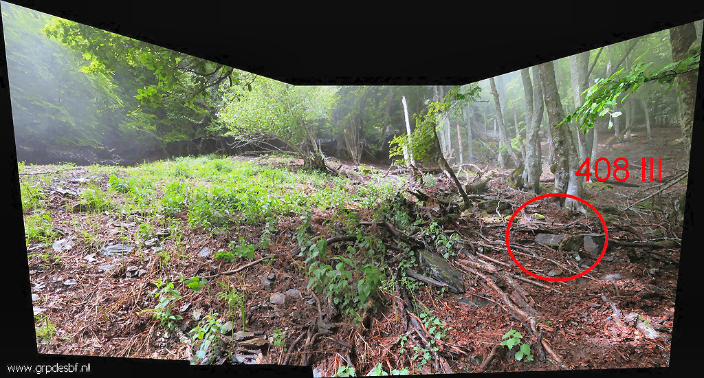 (click photo to enlarge) And this
is a panorama-view
with the position of bm408 III. The open space left is the bed of the
stream/cascade. In reality the slope is a lot steeper than it looks on
this picture. With all the new data, we can 'draw' better maps.
|
||||||||||||||||||||||||||||||||||||||||||||||
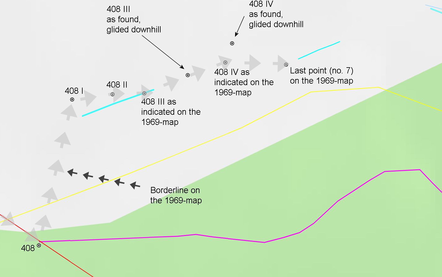 (click photo to enlarge) First the new borderline as drawn on the cadastral map and the waypoints of bm408 to 408d. |
||||||||||||||||||||||||||||||||||||||||||||||
 This map shows how bm48 III and IV have slid away from their original positions. Also important: the last point (point nr 7 in the table of surveyor-data) pinpoints in the direction of the lower stream. We know that bm408 V and VI were not placed because the course of the 'new' borderstream (how intermettant it may be nowadays in the upper part) was obvious enough from bm408 IV onwards (and because the workers were apparently exhausted) |
||||||||||||||||||||||||||||||||||||||||||||||
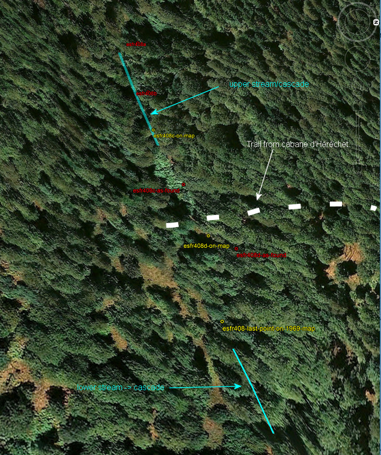
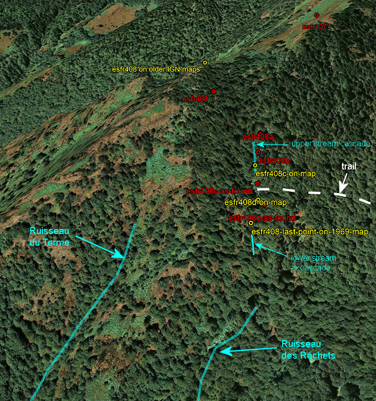 This is the overall view. Conclusion: bm40 I-IV were placed along an intermettant stream, descending to the beginning of the Ruisseau des Réchets. The Ruisseau des Réchets merges much further downstream with the Ruisseau du Terme. In this materialisation of the submarkers in 1969 (and approved by the CMA in Madrid of 1970), a large and long-stretched terrain was ceded to Spain. |
||||||||||||||||||||||||||||||||||||||||||||||
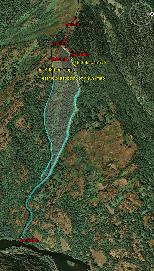 |
Let's show that ceded
terrain on the map. The surface lost to France is considerable: ± 16 hectare. It affects two private cadastral parcels who became Spanish. It seems that something has gone wrong here. If we read the letters exchanged while the conflict heated up, we see that bordercommissioner Jean Sermet talks about a small disputed terrain in the upper part of the streams of about 4 hectares. And my hypothesis is that it all comes down on one erroneous observation of Jean Sermet in 1959. |
|||||||||||||||||||||||||||||||||||||||||||||
 |
And
that erroneous observation is shown in this crucial sketch by Jean
Sermet of december 1959. He writes that on a very clear winter's day with the trees having lost all their leaves, he could see very well the two thalwegs (ravins) which merge beneath bm408 to form the Ruisseau de Terme. That confluence of the two thalwegs is - writes Sermet - very high on the hillside, beneath the rock where bm408 is. And he mentions his estimations of the distances: 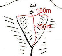 BUT: there is NO confluence of streams or ravins just beneath bm408. |
|||||||||||||||||||||||||||||||||||||||||||||
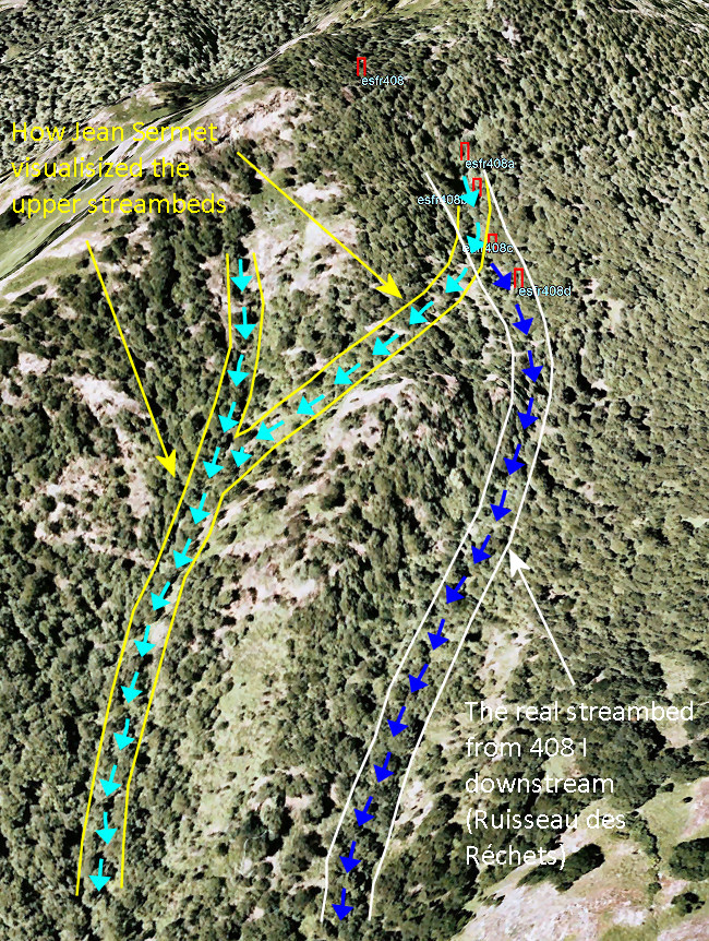 |
BUT: we can well imagine
how Jean Sermet got this erroneous impression. If we study the situation on Google Earth, there seems to be a ravin or streambed which connects the little stream cq cascade de bm408 I-II with the ravin of Ruisseau du Terme. That's what Sermet probably observed from distance. But when on the hillside itself, one will see that there is a ridge in between. No way that the little stream can flow to the Ruisseau du Terme up here. In fact the little stream descends (nowadays intermittantly, perhaps already in 1969) to the Ruisseau des Réchets which merges with the Ruisseau du Terme much further downstream. We have to remind that - as far as we know - Sermet visited the terrain only once, in july 1959. Later visits & reports were done by other men. Also the actual placement of the submarkers seems to have taken place in his absence. (click picture to enlarge) |
|||||||||||||||||||||||||||||||||||||||||||||
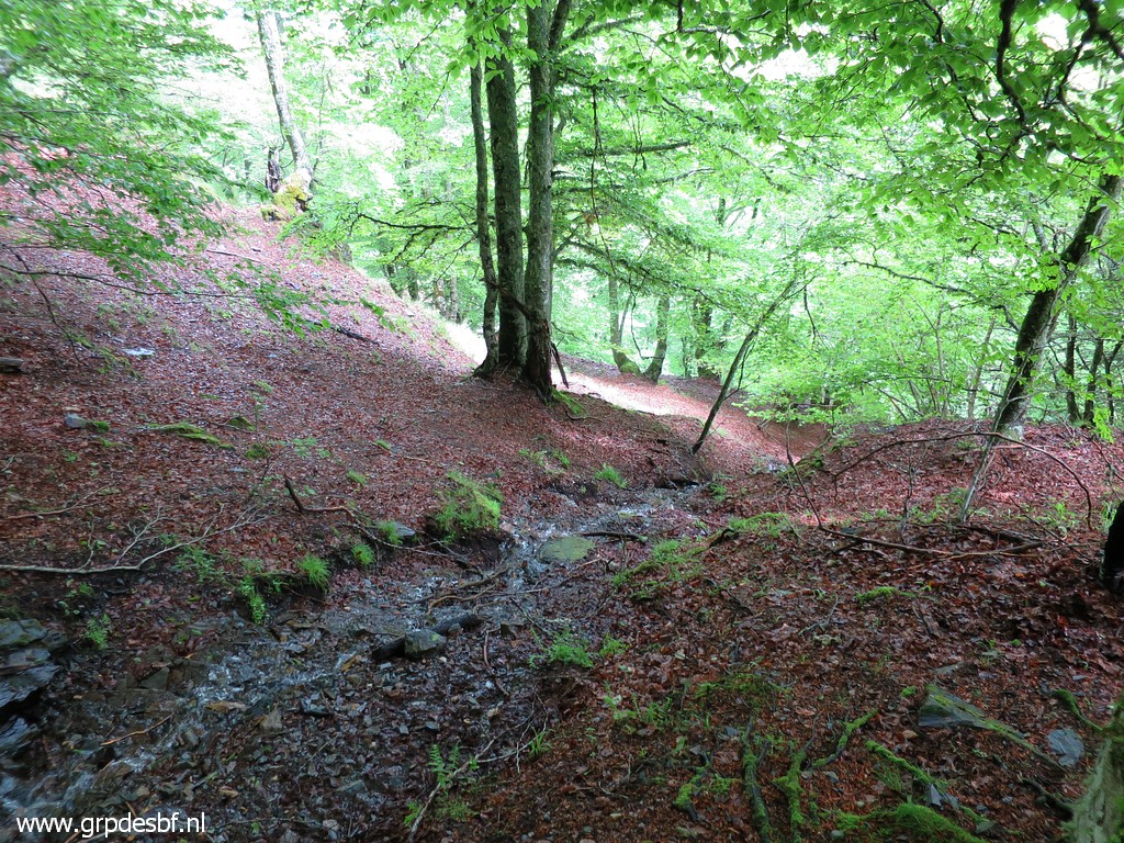 |
We now descend, following
the presumed borderline as established in 1969 (= approximately the
prolonged line of bm408 I-IV downhill) to where this small stream
emerges. That might be the reappearance of the stream cq cascade
of bm408 I-II-II which has gone underground. It soon gets his own cascade down a steep slope and continues to become the Ruisseau des Réchets. The Ruisseau des Réchets finally merges - much further and much lower - with the Ruisseau du Terme. (click photo to enlarge) |
|||||||||||||||||||||||||||||||||||||||||||||
 |
We make a short detour in
the direction of the Ruisseau du Terme. This is a steep passage presumably descending to a lower level. I often wondered if this is the Pas de Vidauvós we see on the Catalonian map. (click photo to enlarge) |
|||||||||||||||||||||||||||||||||||||||||||||
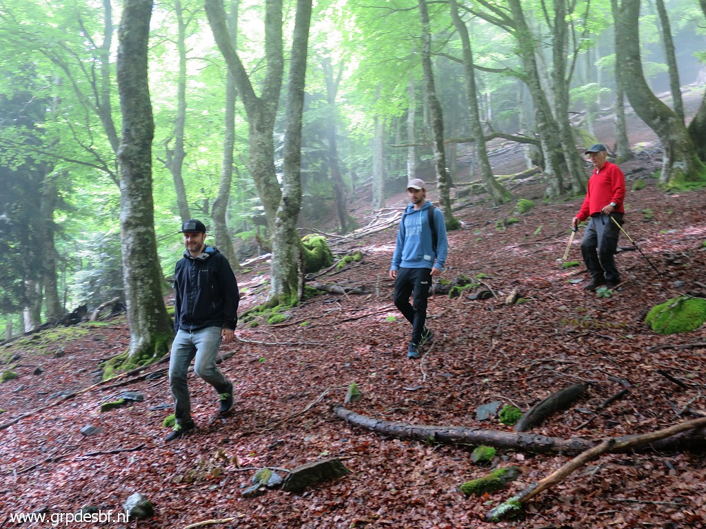
 |
But finally we return to
the cabin. (click photo to enlarge) |
|||||||||||||||||||||||||||||||||||||||||||||
 |
The three musketeers. (click photo to enlarge) |
|||||||||||||||||||||||||||||||||||||||||||||
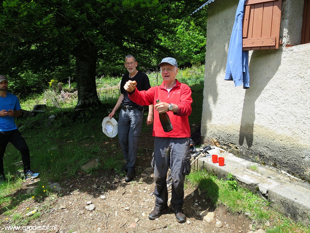 |
The Molia-family has
brought a bottle of champagne to celebrate the success. (click photo to enlarge) |
|||||||||||||||||||||||||||||||||||||||||||||
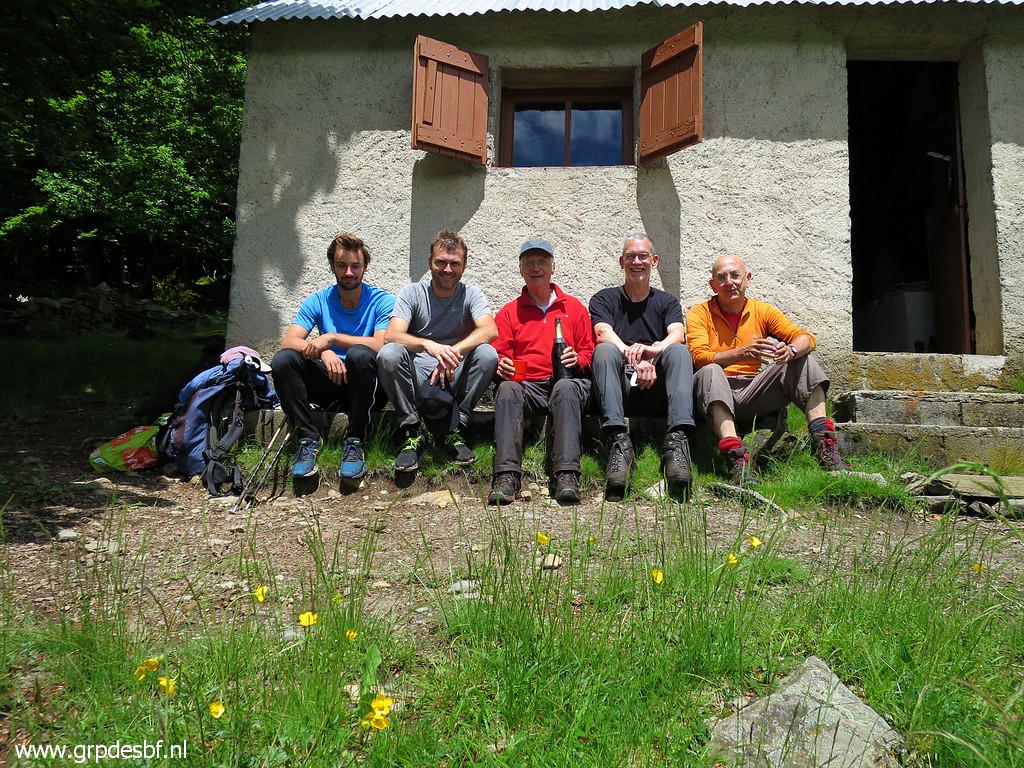 |
'La troupe de Michel' From left to right: Thomas, Xabi, Michel, Jan-Willem and Eef. All credits go to the Molia-family for finding the lost markers. To Michel who has visited this terrain so often and did an extensive research to find the crucial cadastral map and to Xabi who actually found the markers today. (click photo to enlarge) |
|||||||||||||||||||||||||||||||||||||||||||||
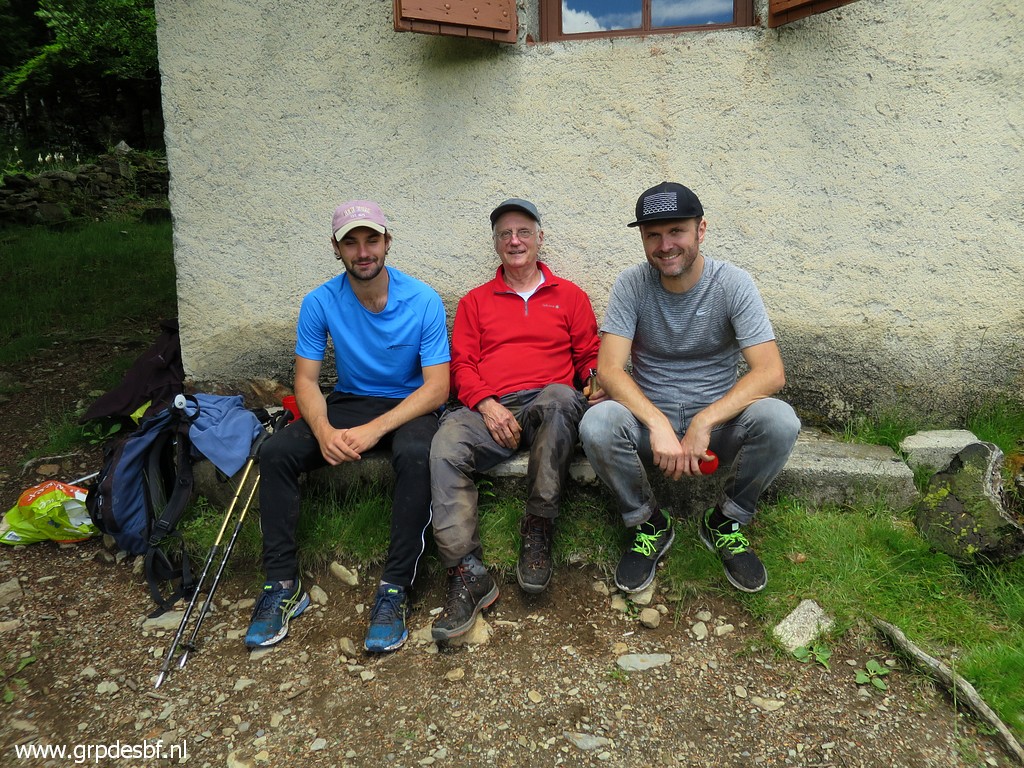 |
The three musketeers in
full glory. We had a little chat with the offspring. Grandson Thomas is a medical student in Bordeaux and thus stepping in the footsteps of his grandfather. Xabi however has a completely different vocation: writing novels and directing movies. A few days later we are in Saint-Jean-Pied-de-Port and we will watch with pleasure his latest movie: Comme des rois. (click photo to enlarge) |
|||||||||||||||||||||||||||||||||||||||||||||
 |
The return journey is not
easy for Michel. Since his surgery he has hardly exercised and the
tough climbing has exhausted him. At the cars, we say goodbye. They return to Bayonne and we - very content - do some strolling and shopping in Bossost. Later Michel will call me that Xabi forgot his smartphone in the cabin and that he has driven back from Bayonne to collect it, spending another night at the cabin. (click photo to enlarge) |
|||||||||||||||||||||||||||||||||||||||||||||
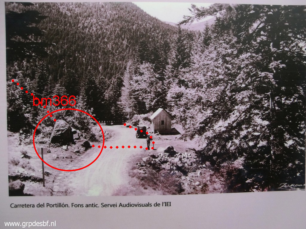 |
In Bossost we spot a
historical information board with this old picture of the Col du
Portillon. We can recognize the rock of bm366! Picture is taken from France and we look towards Spain. (click photo to enlarge) |
|||||||||||||||||||||||||||||||||||||||||||||
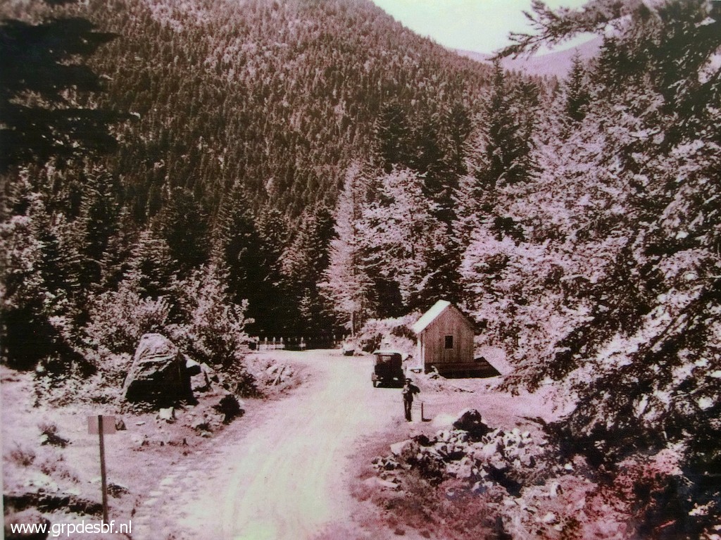 |
Same picture with some
enhancements. The next day we will drive to the Basque country to the camping municipal in Saint-Étiènne- de-Baïgorry. (click photo to enlarge) |
|||||||||||||||||||||||||||||||||||||||||||||