|
The
bordermarkers of the Pyrenees : the GRPdesBF
 |
||||||||||||||||||||||||||||||||||||||||||||||||||||||||||
| - stage 14 - Sources de Marmitou - Col de Pau (bm272-274) |
 |
|||||||||||||||||||||||||||||||||||||||||||||||||||||||||
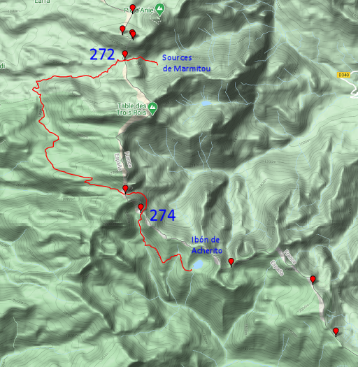 |
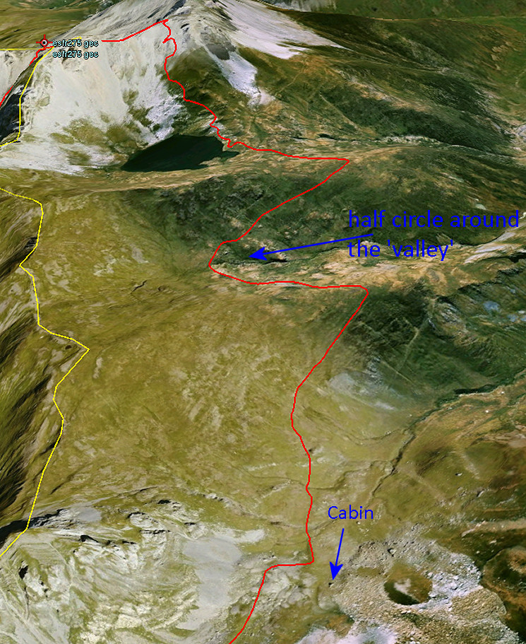
In 2021 I decided to change this stage. See the map to the left. Why? On 13-9-2020 I concluded that a largely waymarked route in Spain between bm272 and 273 is a smoother connection than the previous route via Table des Trois Rois. No variant needed. A reconnaissance will be done in 2021 but this connection is largely waymarked according to the maps. The stage will end at Ibón de Archerito instead of continuing to bm276. The lakeside offers well bivouac-spots. The gps-file is of the new route is grpdesbf-262-274-vs01.kml The maps and directions hereunder have still to be corrected for the new route. |
|||||||||||||||||||||||||||||||||||||||||||||||||||||||||
 |
||||||||||||||||||||||||||||||||||||||||||||||||||||||||||
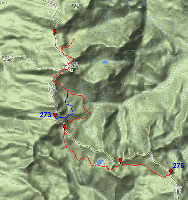
| Only
the bordermarkers along this stage are shown (and some adjoining ones).
The main route is red,
the variants have other colors. The main route provides a smooth
on-going route along most bordermarkers, the variants give access to
the remaining bordermarkers. See the GRPdesBF-principles. Click here for an fullscreen interactive map. In short A long stage, high along the borderridge. It includes - in the beginning - the 'Table des Trois Roi', the ancient tripoint of France, Navarra and Aragon. A variant brings you over rocky terrain to bm273. Considerations The first part - climbing to and beyond the Table des Trois Roi - is over rocky terrain with the traversing of a karst-'valley', guided by cairns. So you will need visibility. Take enough water when you start because the next opportunity might be at the lake of Ibon de Acherito (when taking the variant). That lake makes a nice spot for a bivouac. The stage ends at Col de Pau where there's no water. Alternatives are: ± 1km W of Col de Pau (flatter terrrain, running water perhaps) or at the next stage near bm277 (15om E of it, there seems a source). Factsheet
Gps-files needed
Version 02 July 2014. If you have any correction, suggestion etcetera -> please email me: eefberns@grenspalen.nl MAPS AND DIRECTIONS You might check the relevant webpages in the 'All markers'-section and 'All my trips'-section for more pictures of the bordermarkers and wayfinding-issues. Print your own maps It's easy to print your own - custom made - maps with the GRPdesBF-route and the bordermarkers on them. See: Print your own maps |
||||||||||||||||||||||||||||||||||||||||||||||||||||||||||
 |
||||||||||||||||||||||||||||||||||||||||||||||||||||||||||
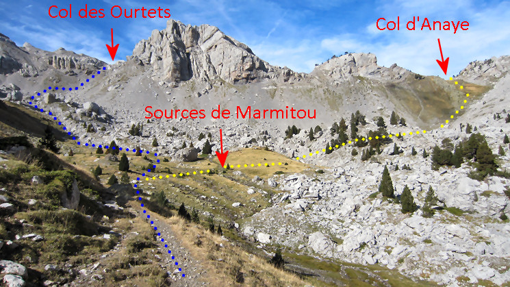 Your starting point is at the Sources de Marmitou, your first goal: Col des Ourtets. That trail is waymarked with cairns |
||||||||||||||||||||||||||||||||||||||||||||||||||||||||||
 |
And here approaching the Col des Ourtets. | |||||||||||||||||||||||||||||||||||||||||||||||||||||||||
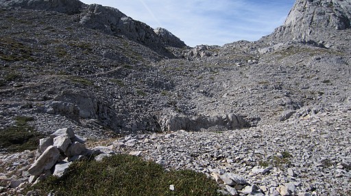 |
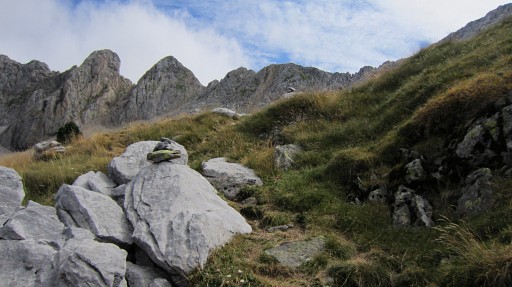
From the Col, the cairns lead you SE through rugged & rocky terrain. | |||||||||||||||||||||||||||||||||||||||||||||||||||||||||
 |
Before the large rock, the trail makes a bend to the right. (If you go straigh on, you'll get to the Pics de Peneblanque at the far end.) Then continue SW until you arrive |
|||||||||||||||||||||||||||||||||||||||||||||||||||||||||
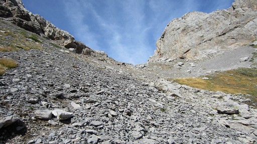
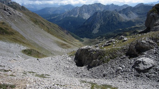
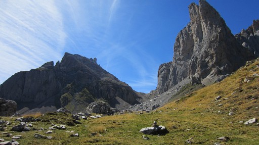
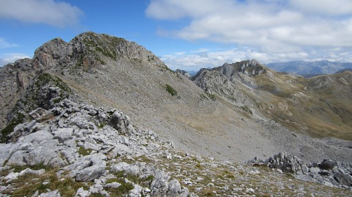
 at this point with a view of the ‘valley’ which separates you from the characteristic Table (left) and Pic (middle). The trail gets more vague here but there are enough cairns to bring you at the other side, at the ‘pass’ between Pic and Table. The blue line is a rough indication of the route through the 'valley'. |
||||||||||||||||||||||||||||||||||||||||||||||||||||||||||
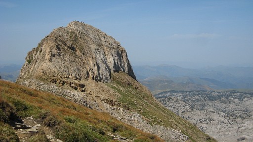 |
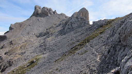
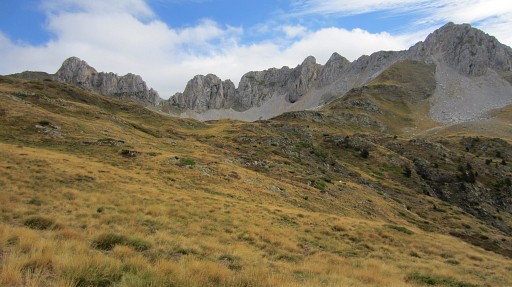
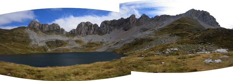
Having arrived at that pass between Pic and Table, you can make the short climb up the slope of the Table to have a view of the Pic, now with a lot of walkers on top of it. | |||||||||||||||||||||||||||||||||||||||||||||||||||||||||
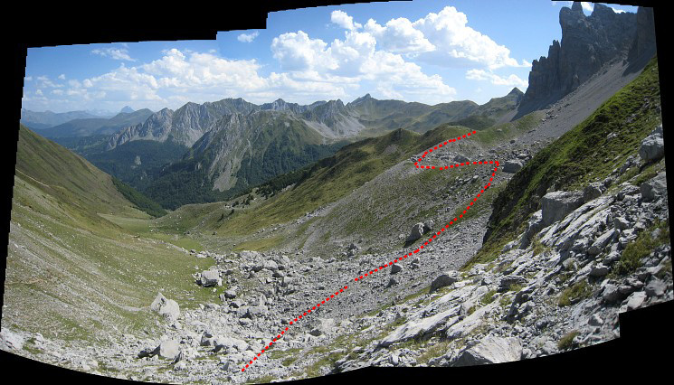
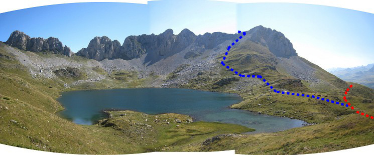
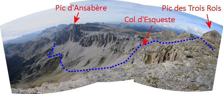 And - from the Table - this panorama looking S to the Pic d'Ansabère. Watch the blue route towards Col de Petragème with bm273. That's the variant of this stage. The main route descends from Col d'Esqueste SE in the valley |
||||||||||||||||||||||||||||||||||||||||||||||||||||||||||
 |
But first along the S-side of the Pic on a trail. On a certain point, there's steep & rocky trail up the summit with splendid views. |
|||||||||||||||||||||||||||||||||||||||||||||||||||||||||
 |
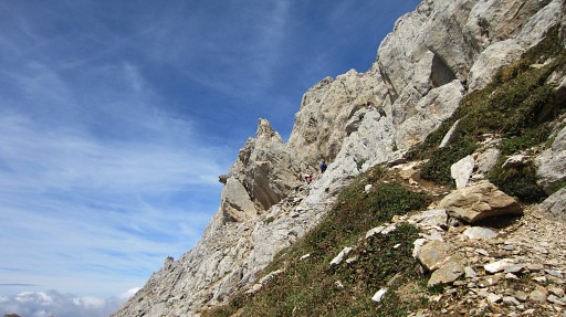
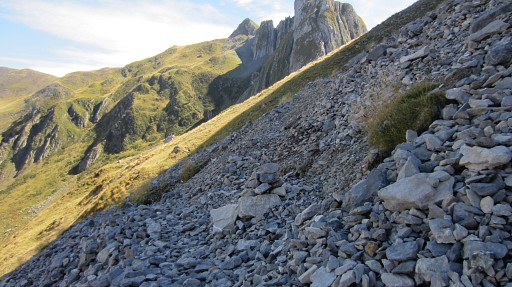
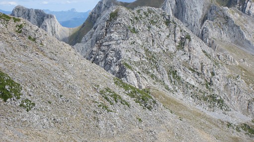
Beyond the Pic there's a pass or saddle between the Pic and
the ridge to the W. The trail continues W along the S-side of that
ridge. That is: straight on on this picture. But at this pass you have to descend S on the grass and pick up a ‘cairned’ trail that will bring you to Col d’Esqueste |
|||||||||||||||||||||||||||||||||||||||||||||||||||||||||
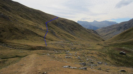
 |
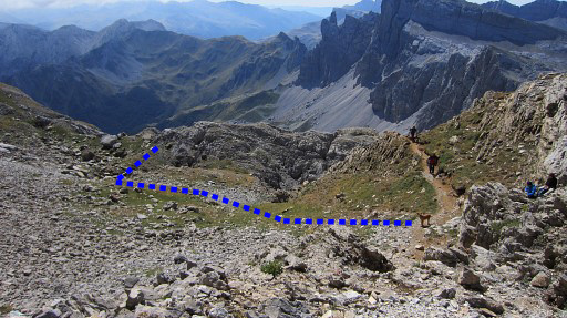
The Col d’Esqueste may not be obvious as such but it’s where you can descend E-SE in the valley. You will descend along two bunches of boulders. At the lowest, a cairned trail starts and climbs S -> that's the beginning of the variant. The main route descends further to Cabanes the Pédain and then goes S through a forest to |
|||||||||||||||||||||||||||||||||||||||||||||||||||||||||
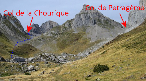 |
Cabanes de Ansabère. From there this view ahead. At the Cabanes d’Ansabère you have to take the trail to ‘les Pics’ (at the right side of the cabanes) = towards Col de Pétragème. Look further uphill for a branch climbing SW to Col de la Chourique. That's the connection with the variant descending from Col de Pétragème. (NB: forget the blue route on this photo, no part of the GRPdesBF) |
|||||||||||||||||||||||||||||||||||||||||||||||||||||||||
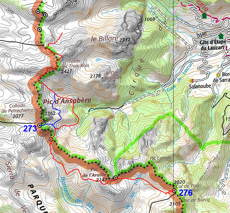
| Variant 1 via bm273 |
||||||||||||||||||||||||||||||||||||||||||||||||||||||||||
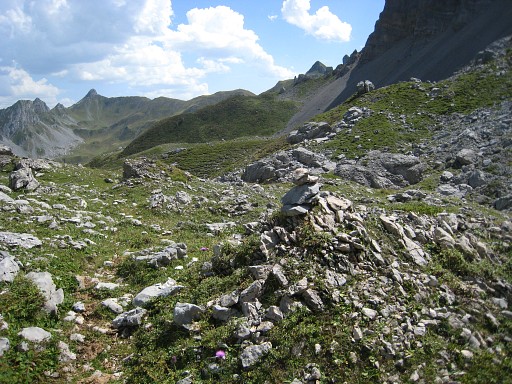
 From the lowest of two bunches of boulders, a cairned trail starts climbing S to - finally - the ridge of a kind of bowl. |
||||||||||||||||||||||||||||||||||||||||||||||||||||||||||
 |
There’s a trail on that ridge, | |||||||||||||||||||||||||||||||||||||||||||||||||||||||||
 |
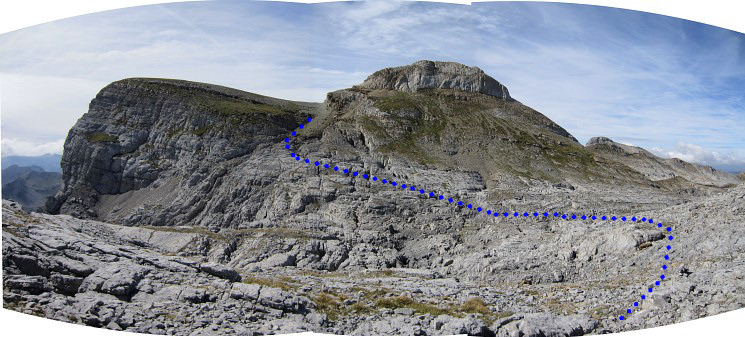
The trail follows in a semicircle the
ridge. This picture: the Col de Pétragème becomes well visible. Then the trail climbs to and merges - after a last tough climb through loose rockfall - with the trail that leads from Cabanes d’Ansabère up to Col de Pétragème. |
|||||||||||||||||||||||||||||||||||||||||||||||||||||||||
 |
Bm273 at Col de Pétragème. | |||||||||||||||||||||||||||||||||||||||||||||||||||||||||
 |
Then back - descending on the main
trail - and making a semicircle to Col de la Chourique. Remember to take the branch to the right at this spot. Otherwise you descend to Cabanes de Ansabère. At this spot the variant ends and the main route takes over. |
|||||||||||||||||||||||||||||||||||||||||||||||||||||||||
 |
Col de la Chourique allmost visible, just around the corner. | |||||||||||||||||||||||||||||||||||||||||||||||||||||||||
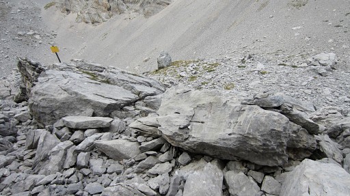 |
Bm274 is easy to find in the mess of boulders because of the yellow sign close to it. |
|||||||||||||||||||||||||||||||||||||||||||||||||||||||||
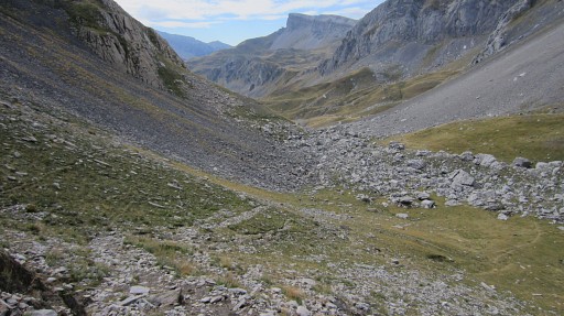 |
Descending into Spain. The cabin at the bottom of the valley is used as a storage room by shepherds. |
|||||||||||||||||||||||||||||||||||||||||||||||||||||||||
 |
There are no facilities inside - you have to sleep at the
floor - but outside the cabin it’s flat and grassy and that makes a
nice bivouac location. There's water a bit down the valley or a bit further along the trail uphill. There is a trail visible - unwaymarked - climbing SE diagonally up the hillside. |
|||||||||||||||||||||||||||||||||||||||||||||||||||||||||
 |
Then the trail arrives at a more
flat level. It starts to make a large semicircle before reaching
- not yet visible - the lake of Ibon de Acherito which is at the foot of the rocky hillridge. But let's show the route on Google Earth: |
|||||||||||||||||||||||||||||||||||||||||||||||||||||||||
 |
||||||||||||||||||||||||||||||||||||||||||||||||||||||||||
 Finally,you’ll arrive at the lake. |
||||||||||||||||||||||||||||||||||||||||||||||||||||||||||
 You have to contnue on the blue route, de red trail is he main one descending into the valley. |
||||||||||||||||||||||||||||||||||||||||||||||||||||||||||
 |
A cairned trail (in the upper part there are various cairn-trails) leads you nicely - using the green hill slopes - up to the ridge. | |||||||||||||||||||||||||||||||||||||||||||||||||||||||||
 |
You are on the ridge now. From the ridge the trail continues to Col de Laraille with bm275. |
|||||||||||||||||||||||||||||||||||||||||||||||||||||||||
 |
Zoom-in from previous picture: the Col de Laraille well visible. | |||||||||||||||||||||||||||||||||||||||||||||||||||||||||
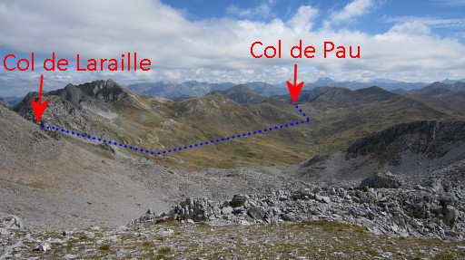 |
This is view along the valley to Col de Pau. From Col de Laraille it's a quite straightforward route to Col de Pau with bm276, although not waymarked for the most part of it. But first to Col de Laraille |
|||||||||||||||||||||||||||||||||||||||||||||||||||||||||
 |
You can traverse the rocky hillside on a waymarked trail and arrive easily at Col de Laraille. Bm275 doesn't look very professionally engraved and may require some searching. There might be a cairn present on top of it. Bm275, looking E in the direction of Col de Pau |
|||||||||||||||||||||||||||||||||||||||||||||||||||||||||
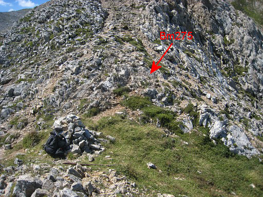 |
Another view of bm275 |
|||||||||||||||||||||||||||||||||||||||||||||||||||||||||
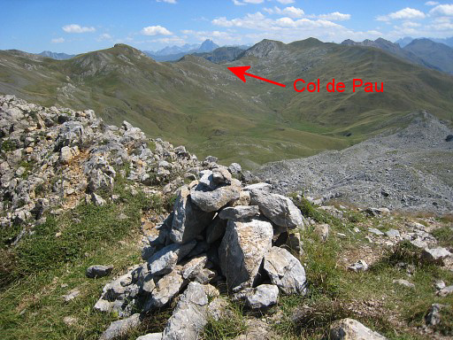 |
This picture: view from Col de Laraille to Col de Pau. |
|||||||||||||||||||||||||||||||||||||||||||||||||||||||||
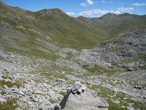 |
I descend on a 'cairned’
trail which is more to the N of the rocky
slope towards Col de Laraille. Along various (cattle-)trails along the slope I proceed in the direction of Col de Pau. |
|||||||||||||||||||||||||||||||||||||||||||||||||||||||||
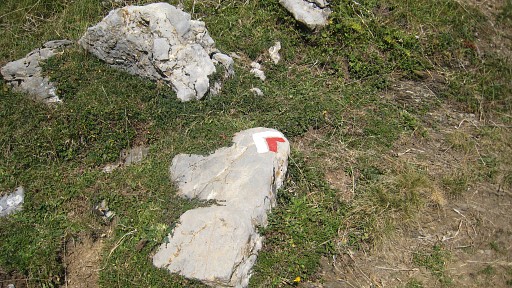 |
In the final part I join the red/white waymarked trail. | |||||||||||||||||||||||||||||||||||||||||||||||||||||||||
 |
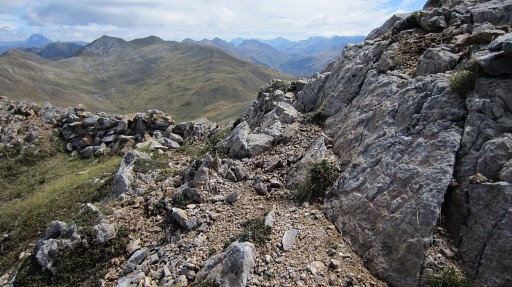
Bm276 is a bit higher up on the ridge to the S. This picture: bm276, looking back at the Col. |
|||||||||||||||||||||||||||||||||||||||||||||||||||||||||