|
The
bordermarkers of the Pyrenees : the GRPdesBF
 |
||||||||||||||||||||||||||||||||||||||||||||||||||||||||||
| - stage 15 - Col de Pau - Pas de l'Escalé (bm275-280) |
 |
|||||||||||||||||||||||||||||||||||||||||||||||||||||||||
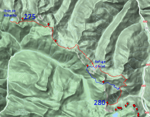 |
In 2021 I decided to change this stage. See the map to the left. Why? On 13-9-2020 I figured out a different route for the previous stage that will end at Ibón de Archerito instead of continuing to bm276. The lakeside is a nice bivouac-spot. So this stage starts at Ibón de Acherito instead of at bm276. It enlarges the route with ± 4km but that's no problem on the overall easy-to-walk trails. The gps-file is of the new route is grpdesbf-275-280-vs01.kml The maps and directions hereunder have still to be corrected for the new route. |
|||||||||||||||||||||||||||||||||||||||||||||||||||||||||
 |
||||||||||||||||||||||||||||||||||||||||||||||||||||||||||
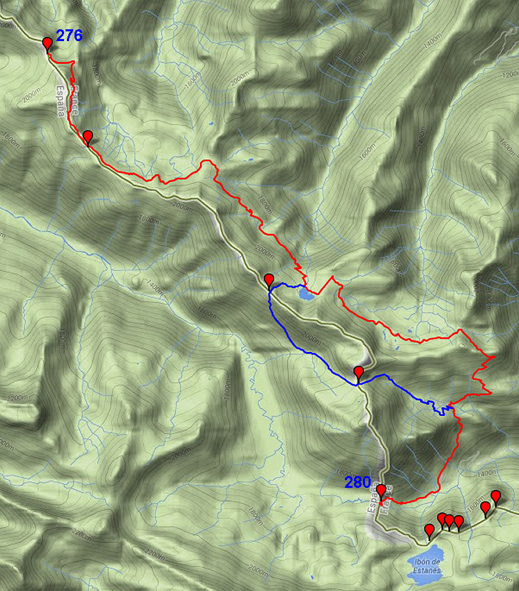
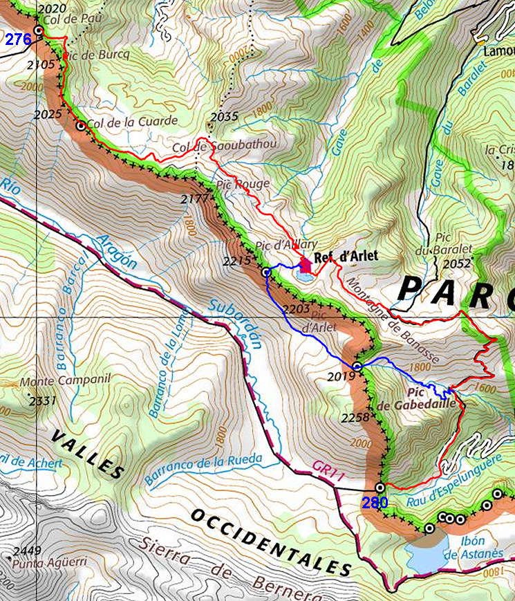
| Only
the bordermarkers along this stage are shown (and some adjoining ones).
The main route is red,
the variants have other colors. The main route provides a smooth
on-going route along most bordermarkers, the variants give access to
the remaining bordermarkers. See the GRPdesBF-principles. Click here for an fullscreen interactive map. In short In general an easy stage with no particular wayfinding issues. The main route remains on the French side of the borderridge while the only variant makes a detour into Spain for the two bordermarkers in between. For the main route the trails are fine and waymarked. The variant lacks a clear path on the Spanish side but navigating is still straighforward. Considerations Water is no problem, you will pass several stream. At the end of the stage, just beyond bm280, there's enough flat space for a comfortable bivouac. Factsheet
Gps-files needed
Version 02 July 2014. If you have any correction, suggestion etcetera -> please email me: eefberns@grenspalen.nl MAPS AND DIRECTIONS You might check the relevant webpages in the 'All markers'-section and 'All my trips'-section for more pictures of the bordermarkers and wayfinding-issues. Print your own maps It's easy to print your own - custom made - maps with the GRPdesBF-route and the bordermarkers on them. See: Print your own maps |
||||||||||||||||||||||||||||||||||||||||||||||||||||||||||
 |
||||||||||||||||||||||||||||||||||||||||||||||||||||||||||
 |
Bm276, a bit S and above Col de Pau. | |||||||||||||||||||||||||||||||||||||||||||||||||||||||||
 |
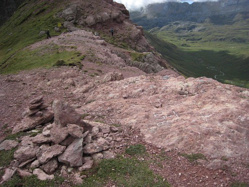
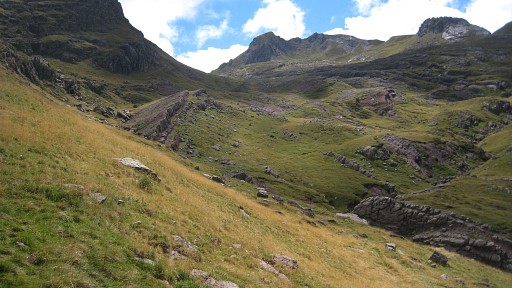
Bm276, looking forward to the mountainridge with the trail which will lead you to bm277. | |||||||||||||||||||||||||||||||||||||||||||||||||||||||||
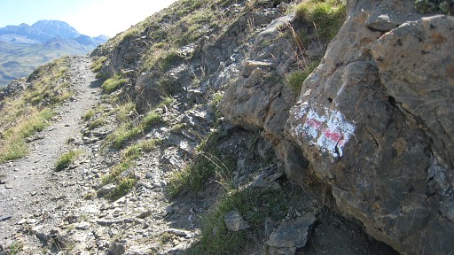 |
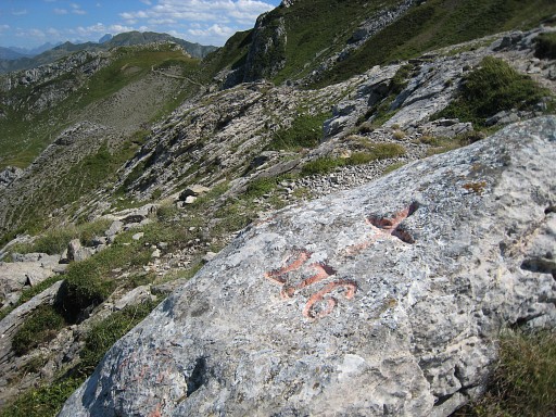
That trail follows the ridge (mainly underneath). These waymarks (red stripe on a white rectangular) seemed to mark the HRP in this area. Or perhaps they indicate the border of the Parc National des Pyrénées. |
|||||||||||||||||||||||||||||||||||||||||||||||||||||||||
 |
Bm277, at Col
de la Cuarde The bm is ± 50m off the path. A landmark for this bm: this information board of the Parc National des Pyrénées. |
|||||||||||||||||||||||||||||||||||||||||||||||||||||||||
 |
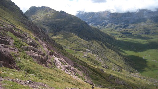
I continue on the trail until Col de Saoubathou where you need to proceed to Refuge d'Arlet. | |||||||||||||||||||||||||||||||||||||||||||||||||||||||||
 |
In the distance: Refuge d'Arlet. This is approximately the spot where the variant starts and climbs to Col d'Arlet (or is climbing already). The main route (= the HRP-trail here) continues past the Refuge and descends further on to Cabanes Grosse where the variant joins it again. |
|||||||||||||||||||||||||||||||||||||||||||||||||||||||||
| Variant 1 via bm278-279 |
||||||||||||||||||||||||||||||||||||||||||||||||||||||||||
 |
Bm278 with a cairn, looking to the pass further on. This bm is another example of a hardly noticeable cross in rocky surroundings. |
|||||||||||||||||||||||||||||||||||||||||||||||||||||||||
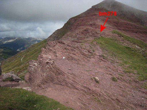 |
It’s position: some 40m NW of the pass itself. | |||||||||||||||||||||||||||||||||||||||||||||||||||||||||
 |
Then on Spanish grounds traversing to Col de la Contende. That’s not difficult: descend S (there are some cairns) and after descending along a sort of ravine, traverse SE on cattle tracks while remaining on the same level. If you descend too much, nothing is lost: the Col is still SE and the climb easy. |
|||||||||||||||||||||||||||||||||||||||||||||||||||||||||
 |
A bit further, getting closer to the next col. |
|||||||||||||||||||||||||||||||||||||||||||||||||||||||||
 |
The Col is now very obvious in the ridge. The final climb is easy though there are no trails or cairns. |
|||||||||||||||||||||||||||||||||||||||||||||||||||||||||
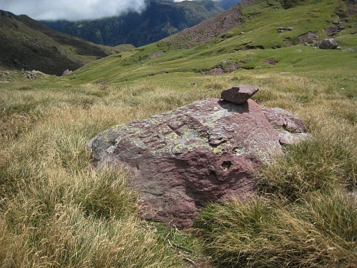 |
Bm279 is on a solitary rock | |||||||||||||||||||||||||||||||||||||||||||||||||||||||||
 |
On the Spanish side I meet a French shepherd with his flock. He told me that
it’s agreed with the Spanish communities that he may let graze his
sheep a bit on the ES-side of the pass. Then the descent towards Cabane Grosse, mostly along a cairns-trail. Having arrived at the dirtroad, descend further towards the cabanes and join the HRP-trail again. |
|||||||||||||||||||||||||||||||||||||||||||||||||||||||||
 |
The HRP-trail then descends SSW through a forest. After a set of lacelets, you have to climb W towards the pass of Escalé d’Aigue Torte. This picture: the final part of the climb to the pass of Escalé d’Aigue Torte. |
|||||||||||||||||||||||||||||||||||||||||||||||||||||||||
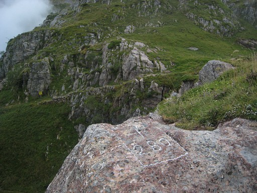 |
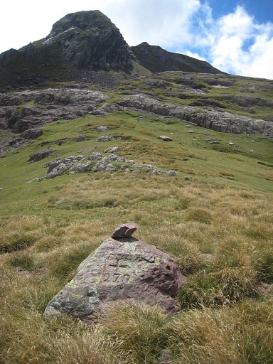
Bm280 The trail climbing to the Col of Escalé d'Aygue Torte is in the background. Bm280 is ± 30m to the NNE of the Col |
|||||||||||||||||||||||||||||||||||||||||||||||||||||||||