|
The
bordermarkers of the Pyrenees : the GRPdesBF
 |
|||||||||||||||||||||||||||||||||||||||||||||||||||||||||||||||||||||||||||||||||||||
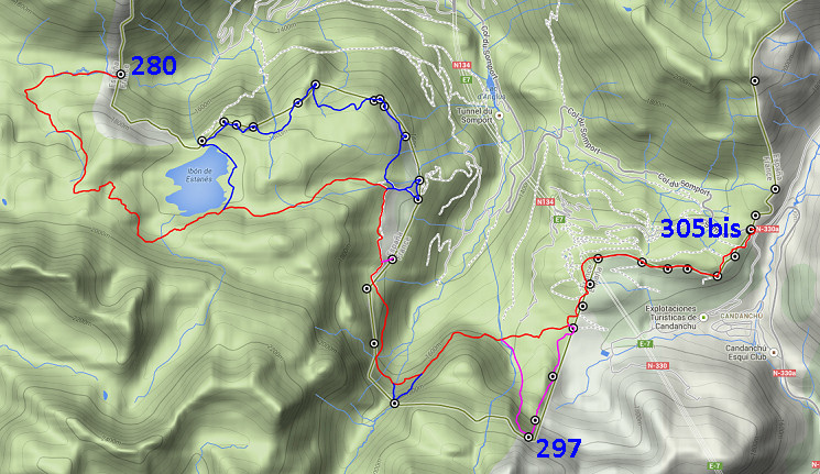
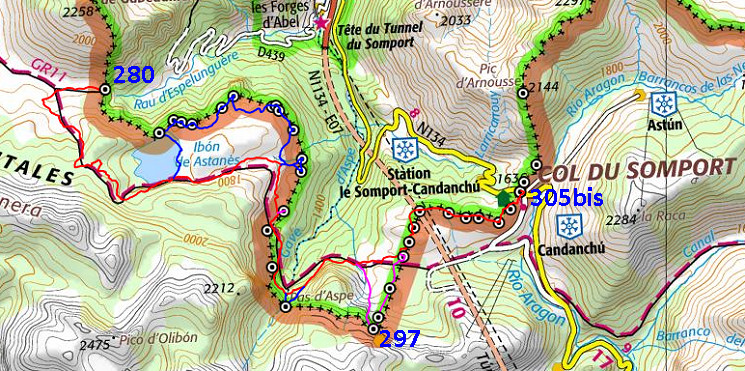
| - stage 16 - Pas de l'Escalé - Col de Somport (bm280-305bis) |
 |
||||||||||||||||||||||||||||||||||||||||||||||||||||||||||||||||||||||||||||||||||||
|
|||||||||||||||||||||||||||||||||||||||||||||||||||||||||||||||||||||||||||||||||||||
| Only
the bordermarkers along this stage are shown (and some adjoining ones).
The main route is red,
the variants have other colors. The main route provides a smooth
on-going route along most bordermarkers, the variants give access to
the remaining bordermarkers. See the GRPdesBF-principles. Click here for an fullscreen interactive map. In short If you stick to the main route, this will be an easy and short stage: most of the trail is well waymarked and the denivellation is limited. The views are fine and the landscapes are divers. The variants add considerably to the total time but their navigation should be no problem as long as the weather is clear. About variant 1: that's an interesting walk and search for 12 bordermarkers, doing a semi-circle. There are few trails but all (spots of) markers can be seen from one to another. Considerations Water is scarce after the beginning. In fact I can't remember any source of running water when I surveyed this part of the border in august 2011 beyond the stream near the Col of Escalé d'Aygue Torte. A bivouac as such however is possible at many spots. At the end - at Col du Somport - one could find easily a bivouac-spot nearby in the hills but for water you have to descend to the Río Aragon along the N-330 for 0,5 km. On the Col itself is Albergue Aysa where you can eat & sleep. Down the road (1km) in the ski-resort of Candanchu, there are more hotels, restaurants & shops but possibly shut in summertime. There's also a busstop for busservices into France and Spain. Factsheet
Gps-files needed
Version 02 July 2014. If you have any correction, suggestion etcetera -> please email me: eefberns@grenspalen.nl MAPS AND DIRECTIONS You might check the relevant webpages in the 'All markers'-section and 'All my trips'-section for more pictures of the bordermarkers and wayfinding-issues. Print your own maps It's easy to print your own - custom made - maps with the GRPdesBF-route and the bordermarkers on them. See: Print your own maps |
|||||||||||||||||||||||||||||||||||||||||||||||||||||||||||||||||||||||||||||||||||||
 |
|||||||||||||||||||||||||||||||||||||||||||||||||||||||||||||||||||||||||||||||||||||
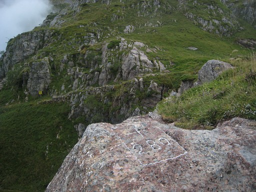 |
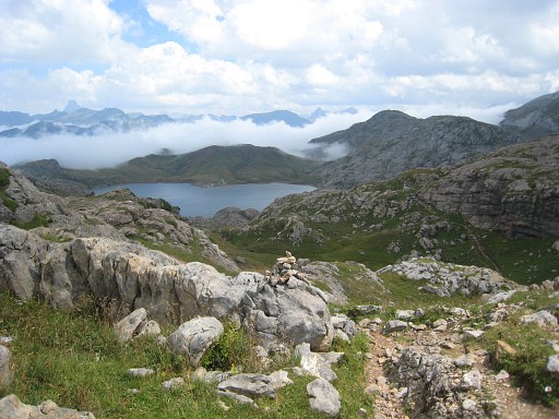
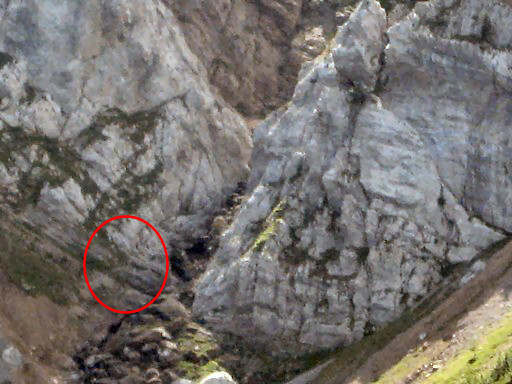
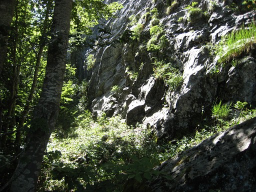
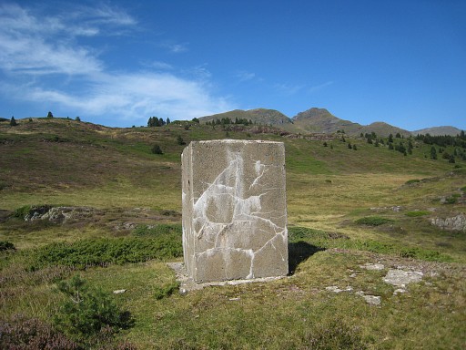
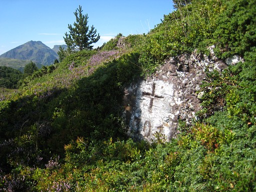
Bm280 The actual col of Escalé d'Aygue Torte is in the background. Bm280 is ± 30m to the NNE of the pass and the trail. |
||||||||||||||||||||||||||||||||||||||||||||||||||||||||||||||||||||||||||||||||||||
 |
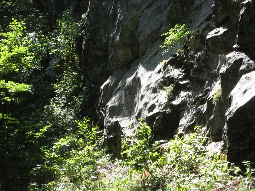
Then on the Spanish side over the grass heading SW along the hill slopes,
crossing a few times a stream, following cattle-tracks as it suits.
Later on you will enter foothills and soon join the GR11-trail (be attentive not to miss it). Continue SE on the GR11. |
||||||||||||||||||||||||||||||||||||||||||||||||||||||||||||||||||||||||||||||||||||
 |
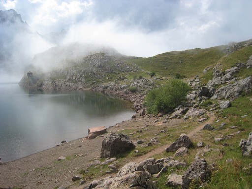
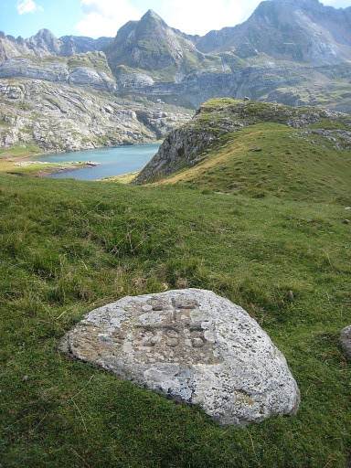
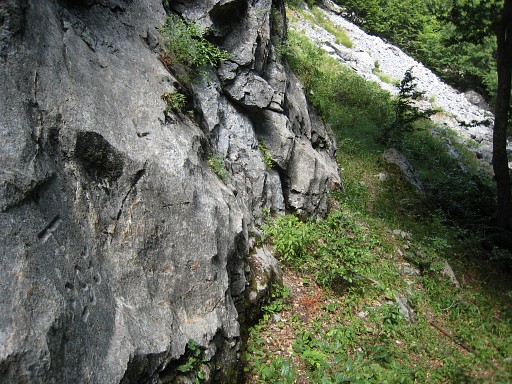
The GR10 will bring you to the Lac d’Estaens, a large lake. It takes quite some time to go along/above it untill you descend to the SE-corner of the lake. At the SE-corner of the lake, the main route keeps following the GR11-trail to the E. Variant 1 leaves here the GR11 and goes N along the lake. |
||||||||||||||||||||||||||||||||||||||||||||||||||||||||||||||||||||||||||||||||||||
| Variant 1 via bm281-292 |
|||||||||||||||||||||||||||||||||||||||||||||||||||||||||||||||||||||||||||||||||||||
 |
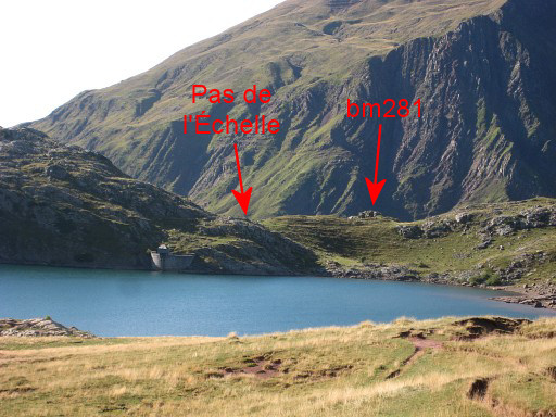
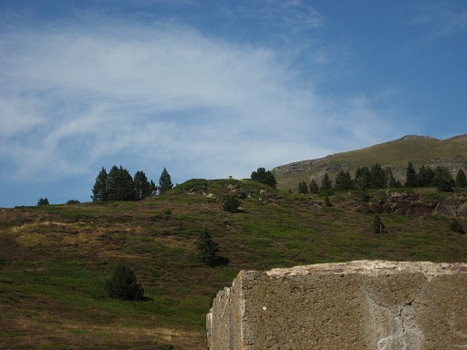
At its most nothern point, the Port de Benere Vannu or Pas de l'Échelle (visible on this picture) is just a small climb. | ||||||||||||||||||||||||||||||||||||||||||||||||||||||||||||||||||||||||||||||||||||
 |
Now a bit closer (or zoom-in from some other picture). |
||||||||||||||||||||||||||||||||||||||||||||||||||||||||||||||||||||||||||||||||||||
 |
Again the bordercross is not on the pass itself but on a outcrop sticking out of the ridge. In this case: ± 40m to the NE. | ||||||||||||||||||||||||||||||||||||||||||||||||||||||||||||||||||||||||||||||||||||
 |
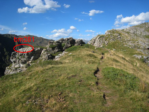
Bm281 |
||||||||||||||||||||||||||||||||||||||||||||||||||||||||||||||||||||||||||||||||||||
 |
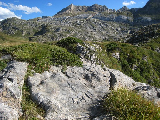
From bm281, the spot of the next one is visible. |
||||||||||||||||||||||||||||||||||||||||||||||||||||||||||||||||||||||||||||||||||||
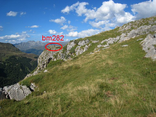 |
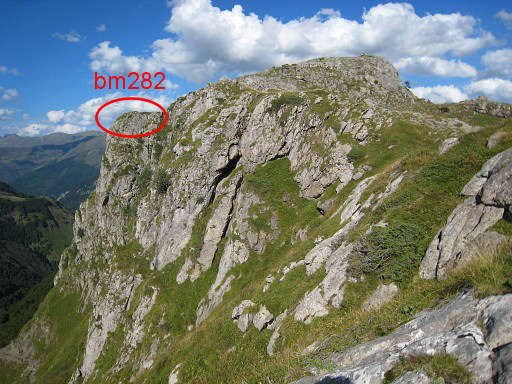
Now closer |
||||||||||||||||||||||||||||||||||||||||||||||||||||||||||||||||||||||||||||||||||||
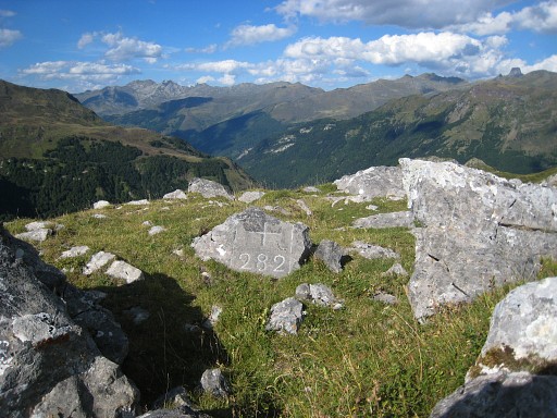 |
Bm282 Could be difficult to find on this field littered with rockpiece |
||||||||||||||||||||||||||||||||||||||||||||||||||||||||||||||||||||||||||||||||||||
 |
From bm282, the spot of the next one is visible. |
||||||||||||||||||||||||||||||||||||||||||||||||||||||||||||||||||||||||||||||||||||
 |
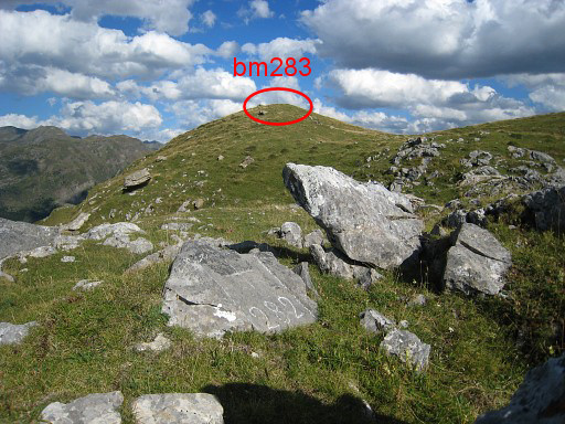
Bm283 with a view back to the Lac d’Estaens. | ||||||||||||||||||||||||||||||||||||||||||||||||||||||||||||||||||||||||||||||||||||
 |
Bm283, looking E in the direction of the hilltop with bm284 | ||||||||||||||||||||||||||||||||||||||||||||||||||||||||||||||||||||||||||||||||||||
 |
with this zoom-in of the apparent location of bm284 which is the summit. |
||||||||||||||||||||||||||||||||||||||||||||||||||||||||||||||||||||||||||||||||||||
 |
Bm284 |
||||||||||||||||||||||||||||||||||||||||||||||||||||||||||||||||||||||||||||||||||||
 |
Bm284, looking in the direction of bm285-286. | ||||||||||||||||||||||||||||||||||||||||||||||||||||||||||||||||||||||||||||||||||||
 |
with this zoom-in. You need to make a curve along the curved hillside to |
||||||||||||||||||||||||||||||||||||||||||||||||||||||||||||||||||||||||||||||||||||
 |
reach this rocky hillside |
||||||||||||||||||||||||||||||||||||||||||||||||||||||||||||||||||||||||||||||||||||
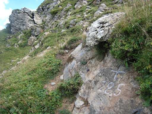 |
with bm285 |
||||||||||||||||||||||||||||||||||||||||||||||||||||||||||||||||||||||||||||||||||||
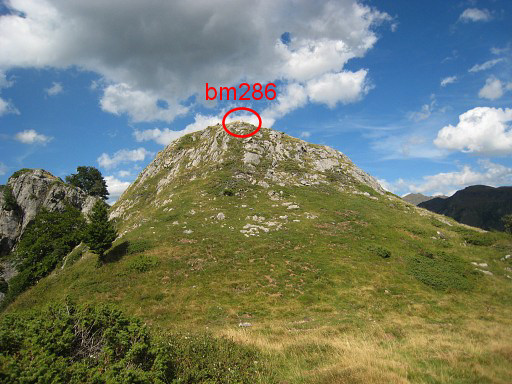 |
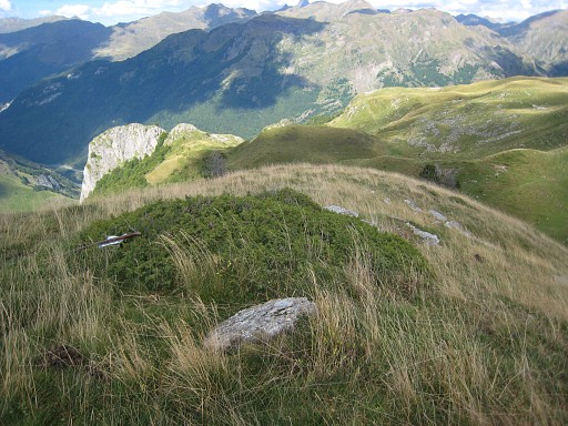
From bm285, it's 250m NE to this little rocky summit with bm286. | ||||||||||||||||||||||||||||||||||||||||||||||||||||||||||||||||||||||||||||||||||||
 |
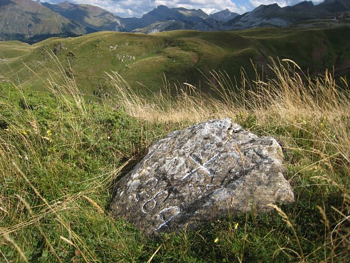
Bm286 |
||||||||||||||||||||||||||||||||||||||||||||||||||||||||||||||||||||||||||||||||||||
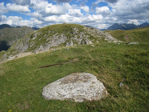
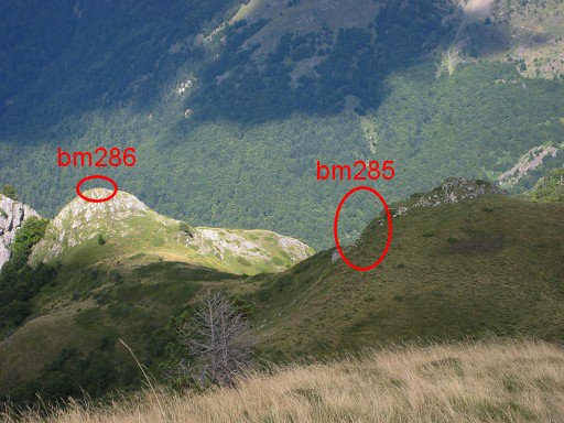
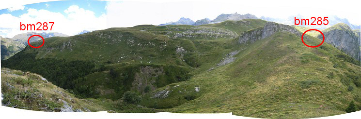 From bm286, this panorama of bm285 - where you come from - and bm287 which is the next goal. You can see that you have to make another curve along the hillside to get there. |
|||||||||||||||||||||||||||||||||||||||||||||||||||||||||||||||||||||||||||||||||||||
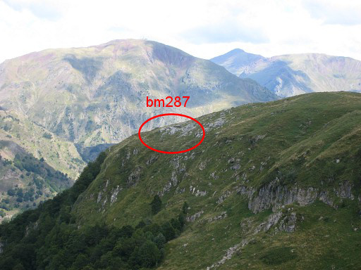 |
Zoom-in In a straight line bm287 is ± 600m away. |
||||||||||||||||||||||||||||||||||||||||||||||||||||||||||||||||||||||||||||||||||||
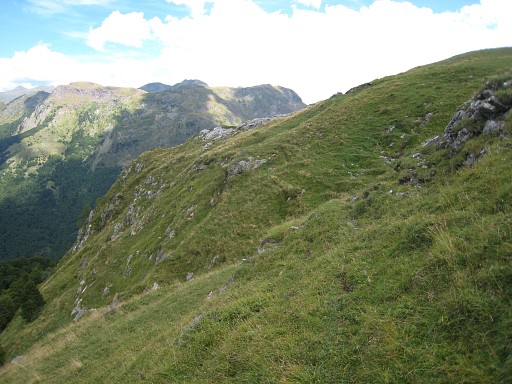 |
Getting closer, some cattle tracks can help you. | ||||||||||||||||||||||||||||||||||||||||||||||||||||||||||||||||||||||||||||||||||||
 |
Getting closer. |
||||||||||||||||||||||||||||||||||||||||||||||||||||||||||||||||||||||||||||||||||||
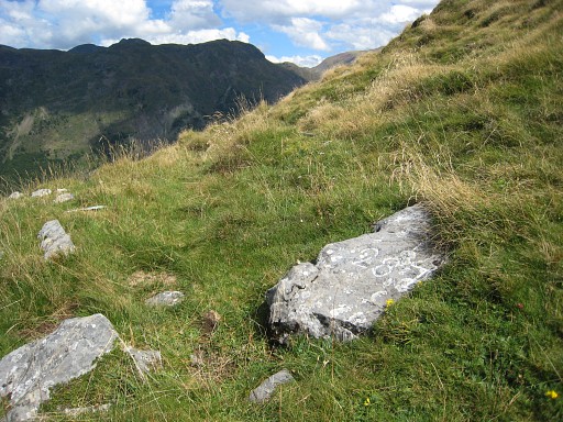 |
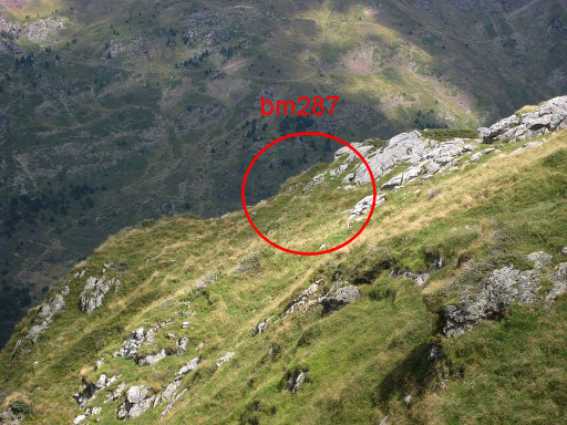
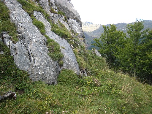
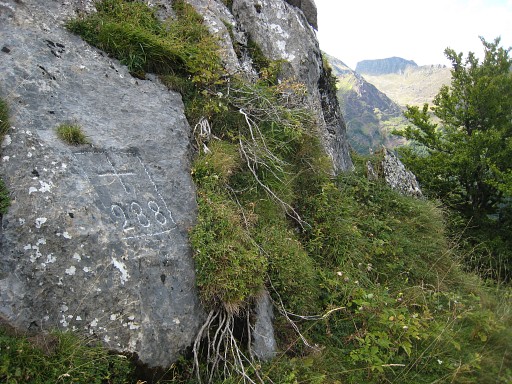
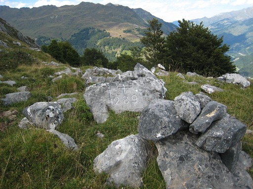
Bm287 bm287 is difficult to find, looking just like the other rockpieces in the grass. Without the chalk, the number is hardly noticeable. Hint: it is not on the hillridge but on its northern slope. |
||||||||||||||||||||||||||||||||||||||||||||||||||||||||||||||||||||||||||||||||||||
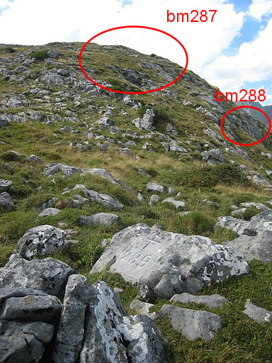 |
Bm288 is ± 60m down the hillside to the E. You cannot see it's spot from bm287. But this view from bm289 shows their relative positions well enough. |
||||||||||||||||||||||||||||||||||||||||||||||||||||||||||||||||||||||||||||||||||||
 |
Bm288 | ||||||||||||||||||||||||||||||||||||||||||||||||||||||||||||||||||||||||||||||||||||
 |
Zoom-in |
||||||||||||||||||||||||||||||||||||||||||||||||||||||||||||||||||||||||||||||||||||
|
Bm289 is not far away, this picture shows its position: ± 80m SSE from bm288. |
||||||||||||||||||||||||||||||||||||||||||||||||||||||||||||||||||||||||||||||||||||
 |
Bm289 |
||||||||||||||||||||||||||||||||||||||||||||||||||||||||||||||||||||||||||||||||||||
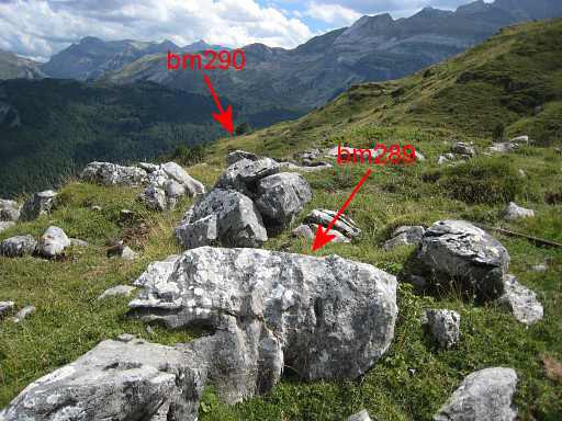 |
About 350m further SSE is bm290. This picture: the backside of bm289 with a view towards a solitary tree. Bm290 stands besides that tree. |
||||||||||||||||||||||||||||||||||||||||||||||||||||||||||||||||||||||||||||||||||||
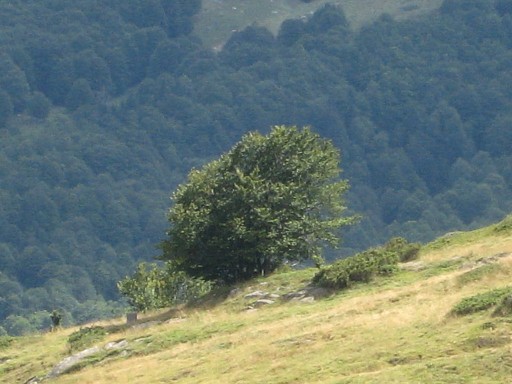 |
Zoom-in to that solitary tree with bm290 under it (to the left) |
||||||||||||||||||||||||||||||||||||||||||||||||||||||||||||||||||||||||||||||||||||
 |
Bm290 In the far distance, you can already see the location of bm291. |
||||||||||||||||||||||||||||||||||||||||||||||||||||||||||||||||||||||||||||||||||||
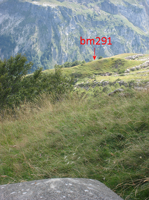 |
Zoom-in to bm291. Bm291 is ± 350m SSE in a straight line from bm290. But you have make again a large curve to the W because of the rough and steep terrain in between. |
||||||||||||||||||||||||||||||||||||||||||||||||||||||||||||||||||||||||||||||||||||
 |
Bm291 |
||||||||||||||||||||||||||||||||||||||||||||||||||||||||||||||||||||||||||||||||||||
 |
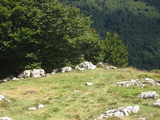
You can already see the spot of bm292 which is in a straight line ± 200m S |
||||||||||||||||||||||||||||||||||||||||||||||||||||||||||||||||||||||||||||||||||||
 |
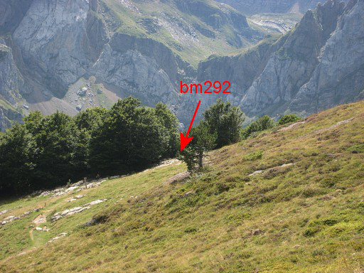
Bm292, hidden in a bush |
||||||||||||||||||||||||||||||||||||||||||||||||||||||||||||||||||||||||||||||||||||
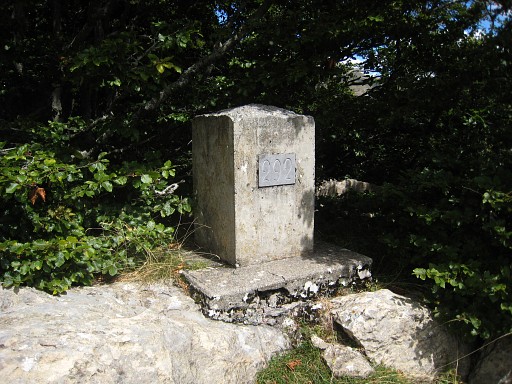 |
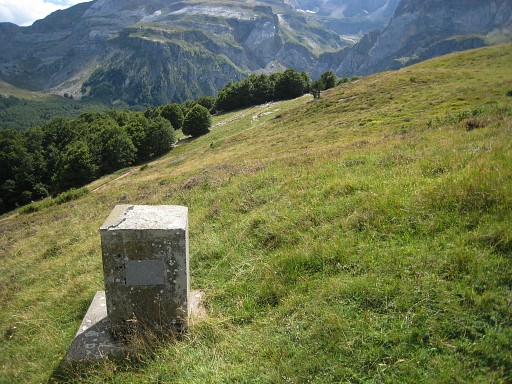
Bm292 |
||||||||||||||||||||||||||||||||||||||||||||||||||||||||||||||||||||||||||||||||||||
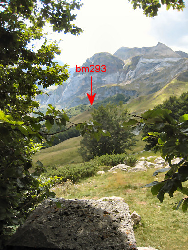 |
A view from bm292 to bm293, The distance in a direct line is ± 650m. But again: walking that straight line is not easy and has no advantage. From bm292 we walk ± 300m W along a path to reach the GR11-trail and continue on the main route. |
||||||||||||||||||||||||||||||||||||||||||||||||||||||||||||||||||||||||||||||||||||
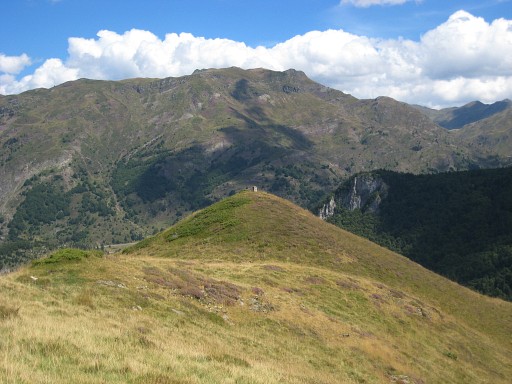 |
We are back on the main route. About 700m to the S, bm293 is closeby to the E on this hilltop. Bm293, seen from the GR11-trail and a 5min hence and forth-trip. In fact it's a tiny bit beyond the maximum reach (100m) for bm's covered by the main route and it should thus qualify for a variant. I hope you don't mind. |
||||||||||||||||||||||||||||||||||||||||||||||||||||||||||||||||||||||||||||||||||||
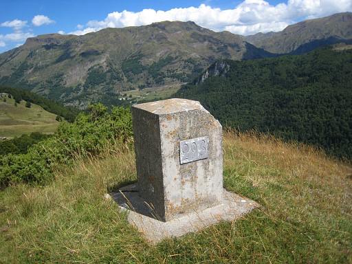 |
Bm293 |
||||||||||||||||||||||||||||||||||||||||||||||||||||||||||||||||||||||||||||||||||||
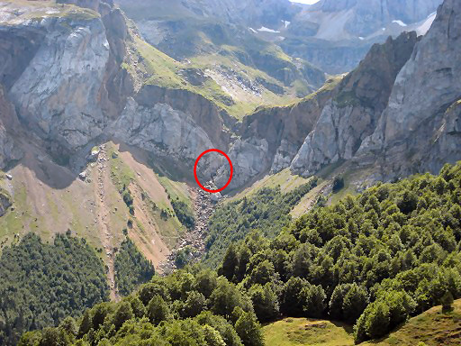 |
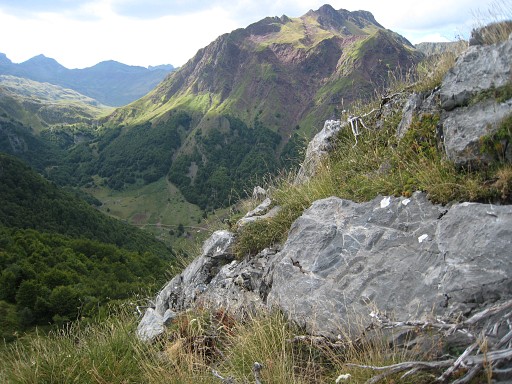
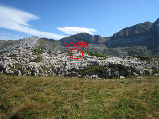
The hilltop of bm293 gives a nice view to Col d'Aspe with indicated, the location of bm296. | ||||||||||||||||||||||||||||||||||||||||||||||||||||||||||||||||||||||||||||||||||||
 |
Zoom-in. Back to the GR11-trail. |
||||||||||||||||||||||||||||||||||||||||||||||||||||||||||||||||||||||||||||||||||||
 |
This is where the GR11 enters the forest (coming from N) and where you have to climb 90m to the W to bm294. |
||||||||||||||||||||||||||||||||||||||||||||||||||||||||||||||||||||||||||||||||||||
 |
Bm294 Then descending back to the trail and continuing for ± 500m to the S. |
||||||||||||||||||||||||||||||||||||||||||||||||||||||||||||||||||||||||||||||||||||
 |
Bm295 is also off the trail. But where to leave the path to get to bm295? There are two giant boulders on each side of the path, this is one of them. That the indicator where you have to leave the path W to reach the bordercross 295. |
||||||||||||||||||||||||||||||||||||||||||||||||||||||||||||||||||||||||||||||||||||
 |
It's against this rockwall, say 70m W from the path. | ||||||||||||||||||||||||||||||||||||||||||||||||||||||||||||||||||||||||||||||||||||
 |
Bm295 |
||||||||||||||||||||||||||||||||||||||||||||||||||||||||||||||||||||||||||||||||||||
 |
Bm295 Then back to the GR11-trail |
||||||||||||||||||||||||||||||||||||||||||||||||||||||||||||||||||||||||||||||||||||
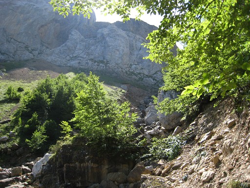 |
This is where the trail has left the forest. From the right descends the ravine coming from Col d'Aspe where bm296 is. The climb to bm296 is a variant. |
||||||||||||||||||||||||||||||||||||||||||||||||||||||||||||||||||||||||||||||||||||
| Variant 2 via bm296 |
|||||||||||||||||||||||||||||||||||||||||||||||||||||||||||||||||||||||||||||||||||||
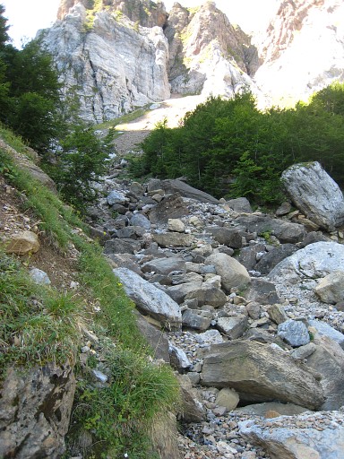 |
Navigation is easy: just climb along the streambed uphill. Some cairns may help you. |
||||||||||||||||||||||||||||||||||||||||||||||||||||||||||||||||||||||||||||||||||||
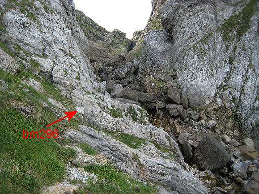 |
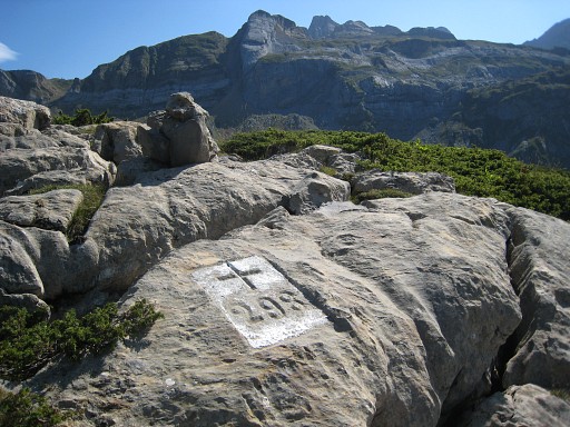
Bm296 is not easy to find, one would expect it at the top of the Col but it is at the foot of the final climb. |
||||||||||||||||||||||||||||||||||||||||||||||||||||||||||||||||||||||||||||||||||||
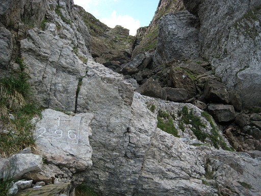 |
Bm296 Descending back to the trail. |
||||||||||||||||||||||||||||||||||||||||||||||||||||||||||||||||||||||||||||||||||||
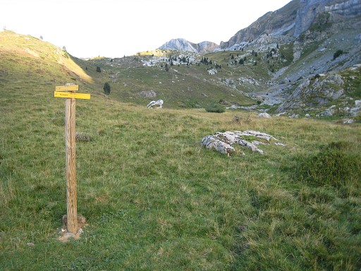 |
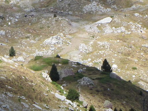
After traversing another forest, you will arrive at the open hills towards Col du Somport. At this spot the next variant starts. This picture: looking into the direction of the variant. The main route keeps following the GR11 for a while. After passing a rocky ridge, the main route leaves the GR11 and heads NE and NEE on a well trail towards bm297 sub2. There's a large yellow signboard there and (of course) the large unnumbered bordermarker 297 sub2. |
||||||||||||||||||||||||||||||||||||||||||||||||||||||||||||||||||||||||||||||||||||
| Variant 3 via bm297 |
|||||||||||||||||||||||||||||||||||||||||||||||||||||||||||||||||||||||||||||||||||||
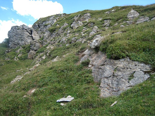
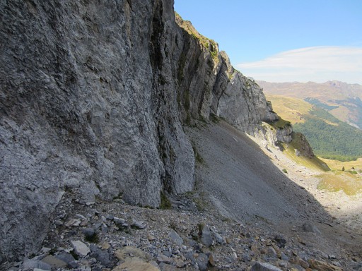 |
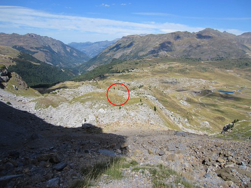
The large rockwall looking to where you come from. It's easier not to follow the rockwall but taking a more direct line from the signpost (picture above) SSE to the hilltop with the bm297-replacement. |
||||||||||||||||||||||||||||||||||||||||||||||||||||||||||||||||||||||||||||||||||||
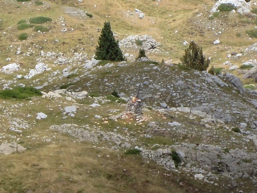
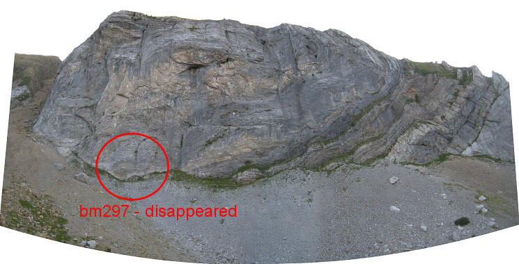 From there you can watch better and go for your own check to the rockwall. This picture: a view from the hilltop of the bm297-replacement towards the rockwall with the approximate location of this disappeared cross. The rockwall was thoroughly inspected on 20120827 |
|||||||||||||||||||||||||||||||||||||||||||||||||||||||||||||||||||||||||||||||||||||
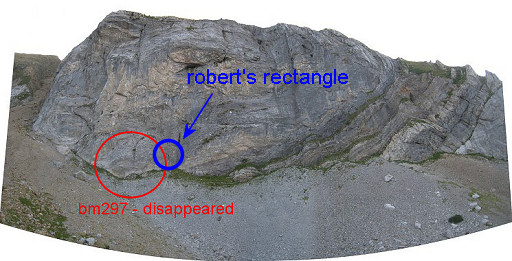 |
Robert Darrieumerlou shows an interesting picture on this page with another picture- more in detail - on this page. It seems the remnants of a rectangle in which the cross and number might have been destroyed. |
||||||||||||||||||||||||||||||||||||||||||||||||||||||||||||||||||||||||||||||||||||
 |
From the rockwall you can spot NNE in the (far) distance the bm297-replacement and bm297sub1. | ||||||||||||||||||||||||||||||||||||||||||||||||||||||||||||||||||||||||||||||||||||
 |
Zoom-in of bm297-replacement | ||||||||||||||||||||||||||||||||||||||||||||||||||||||||||||||||||||||||||||||||||||
 |
Looking further downhill and | ||||||||||||||||||||||||||||||||||||||||||||||||||||||||||||||||||||||||||||||||||||
 |
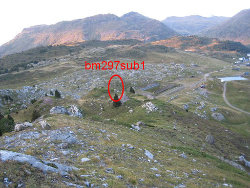
spotting bm297sub1 with it's pole. |
||||||||||||||||||||||||||||||||||||||||||||||||||||||||||||||||||||||||||||||||||||
 |
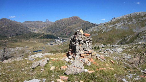
Bm297 - replacement - looking towards the rockwall. | ||||||||||||||||||||||||||||||||||||||||||||||||||||||||||||||||||||||||||||||||||||
 |
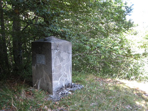
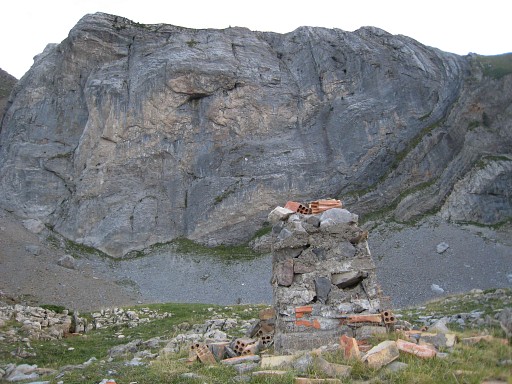
Bm297 - replacement It's ± 175m NNE of the supposed location of the original bm297. This bordermarker was installed in 1977 or 1978 - meant as a replacement for the disappeared cross 297 - together with three other unnumbered intermediate markers between bm297-299. |
||||||||||||||||||||||||||||||||||||||||||||||||||||||||||||||||||||||||||||||||||||
 |
Then on a sort of ridge N to bm297sub1, | ||||||||||||||||||||||||||||||||||||||||||||||||||||||||||||||||||||||||||||||||||||
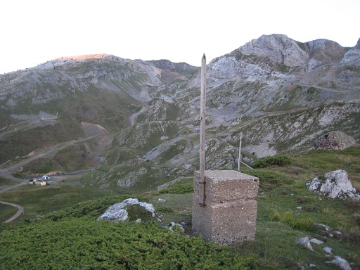 |
Bm297 sub1 However: carrying no alphanumeric indication, these markers don't qualify for my counting of all bordermarkers. But if you're here, you shouldn't miss them. |
||||||||||||||||||||||||||||||||||||||||||||||||||||||||||||||||||||||||||||||||||||
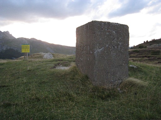 |
Then further on: bm297 sub2, also unnumbered. We are back close to the GR11-trail and on the main route. Note the large yellow signboard in the background, |
||||||||||||||||||||||||||||||||||||||||||||||||||||||||||||||||||||||||||||||||||||
 |
Bm297 sub2 |
||||||||||||||||||||||||||||||||||||||||||||||||||||||||||||||||||||||||||||||||||||
 |
Then - 225m to the NNE - there's this rock "platform"with bm298. This picture: seen from the N. You have to do some curving from bm297 sub2 to arrive here. |
||||||||||||||||||||||||||||||||||||||||||||||||||||||||||||||||||||||||||||||||||||
 |
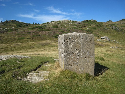
Bm298 |
||||||||||||||||||||||||||||||||||||||||||||||||||||||||||||||||||||||||||||||||||||
 |
From bm298 looking in the direction of bm298sub and bm299. You to curve around the next rock 'platform' to |
||||||||||||||||||||||||||||||||||||||||||||||||||||||||||||||||||||||||||||||||||||
 |
reach this spot with a view towards to - bm298sub - the hillridge with bm299 |
||||||||||||||||||||||||||||||||||||||||||||||||||||||||||||||||||||||||||||||||||||
 |
Bm298 sub Distance from bm298: ± 225m |
||||||||||||||||||||||||||||||||||||||||||||||||||||||||||||||||||||||||||||||||||||
 |
From bm298sub you can easily spot bm299 on the hillridge. Climb to the hillridge W of bm299 to reach easily |
||||||||||||||||||||||||||||||||||||||||||||||||||||||||||||||||||||||||||||||||||||
 |
Bm299 From here follow a trail E over the hillridge (green/yellow waymarking) until it descens to a sort of pass with |
||||||||||||||||||||||||||||||||||||||||||||||||||||||||||||||||||||||||||||||||||||
 |
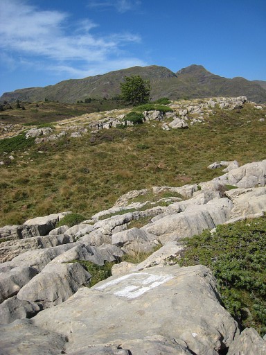
bm300 Then continue E along a trail. |
||||||||||||||||||||||||||||||||||||||||||||||||||||||||||||||||||||||||||||||||||||
 |
A clue for bm301, looking from W to E: behind the tree - on the small hilltop - that's where bm301 is. | ||||||||||||||||||||||||||||||||||||||||||||||||||||||||||||||||||||||||||||||||||||
 |
Bm301 Bm301 is also quite hidden in the undergrowth, in this case 15m S from the path. |
||||||||||||||||||||||||||||||||||||||||||||||||||||||||||||||||||||||||||||||||||||
 |
Since bm302 is difficult to find, this clue: a dead tree to the W along the path. Bm302 is roughly located where the trees in the background stand, 20 meters to the right (=S) of the path |
||||||||||||||||||||||||||||||||||||||||||||||||||||||||||||||||||||||||||||||||||||
 |
Bm302 Then straight to |
||||||||||||||||||||||||||||||||||||||||||||||||||||||||||||||||||||||||||||||||||||
 |
bBm303 where the trail bends to the left (=N) About 300m further you have to make a little detour E to visit |
||||||||||||||||||||||||||||||||||||||||||||||||||||||||||||||||||||||||||||||||||||
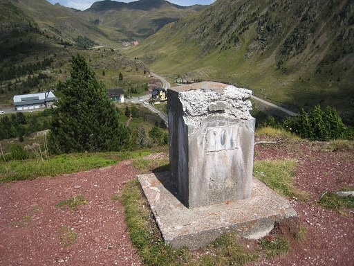 |
bm304 on a hilltop with a view of Col du Somport. Then the trail descends - along a chapel - to |
||||||||||||||||||||||||||||||||||||||||||||||||||||||||||||||||||||||||||||||||||||
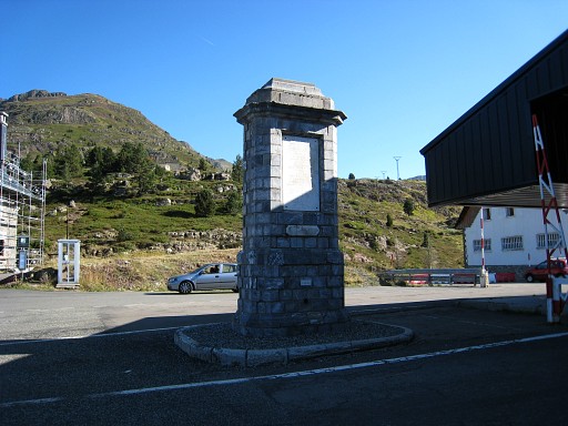
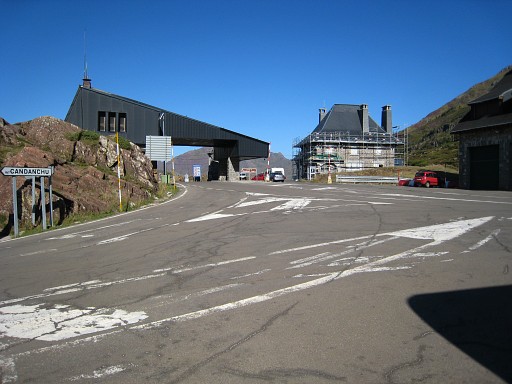 |
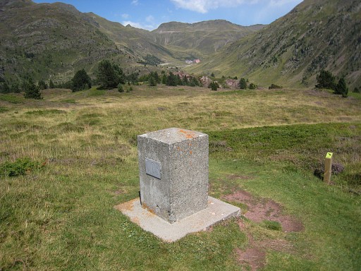
Col du Somport. |
||||||||||||||||||||||||||||||||||||||||||||||||||||||||||||||||||||||||||||||||||||
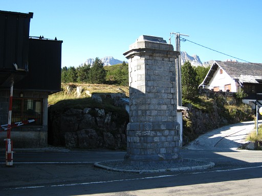 |
You can't miss the spot where bm305 is: |
||||||||||||||||||||||||||||||||||||||||||||||||||||||||||||||||||||||||||||||||||||
 |
Bm305 |
||||||||||||||||||||||||||||||||||||||||||||||||||||||||||||||||||||||||||||||||||||
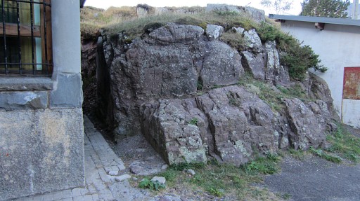
 |
and bm305bis |
||||||||||||||||||||||||||||||||||||||||||||||||||||||||||||||||||||||||||||||||||||