|
The
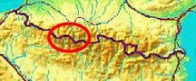
bordermarkers of the Pyrenees : the GRPdesBF
 |
|||||||||||||||||||||||||||||||||||||||||||||||||
| -
stage 22 - Llanos de Larri - Cabane des Aguilos (bm321) |
 |
||||||||||||||||||||||||||||||||||||||||||||||||
Update may 2020: the 5 stages 21-25 (bm320-329) will be replaced by four stages. That will result in a more smooth main route, leaving the high altitude and non-waymarked trails to the variants. Has yet to be worked out. It will result in de following routes: |
|||||||||||||||||||||||||||||||||||||||||||||||||
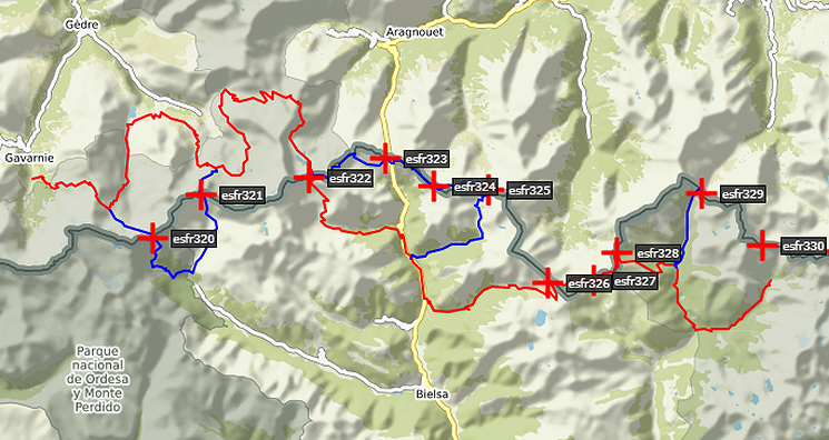 You can already watch these new routes in detail with this kml-file. |
|||||||||||||||||||||||||||||||||||||||||||||||||
Hereunder the original stage: |
|||||||||||||||||||||||||||||||||||||||||||||||||
 |
|||||||||||||||||||||||||||||||||||||||||||||||||
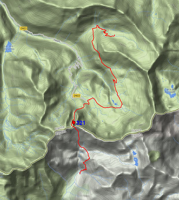
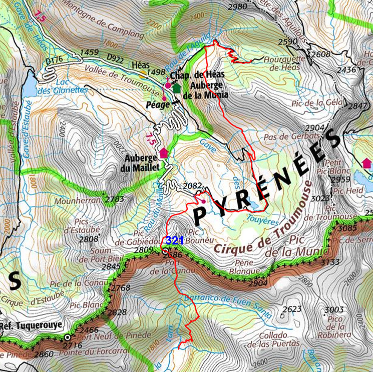
| Only
the bordermarkers along this stage are shown (and some adjoining ones).
The main route is red,
the variants have other colors.
The main route provides a smooth
on-going route along most bordermarkers, the variants give access to
the remaining bordermarkers. See the GRPdesBF-principles.. Click here for an fullscreen interactive map. In short After a tough & rough climb to Port de la Canau, the route (there are no variants) takes you down to the magnificent Cirque de Troumouse. From there it's a smooth continuation to an upper valley with Cabane des Aguilos at the foot of the pass of Hourquette de Héas. Considerations The first part - getting over Port de Canau - requires special care in wayfinding and is tough through steepness and lack of trails. From the Cirque de Troumouse onwards there are enough opportunities for bivouacing and water refuelling. At the end - when sufficient time left - one could continue on the next stage to the Refuge de Barroude but that will take you ± 2,5 h extra. Factsheet
Gps-files needed
Version 02 July 2014. If you have any correction, suggestion etcetera -> please email me: eefberns@grenspalen.nl MAPS AND DIRECTIONS You might check the relevant webpages in the 'All markers'-section and 'All my trips'-section for more pictures of the bordermarkers and wayfinding-issues. Print your own maps It's easy to print your own - custom made - maps with the GRPdesBF-route and the bordermarkers on them. See: Print your own maps |
|||||||||||||||||||||||||||||||||||||||||||||||||
 |
|||||||||||||||||||||||||||||||||||||||||||||||||
 |
The starting point: the
plains of
LLanos de la
Larri. At the end of it to the right, a track starts, well waymarked with cairns. |
||||||||||||||||||||||||||||||||||||||||||||||||
 |
It climbs steeply
along the rocky
mountain-side with various vertigo parts, be careful. This picture: looking back at the Llanos de Larri. |
||||||||||||||||||||||||||||||||||||||||||||||||
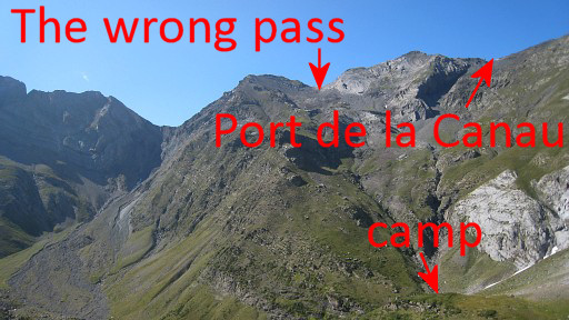 |
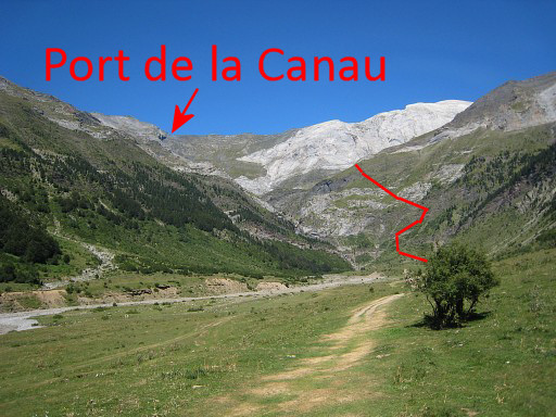
Then this view of the
borderridge with Port de la Canau with bm321. First you will need to descend to the valley ("camp") and then climb to Port de la Canau. This picture shows the risk in climbing to the wrong pass (as I did). From the valley it's not obvious in which way to climb. |
||||||||||||||||||||||||||||||||||||||||||||||||
 |
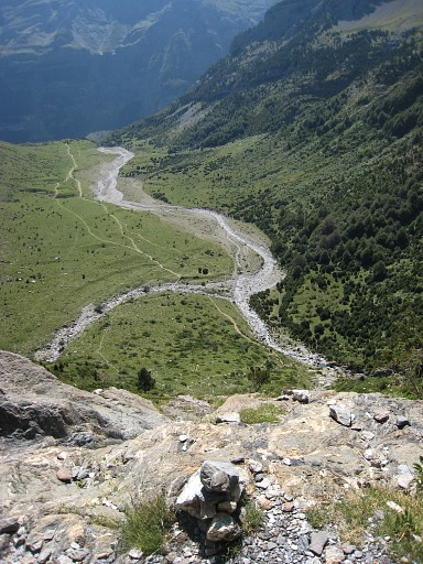
Finally all the
rocky climbing is finished and the trail
(which leads to Lagos de la Munia) flattens. Again: looking back at the plains. Further on you’ll see a grassy slope descending NNW to a stream. |
||||||||||||||||||||||||||||||||||||||||||||||||
 |
Now descend
in that direction (no trail) and arrive here, a little beyond
the stream. It makes a very fine bivouac spot. But how to ascend to Port de la Canau? |
||||||||||||||||||||||||||||||||||||||||||||||||
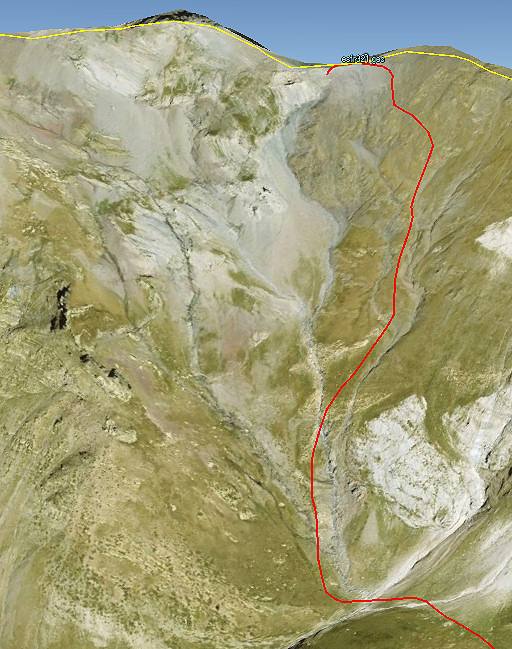 |
Let's show it on a
printscreen from Google Earth. |
||||||||||||||||||||||||||||||||||||||||||||||||
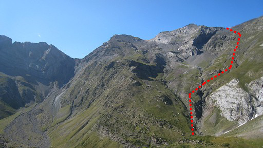 |
And let's project its
approximate course on a previous picture and finally |
||||||||||||||||||||||||||||||||||||||||||||||||
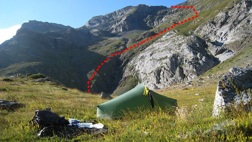 |
on this picture. |
||||||||||||||||||||||||||||||||||||||||||||||||
 |
By
the way: on my way up, you might stumble upon a distinct white
waymarked trail as I did. It might help you uphill for a while. It's unknown where it originates from. It could be a more direct trail from the plains of LLanos de la Larri to Port de la Canau but I found no prove for that. |
||||||||||||||||||||||||||||||||||||||||||||||||
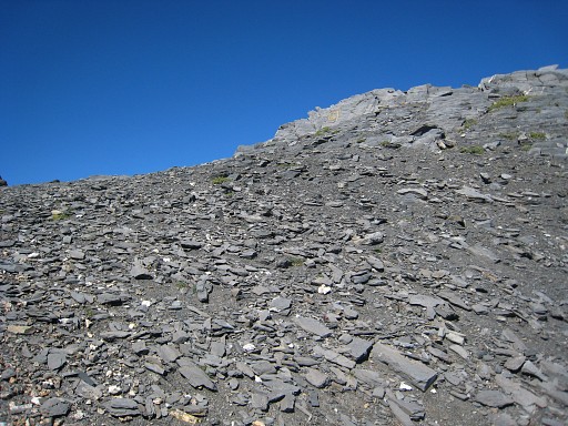 |
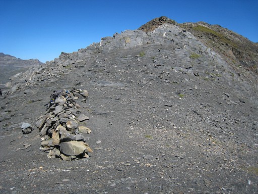
Once in the right
direction, it’s just going up. Climbing is heavy by lack of a real
trail. On this picture: almost at the pass, the bm already but faintly visible with its yellow painting. |
||||||||||||||||||||||||||||||||||||||||||||||||
 |
At the Port de la Canau, bm321 at the other end of the pass. | ||||||||||||||||||||||||||||||||||||||||||||||||
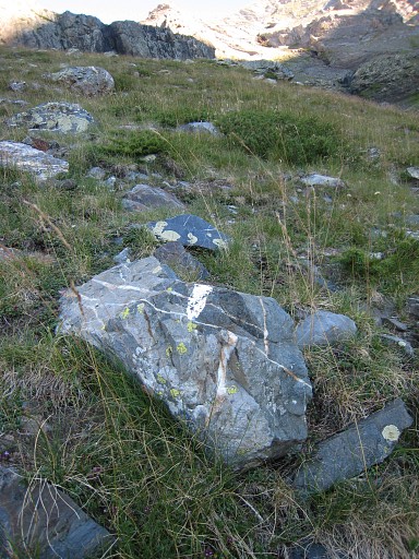
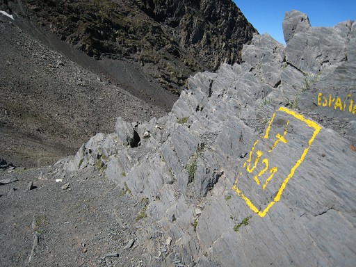 |
Bm321 |
||||||||||||||||||||||||||||||||||||||||||||||||
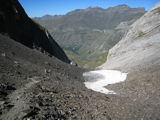 |
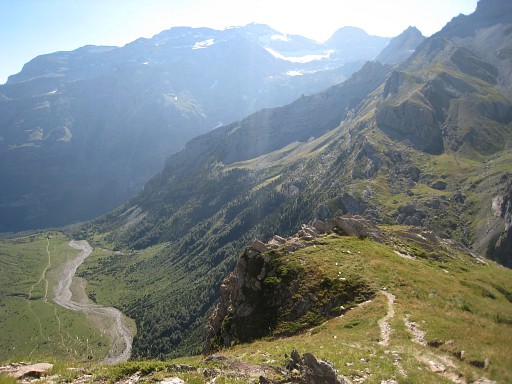
Then in 1½ hours down a well trail to the Cirque de Troumouse where | ||||||||||||||||||||||||||||||||||||||||||||||||
 |
the views are trementous. Now descend NW for ± 1km to a parking spot. Then take a trail to the E and go around the Lacs des Aires. Then the trail goes N - passing Cabanes des Aires - for ± 4km before it turn right and climbs to an upper valley. |
||||||||||||||||||||||||||||||||||||||||||||||||
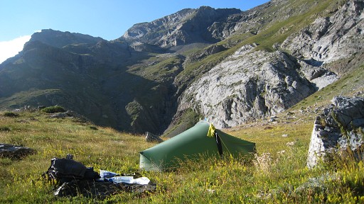
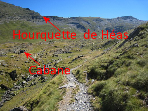 |
If you get close to
Cabane de Aguilous, the upper valley unfolds itself. On this picture the cabane is visible, also the Hourquette de Héas (next stage). |
||||||||||||||||||||||||||||||||||||||||||||||||