|
The
bordermarkers of the Pyrenees : all my trips
 |
|
| -
wednesday 24 august
2022 - Redoing bm271-271bis with Carlos & Conchita |
 |
 |
Summary:
part of a series of 9 daytrips in august & september 2022 across
the Pyrenees. The main goal was to finish my plan to have visited all
bordermarkers at least twice. It was also a kind of sentimental farewell journey, visiting old friends and cherished places. This is daytrip 1. Today: with Carlos & Conchita Roca to bm271-271bis Weather: sunny Basecamp: Camping Asolaze near Isaba Same trip to be seen at Carlos & Conchita's website. |
 track-20220824.kml
(click to open this trip in Google Earth or copy link to Google Maps; click right on this link to download gpx-version). The gps-track has not been manually corrected which explains the inaccuracy and misalignment at some points. For cartographic backgrounds: see the cartography-page Gps-waypoints of all bordermarkers (most recent version): kml: esfr-bordermarkers-all-waypoints.kml gpx: esfr-bordermarkers-all-waypoints.gpx (with elevation added by gpsvisualizer.com) |
|
 |
According to Garmin
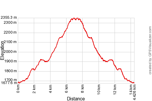
Basecamp (uncorrected track with elevation added by Gpsvisualizer.com): Distance: 14,4 km Max-height: 2355m Min-height: 1678m Elevation: +1109m -1110m Total elevation: 2219m Start 6:38 Finish 16:20 Total time: 9:42 |
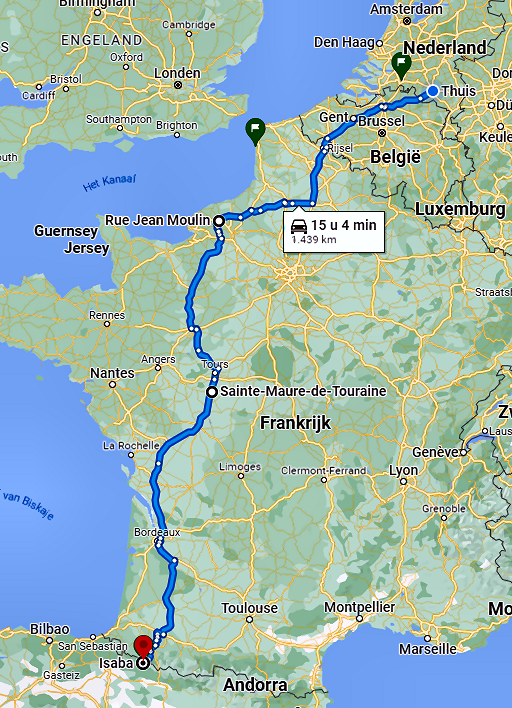 |
The previous 2 days I
drove from Holland to camping Asolaze near Isaba. Camping in between in Sainte-Maure-de-Touraine. Carlos & Conchita have already arrived at camping Asolaze. |
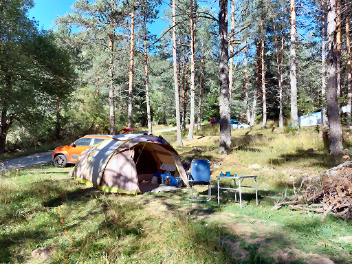 |
My spot on camping Asolaze for these days. |
 |
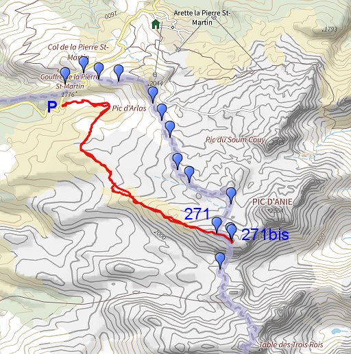
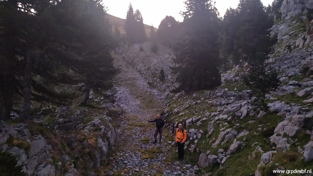
This morning an early
start (6:45) from parking de la Contienda. (click photo to enlarge) |
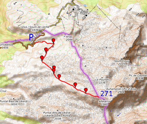 |
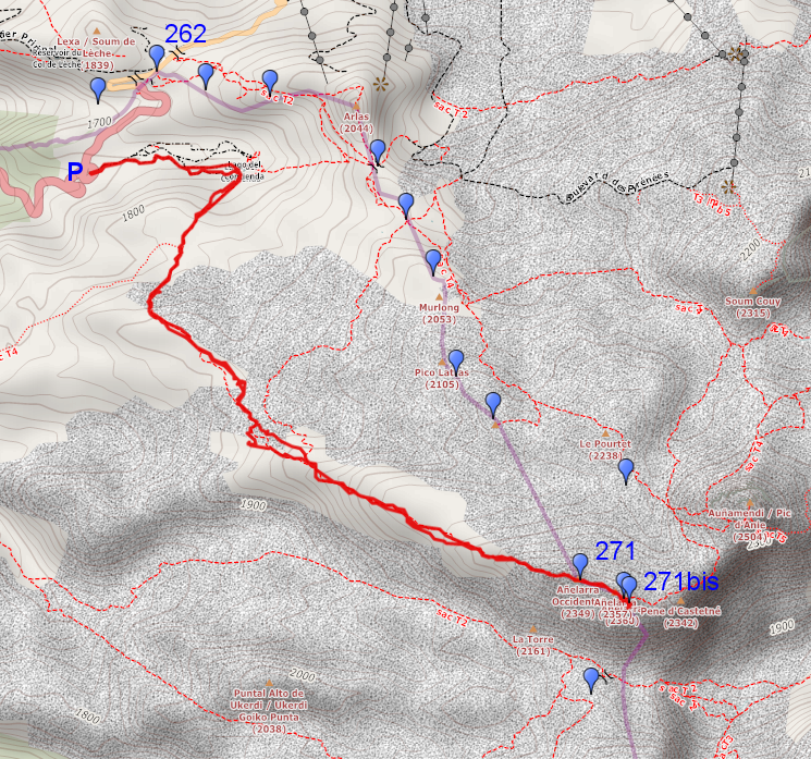
We will follow an
alternative route to bm271 which I found on the OSM-maps. See for more information (maps and considerations) on this alternative route this page. Navigation will be along 8 waypoints. Those waypoints are integrated in this kml-file (gpx-file with this link). |
 |
First we follow cross-ski
trails (click photo to enlarge) |
 |
to arrive at a grassy
plain. (click photo to enlarge) |
 |
To the SW our route enters
the rocky terrain (click photo to enlarge) |
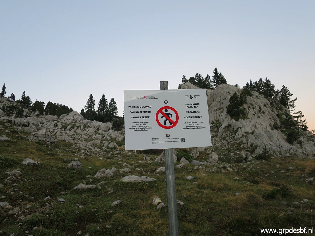 |
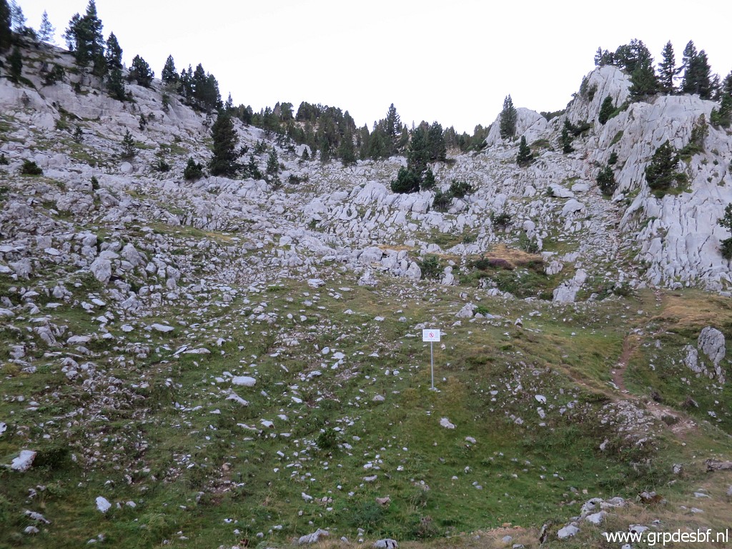
which is now forbidden but
who cares. (click photo to enlarge) |
 |
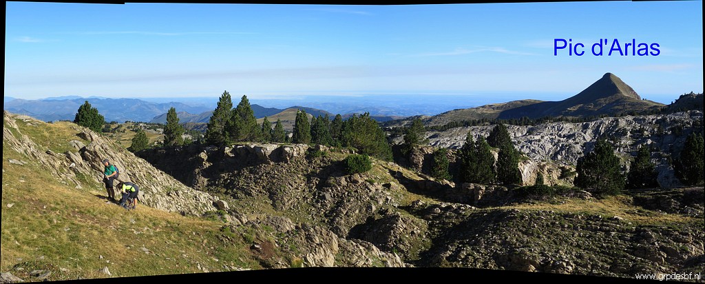
Looking back to the grassy
plains and Pic d'Arlas. (click photo to enlarge) |
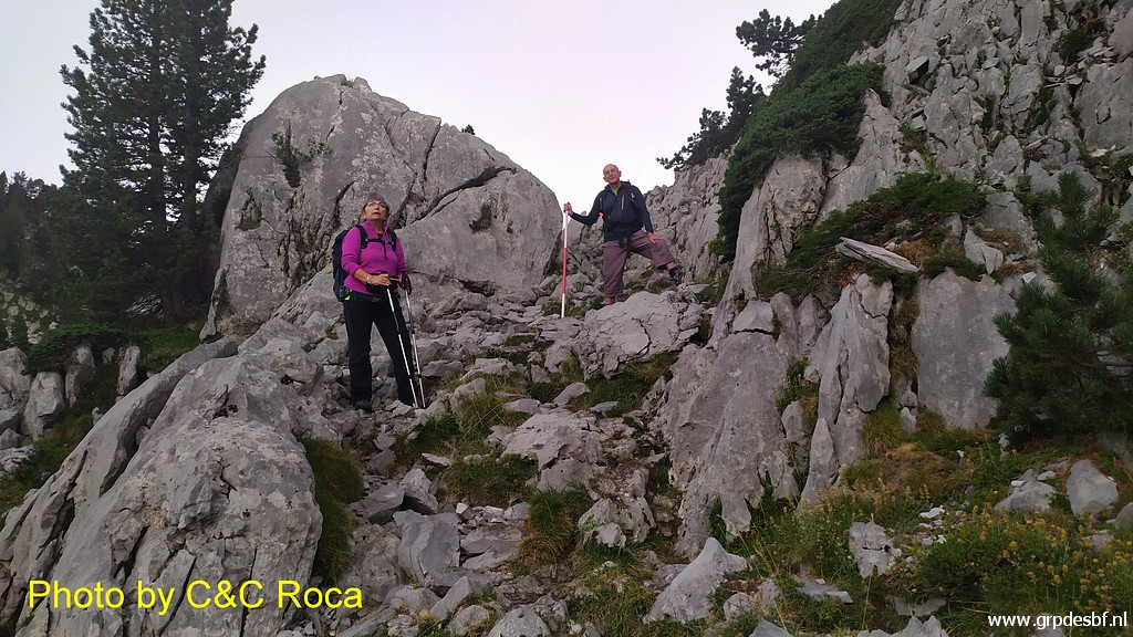 |
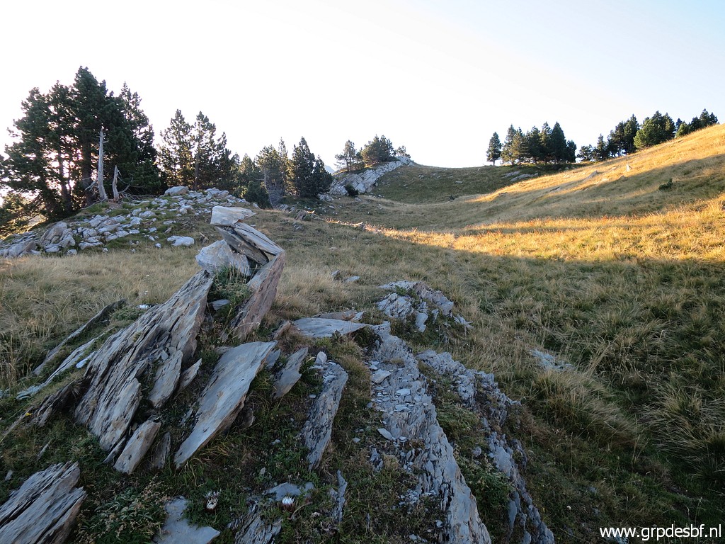
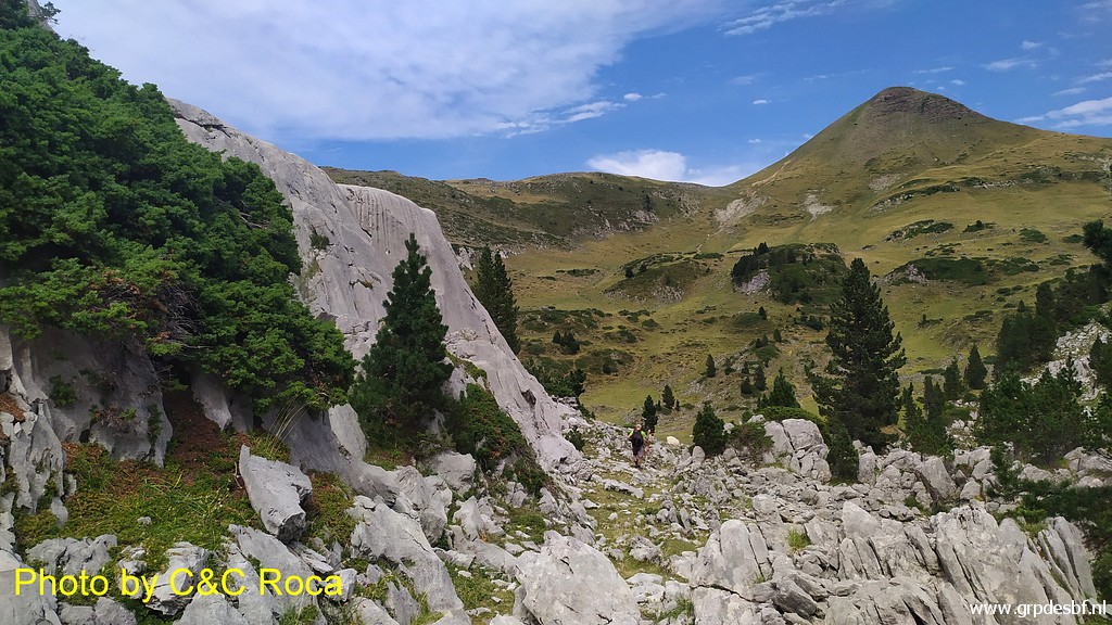
The first part is rocky (click photo to enlarge) |
 |
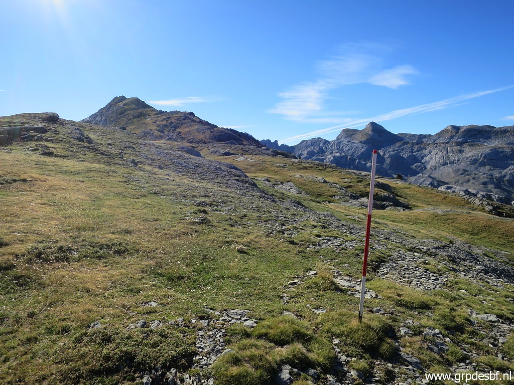
but then it becomes
grassy. The red-white pole is on the third waypoint (I think). (click photo to enlarge) |
 |
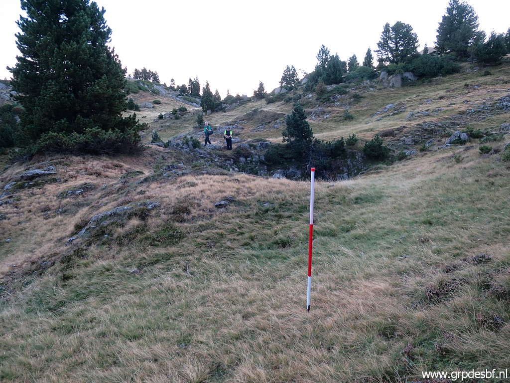
And so we continue,
progressing from one waypoint to the next. (click photo to enlarge) |
 |
There are some cairns but
too few to rely on. (click photo to enlarge) |
 |
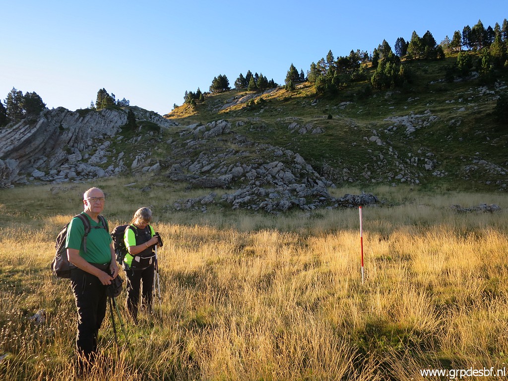
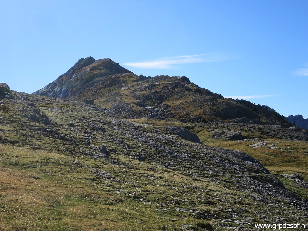
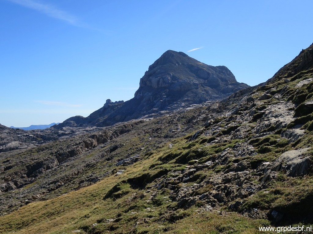
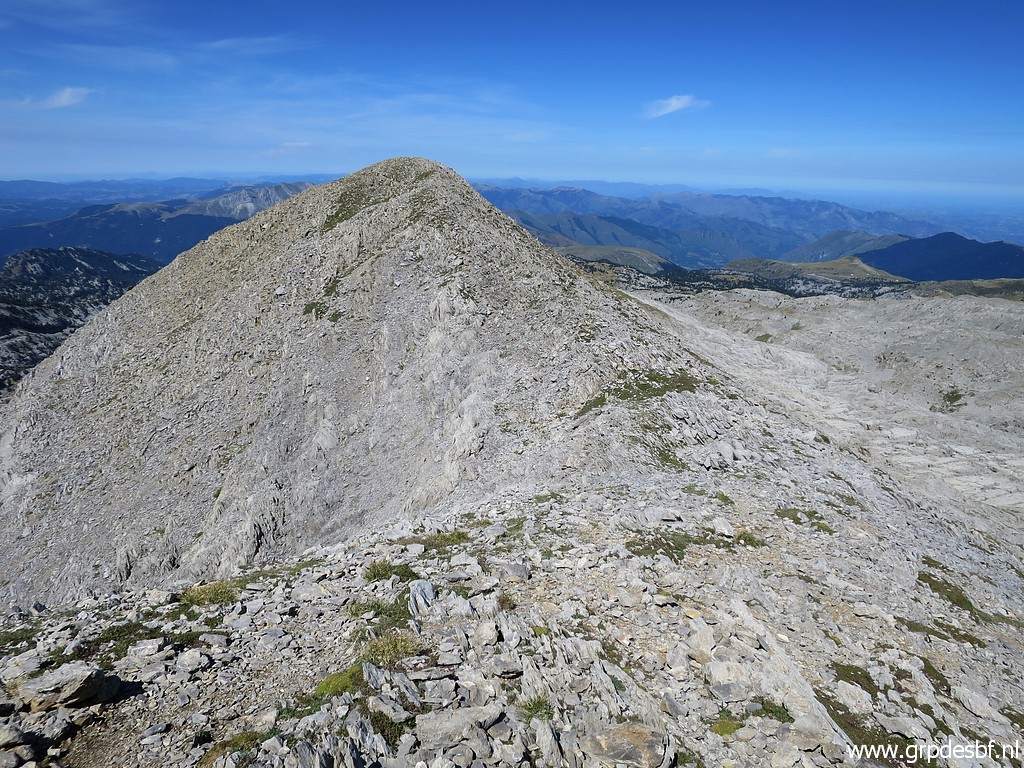
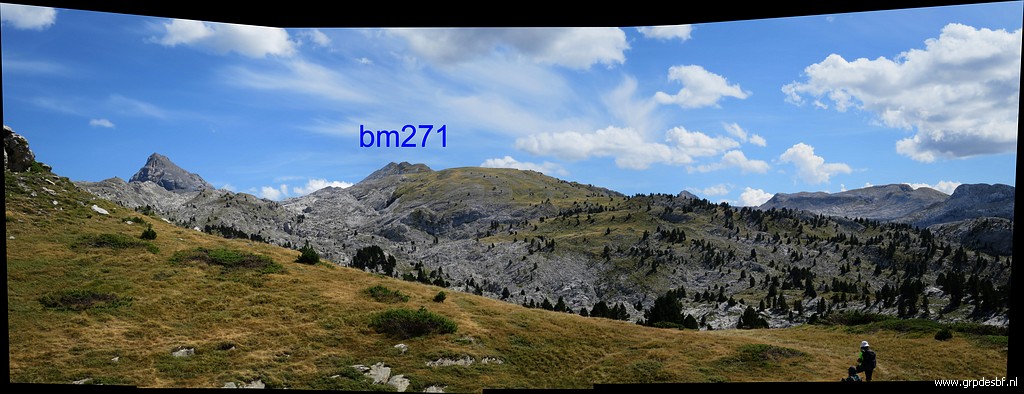
Gradually our destination
comes in sight (click photo to enlarge) |
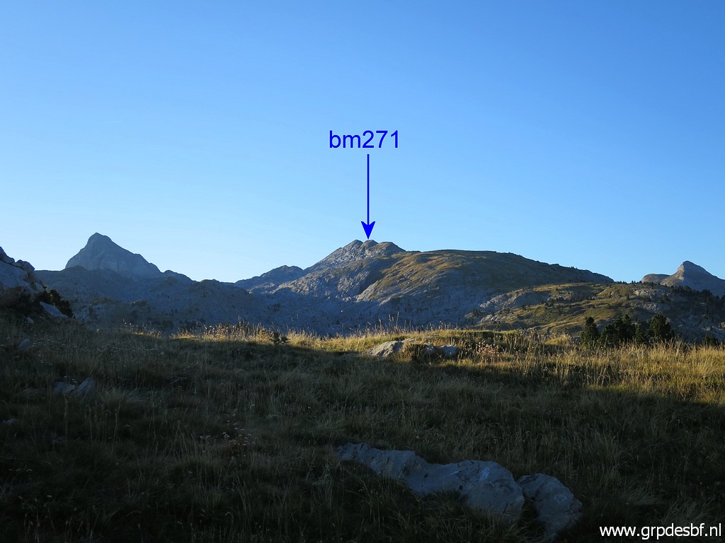 |
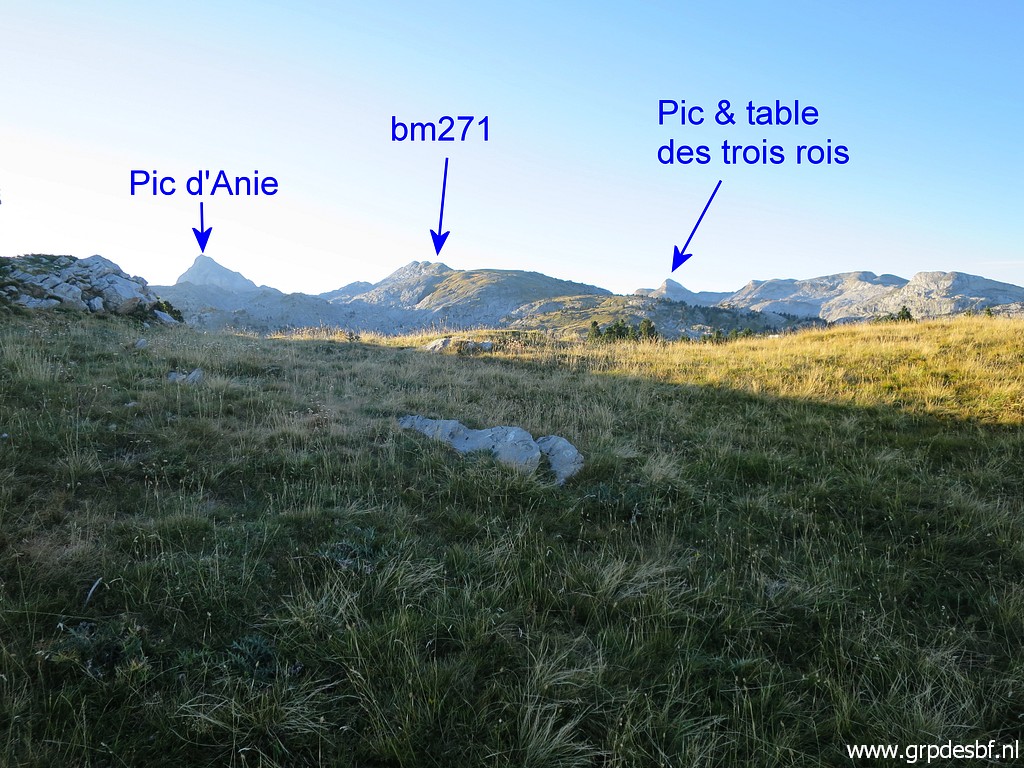
and that is bm271. Seems a simple and not difficult climb to the ridge. (click photo to enlarge) |
 |
Zoom-in to the Table and
Pic des tois Rois. The Table des Trois Rois is mentioned in the treaty of 1856 as being the tripoint where France, Aragon and Navarra meet. (click photo to enlarge) |
 |
Looking back. (click photo to enlarge) |
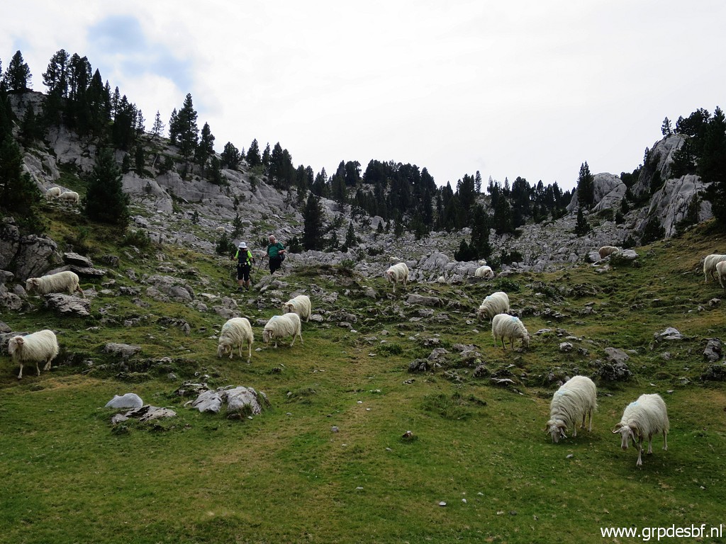
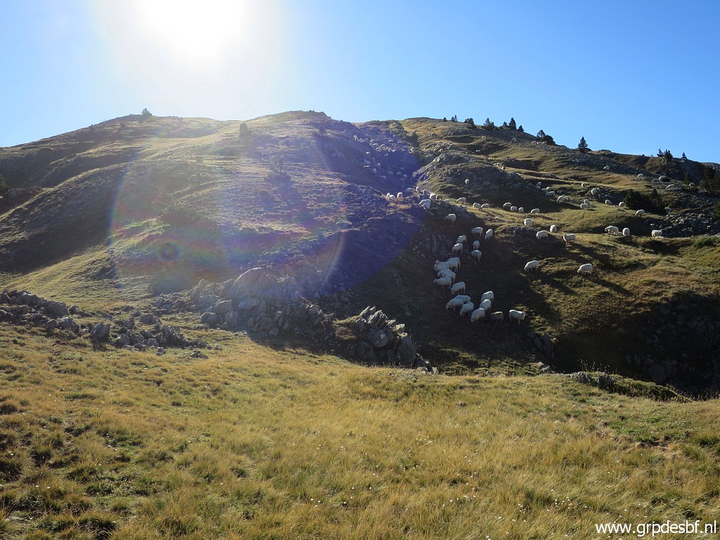 |
A flock of sheep in
between. (click photo to enlarge) |
 |
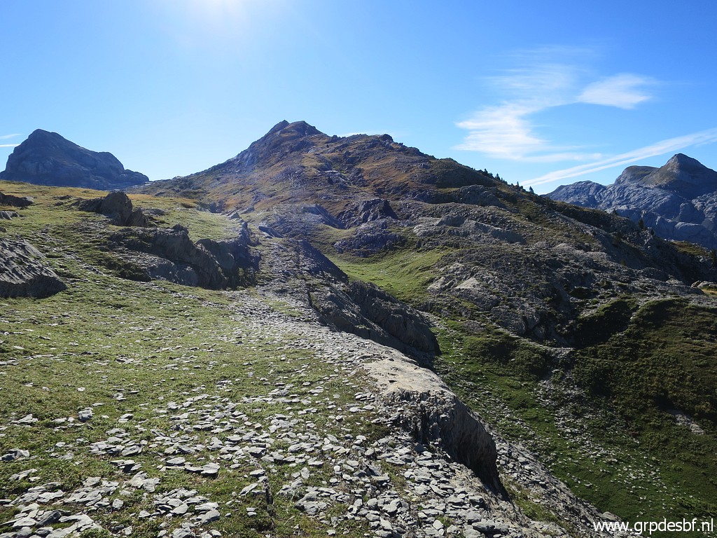
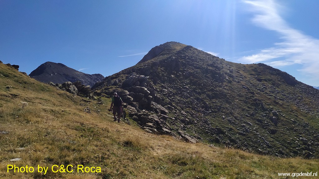
Further on, we are getting
closer (click photo to enlarge) |
 |
to the final climb (click photo to enlarge) |
 |
but still some
denivellation to tackle. (click photo to enlarge) |
 |
Looking back, Pic d'Arlas
still in sight, (click photo to enlarge) |
 |
and looking forward to Pic d'Anie. (click photo to enlarge) |
 |
Time for a break, Carlos
& Conchita leave their backpacks behind for the remaining climb. (click photo to enlarge) |
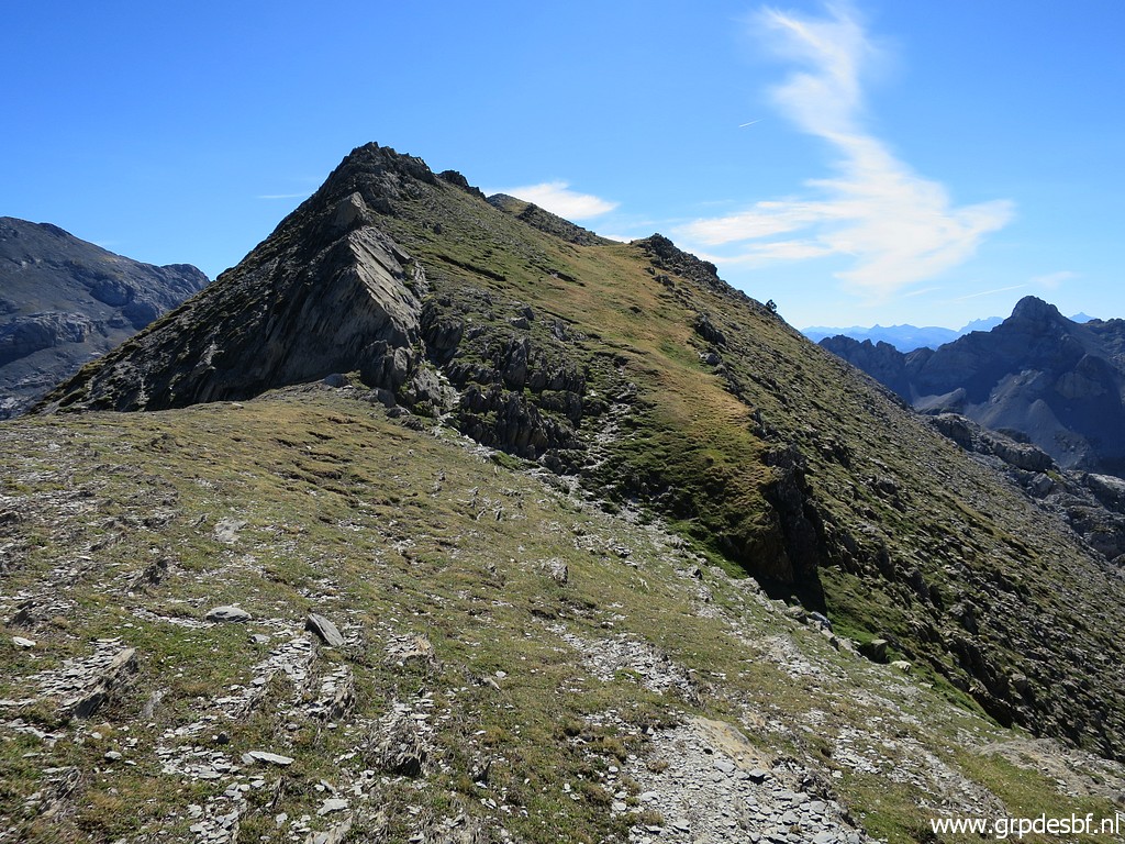 |
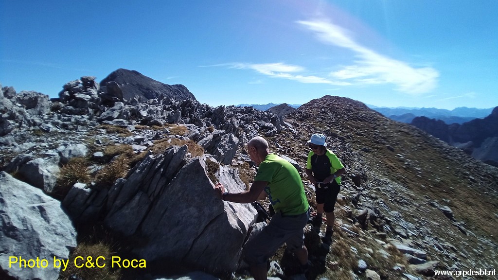
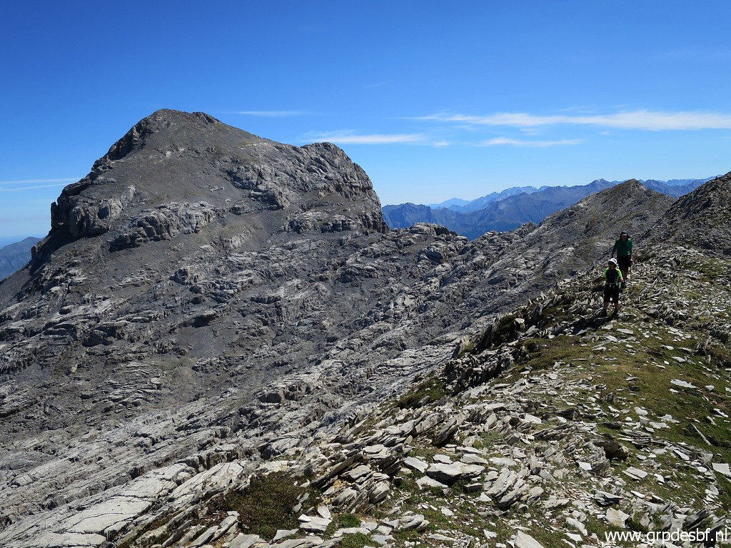
Now we are on the ridge (click photo to enlarge) |
 |
with me leading the pack. (click photo to enlarge) |
 |
It's becoming hot (click photo to enlarge) |
 |
and it's still climbing. (click photo to enlarge) |
 |
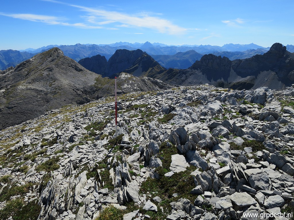
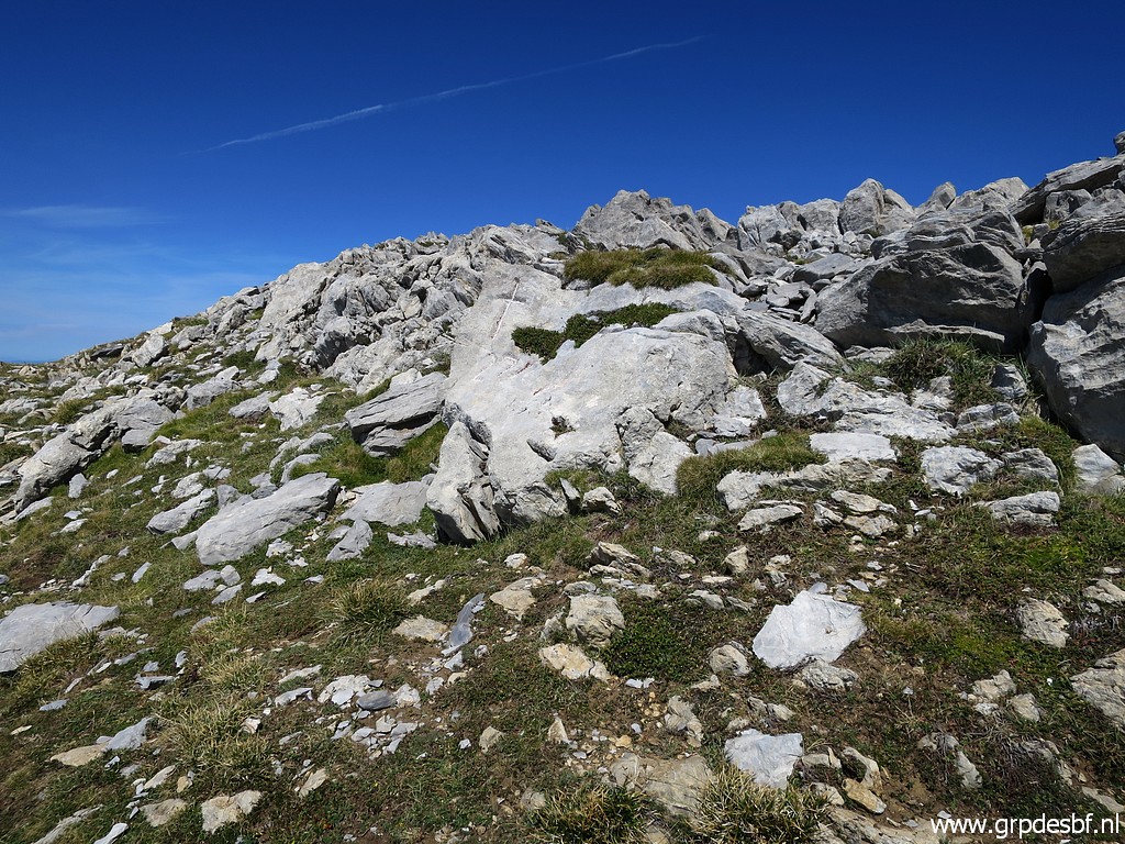
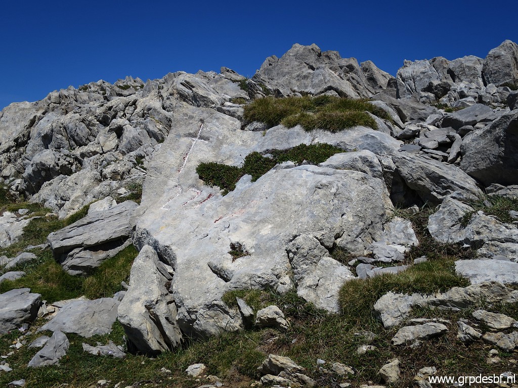
But then - after 4:15h - we arrive at
bm271. (click photo to enlarge) |
 |
Bm271 (click photo to enlarge) |
 |
Bm271 (click photo to enlarge) |
 |
Bm271 (click photo to enlarge) |
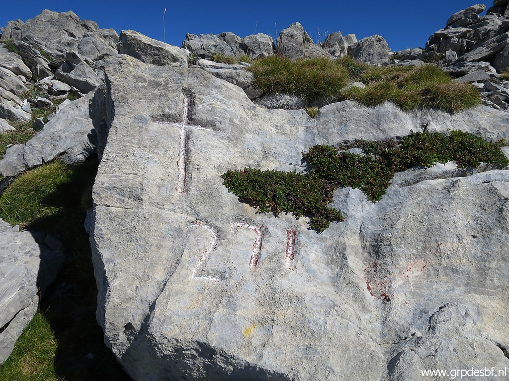 |
Bm271 (click photo to enlarge) |
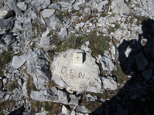 |
I forgot about it but ±
15m E from bm271 there is (or was in 2013) a modern marker at the ridge
(a few meters E of a large cairn). This is a picture of 1 sept 2013. It's a geodetic marker. D.F.N. is the abbreviation of Diputación Foral de Navarra, let's say the government of Navarra. So: the D.F.N. considers (I suppose) this spot to be the exact place where the straight borderline coming from bm270 nods off 90 degrees and follows the ridge NNE to (the unfindable and supposedly destroyed) bm271bis. |
 |
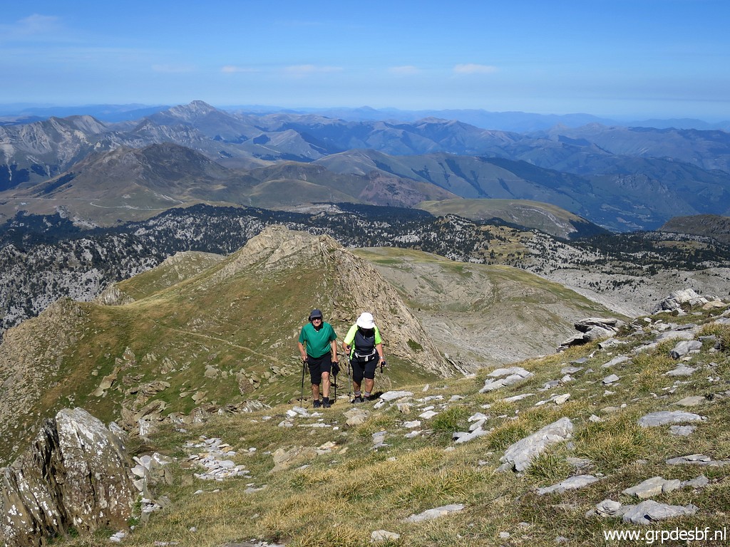
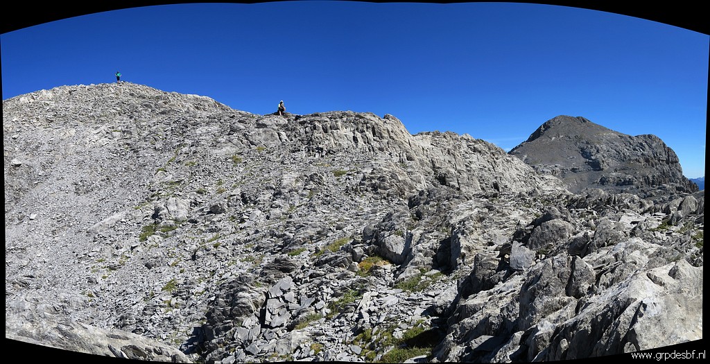
We are not finished yet, I
want to do a last search for bm271bis. So we continue on the ridge, here I am looking back (click photo to enlarge) |
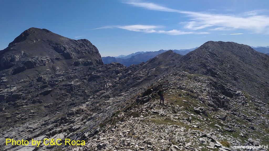 |
and on this picture Carlos
& Conchita are looking forward to me. (click photo to enlarge) |
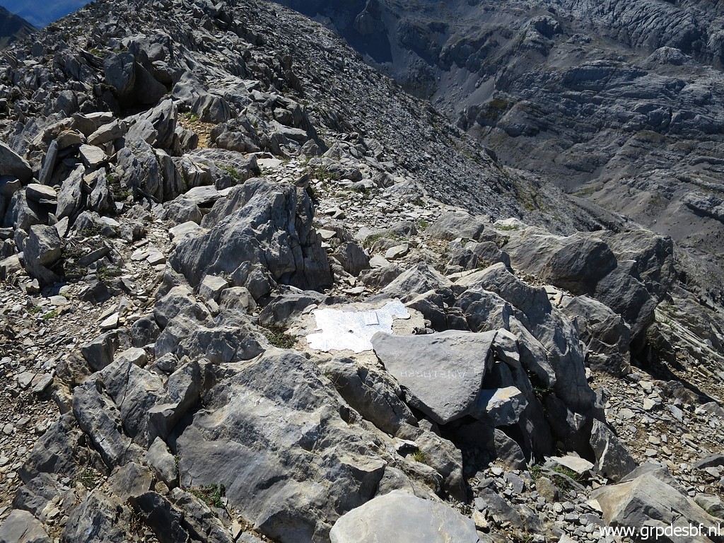 |
Then we pass - on the Pic
de Añelarra, the summit of the ridge - this metal (click photo to enlarge) |
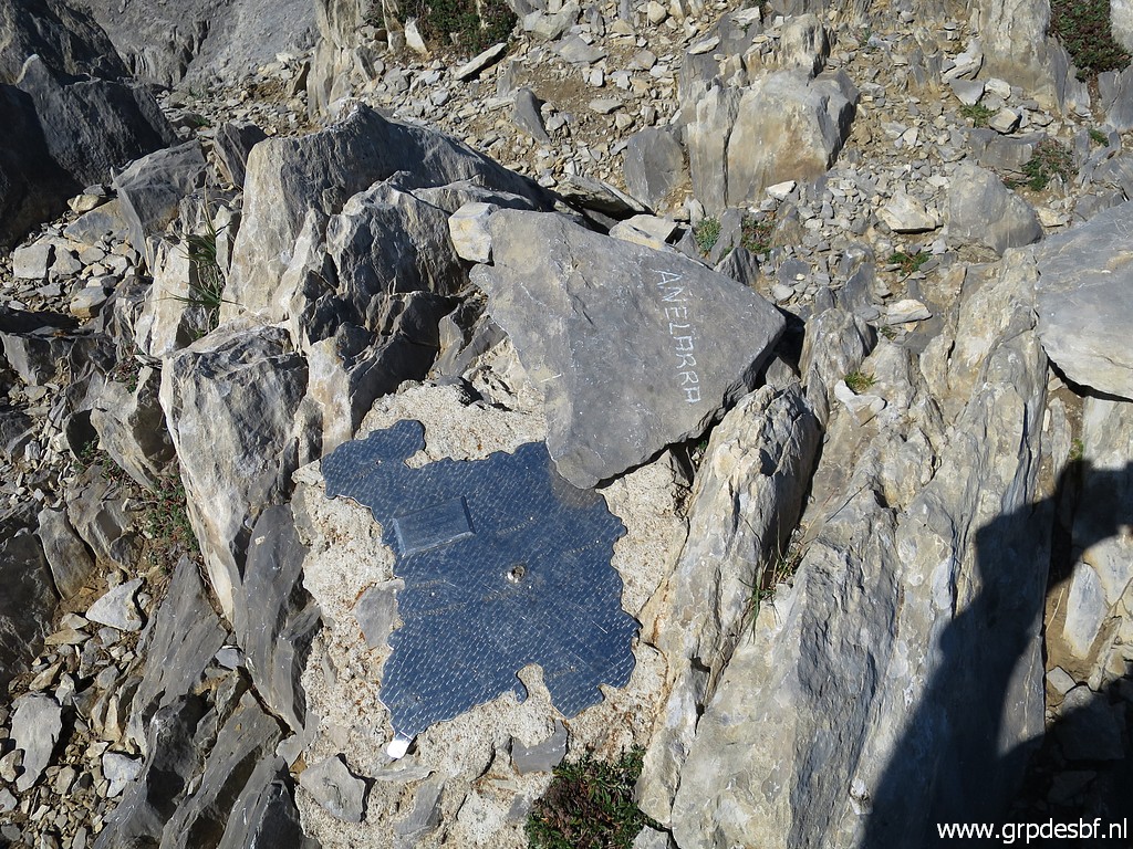 |
plaque in the shape (click photo to enlarge) |
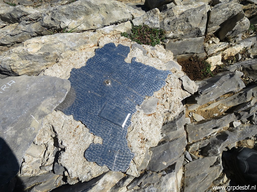 |
of Navarra (click photo to enlarge) |
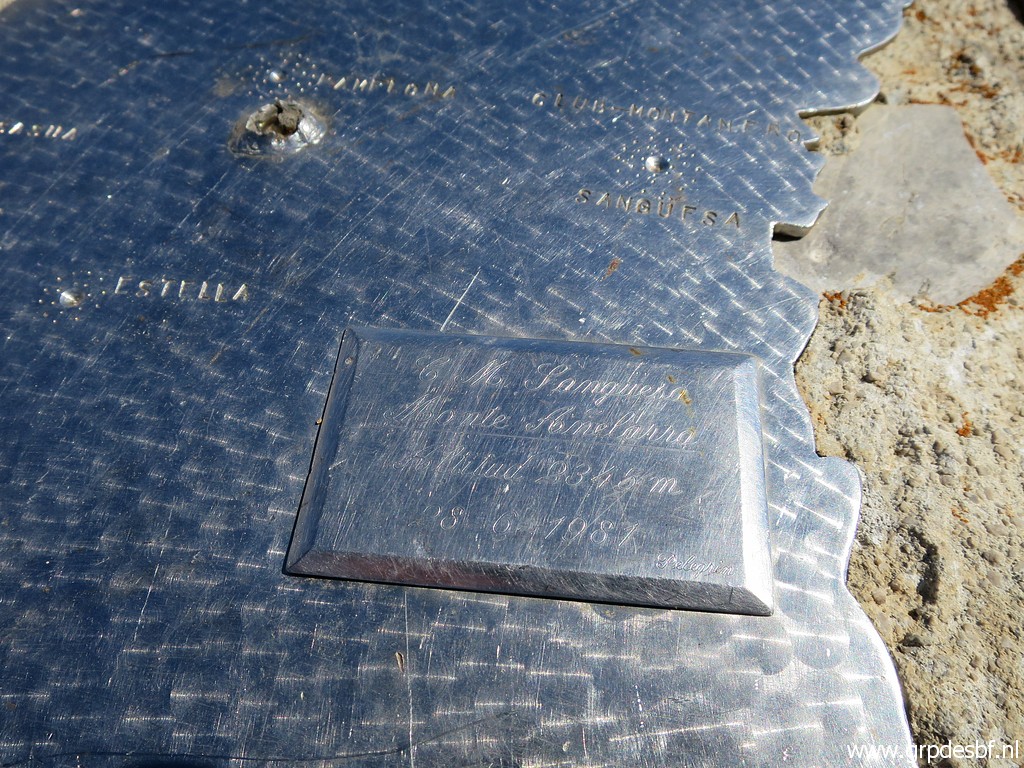 |
with this inscription: G.M. Sangüesa Monte Añelarra Altitud 2345 m 28-6-1981 Pelegrin On this page, we read more about this plaque. (click photo to enlarge) |
But
where is/was bm271bis located? On this page (2013) I made an
analysis of the probable spot of bm271 (more information on that page).
This is
one of the maps I made: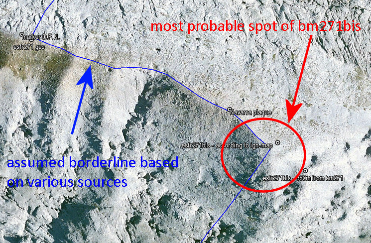 The Añelarra-ridge has two summits. Bm271 is at the western summit and nowadays we find a geodesic marker of Navarra, close to it (with D.F.N. on it = Diputación Foral de Navarra). The second summit is the Pic de Añelarra at ± 240m to the east. Here we find today the iron plaque with the contour of Navarra. The original treaty says that bm271bis is 360 meters from bm271 on the same ridge ("Autre croix à 360 mètres, comptés sur la crête de Sierralongue"). But we have to remember that the distances between the previous bordermarkers 262-271 – as mentioned in the treaty – are often unreliable if we re-measure them in Google Earth. 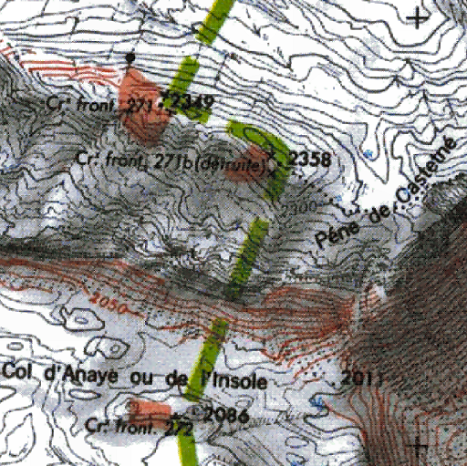 The location of bm271bis on the IGN-maps (though
"détruite") is however
± 310m from bm271 when following the ridge. The location of bm271bis on the IGN-maps (though
"détruite") is however
± 310m from bm271 when following the ridge. NB: we find 271bis only on older french IGN-maps. That position makes sense. The ridge has descended and bends slowly E in the direction of Pic d’Anie. At the same time a minor ridge branches off to the S, in the direction of Col d'Anaye. And that bifork of ridges is a logical spot for bm271bis. Why? Because it indicates where the borderline leaves the main Añelarra-ridge. |
|
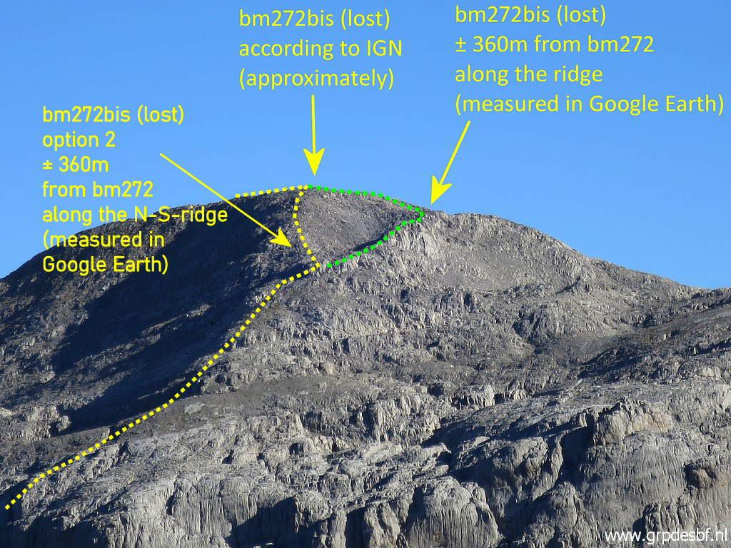 |
A view from the south (13 sept. 2020).
Note: "bm272bis" must be: "bm271bis". We see the 2 ridges. If we strictly stick to the 360m, then we have 2 possible spots depending on which ridge we choose. BUT: the current maps indicate the yellow borderline, not the green one. As said above, the bifork of ridges is a logical spot to indicate where the borderline bends off to the S. So I will stick to that IGN- position, assuming that that was the original spot of bm271bis. (click photo to enlarge) |
 |
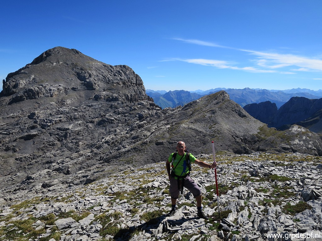
But the above reasoning
has been done afterwards. Today we we will search for bm271bis at two spots -> the IGN-spot and the one 360m from bm271. This is the first one (red-white pole): bm271bis - approximate spot - according to the IGN-map. (click photo to enlarge) |
 |
Bm271bis - approximate
spot - according to the IGN-map (click photo to enlarge) |
 |
Bm271bis - approximate
spot - according to the IGN-map Looking back, Carlos & Conchita in the background (click photo to enlarge) |
 |
Bm271bis - approximate
spot - according to the IGN-map With me (click photo to enlarge) |
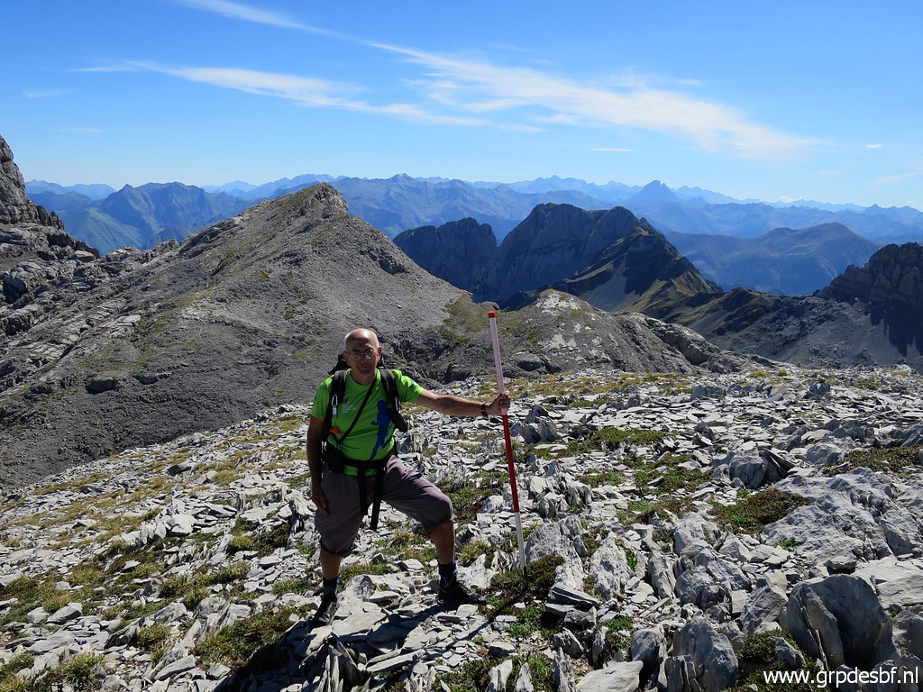 |
Bm271bis - approximate
spot - according to the IGN-map With me. I search around the pole in a circle of about 20m diameter but to no result. (click photo to enlarge) |
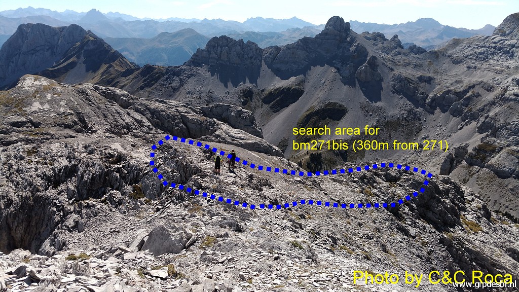 |
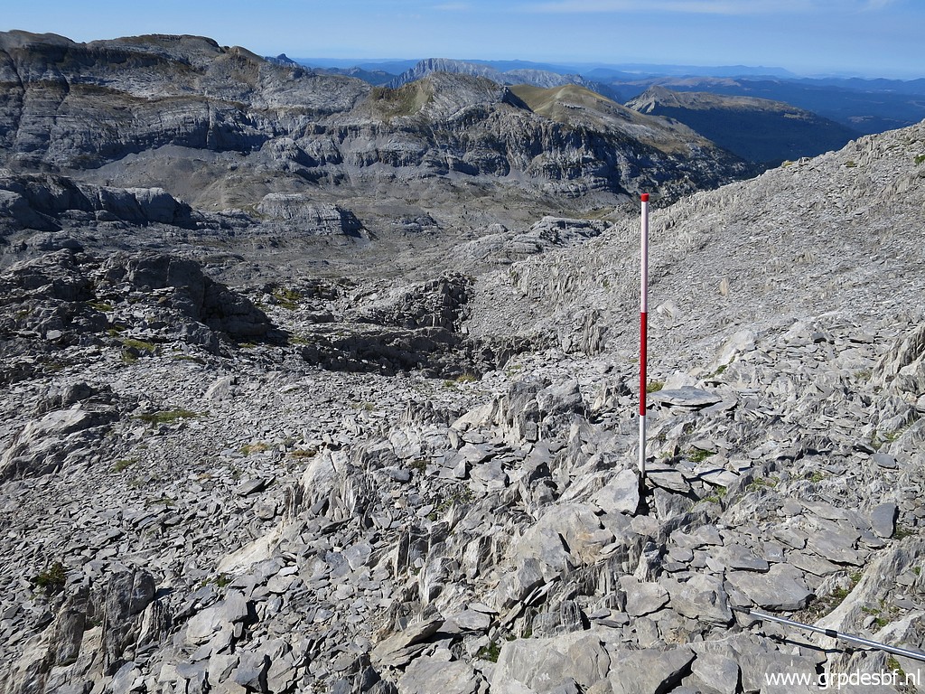
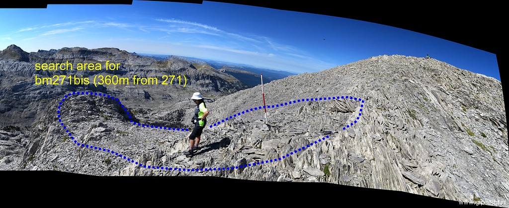
The second spot to explore
is "bm271bis - approximate spot - 360m along the ridge" and an area along the minor ridge going down. Where Conchita and me are standing is ± 360m from bm271. (click photo to enlarge) |
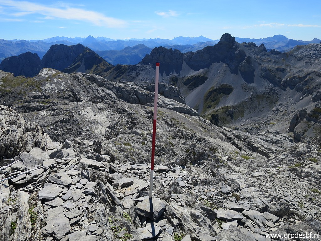 |
Bm271bis - approximate
spot - 360m along the ridge (click photo to enlarge) |
 |
Bm271bis - approximate
spot - 360m along the ridge We can see that from here a sort of ridge descends to a rocky outcrop. In the background a more distinct ridge which also descends. That is the ridge of the borderline on current maps. (click photo to enlarge) |
 |
Bm271bis - approximate
spot - 360m along the ridge Another panorama showing both ridges and the area we searched. (click photo to enlarge) |
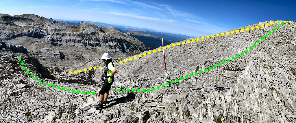 |
Bm271bis - approximate
spot - 360m along the ridge This is a zoom-in from previous picture with the green and yellow borderline as shown earlier. (click photo to enlarge) |
 |
Looking back to Carlos (click photo to enlarge) |
 |
We're done with the
searching - nothing found of course - and return along the ridge. (click photo to enlarge) |
 |
Looking back at the Pic
d'Anie. (click photo to enlarge) |
 |
A last visit to bm271. (click photo to enlarge) |
 |
Bm271 (click photo to enlarge) |
 |
Bm271 (click photo to enlarge) |
 |
Bm271 (click photo to enlarge) |
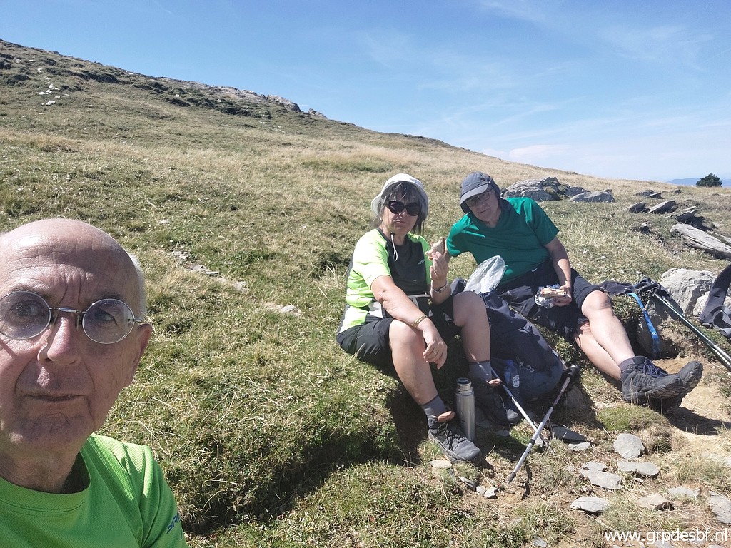 |
We are back at green
pastures and take a break. (click photo to enlarge) |
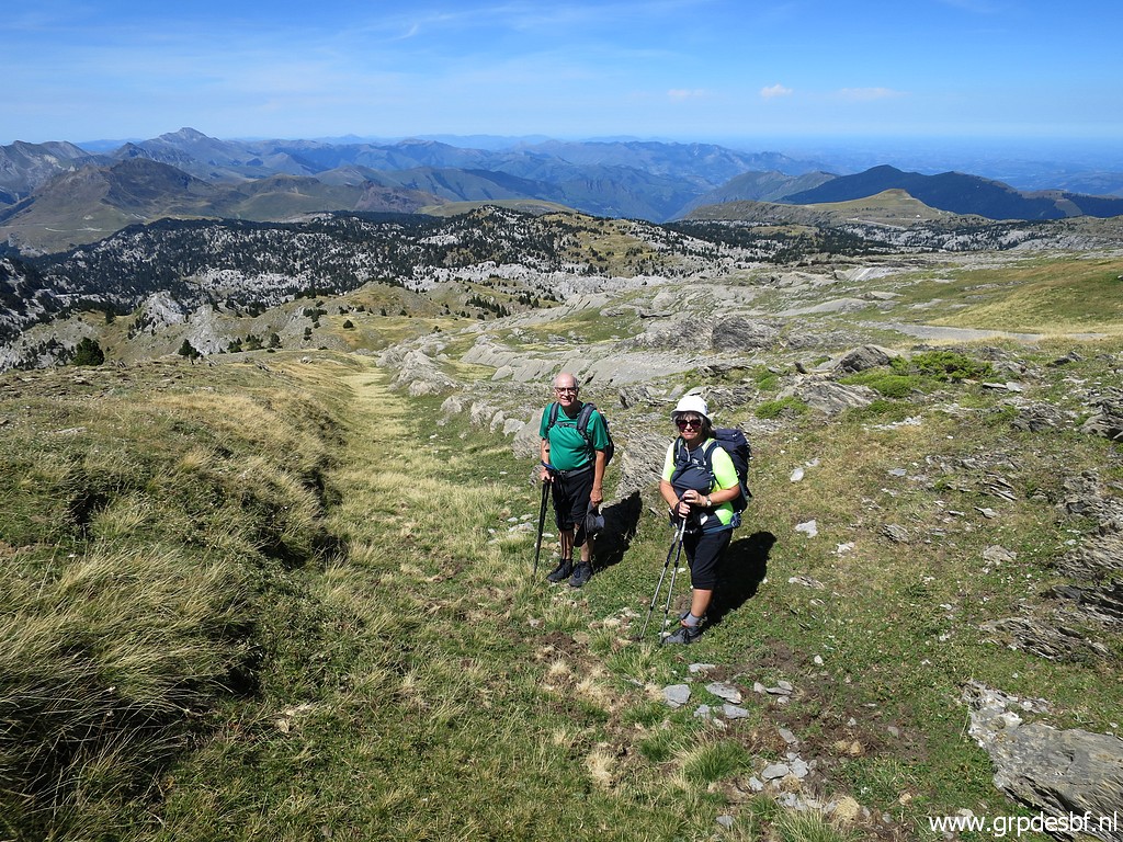 |
And so we return, first (click photo to enlarge) |
 |
over easy terrain, (click photo to enlarge) |
 |
while sometims looking back (click photo to enlarge) |
 |
and finally arriving at
the foothills of Pic d'Aras (click photo to enlarge) |
 |
where we meet sheep again. We are tired. (click photo to enlarge) |