|
The
bordermarkers of the Pyrenees : all my trips
 |
|
| -
monday 18 april
2022 - Redoing bm001 and bm197 |
 |
 |
Summary:
part of a series of 10 daytrips in april 2022 in the Basque country,
mainly redoing bm085 to 197. This is day 10. Today: revisiting bm001 and bm197 Weather: cloudy Basecamp: camping Irouleguy in Saint-Étienne-de-Baïgorry. |
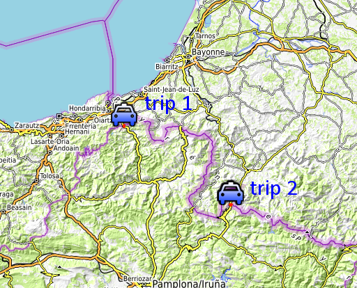
Trip 1 - bm001 |
|
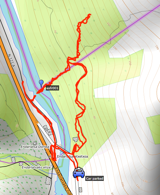 |
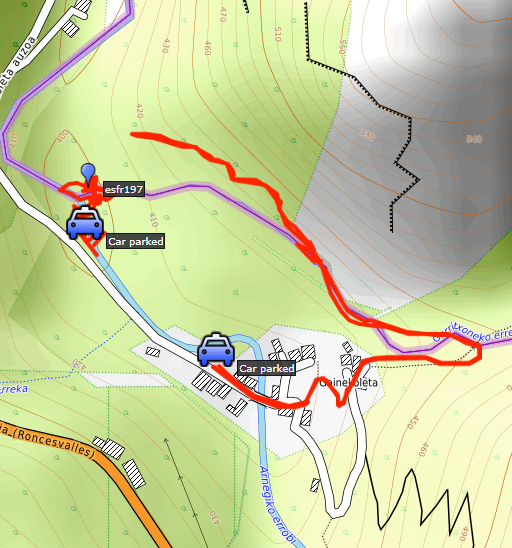
The target was to climb directly from bm001 to 002. As you can see on this map, I didn't succeed in that plan. That was more a question of lack of energy (after the tiring days before) than the climb being too difficult. |
|
track-20220418.kml
(click to open this trip in Google Earth or copy link to Google Maps; click right on this link to download gpx-version). The gps-track has not been manually corrected which explains the inaccuracy and misalignment at some points. For cartographic backgrounds: see the cartography-page Gps-waypoints of all bordermarkers (most recent version): kml: esfr-bordermarkers-all-waypoints.kml gpx: esfr-bordermarkers-all-waypoints.gpx (with elevation added by gpsvisualizer.com) |
|
 |
According to Garmin
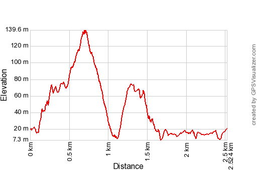
Basecamp (uncorrected track with elevation added by Gpsvisualizer.com): Distance: 2,5km Max-height: 140m Min-height: 7m Elevation: +346m -346m Total elevation: 692m Start 11:59 Finish 13:46 Total time: 1:47 |
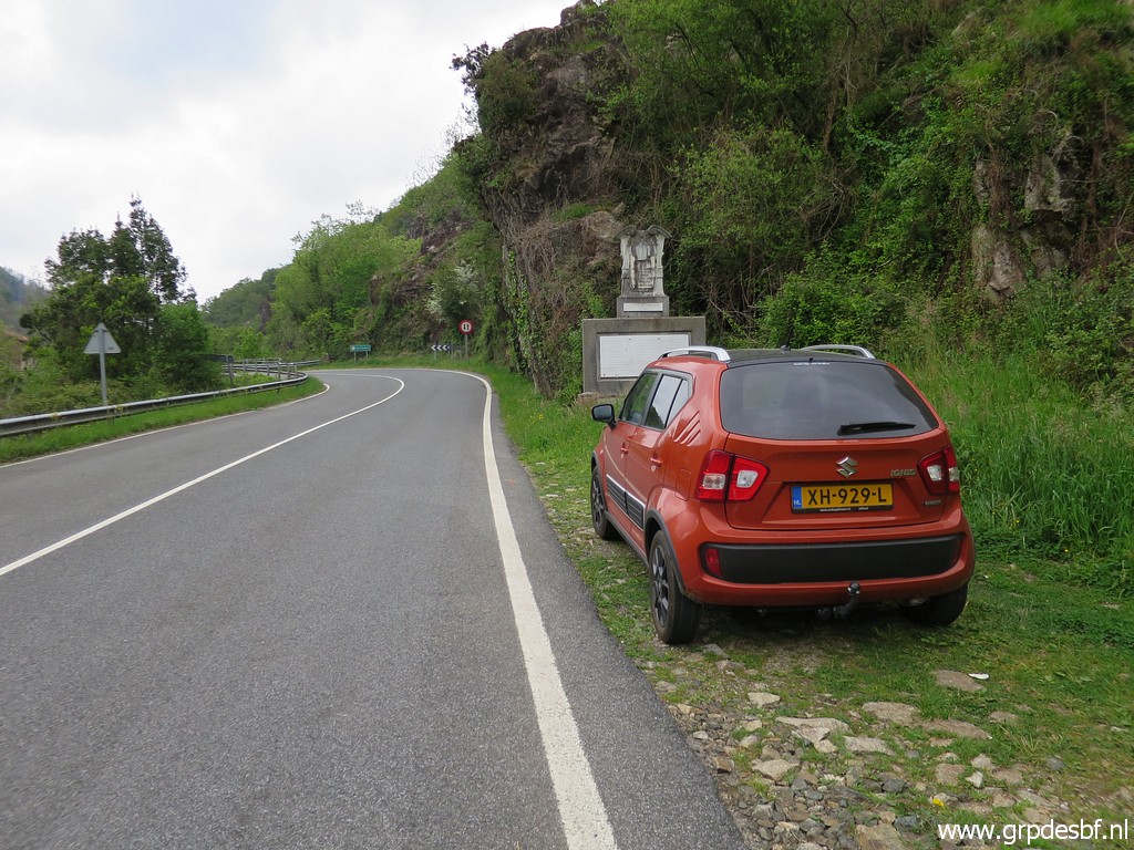 | Parking close to the beginning (click photo to enlarge) |
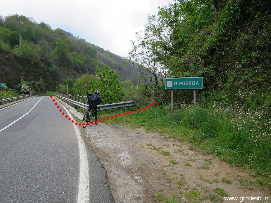 | of the trail. I show in red the course of my main GRPdesBF-route. That is to say the first stage from the coast to Col d'Ibardin (bm013). And well a partly new route. (click photo to enlarge) |
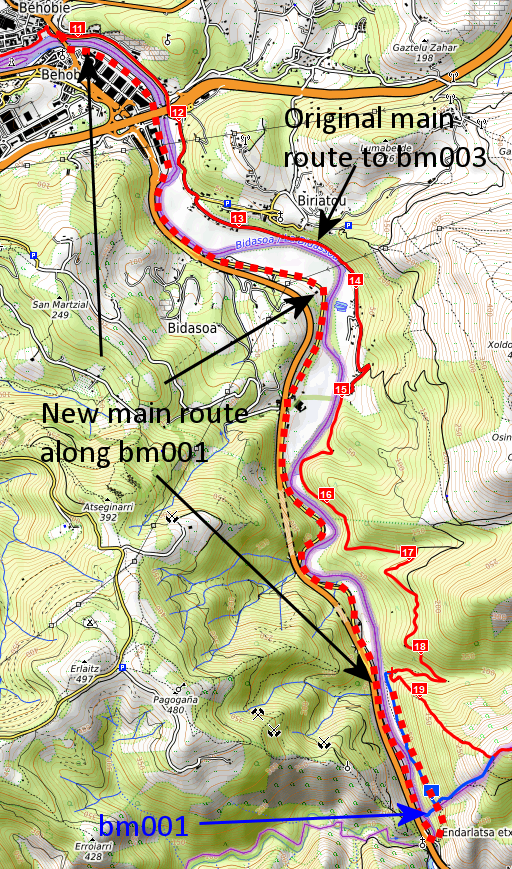 |
And let's show that on a map. The original main route followed from Hendaye a scenic route and climbed to bm003. Disadvantage: it skips the very first esfr-bordermarker which must be done on a variant if you wish to. The new main route shifts in Hendaye to the west-side of the river Bidasoa and follows a cycle track along the river for 7,5 km. Perhaps less scenic but the big advantage is that it gives a clear view of bm001 just before the bridge (but at the other side of the river). My main GRPdesBF-route aims at connecting most of the esfr-bordermarkers in a smooth and elegant way from no. 1 up to no. 602. So no. 1 shouldn't be missed. That's why I changed the route. Note: for a close look at bm001, you need to descend to it from the (new) main trail at the east-side of the river. |
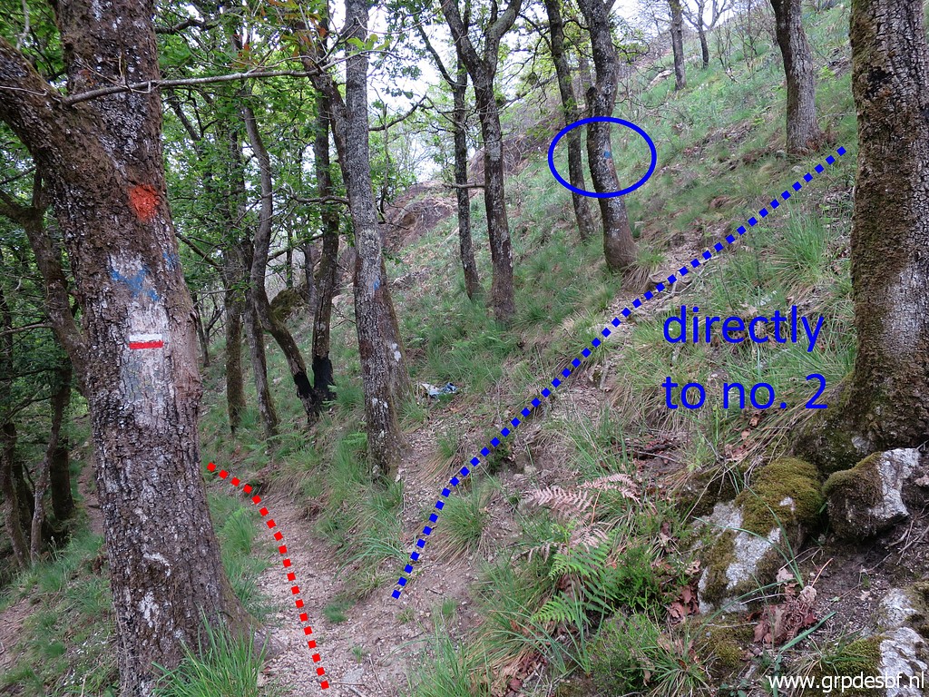
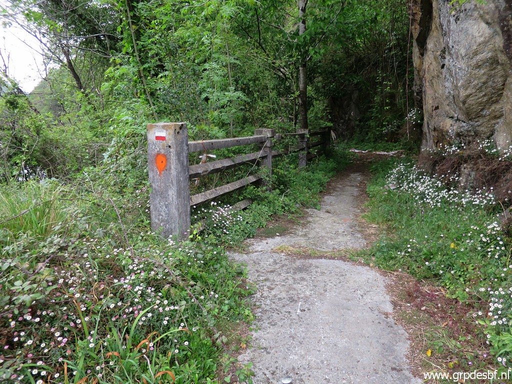 | Entrance, the trail is red-white waymarked and (click photo to enlarge) |
 | soon climbs to a higher level (click photo to enlarge) |
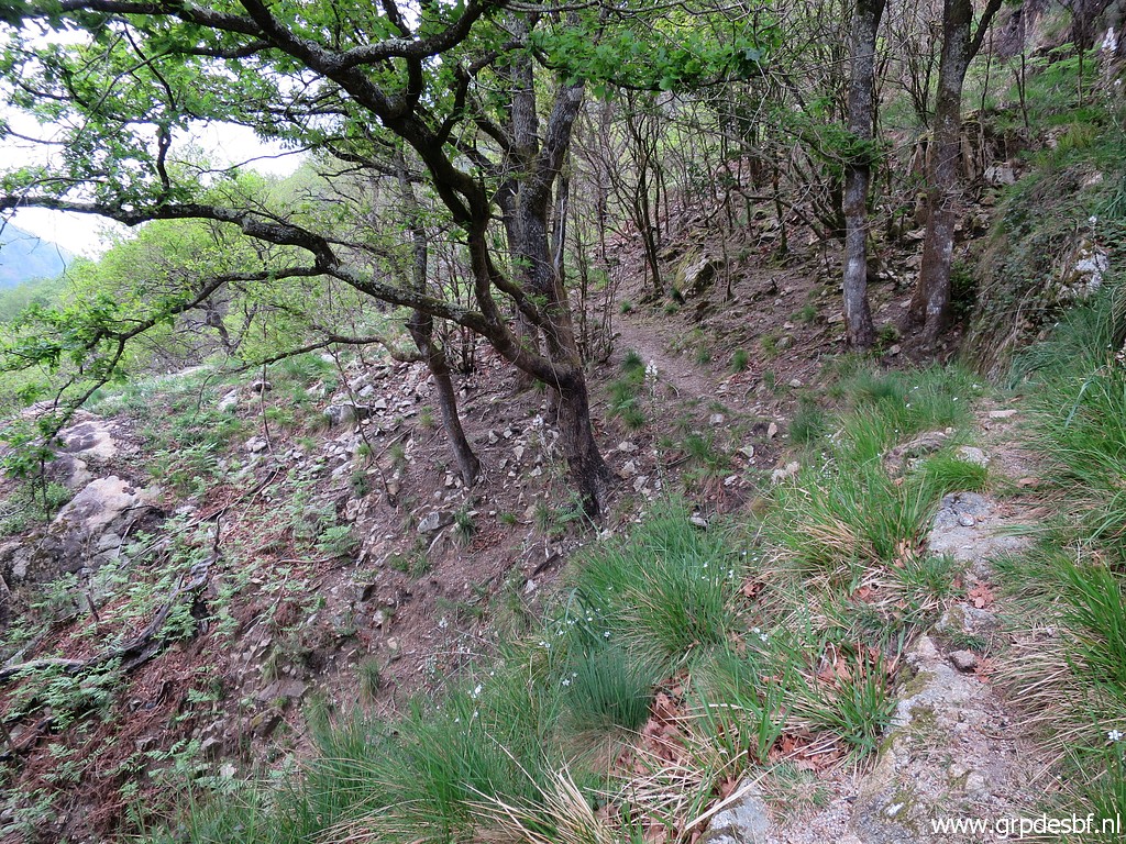 | and traverses (click photo to enlarge) |
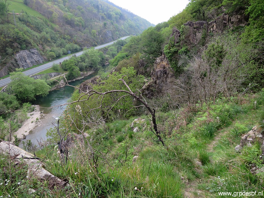
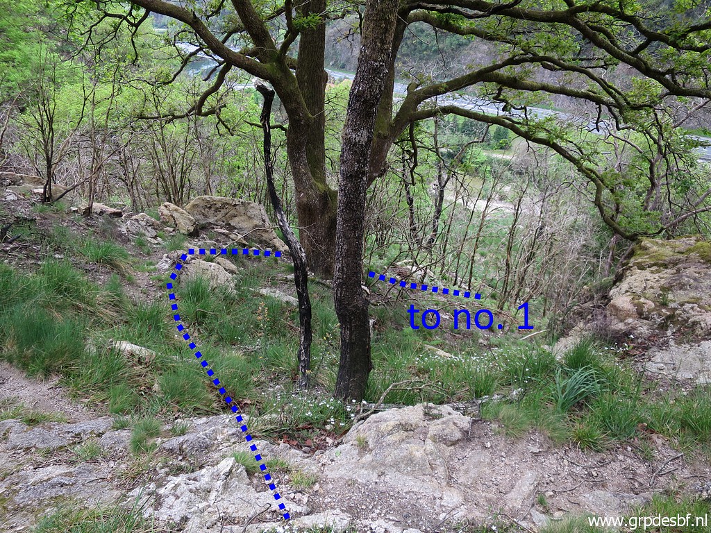
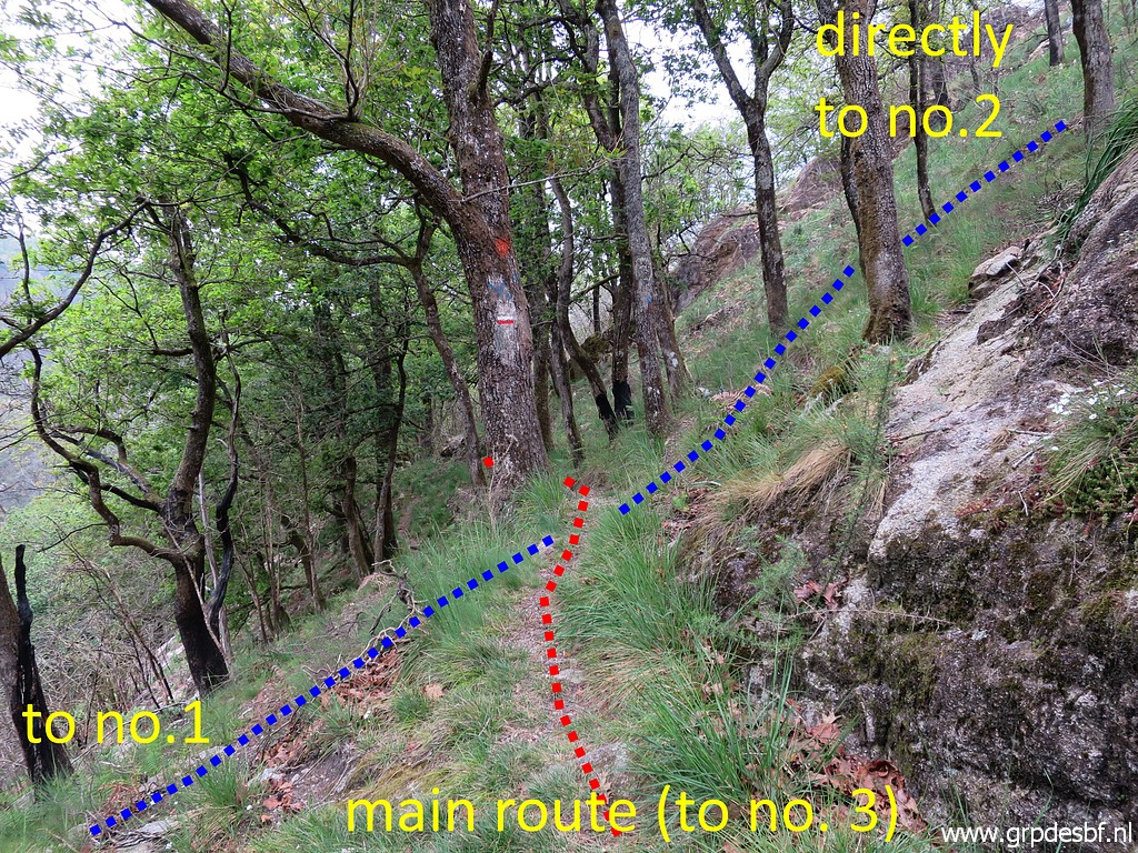 | to this spot. The main route continues on the red-white waymarked trail. For visiting bm001, you need to descend on a short variant and return. Bm002 can be reached directly by climbing the steep hillside. But also - if you follow the main route - from bm003 with a short descent to it. (click photo to enlarge) |
 | The route downhill towards bm001. (click photo to enlarge) |
 | Uphill, we see a blue waymark. (click photo to enlarge) |
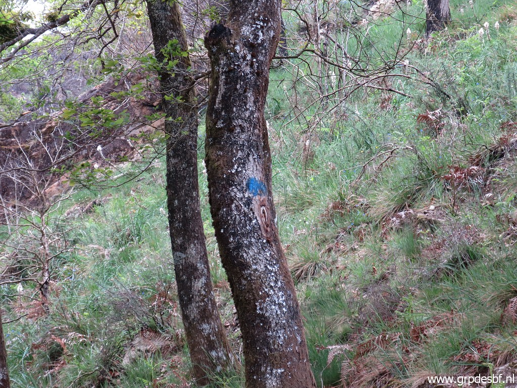 | Apparently waymarking the track of the direct climb to bm002. (click photo to enlarge) |
 | I start climbing the hillside but soon loose the blue waymarks. The hillside is steep but the climb manageable. But could be harder in summer's vegetation. (click photo to enlarge) |
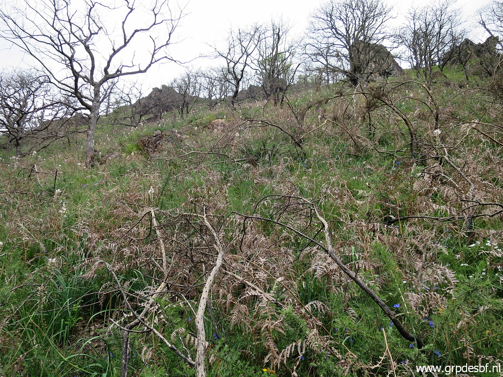
 | However: I get off the 'straight' line to bm002 and give up at this point. I should have looked better at my gps/smartphone to follow the track I saw on Openstreetmaps. But I know enough, the hillside is still manageable and I climbed it already at 2-4-2009. (click photo to enlarge) |
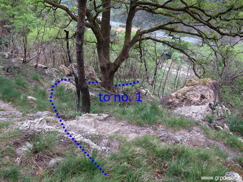
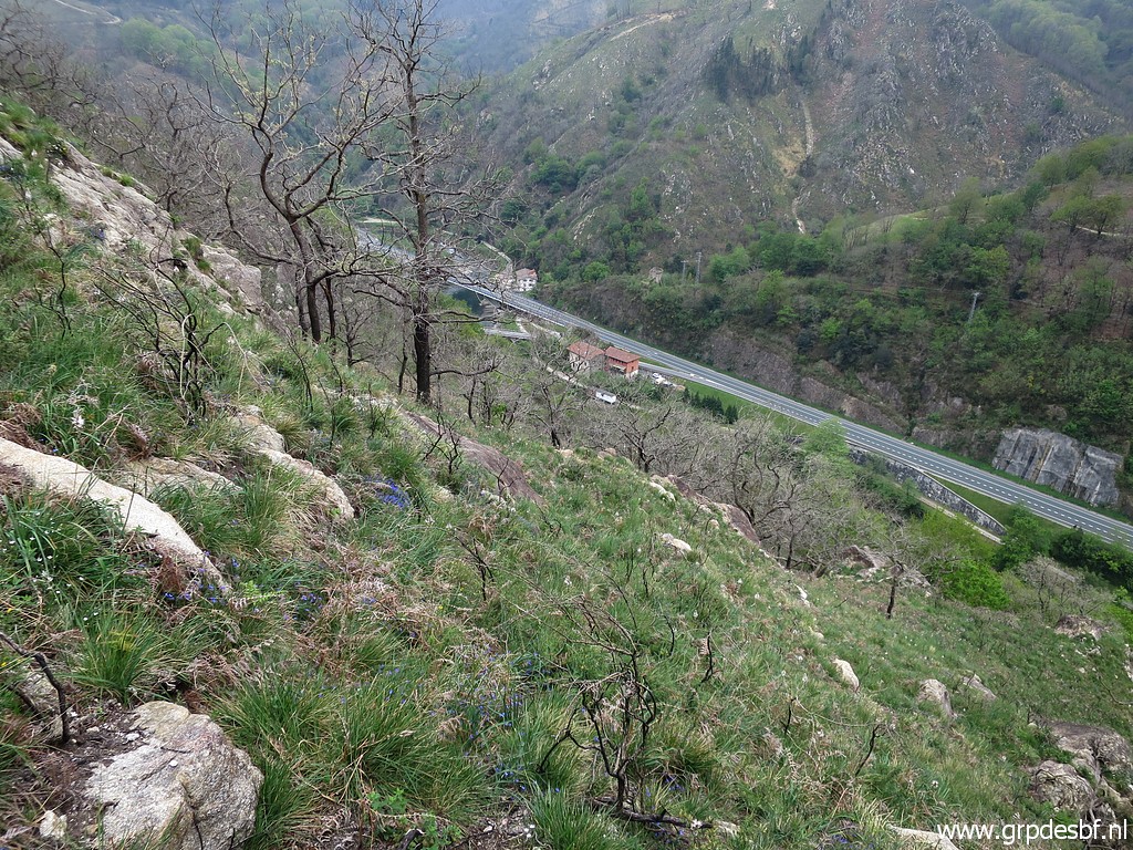
 | I return and now descend to bm001. (click photo to enlarge) |
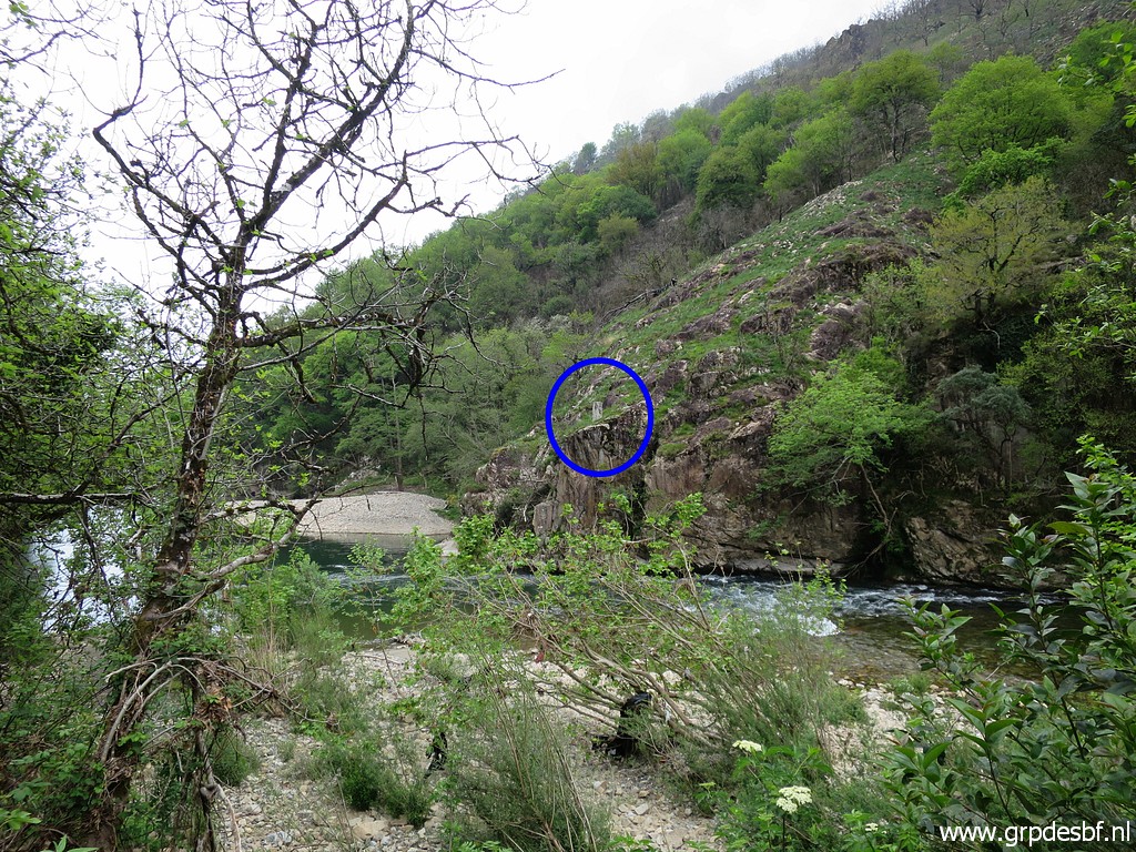
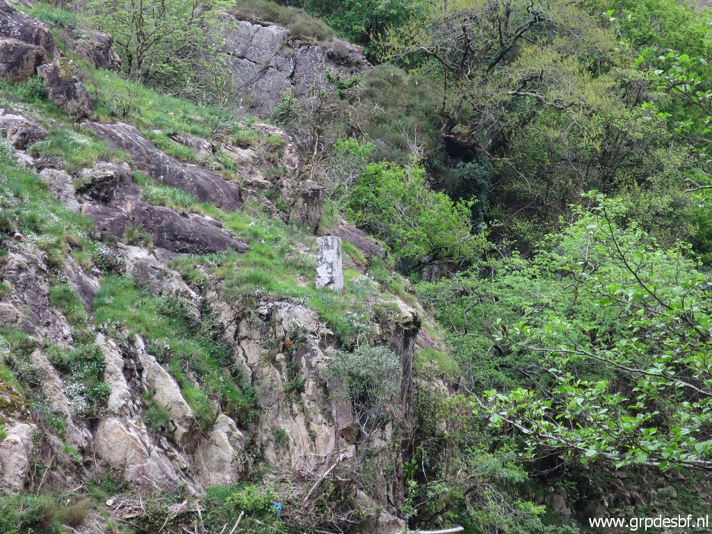
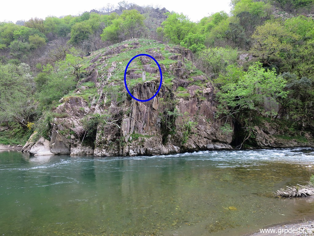
 | Bm001 in the distance (click photo to enlarge) |
 | and now reached. (click photo to enlarge) |
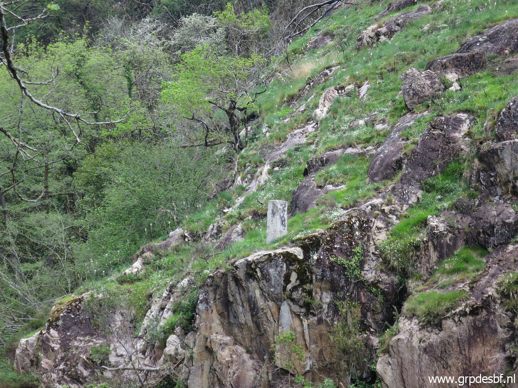
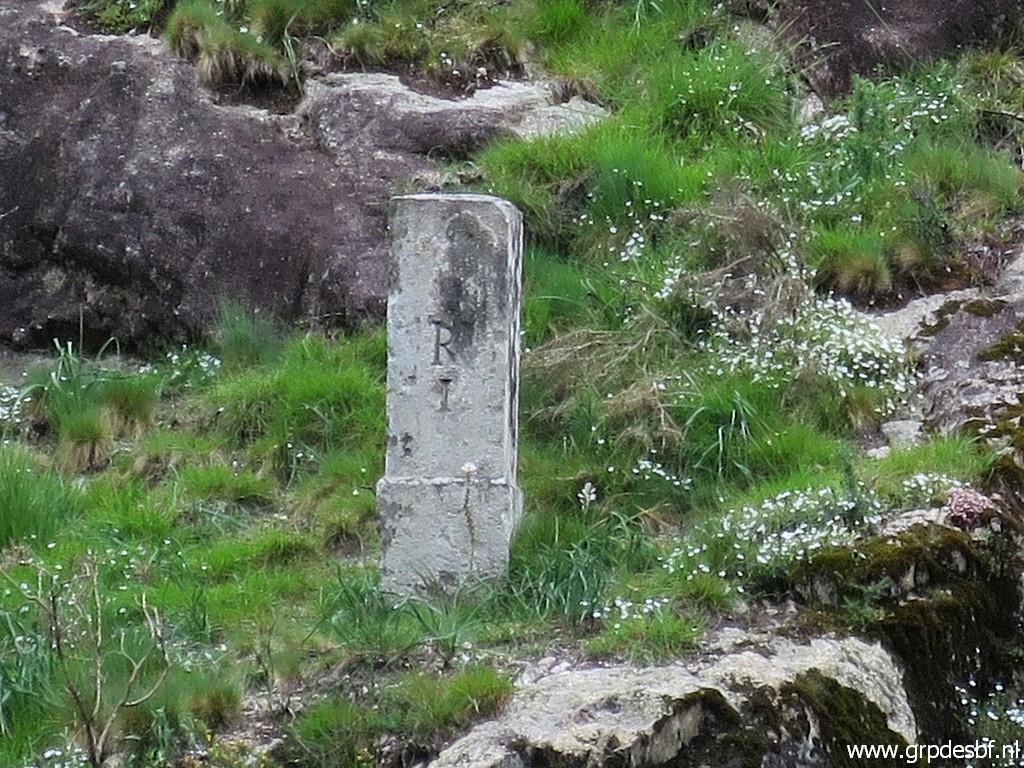
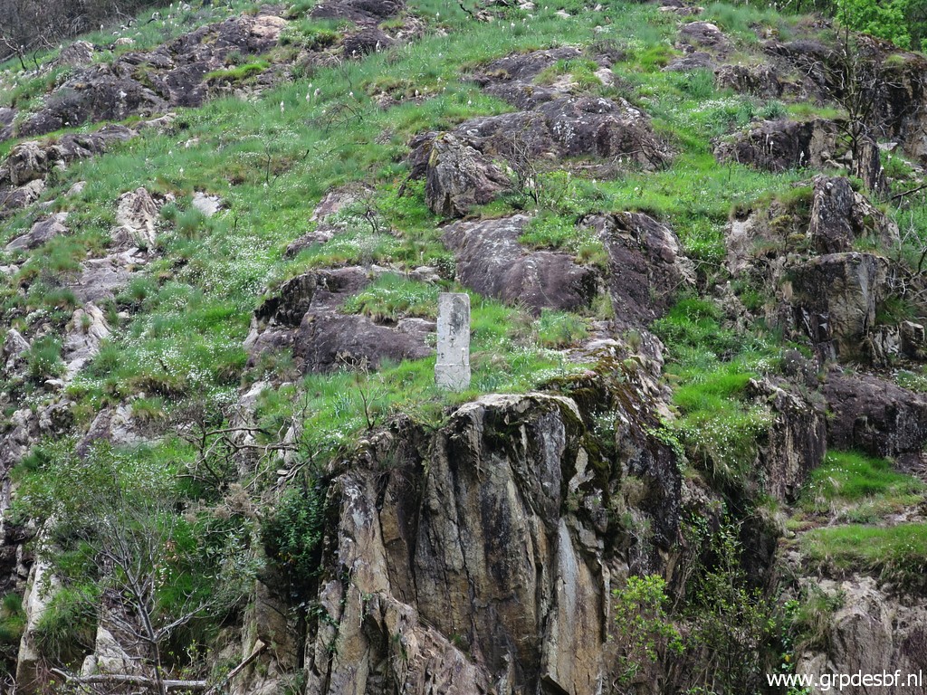
 | Bm001 (click photo to enlarge) |
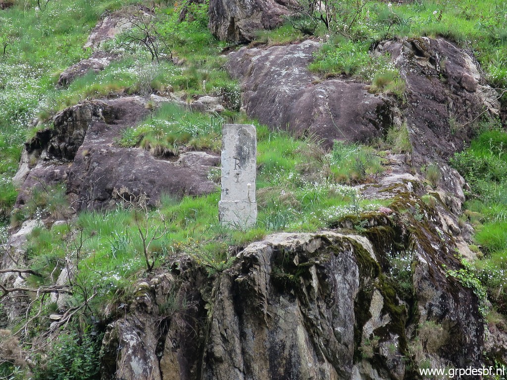
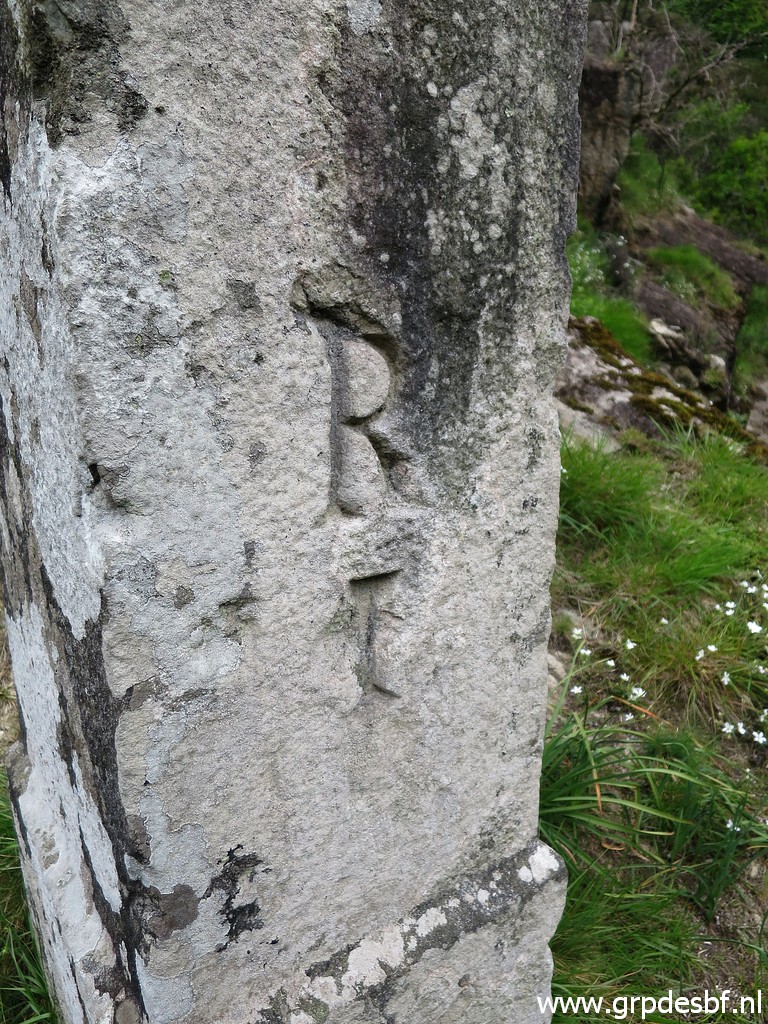 | Bm001, the number. It's not easy to photograph this side because the pillar (click photo to enlarge) |
 | is so close to the abyss, be careful. (click photo to enlarge) |
 | I return to the bridge. (click photo to enlarge) |
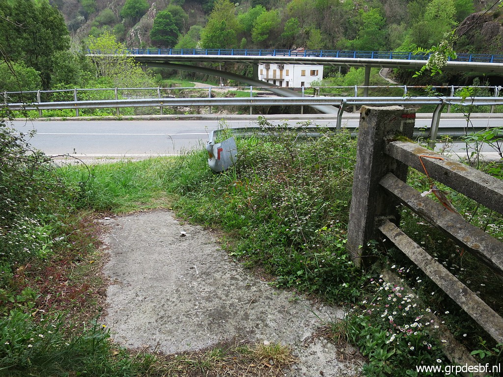
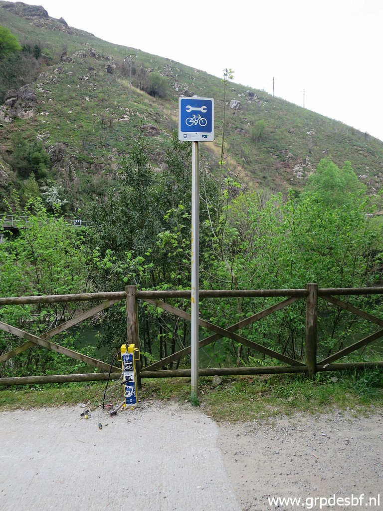 | There is a cycle trail along the west-side of the Bidasoa-river and here (click photo to enlarge) |
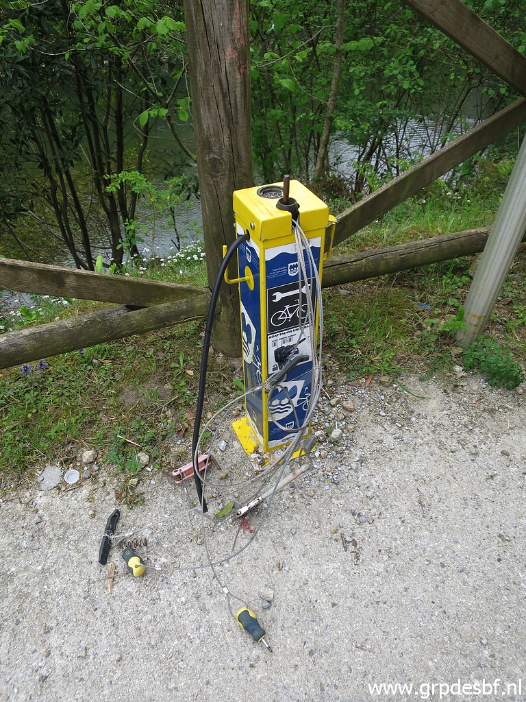 | we see a bunch of bicycle-tools. (click photo to enlarge) |
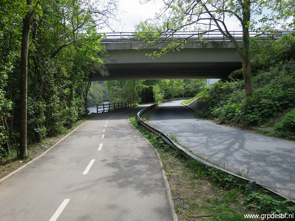
 | Showing how you leave the cycle trail and cross the bridge to the east-side of the river. (click photo to enlarge) |
 | This is that cycle trail, built on an old railway. (click photo to enlarge) |
 | I continue N along the cycle trail to make some pictures of bm001 from this side of the river. (click photo to enlarge) |
 | Bm001, zoom-in (click photo to enlarge) |
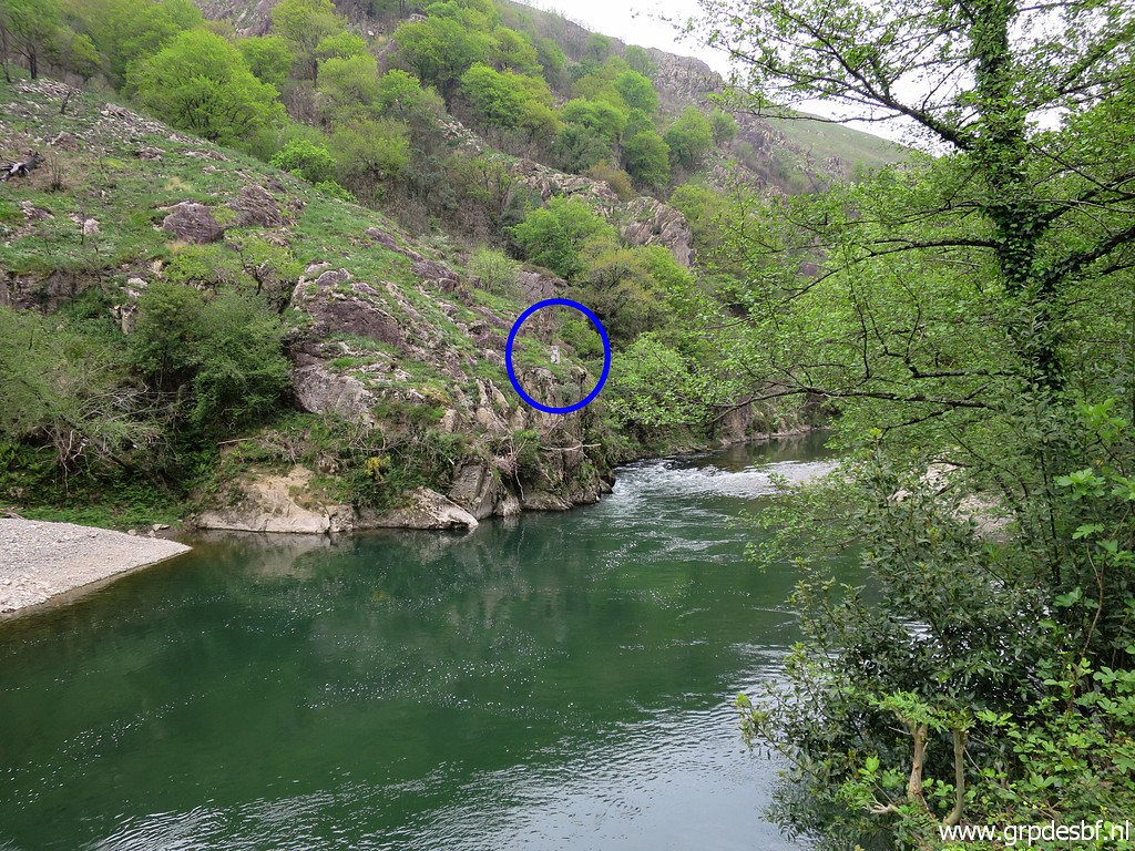 | Bm001 (click photo to enlarge) |
 | Bm001, zoom-in (click photo to enlarge) |
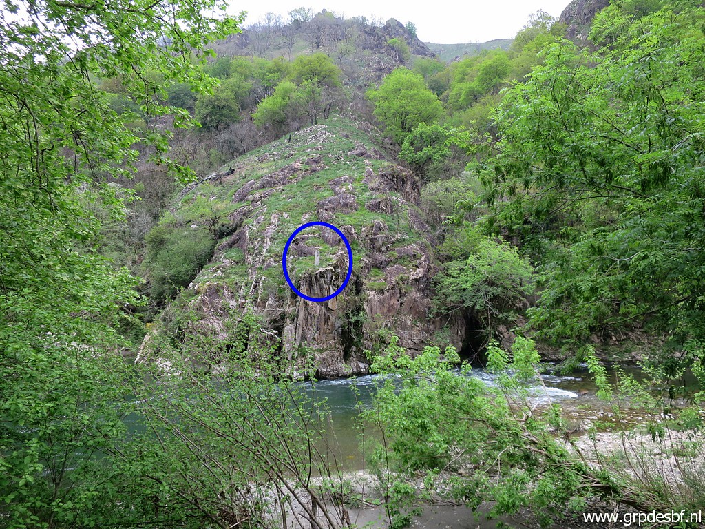 | Bm001 (click photo to enlarge) |
 | Bm001, zoom-in (click photo to enlarge) |
 | Bm001, zoom-in (click photo to enlarge) |
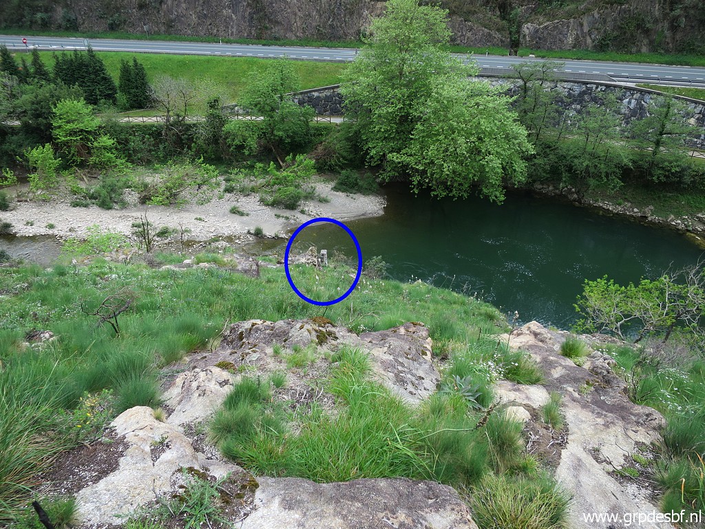
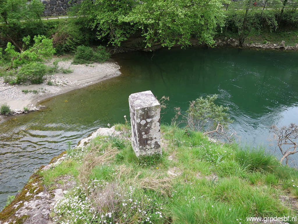
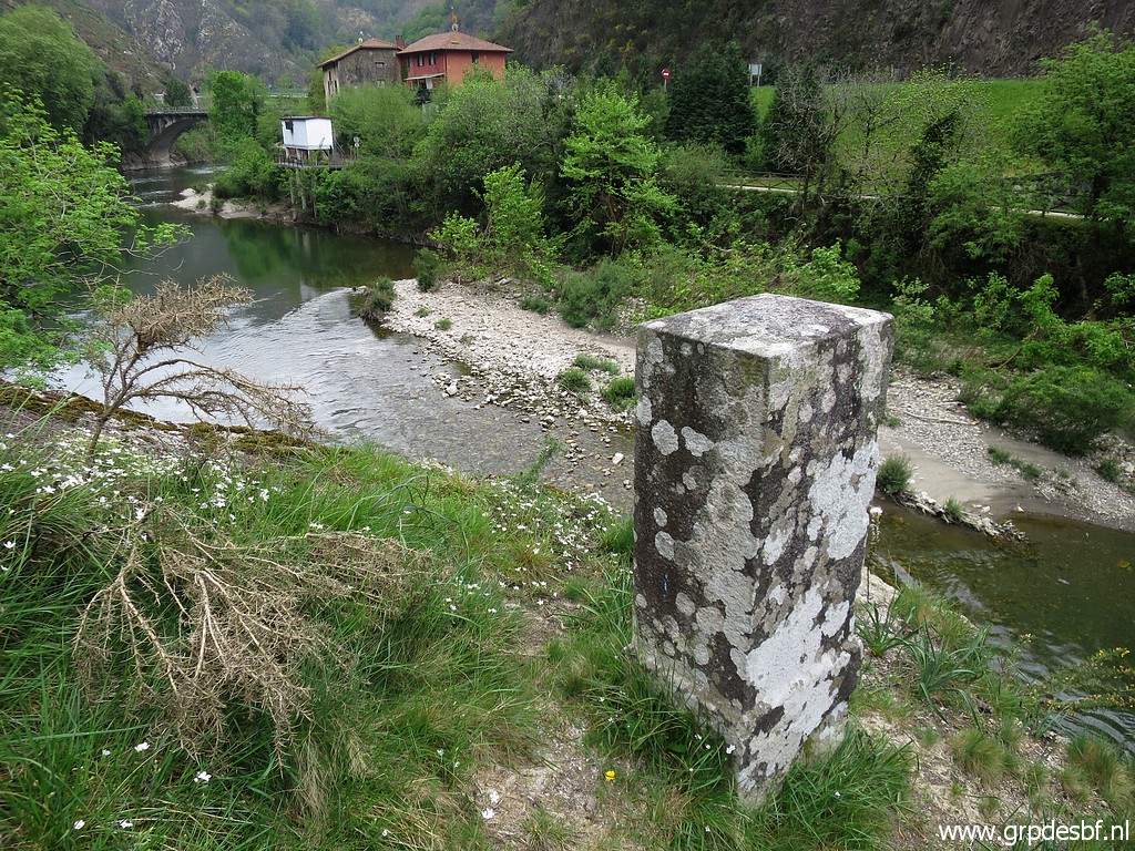
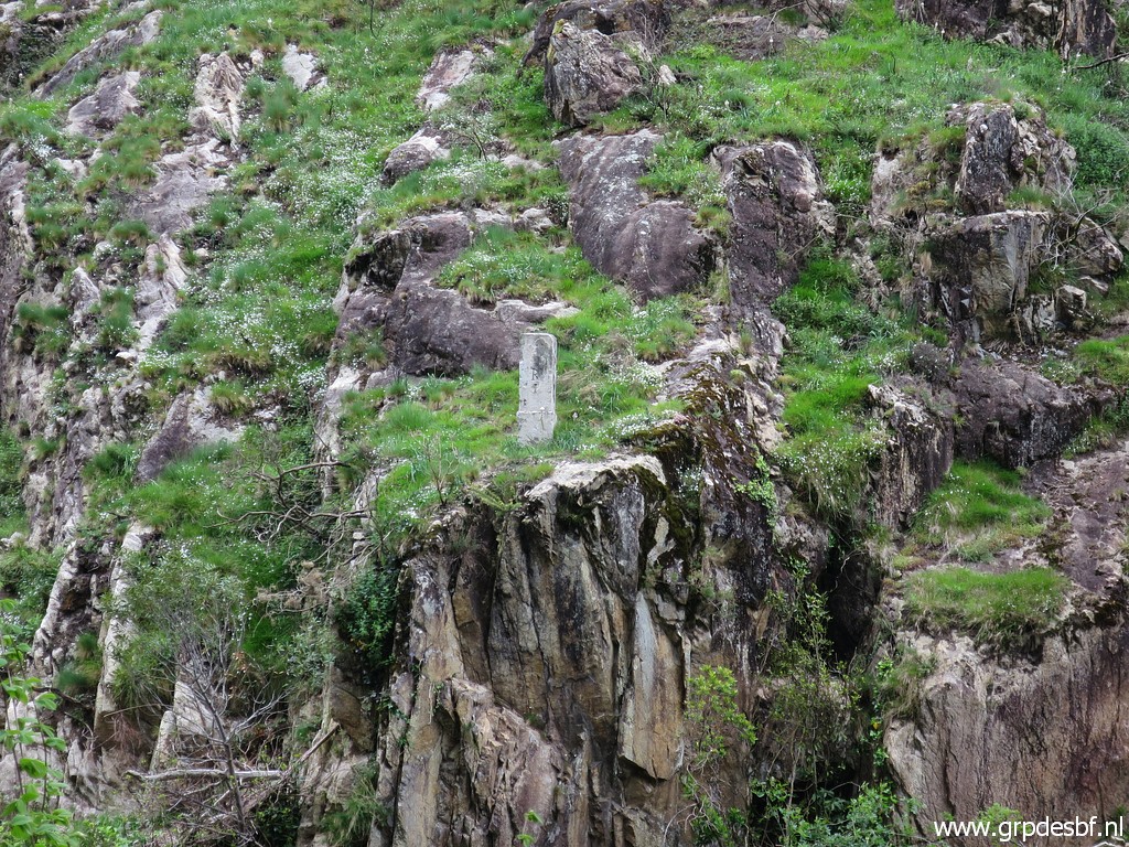
 | A closer look is possible by descending to the riverbank. (click photo to enlarge) |
 | Bm001 (click photo to enlarge) |
 | Bm001, zoom-in (click photo to enlarge) |
 | Bm001, zoom-in (click photo to enlarge) |
 | Bm001, zoom-in (click photo to enlarge) |
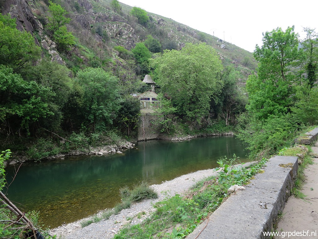 | Then finally a look at this small electricity facility (click photo to enlarge) |
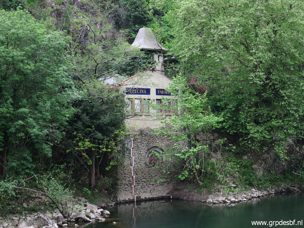 | which is no longer in use. (click photo to enlarge) |
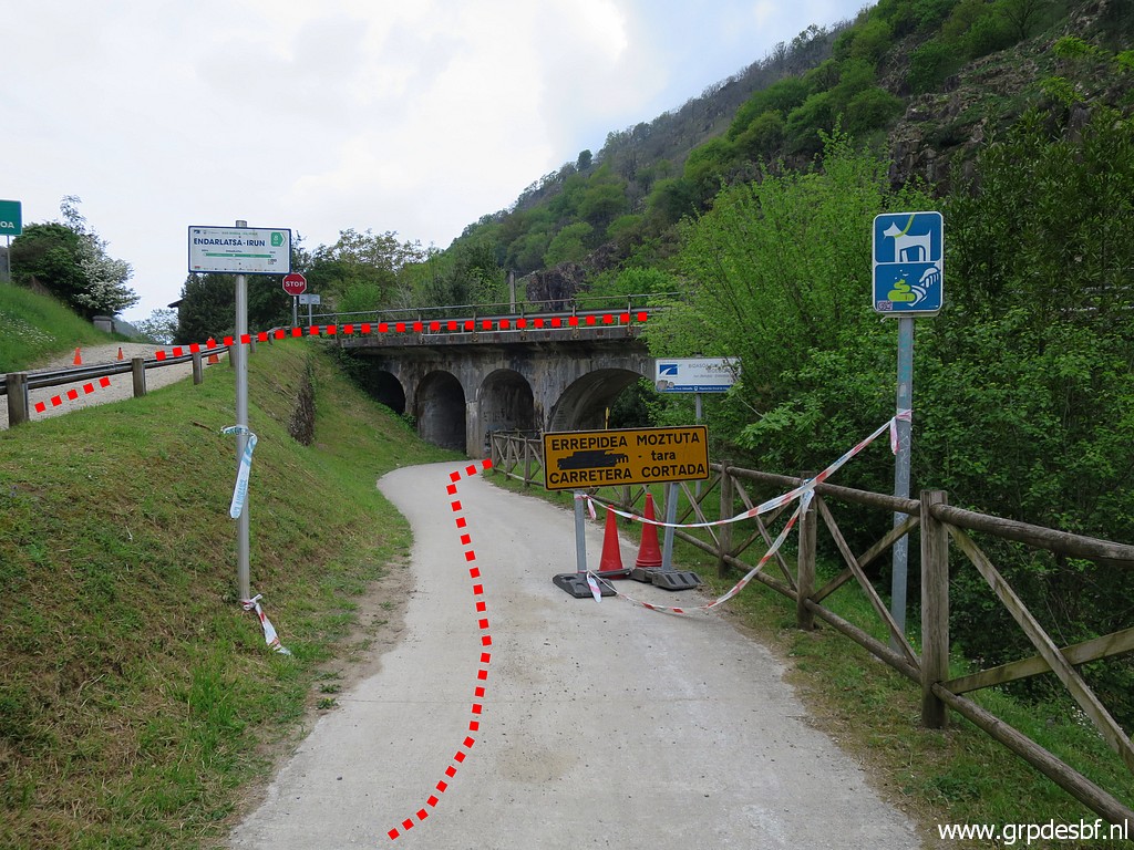
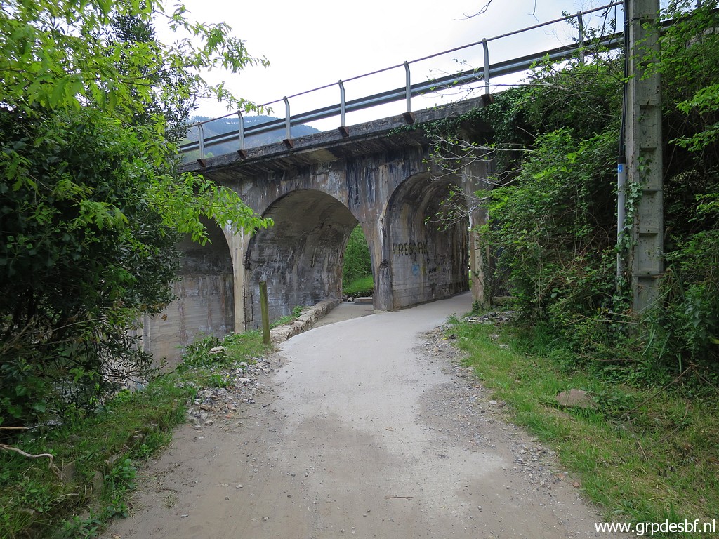 | Back to the car. Here the cycle trail passes underneath the bridge (click photo to enlarge) |
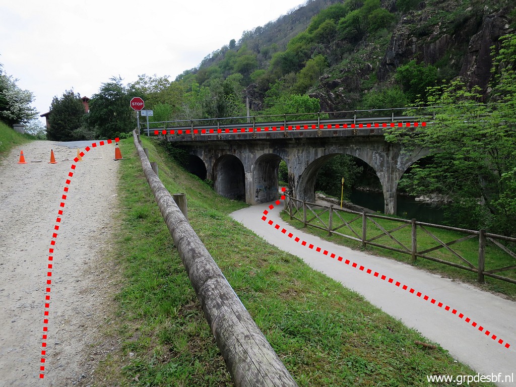 | and then you have to make this curve to cross the bridge (click photo to enlarge) |
 | and after the bridge continue on the red-white waymarked trail. (click photo to enlarge) |
 | Then I drive to Hendaye, just to see how the cycle trail leaves the outskirts of the town. (click photo to enlarge) |
Trip 2 - bm197 |
|
 |
Then a long drive to the hamlet of Gainekoleta. I just want to redo bm197, last done in 2010. This year I want to finish my survey of all esfr-bordermarkers with having done all markers at least twice and no longer ago than 10 years. |
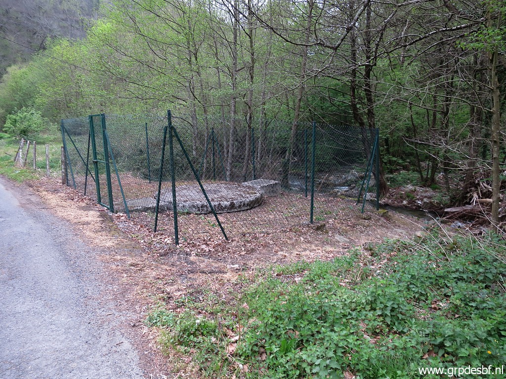 | This concrete construction is the starting point (click photo to enlarge) |
 | for crossing the river. (click photo to enlarge) |
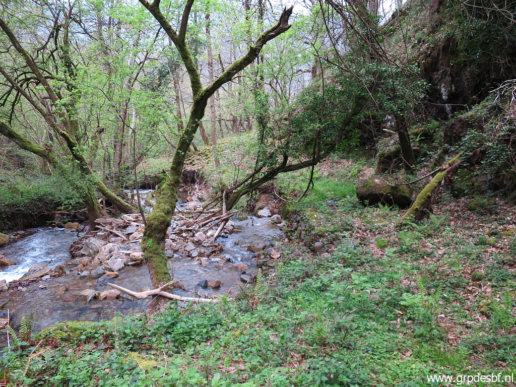
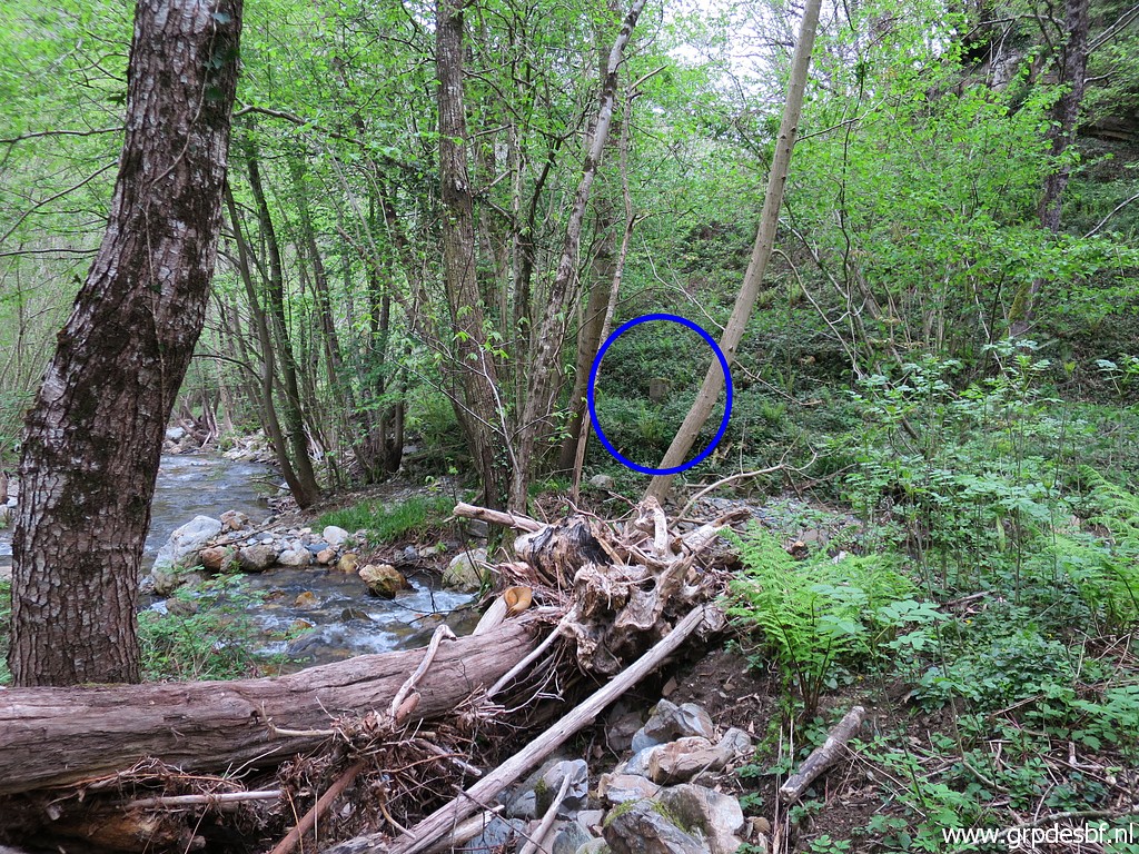 | But once crossed the stream, I cannot find immediately bm197. It is more to the north (click photo to enlarge) |
 | at the other side of a side-stream. (click photo to enlarge) |
 | So I have to cross a second stream to get to bm197. (click photo to enlarge) |
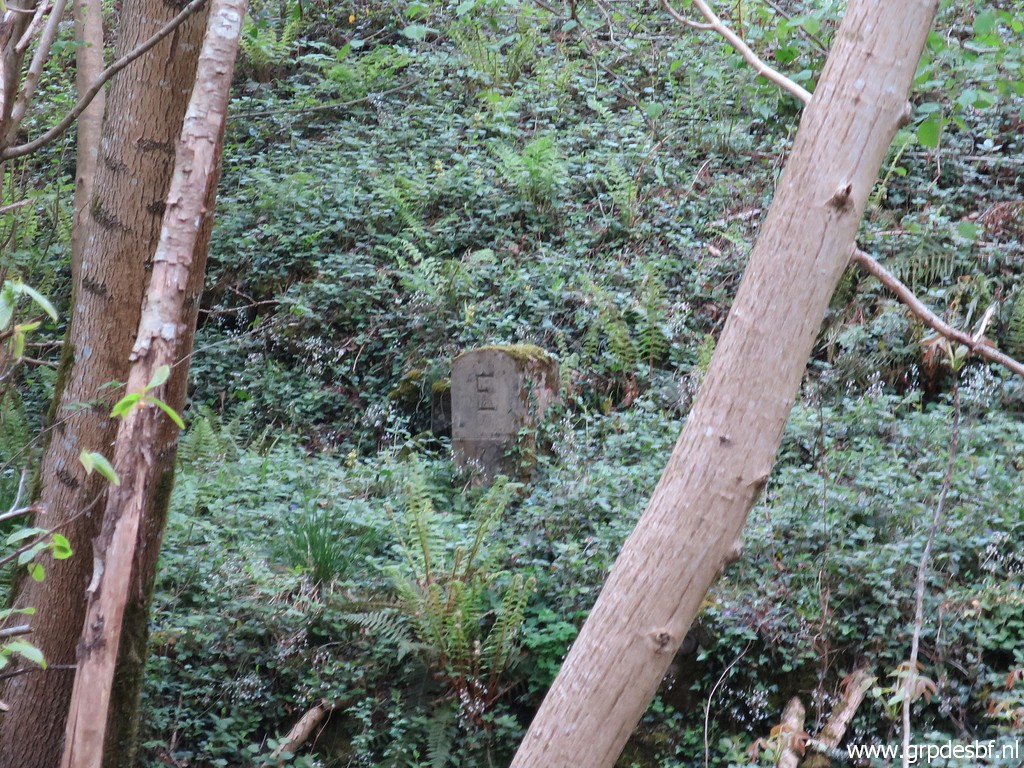
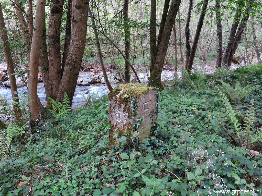
 | Bm197 (click photo to enlarge) |
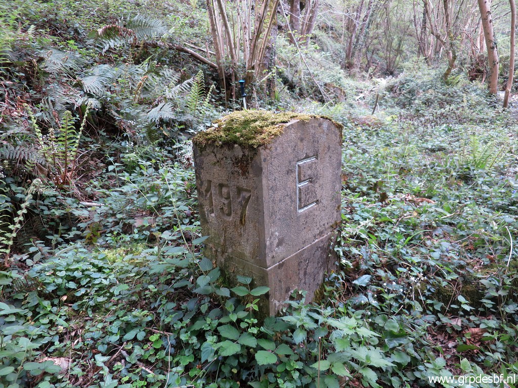 | Bm197 (click photo to enlarge) |
 | Bm197 with (click photo to enlarge) |
 | on the same picture the borderline indicated. (click photo to enlarge) |
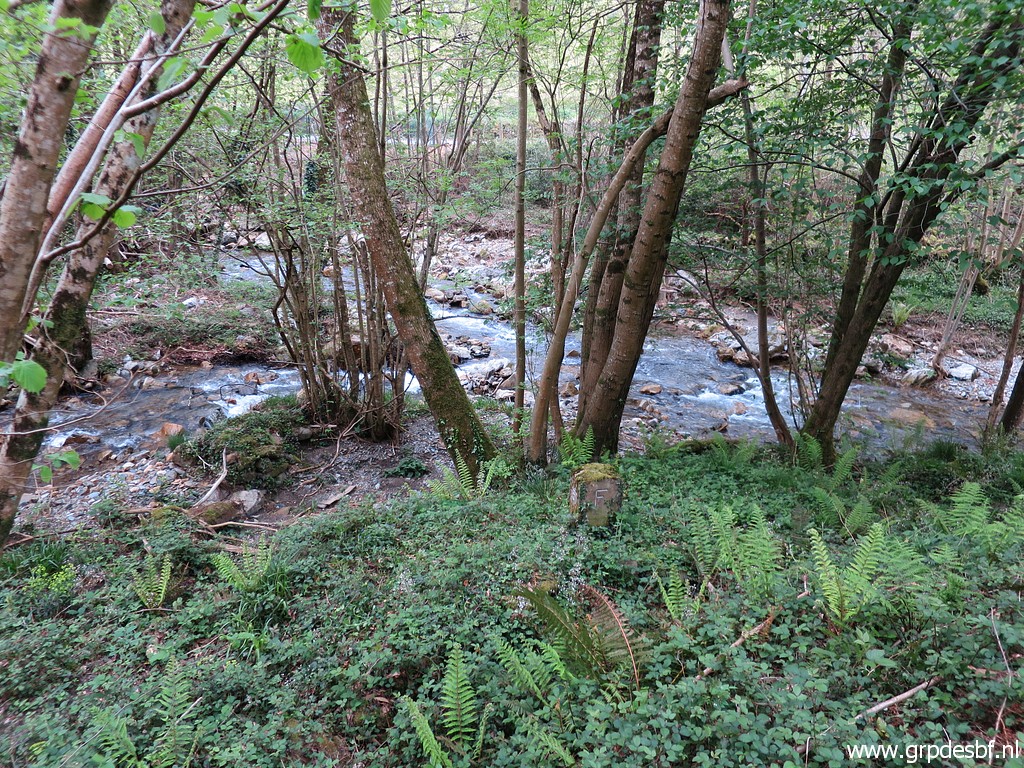
 | This
is the side-stream (looking upstream) which descends from bm198 to the
Luzaide ibaia-river. From bm198 via bm197 up to 196, both streams are
the border. I do a short investigation if there is a trail along the stream upstream but there is none. Later I will try it from the other side. (click photo to enlarge) |
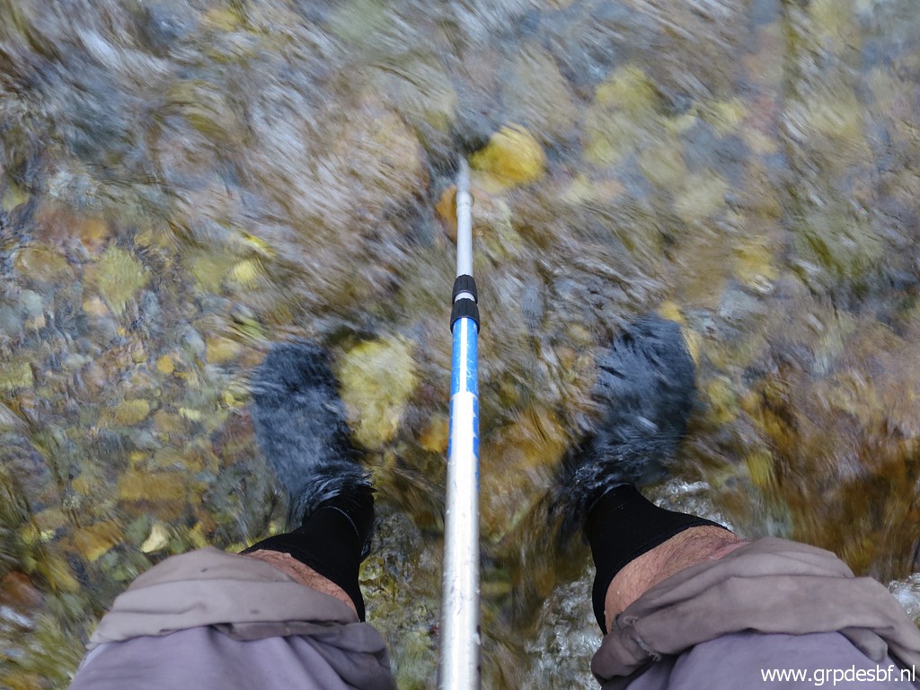 | Crossing back the river. As you can see, I don't care about wet shoes. They dry quickly. (click photo to enlarge) |
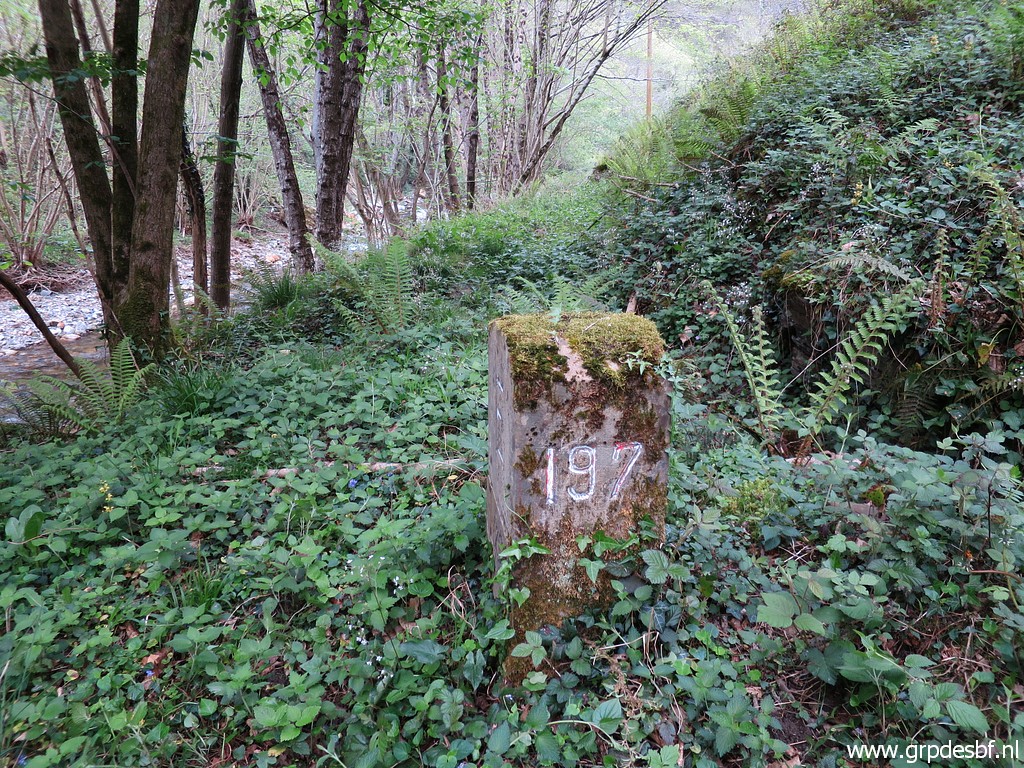
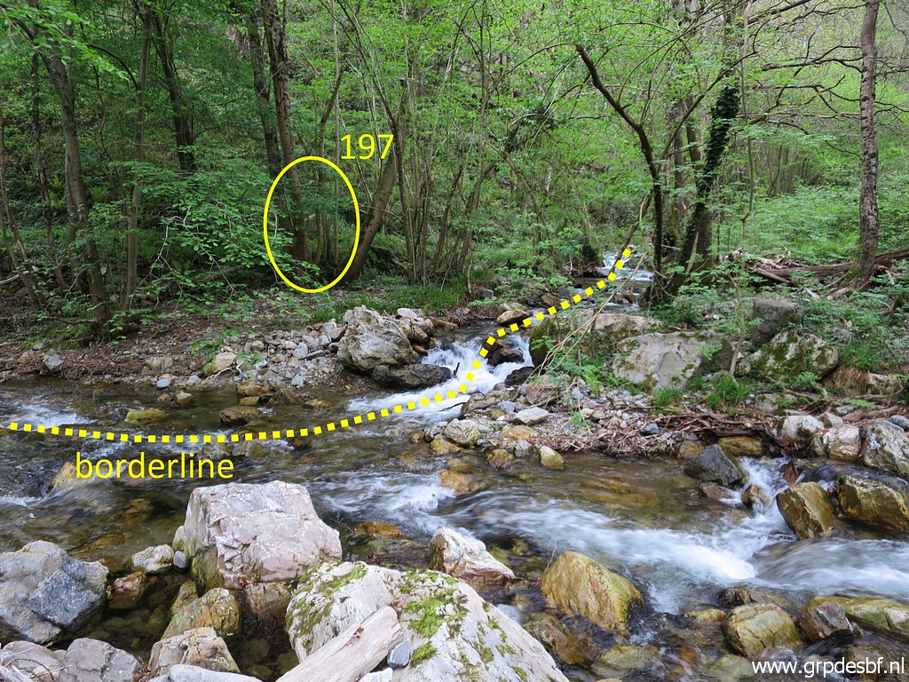 | Another view of bm197 and the borderline. (click photo to enlarge) |
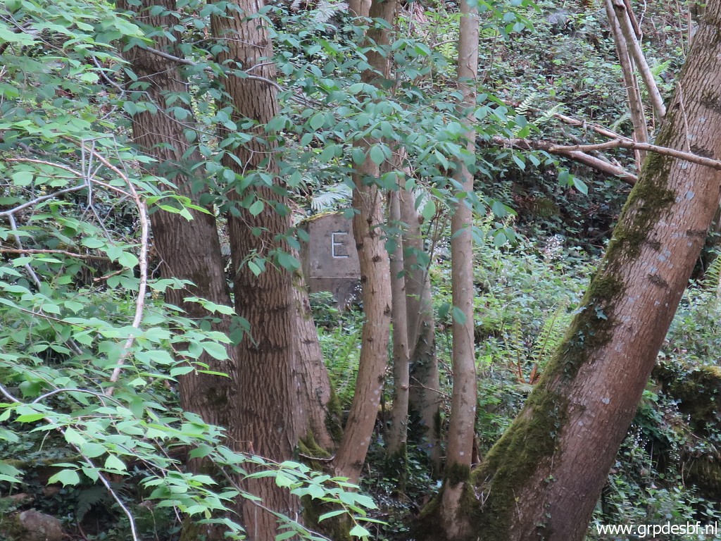 | Zoom-in to bm197. (click photo to enlarge) |
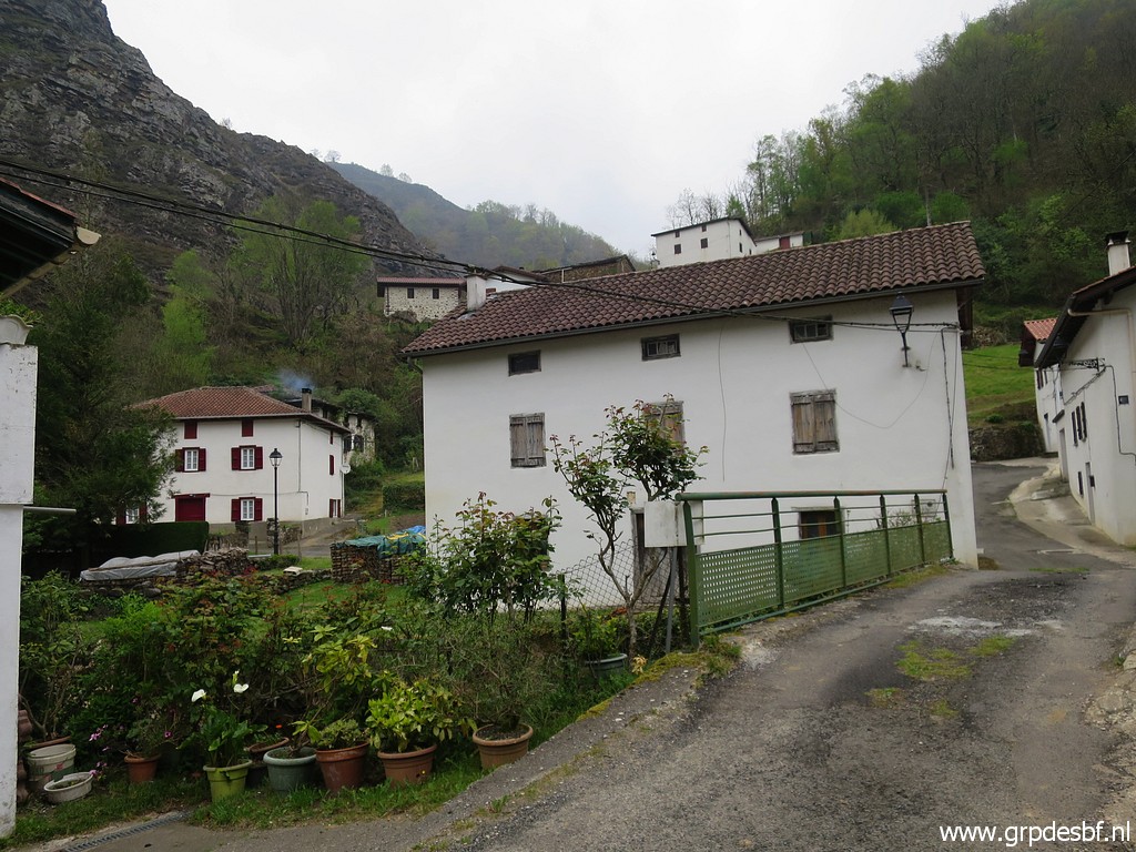 | Driving a bit further to the scenic hamlet of Gainekoleta. (click photo to enlarge) |
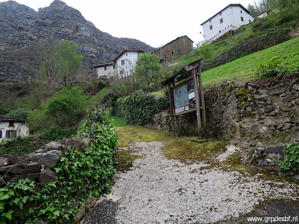 | The waymarked trail (click photo to enlarge) |
 | around the hamlet, still exists. (click photo to enlarge) |
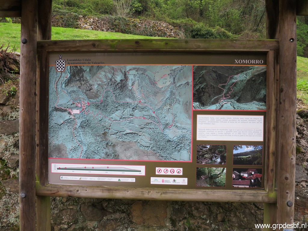
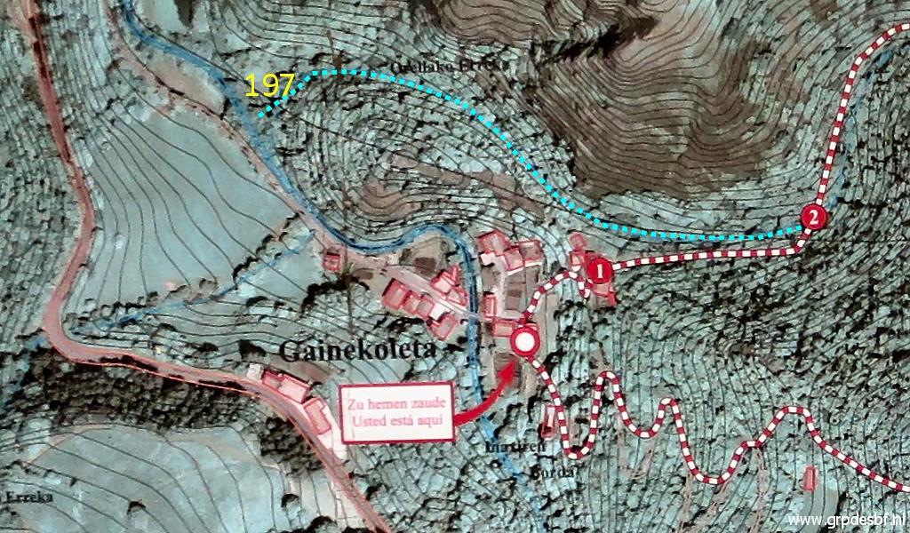 | On this annotated cut out, you can see what I want to try. From nr.2 I want to descend along the stream to bm197. I did that already on 10-5-2010. (click photo to enlarge) |
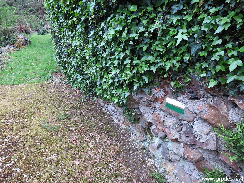 | The trail is white-green waymarked (click photo to enlarge) |
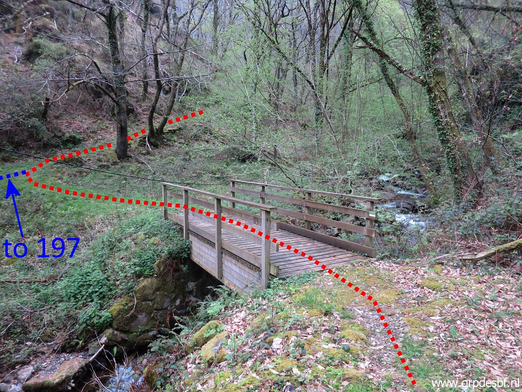 | and brings you to this bridge. Just beyond the bridge, I go left. (click photo to enlarge) |
 | There is a nice trail, (click photo to enlarge) |
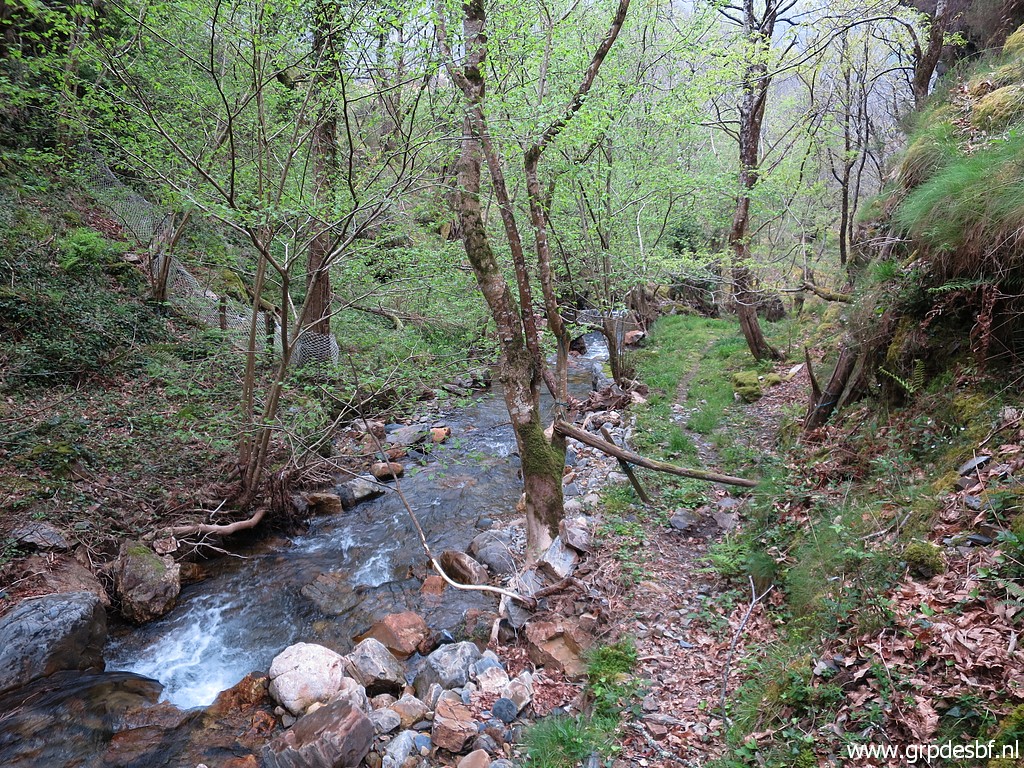 | first along the stream (click photo to enlarge) |
 | and then gradually climbing (click photo to enlarge) |
 | but getting too high and too far from the stream. (click photo to enlarge) |
 | Conclusion: at an earlier point, you have to leave the trail and descend on a vaguer trail towards bm197. Conclusion: crossing the river directly to bm197 is much easier (if you dare to). This trail can be an alternative. (click photo to enlarge) Enough for today, I return to the camping. |
|
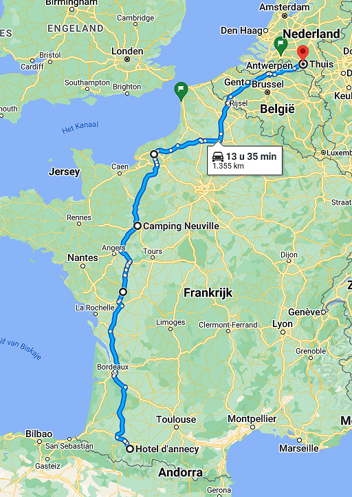
This is my last trip of this holiday. The next day it starts raining in
the whole of the Pyrenees and I decide to return home. First to Lourdes for a night in my favourite 'hôtel d'Annecy', the town still suffering from 2 years of Covid-19-misery with a lot of shops and hotels closed. Then on wednesday driving to Camping Neuville and arriving home on thursday. |