|
The
bordermarkers of the Pyrenees : the GRPdesBF
|
|||||||||||||||||||||||||||||||||||||||||||||||||||||||||||||||||||
| - stage 12 - Port de Larrau - Col de la Pierre St-Martin (bm237-262)  previous
stage next
stage previous
stage next
stage |
 |
||||||||||||||||||||||||||||||||||||||||||||||||||||||||||||||||||
 |
|||||||||||||||||||||||||||||||||||||||||||||||||||||||||||||||||||
| Only
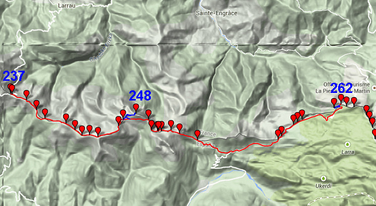
the bordermarkers along this stage are shown (and some adjoining ones).
The main route is red,
the variants are blue. The main route provides a smooth
on-going route along most bordermarkers, the variants give access to
the remaining bordermarkers. See the GRPdesBF-principles. Click here for an fullscreen interactive map. In short A long stage: about half of it right on the borderridge with impressive views, the last third part along the tarmac road to Col de la Pierre St-Martin. Wayfinding is generally easy (follow the ridge or stick to the tarmac) except for the route from bm250 to bm253 across the rockfall. There are two minor variants: nr. 1 climbs the hilltop of Chardékagagna for bm248 and nr. 2 descends to bm261 Considerations Water is scarce and requires descending, study your maps for streams downhill. For example N/NE of bm242-243. Half way, from Port d'Ourdayté (bm255) downhill SW into France, there's a kind of valley with streams and nice bivouac-possibilities. Getting closer to the end of this stage (thus higher towards the dry karst-plateau of Arette-la-Pierre-St-Martin), waters gets more scarce. And it will be even more scarce on the next stage. There is - on the next stage and 1,2 km from bm262 - a small stream/fountain just beyond Col d'Arlas along the trail to bm265. On the spanish map it's called "Fuente de la Contienda". It will be your only watersource if you choose the next day the tough variant along the bordermarkers 268-272 Factsheet
Gps-files needed
Useful You might check the relevant webpages in the 'All markers'-section. They provide more pictures of the bordermarkers and additional information on them. Version 02 December 2014. If you have any correction, suggestion etcetera -> please email me: eefberns@grenspalen.nl MAPS AND DIRECTIONS Print your own maps It's easy to print your own - custom made - maps with the GRPdesBF-route and the bordermarkers on them. See: Print your own maps |
|||||||||||||||||||||||||||||||||||||||||||||||||||||||||||||||||||
 |
|||||||||||||||||||||||||||||||||||||||||||||||||||||||||||||||||||
|
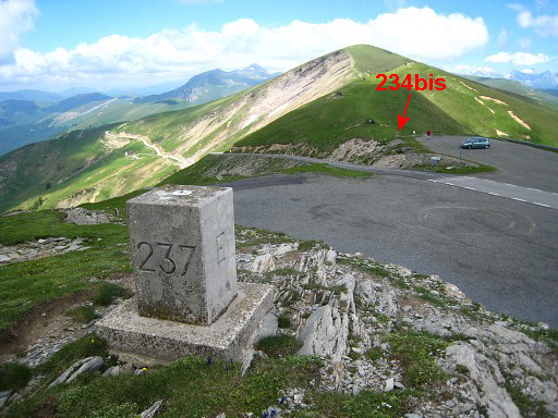
Your starting point: Col de Larrau with bm237 (and bm237bis at the other side of the road). |
||||||||||||||||||||||||||||||||||||||||||||||||||||||||||||||||||
|
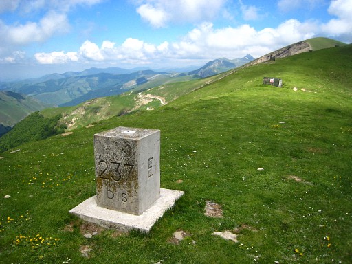
Bm237bis Continue on the ridge |
||||||||||||||||||||||||||||||||||||||||||||||||||||||||||||||||||
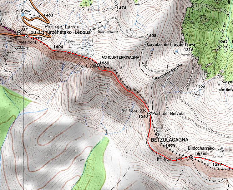 The route follows the ridge but - until bm240 - mostly underneath it. |
|||||||||||||||||||||||||||||||||||||||||||||||||||||||||||||||||||
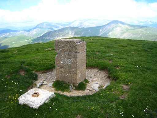
|
Bm238 |
||||||||||||||||||||||||||||||||||||||||||||||||||||||||||||||||||
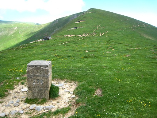
|
Bm239 From here it's easier to traverse underneath the next hill-summit (S of it) to |
||||||||||||||||||||||||||||||||||||||||||||||||||||||||||||||||||
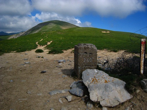
|
bm240. |
||||||||||||||||||||||||||||||||||||||||||||||||||||||||||||||||||
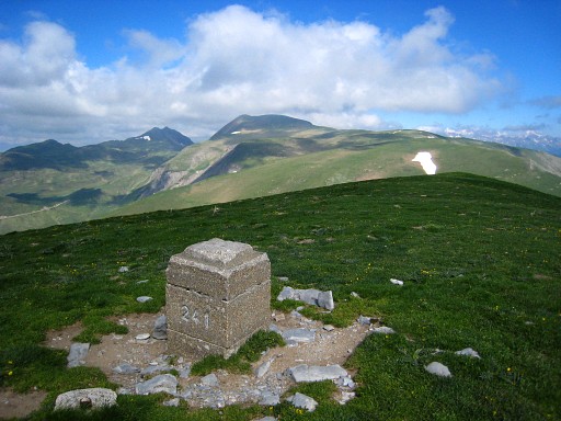
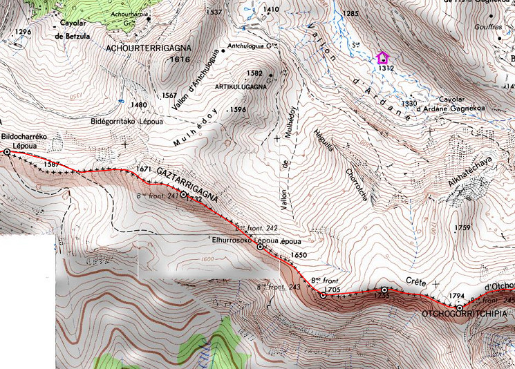 From bm240 onwards, stick to the ridge itself until bm246. |
|||||||||||||||||||||||||||||||||||||||||||||||||||||||||||||||||||
|
It's quite a climb to bm241 and then |
||||||||||||||||||||||||||||||||||||||||||||||||||||||||||||||||||
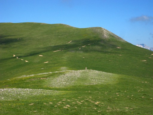
|
descending to bm242 |
||||||||||||||||||||||||||||||||||||||||||||||||||||||||||||||||||
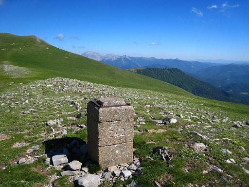 |
Bm242 From bm242, one could descend to the N to the valley where a bivouac is possible. |
||||||||||||||||||||||||||||||||||||||||||||||||||||||||||||||||||
|
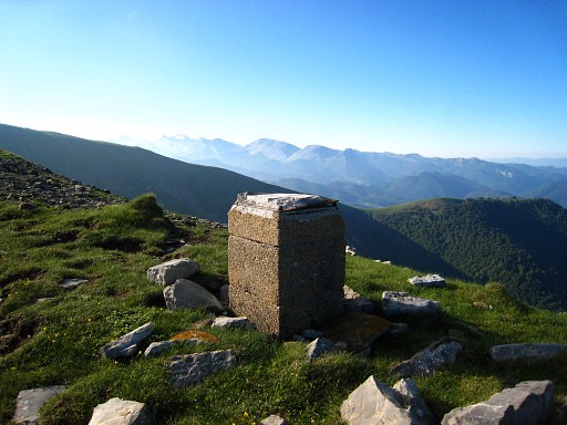
Bm243 |
||||||||||||||||||||||||||||||||||||||||||||||||||||||||||||||||||
|
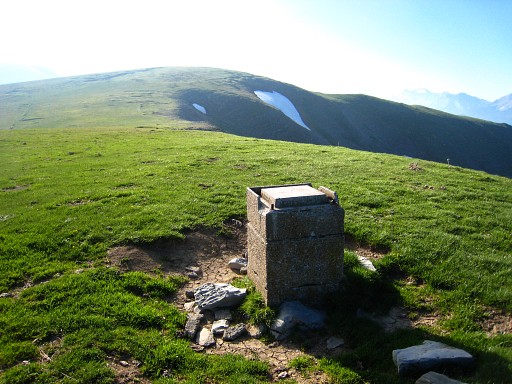
Bm244 |
||||||||||||||||||||||||||||||||||||||||||||||||||||||||||||||||||
|
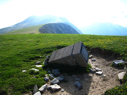
Bm245 You can see how the ridge starts to climb to a summit (Otchogorrigagna) |
||||||||||||||||||||||||||||||||||||||||||||||||||||||||||||||||||
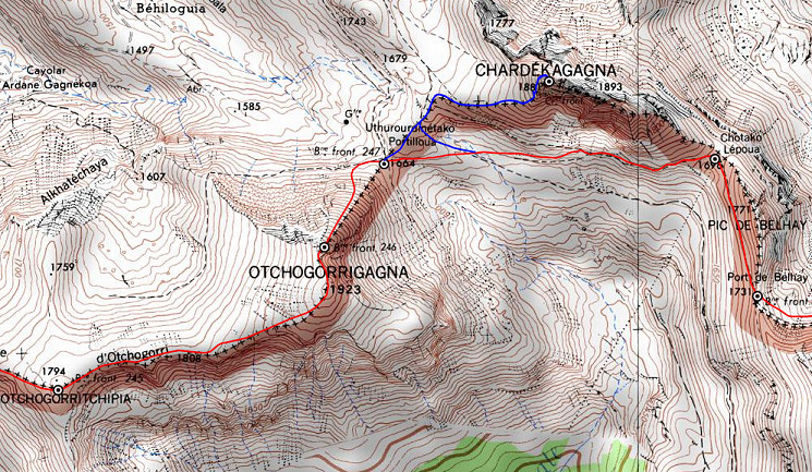 The next part of the stage, including variant 1. |
|||||||||||||||||||||||||||||||||||||||||||||||||||||||||||||||||||
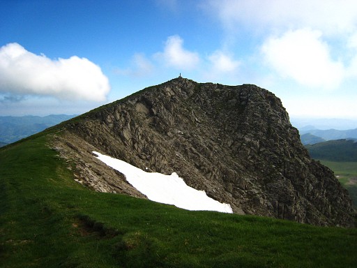 |
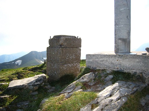
It's a tough climb along the ridge to | ||||||||||||||||||||||||||||||||||||||||||||||||||||||||||||||||||
|
bm246, besides a geodetic pillar. |
||||||||||||||||||||||||||||||||||||||||||||||||||||||||||||||||||
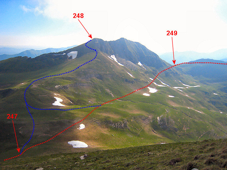 Then a very steep descent to a pass, the Uthurourdinétako Portilloua with bm247. The routes ahead are well visible. Then a very steep descent to a pass, the Uthurourdinétako Portilloua with bm247. The routes ahead are well visible. |
|||||||||||||||||||||||||||||||||||||||||||||||||||||||||||||||||||
|
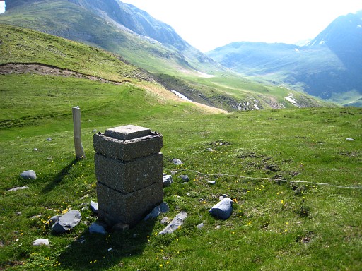
On the pass bm247 |
||||||||||||||||||||||||||||||||||||||||||||||||||||||||||||||||||
| Variant 1 via bm248 |
|||||||||||||||||||||||||||||||||||||||||||||||||||||||||||||||||||
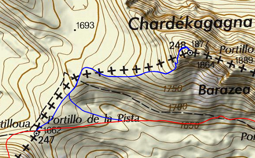 |
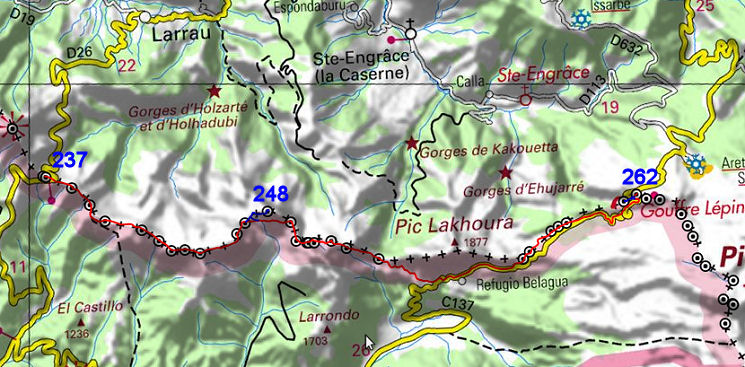
The variant-route on the IGNes-map. It climbs along the ridge to the hilltop. |
||||||||||||||||||||||||||||||||||||||||||||||||||||||||||||||||||
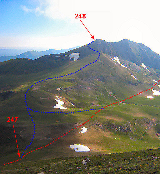 |
This picture show the route better. From bm247 follow the fence-posts (which are on approximately the watershed) until the foot of the most left summit of the summit-ridge of Chardekagaa. You can climb directly to it but it's easier by making a curve to the left. |
||||||||||||||||||||||||||||||||||||||||||||||||||||||||||||||||||
|
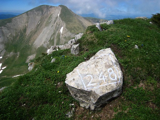
Bm248 is a few meters W of the summit. Return the same way and join the main route again as the maps above show. |
||||||||||||||||||||||||||||||||||||||||||||||||||||||||||||||||||
| End of variant 1 |
|||||||||||||||||||||||||||||||||||||||||||||||||||||||||||||||||||
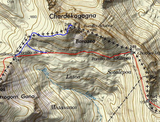 |
From bm247 the main route of the GRPdesBF continues E along the hillside to the next pass with bm249. From bm249 to 250 is another easy traverse underneath the hillridge. |
||||||||||||||||||||||||||||||||||||||||||||||||||||||||||||||||||
|
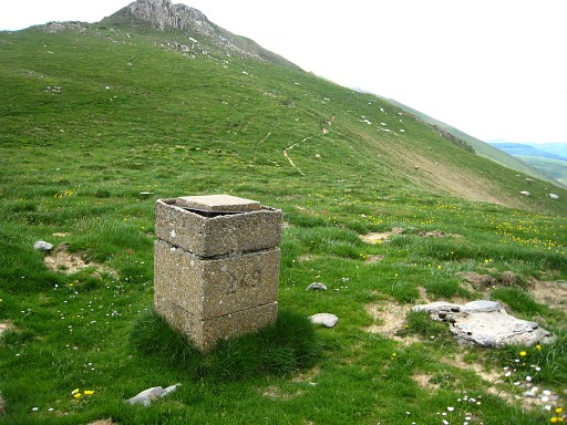
The trail from bm247 until 250 is red-white waymarked. At the pass of Chotako Lépoula: bm249. |
||||||||||||||||||||||||||||||||||||||||||||||||||||||||||||||||||
|
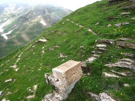
A next shortcut underneath the ridge brings you to Port de Belhay with bm250 |
||||||||||||||||||||||||||||||||||||||||||||||||||||||||||||||||||
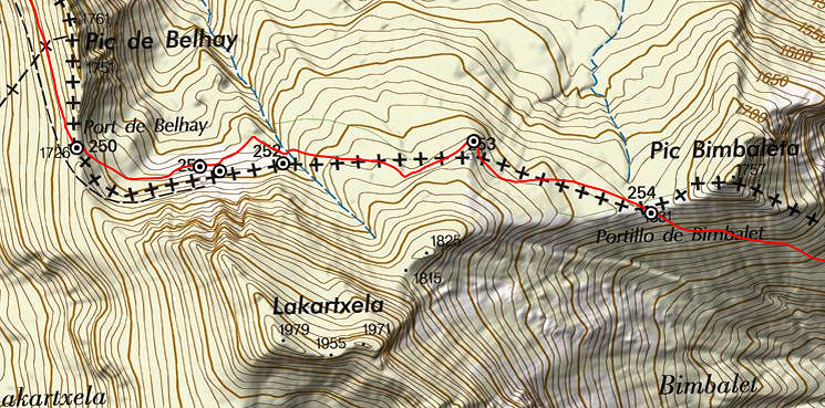 From bm250 until 254, the borderline leaves the watershed and you have to take more care to navigate along the hillside and find the bordermarkers 251 to 253. |
|||||||||||||||||||||||||||||||||||||||||||||||||||||||||||||||||||
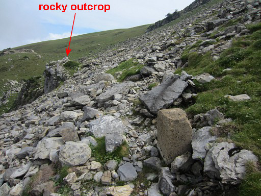
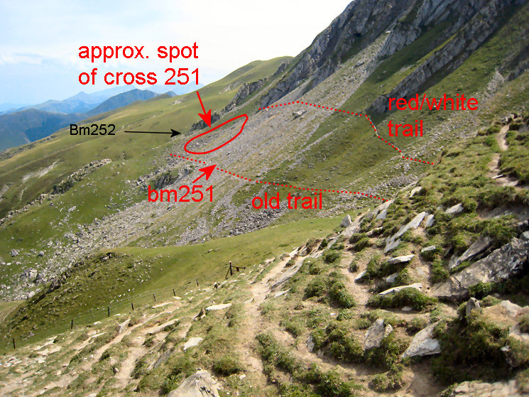 This is an overview of the route ahead, seen from Port de Belhay. Our GRPdesBF-route will takes the old trail. Note: there are two bordermarkers 251! There's a small pillar 251 along the old trail AND a bordercross 251 on a rock 35m uphill. The 252-cross is just behind the lower end of the ridge which you can spot directly behind the circle. |
|||||||||||||||||||||||||||||||||||||||||||||||||||||||||||||||||||
|
Taking the old trail, the borderpillar 251 is hard to miss. But finding the bordercross 251 takes more effort. The rocky outcrop further on along the trail will help you. |
||||||||||||||||||||||||||||||||||||||||||||||||||||||||||||||||||
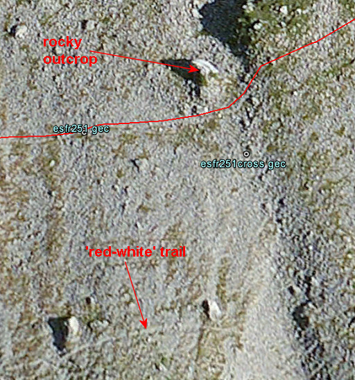 |
As you can see, the rocky outcrop is where you have to climb the rocky hillside SSE for ±35m to bordercross 251. |
||||||||||||||||||||||||||||||||||||||||||||||||||||||||||||||||||
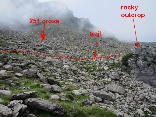 |
This picture shows the situation from underneath the rocky outcrop. |
||||||||||||||||||||||||||||||||||||||||||||||||||||||||||||||||||
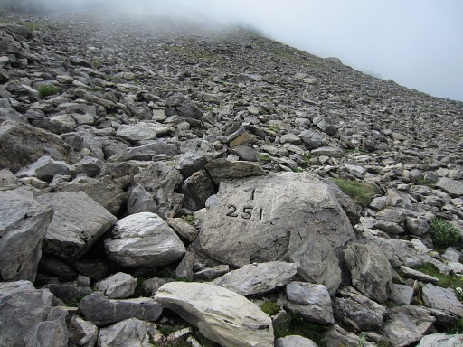 |
Bordercross 251 |
||||||||||||||||||||||||||||||||||||||||||||||||||||||||||||||||||
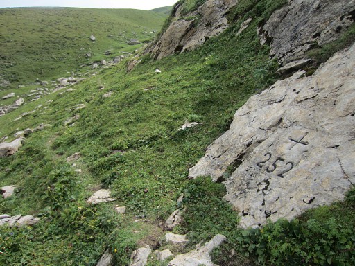
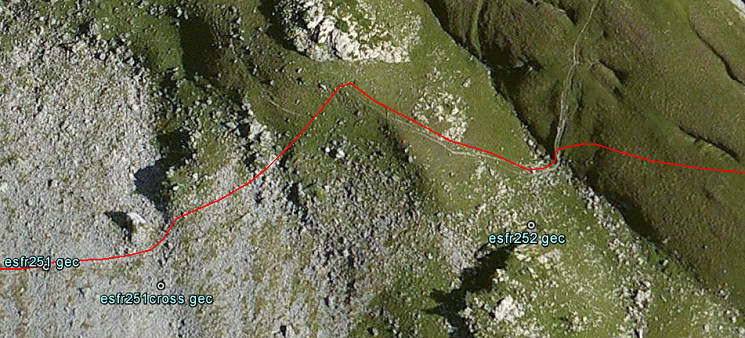 Navigating to bm252 requires again special attention. From bm251-cross descend back to the trail and continue on that cairns-waymarked trail E-NE. After 125m it has climbed to a grassy ridge and the trail has become vague. Turn right at that ridge and proceed SE and soon a trail will appear that descends slowly SE until its bends sharply. At that point, climb 30m S to bm252. |
|||||||||||||||||||||||||||||||||||||||||||||||||||||||||||||||||||
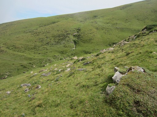 |
So: after descending back to the trail, continue on that
cairns-waymarked trail E-NE. After 125m it has climbed this grassy ridge and the trail has become vague. |
||||||||||||||||||||||||||||||||||||||||||||||||||||||||||||||||||
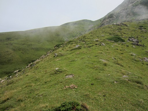 |
This is the grassy ridge, looking SE. Proceed SE here and soon |
||||||||||||||||||||||||||||||||||||||||||||||||||||||||||||||||||
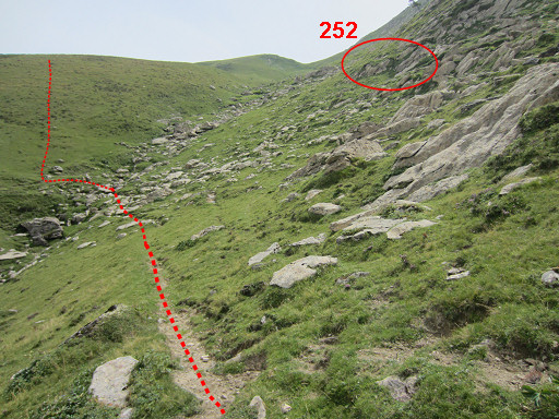 |
this trail will appear. It descends slowly SE until its bends sharply. At that point, climb 30m to |
||||||||||||||||||||||||||||||||||||||||||||||||||||||||||||||||||
|
bm252. |
||||||||||||||||||||||||||||||||||||||||||||||||||||||||||||||||||
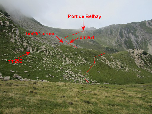 |
This picture gives another view of the situation and is taken further on the route, looking back. |
||||||||||||||||||||||||||||||||||||||||||||||||||||||||||||||||||
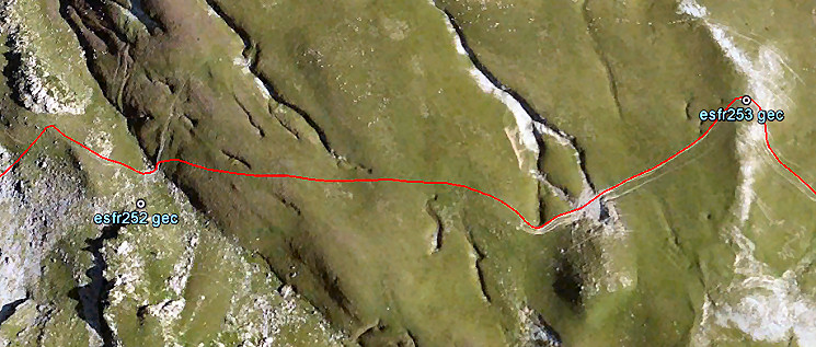 The next part to bm253 requires a climb uphill E for 300m (no trail). Then you can pick up a trail which brings you to bm253. Let's show it in more detail: |
|||||||||||||||||||||||||||||||||||||||||||||||||||||||||||||||||||
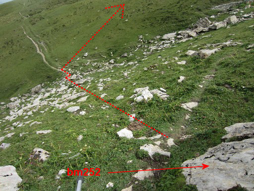 |
From bm252 return to the bend of the trail. From that point, leave the trail and climb ± 300m E up the green slope until |
||||||||||||||||||||||||||||||||||||||||||||||||||||||||||||||||||
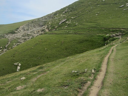 |
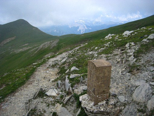
you reach this trail. Follow it SE-NEE, sticking to the dominant trail (because there are parallel trails which won't bring you to bm252.). |
||||||||||||||||||||||||||||||||||||||||||||||||||||||||||||||||||
|
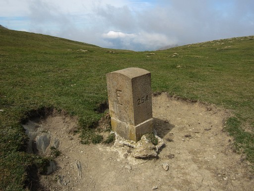
Just beyond a next bend, bm253 suddenly appears. This picture: looking ahead to Port de Bimbaleta The trail now heads SEE towards |
||||||||||||||||||||||||||||||||||||||||||||||||||||||||||||||||||
|
Port de la Bimbaleta with bm254. | ||||||||||||||||||||||||||||||||||||||||||||||||||||||||||||||||||
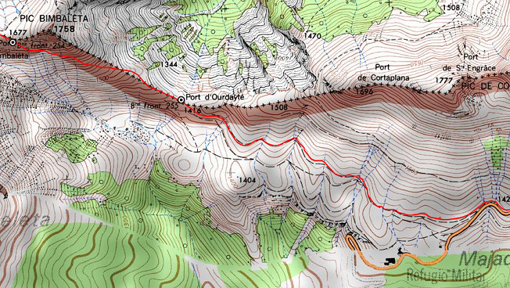 From Port de la Bimbaleta to Port d'Ourdayté is a traverse SEE along the hillside. From Port d'Ourdayté you can pick up the red-white trail which takes you downhill to the road. |
|||||||||||||||||||||||||||||||||||||||||||||||||||||||||||||||||||
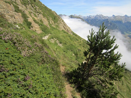 |
This is the hillside on a cattle-trail, gradually descending to Port d’Ourdayté. There's no distinct trail but many cattle trails. Descend on various parallel trails on the hillside, switching to lower ones while advancing to Port d'Ourdayté. |
||||||||||||||||||||||||||||||||||||||||||||||||||||||||||||||||||
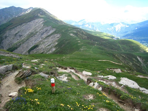 |
This picture: the Port d'Ourdayte in sight, the red-white waymarks have reappeared. They are the waymarks of the GR12 (a regional trail in the Basque country). At Port d’Ourdayté, there's no trace left of bm255. This bordermarker has disappeared in september 2007. |
||||||||||||||||||||||||||||||||||||||||||||||||||||||||||||||||||
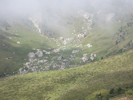 |
SW of Port d’Ourdayté is this valley with a stream where I once camped for the night. From Port d’Ourdayté pick up the red/white trail downhill SE until the road. |
||||||||||||||||||||||||||||||||||||||||||||||||||||||||||||||||||
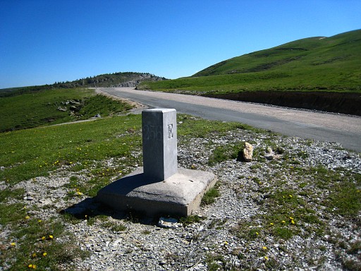
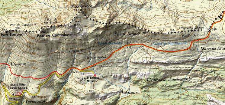 Then an easy stroll along the tarmac road for ± 3km until bm256. Note: the Refugio de Belagua is closed since long. |
|||||||||||||||||||||||||||||||||||||||||||||||||||||||||||||||||||
|
Bm256 |
||||||||||||||||||||||||||||||||||||||||||||||||||||||||||||||||||
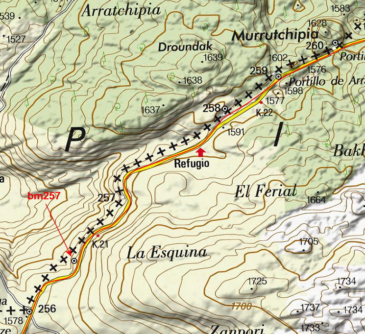 Bm257 to 260 are easy finds along the road at its left side. |
|||||||||||||||||||||||||||||||||||||||||||||||||||||||||||||||||||
|
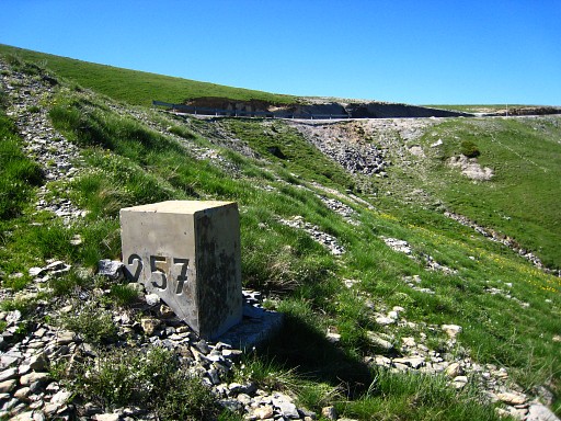
Bm257 is after 300m underneath the road. This picture: looking back. |
||||||||||||||||||||||||||||||||||||||||||||||||||||||||||||||||||
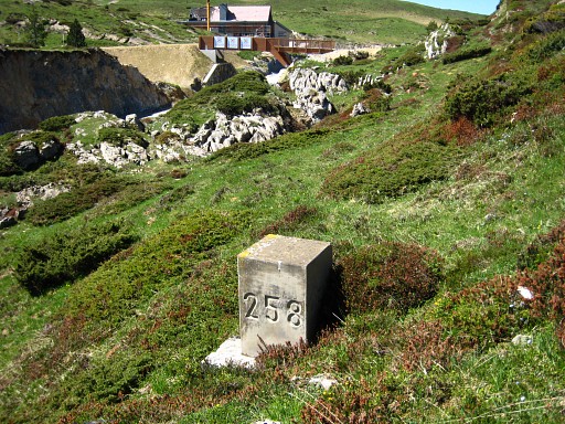 |
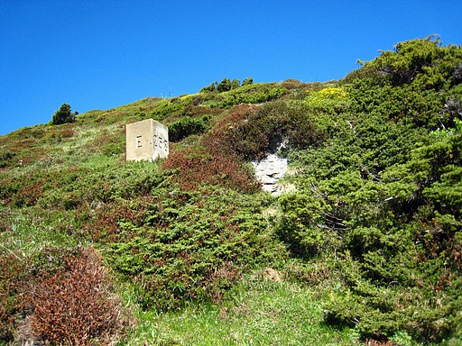
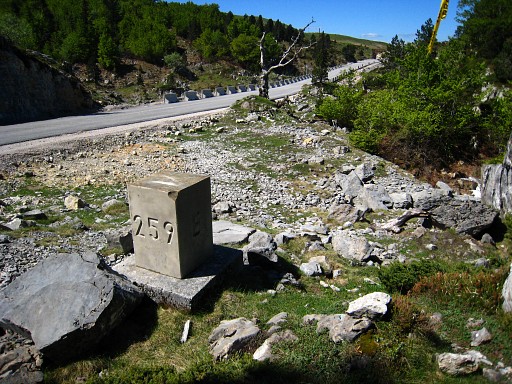
Then - after 1km and just beyond a building - bm258: pillar and cross. This one is somewhat higher and further from the road. This bm was moved from another place to this spot around 1985. The same was done with bm259 in order to facilitate a more straight new road. Two triangular pieces of territory of equal size were interchanged between France and Spain. See this pdf with a map of it. |
||||||||||||||||||||||||||||||||||||||||||||||||||||||||||||||||||
|
Bm258: now also showing the cross. |
||||||||||||||||||||||||||||||||||||||||||||||||||||||||||||||||||
|
After 300m: bm259, pillar and cross, also left of the road. |
||||||||||||||||||||||||||||||||||||||||||||||||||||||||||||||||||
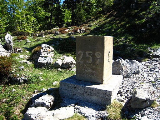 |
Bm259 with the cross in the background. |
||||||||||||||||||||||||||||||||||||||||||||||||||||||||||||||||||
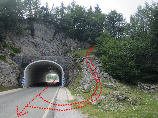 |
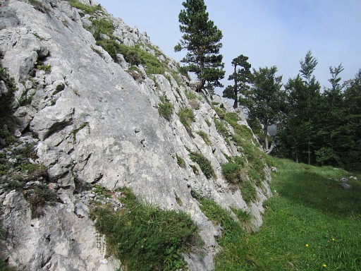
Bm260 is 300m further above a tunnel. It's easier to walk through the tunnel and then - at the left side - climb to above the tunnel. Then you're at the old road with |
||||||||||||||||||||||||||||||||||||||||||||||||||||||||||||||||||
|
bm260 Return to the road. |
||||||||||||||||||||||||||||||||||||||||||||||||||||||||||||||||||
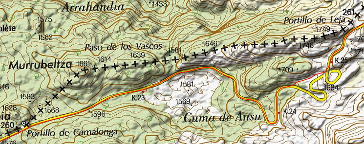 Continue E on the road. After 2km you can take a shortcut as the map shows. When back at the road you will arrive after 250m at |
|||||||||||||||||||||||||||||||||||||||||||||||||||||||||||||||||||
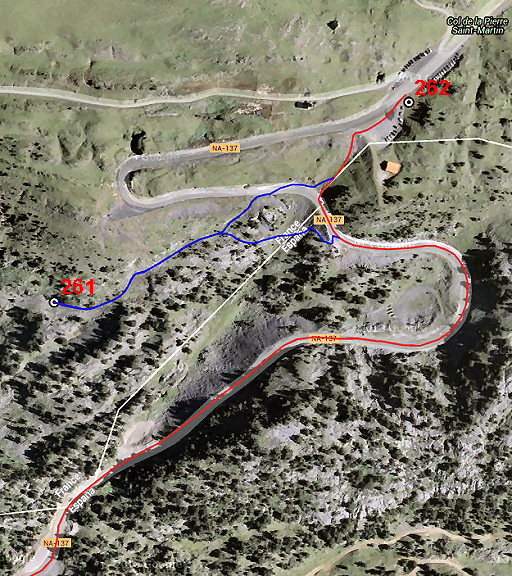 |
a sort of pass overlooking the rest of this stage. The borderline goes straight through a valley towards bm262. For us it's easier to follow the road first and then climb directly to bm262. |
||||||||||||||||||||||||||||||||||||||||||||||||||||||||||||||||||
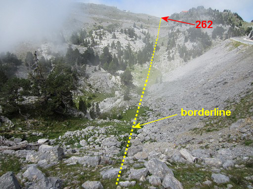 |
This picture: showing the valley and the straight borderline. As said: taking the road is easier. |
||||||||||||||||||||||||||||||||||||||||||||||||||||||||||||||||||
| Variant 2 via bm261 |
|||||||||||||||||||||||||||||||||||||||||||||||||||||||||||||||||||
 |
|||||||||||||||||||||||||||||||||||||||||||||||||||||||||||||||||||
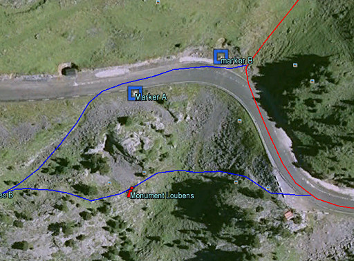 |
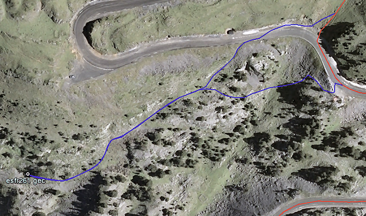
First descend from the bend in the road on a trail. Note: markers A and B are unnumbered markers besides the road. |
||||||||||||||||||||||||||||||||||||||||||||||||||||||||||||||||||
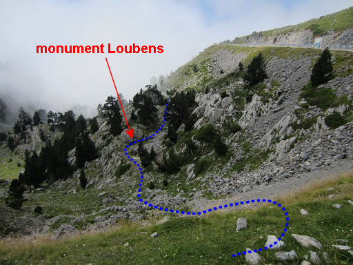 |
The trail will bring you to the monument Loubens. |
||||||||||||||||||||||||||||||||||||||||||||||||||||||||||||||||||
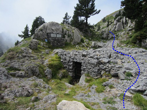 |
This is the monument. Then – behind the monument Loubens – proceed W for ± 50m |
||||||||||||||||||||||||||||||||||||||||||||||||||||||||||||||||||
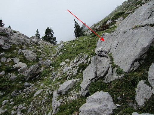 |
About 50m beyond the monument, bend SW. That's about here. At this rock an unnumbered cross. There are more of such crosses to be found around here. See this page. |
||||||||||||||||||||||||||||||||||||||||||||||||||||||||||||||||||
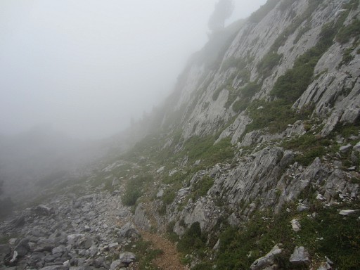 |
Continuing SW - gradually descending - with a rockwall on your right hand | ||||||||||||||||||||||||||||||||||||||||||||||||||||||||||||||||||
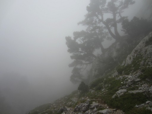 |
These trees indicate that you are close to bm262 which is 10-20m behind the trees. | ||||||||||||||||||||||||||||||||||||||||||||||||||||||||||||||||||
|
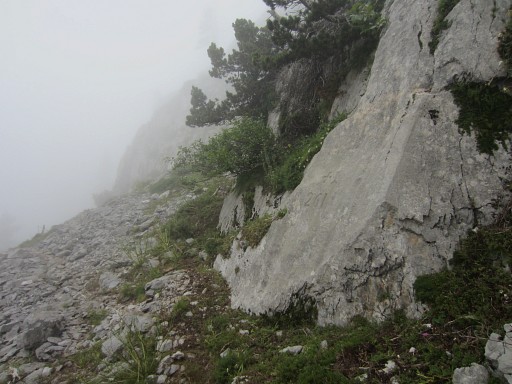
The rock of bm261. NB: the position of bm261 should be considered wrong: the treaty of 1858 describes a different spot. Read all about this mystery on this page. Return the same way. |
||||||||||||||||||||||||||||||||||||||||||||||||||||||||||||||||||
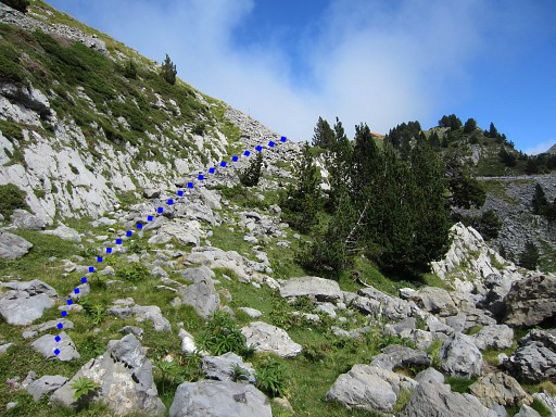 |
Further on you can - close to the Loubens-monument - directly climb to the road. | ||||||||||||||||||||||||||||||||||||||||||||||||||||||||||||||||||
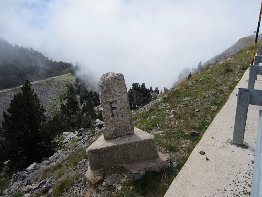 |
At the roadside, this unnumbered marker. | ||||||||||||||||||||||||||||||||||||||||||||||||||||||||||||||||||
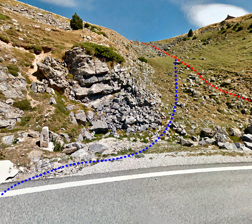 |
On the other side of the road - where the direct climb to the Col starts - there's a second stone marker. |
||||||||||||||||||||||||||||||||||||||||||||||||||||||||||||||||||
| End of variant 2 |
|||||||||||||||||||||||||||||||||||||||||||||||||||||||||||||||||||
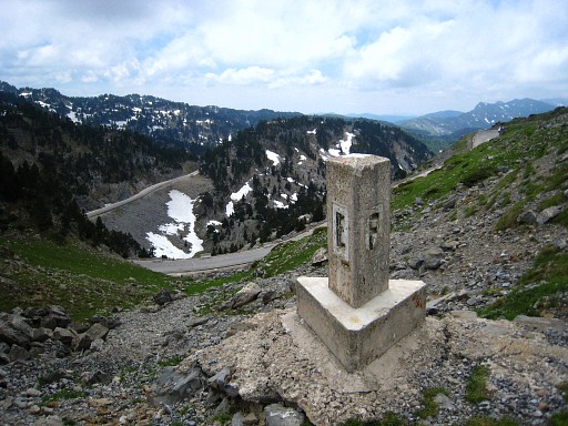 |
Uphill, there's a third unnumbered marker overlooking the other ones down below. | ||||||||||||||||||||||||||||||||||||||||||||||||||||||||||||||||||
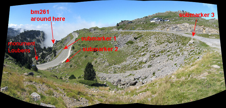 Looking back from another position. |
|||||||||||||||||||||||||||||||||||||||||||||||||||||||||||||||||||
|
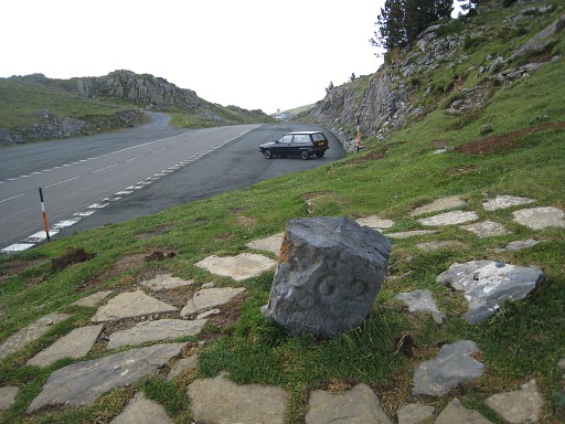
And then the famous bm262 is nearby. End of this stage. |
||||||||||||||||||||||||||||||||||||||||||||||||||||||||||||||||||
 previous
stage next
stage previous
stage next
stage
|
|||||||||||||||||||||||||||||||||||||||||||||||||||||||||||||||||||
